Day 74: Porter Zero Day

Day 74: Porter Zero Day

7/29/2023

Section: Milepost 1953.6 to 1953.6

Total Trail Miles: 985.7

Distance: 0.00 Miles  

Moving Time: 00:00 hrs

Elevation Gain: 0 ft

Click here for current location

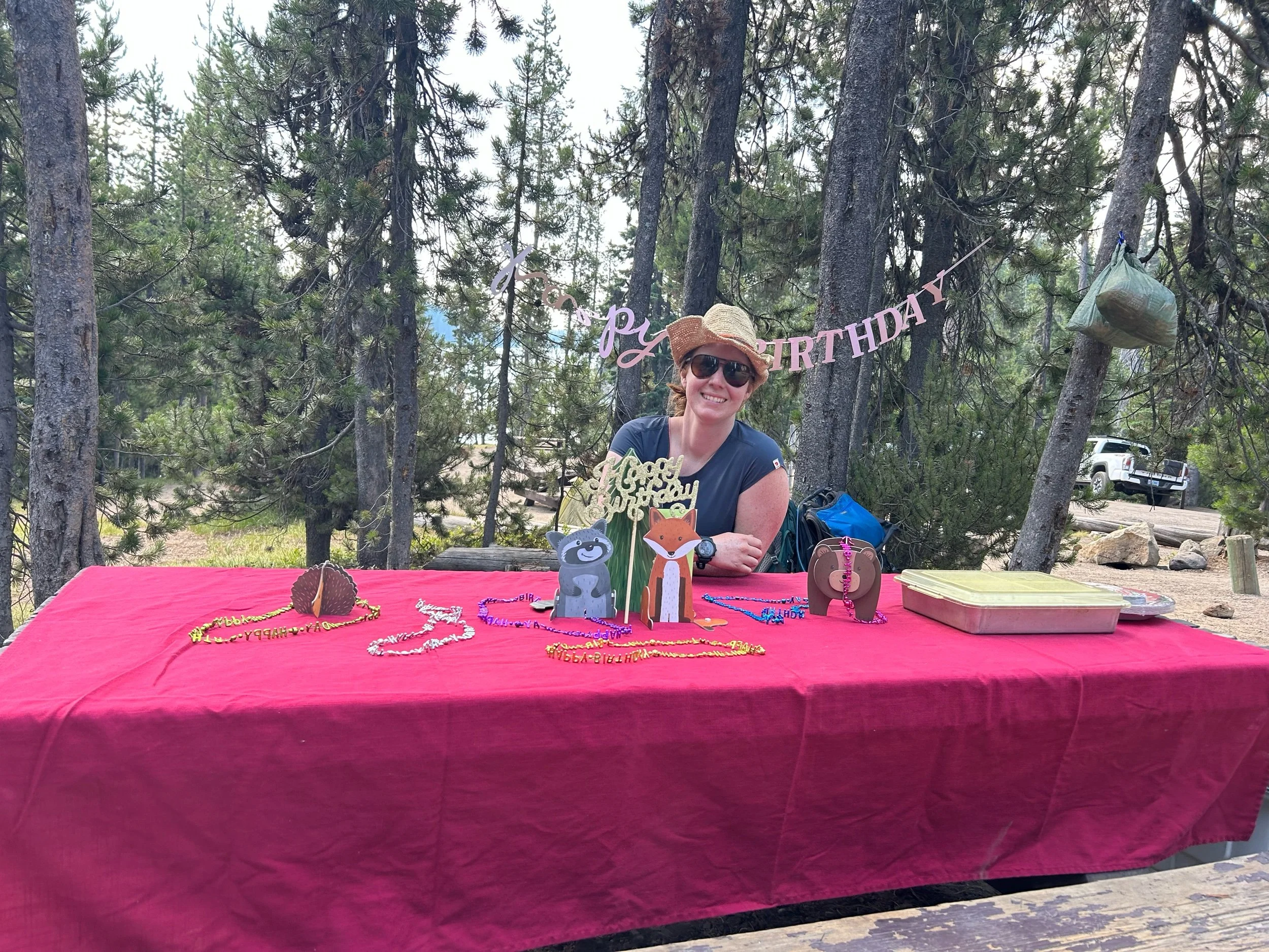
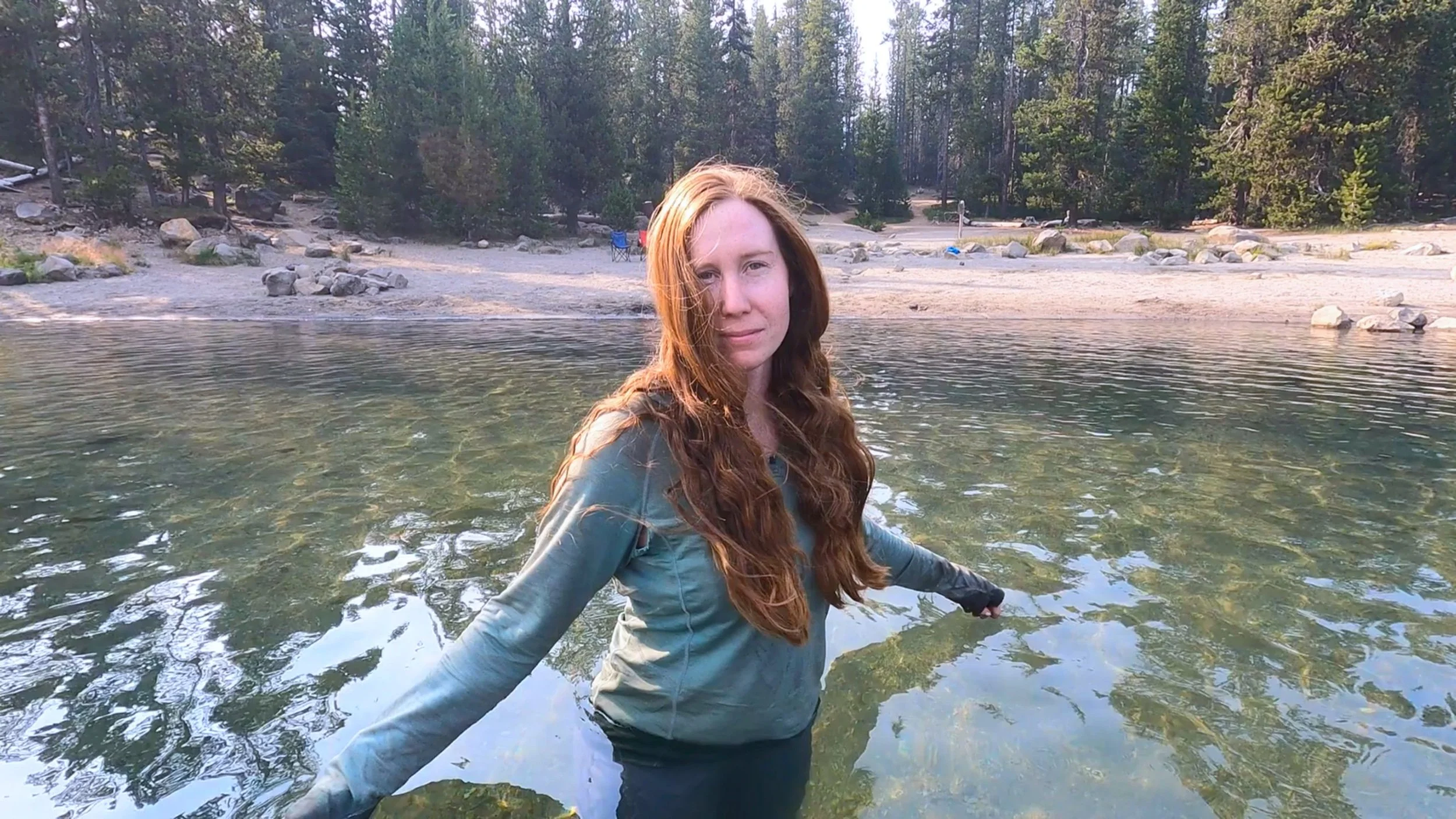
Today was another zero day - they are really adding up and i think July is not going to be our most successful month by far but it was really relaxing. We woke around 8 am and the Porters made us some delicious breakfast - eggs, sausage and coffee. It was amazing. Afterwards I took their two dogs, Ted and Libby, down to the lake and played fetch in the water for the better part of an hour. I took a swim as well before coming back to dry off at the campsite. We charged up our things in the cab of the truck and at 11:55 cracked a few brews while sitting around the site and talking. At around 2 pm I walked down to the resort to get some mustard and we played in the water again on my return. After, we made some bratwurst and had those with pasta salad and potato chips while we looked through the goodies Sandy and Ray brought down to supplement our hiking meals. In the evening we returned to the resort and had beers on the back deck while listening to live music and then came back for some wild Sockeye salmon and corn on the cob. I did my yoga and went for an evening swim before retiring to go to sleep. If today's entry sounds quipped it’s because Amanda told me I have 5 minutes to write this before she starts to get - and I quote here - “angry.”

Day 73: Elk Lake

Day 73: Elk Lake

7/28/2023

Section: Milepost 1963.1 to 1953.6

Total Trail Miles: 985.7

Distance: 10.99 Miles  

Moving Time: 04:35 hrs

Elevation Gain: 905 ft

Click here for current location

I actually got up nearly on time today. Alarm went off at 5 am and I pushed snooze once and then deflated my sleeping pad. I have a pretty good set-up in place now. In the evenings I do my yoga and then set the Z-lite sleeping pad in front of the tent so that I can stage all my things, like shoes, sandals, and everything that needs to come out to the tent in the morning on it, so this morning was a breeze. I got out and Amanda followed about 20 minutes later. I never realized it but it’s all the little details that make up how fast you get up in the morning - like leaving a little bit of water in the jet boil so that you have it ready to boil for cleaning off your toothbrush or letting the last liter of water gravity filter overnight into your platypus so it’s ready to go - these are the details on the fringes that make the difference in shaving 20-30 minutes off in the morning. 

Eventually Amanda was also fed and ready to go. As she finished up her last few details I went into the woods to take care of some of my morning business. As I was finishing up I heard something crashing through the trees nearby. We had also heard something around 2 am - loud enough that Amanda asked me “what was that?” I know that she didn’t honestly expect me to know but I answered “I have no idea, probably a deer.” Well, turns out, yes, it was a deer. A young buck approached me as I was finishing my business, totally unaware that I was there. I stood up and it froze, caught off-guard by my presence. This is the thing that bothers me about wild animals. When I am in the wild, I assume the native creatures are far more aware than me - better smell, better hearing, just better everything. I considered this as I stood 5 feet away from this young buck like “look, you were stupid enough to literally walk right into me, don’t make your problems mine,” then it took a moment while I looked away to crash off into the underbrush again. Actually, it made its way up to Amanda and then, taken by surprise at her presence there, tore off west into the underbrush. Not sure, honestly, how it has survived this long. 

After the morning festivities we eventually got our collective rears in gear and were off, headed south. Amanda was making about 2.4 miles/hour in her pained state. Looking on WebMD (which is usually successful in telling you that you have a terminal illness) it sounded like a classic back sprain would heal itself in 1-2 weeks with moderate exercise suggested. It seemed like backpacking counted for that so we had decided to continue on carefully.

Amanda made her way north, traveling west of the Rock Mesa, a large lava rock shelf that stood tall south of the south sister. The walking was nice as we traveled through open meadows. The fire east of Eugene was casting smoke but it only became an issue in the afternoons - the mornings were very clear and nice. We made decent time as Amanda led the way past Sisters lake where a group of women camping there said hello.

Sisters lake is connected to about 5 other lakes in close proximity, making a perfect breeding ground for mosquitos which came out in droves and made our lives a living hell. From the lakes we retreated up Koosah Mountain. At the top we took a break. Amanda’s back was really bothering her and we had great views up at Mt. Bachelor which, just about 8 months ago, we had been skiing from a different angle. We took a 30 minute break and enjoyed some snacks before heading on down the trail. On top we talked to a girl from Ontario for a while who had gone to school at University of Vancouver and was familiar with the lower mainland and Bellingham. We wound our way down. Amanda was walking pretty well given the back pains. Soon we arrived at the first exit for Elk Lake but decided to stay on the PCT - we are purists when it is convenient and continued on to the second turn-off. Here we took the exit and wound down through burned area to the Elk Lake trailhead. From the trailhead we crossed and walked up Cascade Lakes Highway until we hit Elk Lake.

The plan was to arrive at the Elk Lake campground early on a Friday and secure one of the remaining “First Come, First Serve'' campsites. When we got to Fish Lake campground, however, we found none of these available and far less designated than Rec.gov would suggest, which upset me a little bit. None-the-less, as we were walking back from our search for a free campsite, a group in campsite 7 suggested we look at campsite 8 because the people who had it for the long weekend had not shown up and it was now noon so, technically, the site was free. As we approached we saw the folks from site 9 had gotten a jumpstart on our plans and were positioning camp chairs in the site. We talked to them for a while and, when they found out we were PCT hikers, said they would gladly give up the site for us. In fact they gave us lemonade and nut snacks to boot - really nice people. We sat and talked to them for a while before they headed off in their VW camper van for a new location and we sat there filling out a reservation form to take over the campsite. Amanda’s parents were coming down from Kennewick which was the main reason for trying to get a good site, but Oregon in the summer is tough on the weekends, at any of these campgrounds - we got super lucky with the good graces of those nice folks from Eugene. 

After we had secured the site, we walked down to the Elk Lake resort for some lunch. We were shown into a somewhat shabby eating area and I ordered some beer and Amanda got a seltzer before we ordered burgers for each (Amanda went with Elk). As we ate, we talked to a pair of older woman in there late 50’s, early 60’s. One was from Santa Barbara and the other was from Olympia. They had been hiking together from Southern Oregon and were a blast to talk with. We told them our story about flipping north and they said they hadn’t even tried the Sierra given they were at Kennedy Meadows in late May. After lunch we returned to the campsite, happy to see that the people who hadn't shown up yesterday seemed to have no intention of showing up today. We went for a swim in Elk lake and then I did some blogging. 

Later that night, we returned to the resort for dinner. The restaurant was much calmer. We then came back with some S’more supplies and I got a fire going. Ray and Sandy are about 30 minutes out as I write this and we are going to stay up until their arrival, but not much after because I am ready to pass out!

Day 72: The Three Sisters

Day 72: The Three Sisters

7/27/2023

Section: Milepost 1980.3 to 1963.1

Total Trail Miles: 976.2

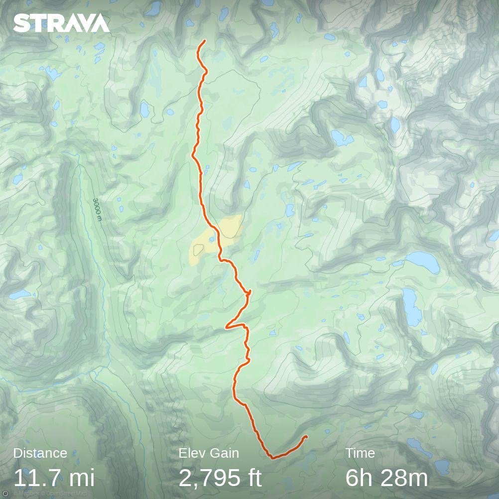
Distance: 17.53 Miles  

Moving Time: 08:15 hrs

Elevation Gain: 2795 ft

Click here for current location

Amanda’s back was better today and after a few tentative steps she was cruising in the morning so - spoiler alert, we moved on south today, if a little slow.

The stage today spends the entire time going around the west side of the Three Sisters - 3 imposing mountains smack dab in the middle of Oregon. The path out today leads around the Yapoah Crater before heading south past Minnie Scott Spring. Shortly after the spring, the PCT climbs up to a short pass - Opie Dilldock Pass - on lava rock before descending from the pass on a long series of tiny switchbacks. From the pass the trail progresses west for about a mile before turning back south to run parallel to the 3 sisters. The PCT passes through the Obsidian area punctuated by an excess of it’s namesake in the area as well as a beautiful falls. From there the trail continues south eventually passing by a small lake which is great for swimming before descending into the Mesa Creek valley and climbing out the other side where the stage ends east of Mesa springs.

I tried so hard to get up at 5 this morning but ended up snoozing for an hour. This put us on the trail at 6 with Amanda tentatively trying out her back. No shooting pains today so we proceeded slowely up the initial climb of the day. The trail wound up and eventually flattened out, allowing us to speed up a little bit. Every blowdown was tense, hoping that no sudden twisting re-aggravated her back. We proceeded on and began running into the NOBO’s. Each one told us of a brutal descent we had upcoming on lava rock. Eventually, we got to the top and looked down - honestly, it wasn't that bad, just a bunch of short little switchbacks making their way down. It kinda looked like that famous street in San Francisco that switches all the way down to the main boulevard. We cruised down, talking to a few NOBO’s on the way. 

The trail proceeded around the Sisters, calmly climbing and dropping through the old glacial moraine. The lava rock eventually gave up and we were back to loam, but continued to take it slowly to ensure we didn’t push Amnda’s back too hard.

After a while, we came to a spot we had been shooting for, for an afternoon break - a small pond which everyone on FarOut were outraged about because of its pond classification. While small, the “pond’s” setting was beautiful, right under the South Sister and the comments all suggested it should be upgraded to a lake. We agreed as we stripped down to swimware level undergarments and jumped in. The lake, like all lakes in eastern Oregon, was crystal clear and the perfect temperature. We swam for about 15 minutes before getting out and drying off. I found my custom monster mix bag had been torn into by a chipmunk while we were away but, fortunately, i didn’t have much left for the bandit to steal. 

We got back on the trail and hiked for another 2-3 hours before setting up camp and settling down for the evening after some focused stretching.

Day 71: Back Pains

Day 71: Back Pains

7/26/2023

Section: Milepost 1980.3 to 1980.3

Total Trail Miles: 959.0

Distance: 0 Miles  

Moving Time: 00:00 hrs

Elevation Gain: 0 ft

Click here for current location


Today we woke up at 5:45 in the frost and Amanda promptly pulled a muscle in her back. Literally, nothing different about today, but she bent down to get something out of her backpack and couldn’t stand up again. She was done for the rest of the day. She stretched and rolled and I worked on the spot a bit and around 12 am we tried to walk and she had shooting pains down her back so we stopped. This is the part that sucks, we really don’t understand what would have caused it. We’ve been doing this for 2 months and a thousand miles but for some reason, this happened today. Maybe it is the new shoes she now has or maybe it was the lava rocks from yesterday but whatever it was we are stuck in the water until she feels better. 

We spent most of the day reading and sleeping, figuring we could catch-up on those activities. I finished the 3rd installment of the Wheel of Time series - not sure I’m super into it, Robert Jordan has a somewhat improvisational way of writing that is getting old, but I’m going to give it one more book. At 5 pm I set-up the tent again and went back up to Little Matthieu Lake for water and to redirect Amanda’s parents to a new weekend destination where we could meet them. My dad had noted that we hadn’t moved all day and had reached out to ask if we were ok. Thanks for checking dad! I told him we were fine and left it at that, didn’t want anyone to get worried. I filled the waters and came back. We had ramen this evening, both feeling unworthy of a full freeze dried meal and then headed to bed. Really hoping her back is better tomorrow. If not, we will go back to Bend to see a chiropractor.

Day 70: Pursuing Lu

Day 70: Pursuing Lu

7/25/2023

Section: Milepost 1996.1 to 1980.3

Total Trail Miles: 959.0

Distance: 15.84 Miles  

Moving Time: 08:00 hrs

Elevation Gain: 3,197 ft

Click here for current location

A month and a half before we started this trail, a very dear friend of ours, who is also one of our co-workers, set foot in Campo, California to begin her own PCT adventure. One of the silver linings of the flip that we did is that we knew there was a chance we would get to see her again and, today, towards the very end - we ran into Amy Lu!

The stage today begins at the Big Lake Youth Camp and proceeds south, rejoining the PCT a mile on. The day crosses over 2 small ridges as it passes the western edges of Mt. Jefferson. As the trail rounds the southern flank of Jefferson it turns due south and proceeds towards Bellknap Crater and Little Bellknap. Here the trail comes upon a massive expanse of Lava Rock as it climbs to the saddle between the two Bellknaps. Once through the saddle the path drops to McKenzie Pass Highway through more lava fields, eventually passing by a trailhead. Once across the highway, the path continues through lava fields, past a turn-off for Lava Lake Campground and makes the final climb of the day to Scott Pass and Little Matthieu Lake. A campground just half a mile past the lake marks the end of the day.

I tried to get up at 5:45 am, but ended up snoozing. You, reader, are probably sick of hearing about my snoozing escapades but I just can’t wrap my head around why it is so hard to get up. The night had pulled drizzle up onto the shore and everything was damp, which was just wonderful because it made the ultra fine black sand stick to everything as we attempted to get packed up. I left the ground tarp outside of the tent - it was a lost cause. The guy who had copied my yoga routine last night was already gone but the other guy who had arrived at the beach with us was still sleeping. We got everything together and tip-toed back to the front entrance of the youth camp where we found a few other hikers milling around and some free coffee. I’m still working on my separation from Coffee but showed some serious weakness in Bend - I love Sister’s Coffee Co. We talked with the others a bit. It sounded like the highly touted free breakfast at the camp wasn’t going to be ready until like 8:30 and we weren’t interested in waiting so we set off around 7:30, headed south. 

There is currently a moderately sized fire just east of Eugene, on the western slopes of the Cascades. Not close enough to be a major concern for us but the plume coming off the fire is moving right overhead and has been since yesterday - which sucks. All the more reason to get out of Oregon before we are too deep into August - I have a little more faith in California’s fire response given they are more geared up for it. The trail weaved up and out of the big lake area through mostly younger growth and some older fire sections. Blow-down was minimal which was awesome. Not much of note in this section. We ran into some NOBO’s, the excitement at a hot breakfast clear on their faces. Soon, we were up and over the first 1000 foot climb and started back down. At the bottom of the trail, we turned from speedy loam to lava rock.

Lava Rock is a staple of Central Oregon - I had kinda forgotten. You can go on whole Lava Tube tours here from Santiam, McKenzie and many other passes through the mountain but this was the first real run-in we had had with it on the trail and I gotta say, not ranking very high on the walk-ability. It downright sucks. It’s sharp, it’s uneven and it’s all loose. Amanda and my moving time took a huge dive as we began our second thousand foot climb of the day. An older English couple walked by and I made a joke about how much I loved walking on the stuff at which point the guy said somberly “well, there’s lots more ahead of you,” which I kinda wish I hadn’t heard. We climbed our way up, up and up until we reached the saddle between the two Bellknap’s and took a picture. Out in front of us was, probably, a beautiful view of the 3 Sisters but today it was a hazy mirage of them instead, kinda pretty in its own right but far from crystal clear. Really want to come back down here and climb those. We began our descent, running into a guy on his way to climb the smaller Bellknap and eventually reached the trailhead. Here we found a mostly-empty water cash, so I guess we are back in an area where we need to start thinking about that again and proceeded on Lava Rock down to McKenzie Pass highway.

At the higway we crossed and started making our way up the 3rd thousand foot climb of the day. The going was incredibly slow. Amanda got new shoes and, while they are better than the Altras she had, the sizing said she needed to be a half size larger and she felt as though her feet were swimming a bit. We clamored on and soon came to the turn-off for Lava Lake Campground. Amy Lu had informed us that this is where she was trying to get that evening. We sat and took a break while considering what to do. It was 3 pm and unlikely that she was stopping so early so we assumed she was ahead of us. With no service, it was impossible to check so we continued on. We made our way up the final grade of the day. The trail transitioned off of lava, which helped with our speed but off to our left, massive fields could be seen. I said something like “Wow, I’m really glad i wasn’t here 150 million years ago!” Which, to be honest, wasn't really that funny. Eventually we arrived at the junction for Matthieu Lake trail and continued on the PCT, soon arriving at Little Matthieu Lake which, we were not allowed to stay at. We filtered water and talked to a guy from Palm Springs who said he knew Amy and thought she was behind somewhere. We finished our filtering and continued on down the path. Just as we were beginning to worry I saw a lone figure coming of the trail. I did a little walking stick wiggle in the air and the figure returned the wiggle with a smile. “Think that’s Amy!” I said excitedly to Amanda. It definitly was and there were hugs all around as we excitedly said hi. We chilled on the trail and talked for about half an hour. There are so many stories to tell, especially when everyone has been through the same areas and lots of beta to communicate about the road ahead. We shared each other’s trail names and talked about the horrers of the Sierra. We took pictures with each other and eventually said goodbye and that we would catch-up in the Fall either in the Sierra or back at home in Bellingham and then she was gone. It revitalized us to talk to her though. It’s great to have someone else who’s close out on the trail, even if you aren’t hiking with them. About 5 minutes later we arrived at our spot for the night and set up. The sand was finally, mostly gone as i set it up. We had some Good-to-Go meals, Gumbo for me and smoked chili for Amanda. It’s good but Amanda’s dad is bringing smoked Salmon to Elk lake this weekend and I am excited about that. We talked and ate and eventually turned in for the night. It was a fight to get up this morning so hoping it will be easier tomorrow.  

Day 69: Amanda’s Birthday

Day 69: Amanda’s Birthday

7/24/2023

Section: Milepost 2002.1 to 1996.1

Total Trail Miles: 943.2

Distance: 4.96 Miles  

Moving Time: 01:52 hrs

Elevation Gain: 187 ft

Click here for current location

It was Amanda’s birthday today and what better way to celebrate than a float on the Deschutes river! We woke around 6 and I got up. I had a muffin that Amanda and Claire had brought back from the Bachelorette party followed by some of the custom monster mix I had made over the weekend. I am telling you, the Trader Joe’s mini peanuts really pop. Eventually Claire and John got up. Sheldon had come back from the Farewell Concert around 2 am so was still sleeping. John made some eggs and then left. Claire and I ran down into Redmond and got some coffees and by the time we were back, Amanda was fully up. I asked Claire if I could take her car into Bend and she said sure. Amanda and I got together some things that we thought we would need for floating the river and set off shortly after 8. The air quality was pretty rough - some fires on the western slopes of the Cascades were pouring smoke into Bend, degrading the air quality.

We made a stop at one of our favorite cafe’s in Bend - Sparrow Cafe. This place serves these Ocean Rolls which are cardimum spiced sweet rolls - they are the best. We got one each and then went to Big O Bagels for some protein. After getting our bagel fix it was about 11 and warm enough to float so we left for the “Park and Float” just a few blocks away. When we arrived we were devastated to find it closed. Because it was a Monday and because the air quality was pretty bad, the employees who rented out the tubes and ran the shuttle had been sent home so we went to Walmart to get our own and came back about an hour later.

We put in at Riverbend Park and mosied on down the Deschutes at about a mile an hour for one hour. At the end we rode the rapids down the Fish Ladder and got out at McKay park. I had managed to submerge my phone and Claire’s Subaru fob but both seemed to be working. From our departure point we walked back to the car and drove back to Claire and John’s house. 

Back at the house, we took showers and started organizing our things. This took a little longer because all of our stuff had been distributed around their place. We did a last bit of laundry and by the time we had everything back in order, John returned, bringing with him the 6 freeze dried meals that I had left in his car all day. Once everything was together, we said goodbye to John and Sheldon and Claire drove us back up highway 20, through Sisters and dropped us off back at the trailhead. We took some selfies and thanked her for all she had helped us with over our 4 day hiatus then we all hugged and Amanda and I set off.

We hiked almost 5 miles to Big Lake Youth Camp who are extremely hiker friendly and offer a camping area for hikers. Once there, the camp doctor helped us find everything. We called the host to try and check in but no luck so some fellow PCT’rs helped us find the camping area. Once there, we found a gorgeous spot right on the beach and settled in for the night. I sang happy birthday to Amanda while she finished her Ocean Role, we did some yoga and then got some sleep listening to small waves lap the beach a few feet from our tent.

Day 65-68: Mid-Summer Bend Break

Day 65-68: Mid-Summer Bend Break

7/20 - 7/23/2023

Section: Milepost 2002.1

Total Trail Miles: 891.0

Distance: 0 Miles  

Moving Time: 0 hrs

Elevation Gain: 0 ft

Click here shere for current location


So…we took a mid-summer’s break in Bend. We weren’t necessarily planning on it but it happened and it was very nice. My sister, Claire, is getting married in October and the break allowed for Amand to attend her bachelorette party and for me to get some golf in with my soon-to-be brother-in-law. 

On Friday, we woke up around 6. Still can’t sleep in even when we have a nice mattress to do so. John and Claire and John’s roommate, Sheldon, went off to work and Amanda and I stuck around to annoy Claire on her work-from-home routines. We mostly caught up on blogging and I worked on replanning the rest of Oregon and California. Around mid-Morning, Amanda and I borrowed Claire’s car to run into Bend. We went to the Mill District to visit the REI where Amanda tried to get new shoes and I picked up some miscellaneous things we needed. REI had been crushed by a mid-summer rush of PCT backpackers and there were barely any shoes to be had for Amanda. We left REI and headed downtown where we were able to go to a running store and Amanda got hooked up with some Topo’s - a running shoe much like the Altra Olympos but one half size larger to give her feet some room.

After shoe shopping, we stopped by one of our favorite restaurants in Bend - Active Culture - a great place for anyone in the area, I highly recommend it. After, we made a short stop at WINCO and Trader Joe’s to resupply before returning to Redmond. That night Claire made us Chicken and Waffles (my request). They were delicious and we relaxed into the evening before heading to bed.

Friday was pretty similar. Claire, Amanda and I went into Bend. I got my back sugared (that’s right, sugared) and the girls went shoe shopping for the bachelorette party. I also took the chance to wash our sleeping bags which were absolutely putrid and checked out SunRiver Brewing, across the street, while waiting on the laundry. We returned to Redmond around 4 pm and Amanda and Claire headed for Carlton, Oregon where this state has just a tiny bit of wine production. That night John and I had some leftovers for dinner before heading to bed.

The next morning we headed up to Prineville for 18 holes of golf on a beautiful Saturday. John beat me, but only by a few strokes. It was a great course and an awesome time. After, we went back into Bend for lunch in the Mill District and then checked in for a suite fitting on our way back to Redmond. That night, John made some steaks on the smoker and we watched My Octopus Teacher and They Cloned Tyron on Netflix - both excellent movies, would highly recommend.

The next morning we relaxed at the house and waited for the girls to come back. There was a massive concert happening in Redmond called the Farewell Festival and Sheldon had weekend tickets so was out most of the time. I worked on rerouting us back south through California while John worked on some house projects. The girls eventually came home and we went out for lunch at a food truck pavilion in the middle of Redmond before returning home for the afternoon. That night, John made some chicken on this smoker and we played cornhole into the evening before eventually passing out later that night, enjoying an extended time on a mattress. 

Day 64: Sisters, Or

Day 64: Sisters, Or

7/19/2023

Section: Milepost 2025.1 to 2002.1

Total Trail Miles: 937.2

Distance: 24.41 Miles  

Moving Time: 10:44 hrs

Elevation Gain: 2,736 ft

Click here for current locations

Ah, today I knew we were getting out and I was so excited. Bend might be the highlight resupply stop on the whole trail. Growing up in Oregon I've been there many times and now that I have a sister living in Redmond, I've returned many times as an adult. It is a craft brew Mecca with incredible food and we were planning on at least 3 days there so it was going to be epic! 

The route today starts in the mosquito hell of a small clearing we had left off on, on the western slopes of Mt. Jefferson. From there the PCT skirts a high ridgeline around the southern flanks of the mountain with incredible views south to Mt. Washington, 3-Fingered Jack and the 3 Sisters. The path then passes under Rock Pile Peak before continuing east around 3-Findgered Jack, however, beta from the NOBO’s coming out of Santiam suggested that we divert off the PCT at Minto pass and drop down to the Old Summit Trail 4014 at Wasco lake and head south on that because of apocalyptic blowdown on the parallel section of the PCT, which is what we did. From Wasco Lake the Old Summit trail winds east to the Jack Lake trailhead before turning south and making it’s way around the lower flanks of 3-Fingered Jack in a way very reminiscent of some earlier desert sections. The path then goes up and over a ridge before dropping around the west end of square lake and paralleling highway 20 all the way to the parking lot. 

We woke to the high pitched whine of…mosquitos, a whole swarm of them all desperately trying to get through the mesh to reach us. I have never been so thankful for such fragile fabric but knew, at the same time, I was going to have to go outside. Some people ditch their rain gear until later in the season but I was oh so happy to have my rain pants for exiting the tent. We did all that we could inside before venturing into the fray and once we were out we wasted no time getting packed up and on our way. Once we were moving the mosquitos fell off, ever so slightly but they still got some bites in. I don’t know what it is but it’s like, one fresh bite makes all the old ones itch even more.

We made our way up to the ridge line and the cross wind helped cut the bugs down a bit. We walked along the ridge line for some time as we rounded the southern end of Mt. Jefferson. Some folks had camped on the ridge and, I gotta say, I was a little jealous - great views, less bugs. As we came off the ridge line we ran into some folks who made a point to tell us about the alternate path on Old Summit trail. One girl told us that she had taken the PCT and her friend had taken the alternate and she wished she had done the same. “It’s like Pick Up Sticks starting here in a few miles,” she said to us with a smile. We walked on, Amanda teaching me about the Pick Up Sticks reference which was totally lost on me. Further on we ran into more NOBO’s also touting the alternate route. “Okay,” i said to Amanda, “not missing that alternate I guess.” 

Eventually, we came to the beginning of the blowdown. Today’s stage featured pretty much every stage of fire regrowth from fresh fire to older fire with young trees coming back to 20-30 year old fire with pretty large trees making a steady come-back. At first it was only a few logs that we had to handle but then it got worse, and then worse again. Our speed dropped below a mile an hour as we hurdled log after downed log - it was brutal. At one point we went about a quarter mile off trail to avoid what was a catastrophic mass of trees and limbs. Ironically, as we neared Minto pass though, the blowdown started to clear up and there were signs the forest service had been out. At the junction, we looked at each other and decided to take the alternate despite the sudden clearing of down trees. “We’ll never know if we made the right decision,” Amanda lamented as we dropped a couple hundred feet to Wasco lake. 

At the lake we decided to fill up on water. As i gravity filtered water I took a long swim in the lake. It was wonderful. After hiking past beautiful alpine lakes in the Sierra that would have been brutal to swim in it is so nice to swim throughout Oregon. I scrubbed the trail dirt off my legs and feet and goaded Amanda to come in before getting out. I went to flip water bladders and caught movement on the edge of the lake. There, in the shallows, I caught sight of another Garter Snake hunting for little insects on the surface. She quickly swam away once she noticed she had an audience but that is the second garter snake I have seen on this trip hunting in the water. A site  I had never seen before. Looking it up later it sounds like this is fairly normal behavior for them.

We eventually cleared out of Wasco lake and made our way up the trail, the imposing silhouette of 3-fingered Jack slowly disappearing as we dropped lower. We ran into a group of 5 mid-40’s women walking their dogs back to the Jack Lake trailhead. Walking is actually a bit of an overstatement as the dogs were resting at every shady spot the ladies walked by. Huskies don’t do well in the heat. They were super nice but we ended up hopscotching them a few times because the dogs needed a lot of breaks. At one point they asked if I had a good map of the area and I said that I did and they asked if I could tell them how close to the trailhead they were. “About 0.55 miles,'' I responded with a smile. They thanked me and Amanda and I walked on. 

At the trailhead, Amanda used the restroom and I texted my mom an update. She was picking us up at the Santiam trailhead to take us into Sisters to a new tap house that had just popped up - Ski Inn Taphouse. I told her we were still a few hours away and Amanda and I got hiking. From the trailhead the trees opened up onto another fire zone and we found ourselves walking amongst a plant that I had been pretty sure I wasn't going to see after the desert - Manzanitas… tons of them and overgrown well into the trail. We hacked our way through groves of Manzanita as views into eastern Oregon opened wide to our left. Out in the distance I could make out Madras and Black Butte which I hadn’t seen in a long time. Amanda’s feet started to hurt really bad and we slowed down. We’ve had our current shoes since Big Bear and they are definitely nearing or over 500 miles at this point. We hiked on, me encouraging Amanda to go a little faster since I had read the taphouse closed at 8 pm, which is a dumb time in my opinion. 

At square lake Amanda was pretty fed up with me waiting and told me to “just go ahead please” so i did and made my way up and out of Square lake. At the top I spooked something large crashing through the underbrush so I waited for her to show up and we walked for a mile together before I went ahead. My mom had brought one of my favorite IPA’s - “Sticky Hands” from Corvallis and I knew it was waiting in the car for me. The highway was loud and obvious as I finished the last mile down to the trailhead. My mom had hiked up about half a mile and I gave her a big hug as I came down. We talked for a while and then she gave me the keys so I could drop my bag at the car and she waited for Amanda. They came up as I was walking back up the trail.

From Santiam Pass my mom drove us down to Sisters, talking to Amanda about getting new shoes. Once there we ran inside Ski Inn taphouse and they said that of course they could feed us. Amanda and I both got the burrito and my mom got pulled pork. I stuffed myself uncomfortably on my meal, and then the rest of both Amanda’s and my mom’s. We had considered slack packing the section between Santiam and McKenzie pass the next day, my mom offering to take the rest of our gear to my sister’s place in Redmond, but Amanda said she couldn’t do it with the shoes she had so we decided to got to straight to Claire’s the next day. We returned to the hotel and enjoyed the hot tub before turning in for the night - so excited for a comfy mattress and a few good days off!

Day 63: Bugs from Hell

Day 63: Bugs from Hell

7/18/2023

Section: Milepost 2048.3 to 2025.1

Total Trail Miles: 914.2

Distance: 22.68 Miles  

Moving Time: 11:03 hrs

Elevation Gain: 4183 ft

Click here for current location

We woke around 5 on the banks of Olallie lak and snoozed a few times before getting out of the tent. The younger camp next to us were getting ready. You could tell that they had been living with bugs for a while longer than we had because they got 90 percent ready before ever stepping foot out of their tents. We weren’t so smart and collected a few bites before leaving camp. Before we left I went out to the dock running out from the front of the general store and snapped a few pictures of Mt. Jefferson reflected off the lake - not too bad for a GoPro. 

We made our way back up the forest service road and eventually came to the PCT trailhead and got on. The PCT wound through an impressive series of little lakes before making it’s way past Ruddy Hill. The burn in this area was expansive and sad. The Lion’s Head fire was brutal but the silver lining was that we got non-stop views of Jefferson up and to the left of us. The trail climbed and eventually passed another forest service road near Breitenbush lake and then passed below Pyramid Butte. 

From Pyramid Butte the trail turned into a dedicated climb up to Park Ridge which was a long east-west running ridge north of Mt. Jefferson. We crossed through a few small lava and snow fields before gaining the ridge. Here we took a break with breathtaking views of Mt. Jefferson and ate a quick lunch. We had some service so we checked in on a few things and eventually left. From the ridge we dropped down and I gave my mom a quick call. She was picking us up from Santiam Pass the next day and I was hoping she could bring us a few things. After the call I sent her a list of items which included one of my favorite IPA’s - Sticky Hands from Block 15 in Corvallis and we continued on our way. The trail wound down to the lower flanks of Mt. Jefferson and, just as we ran out of water, we came across a stream with several hikers refilling at it. This was the South Fork of the Breitenbush River and we stopped to filter here.

I gotta say, i’ not sure I am sold on the Sawyer Filter - it takes forever. If you have time you can gravity filter but if you want to fill up and go, I much prefer the old pump I had. The sawyers are slow and sitting there squeezing them is a drag. Fortunately I filled my time talking to this older guy from Vermont about world travel. We’d been to some cool places so it was fun to hear all the sights he had seen. Soon enough the water was filtered and he was on his way. Amanda and I followed close behind, headed the opposite direction. 

We traversed west and south around the northwest flanks of Jefferson, crossing Russel creek - shout out to Rachel and Rene’s Golden Retriever who goes by the same name. The area here was burned pretty badly and views from the flanks of Jefferson showed clearly how extensive it had been. We passed the turn-off for Woodpecker trail and then did a tricky little crossing at Milk creek. 

Here, Amanda turned on the afterburners. The trail got smooth and she rocketed the last 4 miles in the quickest sprint I think I have seen from her on this trip. Don’t know what it was but she was fast. I think we did the last 4 miles in close to an hour and that was all uphill. At the top, though, the bugs became an absolute menace. We found a campsite in a meadow and immediately donned rain gear, soon finding out why everyone was already in their tents. Amanda boiled water and I frantically set the tent up. I’ve never been driven inside by bugs but that is what happened here. We ate inside and I dreaded having to go back outside to move the food and used containers away. Every time I went out or came in I dragged 5 more in and then Amanda and I had to go on a killing spree to make the inside safe again - really ugly. We fell asleep that night to the incessant buzz of angry insects on the other side of the mesh.

Day 62: Olallie Lake Sprint

Day 62: Olallie Lake Sprint

7/17/2023

Section: Milepost 2067.3 to 2048.3

Total Trail Miles: 891.0

Distance: 19.56 Miles  

Moving Time: 07:37 hrs

Elevation Gain: 3,185 ft

Click here for current location

So here we are, 2 months on the trail, what an achievement. Would have liked to still be going Northbound through the Sierra at this point, but the 1000-year snowpack year is what we were dealt. As it is, I am happy to be back in my second home state and cruising south through the Cascades. Oregon really is a stunning place - I feel like it always plays second fiddle to its northern and southern neighbors, but it has incredible scenery, and it’s a lot quieter than both Washington and California.

Today’s stage continues south through warm Springs Indian reservation, past the eastern flanks of South Pinhead Butte, then through Lemti meadow and Slow Creek. At mile 2051.9 the PCT crosses near Jude Lake and then crosses back into the Mt. Hood wilderness and a major burn zone from the 2020 Lion’s Head fire. The last 4 miles of the stage are in this major burn zone which is quite depressing but eventually delivers you to the Olallie Lake Resort, which is over 100 years old and maintains a nice, cash-only general store for all of your hiking needs. 

We slept in this morning. Yesterday was pretty draining, and I just couldn’t make the 5 am wake-up call work, so we slept in till 6. Also, we were not murdered in our sleep by spirits of the dead, so that was a plus. Amanda gave me one of her breakfast protein pucks, which were less satisfying than she had hoped. I found them to be pretty good and very filling. We packed up and were on the trail at 7:45, but were actually not the last ones out of the campground. 

The trail was incredibly flat. We did a bit of climbing in the morning, but it was almost imperceptible. That’s the thing we have heard and are really starting to believe about Oregon - it is relatively flat, and you can really fly through it. We hiked in relative silence for the first 7 miles. The green tunnel was strong today - there were a few small glimpses back at Mt. Hood and a few forward at Mt. Jefferson, but, other than that - super closed in.

Around lunch, we stopped in a clearing for some food and Amanda and I shared a 100 mg caffeine electrolyte mix which really energized us before continuing on. There are a lot more people on the trail now. It’s crazy I never noticed this while living here, but I remind myself that most of my outdoor escapades were in the Coastal range or the west side of the cascades so I never would have seen all this traffic before but, wow, so many people. We are catching the NOBO bubble of people who started in early April and there are a lot of them. 

Eventually, we reached Jude Lake and crossed out of the Indian reservation into Mt. Hood National Forest. Mt. Jefferson was big on the horizon - definitely want to climb that next summer, it’s beautiful. We came to the burn zone. It is one of the worst we have seen on the trail. I remember the Lion’s Head fire. It was started by a Utility company not shutting down some of their lines and I remember the pictures of burned out SUV’s on forest service roads and so many people being evacuated. It was incredibly sobering to see the 3-year-old remnants even now.

We hiked through the burn zone for around 90 minutes before we were delivered to the Olallie lake resort, about 500 yds down a forest service road off the trail. Here we entered the general store and were delighted to find a good assortment of hiker meals and snacks. We made a little pile at the counter and asked if she could ring us up to know where we were. The general store was cash only and we had only pulled 100 dollars out at Mt. Hood. She did, and we found out we were over our 100 dollars. I traded out a hiker meal for some Ramen so I could get two beers, and then we realized my mom was going to likely give us a ride into Sisters on the 19th, so we didn’t even need one of the Mountain Houses which made room for a 3rd beer. In the end we spent around 96 dollars but got everything we could think we needed. We are only 3 days from Bend after all. After our shopping spree we sat in 2 lazy chairs at the end of a dock with Mt. Jefferson in the background enjoying some cold drinks and Otter Pops. It was wonderful.

After our lazy afternoon retreat, we found the little campground west of the General store and put down our tent. We made dinner and then talked with some NOBO’s who were also camping. Eventually, though, not wanted to repeat the snoozing escapades from this morning, we retreated to the tent for a good nights’ sleep.

Day 61: Mt. Hood 50k

Day 61: Mt. Hood 50k

7/16/2023

Section: Milepost 2090.7 to 2067.3

Total Trail Miles: 872.0

Distance: 24.76 Miles  

Moving Time: 10:02 hrs

Elevation Gain: 2,127 ft

Click here ://uglyamericanadventures.com/paydenandamandahikethepctfor current location

My iPhone is dying here, so this will be short. Not much to talk about today anyway.

We woke at 5 am and were on the trail by 6 - Roadrunner started moving as I was about to hit the snooze one more time and inspired me to get my rear in gear. We hiked for some time up and out of the lake and over a shallow saddle that dumped us back on the PCT. From there it was pretty flat - and I mean very flat for most of the rest of the day.

We went through a trailhead parking lot and both stopped to use the toilets before continuing on. We crossed a road and found ourselves on the course for the annual Mt. Hood 50k. For about 10 miles we dodged runners, about 150 of them, until the PCT departed from the course. We did get to hit up the aid stations for snacks, which was pretty cool - thanks guys!

After we turned off from the race, we continued on for some time to Timothy lake. There we jumped in and had a little swim, the water was perfect. We restarted hiking and made it a few miles before we ran into Carol. Carol was an interesting personality - one of the more grating personalities we had experienced on the trail. Her first words to us were “you must not be thru-hikers, you look way too clean,” said in a way that had zero levity in it. Amanda smiled and responded that, yes, we were and that we had just taken a dip in the lake. Carol responded that she wished she had taken the time to do that, with zero actual desire reflected in her voice. I love this trail, I’ll say that right now, but there are some sub-cultures along the way that are just plain toxic - and this is one of them, the way-too competitive, the how-many-miles-are-you-doing-per-day type that seem to have zero interest in actually disconnecting and enjoying nature. For some reason, Carol did not read into our rather terse responses to her conversation and decided to hike with us for several miles. At one point, when she was able to break away from talking about herself, she asked us where we were flipping from. “The Sierra,” I said, “it was brutal.” “Oh yea, I just assumed the only people going in there were the ones with zero snow experience, and I skipped it all-together.” To which we responded that we were both mountaineers and wanted to see if it was passable - she had zero feel for social queues. We walked for about 20 minutes listening to long stories of Carol’s skiing escapades - I had to ask her where she was from 3 times before she finally realized I wasn’t interested in where she had been skiing the last 3 years - and eventually Amanda sat down to “tie her shoe” and Carol kept walking. We said goodbye and I thanked Amanda for the excuse to stop. 99% of people on this trail are awesome, but you always find some of the more interesting ones along the way.

We hiked on through the green tunnel. I gotta say, I lived in Oregon for 10 years and, yea, never noticed how close in the tree canopies are. We crossed into the Warm Springs Indian reservation and continued south. The campground we were headed to was supposedly haunted based on the commentary from FarOut and, as we got close, I could see why. Oregon has these Douglas Fir groves that, when younger, grow very close together and give off an almost stifling vibe, and that was very apparent here. We reached the campsite and, though I am not superstitious, I was happy to see a few other tents already in position. 

We set up and I got water. I am gravity filtering through the Sawyer with the new CNOC bag, and it is super convenient. We had dinner and then decided to go to bed. Amanda wasn’t having my typing that evening, so I am writing this one day late

Day 60: Timba Line Breakfast

Day 60: Timba Line Breakfast

7/15/2023

Section: Milepost 2104.7 to 2090.7

Total Trail Miles: 848.6

Distance: 14.91 Miles  

Moving Time: 06:39 hrs

Elevation Gain: 2,105 ft

Click here for current location

Ok, so - we got vortexed today. I have been so excited since starting out from Cascade Locks because I knew that, somewhere down the road, we were going to get the Timberline Lodge Buffet Breakfast. Little context here - some hikers believe that the buffet breakfast offered at the Timberline lodge is one of the best along the trail - and it’s endless. In all my years living in Oregon, I’d never had a meal here, much less been inside. I was stoked to give it a try with my hiker hunger. So this morning, when I woke at 5 am, I had a little extra pep in my step as we headed out.

Today’s stage wound south around the bottom of Hood, staying pretty high on its flanks. Timberline lodge is at around 6000 feet, so little elevation can be afforded. The path leads into and out of several moraines as is common with hikes around the PNW volcanoes, but eventually leads under some of the higher lifts and down to the lodge. From the lodge, the path drops way down, over 2000 feet to the more normal cascade elevation while heading south. Eventually it crosses highway 35, and then it continues south towards Bird Butte and Twin lakes, where the day draws to a close.

We were on our way by 6 today. I had made a reservation for 9 am at Timberline lodge and didn’t want to miss it, so we were motivated. The trail dropped from our camping spot a bit before climbing up to the lower flanks of the mountain. An hour of hiking brought us into the open, and soon we could see the lifts heading up to the glacier, with an occasional passenger riding along. This gave us hope and we quickened our pace. About half a mile from the lodge we dropped into a small moraine and out the other side, passed under the lifts and soon after the wonderful site of the lodge came into view. 

Timberline lodge is beautiful, looking out on Mt. Jefferson to the south and supporting incredible views of the south side of Mt. Hood. I can’t believe I had never spent any appreciable time here, growing up in Oregon. As the lodge came into view, we gave an excited sigh and practically skipped down the access trail to the backside of the lodge. We dropped our bags with the other hikers’ bags and went into the dining room and up to the front to be seated. The host sat us close to Roadrunner and her friends. Amanda got some tea and the specialty French toast, and I ordered a light beer and decaf coffee. On the first round I got salmon, biscuits and gravy, sausage and some Honeydew Mellon. When that was over, I went back for a waffle and ordered a second beer. Finally, on the third run, I got more biscuits and gravy and some chocolate bread with whip cream. It was all so incredibly delicious - and we loved every second of it. We sat for several hours just reveling in the wonderful food, but eventually had to give up our table. 

We made our way out into the common area of the lodge. The staff there is incredibly hiker friendly and there are plenty of outlets, Wi-Fi and comfy chairs. Amanda and I agreed we should give our tummy’s some time to rest, so I caught up on my blogging with a 3rd beer while Amanda did some social media-ing. It was around noon by the time we were finally ready to leave, and I had had my fill of people watching. 

At 1 pm, we restarted and lethargically made our way out. Fortunately, the rest of the stage was downhill, so we could practically role. There was a good amount of blowdown that I got to watch Amanda navigate, but other than that, we made good time. We reached highway 35 and played a high stakes game of frogger with the cars going way too fast and continued on the other side. Another 2 hours brought us to the junction of Twin Lakes. I had caught Roadrunner saying it was supposed to be an excellent place to camp, so we turned off here and hiked through crowds of weekend warriors returning from a swim Saturday on our way down.

Another 30 minutes brought us down and Roadrunner waved us over. We set up near her,  and Amanda and I went over to swim in the lake and clean up. We came out and Roadrunner’s friends Yeti and Raccoon from Hudson Bay showed up. Soon after, Clutch arrived. We ate by the water and Clutch shared some drama about Yogi who runs TCO in Kennedy Meadows and Jay-Go who is a trail angel in that area. Amanda had one of the first unsatisfying Good-To-Go meals which was surprising and afterward I cleaned up while Amanda went to use the pedal toilet that was available by the lake. We turned in around 8:30 pm, agreeing to be up around 5 for a much less exciting breakfast.

Day 59: Skirting Hood

Day 59: Skirting Hood

7/14/2023

Section: Milepost 2124.0 to 2104.7

Total Trail Miles: 834.6

Distance: 19.77 Miles  

Moving Time: 08:46 hrs

Elevation Gain: 4,409 ft

Click here for current location

I’ve lived with a good view of Mt. Hood for much of my life, but today’s views were absolutely stunning. Of all the volcanoes, Hood has the most “Matterhorn-ish” look. Avoiding the more typical “flat-dome top,” Mt. Hood shoots into the sky in stark contrast to its northern neighbors like Adam’s, Rainier or Baker. It’s a beautiful mountain that I never miss an opportunity to gaze at.

Today’s route starts in the shadow of Devil’s pulpit and passes between Lost and Bull Run Lake. Lost Lake is one of my sister, Katie’s, favorite lakes for kayaking and I totally get it - very nice, quiet lake for an afternoon out. Shortly after the lake the trail drops to Lolo Pass Road where the day hikers get much more common. The trail climbs from Lolo Pass road to the Top Spure Campground before zigging west and zagging back east to the flanks of Mt. Hood. Here, the PCT crosses over a number of dependable, glacier fed streams, sometimes dipping down into old moraine to cross them. The stage ends at Lady Creek, where a nice campground stands surrounded by a number of small glacial streams. 

Amanda and I started a little late today. Oregon definitely has a more laid-back feel on the PCT as opposed to the first 800 miles. There’s also no big push to get started super earlier. No more hot desert days or slushy snow to try to avoid with the early hours of the day. So we started closer to 8 am, which is one of our later starts. The grade to begin was nice and slightly down, but there was lots of blow-down to contend with, which slowed us down. The logs always seem to be at the worst height for Amanda. Not long after, we came into views of Lost Lake which I took a picture of for Katie. I was cycling in and out of 1 bar of LTE service from Verizon, so the picture never actually went off. The trail wound down to Lolo pass road and as we went we were barked and growled at by 2 sets of dogs. “It’s a rescuuuuuueee” Amanda and I each quipped with each other as the groups moved past us. 

Once at the road, we began the long climb up and out of Lolo pass road. So…many…switchbacks. Oregon isn’t particularly hot yet, but it is muggy and the Mosquitos were an absolute menace at times. From the top of the climb out of Lolo the trail turned southeast and then southwest and descended again. I’m remembering now - lots of up and down in the cascades, especially when circumventing one of the volcanoes - there are no small amount of glacial ridges that have to be gone over. 

At the bottom of the descent we were delivered to an older moraine which now had lots of foliage growing in it. From here the big climb of the day began - almost 3000 feet in the last 7 miles of the stage. We trudged on in silence for several hours, occasionally catching beautiful views of Mt. Hood and south to Mt. Jefferson and the sisters. At the top, we reached Lost Creek, which sported a beautiful tent site, so we decided to stop a mile early and enjoy the evening. It was 8 o’clock at that point, and the distance had taken most of the day. Things slow down a bit when most of the stage is a climb. We made dinner - ramen - and Amanda turned in early while I cleaned things up and filtered water. We now have a new CNOC filter bag that I can hang and let gravity do the work overnight through the Sawyer, so that is excellent. My sleeping bag smells like hell - hoping we can take the time to wash them in Bend!

Day 58: Columbia South Bound

Day 58: Columbia South Bound

7/13/2023

Section: Milepost 2149.6 to 2124.0

Total Trail Miles: 815.3

Distance: 23.3 Miles  

Moving Time: 10:32 hrs

Elevation Gain: 5,241 ft

Click here for current location

And so the great journey south, back to the Sierra, begins. Today’s stage winds east along I-84 for some time. We are “blue blazing” it today, which is in reference to some of the alternate “blue” pathways on the FarOut app that represent trails which are not the PCT but sometimes more interesting than the PCT. Today was one of those alternates - the Eagle Creek Trail, which winds south from I-84 along Eagle Creek. This alternate climbs up out of the gorge in beautiful style, crossing high above the creek on wonderful wooden bridges, eventually switch backing up to the Indian Springs Trail which takes a brutal strait line approach up to Indian Springs campground before turning on to the PCT. From here the PCT follows ridge lines for the rest of the stage, eventually meandering into camp.

The alarm went off at 5, and I snoozed for a while before we finally got our butts out of bed. There were about 20 campers around, but many of them were still fast asleep, with no signs of getting up soon. Things must really slow down once you get through Oregon. We made up our things and then snuck down to the secret railroad crossing. Looking both ways, we jetted across and climbed up the small hill delivering us to the man street of Cascade Locks. We snapped a picture in front of the Oregon PCT monument (little premature) and crossed the road. As we walked down the Main Street, we came across a little coffee shop and got two chorizo breakfast burritos and I got a decaf Caramel Latte…because I am basic. While we ate, a girl came up and talked to us a bit. She was from Squamish, BC and super nice. She told us about the Eagle Creek alternative, and we thanked her before she headed off, and we finished our breakfast.

After the burritos, which were some of the best we have had on the trail, we started off. We crossed the main road and then walked an asphalt path east, eventually ducking under I-84 and continuing east. The path eventually wound past a fish hatchery and then followed Eagle Creek south into the Cascades above the gorge. We stopped for a bathroom break, then walked along the road before reaching the Eagle Creek trailhead proper and started up. The path continued to follow the creek, sometimes precipitously so as steep falls developed on the side, always accompanied by cables stapled into the wall. It was here I saw my first Dipper - a bird which lives around small creeks and tributaries and has a peculiar habit of doing little squats over the water. As is customary when seeing these birds, I did my own “Dipper Dance” to celebrate before we continued on. I love being back in Oregon - it’s where I have so many memories as a teenager. It smells and feels familiar, and I love it for that. We went on for several miles and eventually caught up with the girl from the coffee shop. We found it her name was Jessica (Road Runner) and that she was from Ontario originally, but ad lived in Squamish for 9 years now which is only about an hour north of Bellingham. 

The trail wound up behind a waterfall and we took some pictures. After, we came to a river bank and Amanda and I stopped for lunch. Jessica continued on, saying she would see us at camp. We chilled by the river and talked to an older woman down from Washington about the trail for a while - she had done most of it before we moved on. The trail crossed some more high bridges and eventually turned up from the river, switch backing into the mountains. The climb was steep and there were many SOBO and NOBO hikers on the trail. We turned off on Indian Springs Trail and it got VERY steep. We climbed up and over constant blowdown for about 2 miles before it intersected the PCT at Indian Springs campground. Here, we took a quick break before continuing on.

The trail stayed on the ridge line for the rest o the day, eventually delivering us to a water supply just a little before the camp. Amanda and I traded tent for water bladder and I filled while she went ahead to set up. When I arrived, she had set almost everything up and was talking with Jessica and Jessica’s friend, “Clutch.” We ate dinner and talked about Tim Hortons and Trader Joe’s for a long while before eventually turning in for the night.

Day 57: Portland Reorientation

Day 57: Portland Reorientation

7/12/2023

Section: Milepost 789.7 to 789.7

Distance: Miles  

Moving Time: hrs

Elevation Gain: ft

Click here for current location

Waking up 2 days in a row on a mattress was something to appreciate. Katie had set us up on the guest bed in her office and their air condition had kept it perfect for sleeping. Both parents were coming up to Portland for breakfast, so Amanda and I were up at 7 getting ready. Katie had suggested a nice little place on Alberta street called Tin Shed Garden Cafe. My parents showed up, and we gave them big hugs. We sorted through the boxes of resupply they had brought up, loading our backpacks with things we needed, and then walked a few blocks to the café, talking about our adventure in the Sierra the whole time. 

Once there we got self serve coffee and ordered our breakfast and then Amanda and I recounted our whole tale in detail. My parents, like Jeff and Karen, had found The Codger’s YouTube channel. The Codgers are an older pair of guys in their late 60s who thru-hike the long trails in the US and had taken on the PCT this year about 4 weeks ahead of us but, because there was some delay in their posting, appeared to be just ahead of use on their channel. Not sure if it was good that my parents were able to see every detail of what we were in for in high definition - sometimes the imagination is a little gentler, but at least they had some serious context for what we were doing. 

After breakfast, we returned to Katie’s and my mom had to head back to Corvallis. My dad was sticking around since he was flying out of PDX that night, so he took us to REI for a few things we needed. I had decided to return my FitBit - it just wasn’t keeping up with the long days - and replace it with a Suunto. We also got a replacement set of socks each and some other miscellaneous things we needed. The resupply boxes my parents had brought up covered most of the food we needed for the next week-long stint, so we didn’t need much in the way of food. When we got back I had figured out that the Suunto could download maps and started it downloading the Oregon map…which I soon found out was going to take hours… Amanda had been craving Indian food, like to the point where she was having dreams about it, so Katie suggested a place and then drove us all down there for lunch while I left the watch working. The food was amazing and definitely what Amanda was craving. 

After lunch, we returned to Katie's apartment. I had fully been expecting to get a few miles in during the afternoon on the trail but found my watch still downloading maps, and I’m a stickler for letting those kinds of things finish up, so we talked in Katie's living room for a few hours while the Suunto finished its thing. When it was all done, we decided it would be good to at least get to the trail head that evening, so we could get an early start out the next day.

We loaded into my parent's old 2001 Honda Odyssey, which Katie has now outfitted with a kayak hauler and is repping over 300k miles! The drive out to Cascade Locks was about 45 minutes and, once there, we were shown to an overflow parking lot with about 20 hikers and also a small sailing group doing some event on the Columbia that weekend. We said our goodbyes and thanked Katie and my dad for their help and support getting us back on the trail so fast. Once they were gone, Amanda and I set up our things for the evening, and then we headed across the railroad tracks to Thunder Island Brewing for dinner and a few brews. We sat and ate while working a few finishing details on our plan ahead. From Cascade Locks, we were planning on doing a single stretch to Santiam or McKenzie pass, about 7-8 days, at which point my other sister, Claire or my parents could pick us up again, and we could likely stay with Claire and her fiancé John in Redmond. This would also allow Amanda to make it to Claire’s bachelorette party back in Portland on the 22nd. 

Amanda went off to pick up a few last minute things at the local market in Cascade Locks and Ii worked some more on my blogs. Eventually it grew “late” and I headed back across the tracks. Amanda and I turned in and eventually fell asleep. It had been an efficient transition and tomorrow, we would head south!

Day 56: Oregon Bound

Day 56: Oregon Bound

7/11/2023

Section: Milepost 789.7 to 789.7

Distance: Miles  

Moving Time: hrs

Elevation Gain: ft

Click here for current location

We woke around 5 and tried to go back to sleep - this only partially worked because of the wonderfully soft mattress we woke up on. At 7, we stepped outside to the picnic area, where breakfast was being served. We sat with two guys from Japan, Wildfire, Karen and a guy, Alex, from Puyallup, Wa. We had orange juice, bacon, eggs and a fruit cup - a wonderful simple breakfast - as we talked with the folks at the table. All had jumped off either the PCT or JMT because of conditions. After breakfast, Amanda and I made a pro’s and con’s list regarding our options. Our main considerations were

Jump to Quincy, just north of Sonora Pass where the snow was likely better and hike north until conditions improved in the Sierra before coming back

Jump to the California/Oregon border and hike south towards the Sierra, hope things got better by August

Jump to Oregon/Washington border and hike south and come back in September when things would get much better.

We decided on the Oregon/Washington border. My family is in Oregon to facilitate the change, and it would allow us a long stretch of uninterrupted hiking with high likelihood that the Sierra would be in much better condition when we got there.

I was just going to ask the host for one more night, so we could catch the bus to Reno the next morning, when Amanda yelled for me to stop. Evidently, Alex was driving back to Puyallup and was willing to give us a ride to Reno and the Japanese guys a ride to Mammoth. This worked out perfect because the morning shuttle was going to be expensive, and we needed to retrieve the box we had sent from Kennedy Meadows to Mammoth. We thanked Jeff and Karen for all that they had helped with, including the copious amounts of fruits and veggies they had given us for the trip, and they offered for us to stay in their condo in Mammoth on our way back through. Amanda checked out of our room, and then we loaded up 5 backpacks and 5 people into Alex’s early 2000’s Honda Accord before setting off.

The ride to Mammoth took a little over an hour. Once there, we dropped the Japanese guys off in front of Vons and went to the post office. Here, I mailed all our snow gear and boots back to the family and picked up the Kennedy Meadow’s box, while Alex and Amanda returned to Von’s to give back one of the Japanese guy’s passports that he had left in the car. From Mammoth, Alex drove us to the Reno airport, all of us commenting on how green the Owen’s valley was for this time of year. Alex was a CPA for a firm in Seattle and had taken time off to do the JMT but was now trying to figure out what he would do with the JMT off the table. We brainstormed until we arrived at the airport. I gave him 30 bucks and we said goodbye.

We caught a 6:30 pm flight direct from Reno to Portland, where my sister, Katie, picked us up with 3 large Yumm! Bowls and an IPA for me. We told her all about or adventures on the way back to her house and she caught us up on current events. Once at her place, we ate one of our favorite meals and talked with her and her roommates into the evening before passing out, happy to have made a quick decision and be getting a move on with the change of plans.

Day 55: Kearsarge Pass

Day 55: Kearsarge Pass

7/10/2023

Section: Milepost 788.2 to 789.7

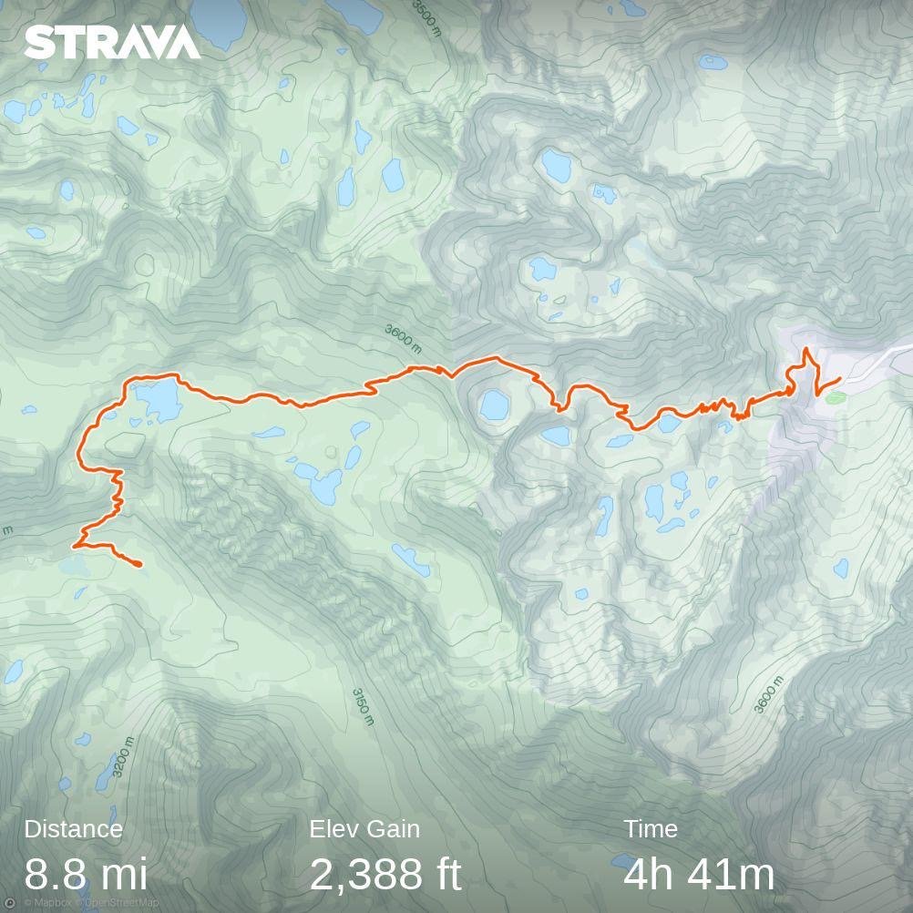
Distance: 8.83 Miles  

Moving Time: 04:41 hrs

Elevation Gain: 2,388 ft

Click here for current location

Today, we bailed on the Sierra. We haven’t officially made the decision yet, but I don't think we are coming back till later this summer. I’ve mentioned a lot of reasons for this in the last two posts, so I won't wax poetically about it anymore but, suffice to say, we can't finish this hike in 6 months at 10 miles a day, and that’s about all anyone can do in the Sierra in its current condition. At this rate it would take us another month to finish and that would leave us in the North Cascades in the middle of November which won’t work so, today, we came out on Kearsarge pass and got a ride to Independence, CA. 

The stage started at the Vindette campground - one of the many nice places to stay overnight in Kings Canyon National Park. From the campground, the path winds north and upward, climbing back above 10,000 feet on the PCT. At this point, there is an upper and lower approach to Kearsarge pass. One is called the Kearsarge Pass trail and the other is called Bullfrog Lake trail. We took the latter, having heard that it was more snow free. The Bullfrog lake trail winds northeast, crossing on the upper shores of Bullfrog lake before traveling due east through a flat valley and then ascending to a little over 11,000 feet at Kearsarge pass. As the trail ascends, there are beautiful views of the backside of Kearsarge pinnacles. From the pass, the trail descends through a hanging valley bordered by glacial moraine and then through a series of several lakes, each lower than the last. Finally, the trail winds down to the Kearsarge Pass trailhead, where a small parking lot and campground wait for tired returning hikers.

We slept in this morning. Actually, I could have kept sleeping for another few hours. I was wasted after the previous day's battle and both Amanda and I were pretty sluggish, but Wildfire got up and I didn't want to let him down, so I deflated my sleeping pad and started organizing my things. We were in close proximity to the river, which made everything a little colder, but we fought through and got everything together. I made the last of my Brown Sugar Oatmeal and choked it down before we did our warm-ups and hit the trail.

We started up the PCT, hoping desperately that the constant trail interruptions would not be such a feature on today’s stage. We were pleasantly surprised as we climbed up to 10,000 feet to find a smooth patch of dirt beneath our feet. I noticed, for the first time, ferns growing on either side of our path. Just before the turn-off for Bullfrog lake, we ran into snow. It wasn’t bad, but memories of yesterday fresh in my mind darkened the mood a bit. Not long after, we found the junction and turned off. It wasn’t a momentous thing, but it occurred to me that we would likely not be returning to this path anytime soon - that the next time I would exit this way would be several months from now. It was a little upsetting to think this as I was giving up on the dream of completing the trail in one straight line, but I reminded myself that this year was unlike anything in living memory, that finishing was the ultimate goal and that completing the Sierra would almost certainly jeopardize that. 

We turned into Bullfrog Lake Trail and started climbing. Wildfire swept behind us, I think so that he could properly depict our location. His wife, Caren, who had given us Pacifico’s and fruit almost 2 weeks earlier in Tehachapi, was coming to give us all a ride down to Independence and was watching his Garmin InReach location. The plan was that she was going to leave around the time we reached the pass to come get us.

We wound up and around Bullfrog lake. The Kearsarge Pinnacles began to dominate the background, and I couldn’t help but think of all the amazing routes that must have been developed through these incredible spires. After Bullfrog Lake, we traipsed east across the valley. Heart lake could be seen in the distance - it really did look like a heart, kind of like Guitar Lake from Whitney. The snow was intermittent, but at one point became solid in front of us.

We all stopped, and I looked at my GPS app. “I think the switchbacks go up above us.” We all looked up and could see the tiny Kings Canyon Sign silhouetted in the pass 700 feet above us. We all agreed to straight-line it up the scree slope above us instead of fighting through more snow. We headed up and, in about 100 feet, gained the first uncovered switchback. From there, we climbed for about 25 minutes before reaching the pass. 

At the top, we all stopped and took in the beautiful views below. A day hiker came up, and we talked to him for a while. He was climbing Mt. Gould, just above the pass, and informed us that the way down was partially snow covered but better after we had dropped the first 1000 feet. We thanked him, took pictures of ourselves around the King's Canyon Sign, and headed down. 

The first 1000 feet were sloppy. The sun had warmed the snow and made things very unstable, but at least there was minimal sun cupping, which was appreciated. We wound down and down, occasionally talking with day hikers headed for the pass. Everyone was surprised by the snow. We passed Postpile lake and a number of others. Wildfire informed us that Karen had arrived and was hiking up. “Can’t wait to see her again!” we both said. We hit the middle section of switchbacks and came to Flower Lake and there was Karen waiting on a rock. We walked out and said hi before continuing on, regaling her with all the woes of the previous days.

About an hour more brought us down to the trailhead. Beautiful views abounded all the way down. At the bottom, Karen had brought cold beer, soft drinks and fresh snacks. 

We sat at on the ground behind the car, which we all thought was funny because Karen had clearly offered us folding chairs, and talked, enjoying cold drinks. I remember Sean saying a while back that there was nothing he enjoyed more on the trail than cold beverages now, and i have to agree. After a while, our thoughts turned to a burger, and we loaded up to go down into Independence. 

Karen and Wildfire were staying in Independence at the Mt. Williamson Hotel and Karen had checked with them earlier about availability. Originally, there had been no spots open, but a last minute cancellation made it possible for us to stay, so we took it. We took a load of dirty clothes back to the office for cleaning before taking showers. It had been a long 8 days, and it felt incredibly good to finally get the miles of dirt off of us. Afterward, we tried to find a place for a burger in Independence, only to find that most of the places were closed, as it was Monday. Finally, we drove all the way down to Lone Pine where we found the Mt. Whitney Restaurant which boasted the best burger in town. We sat and had a great burger and a few brews, relishing the 1st-world convenience of warm food and cold drinks. We talked for an hour or so before heading back to the ice cream shop in Independence, where we tried a number of unique ice cream flavors - including Jalepeanut - which was my favorite.

On the way back to the hotel, we stopped at the county courthouse because it supposedly had one of the oldest groves of planted trees in America. In the back we found them - 2 100-year-old Lebanon Cedars, 2 Deodar Cedars and 2 Sequoias. We talked to a lady named Nancy, who we later found was like the quasi-mayor of the town. She told us all about the trees and the history of Independence and the Owen’s Valley - focusing on some of the more devious activities of the LA Department of Water and Power (DWP). 

After, we returned home - exhausted and ready for bed - and turned in for the night, saying we would see both Jeff and Karen in the morning for the family style breakfast.  

Day 54: Forrester Pass

Day 54: Forrester Pass

7/9/2023

Section: Milepost 778.2 to 788.2

Distance: 8.61 Miles  

Moving Time: 04:47 hrs

Elevation Gain: 1,496 ft

Click here for current location

Today was probably the hardest ten miles i have walked in my life and that’s even considering I am in the best hiking shape of my life. We walked for over 12 hours and gained 10 miles - don’t think the Strava stats above are correct... Our moving average regularly dropped to less than ½ mile per hour. It was brutal. If yesterday wasn’t enough to convince us to consider flipping up north, then today was. 

The stage today started out where we had stopped the night before, in a beautiful, high basin below Diamond Mesa, Junction Peak and Forrester Pass. The PCT/JMT progresses north up through the 5 lakes in this basin and goes over Forrester Pass at an elevation of 13,120 feet - the highest point on the PCT. Forester Pass was named after the Forestry personnel that discovered the pass in 1929 and demarcates the border between Sequoia NP and Kings Canyon NP. From here the trail drops into a cascading set of hanging valleys each with their own little lake before dropping all the way down into the Bubb’s Creek river valley along which there are numerous, beautiful backcountry camping spots to choose from. The stage ends under the Kearsarge pinnacles and at the junction for Kearsarge pass which is a popular exit point for PCT hikers to resupply.

Today started at 4. We had agreed to try and be underway by 5. The ranger had told us yesterday that Forrester was shaded most of the day so an extra early start was unnecessary and that the extra light might help us navigate up the lakes basin since the trail was completely covered in snow. Actually, not just the trail, the entire basin - it’s July and we only see 5-10 feet of trail every mile or so. Anyway, I was going to snooze but I saw Wildfire’s red headlamp moving about and felt bad because he was cowboying it and we were warm in our tent so I got up and got a move on. Amanda was a little slower, it was cold-ish - actually it was like 37 but with the breeze that had kicked up over night it felt pretty cold. The stark and imposing scenery that surrounded us also made it feel colder. Eventually Amanda got up and we got our things together. Just before we left, a guy in his mid-20’s showed up from the river valley below. He wasn’t much of a talker but we learned his name was Kyle and he was headed over today as well. Kyle is one of the first people we have seen since leaving Whitney 2 days ago. I can’t stress how crazy this is. It’s July and we are on one of the most coveted trails in the world - not America, the world - and Kyle is the only person we’ve seen in two days. It’s just not a normal year, by any measurable standard. We weren’t quite ready to leave so he departed and we finished preparation. Finally, around 5:20, we stepped off of our little island of rock and onto the sun cups. I know I have described these before but, to reiterate, they are little sunken snow ovals from hell. We don’t see these too often in the northwest because we are usually on a glacier doing these kinds of activities but they suuuuuuck. They are the most inconsistent, horrible surface to walk on and we had to cover 1.5 miles to the base of the pass on them. 

We progressed up the little basin. The sun cups where frozen which helped only a little bit. I felt bad for Amanda, with shorter legs, trying to navigate sun cups that were deeper than she could step. It helped if you could span from lip to lip, but that wasn’t always possible and, as they warmed, the lips couldn’t hold weight anymore and you would get sucked into them. At around 8 we reached the northern end of the basin. We had been watching Kyle and he had traversed way to far east at the base of the wall through which Forrester passed - almost to the base of Ski Mountaineer’s Pass - but he had figured it out and was traversing back. We started up the approach - the PCT’s nice switchbacks deep under the snow beneath our feet. Under normal summer conditions it’s not uncommon for a PCT hiker to roll through 3-4 passes a day, but under our current conditions, these passes are practically mountaineering commitments. The approach slope started gradual and steepend half-way to the point where I, up above the other two, called down that they should have their axes ready before getting up to the steep. We had originally agreed to angle for one of the first exposed switchbacks that was way to climber’s left, almost under the chute we were all worried about but Kyle, on his way back, had actually accessed a higher switchback by climbing on top of a rock in the middle of the wall above us and climbing up to the middle of a higher switchback. Looking left at the 50 yard traverse that was going to be required to get to our original goal, I called down for Amanda to head straight for “Kyle's Rock” and Wildfire, who was already under the rock, gave me a thumbs up. We all got to the top of the rock - really more of a boulder - and then Wildfire took the first shot at the class 4 scramble up to the switchback. Again, none of this would ever normally be required in July on the PCT, but these are the conditions we are currently working with. Amanda followed and then I was up on the switchbacks. We took off our spikes and followed Wildfire up to the dreaded chute.

I cannot articulate how ludicrous Forrester pass is. If you were standing down in the little valley we slept in looking at the insane array of peaks around you, you would probably say there was no good way out of it except back the way you came. The 1920’s forest service were composed of psychopaths though and they looked at the tiny notch at 13000 feet, probably with a stick of dynamite in their hand and a cigarette hanging out of their mouth and said - “oh yea - we’re putting a trail there.” Beautiful switchbacks are carved out of the granite 6 feet wide with nothing but air under them for hundreds of feet below in one of the most imposing environments in North America. It’s reminiscent of a time in this country where humans approached nature as something to be tamed, and the JMT is that mentality on display. A trail shouldn’t exist here, and yet it does.

The switchbacks rose for about 400 feet before we rounded a corner and there was the dreaded ice chute we had heard so much about. Maybe it was our harrowing experience on Mt. Whitney but we all took a look at it and breathed a sigh of relief - the fear mongering of FarOut had gotten to us. It was definitly a no fall zone. A fall would likely be fatal but the boot path was way more established than it had been on Whitney and there were pre-existing holes for ice ax self belay. Jeff (Wildfire) went across first, then Amanda and then myself - the whole thing took about 10 minutes. Then we finished off the last 5 switchbacks and were at Forrester pass.

We stopped at the top and took about 30 minutes to enjoy incredible views North. Amanda and I have tried to compare the Sierra to other places we have been. I think the closest would be the Dolomites - the two are sister ranges in terms of stark beauty and severity as well as endless jaw dropping views. Patagonia would be another similar setting given the granite. We ate and talked for a while. We could already see miles of sun cups below us and dreaded leaving our perch but eventually I took some timed pictures of us in front of the pass sign and we stepped off rock onto snow.

The next 5 hours were something of a horrer story - so bad, we just found ourselves laughing at times. The descent from Forrester started with about a quarter mile of sun cups which, since they were facing north and east, had gotten some sun and were unstable. After the quarter mile, which probably took 30-40 minutes to navigate, we walked a north running ridge on a thin band of rock on the actual dirt PCT. This quickly ran out into a steep patch of snow that would have required dedicated ax work to cross so we looked elsewhere. That’s the thing about the JMT/PCT in the Sierra - if the trail isn’t in working order and you take one step off of it you go from tranquil walking to mountaineering skills in a hurry. It’s like the trail is a small concentrated dot of peace that has been carved out of the maelstrom of imposing rock of these mountains. So, with the trail gone, our next best option was a class 4 down climb through an unstable, nearly vertical field of granite boulders - so we took that. An hour of navigating and willing oven-sized rocks not to move brought us back to the PCT. For about 15 minutes we got to actually hike on it and we relished every moment of it but, all good things must end and they did. For the next 3 hours we traveled through sun cups. I won’t say we were gracious about it but we were dedicated and we inched down to the lower lakes of the valley, mostly making about half a mile an hour. There were small islands of rock that we took advantage of but, mostly, it was just hours of jumping from rim to rim of sun cups and hoping they held. We all went down, many times, usually swearing but got back up and kept going and eventually we arrived at the tree line.

In the trees, things just became a different form of terrible. The sun cups disappeared, for the most part, but were replaced by an angled snow field that the PCT was using to drop further into the valley. This would have been fine on trail, but we were on soft snow and traversing was slow. We inched our way down, stopping to get water and take a break after the sun cup fiasco. We thought the trees would help but this was a younger patch of trees, all the same age, obviously the first to have come up after a massive avalanche about 20 years ago and they weren’t much for cover. I know this all sounds negative, and it was brutally hard, but we kept up a great attitude, usually a little cynical but it kept us going. At the end of the day, we were still hiking in one of the most beautiful areas in the world and that was unmistakable to all 3 of us. 

Eventually we did get to the bottom of the Bubb’s river valley and started following it further down. This brought us to the next challenge of the day - the crossing of one of the tributary streams to Bubb’s creek. Actually, the tributary was technically Bubb’s creek but it formally became Bubb’s when it dumped out into the bottom of the valley. In any case, we had to cross it. It was not the widest river we had crossed but it was deep and had a lot of flow. 2 options were before us - cross conventionally at the PCT crossing, which some had done. It wasn’t deep but it was really fast. The second option was a log lying above one of the most violent sections we could see, about 30 yards upstream. We agreed to take the log and butt scootch-it across. I went first with my backpack without incident. The log had been cleared on the top so no issue with the scootching. I came back and took Amanda’s bag across. Wildfire went then and almost fell in at the end but saved it and then Amanda cruised across. These crossings always add some spice to the day that I’m not sure is needed.

After the log we entered the final challenge of the day - series after series of avalanche patches. This had obviously been a big snow year for the Sierra but nothing drove that point home like seeing 3 solid miles of apocalyptic avalanche damage along Bubb’s creek. Trees larger around than my torso were ripped in half and everywhere were tangled messes of limbs and trunks - it was absolute chaos. I honestly don’t think the park service will have this cleaned up this year, maybe even into next year. These miles went slow. It was endless bobbing and weaving, climbing and crawling up and over and through to get further down the valley. I think we were a little delirious at this point because we couldn’t stop laughing. From mountaineering to boulder fields to sun cups to river crossings to avalanche tangles - today had everything you could never want in a hike and all we could do is laugh. You know what is crazy to me though - there are people, very few i think, but people who have come before us, done this and said - “you know what i want? I want 300 more miles of this” and are going on north into even more dense snow pack. I brought this up to Jeff and he smiled and said “maybe they like the challenge.” “I like the challenge,” i replied with a smile “but I’d like to finish more i think and that’s not going to happen on 10 mile, 12 hour days.”

Eventually the trail got everything out of it’s system and the last 2 miles were fairly good. We cruised down the trail past a few sanctioned NPS camping sites until we got close enough to the junction of Kearsarge pass that we could feel good about getting out easily the next day. We did our typical evenin activities, thought about making a fire and decided we were too tired and then said good night and went to bed having decided we could sleep into 5, given our superhuman effort today. 

I know this post may sound a bit negative and I apologize for this - it really isn’t meant to be. There are no bad days on the trail. There are days I want to end, there are days I really want to end with a beer and a cheeseburger but none that I have regretted. I am becoming more and more convinced that most of the NOBO’s skipped the Sierra all-together and that was probably a good decision but I don't regret continuing north and trying. Some people are good to go on the word of others but we had to see this for ourselves and make our own opinions and I can now officially say that these mountains are just not ready to be thru-hiked. They can be hiked but not at a pace or with the ease they were meant to be this time of year and it all comes down to time. At this point, barring some miracle beta from up ahead, I don't think we will be continuing the Sierra until the Fall, and I’m coming to peace with that a little more each day.

Day 53: Hard Truths

Day 53: Hard Truths

7/8/2023

Section: Milepost 768.2 to 778.2

Distance: 11.76 Miles  

Moving Time: 06:28 hrs

Elevation Gain: 2,795 ft

Click here for current location

Today was a bellwether day. I had been looking at the map of this section since we left Kennedy Meadows and I knew that it would be an indicator of how sections to come would go. This is because, according to NOAA, today’s section was the first to be completely covered in snow - up to 60 inches of it uniformly throughout the stage. I told myself that if today went well and we could do 15 miles-ish without trouble then the Sierra wouldn’t set us back too much and we could continue NOBO. We would fall behind a little but not so much that we couldn’t finish. It was also an indicator as to whether our food would hold out for us to get to Bishop Pass instead of exiting out of Kearsarge pass which I really did not want to do. Well, look at the milepost above and you will get a sense of how things went… 10 miles in 12 hours. 

We woke at 4:30 - and I snoozed three times. Thankfully, Wildfire’s alarm never even went off so he was also a little late to get up. I wolfed down two more oatmeal packets and dry heaved - really hate those things - then started packing up. Amanda was even slower than me getting up so we didn’t hit the trail until after 6 am. Today’s goal was to get to the base of Forester Pass, which is the highest point on the PCT and along the way we were going to cross 3 major streams - all of which were reported to be raging so there was some urgency to get on the trail and move out. 

We hiked back up to the junction between the PCT and the JMT, Wildfire about 15 minutes ahead of us. Izzy, Push-pop and Aspen’s tents sat silently above our camping site on the way out. They had been gone for several hours now and Amanda and I both hoped things were going well for them. We climbed up a dry, southern facing ridge. Some snow patches hung around near the trail and required moderate amounts of route finding, but nothing terrible. At the top of the ridge we descended the north side of the ridge and things got ugly. The ridge and the larger ridge below it, to Wallace creek, was entirely snow covered and steep. Navigating down was slow but, confidence had been severely boosted on Whitney the day before so we made good time. Halfway down I saw two figures talking and recognized Wildfire's hat. I called down to them and Wildfire waved back up at me. I climbed down, and I do mean climbed, the snow was softening and very steep such that i had to self belay myself down. When I arrived I found the other figure to be the Ranger for Tyndall Lake, which was situated 5 miles from Forrester Pass. He was going over crossing beta for the streams ahead and, in classic backcountry style, doing his best to scare the shit out of us. 

For the first stream, Wallace, he was recommending crossing at the PCT crossing. This is almost never where you want to cross in high water due to the fact that stock (horses and other animals) are typically crossed there, making a trench that can cause you to use your footing. The ranger recommended this, for the case of Wallace, because large, stable boulders had been placed there for the summer crossing and they were stable. For the second crossing, at Wright Creek, he recommended cutting up the top of the ridge ascended on the other side of Wallace and then traversing North so that we arrived approximately a mile upstream of the typical PCT crossing. He showed me on a map and I added a pin to find it later. This advice is more typical. Many creeks on the PCT have an area upstream where the topography is less extreme and the creek “fans out” becoming shallower and moving slower. He described Tyndell creek, which was our final cross, as a monster and said we should go way up stream to another flat spot to cross. From streams, conversation turned to Forester Pass. Forester pass is the highest point on the PCT and, excluding Whitney, one of two dangerous traverses this season. It is a small notch in an imposing ridge line found in the 1920’s by the forest service. This pass had been a point of a lot of conversation because it still had some snow over the path above a steep snow chute so a fall here would be potentially fatal. Here, he was actually more positive. “It’s in great shape now,” he said and then went on about how dangerous it had been up until about a week ago. “It used to be solid ice, with no good snow to self belay on. I told a lot of people to rethink it. It’s still dangerous but the boot pack is now better and there is good snow to self belay, but don’t fall. If it looks bad, come back, I have extra food at the Ranger Station - don’t feel like you are trapped.” I then asked if there were any more ranger stations between Forester and Bishop pass. “Of course,” he said “why, are you not getting out at Kearsarge.” I told him we had enough food for 5 days and were thinking of trying to make it. “Look,” he said “you are the first group I have seen in 4 days. Hardly anyone is coming through and I haven’t seen anyone come over from the other side in a while either. I don’t know how fast you are moving but, these days, I'm lucky to make 1 mile an hour and that won’t get better any farther north in Sequoia, Kings Canyon or Yosemite. Right now, you literally have to swim Rae lakes if you want to get across, there is no other alternative. You do what you want but there are more bad rivers and more high passes between here and Bishop - you should really be sure you have enough food. This is a crazy year, I don’t like to tell people how to enjoy the park but it seems to me it would be better to come back later and actually enjoy it rather than doing battle with it every day, but that’s just my opinion.” After this pep talk he went over the river beta one more time and then wished us a good day before taking off. “Damn,'' I said to the other two, " it sounds like Armageddon out there.

We clamored down the rest of the way to Wallace creek and then did a little briefing before going in. The run out on the downstream side was pretty bad  but the creek looked shallow enough even though it was running fast. Wildfire went first and, while he struggled with footing a little, he made it across. Amanda went next and slow and I went right behind her. There were a few parts where footing was subpar but she made it happen. Afterwards, we sat, ringed out our socks and tried to dry our boots. Once the socks were damp instead of soaked we headed up the ridge on the other side of Wallace. At the top, we turned east and headed straight up the ridge, off-trail to where the Ranger had said the good crossing was. We turned back north and heard Wright before we saw it. It’s difficult to call these things creeks as their name suggests, they are full on rivers and are roaring in places. Fortunately, we found the area the ranger had suggested, in a flat meadow area. The river had fanned out and this crossing was actually easier. I went first, to test, and then Amanda and then Wildfire. 

After this second crossing we stopped to ring out socks and dry boots again. This is the other thing taking so much time - the crossings. Everyone suggests crossing in your shoes for traction, but between finding a crossing, crossing, and then drying, crossings take up to an hour or more to do and sometimes necessitate large, off trail maneuvers to find a safe place. It’s just very slow. 

After crossing Wright creek we carried on. The trail rose slightly up to Bighorn Basin where the ranger had said we should camp. As we approached, we gave a mutual groan at a massive expanse covered almost entirely in sun cups. Amanda and I put on the snowshoes while Wildfire went scouting ahead. We walked in the snowshoes but they really didn’t help. All 3 of us ate it on the small climb up into the basin. Once there though, we were awed by 360 degree views of the Sierra - it was amazing. Eventually we decided to get off the sun cups and go off trail to the edge of the basin where snow was minimal. From the basin, the trail entered the upper reaches of the Tyndell creek valley. From far below we could hear the “monster” roaring up at us. “That sounds fun to cross,” i said nervously to the other two. The trail wound down as the creek rose up to meet us and, eventually, we came to the turn-off for the Tyndell creek ranger station. It was a half mile away and we all agreed we wanted to get the crossing over since it was 3 pm and we could get up close to Forrester with the time we had left. We went on and eventually came to the PCT crossing of the creek - except we couldn’t really get close because the creek was overflowing onto the PCT. It was absolutely raging. “Wanna cross here?” I joked to the other two. We went up to a flat, meadow area and, sure enough, found a place where the creek broke into two streams and crossed one, then the other without incident. The creeks are really bad right now but if you are smart about crossing, they are manageable. 
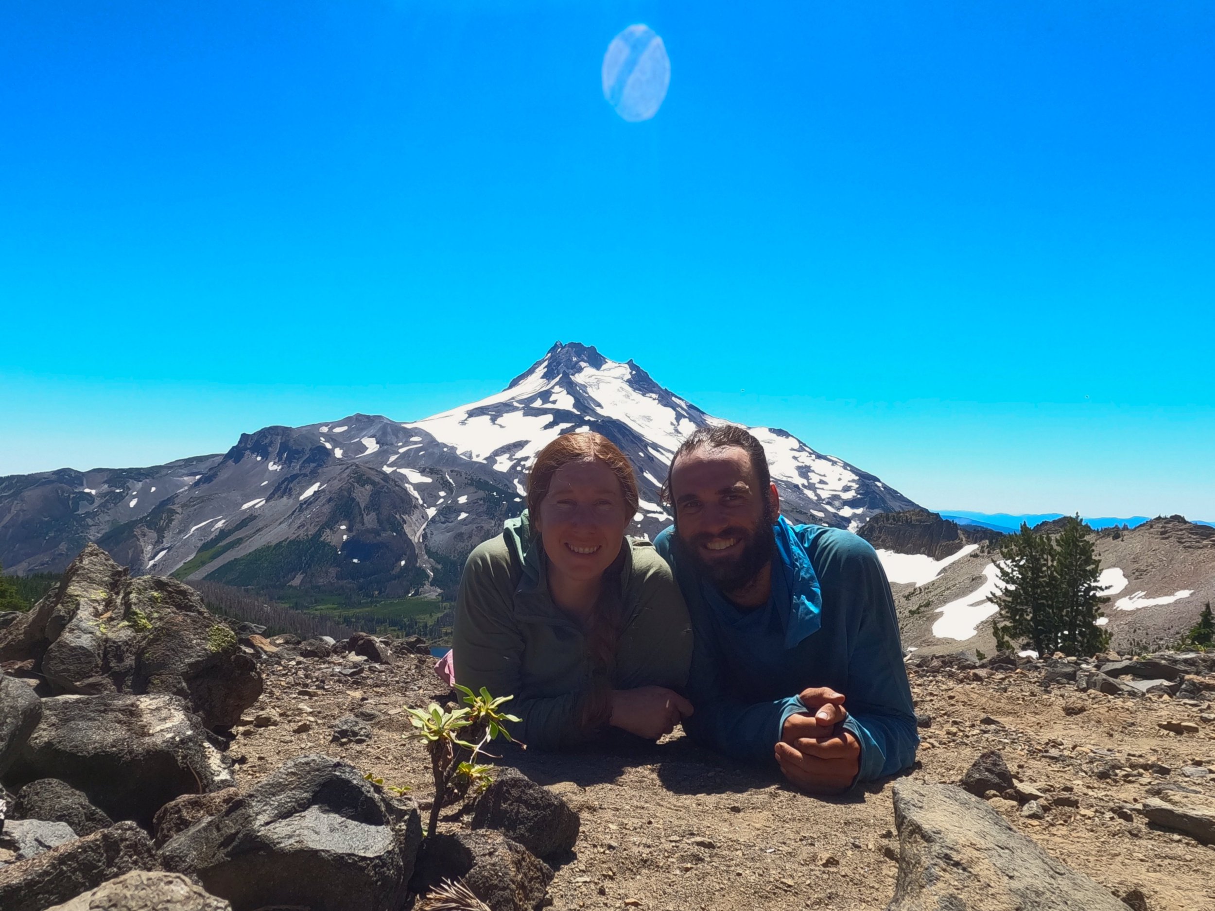
From the crossing we, again, stopped and dried our things. It was around 4 and we wanted to get through more sun cup terror we had heard was on the agenda to reduce what we had to do for Forrester the next day. We straight lined it up from the crossing knowing we would intersect the PCT at some point and after about 800 vertical feet we found it, barely, as it was still under snow. We followed the trail for about 20 yards before it disappeared again under sun cupped snow and so we straitlined it up again trying to stay off the sun cups as long as possible. Eventually we did have to enter that most terrible of terrains and began island hopping from rock outcropping to rock outcropping slowly climbing out of the top of the Tyndall River valley and into a high basin. Forrester could be seen off in the distance now as a small notch in a wide band of rock. We climbed higher and higher until the sun got to a point that we decided to stop and take advantage of it to fully dry our things. We settled on a nice spot where we could pitch a tent and were close to water. The Sierra here is very arid and desolate looking. Not much grows and the mountains are massive and imposing but gorgeous. Amanda and I thought it looked very similar to the Himalayan region near the Indian border with Pakistan - very bare and arid. 

Amanda set up the tent while I stepped back into the sun cups to descend to a melted part of a river where I filled Amanda’s bear canister and Wildfires CNOC water bladder with water we could filter at the camp. We had dinner and talked for awhile. Eventually I did my yoga, cleaned up and we all said goodnight, agreeing on a 4 am wake-up to take advantage of the stiff snow.

Today brought me to a hard realization - I don’t think we will continue in the Sierra, much less on to Bishop pass. I so desperately wanted to do this thing in a straight line, there was something so perfect about it, but this just isn’t the year. There are many things that go into this decision. We have had to use more mountaineering skills on this trip than i ever thought we would need and should be necessary - it’s not an expedition, it’s a through-hike. The water crossings are hard and dangerous. The passes are not walk-ups, they require a good amount of ice ax work. In general, there’s more risk in these sections then there ever should be. We have the skillset to handle that but it’s not what i was looking for out of this experience. This is supposed to be a relaxing walk-about with beautiful views and a time to let the mind rest and wander and it’s difficult to do when all you are thinking about is the next pass, or the next monster river or navigating around mound after mound of snow on the trail. At this point we spend more than half of our day off the trail instead of on it. But in the end, it’s not the extra risk, or sun cups or tedious rerouting - it’s time. We have 6 months to finish the PCT and 300 more miles of this terrain is going to eat a lot of that up without producing any distance. I want to do this in a straight line, but i want to finish it more, so i think we will have to come back to the Sierra in the fall. Kinda silly because we will have done 2 of the 3 major challenges at the worst time but, again, it’s not that we can’t do it, we just don’t have the time and that sucks. It’s going to take me a few days to get over this, because it hurts but i am glad we tried. I am glad we tried because I now know exactly why we are going to skip and come back - i had to see it to believe it but now I certainly believe it.

Day 52: Whitney for the Win

Day 52: Whitney for the Win

7/7/2023

Section: Milepost 768.2 to 768.2

Distance: 13.51 Miles  

Moving Time: 07:56 hrs

Elevation Gain: 4,518 ft

Click here for current location

My alarm went off at midnight. I had kinda already been awake because the JMT couple in the tent next to us was up around 11 getting ready to go. At midnight I begrudgingly got out of bed and went to make some Cinnamon oatmeal - not my favorite breakfast by far but something simple and easy to prepare. The moon wasn’t up but it was so bright it was already starting to cast its own moonrise glow. Amanda dawdled for a while, really not wanting to get out of bed but eventually I heard her stir and start getting things together. 

Today’s morning festivities were easy because we were leaving everything at basecamp and coming back. I was only taking a small summit bag with some snacks, ice axe, GoPro, Fitbit charger, 3 liters of water, sunscreen/lip balm and sunglasses - pretty standard set-up for a summit bid. About 20 minutes after I started making oatmeal Amanda was up and the JMT couple left, heading towards Whitney with their whole load. “Must be going out Whitney Portal,” I said to Amanda, nodding at their empty site. 

We finished eating and shouldered our prepared summit packs, relishing how light they were compared to our normal loads. As we were doing our last mental run-through, a red light came on in Wildfire’s tent signaling that he was also preparing to leave. We made our way out of the camp site and onto the JMT heading east towards Mount Whitney. The moon had finally risen and was casting lunar vibes throughout the forest. The trail went on for about a mile before we lost it in the snow. A massive avalanche had ripped through the Whitney creek area and loads of trees were down as well as excess snow. I followed the route on Gaia, my map app, and was able to navigate a way through the trees and snow. Every once in a while a snippet of the trail would show up signaling we were on the right path but, other than that, it was early morning route finding. 

The JMT wound its way along some beautiful alpine lakes. PCT hikers were not allowed to camp east of the Crabtree ranger station, but JMT hikers could as this was the JMT and I was a little jealous of that because, wow, what an amazing view. The trail eventually wound up and out of the little valley of lakes into a massive drainage basin surrounded by peaks, including Mount Young, Mount Whitney and Mount Hitchcock. With the moon casting amazing light on these peaks it was one of the most ethereal sites I have ever seen. I stopped and took some epic night shots with the GoPro.

We eventually came to an expansive snowpack where navigation became less of an issue but something else took its place - sun cups. For those who are unfamiliar with these agonizing snow features, they are essentially large, deep, unevenly spaced cups in the snow that are caused by non-uniform melting by the ground beneath. They make for the worst surface to walk on I can think of because every step must be calculated and they usually collapse on you when warmed in the sun. Collapse of sun cups was not a major issue in the frozen morning and with Microspikes on we traveled decently well, however, two miles of uneven and uniform surface was a menace. We climbed up into the basin on the cupped snow. I could see the JMT couple ahead of us but for some reason they kept turning their headlamps off. We hugged the edge of the snow at the basin, aware that large bodies of water were present in the middle. After a little bit we started navigating up a series of ledges. 

On pretty much every alpine approach, navigating ledges is key as they are a common feature for most mountains. It’s not my favorite thing to do because you are often doing so in the dark without the advantage of looking down to see how they develop. It’s easy to get “cliffed out” or end up following a ledge that doesn’t go where you want. 

This morning I chose a different ledge than the sporadic headlamp duo ahead of us and managed to pick correctly as it led us up to the higher section of the basin where we could access the switchbacks up to the flanks of Mt. Whitney.

For those unfamiliar with Mt. Whitney, it is the highest mountain in the lower 48 states at just shy of 14,500 feet. During the normal climbing season, it is not considered a technical mountain. The JMT drives straight to the top of the mountain and, in a typical July, fit families can walk right up it. This was not a typical year though - snow was still very much consistent on the route, which brought us to the 3rd challenge, snow covered switchbacks. On the Whitney Creek approach, which was the route we were on, the JMT accesses the main ridge of the mountain by climbing about 25-30 switchbacks wrought into the scree and granite blocks of the mountain. It is a truly remarkable trail, the likes of which are no longer built in our parks. I cannot begin to describe the amount of work and effort that went into building or maintaining it. The challenge this year was that the switchbacks were covered in snow in some sections which means that climbers have to traverse these snow patches, some of which extend a thousand vertical feet below the patch being crossed. At 4 am we arrived at the switchbacks, just behind the JMT couple. We made our way up the first few and then came to the first snow patch. All 4 of us put our Microspikes back on and traversed the first snow patch, then took the spikes off for about a quarter mile, then put them on for the next snow patch and so on and so on. After the first 4 or 5 patches, the crossing became more menacing. Large run-outs below the patches meant that not arresting in the event of a fall became serious or fatal. On one such patch, the four of us decided to just cut the switchback and go straight up to the next one. It was light by this time so we started climbing, staying out of each other's potential rock fall. The scree and granite blocks of the Sierra are a little different than at home in the North Cascades - things move. As I made my way up through the steep field of blocks, trying to work on solid pieces not based in sand, I moved across a refrigerator sized block of granite that wiggled above me as I traversed around it. I haven’t had this happen much in the climbing i have done throughout my life and i sincerely hope it never does again, it is a very unnerving feeling. “Ok, no more scrambling,” I said to Amanda as we reached the next switchback - she just nodded in agreement. Fortunately, from there, we were close to trail saddle, where the traffic from Whitney Portal joins those from our side of the mountain. Here we continued on up a spectacular stretch of the JMT which runs along the length of Whitney ridge reverse to what we did far below in the sun cups. 

Whitney is a gorgeous mountain, brutal and beautiful all at the same time. It has a number of spires which lean out towards the east and make small saddles from which you can climb up to and look down over a 1000 feet - it is amazing. While the ridge up to Whitney is unique the summit itself is actually a little mundane. At the end of the ridge is a 500 foot tall lazy, flat dome composed of stacked rocks which makes up the summit. Usually the JMT makes a nice sweep up to it but, because of the snow, there is an actual boot pack which straight-lines to the peak. On our approach and way up this boot pack we ran into 2 guys on their way up as well from Whitney Portal and a French guy on his way down. We said hi to both and kept going. At around 8:30 we were on top and alone on this incredible peak with 360 views of the Sierra - it was amazing! Soon after, Wildfire showed up - I had seen his headlamp blinking below us as we finished the sun cup section. We hi-fived and took pictures. Amanda and I could have stayed up there forever - it was probably the best I have ever felt at that kind of altitude. We had cell service for the first time in about 5 days so we did a quick check-in but left soon after, wanting to get back through the sections below before the heat of the day really started destabilizing things. Actually, I discovered that my Wells Fargo account was slightly overdrawn and had to do a little banking at 14,000 feet - so that was cool. On our way down we said hi to the JMT couple and the two guys we had passed on the way up. We also signed the register at the Smithsonian Hut which stands on the summit and headed down. We didn’t see any of our friends' names on the register or the group of 7 which we thought was weird because we figured they were ahead of us.

The initial descent was largely uneventful. The Whitney Portal traffic was really picking up and we passed probably 8 groups on the way down, which made us really appreciate our alone time on the summit even more. Most of the Whitney Portal groups were talking about a group of 4 which had been stranded on the mountain all last night. Evidently they had expected there to be trees to make firewood and other amenities which are obviously not available on the mountain. One of the group had made a desperate attempt to get down early in the morning by glisading on the hard ice and had fallen a fair distance, somehow not hurting himself in the process. One group had the comment “this is the problem with having the tallest mountain in the lower 48 only 4 hours from LA.”

We got down to the trail junction where you can go to Whitney Portal or to Crabtree where we were camped. Here we said goodbye to the JMT couple and headed down the switchbacks. At the first snow covered switchback we decided not to down climb through the granite blocks because, you know, I don’t like to see something weighing a ton move when it shouldn’t, so we traversed on snow. This was just as harrowing. Amanda and I have both done a good amount of mountaineering, so we know the moves and how this kind of traverse should be done but this first traverse was over a “no-fall” zone, an area where a fall would likely be fatal. In these areas one would typically rope up but, as we had no rope, we did this using our ice axe for a self belay. It’s a good, solid technique but still very uncomfortable. It was at this moment I started remembering some of the notes I had read from other people doing this climb in FarOut. The snow covered sections were described as “sketchy,” “non-ideal,” and other Gen-Z’ish language which really made me realize not many people who had done this section had realized the inherent danger they were in while doing it. Whether it was from either the traverse itself or the free-spirited refrigerator sized granite blocks on the scramble. From there until the last ugly traverse both Amanda and I occupied ourselves with our own beta for this climb to share on FarOut. 

Eventually, after about 9 more traverses of diminishing consequence we reached the bottom of the switchbacks and Wildfire joined us, also voicing his discomfort with the snow covered switchbacks. From here we made the long approach back across the now soft and less stable suncups and into the navigation zone, eventually getting back to camp around 5 pm. It had been a much longer and committed climb than expected but we were so happy to have done it.

Back at camp I was surprised to catch sight of Izzy just arriving at camp. “Izzy” I shouted and she turned around and smiled as she said hello. Also with her were push-pop, UK Sam, Aspen and ET. In addition, the group of 7 we had camped with 2 nights before had also shown up. Turns out Izzy, Push-pop, Sam and ET had gotten off at Cottonwood pass literally an hour before we had gone through. They had been worried about having enough food and resupplied in Lone Pine - so we hadn’t fallen behind as far as we thought!

After catching up for about an hour and sharing info on the route we had dinner with Wildfire, recounting the day before turning in for some much needed sleep.