7/8/2023
Section: Milepost 768.2 to 778.2
Distance: 11.76 Miles
Moving Time: 06:28 hrs
Elevation Gain: 2,795 ft
Click here for current location
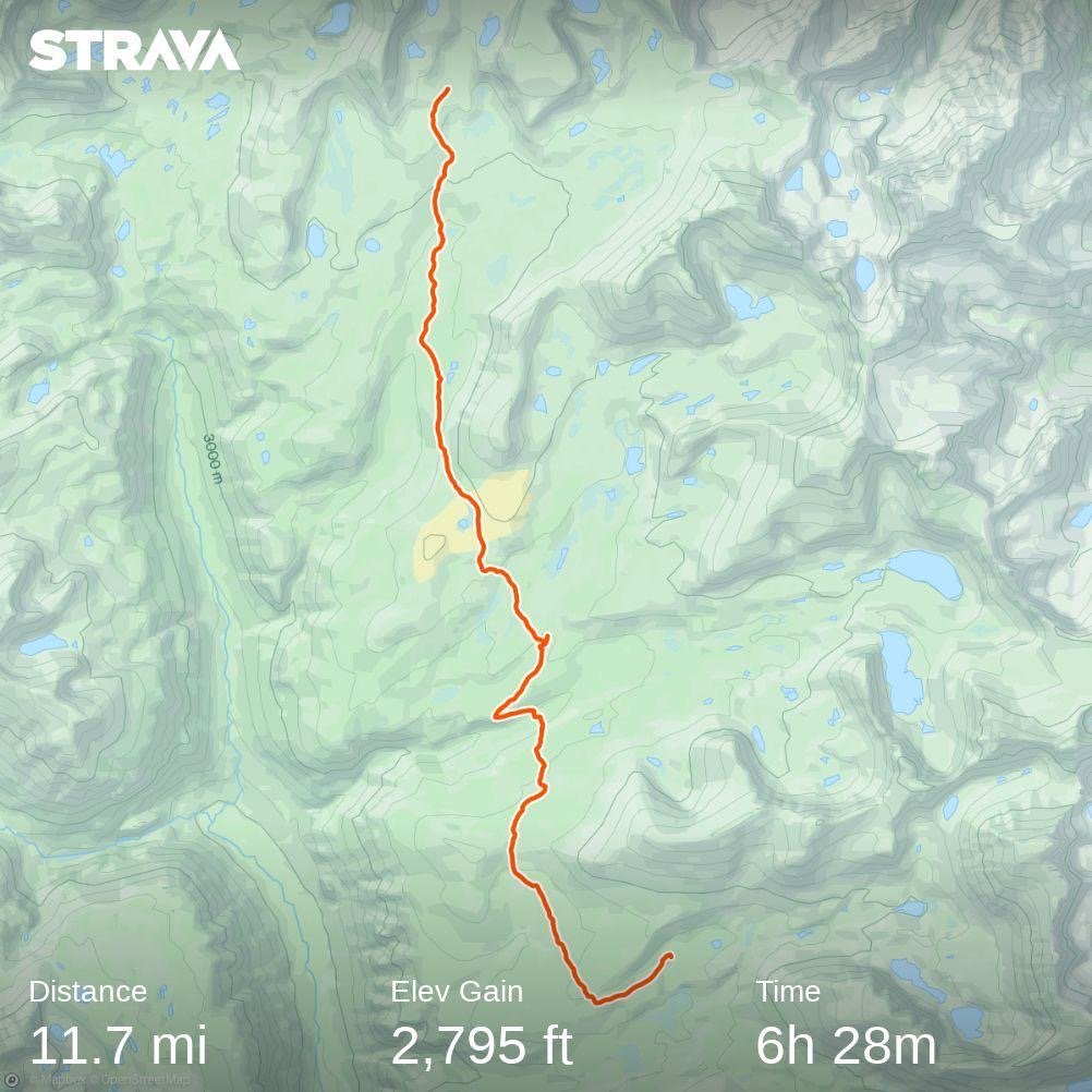
Today was a bellwether day. I had been looking at the map of this section since we left Kennedy Meadows and I knew that it would be an indicator of how sections to come would go. This is because, according to NOAA, today’s section was the first to be completely covered in snow - up to 60 inches of it uniformly throughout the stage. I told myself that if today went well and we could do 15 miles-ish without trouble then the Sierra wouldn’t set us back too much and we could continue NOBO. We would fall behind a little but not so much that we couldn’t finish. It was also an indicator as to whether our food would hold out for us to get to Bishop Pass instead of exiting out of Kearsarge pass which I really did not want to do. Well, look at the milepost above and you will get a sense of how things went… 10 miles in 12 hours.
We woke at 4:30 - and I snoozed three times. Thankfully, Wildfire’s alarm never even went off so he was also a little late to get up. I wolfed down two more oatmeal packets and dry heaved - really hate those things - then started packing up. Amanda was even slower than me getting up so we didn’t hit the trail until after 6 am. Today’s goal was to get to the base of Forester Pass, which is the highest point on the PCT and along the way we were going to cross 3 major streams - all of which were reported to be raging so there was some urgency to get on the trail and move out.
We hiked back up to the junction between the PCT and the JMT, Wildfire about 15 minutes ahead of us. Izzy, Push-pop and Aspen’s tents sat silently above our camping site on the way out. They had been gone for several hours now and Amanda and I both hoped things were going well for them. We climbed up a dry, southern facing ridge. Some snow patches hung around near the trail and required moderate amounts of route finding, but nothing terrible. At the top of the ridge we descended the north side of the ridge and things got ugly. The ridge and the larger ridge below it, to Wallace creek, was entirely snow covered and steep. Navigating down was slow but, confidence had been severely boosted on Whitney the day before so we made good time. Halfway down I saw two figures talking and recognized Wildfire's hat. I called down to them and Wildfire waved back up at me. I climbed down, and I do mean climbed, the snow was softening and very steep such that i had to self belay myself down. When I arrived I found the other figure to be the Ranger for Tyndall Lake, which was situated 5 miles from Forrester Pass. He was going over crossing beta for the streams ahead and, in classic backcountry style, doing his best to scare the shit out of us.
For the first stream, Wallace, he was recommending crossing at the PCT crossing. This is almost never where you want to cross in high water due to the fact that stock (horses and other animals) are typically crossed there, making a trench that can cause you to use your footing. The ranger recommended this, for the case of Wallace, because large, stable boulders had been placed there for the summer crossing and they were stable. For the second crossing, at Wright Creek, he recommended cutting up the top of the ridge ascended on the other side of Wallace and then traversing North so that we arrived approximately a mile upstream of the typical PCT crossing. He showed me on a map and I added a pin to find it later. This advice is more typical. Many creeks on the PCT have an area upstream where the topography is less extreme and the creek “fans out” becoming shallower and moving slower. He described Tyndell creek, which was our final cross, as a monster and said we should go way up stream to another flat spot to cross. From streams, conversation turned to Forester Pass. Forester pass is the highest point on the PCT and, excluding Whitney, one of two dangerous traverses this season. It is a small notch in an imposing ridge line found in the 1920’s by the forest service. This pass had been a point of a lot of conversation because it still had some snow over the path above a steep snow chute so a fall here would be potentially fatal. Here, he was actually more positive. “It’s in great shape now,” he said and then went on about how dangerous it had been up until about a week ago. “It used to be solid ice, with no good snow to self belay on. I told a lot of people to rethink it. It’s still dangerous but the boot pack is now better and there is good snow to self belay, but don’t fall. If it looks bad, come back, I have extra food at the Ranger Station - don’t feel like you are trapped.” I then asked if there were any more ranger stations between Forester and Bishop pass. “Of course,” he said “why, are you not getting out at Kearsarge.” I told him we had enough food for 5 days and were thinking of trying to make it. “Look,” he said “you are the first group I have seen in 4 days. Hardly anyone is coming through and I haven’t seen anyone come over from the other side in a while either. I don’t know how fast you are moving but, these days, I'm lucky to make 1 mile an hour and that won’t get better any farther north in Sequoia, Kings Canyon or Yosemite. Right now, you literally have to swim Rae lakes if you want to get across, there is no other alternative. You do what you want but there are more bad rivers and more high passes between here and Bishop - you should really be sure you have enough food. This is a crazy year, I don’t like to tell people how to enjoy the park but it seems to me it would be better to come back later and actually enjoy it rather than doing battle with it every day, but that’s just my opinion.” After this pep talk he went over the river beta one more time and then wished us a good day before taking off. “Damn,'' I said to the other two, " it sounds like Armageddon out there.
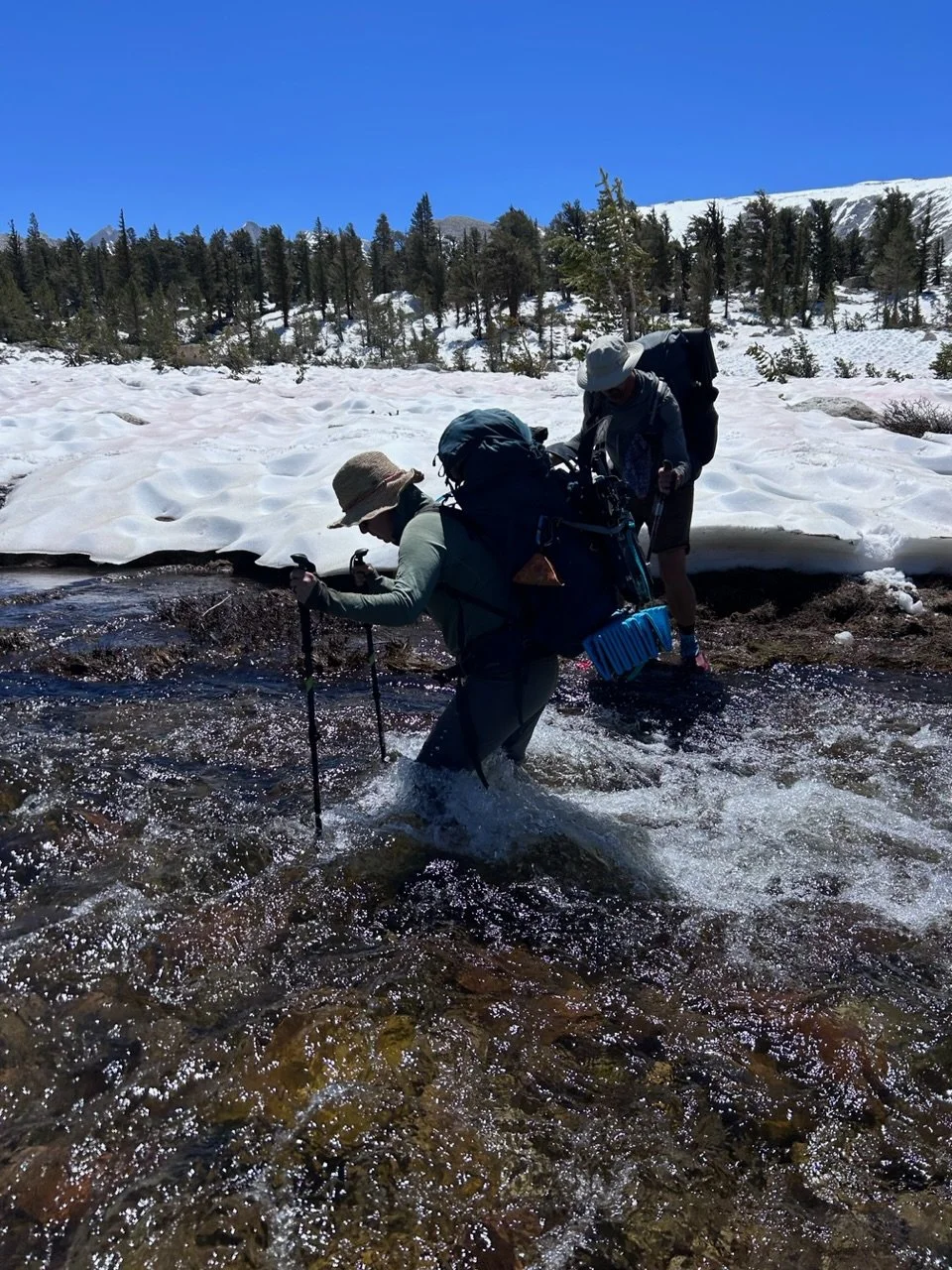
We clamored down the rest of the way to Wallace creek and then did a little briefing before going in. The run out on the downstream side was pretty bad but the creek looked shallow enough even though it was running fast. Wildfire went first and, while he struggled with footing a little, he made it across. Amanda went next and slow and I went right behind her. There were a few parts where footing was subpar but she made it happen. Afterwards, we sat, ringed out our socks and tried to dry our boots. Once the socks were damp instead of soaked we headed up the ridge on the other side of Wallace. At the top, we turned east and headed straight up the ridge, off-trail to where the Ranger had said the good crossing was. We turned back north and heard Wright before we saw it. It’s difficult to call these things creeks as their name suggests, they are full on rivers and are roaring in places. Fortunately, we found the area the ranger had suggested, in a flat meadow area. The river had fanned out and this crossing was actually easier. I went first, to test, and then Amanda and then Wildfire.
After this second crossing we stopped to ring out socks and dry boots again. This is the other thing taking so much time - the crossings. Everyone suggests crossing in your shoes for traction, but between finding a crossing, crossing, and then drying, crossings take up to an hour or more to do and sometimes necessitate large, off trail maneuvers to find a safe place. It’s just very slow.
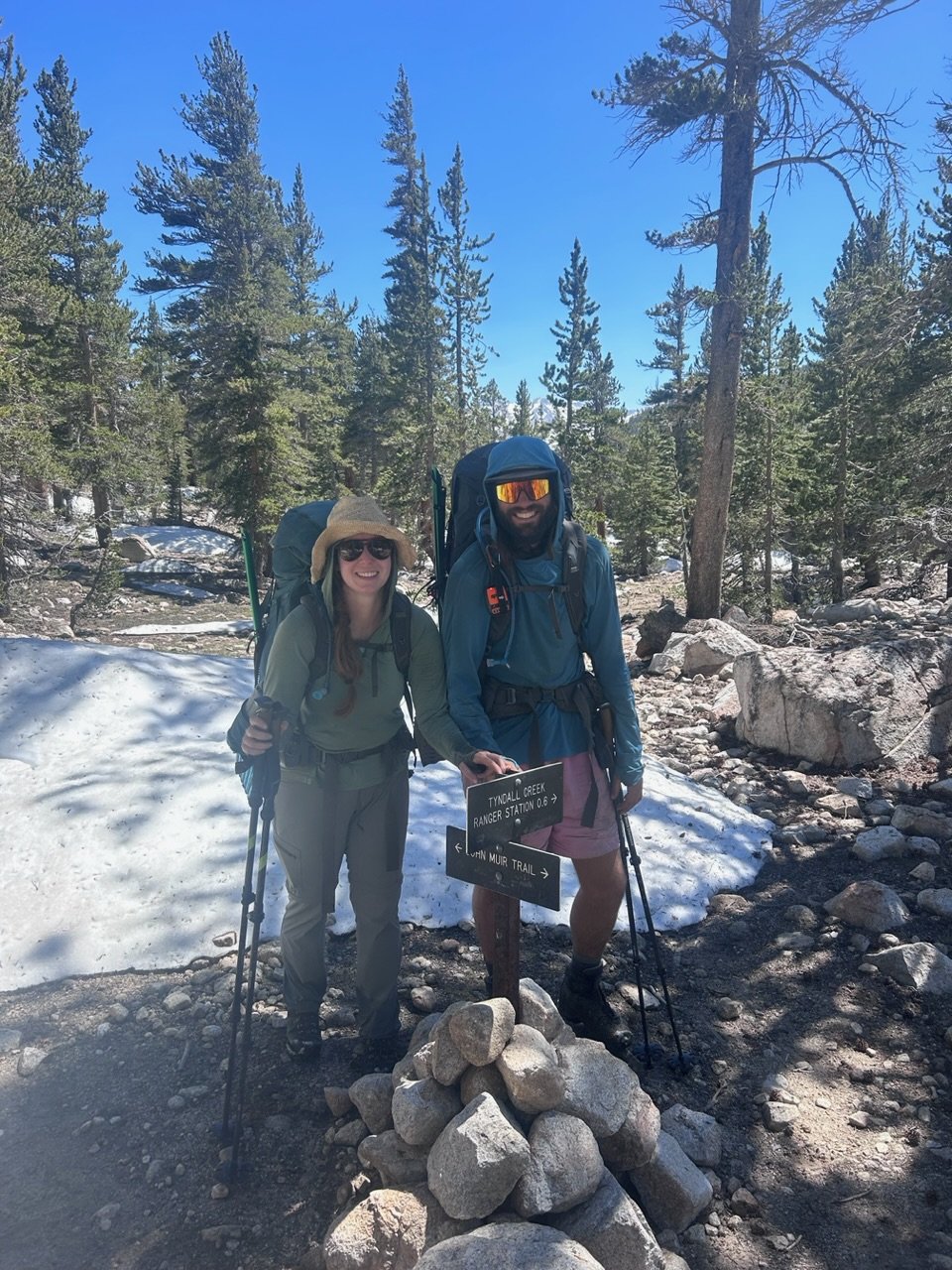
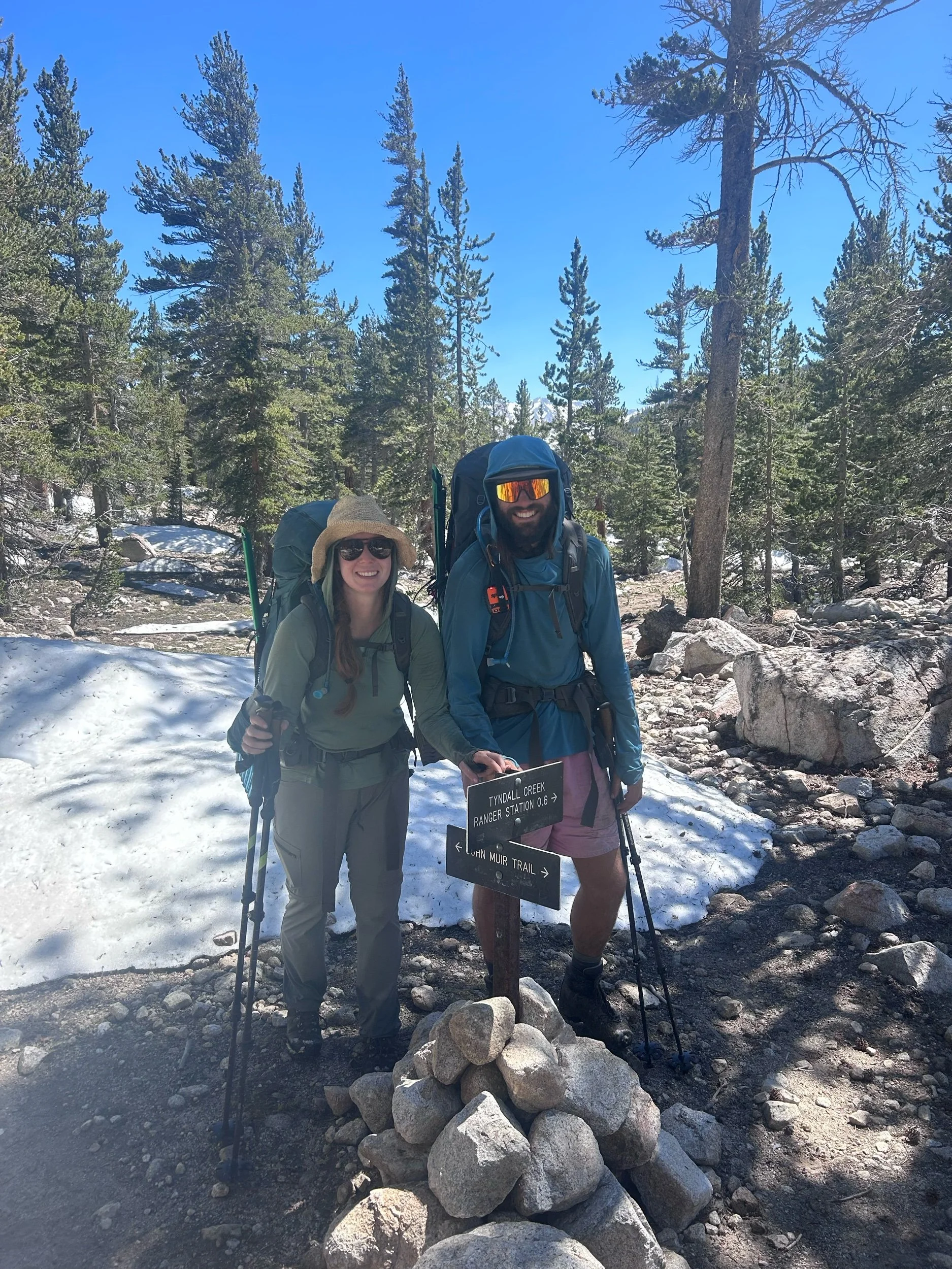
After crossing Wright creek we carried on. The trail rose slightly up to Bighorn Basin where the ranger had said we should camp. As we approached, we gave a mutual groan at a massive expanse covered almost entirely in sun cups. Amanda and I put on the snowshoes while Wildfire went scouting ahead. We walked in the snowshoes but they really didn’t help. All 3 of us ate it on the small climb up into the basin. Once there though, we were awed by 360 degree views of the Sierra - it was amazing. Eventually we decided to get off the sun cups and go off trail to the edge of the basin where snow was minimal. From the basin, the trail entered the upper reaches of the Tyndell creek valley. From far below we could hear the “monster” roaring up at us. “That sounds fun to cross,” i said nervously to the other two. The trail wound down as the creek rose up to meet us and, eventually, we came to the turn-off for the Tyndell creek ranger station. It was a half mile away and we all agreed we wanted to get the crossing over since it was 3 pm and we could get up close to Forrester with the time we had left. We went on and eventually came to the PCT crossing of the creek - except we couldn’t really get close because the creek was overflowing onto the PCT. It was absolutely raging. “Wanna cross here?” I joked to the other two. We went up to a flat, meadow area and, sure enough, found a place where the creek broke into two streams and crossed one, then the other without incident. The creeks are really bad right now but if you are smart about crossing, they are manageable.
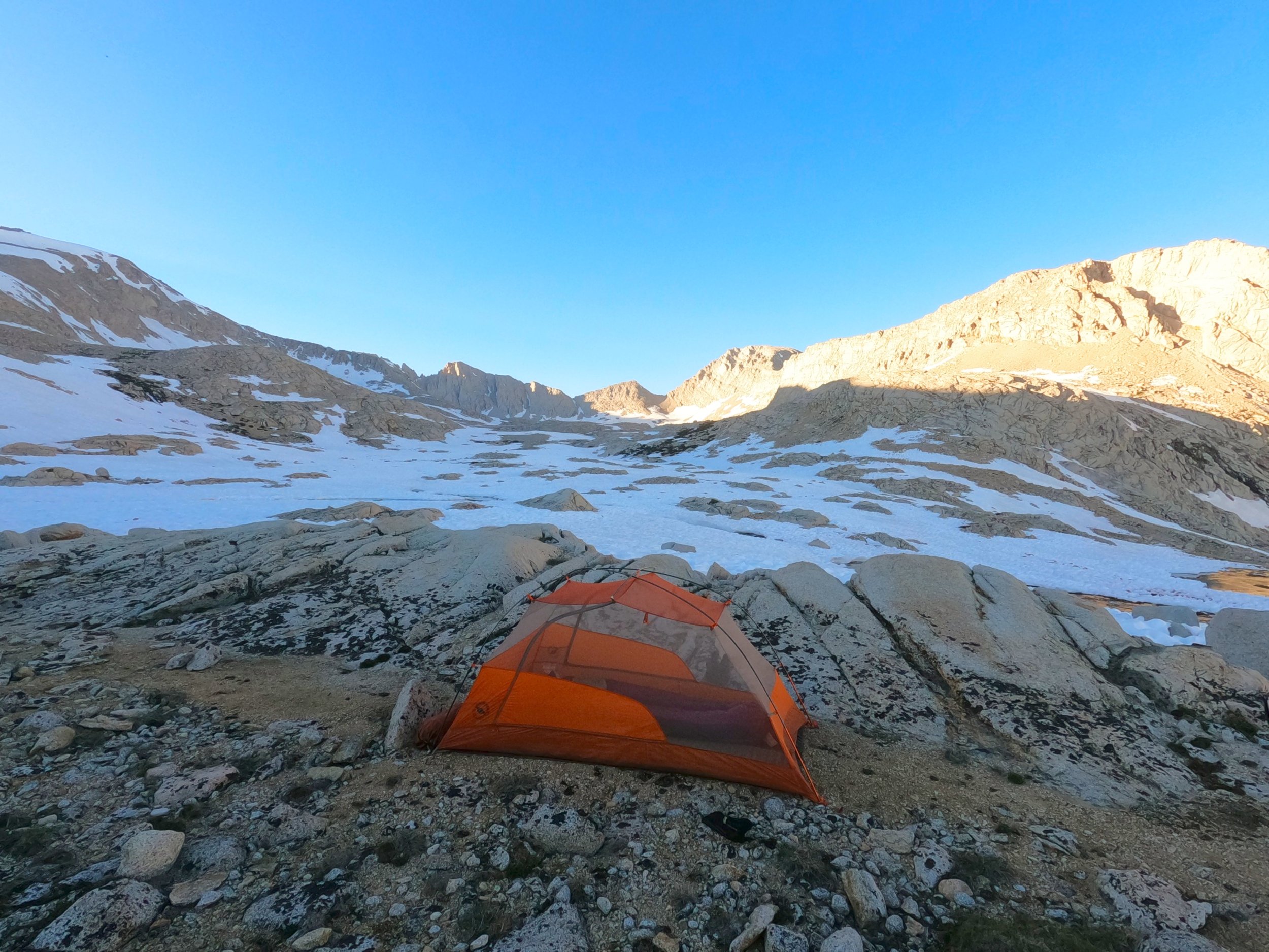
From the crossing we, again, stopped and dried our things. It was around 4 and we wanted to get through more sun cup terror we had heard was on the agenda to reduce what we had to do for Forrester the next day. We straight lined it up from the crossing knowing we would intersect the PCT at some point and after about 800 vertical feet we found it, barely, as it was still under snow. We followed the trail for about 20 yards before it disappeared again under sun cupped snow and so we straitlined it up again trying to stay off the sun cups as long as possible. Eventually we did have to enter that most terrible of terrains and began island hopping from rock outcropping to rock outcropping slowly climbing out of the top of the Tyndall River valley and into a high basin. Forrester could be seen off in the distance now as a small notch in a wide band of rock. We climbed higher and higher until the sun got to a point that we decided to stop and take advantage of it to fully dry our things. We settled on a nice spot where we could pitch a tent and were close to water. The Sierra here is very arid and desolate looking. Not much grows and the mountains are massive and imposing but gorgeous. Amanda and I thought it looked very similar to the Himalayan region near the Indian border with Pakistan - very bare and arid.
Amanda set up the tent while I stepped back into the sun cups to descend to a melted part of a river where I filled Amanda’s bear canister and Wildfires CNOC water bladder with water we could filter at the camp. We had dinner and talked for awhile. Eventually I did my yoga, cleaned up and we all said goodnight, agreeing on a 4 am wake-up to take advantage of the stiff snow.
Today brought me to a hard realization - I don’t think we will continue in the Sierra, much less on to Bishop pass. I so desperately wanted to do this thing in a straight line, there was something so perfect about it, but this just isn’t the year. There are many things that go into this decision. We have had to use more mountaineering skills on this trip than i ever thought we would need and should be necessary - it’s not an expedition, it’s a through-hike. The water crossings are hard and dangerous. The passes are not walk-ups, they require a good amount of ice ax work. In general, there’s more risk in these sections then there ever should be. We have the skillset to handle that but it’s not what i was looking for out of this experience. This is supposed to be a relaxing walk-about with beautiful views and a time to let the mind rest and wander and it’s difficult to do when all you are thinking about is the next pass, or the next monster river or navigating around mound after mound of snow on the trail. At this point we spend more than half of our day off the trail instead of on it. But in the end, it’s not the extra risk, or sun cups or tedious rerouting - it’s time. We have 6 months to finish the PCT and 300 more miles of this terrain is going to eat a lot of that up without producing any distance. I want to do this in a straight line, but i want to finish it more, so i think we will have to come back to the Sierra in the fall. Kinda silly because we will have done 2 of the 3 major challenges at the worst time but, again, it’s not that we can’t do it, we just don’t have the time and that sucks. It’s going to take me a few days to get over this, because it hurts but i am glad we tried. I am glad we tried because I now know exactly why we are going to skip and come back - i had to see it to believe it but now I certainly believe it.