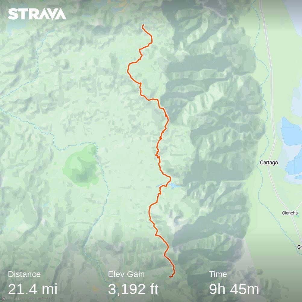
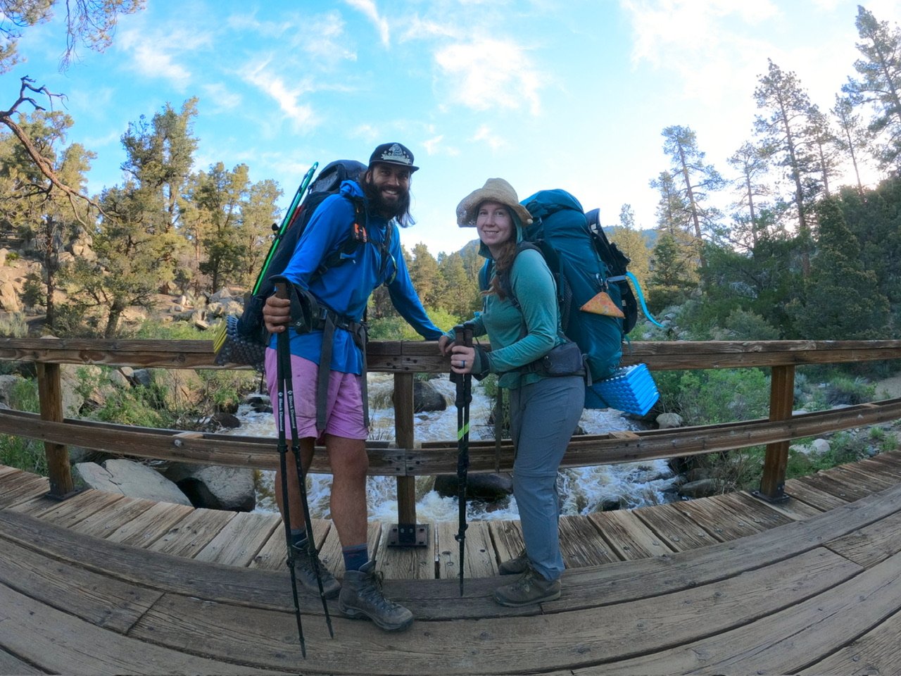
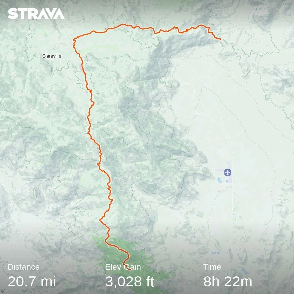
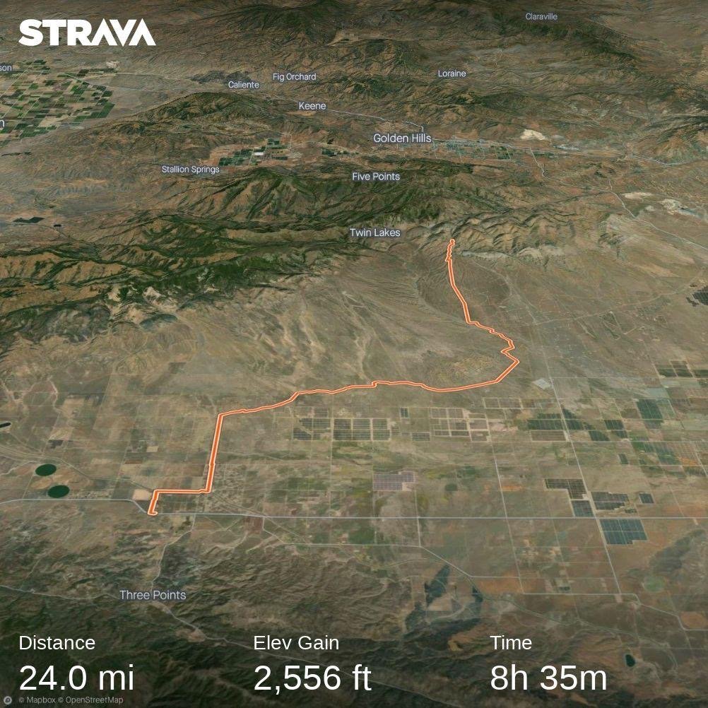
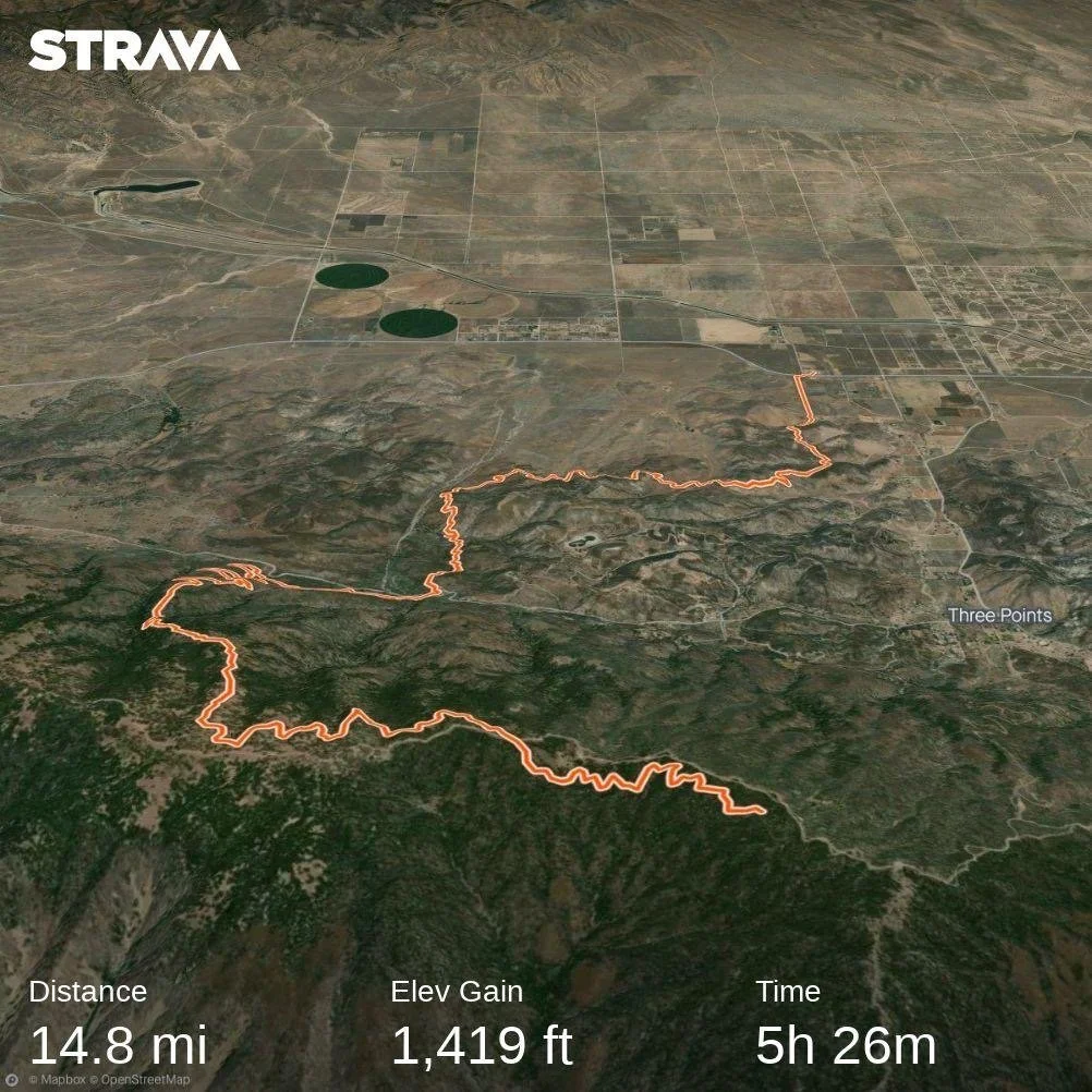
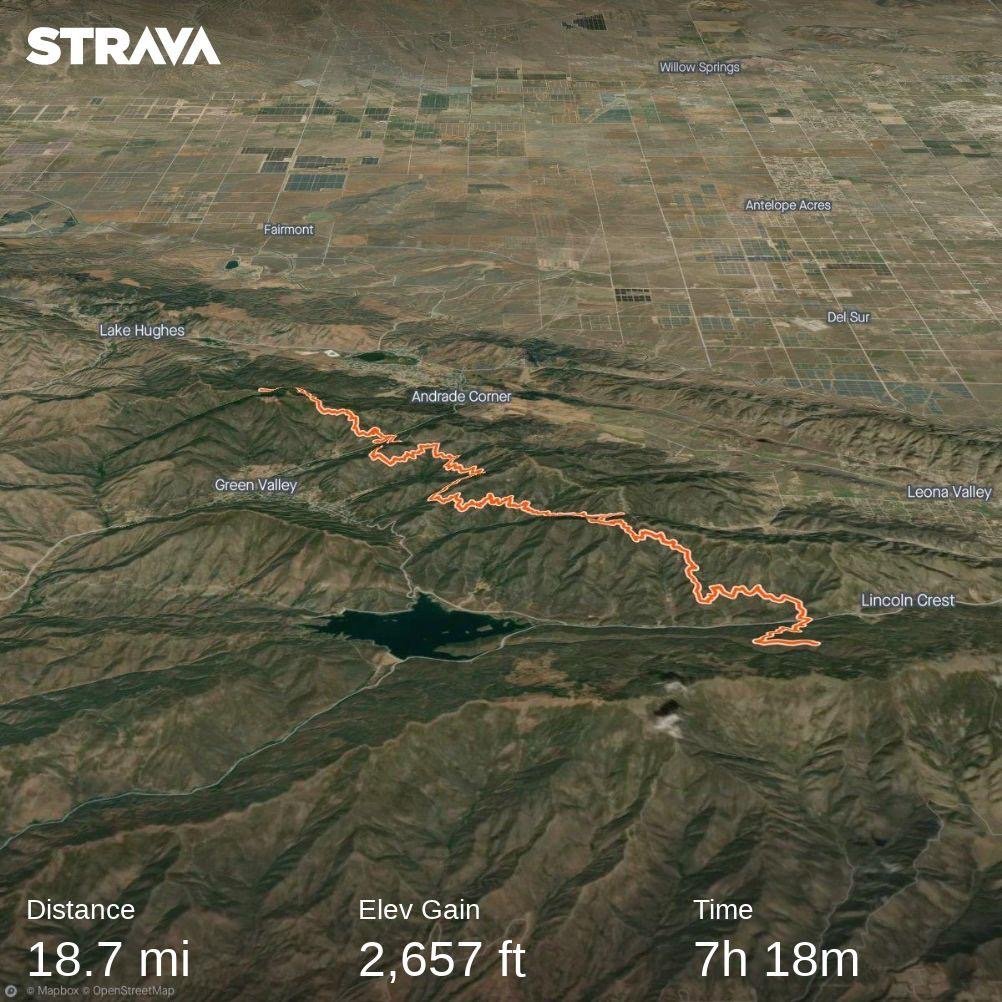
Day 51: Water Works

Day 51: Water Works

7/6/2023

Section: Milepost 756.4 to 768.2

Distance: 12.6 Miles  

Moving Time: 06:27 hrs

Elevation Gain: 2,385 ft

Click here for current location

Today will be short because i need to get up at midnight to do Whitney. Today’s stage winds northwest before dropping down into the Rock Creek valley making for the first major river crossing of the Sierra. From the Rock Creek valley, the PCT rises, eventually going over Guyot pass. From the pass it drops down a bit through a basin and eventually crosses Whitney Creek which was also a healthy crossing. Just after the creek the PCT joins with the JMT to go north. Here is where most people jump onto the JMT in order to climb Whitney.

Today started around 4:30 am. The group of 7 was up at 2 and on their way to take advantage of the solid, early morning snow. They were not quiet about leaving either. We woke up, had breakfast and were off a little after 5, also enjoying the good snow conditions. Wildfire left us behind pretty fast and we carried on by ourselves through a bunch of low hills before dropping down to Rock Creek. Here, Wildfire was waiting and had found a good place to cross near the Rock Creek ranger station. We followed him over and used a fallen log to cross a very healthy running river. On the other side we made a few more small crossings before circumventing a large meadow north and then west. We traveled about half a mile and found a nice rock to sit on and snack about 100 yards from where our game trail rejoined the actual PCT. The water is really running - these streams would almost be dry in a normal July but they are absolutely raging. 

After our snack, we tried to rejoin Wildfire but he must have taken off. We climbed a thousand feet before the grade tapered off through some beautiful groves of Sierra Juniper and then climbed another 500 feet to the top of Guyot pass where we took another quick break. We have acclimatized pretty well by now but those 11,000 foot passes always take the breath away. We wound down, the trail was much less snow covered than yesterday but there were still some spots. At one point we just straight-lined it down to a basin - Guyot Flat - and threw on the snowshoes to cross some flat snow. On the other side we helped each other put the shoes back in their holsters and continued on good dirt for another 3 miles where we came to Crabtree meadow and Whitney Creek. Whitney creek was also raging but where the PCT crossed it, it was nice and calm. Evidently not calm enough because Amanda took a spill halfway across and I was able to grab her so she could stabilize - got it on camera too so that should be forthcoming. We got across, Wildfire waiting on the other side and chuckling at our antics and Amanda laid her things out to dry. 

After about 20 minutes of drying we followed Wildfire up the PCT to were it joined the JMT, which was an exciting milestone, and turned right. A mile on led us to a beautiful campground where Wildfire was waiting for us. It was about 3:30 so we did our chores and ate dinner fast in order to get to bed at a good time for the midnight start. Probably not necessary but, gotta see the sunrise from the top of Whitney! 

As I was lying in bed, Amanda thought of a good name for herself - maybe as a placeholder or maybe permanent - River Dancer.

Day 50: Sequoia NP

Day 50: Sequoia NP

7/5/2023

Section: Milepost 744.2 to 756.4

Distance: 12.97 Miles  

Moving Time: 07:24 hrs

Elevation Gain: 2,352 ft

Click here for current location

Yea… that mileage isn’t great. Not great at all. And it took us all day to do, so that tell’s you all you need to know about how our day went. We both knew the Sierra was still in a rough state coming in, but I was very optimistic about what we could accomplish. The “curve” I have been following assumes the whole thing is done on clean trails and we found something very different today - snow in patches every 25 feet. There’s nothing technical or scary about it but it is slow - I watched our mile time go from 24 to 27 to 33 to 45 minutes and it killed me. This is why about 95 percent of people from Kennedy were not even attempting the Sierra - too slow, too many things to carry, can’t do the typical 30 mile day anymore, etc, etc. If this is what is in store for the next 5 days then our plan of going all the way to Muir Trail Ranch is kaput - we would have had to carry about 15 days of food in and that’s just not practical so, looks like we will be paying a visit to Bishop. One small hope I still hold on to is that, after we do Whitney in two days the stages become completely snow covered - there shouldn’t be too much of this patchy stuff and the snow shoes we have lugged from Kennedy may become more of the silver bullet I was hoping they would be. They aren’t worth much right now - we would have to put them on and take them off every 5 minutes - but if the core Sierra zone is solid snow then they might shine. Really won’t know for another couple of days.

The route today starts out on clean, snow free trail heading east from Dutch Meadow and climbing west towards Mulkey Pass and then Trail Pass. These two passes are one of the first “outs” of the Sierra - trails you can take to get down to 395 and all the towns along it. Logistically, these “outs” are tricky because they are a lot of extra mileage and elevation gain/loss which is why I had wanted to skip them all together and just go straight to Muir Trail Ranch which sits almost on the trail. Anyway, after Trail Pass the route switches back up the north side of Trail Peak and circumnavigates it, passing Poison Meadow. From there the PCT travels north towards Cottonwood Pass and then goes around the southern end of Chicken Spring Lake before crossing into Sequoia National Park. The path then descends beneath Cirque Peak, crossing a number of cirques while doing so, crosses Siberian Peak Trail and ends in a flat high basin.

We were up at 5 today. My FitBit is killing me. The watch is way more of a lifestyle watch than an adventure watch. If it dies on me than the time is off and i have to sync it with my iPhone to reset the time. Only problem is, the iPhone has to be connected to the internet to do that and i haven’t had internet since Kennedy meadows so I’m perpetually 2 hours behind. I’m getting a Suunto when we get to our next town, and I’m hoping Fitbit will take this Sense back. Anyway - the 4 am alarm I had set wen’t off at 6 am when we were finally on the trail so that was super helpful and we got up closer to 5. I force-fed myself some Quaker Oatmeal - one pack is all i could manage before leaving. 

Wildfire, Amanda and I were on the trail around 6:30. He got that name, we found out last night, by accidentally setting his pants on fire last year when he did the first 700 miles from Campo so, good name. We wound up out of camp and soon came to Mulkey Pass and then Trail Pass. As we entered the switchbacks I heard voices above me and looked up to see a few people 2 switchbacks above. We carried on and eventually hit our first patch of snow. The boots are great in the snow, really painful to walk longer distances in but so much better for snow. As we came up the last switchback we ran into two girls filtering water. We said hello and kept going, them following close behind. The patches were pretty annoying but we were still hopeful as we dodged and climbed over them. A half mile on we ran into the rest of the 2 girl’s group. We had briefly seen them on arrival in Kennedy Meadows - they were leaving as we were arriving. Sounds like they went down to Lone Pine out of Trail pass. We talked a little bit and then let them go ahead as we were stopping to eat a quick snack - that oatmeal did me dirty. Soon after them Wildfire showed up, he had stopped to adjust his back and let us go on and we continued onward. 

The rest of the morning we played hopescotch with both Wildfire and the group of 7. Half of their group was pretty fast but the other half was having trouble with the snow so we got spread out all over along the trail. I watched our mile time go down and down. I also forgot to eat until we got to Cottonwood pass which was several hours on so by the time we arrived I was pretty hangry. We also tried the snowshoes way earlier than we should have and they were very unhelpful and just cost us time. In any case, we got to Cottonwood pass and then Amanda and I decided to go on a little bit to a really nice alpine lake - Chicken Spring lake - where Wildfire joined us for lunch. 

We talked about how irritating the snow was and how slow we were going before filtering water and traversing uphill to catch the trail again. From there we continued our slog through inconsistent patches of snow, heading down hill. Everyone took a fall today, no one was saved. At the National Park boundary I really wanted to get a picture of the sign, but it was still under snow or on a tree that had fallen so we continued on, devastated. We talked to the two Germans in the group of 7 - one was from Bonn and we told him about our time in Germany. We descended about 2000 feet and eventually came to the basin. We were ahead of Wildfire but some of the front runners from the group of 7 were setting up at a campsite near a seasonal stream. We caught Wildfire as he went by and deliberated on our next move. It had been a brutal day. There was a campsite 1.5 miles down trail but no mention of water. We decided to stay since no one wanted to drycamp and 1.5 miles was not worth the risk of that. The other thing is we are 11.5 miles from Whitney basecamp and, since we are all going to climb Whitney, an extra 1.5 miles doesn’t really do us any good, so we called it, having gone all of 12.88 miles. It’s tough to articulate how frustrating it is to come off weeks of 20+ mile days only to fight hard for less than 13 but we could all feel each other's frustration. Much of the talk around dinner that night was about what could make things better and maybe farther on the snow would get more consistent. It’s not that the snow is bad, it’s just these sections of trail, separated by huge blobs of snow, that make it massively frustrating. We will get a better feel for how well we can travel on consistent snow the day after Whitney and that will figure into our decision to go north of Mammoth. After dinner we all turned in, agreeing on a 4 am wake-up and that tomorrow would be better.

Day 49: Bugs

Day 49: Bugs

7/4/2023

Section: Milepost 723.0 to 744.2

Distance: 21.43 Miles  

Moving Time: 09:45 hrs

Elevation Gain: 3,192 ft

Click here for current location

Today is going to be short because it was a long one and I don’t want to go to bed late. Also, happy 4th everyone!

Last night was a menace. We had expected the breeze that was whipping up in the evening to stick around which is why we initially set up to cowboy camp - thinking it would keep the bugs off of us. It did not and they were vengeful. Also, without the wind, despite being at 10,000 feet it was warm and I was dying in my bag but i couldn’t stick any limbs out because they would get devoured. So I sat there, sweating until about the 10th bug bit my face and said “f*** it - I’m putting the tent up,” which I did in the dark, without staking it. Amanda joined me a little after and then, at 3 am, wouldn’t you know it - the wind came howling back and whipped at our unstaked tent all night. At around 4 am we had had enough and just said screw it, got up and left. Wildfire was gone and we assumed he had grown tired of our antics and left earlier.

We made our way deeper north into the Inyo National forest. The mosquitos were relentless. Eventually, as we were passing under the west side of Olancha peak we ran across the 3 ladies we had ridden in the car to the trailhead at Kennedy Meadows with. We waved at them and continued on. Just beyond their campsite, Wildfire caught up to us. He had actually had an almost worse night than us and said he was getting bit so bad he got up at 3 and descended a few hundred feet where he thought about pitching his tent but instead decided to make coffee and stir in anger at the evening. We all laughed about what a terrible night it had been and then headed on, Wildfire going ahead. 

We started running into snow on a little further, still well frozen but not enough of it to warrant microspikes and eventually we headed down a hillside cutting the snow covered switchbacks which put us back close on Wildfire's tail. The trail wound down for a while until we reached a seasonal stream at 723.3 and stopped for a snack and water. The squeeze pouch has really developed some holes and it is all I can do to keep it from leaking as I filter. We sat and ate with Wildfire at the creek and took our boots off to give our feet a rest. The boots are brutal, especially compared to the trail runners but so much better in the snow. 

Eventually we all left and began the climb of the day, taking us up over 2000 feet to a dramatic ridge. It was a brutal climb in the heat of the day but I day dreamed about how we could expand Auto Train services in the United States one day which helped pass the time. We hopscotched with Wildfire as we climbed, eventually cresting at the top where we stopped for lunch and great views at the Owen’s valley - its wide reservoir of water far fuller than it had been in a long while.

From the top we desceneded a long way down to Ash meadow and then climbed a short bit to Dutch Meadow. Amanda told Wildfire and I we could go along and that I should set the tent up when I got there. The last 2 miles seemed to take forever but we made it. I filtered water and set up the tent and learned that Wildfire was an engineering consultan for the Aerospace industry. Eventually Amanda showed up and we ate dinner fending off Mosuitos the whole time before they drove us inside for the night.

Day 48: Into the Mountains

Day 48: Into the Mountains

7/3/2023

Section: Milepost 705.8 to 723.0

Distance: 17.95 Miles  

Moving Time: 08:14 hrs

Elevation Gain: 4,705 ft

Click here for current location

It amazed me all day how much the scenery changes along the first stage out of Kennedy Meadows. Literally, just two days before, we were in the desert and very much so as we left during a heat wave and in just this one day we are delivered to 10,000 feet in the Sierra and the difference is night and day. Amanda and I have hiked all over the world and almost nothing is as dramatic as the change in scenery we experienced today.

The stage today leaves the Kennedy Meadows campground in the Inyo National forest, heading due north along the east bank of the South Fork of the Kern River. Finally, water is no longer an issue - there’s plenty of it. The trail crosses into the South Sierra Wilderness and crosses the Kern River at mile marker 707.8 before climbing up into a small river valley east of Crag Peak. From the saddle at the top of the valley, the trail crosses Crag Creek and begins following it through Clover Meadow maintaining a large ridge to the east. This ridge necks down with an adjacent ridge on the west side and the trail clamours up through another saddle before opening grandly on a large meadow called Beck Meadow. The PCT then edges around a small hill to the east of Beck Meadow and meanders down to rejoin the South Fork of the Kern River where a bridge crosses over. The last part of the stage is a brutal climb up into Cow Canyon following along a small unnamed peak until it leaves the canyon at 10,000 feet, offering several nice camp sites.

Amanda and I were up at around 5 am this morning. We had slept well, but been woken up briefly by a group of Boy Scouts who went by quite noisely at midnight for some reason. We packed up and ate breakfast - trying to eat through the few things we weren’t stoked about and saving our favorites for later in the trip. After breakfast we headed out. We stopped to sign the trail register and say hi to UK Sam (Trip Hazard) who had arrived in the night and was packing his tent up. We asked him about Markus and Izzy and he said the last thing he saw before leaving the General Store was Markus with a 6-pack so, we’ll see how that goes. 

We started on the trail, which wove peacefully through pine trees on a solid trail. Everyone has said the trail gets vastly more logical and nice in the Sierra so we are excited to see it. It was fine in the desert but supposedly it’s supposed to get even better. We hiked on and soon UK Sam passed us. We are loaded down with 10 days of food and snow shoes so our moving average is going to be slow for a few days. We’ll make it up on them on the snowfields and when we don’t have to do the awful exit to Lone Pine. 

Further down the trail we came to a beautiful bridge over ther Kern River and took some pictures on it. Shortly after, we came across the boy scouts now heading back towards Kennedy Meadows - must have been some kind of night hike. We are still seeing lizards on the path but, sad to say, we have probably seen our last Regal Lizards - goodbye little dudes, you will be missed. After the Boy Scout encounter we started our first climb of the day into Beck Meadow and a short time later the scene opened on a beautiful moderate meadow which we began climbing into. About half way up and out of the meadow we stopped and pulled water. Several leaks have appeared in the squeeze bag but Amanda and I have agreed that, if the bag catastrophically fails we are just going to drink out of the streams. Sean and many others have said they have been doing it in the desert without any issue and that the Sierra is probably the cleanest section on the whole trail. We will see, filtering is such a pain but so is shitting your pants. After filtering, some snacks and a bag of Sour Patch kids we made our way up the trail, eventually cresting out of Beck Meadow and at the top looked down on a much more expansive meadow - Clover Meadow. We descended down and then meandered around a low hill in the middle of the meadow before the trail turned east briefly and made it’s way back down to the Kern River where another great bridge was located.

We took lunch at the bridge watching a bunch of swallows ride the wind below the bridge briefly ascending to feed young before going back out of get more food. “I wish I could have a personal Swallow to eat all the bugs that have been flying around me,” I said to Amanda. We sat and took advantage of a very flat, very level rock. Getting out of the backpacks is a chore now with all the crap and weight we have, but we help each other out and that makes it easier. We ate and talked about how exciting it is to be in the Sierra. I eventually walked down to get water and Izzy (Butter) showed up. We gave a little cheer and she sat and immediately swapped to sandals so she could sit on a rock in the river. We asked about Markus and she said he was somewhere behind but had had a bit of a late night and was probably going to be a while. We talked for a little bit and then Amanda and I said adieu, heading out over the bridge. 

After crossing the Kern we had around 5 miles and 2200 feet to climb. The nice part was that, now, the elevation and the cooling of last week’s heat wave made for mild temperatures to hike in. We made our way towards Cow Canyon, which is more of a tiny river valley than an actually canyon, and at the mouth were relieved to find plentiful shade along the river. The climbing transitioned from peaceful, to moderate, to difficult, to an all out assault over the course of about 2 hours. At the end we were dilvered into an alpine meadow with many rocks that looked extremely Sierra’ish and Amanda saw our first Marmot!! It looked like a chubby, miniature golden retriever and squinted at us with a bucked-tooth grin before running off. 

We climbed up to a set of campsites and Amanda said she was done for the day. I ran ahead to take a look at the second camp site, which was much better, and convinced her to climb a little more for great views out on the mountains. 

At the top, Amanda passed out in the sun and I did my typical exercises then went and got water - stumbling on a few more marmots. The breeze was keeping the bugs down which i was very happy for and at this altitude we decided on cowboy camping. I began making dinner, excited to eat through our food weight and a section hiker came through. I didn’t catch his name but he was from New Jersey. A friend had dropped him off at Cottonwood Lakes Trailhead so he could escape the heat of the desert but he had been just as devastated by the snow. “I’m done,” he said sheepishly “think i am going to go home and get some hikes done in the White’s (mountains) - but those snowshoes are going to be really helpful up there” before pulling out his phone and showing me the snow. It didn’t look terrible but the suncups were going to be a menace. Just as i was talking and enjoying my dinner Izzy and Markus came by. They didn’t want to interrupt but said they were going up to catch Sam and continued on saying they would see us tomorrow. Just after them, a 4th guy showed up and started looking around. The guy from New Jersey departed wishing us luck and we talked with the 4th guy. Amanda put it together pretty quick that this was Wildfire, whose wife had given us beers and food our first day out of Tehachapi. I got up to shake his hand and say how awesome his wife had been for trail-angeling. We talked a while more than Amanda and I started our wind-down activities, eventually getting in our sleeping bags. Tomorrow was going to be another big day and the day after that, the adventure was really going to begin.

Day 47: Kennedy Meadows NERO Day

Day 47: Kennedy Meadows NERO Day

7/2/2023

Section: Milepost 703.4 to 705.8

Distance: 2.48 Miles  

Moving Time: 01:04 hrs

Elevation Gain: 217 ft

Click here for current location

We managed to sleep in ‘till about 7. The sun was up and already things were warming as we headed down to the Grumpy Bear deck for some breakfast. At the deck we found some of the crew from last night already milling around waiting for the grill to open. At 8:30 sharp, the owner came out and announced it was time and we all charged the bar. The classic thing to get at Grumpy’s is the Hiker Breakfast. One massive, and i mean MASSIVE pancake with a side order of hash browns, sausage patty and eggs any style. They offer unlimited pancakes which is pretty hilarious because I don’t think anyone can manage the one they give you to start!

After breakfast we sat around talking about the things that needed to get done today before we left and we had all agreed that we would leave tonight and walk a few miles. It was nice to have a group to go into the Sierra with. There was Izzy (Butter) and Markus (Push Pop), a guy from Tennessee we met in William’s group back in Acton, Tyler (Aspen) and UK Sam (Trip Hazard). Many people are still skipping the Sierra but some are giving it a shot. I got out my phone and started making a list of things we needed to do today on Google sheets as Amanda rolled her eyes and Markus made some comment about me using a spreadsheet program for such a mundane task. “I use sheets for everything Markus - my life runs on sheets' I said with a smile. “Your name should just be Sheets,” Izzy said and I replied “Hey! I like that!” So, officially, my trail name is now and forever more - Sheets! 

After breakfast Amanda and I headed just up the street to Triple Crown Outfitters, a little gear shop run out of a container by a triple crowner who has done the PCT twice. Every year she runs this really well equipped little shop just next to Grumpy Bear’s and saves a lot of hikers butts. We had received a lot of packages from REI, thermarest and my parents but needed a few more things, so Amanda went inside while I waited outside. While outside I perused the many bulletin boards of info including beta on all the water crossings we had ahead of us by a guy named Andrew Skurka. I took note of the website and then went in after Amanda and picked up the bear box Philipp had ordered from the store. He wasn’t coming in until the 5th and the owner wasn’t going to be operating the store on that day. 

Back at Grumpy’s Jason, Lorena and Simon had showed up. Simon had taken a fall and had his arm in a sling but maintained it was no big deal. Lorena said Philipp was still a few days back and Simon took his bear box as they were sticking around until Philipp showed up. 

The rest of the day was mostly chores. I downloaded the KML file of all the river bypasses from the site I had seen at Triple Crown Outfitters, than finally took a shower and did the rest of my laundry. Amanda then laid out all of our things and organized our backpacks. A lot of people commented on the snowshoes. I think they can go either way - they will help us move fast in the late afternoon when the snow gets sloppy but if we are doing a lot of traverses they will be virtually useless. One thing is for sure - our bags are heavy. 

At around 1 we had lunch and then missed the 2 pm shuttle back to the general store so Amanda and I went and hitched a ride instead from a very nice couple from LA out doing some Freedom weekend backpacking. At the store I found two extra boxes that had not originally been given to me, one with Amanda’s new bear canister - critical for Yosemite - and about 8 meals we had ordered from REI. I sent our shoes and other miscellaneous items up to Mammoth now that we had our boots - thanks Mom and Dad! We finished off our provisions in the store and the two girls who worked for the PCT organization gave us a ride with 3 other hikers back to the trail head after stamping our permits. The rest of our group was going to come a little later that evening

At the trail head we thanked them and headed north. The backpacks were heavy and our feet were not as pleased with the boots as they were with the hiking shoes. We meandered about 2.3 miles north until we came to the Kennedy Meadows campground. The PCT girls were already there getting settled. We picked a spot and Amanda set up the tent while I went to get water. Our water bladder is leaking just a little so, maybe the standing-on-it trick isn’t such a great move after all. We had some Ramen as we weren’t too hungry after the giant burgers at Grumpy Bear’s and eventually the bugs drove us inside, but the landscape was finally looking like the Sierra and we are tremendously excited!

Day 46: The End of the Desert

Day 46: The End of the Desert

7/1/2023

Section: Milepost 682.3 to 703.4

Distance: 22.03 Miles  

Moving Time: 09:00 hrs

Elevation Gain: 3,864 ft

Click here for current location

Happy July 1st everyone!! It is a commonly held belief by all who hike the PCT that Kennedy Meadows marks the end of the desert and the beginning of the Sierra and the views of the Sierra seem to confirm that. The profound irony of our grand adventure here is this - the hottest day we have had on the PCT was day 1 in the desert, just outside of Campo and the second was today on our last day of the desert. Two appropriate bookends for the hottest section of this trail but I have to reiterate, again, that we have been exceedingly lucky in the desert. I‘m not sure we had a single day above 90 degrees - it could have been so much worse. This season has been tremendously mild in the southern section of the PCT.

We woke around 5 - my alarm didn’t go off but we were up anyway. Another great sleep which is digging into a major deficit we have developed on the trail. I had some more breakfast snacks - we loaded up in Lake Isabella and so I was going to town every snack session. Izzy left as we were finishing breakfast, Ben accompanying her for the first mile. We followed shortly after. Some people had arrived later in the evening last night and had arranged their tents along the road. Amanda and I made our way back down the trail and eventually arrived back at the road. From here we said hi to a couple who had slept there and then pushed on up the trail.

The first part of the day today was a consolidated climb for a little over 2800 feet and about 7 miles. Nice grade but consistently up. We meandered up in relative silence, lost in our own thoughts. At around noon, we stopped at a nice log and sat down for lunch. Despite reloading only about a day ago, I had done some good work on my food. Honestly, some real favorites have started to emerge as I travel on this trail.

  • Potato chips - I ate through a family size bag in less than 24 hours

  • Homestyle rice crispy treats - so glad Kellogg’s came out with these

  • Nature’s Bakery Fig Bars

  • Peanut Butter Filled Cliff Bars

After lunch we continued on down the trail. There are these grasshoppers in this area that make a high pitched buzzing sound when they take off and now that we have heard a rattlesnake rattle the two sound very similar. Needless to say, Amanda was very on edge for the warmer part of the day when these guys get to be really active. The trail continued to wind down to the mouth of a canyon we had climbed into, which amplified the heat, before it set us down into a wide open valley. This was the Rockhouse Basin through which the South Fork of the Kern River flowed, and it was flowing. We heard it before we saw it but eventually the trail drew up beside the swolen river where we found Izzy and UK Sam (Trip Hazard) chilling in some bushes nearby. 

We broke here for lunch, quickly finding the horse flies to be an absolute menace. I walked down to filter water. I have a new method where I stand on the squeeze bag lightly to get the water flowing through the filter and then finish off by rolling the squeeze bag up to pressure the rest of the water out - it’s lazy but it seems to work. After I had filtered out about 2 liters for both Amanda and I, I returned to find Izzy gearing up to leave. Trip Hazard was going to stick around till about 1:30. Amanda and I had some more snacks - Amanda is going to actually finish net positive on food for this segment and gave me some of her snacks. I had my last Homestyle Rice Crispy treat and we started packing up. 

The trail paralleled the Kern Riverall the way back to Kennedy Meadows, sometimes getting closer and other times winding away from it. The path meandered for a while and it wasn’t long before we saw Izzy’s tell tale silver sun-brella off in the desert. We caught up to her and passed as she paused for a break - it was hot and all Izzy said was “I’m so f***ing done with the desert.” We laughed and agreed before pressing on. It’s a sentiment we are all feeling as we close in on Kennedy Meadows. You have been fun desert but it's time for something new and I can see that new something off in the distance every day now. 

The path went up and down for a bit before passing through the west side of private property. We passed through two more gates and Sherman Pass Road came into view where we could see cars coming and going and weekend warriors setting up for the long 4th of July weekend. 

We reached the road and stopped for a while. We hadn’t really thought of what to do once we got here. Trip Hazard had mentioned a shuttle but we had no idea what times it came and there was virtually no service in Kennedy Meadows. Feeling a little let down that there was no massive procession of hundreds of people clapping for our momentous ascent out of the desert we begrudgingly began walking the road. Just as we were about to start complaining about tarmak trudging, a guy in a green Danger Ranger (Ford Ranger) came swinging around the bend. We threw our thumbs up in desperation and asked if we could get a lift. English was not the driver's first language but we were able to battle through a few misunderstandings to tell him we wanted to go to the General Store. He smiled and told us to hop into the bed of the truck. We thanked him profusely and jumped in and he took us the extra mile into the general store. 

We arrived at the General Store, which slightly larger than a gas station convenience mart. We found a large party in progress upon arrival. Eveidently there had been a 4th of July tractor parade and a band had been set up to perform on the back deck of the store. I got a beer and a Gatorade and Amanda got a Gatorade. I put my name down for the packages I was expecting to receive there. The clerk smiled and said it would be about 45 minutes to check for them. We relaxed in a side yard away from the music with some other hikers and enjoyed our drinks and the free Wi-Fi service. The small town tractor parade after party was quite a wild affair. There was a drunkenly officiated wedding at one point and one old lady walking around asking personal questions to the foreign hikers which I’m pretty sure they didn’t understand. Eventually Izzy showed up and we clapped for her before I went in to get my packages. There were 6 of them because REI had decided to send everything in separate packages as well as one large one from my parents with the snowshoes. Amanad and I considered getting some dinner but decided to wait for later in the evening. Just before 6 pm about 7 of us hikers, including Trip Hazard, Izzy, Aspen and Chicken Feed Backpack Man (Dumor) went down to the edge of the road expecting a shuttle from Grumpy Bear’s bar and grill. While the General Store might be where many hikers resupply, Grumpy Bear’s is where many of them stay the night and they run a shuttle from the trailhead to the bar, stopping at the General store to pick up anyone that might want to come spend some money at their establishment. The problem was that 6 o’clock came and went and no shuttle showed up. At around 6:30, Amanda spotted a big Dodge truck come into the parking lot and suggested we go ask if they could take us into Grumpy Bears. I walked over to the truck and offered 20 dollars to the guy, which he gladly accepted, and we all piled into the bed. 

The truck drove us 10 minutes (about 3 miles) down the road and deposited us in front of Grumpy Bears. We went inside and an overwhelmed bartender looked at us and said “Ok, we’re doing this out on the deck.”  Out on the deck the bartender gave us a long spiel about what went and didn’t go and gave us all wristbands before delivering some final, devastating news. “The owners and staff got crushed today given the festivities and shut the kitchen down early to take the afternoon off. I’m not even getting paid to be here, just volunteering to run the bar. Sorry but not sorry.” I immediately looked at Amanda to see her crestfallen face before asking “Will the kitchen be re-open for breakfast?” He confirmed that it would be and there would be all the pancakes we could eat at that time. So, instead of eating i got some more beers and ice cream and we sat out on the deck the rest of the night chatting with all the other hikers. At this point we have been hiking with the same people for more or less the last 2 weeks and know everyone pretty well which is nice. I wasn’t sure how long that was going to take to happen but happy to have a little crew now. I did some blogging and Amanda played some games with a newer group we were less familiar with. Around 11 pm we turned in - Amanda leaving a little earlier to go set up the tent and i follow a little after. I had had so much fun catching up with everyone I forgot to shower - that and Amanda had started using my other pair of pants today because her brand new SmartWool leggings had ripped holes all along the inner thigh in under 5 days. My baggies were the only things that offered any protection from chafing so, i had no clean pants to change into. 

I grabbed my things and left, saying goodnight to the few people still on the deck. Leaving the bar, I walked along a road back to the campground where I searched for Amanda’s tent spot, finally finding it. I set down my things and hopped into bed relishing our achievement of finally making it out of the desert.

Day 45: 1 Quarter of the Way

Day 45: 1 Quarter of the Way

6/30/2023

Section: Milepost 658.1 to 682.3

Distance: 25.13 Miles  

Moving Time: 11:01 hrs

Elevation Gain: 4,495 ft

Click here for current location

Today was a long one - it might have been Amanda’s longest day. We had been slightly behind schedule since Tehachapi since we came off at Willow Spring Roads instead of highway 58. This had put us about 10 miles behind and we had been trying to recover that ground. Today we started about 5 miles behind and were committed to making it back up and getting to Chimney Peak Campground, which had pit toilets and picnic tables. 

The stage today stays in the Owen’s Peak wilderness the entire time, winding northwest along the backside of the Mt Jenkins ridge before curling over a saddle and down into a small valley. From this low point the trail made it’s way over another small rise before descending again into a small confluence of two or three rivers. A highly appreciated facet of this stage is it marked the first time we didn’t need to do a long water carry or depend on water caches. Natural water is a wonderful thing to see. From the rivers a long rise, over 2000 feet, took us above a ridge east of Lamont Peak where it wound east before turning northwest and linking with the west side of a ridge then descended down to Chimney Peak campground which sits in a low meadow. 

We woke at 5, trying to get an early start. In lake Isabella, we had heard that it was potentially going to be triple digits over the weekend. We were pretty high up but that didn’t mean we were exempt from the temps so early starts were the move. We ate some basic breakfast bars and other items before getting the tent together and heading out. We had both slept hard the night before and felt very refreshed. I love the idea of cowboy camping but I also love getting a full night’s sleep. We passed by a plack for Jenkins, who the nearby peak was named for and who had died doing trail maintenance there. The sun came up and things started to warm. We made our way down off the ridge a bit before regaining another saddle. Here someone had left a “25%” at the 662.5 mile mark to demark one quarter of the way along the trail.

I have to say here, if you look at the trail map you would only think we were 1/8th of the way complete because we do so much weaving and winding north of LA, but we are and it is a pretty awesome achievement. If we’ve made it this far, we can definitely do the rest.

We descended a bit before climbing again over a small rise and descending down to Spanish Needle Creek. On the descent, we had a run in with a pretty scheisty squirrel. At the bottom we took a break. Here we had a large climb ahead of us so we stopped for lunch and to fill up on water. I ate some more Homestyle Rice Crispy treats and other less exciting foods before filtering some water. I also took the chance to wash my sun shirt - pretty disgusted at how much dirt came off of it, before taking it back to where Amanda was relaxing to hang dry. After lunch we pulled on our packs. “Ready to embrace the suck,'' I said, smiling to Amanda. “Let’s do it,” she said. 

We climbed for 2 hours in the hot sun. It was brutal. Amanda found an ear bud on the ground which I threw in my bottle holster before continuing on up. A mile or so on we ran into a Japanese hiker. Amanda told him about the ear bud at which point he reached for his left ear, a surprised look on his face. I pulled out the bud and gave it to him which put a huge smile on his face. We climbed on, going over several fallen logs. The climb went on and on and on but after another hour of hiking we came level to a pass and went through it. After passing through, we hiked another mile and took a quick break at a good sitting spot. Here Markus (Push-pop) caught up and I shouted “Is that who I think it is!!” The thing about Markus is, he takes breaks back in the bushes, usually napping for a few minutes so we typically pass him without knowing and then suddenly he will be passing us and we didn’t even realize we had gotten ahead of him.

We talked with Markus for a while before he carried on ahead of us and we followed after him, overcoming more groups of blow-down trees. We rounded the end of the drainage and turned north. There were a few groups of unknown hikers at the turn that we said hi to before moving on. From the turn, the trail started winding down and down and down. A wide valley developed on our west side and we eventually bottomed out and wound up and down before we came to Chimney creek. We crossed the creek and came to Canebrake road where we turned off the trail and headed northeast another 0.8 mile to Chimney Creek Road. 

At Chimney Creek Road we found Izzy and Markus. Izzy was setting up her tent and Markus was sitting at the picnic table. We said hi and started setting up our own camp adjacent to them. I set up the tent while Amanda pumped water. As we arranged things, a friend of Izzy’s named Ben showed up from Bozeman with his chocolate lab Billy and parked his car. Amanda came back and we joined Markus, Izzy and Ben at the picnic table. Ben had brought beer, sausages and pasta to share - total savior. We ate and talked for a while trying to convince Markus to stay around but he was done with the desert and dedicated to getting out of it. The stage tomorrow is technically considered the last desert stage and Markus was rabid to get it over with. 

Night eventually set in and Markus did leave. Amanda and I returned to our tent, got in and passed out. She has a rule - if I socialize, then no typing so I headed straight to bed listening to Izzy and Ben talk into the late evening.

Day 44: Lake Isabella Vortex

Day 44: Lake Isabella Vortex

6/29/2023

Section: Milepost 639.6 to 658.1

Distance: 18.3 Miles  

Moving Time: 07:04 hrs

Elevation Gain: 2,795 ft

Click here for current location

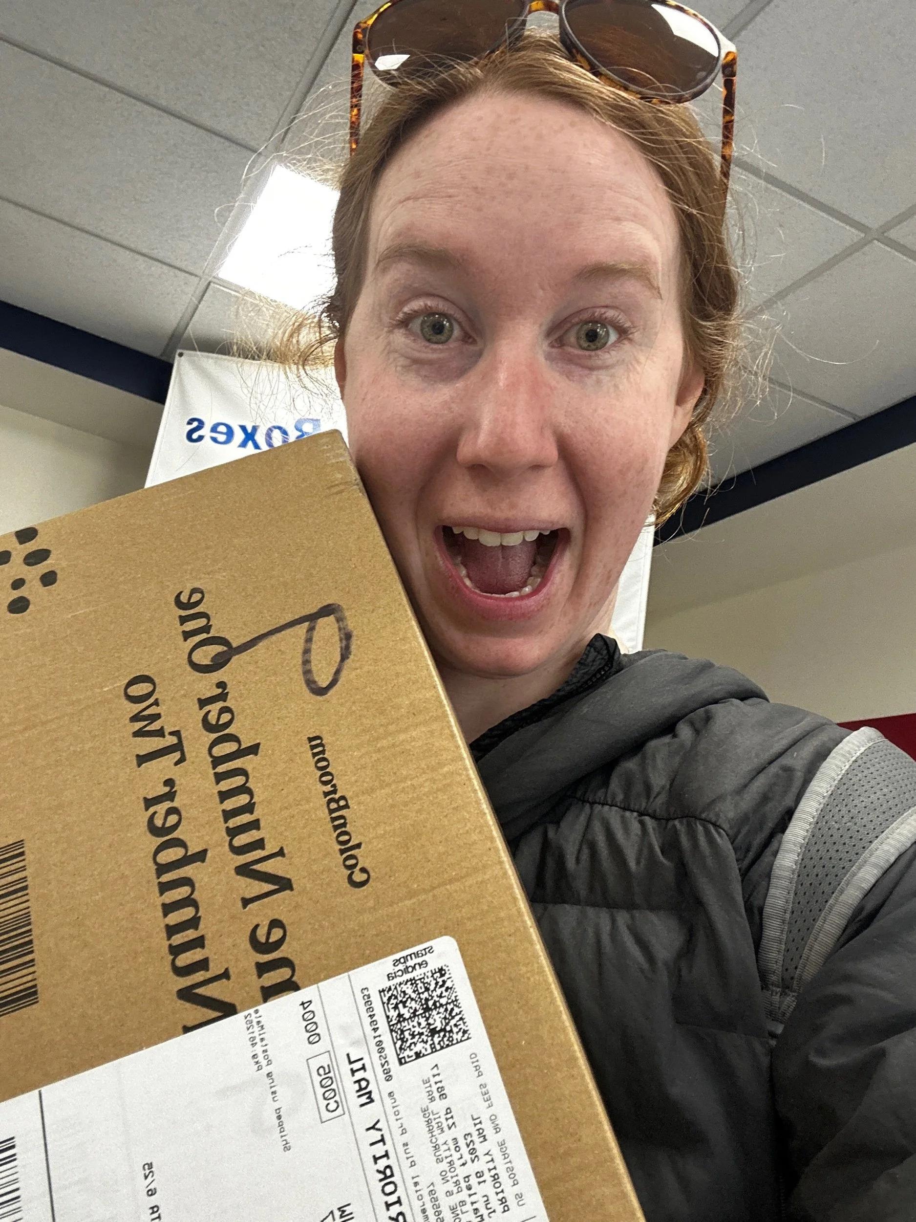
So, today’s stage was split in two sub stages around the town of Lake Isabella - a small town ~35 minutes west of Walker Pass. To cut down on weight leaving Tehachapi, Amanda and I had agreed to resupply in either Lake Isabella or Ridgecrest. Ridgecrest is a sister city, but approximately 34 minutes east of Walker Pass. What I can say to all PCT hikers looking at this stage is - just pack 2 extra dinners and snacks to get to Walker Pass. Both towns are out of the way and not hitch friendly. Lake Isabella isn’t really the friendliest - full stop - and it’s probably my least favorite resupply stop on the trail to date, beating out Cabazon and Cajon Pass. In fact, I am only writing up the first half of today because Amanda and I got here, resupplied, had lunch and then promptly got stranded by a ride I had set up. We called another one in, all the way from Ridgecrest but it is going to cost us 75 dollars to get back to the trailhead this evening and we won't get to camp till probably around 10 pm. Really irritating but - guess that’s life.

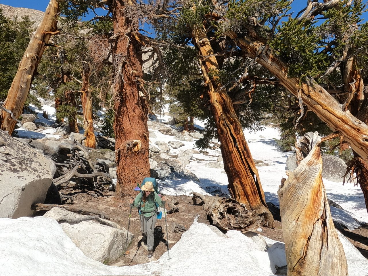
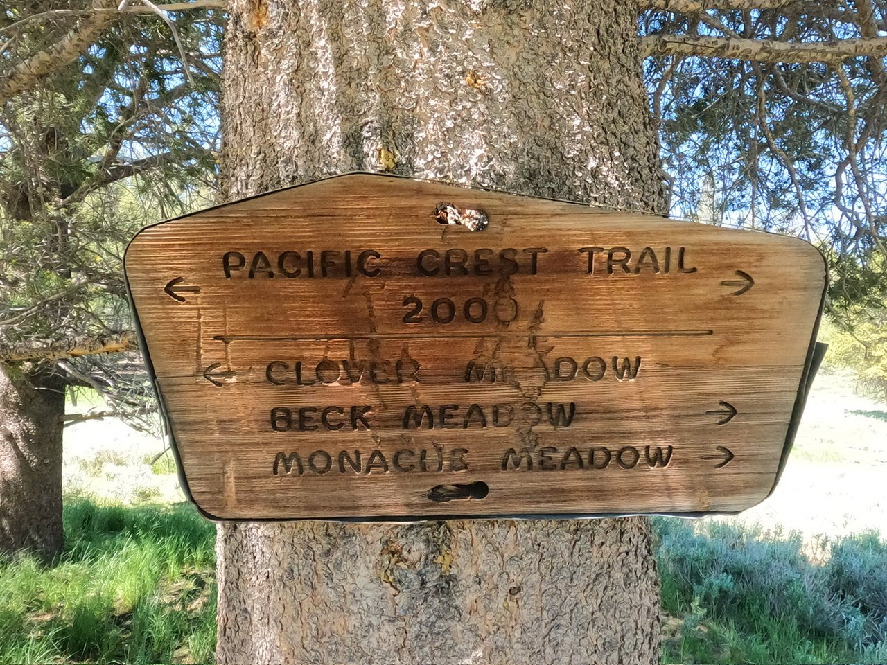
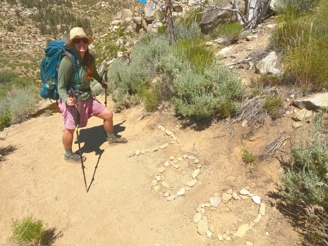
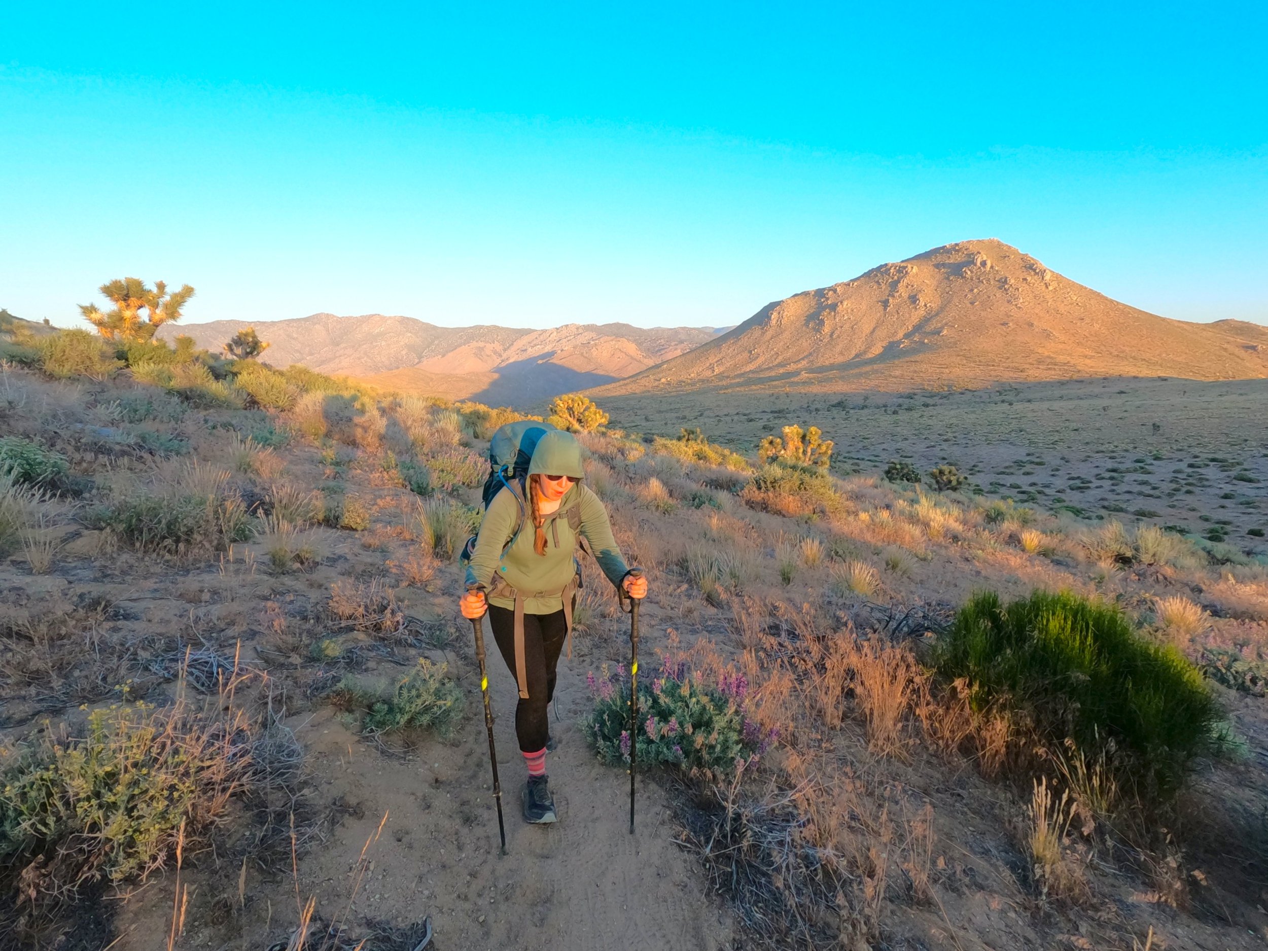
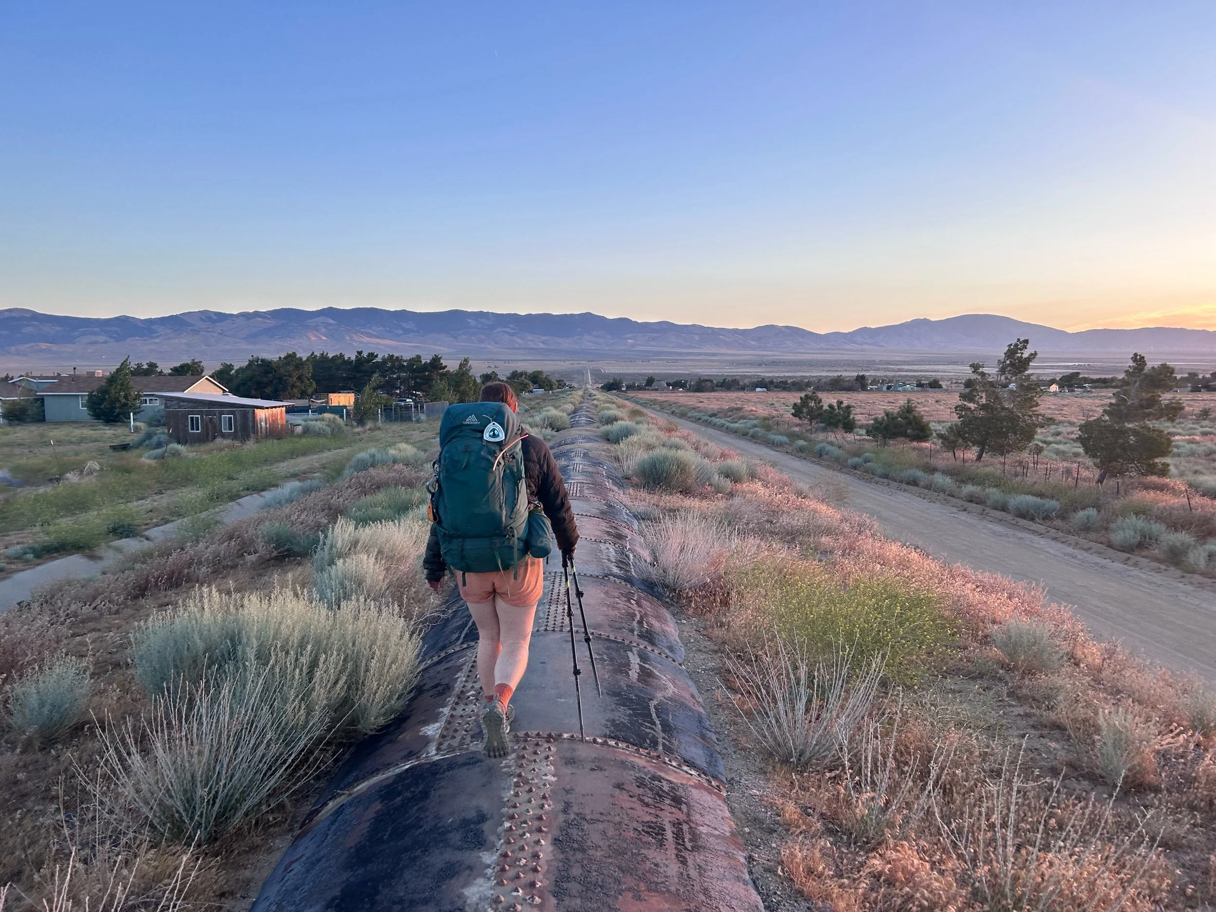
The stage today descends further from the high of Skinners Peak yesterday and takes place entirely in the expansive Kiavah Wilderness weaving north through expansive groves of Flannel bush before joining a road briefly and turning east. The trail continues on the road east for a while before jumping off and continuing on path for some time gaining a very thin saddle before dropping down to Walker Pass. From the pass the path climbs steeply up a wide hill on the north side of Walker Pass before reaching a nice, lofty campground on the ridge.

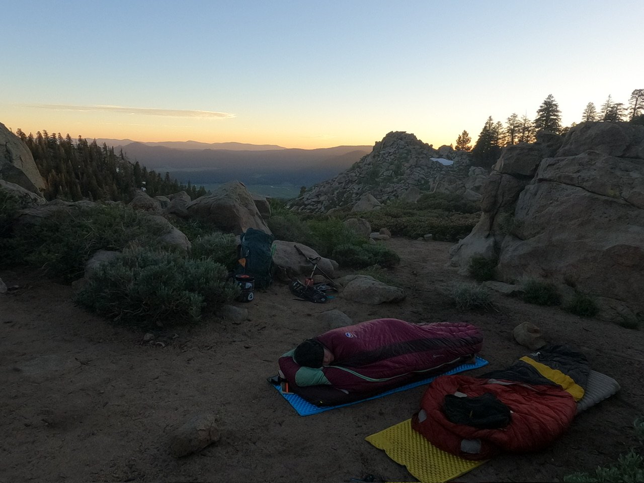
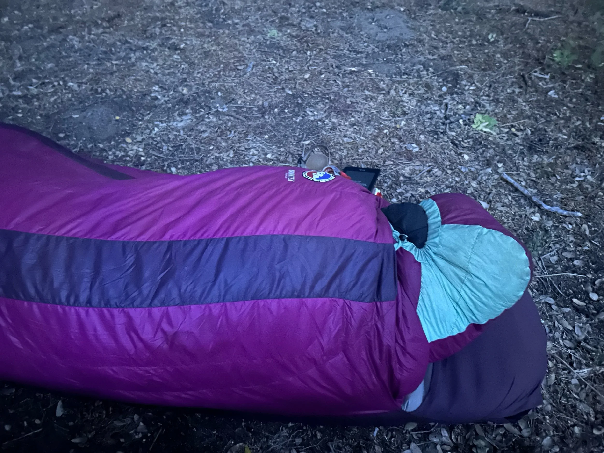
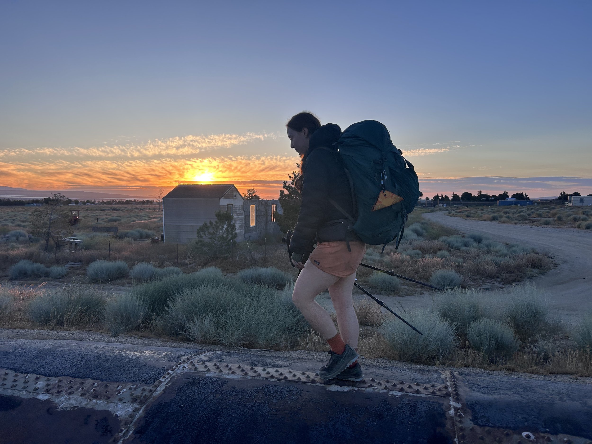
Amanda and I woke at around 4:30 - no sleep had really been had the night before. Cowboy camping is either amazing or terrible, there doesn’t seem to be any in-between. The problem is that Amanda and I already had sleeping bags coming into this trip. This, in itself, wasn’t really a problem. The problem was that they are both 15 degree bags and the nights are, at their lowest, 45 degrees. So, while sleeping on the trail, I don’t really use the sleeping bag in the way it was designed. I throw the bag over my body like a blanket and try to keep both arms and legs outside uncovered all night. In a tent this really isn’t a problem because, no bugs in the tent, but outside I get eaten alive. Our new policy is to continue tent camping until we are out of the desert, the bugs are better and the nights are cooler because last night was terrible. 

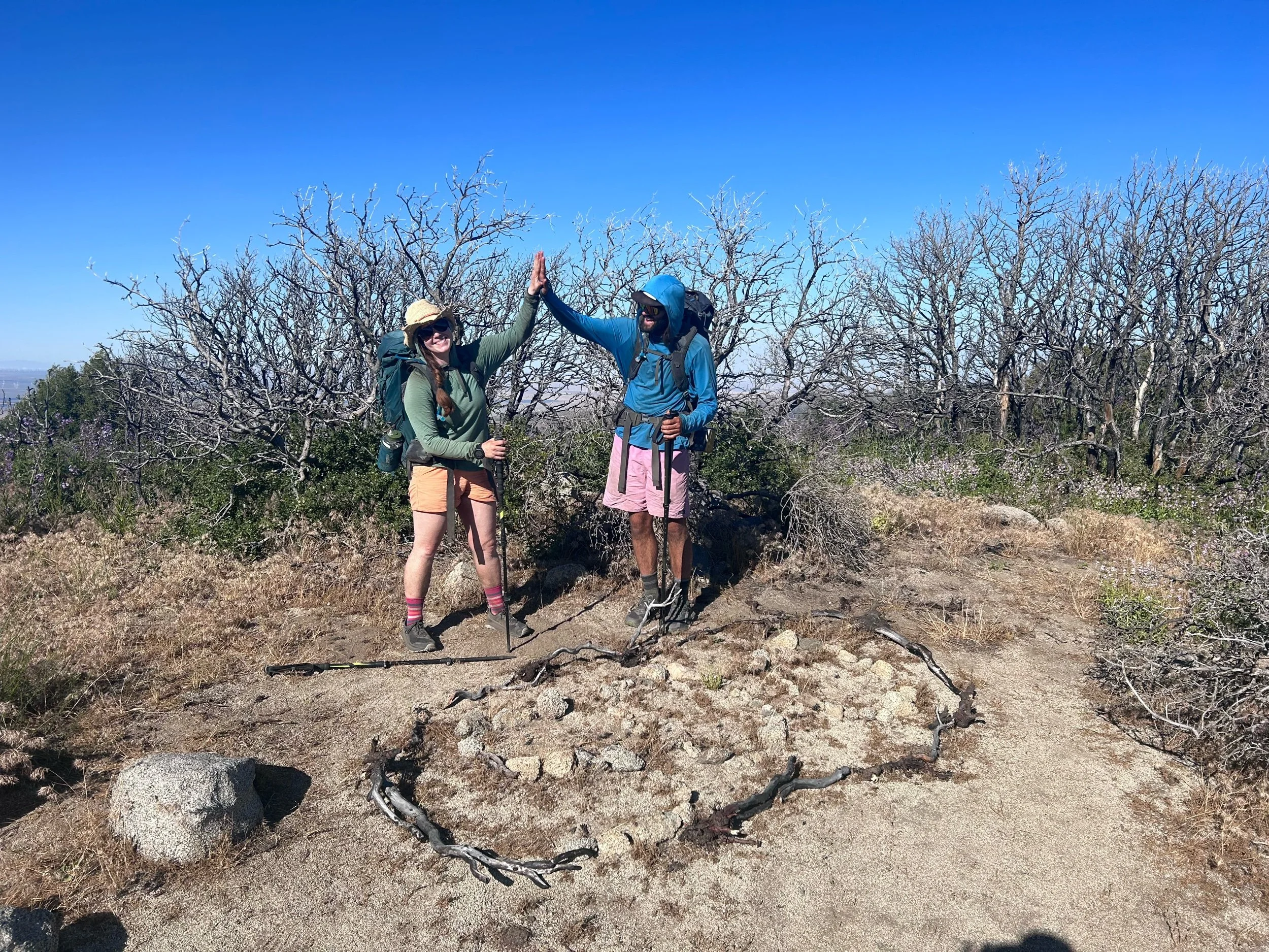
So, anyway, no sleep was really had last night and we set out early because the mosquitos were back out and hungry. We packed up quickly. Sticks, the girl who had a hurt knee and was helping out at Hiker Town, had shown up later in the evening last night and was still sleeping. We tried to be quiet as we packed up. We were out on the trail around 5:30, meandering around some low hills. The desert setting was still around but we hiked through low trees as we made our way through the morning. 

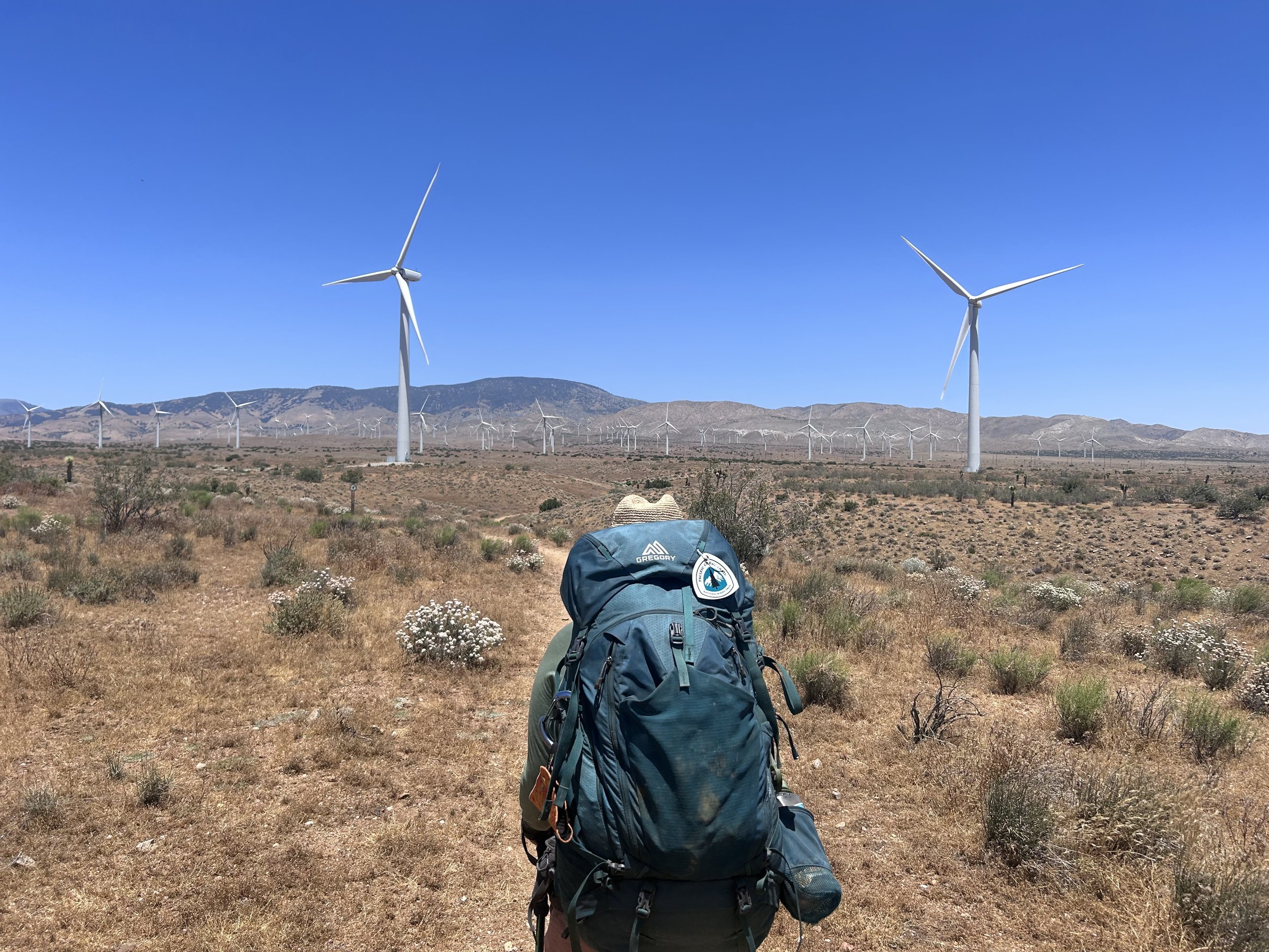
The trail made its way out and around some major hills and we eventually joined the road. Here we continued on. Roads on this trail have been miserable to hike on. You wouldn’t think so but these are definitely Off Road Recreation roads and they are riddled with large, loose stones which make the going very slow. At the road, the trees gave away to copious amounts of flannel bush brightly blooming yellow. We stopped for a restroom and snack break before continuing on. Thirty minutes later we came across a sign which put us back on a trail headed north.

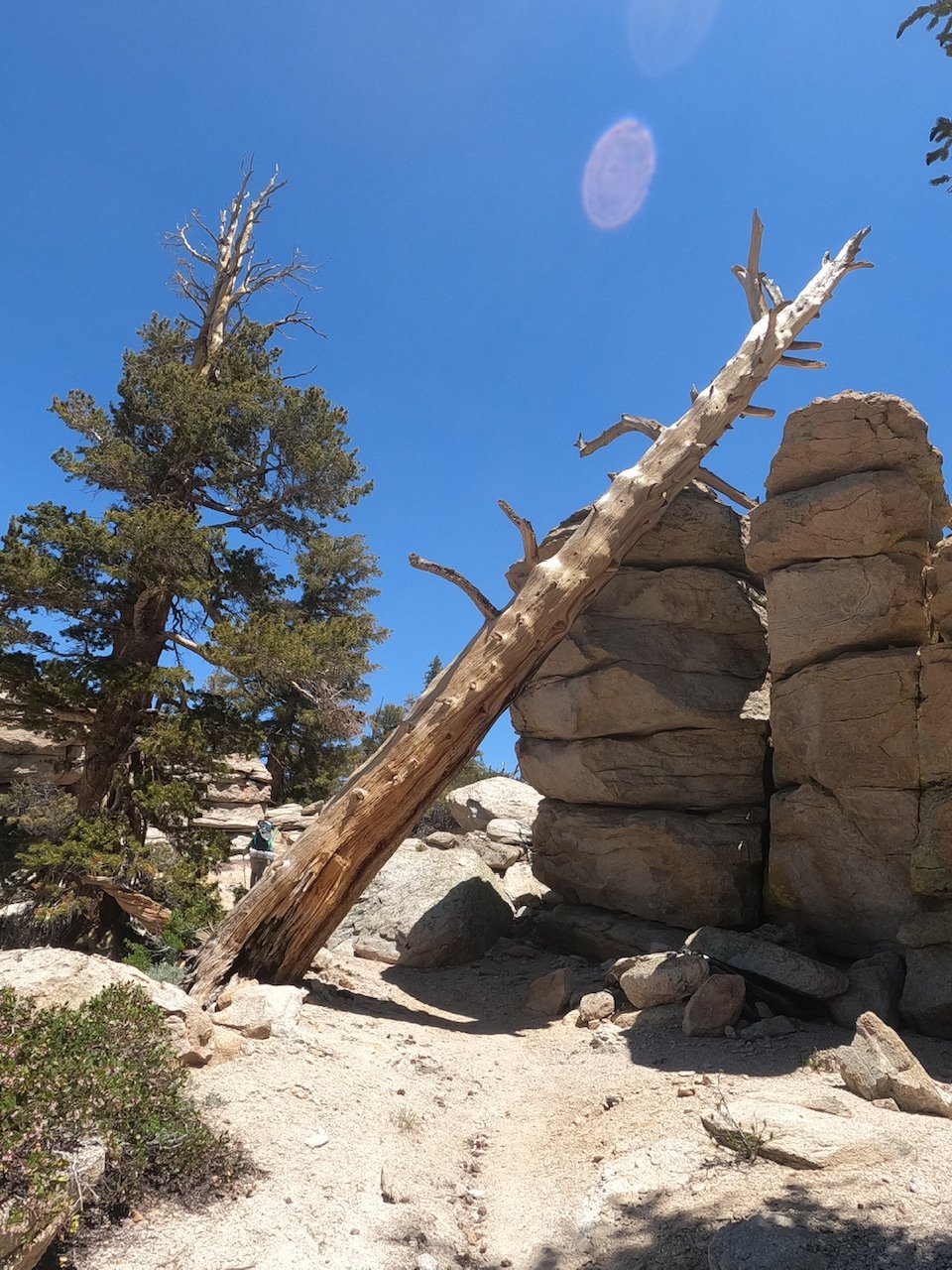
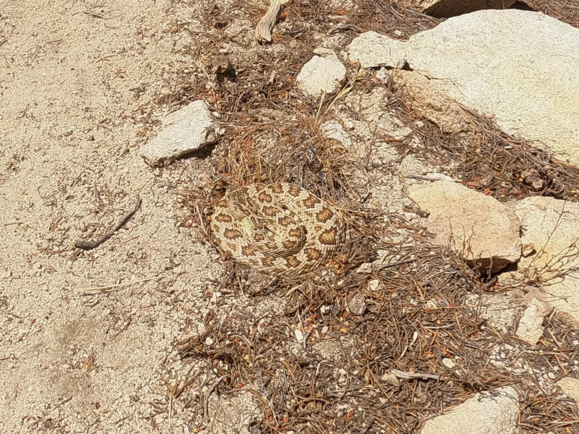
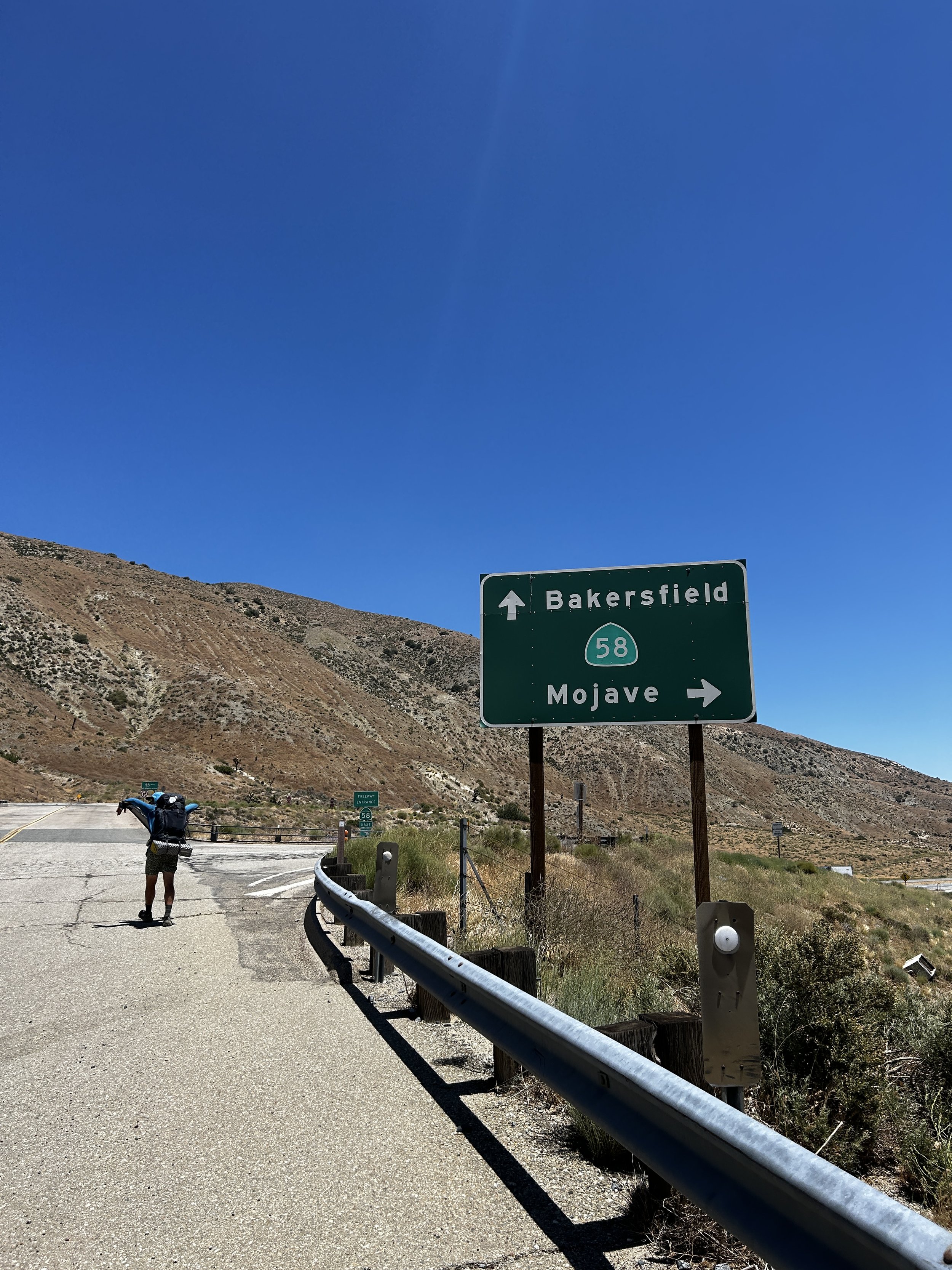
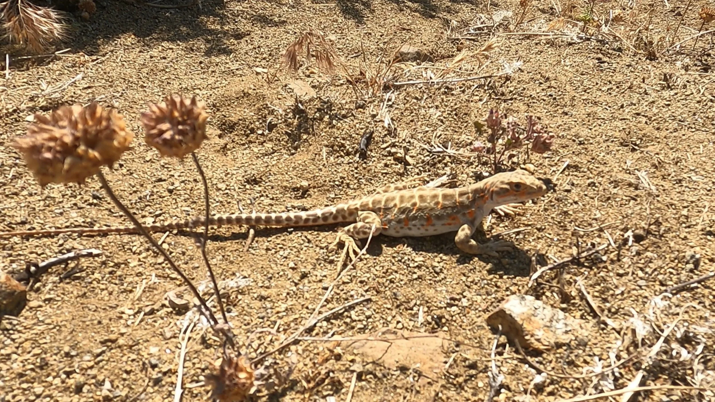
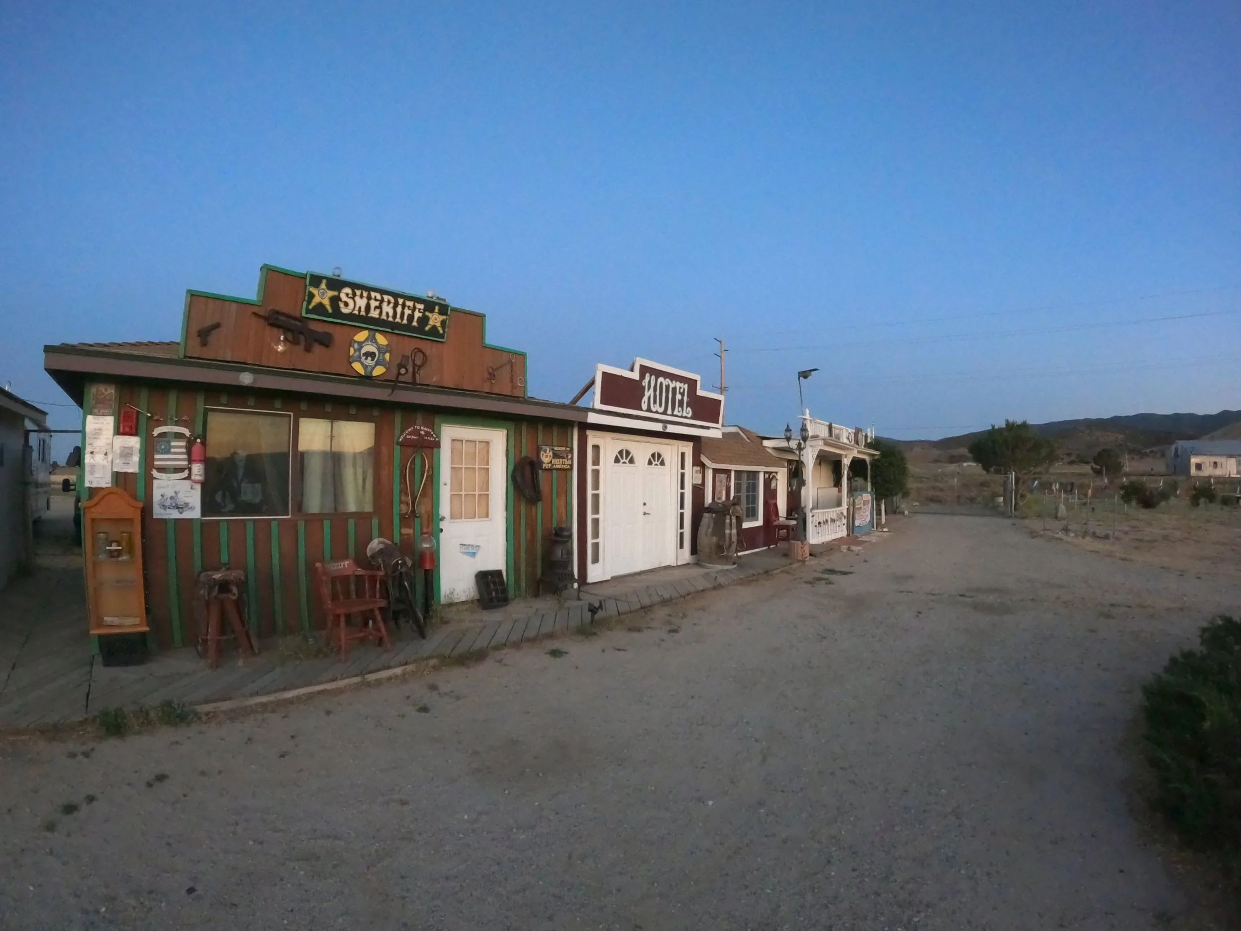
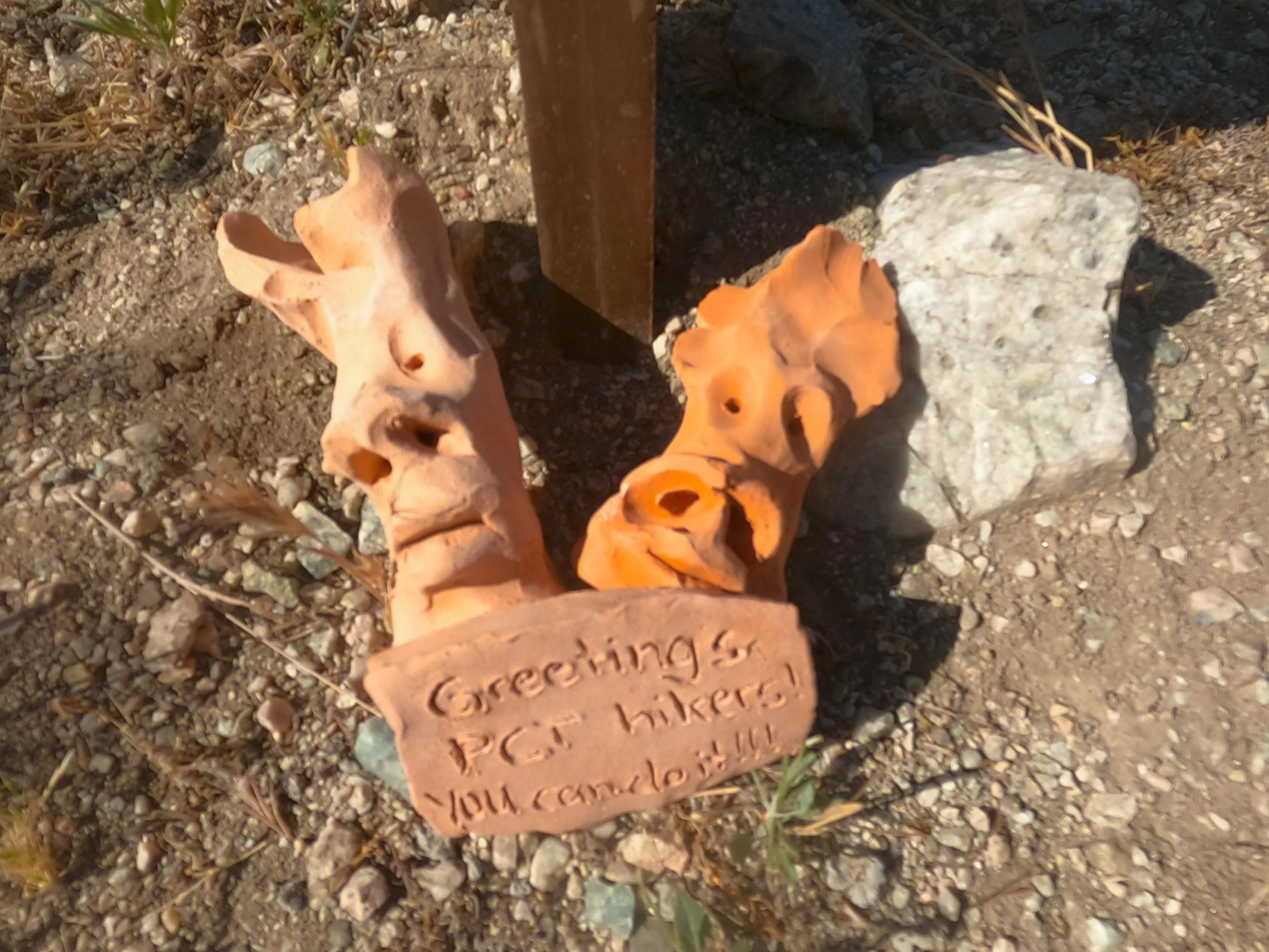
The path continued its winding pattern, striving to stay on the same elevation. Eventually the trail turned north and started a long, winding descent to Walker Pass. As we continued down you could see, way below, the road and lots of traffic heading east and west. Again, the frustration of consistent grades set in as we knew the road was only a few miles away but we still had seven miles of descent to go in order to reach the road. We traveled down and down and came across a slew of Regal Lizards. Each one we stopped and commented on - all super chubby. We also talked to an elderly couple from Tehachapi who told us about our options for resupply from the pass and told us good luck on the travels north. Eventually we came down to Walker Pass Campground. There was water here but we were only about 10 minutes from the highway so we continued on and got to the road. Here there was a plaque for Joseph Rutherford Walker, who had originally found this pass through the mountains, and also a water cache. We were still good on water so we traded our shoes for sandals and headed out to the road to start hitching. 

There are two towns from Walker Pass that most hikers try to get to. Eastbound takes you to Ridgecrest and west heads to Onyx and then Lake Isabella. We had heard that Ridgecrest was a little better so we started hitching on the east bound lane. The problem here was that the tractor trailers reached the peak of the pass here and pulled onto the medium where we were hitching, running us off the road. After this had happened a few times, Amanda and I decided to swap to the west side of the highway where a passing lane had been made available and we could hitch without fear of getting smooshed. 

After about 10 minutes, a white Chevy pick-up truck showed up and an older guy with long white hair got out and started shifting things to make room. We got in and put our packs on the back seat. “Lake Isabella Von’s?” I asked our driver, Ted. “Yea, I can get you there,” he said with a grin.” Ted was pretty wild, complaining about the long haul truckers who he felt were degrading the speed on the highway and passing on double yellow lines. He didn’t wear a seatbelt and had an open Budweiser which he held in one hand as he drove. You kinda have to take what you get when hitching but Ted was super nice and we talked about classic rock as he drove. He was a big concert goer and had just purchased a 2006, 40’ motorhome which he insisted on showing us on his phone while he drove. California has some unique drivers. 

We reached Onyx in about 15 minutes and I was dismayed to find that we still had 30 minutes to Lake Isabella. 45 minutes off the trail one-way was just too far. He pointed to his house as we drove by and said if we didn’t get a ride back he would take us back. We drove along Lake Isabella which was very high - almost overflowing the newly renovated dam on the west side, if Ted was to be believed. “I’ve lived here 11 years and never seen it this high” he said. Eventually, we arrived at the Von’s (which is just a nice Albertsons for my friends in the northwest) and dropped us off. I dropped a 10 dollar bill on the console between Ted and I which he tried to deny but I wasn’t taking it back. We thanked him and headed to the shade in front of the Vons.

I went in first while Amanda watched our bags. I got a bunch of snacks - some chips, nuts, a beer and breakfast bars - before heading back out to Amanda so she could do her run. While she was inside I called the bus dispatch who informed me they only ran Monday, Wednesday and Friday… It was Thursday. I sent some texts out to a few trail angels and one guy, Mike, told me he could do 5 pm - it was noon. Amanda came out and I went back in briefly to get some Homestyle Rice Crispy treats - these are my trail cocaine - they are amazing. Classic Rice Crispy with unmelted mini-marshmallows distributed throughout. After the shopping spree Amanda and I contemplated what to do with our dilemma. This was supposed to be a quick trip but here we were basically stranded till 5. 

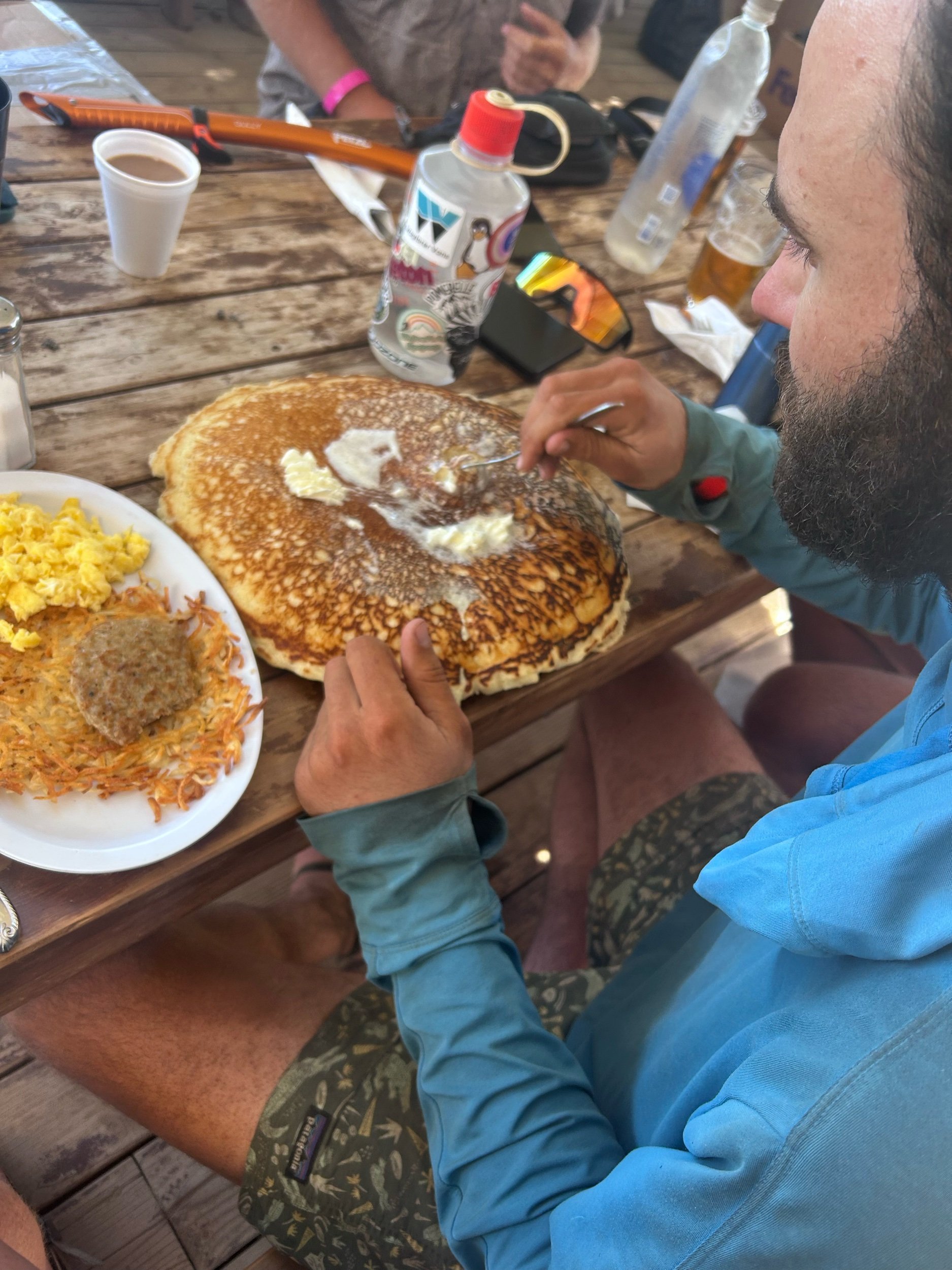
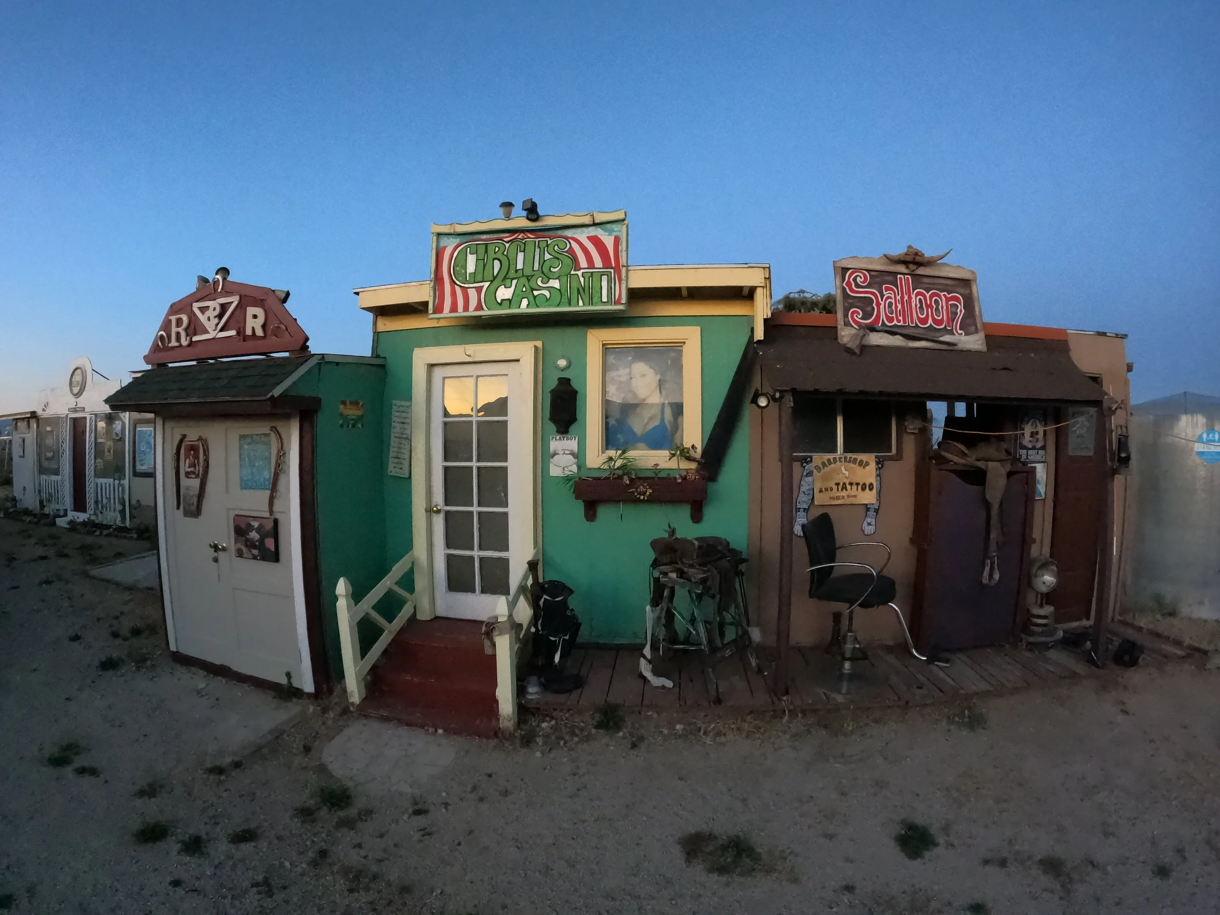
Looking on FarOut, Dena’s Diner was the popular stop in Lake Isabella so we made our way through some sketchy alleys to the popular spot. Eastern California is dramatically different then Western California. Small wild towns with fascinating people. We made it to the diner. I got a beer and burger and Amanda got one of their famous shakes. We told the waitress we were going to be there a while. She smiled and motioned around to the empty diner saying “No worries, not really that busy.” We proceeded with our typical proceedings when we get internet - uploading fresh GoPro videos, updating Strava names, etc. etc. We stayed there for 4 hours until 5 when I reached back out to Mike who proceeded to ghost me. 5 came and passed and then 5:30 and eventually I gave up and reached out to a trail angel who had contacted me at the pass, named Jaime. Jaime was in Ridgecrest, about an hour away, but instantly responded and said he would come save us from Isabella for 75 dollars. Amanda and I deliberated but decided it was worth it. Jaime said he was on his way and I got another beer while waiting.

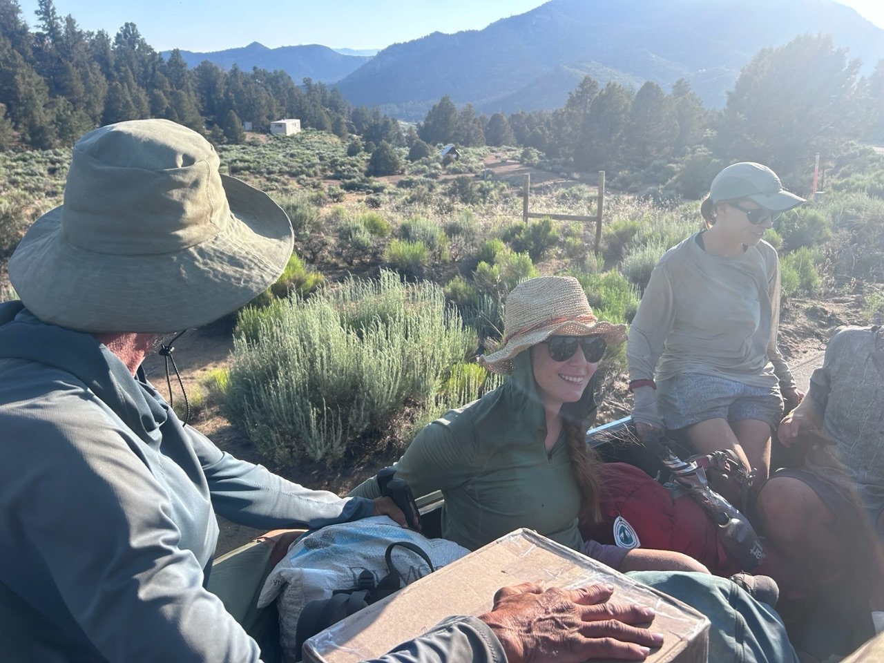
At 7 Jaime showed up in a brand new RAV4 and we paid for our goods, thanked the staff and loaded our things into the back of the car. Jaime was a similarly interesting driver - frequently straying into the other lane while telling us about how he drives for Uber - glad I wasn't asked for a review because he was almost as bad as Ted. Jaime got us back up the pass and eventually pulled over to let us out. We thanked him for saving our butts and walked to the north side of the pass to organize our things, both commenting on the quality of California drivers. 

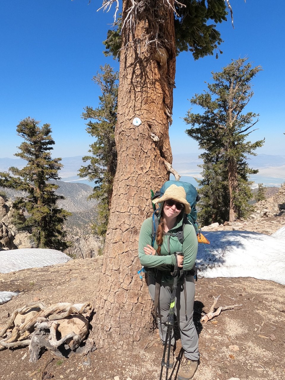
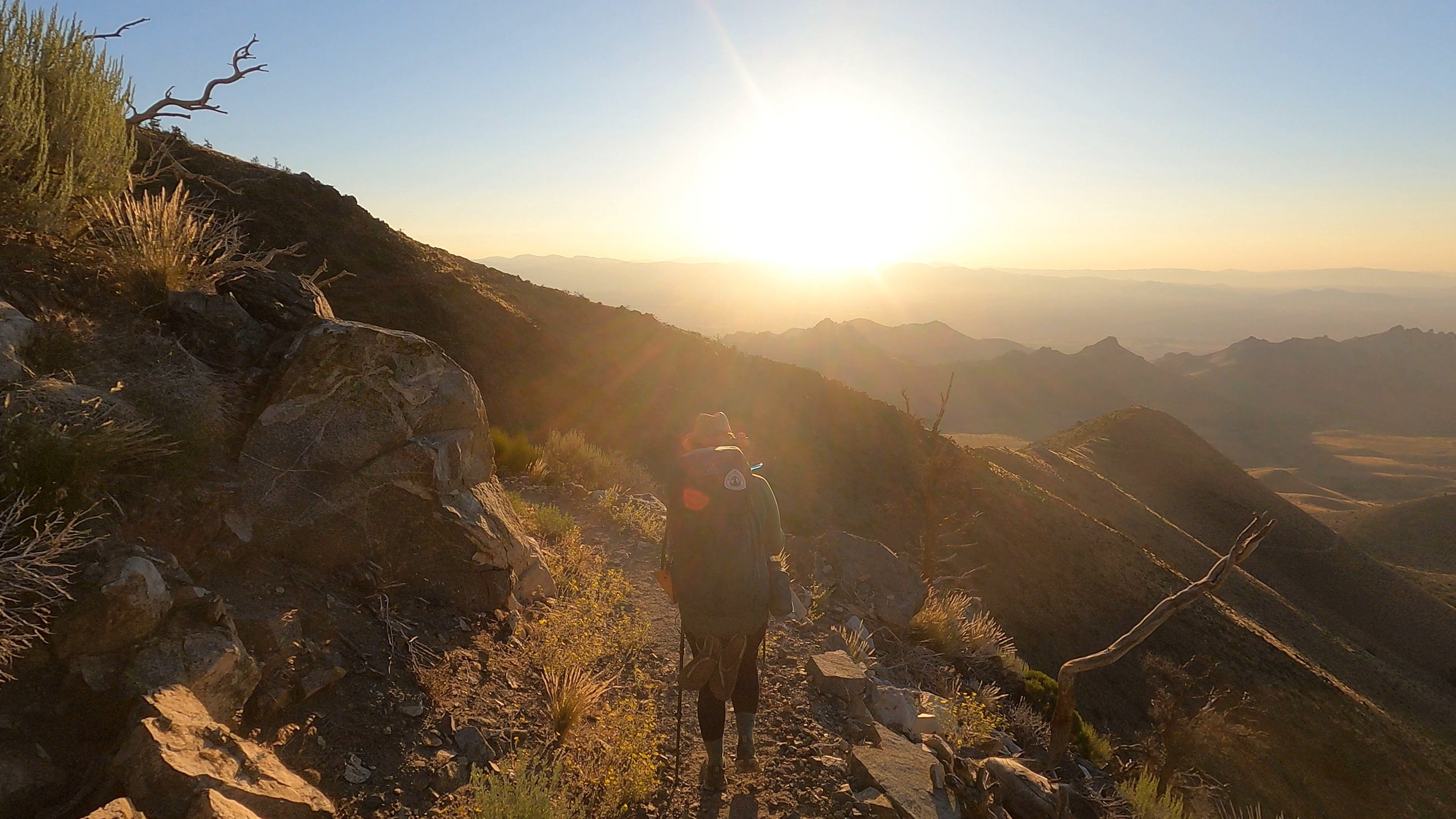
At 7:45 we were back on the trail slowly winding our way up the ridge north of the highway. The silver lining on this late start was that it was much cooler and we could climb in comfort. We wound up and up and, suddenly, Amanda stopped to examine the ground under her feet. “Scorpions!!” She exclaimed excitedly. We had hiked in the desert for over 40 days and not seen these poster-bugs of this environment and were both elated to find them. These were Striped Tail Scorpions and appeared to be very active in the evening. Almost as soon as she had spotted the first one, she saw another one and then another. “How have we missed these the whole time?” We both mused to each other.

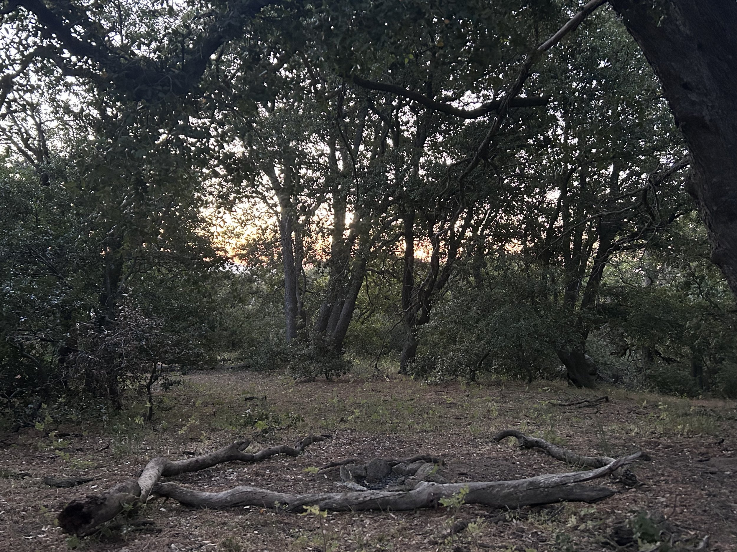
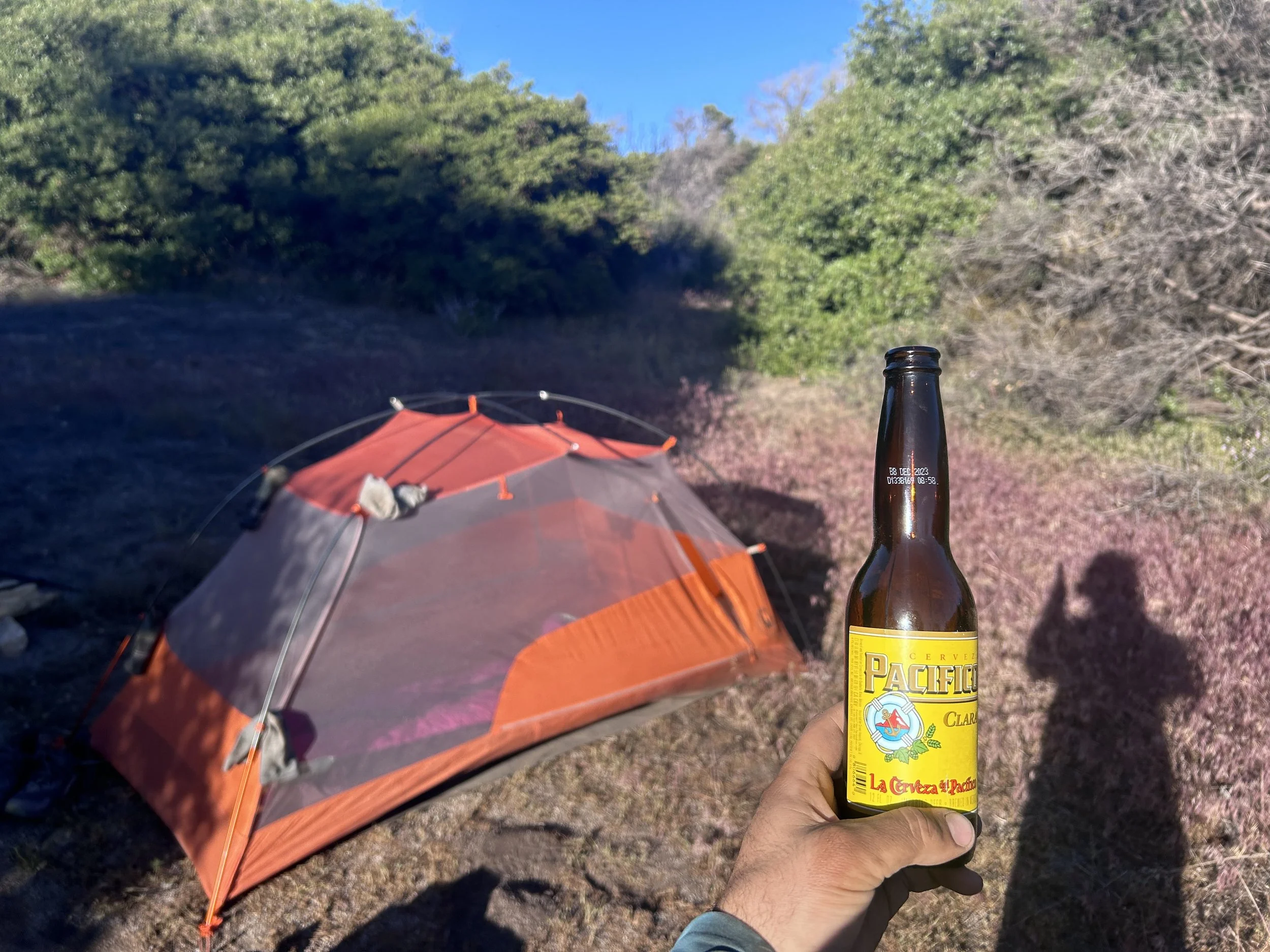
The trail wound up and up. We passed the French guy and Taiwanese girl looking off at the beautiful sunset. We talked for a while and then continued on. Another hour brought us to a beautiful campground where we set up our tent. No more cowboy camping for us…especially given the scorpions, and had a quick snack before getting into the tent and passing out. Long day, with a much longer stop than expected. Think the lesson learned for those of you hiking the PCT - totally not worth resupplying from Walker Pass. Just carry two extra days of food and carry on through to Kennedy Meadows. 

Day 43: Kitty Litter Climbing

Day 43: Kitty Litter Climbing

6/28/2023

Section: Milepost 617.2 to 639.6

Distance:  20.33 Miles  

Moving Time: 08:31 hrs

Elevation Gain: 3,981 ft

Click here for current location

Today was long but very rewarding because, finally after 600 miles, we got our first glimpse of the Sierra! Way off in the distance, but not so far as to seem forever away, we got stellar views of some snow capped peaks north into the Golden Trout Wilderness - so that was awesome! 

Today’s stage was pretty much waterless except for one amazing cash about 2/3rds of the way through it. Honestly, if it weren’t for the trail angels keeping up the cache we stayed at last night and the intermediate one today, a hiker would have to walk from Landers Campground at mile 610 to McIver’s spring at mile 645 without water. 35 mile days are possible but i don’t know if you could carry enough water to get there and what a day it would be! The route today continues east under the watchful gaze of Mayan peak up a shallow valley and around the northern slopes of Pinion mountain. The landscape in the early parts of today is still very much desert as we pass through groves of beautiful Joshua trees and the path is like sand or kitty litter, very difficult and annoying to walk on. At mile 623 the trail crosses Dove spring road and turnes north, going up and down in elevation through several drainages until it makes a final climb up to Wyley’s knob. Here it sinks back down to meet road SC120 where the water cache is still in full swing - thank goodness. The last 3rd of the day is dedicated to a 1500 foot climb up and over Skinner’s peak on the back side of which one can finally view the Sierra before descending down the opposite side and onto a flat-ish plateau where we camped for the evening.

Amanda and I woke at 3:30. Actually we woke at 2:30 because a truck had come up the road and stopped which we thought was odd and concerning but around 3 am it seemed to leave so… maybe someone just coming back late from Taco Tuesday. We couldn’t really get back to sleep so we got up and packed our things up. We’ve kinda given up on hot breakfasts - it’s pretty time consuming and I don’t have the mental energy in the morning to do dishes so, we just eat fancy Fig Newton bars and get underway. At around 4:15 we were ready to start and on our way. I hate waking up in the early mornings but I love hiking in them. Something about being shrouded in the dark - you just worry about what’s right in front of you and that’s all. The darkness didn’t last for long though as a slow glow started lighting the eastern horizon. We crossed over a small road and continued climbing on the other side. As the sun started throwing more light everything was cast in beautiful shades of orange, pink and purple. I got some good videos of Amanda and the Joshua trees framed in the sunrise as it started to peak over the ridge ahead. We stopped shortly after for a second breakfast and…other morning routines, before continuing on.

Eventually the path delivered us to Dove Spring road and turned north, putting the rising sun on our right. The morning was cool but you could tell the heat was coming as we meandered into and out of little ravines. The trail crossed by an old mine with the old equipment rusting away. At mile 627 we started climbing on a consistently sandy path out from another forest service road in earnest towards Wyley’s Knob. The climb seemed to go on forever. In the distance we could see Push-pop making his way up the same grade in front of us. Around 11 we crested over “the knob” and started descending towards the water cache. The long winding trail seemed to descend forever but, the more I hike on this trail, the more it makes sense. The designers always tried to get from one high point of the next without giving up any more ground than necessary which sometimes translates to large traverses but never any more lost ground than is absolutely necessary. As we came down we passed a small stand of trees and said high to a couple. The guy seemed French and the woman seemed Japanese but they were tucked back under the tree and we kept moving.

The trail continued winding down while Amanda’s comments about how hungry she was continued winding up until suddenly, Amanda lept back from the step she had just taken. It took me a second to see it but, sure enough, coiled cup right on the left edge of the trail, a tan and reddish rattlesnake sat sunning itself. Amanda had gotten within 2 feet of it before noticing and it had not even rattled. In fact, the snake seemed completely unconcerned with our presence. Its head didn’t come up and it didn’t uncoil. We took a second to look for another path and rock hopped up on the right side to give the snake some space. We came down and still no movement until we started taking some pictures - not getting any closer to do so, to be clear - when suddenly, as if a timer had gone off in the snake's head, it calmly uncoiled and slithered off. No rattle, not really a care in the world. We watched it go, mesmerized, until it had disappeared all together. “Another sign the desert isn’t going away without a fight,” I said to Amanda “2 snakes in 2 days when we haven’t seen one since going up into Idylwild 2 weeks ago.” She grimmly nodded “Hope that is the last one.” 

A few minutes later brought us down to the bottom of the hill and the waiting water cash, as well as Push Pop and Izzy sitting in the shade. We picked out our own shade and got to work eating. I picked up a foot and a half long pepperoni in Tehachapi, which Amanda is disgusted by, but have now eaten down to about 9 inches. It disgusts me too. I’ve had way better pepperoni on this trip but this is the one I am stuck with and, with some sharp cheddar cheese, it’s not bad. I also put down some more snack bars and peanut butter nature valley cookie sandwiches then I got to work developing a song to leave Philipp in the trail register. See, Philipp is 2 or 3 days behind us and, as our favorite German on the trail (sorry Charlie), we have been leaving him songs in the registers. Amanda came up with the 2 and I was responsible for the next one. The song below, sung to the tune of Time by Pink Floyd, is what I developed.


Trudging away the miles that make up a dull stage

Clamor and climb through the sand with a sense of rage

Hiking around on this subpar ground with a big frown

Waiting for Phillip to lead me to shade


I sincerely hope he is reading these. Other people are probably going to wonder about our obsession with this one German guy as well. Anyway, we finished our snack and song writing, said “see ya soon” to Push-pop and Izzy and went over to the very nice water cache to fill up. I took on 5 liters and Amanda took on 4 before, begrudgingly, we began the 1500 foot climb in the afternoon sun. I stopped a short distance beyond to write out my lyrics in the register.

Surprisingly, the climb went very fast. I followed Amanda as the elevation melted away and soon we crossed over the southeastern shoulder of Skinners Peak. 

I am impressed how well and quickly our bodies have adapted to the daily punishment. Early on in this trip the climb we did today with 10 extra pounds of water during the hottest part of the day would have been grueling and brought our progress to a quick stop but today we just kind of arrived on top and looked around almost surprised that that was all. It’s a great feeling that is so subtle you almost don’t notice it - almost more the absence of fatigue that is expected than some new kind of feeling. We can do successive 20+ mile days now without too much trouble and that is really exciting… and also necessary down trail from Kennedy Meadows so - just in time.

Once on top we descended a short distance, then paused to take in the Sierra. I have enjoyed the desert. It has not been nearly as bad as I thought it would be temperature-wise and there have been no end of beautiful sunrises and fun little critters to see. The Regal Lizards have been my favorite, but seeing those mountains today put a big, stupid grin on my face. I have always loved the Sierra. They aren’t my home mountains anymore but they were for a long time and I have a considerable set of memories spanning the first 12 years of my life amongst them so, yea, I’m excited to be headed that way.

We walked on and another hour put us down into an expansive campground where I set out the ground tarp and we got to work making dinner. Tonight was mountain house Lasagna and it was delicious. Earlier in the season this campground would probably be pretty full but tonight we have it to ourselves. After dinner I do my yoga and some exercises before coming back to blow up the air mattress. We are cowboy camping tonight despite the awef flies. Hopefully they will go away when the sun goes down but, as for now, they are terrible. Another great day and one of the last few in the desert. Tomorrow is a mini town day and I am stoked to get some hot food not out of a bag!

Day 42: 6-Hundo!!

Day 42: 6-Hundo!!

6/27/2023

Section: Milepost 597.5 to 617.2

Distance:  20.72 Miles  

Moving Time:  08:22 hrs

Elevation Gain: 2,799 ft

Click here for current location

Last post for a while - going into the Sierra. See you in 2-3 weeks! Lots of new material at that time!

The hundo’s are really going by fast now! At 20+ mile days, that seems to happen. Today was much better - think the extra sleep helped and not dong a 34 mile day the day before was also probably a positive change. Today’s stage travels north for the first half of the stage before turning east for the second half. The trail starts in BLM land, then transitions into the Sequoia National forest for a bit - which is super exciting - before then crossing back into BLM land. Water was plentiful for the first half of the day but then got scarce after turning east.

We woke at around 5 and were going by 6, again aided by the lack of tent deconstruction. We descended a short distance to the bottom of the pass and then climbed back up the other side looking for Izzy and Push-pop without much luck. The trail wound around the west side of Weldon Peak and descended a short distance. We were back in the high desert forest and very happy to have big trees all around us, though, I am pretty sure none of them were actually Sequoia’s. 

The trail crossed through an easement and a road where someone had set-up a giant billboard with the 10 commandments on it so… thanks for that… and then, soon after, we came to the 600 mile sign written in pinecones. We took a picture and continued on. At mie 602, after skipping through some more easements, we came to the border of Sequoia National Forest and entered. The trail continued and a few miles on we came across the first of many water opportunities - Robin Bird Spring where we shed our backpacks and took a break to refill water. After a 20 minute break we headed on up the trail. 

The trail elevation was steady and perfectly groomed so we sped along north for some time. At various points we checked FarOut for water upcoming or data on campsites. On many of these features we were elated to see very imaginative commentary from Sloppy Joe who is the same Joe we traveled with during week 2 on the trip. It turns out that we are only about 4 days behind him and I am hoping we get to catch-up in the Sierra, but his commentary is absolute gold and he is a prolific commentator on FarOut. 

At mile 610 the trail turns east and we stopped at Landers Camp Ground which was a fabulous spot with plenty of shade. We found Push-pop and Izzy getting packed up to leave and talked to them for a while before filling our own water bags. It sounded like they did not have the best luck finding a site after ours last night and had bivvy’d to get out of the wind. After we filled our water we packed up and carried on. 

Not far out of Landers the scenery began to change…back to the desert. I had really hoped that we would get to keep the trees but it very much descends back into desert. We hiked on and at one point Amanda surprised a rattlesnake who sped off, rattling the whole time. Like a champ though, she continued out in front as the trail began to wind down around some ridges. As we wound down we heard some voices below us. “Damn, how are they keeping up that conversation going uphill so fast,” Amand asked me. The answer made itself apparent as 2 women came up the trail on horses with a third pack horse between them. We went off to the side and said hello and asked them how their day was. They smiled and said “Better now, but we had to work on getting these guys around some blowdown down below for almost an hour.” We told them sorry about that and that the rest of the trail up to Landers was in better shape before carrying on. Another 20 minutes brought us to the blow down they had talked about and - yea - I have no idea how they got the horses around it.

We descended for another 90 minutes, eventually reaching Kelso road where a huge water stash had been left. We found a group of 4, including the girl who had been left behind at Hikertown, reunited and staked out in some spots by the trail. Amanda and I deliberated on going on further for a while but decided to eat dinner first before deciding. We had some ramen and fought off red ants for about 45 minutes before deciding to wake up early the next morning instead of pushing on now. We found another tent site down the way and set-up our tent there, seeing more red ant evidence. I did my yoga and talked to the group of 4 about the UFO they had also seen leaving Hiker Town before Amanda and I turned in for the night

Day 41: Grind

Day 41: Grind

6/26/2023

Section: Milepost 578.1 to 597.5

Distance:  19.1 Miles  

Moving Time:  hrs

Elevation Gain: 3,123 ft

Click here for current location

I hated today. Today might be my least favorite day so far. I at least put it up there with day 34 and the day going by Silverwood Lake. The thing is, I’m not sure why it was so terrible. The way I have the itinerary set up, no day should be much harder or easier than the last at least from an elevation and mileage perspective. There are intangibles on the trail - things that I can't plan or account for. Trail surface and quality is one and that was terrible today but there was something more - I think today felt like we were just spinning our wheels and not really going anywhere. Could have also been the mileage I did the day before. It was up and down and around and always I looked back or at the map and it seemed like we hadn’t moved. Anyway, here is the tale of terrible day 41.

We woke at around 8 - that might have been one of the main problems, in retrospect. Late start days are always miserable. You feel like everyone has a head start on you and it’s already hot. Nothing like starting in the cool to get your legs under you properly. We made a quick breakfast and were on the road a little faster than usual due to the fact that we had cowboy camped and there was no tent to put away. I liked that part - think we will do that more in the future. We were hiking by a little after 9. I forgot to start my Strava so the mileage above is based on mapping. The PCT wound north in BLM land on an ORV recreation road which was miserable because of the copious amounts of large, loose stones everywhere. The sun was already baking the road. We have been miraculously lucky with cool weather this year, but still - a wide road in direct sun warms quickly. Eventually the road transitioned to trail and at mile 583 we came across one of the few water stops along the way. We filled up on about 4 liters a piece, knowing that we would have to dry camp later that night. This was another factor that probably added to the overall “sourness” of the day. We were kinda of the thinking that, after the viaduct, our water woes would be done - well, we are finding out the hard way the desert is going to be cruel right until it ends in Kennedy Meadows. 

We carried on and up a little ways from the stream was a spring where we found Push Pop chilling in some shade. We said hi and continued on. Above and behind us, the ever present “whomp” of wind turbines could be heard. They literally seemed to be everywhere. From the spring we descended a short way and then began meandering around ridges and up and over small passes for most of the rest of the day, paralleling a service road for the turbines on our right. The day was hot and I was really fighting fatigue but we carried on. 

At mile 594, we crossed a dirt road with a beautiful campground. Amanda and I both looked at each other, knowing we were about 6 miles behind schedule already and knowing we weren’t going to make it up today. “Let’s keep going,” I said. We passed Push-Pop on the back side of the campground. He and Izzy had just had a similar conversation and were carrying on as well.

From the campground, the trail rose to climb the east side of a ridge. The day was cooling and with it, the wind was coming up. We carried on up the hill, hating every vertical step. Towards the top of the climb we met Izzy who told us she had been walking backwards to help with some Achillis pain she was having. I said we were looking for a camping spot near Hamp William’s Pass and she said that her and Push Pop were as well.

We made our way along the east side of the ridge. Someone had done an incredible amount of work clearing what looked like an old war zone of blowdown off the trail. I guess lots of wind and dead trees will do that. As we neared the pass we found a bare patch of ground that was supposed to be the camp spot. Izzy came by and I offered to share but she was committed to getting closer to the pass. “And, if I keep going then so does Markus (Push Pop)” she said with a grin. We waved goodbye and after looking around a little more I found a much nicer spot just up the hill. As we moved up that way, Markus came by and just shook his head when we told him Izzy had kept going. “See you tomorrow,” he said with a wave.

Once all our things were at the new spot we got to work getting things in order. We left the tent in the backpack, committed to the cowboy camping life now and made dinner. Sean had given us 2 “Good-to-go'' freeze dried meals. Made in Maine these were meant to be high-style freeze dried food. Amanda had eaten hers the night before and said it was delicious and so I was excited. I had the Mexican Quinoa Bowl in Adobo sauce and - oh my lawd - it was delicious. Definitely will be ordering more of these for down the trail. Amanda and I had already ordered our 10 meals for Kennedy Meadows and were devastated we had not tried one of these before making that decision. After dinner, despite being super tired, I caught up on 3 days of blogging before passing out - hoping I didn’t wake up sometime in the night with a bear standing over me

Day 40: Saved my Spot

Day 40: Saved my Spot

6/25/2023

Section: Milepost 558.5 to 578.1

Distance: 33.35 Miles  

Moving Time: 11:577 hrs

Elevation Gain: 7,086 ft

Click here for current location

Wow, today was an adventure - not really the kind you wish for, but one none-the-less. For context, almost every hiker on the trail has some sort of GPS beacon. Most use the Garmin In-Reach Mini, but some of us are still kicking around with the Spot we have had since 2015 and that works just fine - when it is actually on your person. The idea of these little things is that you can share your location - kinda like the FindMyIphone app but distributed to a wider audience. Anyone who has clicked the “Click Here for Current Location” link I share above has seen the location as reported by my little Spot locator. The devices also have a nice SOS button you can click to have someone come get you in a helicopter which, thank god, Amanda and myself have never had to use. Anyway, today is the story of how I lost… and regained that little beacon.

We woke around 6:30 and started moving. The town day yesterday had been one of our more organized and the tidyness of our bags reflected that. At 7 we went down for some breakfast and all of the old people stared at us for the second day in a row. We aren’t that disheveled but there’s also not much going on in Tehachapi. After breakfast we went back up to the room. I attempted to organize an Uber without luck and we started calling down the list of trail angels we had snapped a picture of at the trailhead. On the second try someone picked up and an elderly lady on the other end said she would be delighted to come pick us up.

At around 8:15, a lovely woman arrived at the lobby of the Best Western and we loaded our things into her car before she drove 20 minutes back out to the Willow Springs Road trailhead, telling us all about her grandchildren on the way. At the trailhead I gave her 10 dollars and we unloaded our backpacks. We waved goodbye as she rolled out of the parking lot and, just like that, we were back on the trail.

From Willow Springs road, the PCT heads northeast, rising slowly up through the hundreds of surrounding turbines. The Boy Scouts manage the trail in this area and, have to say, they do a great job. The trail crested a few miles along and then started a long wind down to highway 58. Along the way, we hopscotched with the Czech and Slav pare Sam and Alesh as the trail switchbacks down to the highway. At the bottom we found a smiling woman in front of her Subaru offering drinks and fruit. She had just dropped her husband, Wildfire, off at the trailhead and saw us coming down so decided to offer a little trail magic. We thanked her profusely and I enjoyed a cold Pacifico while Amanda had a soda. We talked with her for a while before she departed, giving myself and the other guys another beer for the road.

After the switchbacks, the trail follows Cameron Road to highway 58 where it crosses the highway and comes to a water cache. Here the four of us refilled our water bladders and topped up our water bottles. It was another 20 miles to the next water… a phenomena that will not be a problem in a few more stages but will also not be missed as a facet of the desert. From the cache, we left the 2 guys who were going to take a lunch break and started down the trail. From the road the PCT stayed relatively flat for about 2 miles, paralleling the highway before turning north and up to climb into the Tehachapi mountains. The day was warm, though still much cooler than it should have been this time of year. Amanda and I began methodically climbing the switchbacks for about 1000 feet before taking a break under some Joshua trees. From the trees the grade lessened some and the trail proceeded in a more direct manner up a ridge before winding between some local hilltops. The wind was crazy which is why I may have done a quick check on my backpack to find, to my horror, an empty holster where my Spot GPS beacon should have been. “Amanda,” I shouted “I think the beacon fell off.” We stopped and I looked at the Spot app, thankful that I still had service. It appeared to have fallen off at the water cache and was still sending a signal from there. I quickly put out a notice to our parents that it had been lost and a comment out on the FarOut app to let people know that it was mine and see if someone was willing to bring it up. We carried on, but I couldn't let it go. Finally, Amanda said “do you just want to go down and get it?” The Spot was 6 miles back and 2400 feet down. “Kinda,” I said. We agreed on a campsite and I jettisoned my backpack in some bushes taking the daypack out of it as well as some water and snacks. Amanda continued on and I headed down.

The descent was brutal, knowing that i was in for a 30+ mile day and over 6000 feet of elevation gain. On the way down I ran into the younger guy with highlights that we had first met at Silverwood Lake a few weeks before and again at Tehachapi. When I told him about the Spot he grimaced and said “oh yea, i picked that up on the trail back near Willow Springs and set it in the hiker box. Sorry man, would have brought it up if i'd known it was yours.” I told him no worries and thanked him for grabbing it before continuing on. On the way down I ran into more people including Push Pop and Izzy who both light-heartedly told me I was going the wrong way. I explained the sitch and they told me good luck. 

It was sundown before I reached the bottom and dark by the time I had done the first 1000 feet back up. Thankfully I remembered my headlamp. The wind was insane as I climbed back up to the backpack. I had a run in with a bobcat and prayed that that was the largest cat I would see. I eventually reached Amanda at 11 pm. She had left her sticks out on the road, which the PCT was briefly following, for me to see. We cowboy camped that night, not worrying about the tent. The stars were amazing and I was so glad to be lying down after what will probably be the longest day I will do on the PCT.

Day 39: Tehachapi Zero Day

Day 39: Tehachapi Zero Day

6/24/2023

Section: Milepost 558.5 to 558.5

Distance: 0.00 Miles  

Moving Time: 0:00 hrs

Elevation Gain: 0 ft

Click here for current location

Going to keep this a little short and sweet because, due to some events that are in the story tomorrow, I have fallen a little behind on this blog and need to keep up. And, you know, it’s a zero day so just chores mostly.

Amanda and I woke up on a beautiful Saturday morning in Tehachapi. We had breakfast at the Best Western kitchen in the lobby with Sean before heading back up to our rooms to start the day. Sean stopped by shortly after to say goodbye as he was only Nero-ing. He had received a very large resupply box the day before from his wife and gave us half of it, including 4 freeze-dried meals and a bunch of snack bars. We tried to say no and that that was too much but he insisted he couldn’t carry that much and, since we hadn't resupplied, we agreed to take the excess off his hands. We also agreed to meet him in Kennedy Meadows where he was planning on leaving the trail to head up to Lassen and continue. 

After that Amanda and I split. Amanda was headed back to the post office to try and get her cousin Rachel’s resupply box (round 2) and I headed over to a nearby coffee shop to sync my GoPro media on what I was hoping was going to be a more open connection than the hotel’s. As I entered the coffee shop, I noticed Push Pop (Markus) sitting at a table. He waved and motioned me over. We sat and chatted for a while before he eventually left and I got to work on updating my blog while the GoPro sync’d up. I write up my stories on the trail in Google Docs but often don’t have the service to upload them until I am in town so I had a bit of a backlog to work through. It was about 15 minutes of diligent work before I looked down at my coffee and realized it wasn’t decaf. I have been avoiding coffee all-together on the trail and, on town days, try to stick to decaf, but it seems they had gotten my order wrong. “We’ll,” i said to myself “this should help with the blogging.” 

Two hours later Amanda dropped by. She had seen Jye and Vanessa and said goodbye to them. They were renting a car and heading up to the northern terminus. We decided to go to the German Style Bakery everyone in town was raving about and walked across the street. There I had a Cuban sandwich (super German) and Amanda had a turkey sandwich. We talked a bit about all the people heading off the trail and those staying on and about the rest of our day. After the meal, Amanda went back to the hotel and I went to get my beard trimmed up. The barber was on a quick lunch break so I waited for about 10 minutes before she showed up. She gave me a quick trim and told me all about her life before finishing up. I thanked her and paid before making my way back to the hotel. 

Once back, Amand and I headed to Walmart just on the west side of Tehachapi. There we loaded up on the few things that Sean hadn’t already provided us with and then heading back. On our way back we ran into Kevin and Alex who we had been hopscotching with us over the last few weeks. They said a bunch of people were in town and some were just coming in that evening and that they were headed to one of the 4 breweries in town. We smiled and wished them luck before heading back to our room and organizing our things. After parsing out all of our meals I took a soak in the tub and then Amanda and I headed to the pizza place in town - TK Pizza.

On arriving at TK Pizza we found the Kiwi’s already finishing up but they stayed to talk with us once they saw us arrive. We shared lots of stories about travel as well as our own backpacking adventures in New Zealand and about the trail so far. At around 9 pm we all decided to head back as Amanda and I were trying to get a pretty early start the next morning. The kiwis were staying in Tehachapi for two days to rest up but we told them we hoped we would see them down trail.

Back at the hotel, Amanda and I took another soak in the hot tub, enjoying the warmth before packing back up to bed. This will probably be the last time in a while before we are in an accommodation like this again - likely Mammoth which is a good 3 weeks down the trail!

Day 38: Turbine City!

Day 38: Turbine City!

6/23/2023

Section: Milepost 541.5 to 558.5

Distance: 17.19 Miles  

Moving Time: 06:26 hrs

Elevation Gain: 2,604 ft

Click here for current location

The stage today winds east, up and out of the small river depression we were delivered to the day before. At mile 544.5, it descends into another river valley before winding ~1700 feet up to the top of a north running ridge. On top, the path ambled across a number of low summits before turning northeast and easing itself down to the Tehachapi Willow Springs Road. My itinerary had us going beyond Tehachapi Willow Springs Road to Highway 58 but Sean and others were getting off at the earlier road and so we decided to do the same.

We woke up at around 6 am. The wind had been insane the night before, howling through the oak tree above our tent from about 11 pm to 2 am. I have been scarred about wind in tents since I took a group of friends up to the Bugaboos in British Columbia a few years back and we got caught in a massive thunderstorm. At the time there had been no good way to stake the tents on the granite shelf we were camping on and the whole thing was quite a catastrophe so last night's wind kept me staring up through the mesh at the waving limbs above us the whole time. To compensate, we slept in and several groups, including Push-Pop and Sean were up and out before us. 

Once we had eaten and packed up, we beelined directly up the hillside to rejoin the trail. Looking back, i could still see Jye (Tit Punch) and Vanessa (Sugar Momma) packing up. We hiked in relative silence most of the morning, but occasionally commented on the crazy wind and the far off turbines. At one point on one of the many dips into a side valley, I caught a glimpse of a lizard we had been looking for for some time. This was a Leopard Lizard. We had talked with Sean about another lizard, the WhipTail Lizard, which seemed to have some very “Leopard-like” markings on it’s side but he had assured us that was the Whip Tail, but today, as we meandered along under the warming sun, we caught a much larger lizard with leopard print skin and took a picture to confirm with Sean later.

Shortly after our lizard encounter, we came to the edge of a ridge and looked down to see switchbacks disappear below us only to reappear on the far side of a small valley. Deep below, at the bottom, we could see Sean’s tell-tale blue Patagonia running shirt making its way up the switchbacks on the other side. I took out a cliff bar and started munching as we made our way down into the valley. At the bottom, we crossed and began our climb, begrudging to a small degree how late we had started. The sun wasn’t even that bad which made me muse about what this hike must be like in a true, hot California summer. We climbed on and eventually caught up to Sean, who fell into step behind us. We excitedly told him about the Leopard lizard which he had also seen and confirmed that we had the species correct this time. We walked on, crossing through the long series of low summits on the ridge, talking on and off.

Far behind us we could see Jye and Ness just reaching the descent into the valley. We traveled on and eventually came to “the Oasis.” Here, on this little, random patch of land a group of trail angels had set up a picnic table with chairs and repository boxes for books and snacks. Delightedly, we sat and relaxed for a while, taking the chance to snack and refill water at the drums that had been left behind, all commenting on what a wonderful stop it was. We stopped for so long that Jye and Vanessa caught up to us and joined for a while before we headed out. Walking on, we continued to meander through the low summits of the ridge, still very much in the desert but a little higher than before. As we headed north, the wind turbines that dominate Tehachapi pass could be seen and, as the sun began to come down from its noon high, Jye and Vanessa caught up to us and joined our little group. Sean, Jye and I talked as we walked while the girls talked behind us. Jye and I talked about van life and our mutual love for wind turbines as the trail began to descend toward the Willow Springs Road. At one point, a day hiker came up going the opposite direction and we all said hi.

The trail continued to wind down, in a seemingly endless fashion as we entered the domain of the wind turbines. Looking up, these turbines were noticeably older than those we had walked amongst the day before with smaller blades and older looking bodies. Far off in the distance we could see an entire array of much smaller turbines spinning at much lower speeds. Jye and I talked about future plans on the trail. It sounds like both him and Vanessa are going to rent a car and drive to the Canadian border tomorrow to begin traveling SOBO as this is the typical time when most of the SOBO hikers are starting. I told him that was awesome and told him all about my favorite parts of the North Cascades. 

About an hour more finally brought us down to Willow Springs road and, at Jye and my insistence, we both crossed briefly to read the informational signs on the wind turbines themselves. It was an informational sidequest that I think we all appreciated in the end. Turns out Tehachapi was the site of an American wind turbine uprising, being one of the predominant sites of wind turbine development in the United States. There - I bet you just learned something awesome about wind turbines that you didn’t know before. Afterwards we moved out to the highway and put our thumbs up to see if we could get a ride. Sean looked at us all with our thumbs up in the air and laughed as he told us we were supposed to point our thumbs in the direction we wanted to go, not straight up and asked who had taught us that. “We learned it from your generation Sean!” I said with a grin to which he just laughed. A long line of cars went by without so much as a turn signal or brake light. “Tough crowd today,” Jye said. As the cars passed, the day hiker we had seen earlier crossed the road, looking at us curiously. He came over and asked if we needed a ride. We told him there were 5 of us as he pointed to his Lexus sedan. He assured us it wouldn’t be a problem and we all migrated over to his car. The boot of the car was surprisingly large and we smooshed our way into the back seat giving Sean the front. The Lexus was maxed out but it made its way down the pass just fine. The day hiker’s name was Dillon and he was from Idaho completing an internship in Lancaster as an electrical engineer for a wind turbine company. He took us to the post office where Amanda and I were expecting a package from Amanda’s cousin Rachel. Sean was also looking for a package from his wife. The post office staff was able to find Sean’s package but not Amanda’s, much to her chagrin. We committed to trying again the next day as we were zeroing in Tehachapi and went about calling an Uber to ride to the Best Western Plus where Amanda and I had used some credit card points to book a room. 

We arrived at the hotel, dropped our things and scrubbed ourselves clean before all walking down to Red House BBQ which many hikers before us had raved about on FarOut. We loaded up on classic bbq and I tried a few beers on tap. Jye and Vanessa joined us later and we apologized to Jye as he was a vegan but all of us had forgotten when choosing a place to eat. He seemed un-bothered by it and we talked late into the evening. Vanessa was a purser on a super yacht for a family down in Tennessee and had all sorts of fun tails from her job. We shared tales of our many travels and eventually we all realized how tired we were. We walked back to the hotel, stopping at a gas station (which Jye referred to as a “Servo” in Australian English) for some ice cream bars and other snacks. 

Back at the hotel, Amanda and I went out to try the hot tub for a bit before returning to our room to pass out on the wonderful mattress.

Day 37: The LA Viaduct

Day 37: The LA Viaduct

6/22/2023

Section: Milepost 517.6 to 541.5

Distance: 24.07 Miles  

Moving Time: 08:35 hrs

Elevation Gain: 2,556 ft

Click here for current location

So much had been said about this day. It is supposed to be, if not a beautiful stage, one of the more iconic ones. The LA Viaduct is a large underground pipe used to shuttle water around California and the PCT walks on top of it for a span of around 20 miles. In the early parts of the stage, the viaduct is above ground and the riveted panels that compose it are a notorious site referenced in many PCT blogs and stories. Typically, Antelope Valley, through which the viaduct runs, is extremely hot. At this point, in late June, it is not uncommon to see triple digit temperatures here but, as Sean and I had said to each other countless times yesterday, this was not a normal year and today temperatures were expected to be in the high 60’s. This was extremely fortunate for us because it really allowed folks hiking today to start whenever they wanted without fear of getting stuck without water in the middle of the 14 mile carry. This might have been why, despite Amanda and my best efforts, the 3 AM start time was actually 5 am.

We woke up and were ready by 5. I technically could have been ready at 3 because that gas station hot dog I ordered after the burger was not jiving with my stomach. I had gotten up at 1 and stepped outside, noting a massive red meteor in the sky, or a jet with afterburners on, and made my way to the restroom. We probably should have just gotten up then because I woke Amanda up anyway but we went back to sleep and got back up at around 4:15 instead.

We grabbed two glow sticks and I wrapped mine around my neck. It wasn’t truly an all night hike but might as well enjoy the early hours of the morning with some fun light tricks. All the other hikers today were going to start around 6 so we got a little jump on them. We crossed 270th Avenue and climbed a small berm on the opposite side before heading out on a long stretch north. We stopped and filled our water bladders to 2 liters at a small spigot before turning east again. Here, the aqueduct came into view next to us - a 20 foot wide span of water flowing lazily east with us. Eventually the straight lines we were following started to deviate a little bit and the aqueduct came to a stop. Here the trail turned north and continued on seemingly forever its surface now the iconic black metal, riveted section of viaduct. We began walking on the viaduct. Amanda commented that walking on the rivets felt like a mini massage. At one point we crossed over a gravel road intersection high above on the viaduct- i think PCT hikers were meant to get off and walk the road a bit before this but Amanda and I were committed.

As we hiked on, the viaduct eventually went completely underground and sections became concrete covered. Things started to get monotonous. There was no elevation change and very few directional changes. The few cars that came by became big events as we both became highly excitable at the smallest things. At mile 535 we came across our next water source. This was cottonwood creek and faucet and we stopped to fill our waters. Shortly after starting to enjoy our break Jai and Ness joined us. They had started about 30 minutes after us. Jai believed we really had started at 3 and incredulously asked what we had been doing all morning. He gave a laugh when he found out we had started at 5. Markus (Push Pop) showed up and then Sean as we were disembarking. We said good bye to everyone and that we would see them up the trail. We hiked on into the wind farm section of the viaduct and our voices were quickly drowned out by the subtle roar of about 100 turbines running above our heads. We walked in the roar for another 3 hours, the trail continuing on in its boring, straight trajectory until we had left the turbines behind. We wound our way up to a creek where a very nice camping area was located. Amanda and I set about putting our things together in the shade of a wonderful old oak tree. Jai came by as well as Ness but decided to camp further up the trail. We said we might join them before I settled down to write and make dinner. It was our longest day so far and also the flattest but it marks the beginning of the end of the desert. In 9 days we would be in Kennedy meadows and that will be it for the desert. Crazy that we have been on this trail for a month but what an experience it has been. 

Day 36: Hikertown Bound

Day 36: Hikertown Bound

6/21/2023

Section: Milepost 503.0 to 517.6

Distance: 14.80 Miles  

Moving Time: 05:26 hrs

Elevation Gain: 1,419 ft

Click here for current location

Today was pretty short and sweet and it had the benefit of ending in one of the most fascinating camping sites along the trail - Hikertown. The stage winds its way in a sort-of sideways “U” fashion ending the same longitude as it started but about 5 miles north. The path begins in the Angeles National forest and descends throughout the day until it is level with Antelope Canyon so that, tomorrow, we can cross the valley at one of the lowest points on the PCT and begin our climb up to Tehachapi. 

We woke…well, I woke around 5 and got up before eating my morning pop tart and watching Amanda slowly make her way out of the tent. After a bit of delay we joined Sean on the trail at around 6:45 (so, you do the math there) and were on our way. Amanda led and made great progress on a fairly level trajectory for the first 5 miles. The trail wound through medium oak trees and we saw limited people save for Collin, the French guy we had camped with a few nights before. Sean, Amanda and I talked about a lot of things from healthcare to habitats as we wound our way east and then North. 

At mile 506.5 the trail turned abruptly north and began winding down the grade again towards an intermediate plateau between the Angeles mountains and Antelope Valley. At the plateau, we followed a road and crossed a stream where we said high to the Collin who was filtering water and took a quick break. From the water stop we pressed on, eventually climbing a short bit and crossing the road. Sean told us all about a tree off the trail that had the largest nut in North America -the Buckeye Tree. After crossing the road, we wound through some low, grassy hills. The trail made some maddening twists and turns back on itself before eventually dropping us all the way down to the valley floor. Here, the trail straightened out and made a beeline north towards highway 138. The path widened and Amanda, Sean and myself were able to almost walk next to each other.

The trail dumped out on highway 138 and kitty corner to our exit we could see the ~2 acre complex of quirky miniature buildings that we knew to be hiker town. We waited for a break in the semi-trucks and ran across before crossing 270th street and climbing up the berm to enter hiker town’s gate. 

Once inside we were met by a zany miniature town of cartoon houses surrounding a double-wide house and porch on which a few hikers were already sitting and talking. We took note of a sign offering free rides up to Neenach market where you could do a lite resupply and get some food. As we rounded the porch we were called over to a garage/living area where a younger and older woman were already getting drinks and snacks going for Akira and Collin. I got a Tecate and Amanda and Sean got coconut waters. We sat and chatted for a while. Amanda prepaid for 2 showers and got us a stay in one of the whacky cabins then Sean called for the free Neenach market ride while Amanda and I put our stuff away in the cabin. By the time we were done the ride had arrived. We headed over and found Sean waiting in a golden, late 90’s Windstar van with a grumpy looking driver. We got in and Collin and Akira joined us, filling out the car. 

The ride took about 5 minutes and, as we exited the van, a set of 4 hikers got in, telling us we should get the hiker burger. We thanked them and entered the market like kids in a candy store. In our first round of purchases Sean got 3 Fantas, Amanda got 1 and I got a grape Fanta and a Stone IPA. We ordered a burger each and I went with jalapeño poppers over fries. Outside we found that Sean had already downed 2 Fantas and Amanda got to work on our own. Coming down out of the mountains today Fantas were a huge point of conversation so we were excited that Neenach market not only had them but had the cool old style Mexican Fantas. 

We talked for a while and found out that Akira was a truck driver in Japan and had heard about the trail on an apple podcast and had decided to do it. Our names were called and we got our burgers. They were excellent and came with a spare slice of ham bundled up inside. We ate in near silence for a few minutes after which we commented on how great burgers were. After we were done all of us made independent, haphazard trips back into the store to get a number of things including ice cream and circus peanuts. After we were all set, the driver took us back to Hiker Town and we congregated on the porch for the afternoon. I should say, I congregated while Amanda actually did chores which needed to be done, including her laundry and took a shower. 

A group that has been a day or two ahead of us for a while was at Hiker Town and headed out for the night. Night hiking wasn’t really necessary this week because of the unseasonably cool weather in Southern California but hiking the viaduct at night has become something of a tradition so many people still do it. This group was definitely getting amped up for the hike, downing 4Locos and smoking a ton of pot. At about 6 they finally got in gear and about 10 hikers headed out for the trail. One girl stayed behind, referencing a pain in her knee. She was going to hitch to Tehachapi and wait for her friends while she recovered. We talked some more and then Amanda and I headed to bed thinking we were going to try and get up around 3 and at least hike half of the viaduct in the dark. We said good night and I ran around to trying find Marta, who ran the place, to see if she could let me in to take a shower even though it was after hours. I got lucky and she let me take a quick shower after which I took some pictures of the little cabins and tried to write but it was getting late and I quit a little bit after starting. Finally, I laid down on a real mattress next to Amanda and fell asleep. 

Day 35: Poodle-dog Bush Dodging

Day 35: Poodle-dog Bush Dodging

6/20/2023

Section: Milepost 481.3 to 503.0

Distance: 18.35 Miles  

Moving Time: 06:46 hrs

Elevation Gain: 3,567 ft

Click here for current location

The stage today travels northwest all day and maintains within the boundaries of the Angeles National Forest. We were treated to beautiful views north of the Antelope Valley through which we would be crossing in 2 days via the Los Angeles Viaduct. The weather is unseasonably cool right now and has been since we started, for which we are extremely lucky and grateful as it looks like it will hold through our day on the viaduct. 

We slept in this morning and weren’t on the road until around 7. As we were packing up a hiker came up and said hi. His name was Han Solo as his last name was actually Han and he generally hiked alone. We talked to him for a while and then followed him out on the trail, a few minutes behind. The trail followed a ridge and forest service road for another mile before jumping both the ridge and road and descending a drainage down to Lake Hughes Road. As we descended, we passed by an older couple trail running and continued to wind in and out of depressions in the ridge to maintain a steady descent. The trail delivered us down to Lake Hughes road where some hikers choose to hitchhike into town to resupply. We did not need a resupply but did spend a little time at the trailhead hiker cache where I found a Pacifico and slipped it into my bag, Amanda rolling her eyes at me as I did so. As we left, I sent a few bucks via Venmo to the trail angel managing the cache as a thank you.

We crossed Lake Hughes Road and carried on up the first of several climbs today. As we climbed we saw Han Solo talking with someone in blue about 100 feet above us on a switchback and we carried on. As we came up to that switchback we were delighted to see Sean waiting for us. “I thought I saw you guys coming up so I waited!” He said as we both shouted “SEAN!!” We asked him about his stay as he had resupplied in Lake Hughes. “Good,” he said in response, “except I forgot yesterday is now a holiday and I got locked out of my airbnb!” We all laughed and carried on up the trail excitedly telling Sean how we had seen a roadrunner near Vasquez Rocks the day before.

The trail gained a ridge and maintained that ridge as it passed through new growth around a large burned area. The path under our feet was mostly sand, charred black in places. As we carried along we saw a lot of the plants that grow first out of a fire area in the desert such as Manzanita bushes. Another plant that was becoming more numerous and concerning was Poodledog Bush. Amanda, Sean and I had never heard of this notorious plant before hiking the PCT but it is mentioned highly in the commentary on FarOut and Sean had looked it up in Lake Hughes. Evidently its leaves have hairlike follicles that prick your skin as you go by causing a Poison Oak like rash. The weird part, Sean said, was that you could be pricked in one place and get a rash there and then get pricked a year later in a different place but the rash would come back in both areas - the new and the old. “Kinda like a zombie rash,” Sean added with a grin. 

As we came around a bend we were suddenly met with a section of trail inundated with poodle dog brush. “Walk carefully,” Amanda said before setting off. We picked our way through the patch, attempting to avoid contact. Sean had full length pants on but Amanda and I were both working with shorts so we made extra careful to not let the Marijuana looking leaves touch us. We made our way out of the patch and then carried on… into another patch and another. After 2 or 3 patches we came across a stump with a handwritten note stating “Fear not, trail crews have cleared Poodledog brush from here on out,” and they sure had. As we came on another section, there was clear evidence that bushes near the trail had been cleared of the bush where it impinged on the trail.

A few miles on we actually ran into the trail crew. 2 groups of about 15 people each were busily doing trail maintenance under the supervision of a ranger. We thanked the mostly young faces as we went by telling them the trail looked great. They smiled back and told us good luck. We came to a parking lot,  arriving on a freshly groomed trail to find 3 passenger vans with a logo stating the trail crews were volunteers from William S. Hart Union Highschool - so thanks for all the hard work William S. Hart Union Highschool!!! 

We carried on along the ridge and took a quick break at a forest road crossroads to have a snack before our final climb of the day. I am now taking large bites of pepperoni and then cheddar cheese to get a real charcuterie board effect in my mouth - it works. After our snack we started our climb. About 2 miles in we came across the 500 mile marker and stopped for some pictures and then climbed on. At the top we came to a road and a cistern where Amanda and I traded water bladder for tent and she went on to find a place to stake it. Sean and I met a Slav and Czech guy that Sean had told us about on top of the cistern and we talked for a while. The Slav was from Bratislava and was named Sam, the other guy's name I can’t remember but was from Prague. They were both nice to talk to. We talked about beer and how the Czech’s have the original Budweiser while pulling water out of the cistern.

After water filtering Sean and I made our way down to camp. Amanda had staked out a spot just up from Bear Campground which was an old abandoned campground we were targeting. She said that there were no good places and lots of red ants so she had come back up the trail a bit to find these spots. We settled down for our evening activities and talked while eating dinner. I pulled out the Pacifico telling Sean i had found it at the hiker box near Lake Hughes Road. He smiled and said “That’s good since I put it there!” Evidently, Sean had stayed with William’s group and gotten more trail magic the day before from William’s dad and encouraged the last of the Pacifico’s be left at the Lake Hughes Road hiker trail box. After dinner, Sean gingerly got into his sleeping bag, as he is still trying to heal his tailbone and I did my nightly exercises and yoga. The spot Amanda had picked was right near a large patch of beautiful red flowers which Sean said the hummingbirds loved and I had to agree as I watched about 15 male hummers viciously (as viciously as a 2 oz bird can be) fight over the patch of red flowers. Afterwards I came back for some reading and much needed sleep.

Day 34: Hiking in a Cloud

Day 34: Hiking in a Cloud

6/19/2023

Section: Milepost 463.9 to 481.3

Distance: 18.72 Miles  

Moving Time: 07:18 hrs

Elevation Gain: 2,657 ft

Click here for current location

So, I will be the first to admit, today’s stage has been my least favorite so far. We hiked in a cloud most of the day. Sean had told us a few ways ago that this summer has been cooler than usual so far and because of this, the marine layer off the Pacific travels further inland and sticks around all day. I truly feel bad for the folks in Santa Barbara or LA - I don't think there has been a single day on this trek since starting in mid-May that we have been able to see west down to the coast - it’s just been a solid wall of fog. Well, today, we got to walk in that wall of fog…almost all day. The stage today spends the entire time in the Angeles National forest traveling almost perfectly northwest all day. The only significant road crossing was the San Francisquito Canyon Road about 3⁄4 's of the way through the day.

Amanda and I woke around 5:30 am in a cloud, still tired from our late arrival the night before. I finally had my puffy so I threw that on, instantly compensating for the lost warmth of my sleeping bag. We packed up and ate a cold breakfast of…POPTARTS and then were on our way.

The trail meandered down from the ridge we had camped on the night before to the Bouquet Canyon Road - not really a canyon per say, but a nice, small road. From there we started our first climb of the day out of the road, the path painfully gaining very little ground over a long distance. With more food we were able to better regulate our blood sugar but, because of the bleak environment and not being able to see out very far, we were both less than our usual energetic selves. 

We continued on for the first half of the day with little worth noting. FarOut, the app we were using to get intel on the path ahead, had indicated that there was very little water, so we carried 3 liters apiece to get to a fire station on the San Francisquita Highway but that info turned out to be far from the truth as we passed about 10 streams throughout the day. Eventually we arrived at the fire station and searched around for a spigot. We ate some snacks before I screwed the Sawyer filter directly onto the spigot and filtered into our platypus’s (platypai?). While doing this I was stung by a fire ant but I did not retaliate against this act of violence because violence begets violence. I did verbally assault the ant but it didn’t seem to care. The sting still hurts even now that it's been 6 hours.

After we filled our water bags we delayed for a bit more before pulling our backpacks back on and heading up the trail. From the station the trail climbed up to a notch in a ridge where we passed through and suddenly, as if a curtain was pulled up on the world, we were able to see North out into the Antelope Valley - an amazing view after the blandness of the day. 

We hiked on another 4 miles before finding a camping spot near a forest service road. Campsites were strangely rare in this section of the trail but a few unofficial spots were scattered here and there. We set up camp and had some ramen for dinner before completing our typical evening activities and settling down to sleep. A meh day on the trail for sure, but those are bound to happen occasionally. 

Day 33: Thief in the Night

Day 33: Thief in the Night

6/18/2023

Section: Milepost 444.3 to 463.9

Distance: 20.91 Miles  

Moving Time: 09:01 hrs

Elevation Gain: 4,132 ft

Click here for current location

I woke at 2:30 this morning to the sound of rustling at the base of a tree 5 feet from our tent against which Amanda’s backpack was leaned. Silhouetted against the grainy light of a street lamp in the KOA, I saw a masked bandit tugging on a bag of Whisps which Amanda had strategically located in her easy access pouch for the next day’s adventure. I quickly reached over to the opposite side of the tent for a headlamp and flicked it on to reveal the inquisitive eyes of the raccoon staring back at me. He started coming towards me to which i said “No, go away trash panda!” That stopped him in his tracks and more name calling sent him on his way. From there on out, sleep was hard to come by. I should note here that Amanda and I are typically very conscious of our food storage and keep everything in the smell proof bags we brought, if not a bear canister where they are required. We had, on this occasion, tried to prep our bags for the next day by putting a few snacks in the easy-to -access side pouches of our bags. For context, an entire Carnitas buffet had been left out on two picnic tables across the road from our site - no idea why the raccoon wasn’t occupied by that alone for the entire night instead of our stuff, but whatever, he never came back so must have found some easier items to make off with.

After some tumultuous sleep which, in addition to the raccoon, included some bogens ripping through the campground on dirt bikes around midnight, we woke at 4:30 to get an early jump on the day. The idea was to get to Maria Bonita’s Mexican Restaurant at 11 for opening. We had pocket pies for breakfast and were out around a quarter to 6, catching Phillipp to say goodbye before leaving. He and some of the others were going to do laundry and then head across the hills to Agua Dulce a few hours after us.

We left the campground and then crossed the Santa Clara River before making our way up into the hills beyond. The trail crisscrossed through BLM land and the Angeles National Forest as we climbed into the range between Soledad Canyon and Agua Dulce. A couple of hours climbing brought us to the crest of the ridge before we began descending. In the distance we caught our first glimpses of Vasquez Rocks, the site of many famous movie scenes. The trail cut due north before heading west in parallel with I-14, eventually sinking below the berm on which the highway sat. The trail again turned north and directed us through an 8 foot drainage tunnel under the highway and on the other side, we were in Vasquez Rocks State Park.

We serpentined through Vasquez Rocks for about an hour taking in the beautiful rock formations caused by the San Andreas fault. Eventually we reached a horse parking trailhead and Amanda made a beeline for the restroom where she was cut-off by an older lady who was part of a larger group already in the parking lot. I sat and enjoyed some Dill Pickle sunflower seeds - David’s this time instead of Spits, much better - while watching my wife’s frustration mount waiting for the bathroom. When she finally came back we sat and snacked for a while and, suddenly, saw an animal we had been looking for this entire time. True to its namesake we saw it running on a small road next to our picnic table - a tall lanky bird with a little mohawk. The roadrunner didn’t stick around but I do think I heard a little “meep, meep” as it took off in a cloud of dust. “I hope we get to tell Sean we saw one,” Amanda said as we smiled at each other.

We made our way out of Vasquez Rocks and walked the Agua Dulce Canyon Road for a while until it delivered us to the front of Maria Bonita’s Mexican Restaurant. We were there about 15 minutes after opening but were still the first in attendance. As we put our things down I nearly put Amanda’s eye out with my trekking poles. You see, Amanda is incredibly conscious about trekking pole tip safety - fanatical could be another word to describe her feeling on the topic. I can’t tell you how many times I have been chided on this trip about keeping my pole tips down or not letting them “swing about.” Anyway, it finally came full circle today when I swung them towards her on accident just as she was bending down to get something out of her backpacks and “almost took her eye out.” Anyways, I told her I would write this down as having happened for posterity so there it is.

We were shown inside and given some chips and salsa which we started working on immediately. More chips came as the friendly waiter realized we weren’t messing around. Amanda ordered a burrito and I ordered Enchiladas Suez as well as a Mezcal Margarita which the waiter gave me a good natured hard time about. More chips were also brought. We stayed for two hours, catching up on blogs and stravas and just general communications. We each got a spare margarita on the house which put Amanda on the far side of tipsy. We paid and thanked the host profusely after filling our water bags for the second half stretch. 

Outside I ran across to the hardware store. I had broken my fork and we also needed wipes, neither of which were to be found. As I came out of the store, I saw Phillipp and the gang headed up to a trail angel’s house affectionately referred to as “The Oasis.” Down the road, coming up the other way were the Ride Brides, sans Tit Punch (Jye) and Sugar ‘Mama (Ness). I talked to them for a while and found out they were taking a zero day in Agua to resupply like Phillipp. I recommended Maria Bonita’s Mexican Restaurant before heading across the road back to Amanda.

We decided to visit the Oasis as we had heard that Farmer John, who ran the place, stocked a small resupply. We walked about a mile down the road before navigating a maze of fences and warning signs to get into the little compound. We found Phillipp, Charlie, Jason and Lorena as well as a few others already inside and they told me where to find the famous Farmer John. A kindly bald man came out and opened his resupply shack where I found two packs of “Dude Wipes” and paid for them. Amanda and I briefly considered sticking around with our little familiar bubble but, we do as the curve (which is what i refer to my daily mileage calculation as) commands. Plus, it is likely that most of this crew will catch up to us in the near future so we headed out.

Heading out was easier said than done. The day was in the mid-80s, we were facing another 10 miles and 2000 feet of elevation gain and, maybe most daunting of all, Amanda had eaten a massive burrito and put down 2 margaritas, which is 2 more than she can really have and still expect to function normally. That all being said, we headed off into the heat of the day, navigating city streets for about 2 miles before leaving Agua Dulce and climbing a forest service road. The trail eventually split from the road and began the aggravatingly slow climbing we are so familiar with now. It was incredibly slow going but a few hours brought us up through the dry, scrubby hills of Angeles National forest to the crest of Sierra Pelona where we dumped down the other side. Half a mile from camp we came across a spring where I traded the tent with Amand for her water bladder. I filled water while she went on to set up camp. After listening to “Time” by Pink Floyed about 5 times I had filled 8 liters of water and rejoined Amanda. Two others shared our camp, Collin from France and Akira from Japan who had been at Maria Bonita’s Mexican Restaurant with us earlier that day. Dinner was cheese and salami wrapped in Hatch Chili soft taco shells. Before bed i did my typical yoga and then retired to the tent. We are back under an approach path for LAX so, yay for more plane noises and hopefully less trash bandits! 

Day 32: Back to the Desert

Day 32: Back to the Desert

6/17/2023

Section: Mile post 430.4 to 444.3

Distance: 14.23 Miles  

Moving Time: 05:42 hrs

Elevation Gain: 1,098 ft

Click here for current location

Note: I am trying to get Squarespace’s Subscribe feature working below. If you are interested in receiving notifications for new stories go ahead and subscribe with the form at the bottom and hopefully I can get that feature working soon.

We are firmly back in the desert and, spoiler alert, I did not get my enchiladas…today. Our stage this morning took us along the border of the Angeles National Forest and the San Gabriel Mountains National Forest, occasionally straying into one or the other as it traveled west and then north towards Agua Dulce. It was a hot day, though nowhere near as hot as it could be this time of year on the edge of the Mojave desert, for which we were very thankful. There was no denying by the end of this day though - we were back in the desert and would be for at least another nine days.

We woke around 5:30 am. Some people who had camped by us were already hours gone but others were also just waking up. I got up and packed my things before making grits while Amanda organized her things in the tent. By the time we were ready to leave we were the last ones in the campground, Sean having left just before us. We migrated out to the road and then up to rejoin the PCT, Amanda telling me about how she had thought she had heard something dying in the night not far from our tent. “Glad it didn’t wake me up,” I joked as we made our way around the north side of Messenger Peak. Sean later told us he had heard it too and thought it was a screech owl. 

The day was already pretty warm. We made our way west staying on the opposite side of an east-west running ridge on a forest service road. As we approached the western reaches of the ridge, the afternoon’s path could be seen far below as a gray cut in a far off ridge. Before we reached those sections though we were delivered to an out-of-service ranger station. At this point we truly were on the last of our food reserves, though Sean had given us a spare salami the night before, evidently having overpacked for his next resupply at Lake Hughes. Thanks Sean!

We arrived at the North Fork Station and, speak of the devil, Sean was there taking a rest near some water jugs. He smiled and waved us over explaining that if we walked up to the gate in front of the station the custodian would likely bring us some trail magic. Sure enough, as we approached the station a kindly old man came out smiling and asked if we wanted a coke or Gatorade. We both smiled back and said Gatorade. He came back with 2 cold Kirkland Gatorade alternatives as well as a cliff bar and rice crispy apiece. We talked a little bit and he told us that the main wave of hikers was really starting to ease. Evidently no one had stayed at the station the night before, despite typically being a very popular spot, for the first time since the season had started. He also said we were lucky because, in another two weeks, it would likely be triple digit temperatures at the station. After conversing a while we both thanked him profusely before making our way back to the water station. Here we finished our Gatorades before making our own electrolyte mixtures and drinking those as well. Sean gave us each a Kirkland brand Kind bar and we had it along with the rice crispy treat and cliff bar. After a few minutes we all got up and headed on down the trail together. 

We talked for miles as we descended further and further into the desert. At times we passed through white sandy trail that shot the heat directly back up into our faces. Sean talked about his job on the board of the Sierra Club and we talked about ours as well as all the places we had each traveled to. The time passed quickly this way and eventually we reached our final water stop before the Soledad Canyon Road. Sean filled up and we carried on covering the last 3 miles in an hour and a half or so. 

The trail dropped down to the Soledad Canyon Road and, wouldn't you know it, more trail magic! The group that had stayed with us the night before at Messenger Flats was composed of about 8 people, one of which was named William. William’s dad had flown out from Maine and was trail angel-ing for these few stages. He had brought subway sandwiches, beer, drinks and lots of snacks! We joined the group in a covered gazebo type structure and chatted with them all for the better part of an hour. William’s dad was taking their bags up to Vasquez rocks for them so they could travel light and when he heard we were going into Acton for resupply he offered us a ride which we graciously accepted. We said goodbye to Sean and the rest and said we would catch-up in a few days.

We made a quick run into Acton and quickly resupplied, trying to not repeat the mistakes we made in Wrightwood. After collecting our haul, William’s dad took us back to the trailhead. We thanked him and hiked a quarter mile down the road to the KOA where many hikers stayed the night. There we did laundry and took showers, happy to separate ourselves from the dirt of the trail. We also received the package my parents sent us - thanks Mom and Dad! In it i found my Arcteryx puffy and the new Fitbit I had ordered as well as many tasty treats to supplement the shopping run. It always seems like too much stuff until you lay it out and take it in! Afterwards we set-up camp and Amanda watched our things while I headed back to the lobby to grab a pizza and chicken pot pie for Amanda. There I found Phillipp, Charlie and several others we had left in Wrightwood. We talked and caught up while I made the meals, happy to see some familiar faces. I helped Phillipp and the rest of them order pizza from the Acton Pizza restaurant and then headed back to Amanda where we settled down for the evening hoping for an earlier, and cooler, morning the next day.