7/18/2023
Section: Milepost 2048.3 to 2025.1
Total Trail Miles: 914.2
Distance: 22.68 Miles
Moving Time: 11:03 hrs
Elevation Gain: 4183 ft
Click here for current location

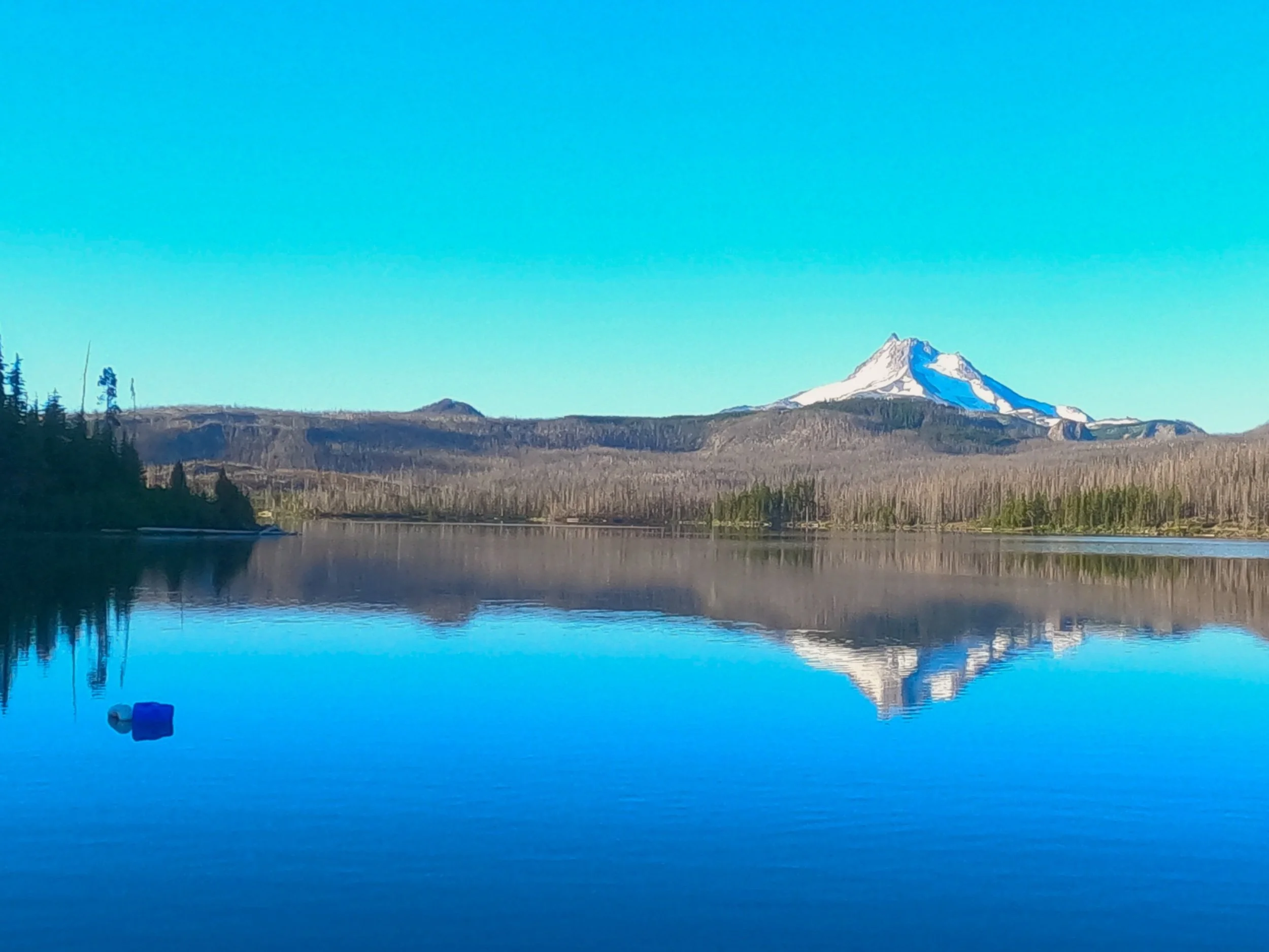
We woke around 5 on the banks of Olallie lak and snoozed a few times before getting out of the tent. The younger camp next to us were getting ready. You could tell that they had been living with bugs for a while longer than we had because they got 90 percent ready before ever stepping foot out of their tents. We weren’t so smart and collected a few bites before leaving camp. Before we left I went out to the dock running out from the front of the general store and snapped a few pictures of Mt. Jefferson reflected off the lake - not too bad for a GoPro.
We made our way back up the forest service road and eventually came to the PCT trailhead and got on. The PCT wound through an impressive series of little lakes before making it’s way past Ruddy Hill. The burn in this area was expansive and sad. The Lion’s Head fire was brutal but the silver lining was that we got non-stop views of Jefferson up and to the left of us. The trail climbed and eventually passed another forest service road near Breitenbush lake and then passed below Pyramid Butte.
From Pyramid Butte the trail turned into a dedicated climb up to Park Ridge which was a long east-west running ridge north of Mt. Jefferson. We crossed through a few small lava and snow fields before gaining the ridge. Here we took a break with breathtaking views of Mt. Jefferson and ate a quick lunch. We had some service so we checked in on a few things and eventually left. From the ridge we dropped down and I gave my mom a quick call. She was picking us up from Santiam Pass the next day and I was hoping she could bring us a few things. After the call I sent her a list of items which included one of my favorite IPA’s - Sticky Hands from Block 15 in Corvallis and we continued on our way. The trail wound down to the lower flanks of Mt. Jefferson and, just as we ran out of water, we came across a stream with several hikers refilling at it. This was the South Fork of the Breitenbush River and we stopped to filter here.
I gotta say, i’ not sure I am sold on the Sawyer Filter - it takes forever. If you have time you can gravity filter but if you want to fill up and go, I much prefer the old pump I had. The sawyers are slow and sitting there squeezing them is a drag. Fortunately I filled my time talking to this older guy from Vermont about world travel. We’d been to some cool places so it was fun to hear all the sights he had seen. Soon enough the water was filtered and he was on his way. Amanda and I followed close behind, headed the opposite direction.
We traversed west and south around the northwest flanks of Jefferson, crossing Russel creek - shout out to Rachel and Rene’s Golden Retriever who goes by the same name. The area here was burned pretty badly and views from the flanks of Jefferson showed clearly how extensive it had been. We passed the turn-off for Woodpecker trail and then did a tricky little crossing at Milk creek.
Here, Amanda turned on the afterburners. The trail got smooth and she rocketed the last 4 miles in the quickest sprint I think I have seen from her on this trip. Don’t know what it was but she was fast. I think we did the last 4 miles in close to an hour and that was all uphill. At the top, though, the bugs became an absolute menace. We found a campsite in a meadow and immediately donned rain gear, soon finding out why everyone was already in their tents. Amanda boiled water and I frantically set the tent up. I’ve never been driven inside by bugs but that is what happened here. We ate inside and I dreaded having to go back outside to move the food and used containers away. Every time I went out or came in I dragged 5 more in and then Amanda and I had to go on a killing spree to make the inside safe again - really ugly. We fell asleep that night to the incessant buzz of angry insects on the other side of the mesh.