7/19/2023
Section: Milepost 2025.1 to 2002.1
Total Trail Miles: 937.2
Distance: 24.41 Miles
Moving Time: 10:44 hrs
Elevation Gain: 2,736 ft
Click here for current locations

Ah, today I knew we were getting out and I was so excited. Bend might be the highlight resupply stop on the whole trail. Growing up in Oregon I've been there many times and now that I have a sister living in Redmond, I've returned many times as an adult. It is a craft brew Mecca with incredible food and we were planning on at least 3 days there so it was going to be epic!
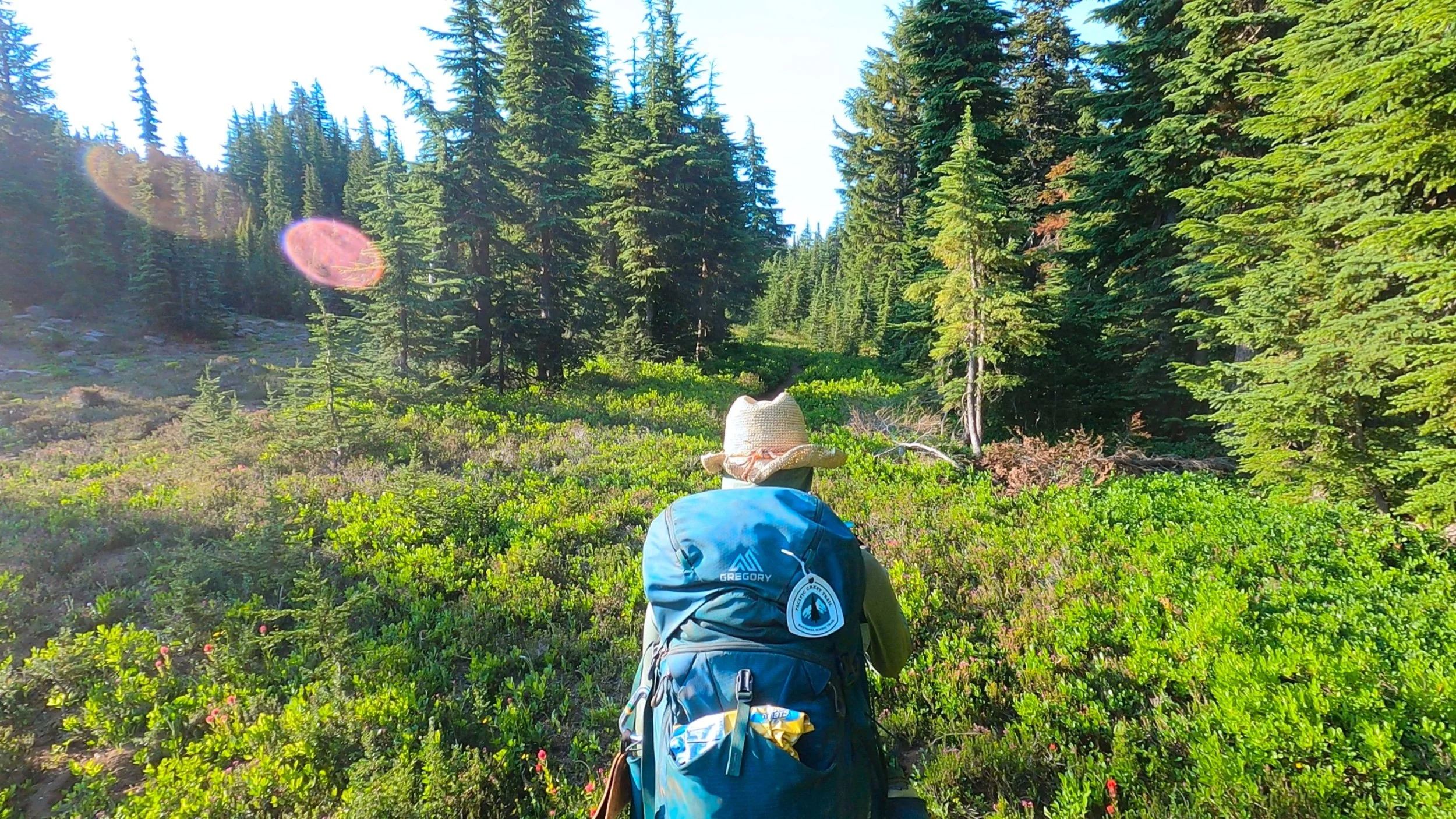
The route today starts in the mosquito hell of a small clearing we had left off on, on the western slopes of Mt. Jefferson. From there the PCT skirts a high ridgeline around the southern flanks of the mountain with incredible views south to Mt. Washington, 3-Fingered Jack and the 3 Sisters. The path then passes under Rock Pile Peak before continuing east around 3-Findgered Jack, however, beta from the NOBO’s coming out of Santiam suggested that we divert off the PCT at Minto pass and drop down to the Old Summit Trail 4014 at Wasco lake and head south on that because of apocalyptic blowdown on the parallel section of the PCT, which is what we did. From Wasco Lake the Old Summit trail winds east to the Jack Lake trailhead before turning south and making it’s way around the lower flanks of 3-Fingered Jack in a way very reminiscent of some earlier desert sections. The path then goes up and over a ridge before dropping around the west end of square lake and paralleling highway 20 all the way to the parking lot.
We woke to the high pitched whine of…mosquitos, a whole swarm of them all desperately trying to get through the mesh to reach us. I have never been so thankful for such fragile fabric but knew, at the same time, I was going to have to go outside. Some people ditch their rain gear until later in the season but I was oh so happy to have my rain pants for exiting the tent. We did all that we could inside before venturing into the fray and once we were out we wasted no time getting packed up and on our way. Once we were moving the mosquitos fell off, ever so slightly but they still got some bites in. I don’t know what it is but it’s like, one fresh bite makes all the old ones itch even more.
We made our way up to the ridge line and the cross wind helped cut the bugs down a bit. We walked along the ridge line for some time as we rounded the southern end of Mt. Jefferson. Some folks had camped on the ridge and, I gotta say, I was a little jealous - great views, less bugs. As we came off the ridge line we ran into some folks who made a point to tell us about the alternate path on Old Summit trail. One girl told us that she had taken the PCT and her friend had taken the alternate and she wished she had done the same. “It’s like Pick Up Sticks starting here in a few miles,” she said to us with a smile. We walked on, Amanda teaching me about the Pick Up Sticks reference which was totally lost on me. Further on we ran into more NOBO’s also touting the alternate route. “Okay,” i said to Amanda, “not missing that alternate I guess.”
Eventually, we came to the beginning of the blowdown. Today’s stage featured pretty much every stage of fire regrowth from fresh fire to older fire with young trees coming back to 20-30 year old fire with pretty large trees making a steady come-back. At first it was only a few logs that we had to handle but then it got worse, and then worse again. Our speed dropped below a mile an hour as we hurdled log after downed log - it was brutal. At one point we went about a quarter mile off trail to avoid what was a catastrophic mass of trees and limbs. Ironically, as we neared Minto pass though, the blowdown started to clear up and there were signs the forest service had been out. At the junction, we looked at each other and decided to take the alternate despite the sudden clearing of down trees. “We’ll never know if we made the right decision,” Amanda lamented as we dropped a couple hundred feet to Wasco lake.
At the lake we decided to fill up on water. As i gravity filtered water I took a long swim in the lake. It was wonderful. After hiking past beautiful alpine lakes in the Sierra that would have been brutal to swim in it is so nice to swim throughout Oregon. I scrubbed the trail dirt off my legs and feet and goaded Amanda to come in before getting out. I went to flip water bladders and caught movement on the edge of the lake. There, in the shallows, I caught sight of another Garter Snake hunting for little insects on the surface. She quickly swam away once she noticed she had an audience but that is the second garter snake I have seen on this trip hunting in the water. A site I had never seen before. Looking it up later it sounds like this is fairly normal behavior for them.
We eventually cleared out of Wasco lake and made our way up the trail, the imposing silhouette of 3-fingered Jack slowly disappearing as we dropped lower. We ran into a group of 5 mid-40’s women walking their dogs back to the Jack Lake trailhead. Walking is actually a bit of an overstatement as the dogs were resting at every shady spot the ladies walked by. Huskies don’t do well in the heat. They were super nice but we ended up hopscotching them a few times because the dogs needed a lot of breaks. At one point they asked if I had a good map of the area and I said that I did and they asked if I could tell them how close to the trailhead they were. “About 0.55 miles,'' I responded with a smile. They thanked me and Amanda and I walked on.
At the trailhead, Amanda used the restroom and I texted my mom an update. She was picking us up at the Santiam trailhead to take us into Sisters to a new tap house that had just popped up - Ski Inn Taphouse. I told her we were still a few hours away and Amanda and I got hiking. From the trailhead the trees opened up onto another fire zone and we found ourselves walking amongst a plant that I had been pretty sure I wasn't going to see after the desert - Manzanitas… tons of them and overgrown well into the trail. We hacked our way through groves of Manzanita as views into eastern Oregon opened wide to our left. Out in the distance I could make out Madras and Black Butte which I hadn’t seen in a long time. Amanda’s feet started to hurt really bad and we slowed down. We’ve had our current shoes since Big Bear and they are definitely nearing or over 500 miles at this point. We hiked on, me encouraging Amanda to go a little faster since I had read the taphouse closed at 8 pm, which is a dumb time in my opinion.
At square lake Amanda was pretty fed up with me waiting and told me to “just go ahead please” so i did and made my way up and out of Square lake. At the top I spooked something large crashing through the underbrush so I waited for her to show up and we walked for a mile together before I went ahead. My mom had brought one of my favorite IPA’s - “Sticky Hands” from Corvallis and I knew it was waiting in the car for me. The highway was loud and obvious as I finished the last mile down to the trailhead. My mom had hiked up about half a mile and I gave her a big hug as I came down. We talked for a while and then she gave me the keys so I could drop my bag at the car and she waited for Amanda. They came up as I was walking back up the trail.
From Santiam Pass my mom drove us down to Sisters, talking to Amanda about getting new shoes. Once there we ran inside Ski Inn taphouse and they said that of course they could feed us. Amanda and I both got the burrito and my mom got pulled pork. I stuffed myself uncomfortably on my meal, and then the rest of both Amanda’s and my mom’s. We had considered slack packing the section between Santiam and McKenzie pass the next day, my mom offering to take the rest of our gear to my sister’s place in Redmond, but Amanda said she couldn’t do it with the shoes she had so we decided to got to straight to Claire’s the next day. We returned to the hotel and enjoyed the hot tub before turning in for the night - so excited for a comfy mattress and a few good days off!


