Day 59: Skirting Hood

Day 59: Skirting Hood

7/14/2023

Section: Milepost 2124.0 to 2104.7

Total Trail Miles: 834.6

Distance: 19.77 Miles  

Moving Time: 08:46 hrs

Elevation Gain: 4,409 ft

Click here for current location

I’ve lived with a good view of Mt. Hood for much of my life, but today’s views were absolutely stunning. Of all the volcanoes, Hood has the most “Matterhorn-ish” look. Avoiding the more typical “flat-dome top,” Mt. Hood shoots into the sky in stark contrast to its northern neighbors like Adam’s, Rainier or Baker. It’s a beautiful mountain that I never miss an opportunity to gaze at.

Today’s route starts in the shadow of Devil’s pulpit and passes between Lost and Bull Run Lake. Lost Lake is one of my sister, Katie’s, favorite lakes for kayaking and I totally get it - very nice, quiet lake for an afternoon out. Shortly after the lake the trail drops to Lolo Pass Road where the day hikers get much more common. The trail climbs from Lolo Pass road to the Top Spure Campground before zigging west and zagging back east to the flanks of Mt. Hood. Here, the PCT crosses over a number of dependable, glacier fed streams, sometimes dipping down into old moraine to cross them. The stage ends at Lady Creek, where a nice campground stands surrounded by a number of small glacial streams. 

Amanda and I started a little late today. Oregon definitely has a more laid-back feel on the PCT as opposed to the first 800 miles. There’s also no big push to get started super earlier. No more hot desert days or slushy snow to try to avoid with the early hours of the day. So we started closer to 8 am, which is one of our later starts. The grade to begin was nice and slightly down, but there was lots of blow-down to contend with, which slowed us down. The logs always seem to be at the worst height for Amanda. Not long after, we came into views of Lost Lake which I took a picture of for Katie. I was cycling in and out of 1 bar of LTE service from Verizon, so the picture never actually went off. The trail wound down to Lolo pass road and as we went we were barked and growled at by 2 sets of dogs. “It’s a rescuuuuuueee” Amanda and I each quipped with each other as the groups moved past us. 

Once at the road, we began the long climb up and out of Lolo pass road. So…many…switchbacks. Oregon isn’t particularly hot yet, but it is muggy and the Mosquitos were an absolute menace at times. From the top of the climb out of Lolo the trail turned southeast and then southwest and descended again. I’m remembering now - lots of up and down in the cascades, especially when circumventing one of the volcanoes - there are no small amount of glacial ridges that have to be gone over. 

At the bottom of the descent we were delivered to an older moraine which now had lots of foliage growing in it. From here the big climb of the day began - almost 3000 feet in the last 7 miles of the stage. We trudged on in silence for several hours, occasionally catching beautiful views of Mt. Hood and south to Mt. Jefferson and the sisters. At the top, we reached Lost Creek, which sported a beautiful tent site, so we decided to stop a mile early and enjoy the evening. It was 8 o’clock at that point, and the distance had taken most of the day. Things slow down a bit when most of the stage is a climb. We made dinner - ramen - and Amanda turned in early while I cleaned things up and filtered water. We now have a new CNOC filter bag that I can hang and let gravity do the work overnight through the Sawyer, so that is excellent. My sleeping bag smells like hell - hoping we can take the time to wash them in Bend!

Day 58: Columbia South Bound

Day 58: Columbia South Bound

7/13/2023

Section: Milepost 2149.6 to 2124.0

Total Trail Miles: 815.3

Distance: 23.3 Miles  

Moving Time: 10:32 hrs

Elevation Gain: 5,241 ft

Click here for current location

And so the great journey south, back to the Sierra, begins. Today’s stage winds east along I-84 for some time. We are “blue blazing” it today, which is in reference to some of the alternate “blue” pathways on the FarOut app that represent trails which are not the PCT but sometimes more interesting than the PCT. Today was one of those alternates - the Eagle Creek Trail, which winds south from I-84 along Eagle Creek. This alternate climbs up out of the gorge in beautiful style, crossing high above the creek on wonderful wooden bridges, eventually switch backing up to the Indian Springs Trail which takes a brutal strait line approach up to Indian Springs campground before turning on to the PCT. From here the PCT follows ridge lines for the rest of the stage, eventually meandering into camp.

The alarm went off at 5, and I snoozed for a while before we finally got our butts out of bed. There were about 20 campers around, but many of them were still fast asleep, with no signs of getting up soon. Things must really slow down once you get through Oregon. We made up our things and then snuck down to the secret railroad crossing. Looking both ways, we jetted across and climbed up the small hill delivering us to the man street of Cascade Locks. We snapped a picture in front of the Oregon PCT monument (little premature) and crossed the road. As we walked down the Main Street, we came across a little coffee shop and got two chorizo breakfast burritos and I got a decaf Caramel Latte…because I am basic. While we ate, a girl came up and talked to us a bit. She was from Squamish, BC and super nice. She told us about the Eagle Creek alternative, and we thanked her before she headed off, and we finished our breakfast.

After the burritos, which were some of the best we have had on the trail, we started off. We crossed the main road and then walked an asphalt path east, eventually ducking under I-84 and continuing east. The path eventually wound past a fish hatchery and then followed Eagle Creek south into the Cascades above the gorge. We stopped for a bathroom break, then walked along the road before reaching the Eagle Creek trailhead proper and started up. The path continued to follow the creek, sometimes precipitously so as steep falls developed on the side, always accompanied by cables stapled into the wall. It was here I saw my first Dipper - a bird which lives around small creeks and tributaries and has a peculiar habit of doing little squats over the water. As is customary when seeing these birds, I did my own “Dipper Dance” to celebrate before we continued on. I love being back in Oregon - it’s where I have so many memories as a teenager. It smells and feels familiar, and I love it for that. We went on for several miles and eventually caught up with the girl from the coffee shop. We found it her name was Jessica (Road Runner) and that she was from Ontario originally, but ad lived in Squamish for 9 years now which is only about an hour north of Bellingham. 

The trail wound up behind a waterfall and we took some pictures. After, we came to a river bank and Amanda and I stopped for lunch. Jessica continued on, saying she would see us at camp. We chilled by the river and talked to an older woman down from Washington about the trail for a while - she had done most of it before we moved on. The trail crossed some more high bridges and eventually turned up from the river, switch backing into the mountains. The climb was steep and there were many SOBO and NOBO hikers on the trail. We turned off on Indian Springs Trail and it got VERY steep. We climbed up and over constant blowdown for about 2 miles before it intersected the PCT at Indian Springs campground. Here, we took a quick break before continuing on.

The trail stayed on the ridge line for the rest o the day, eventually delivering us to a water supply just a little before the camp. Amanda and I traded tent for water bladder and I filled while she went ahead to set up. When I arrived, she had set almost everything up and was talking with Jessica and Jessica’s friend, “Clutch.” We ate dinner and talked about Tim Hortons and Trader Joe’s for a long while before eventually turning in for the night.

Day 57: Portland Reorientation

Day 57: Portland Reorientation

7/12/2023

Section: Milepost 789.7 to 789.7

Distance: Miles  

Moving Time: hrs

Elevation Gain: ft

Click here for current location

Waking up 2 days in a row on a mattress was something to appreciate. Katie had set us up on the guest bed in her office and their air condition had kept it perfect for sleeping. Both parents were coming up to Portland for breakfast, so Amanda and I were up at 7 getting ready. Katie had suggested a nice little place on Alberta street called Tin Shed Garden Cafe. My parents showed up, and we gave them big hugs. We sorted through the boxes of resupply they had brought up, loading our backpacks with things we needed, and then walked a few blocks to the café, talking about our adventure in the Sierra the whole time. 

Once there we got self serve coffee and ordered our breakfast and then Amanda and I recounted our whole tale in detail. My parents, like Jeff and Karen, had found The Codger’s YouTube channel. The Codgers are an older pair of guys in their late 60s who thru-hike the long trails in the US and had taken on the PCT this year about 4 weeks ahead of us but, because there was some delay in their posting, appeared to be just ahead of use on their channel. Not sure if it was good that my parents were able to see every detail of what we were in for in high definition - sometimes the imagination is a little gentler, but at least they had some serious context for what we were doing. 

After breakfast, we returned to Katie’s and my mom had to head back to Corvallis. My dad was sticking around since he was flying out of PDX that night, so he took us to REI for a few things we needed. I had decided to return my FitBit - it just wasn’t keeping up with the long days - and replace it with a Suunto. We also got a replacement set of socks each and some other miscellaneous things we needed. The resupply boxes my parents had brought up covered most of the food we needed for the next week-long stint, so we didn’t need much in the way of food. When we got back I had figured out that the Suunto could download maps and started it downloading the Oregon map…which I soon found out was going to take hours… Amanda had been craving Indian food, like to the point where she was having dreams about it, so Katie suggested a place and then drove us all down there for lunch while I left the watch working. The food was amazing and definitely what Amanda was craving. 

After lunch, we returned to Katie's apartment. I had fully been expecting to get a few miles in during the afternoon on the trail but found my watch still downloading maps, and I’m a stickler for letting those kinds of things finish up, so we talked in Katie's living room for a few hours while the Suunto finished its thing. When it was all done, we decided it would be good to at least get to the trail head that evening, so we could get an early start out the next day.

We loaded into my parent's old 2001 Honda Odyssey, which Katie has now outfitted with a kayak hauler and is repping over 300k miles! The drive out to Cascade Locks was about 45 minutes and, once there, we were shown to an overflow parking lot with about 20 hikers and also a small sailing group doing some event on the Columbia that weekend. We said our goodbyes and thanked Katie and my dad for their help and support getting us back on the trail so fast. Once they were gone, Amanda and I set up our things for the evening, and then we headed across the railroad tracks to Thunder Island Brewing for dinner and a few brews. We sat and ate while working a few finishing details on our plan ahead. From Cascade Locks, we were planning on doing a single stretch to Santiam or McKenzie pass, about 7-8 days, at which point my other sister, Claire or my parents could pick us up again, and we could likely stay with Claire and her fiancé John in Redmond. This would also allow Amanda to make it to Claire’s bachelorette party back in Portland on the 22nd. 

Amanda went off to pick up a few last minute things at the local market in Cascade Locks and Ii worked some more on my blogs. Eventually it grew “late” and I headed back across the tracks. Amanda and I turned in and eventually fell asleep. It had been an efficient transition and tomorrow, we would head south!

Day 56: Oregon Bound

Day 56: Oregon Bound

7/11/2023

Section: Milepost 789.7 to 789.7

Distance: Miles  

Moving Time: hrs

Elevation Gain: ft

Click here for current location

We woke around 5 and tried to go back to sleep - this only partially worked because of the wonderfully soft mattress we woke up on. At 7, we stepped outside to the picnic area, where breakfast was being served. We sat with two guys from Japan, Wildfire, Karen and a guy, Alex, from Puyallup, Wa. We had orange juice, bacon, eggs and a fruit cup - a wonderful simple breakfast - as we talked with the folks at the table. All had jumped off either the PCT or JMT because of conditions. After breakfast, Amanda and I made a pro’s and con’s list regarding our options. Our main considerations were

Jump to Quincy, just north of Sonora Pass where the snow was likely better and hike north until conditions improved in the Sierra before coming back

Jump to the California/Oregon border and hike south towards the Sierra, hope things got better by August

Jump to Oregon/Washington border and hike south and come back in September when things would get much better.

We decided on the Oregon/Washington border. My family is in Oregon to facilitate the change, and it would allow us a long stretch of uninterrupted hiking with high likelihood that the Sierra would be in much better condition when we got there.

I was just going to ask the host for one more night, so we could catch the bus to Reno the next morning, when Amanda yelled for me to stop. Evidently, Alex was driving back to Puyallup and was willing to give us a ride to Reno and the Japanese guys a ride to Mammoth. This worked out perfect because the morning shuttle was going to be expensive, and we needed to retrieve the box we had sent from Kennedy Meadows to Mammoth. We thanked Jeff and Karen for all that they had helped with, including the copious amounts of fruits and veggies they had given us for the trip, and they offered for us to stay in their condo in Mammoth on our way back through. Amanda checked out of our room, and then we loaded up 5 backpacks and 5 people into Alex’s early 2000’s Honda Accord before setting off.

The ride to Mammoth took a little over an hour. Once there, we dropped the Japanese guys off in front of Vons and went to the post office. Here, I mailed all our snow gear and boots back to the family and picked up the Kennedy Meadow’s box, while Alex and Amanda returned to Von’s to give back one of the Japanese guy’s passports that he had left in the car. From Mammoth, Alex drove us to the Reno airport, all of us commenting on how green the Owen’s valley was for this time of year. Alex was a CPA for a firm in Seattle and had taken time off to do the JMT but was now trying to figure out what he would do with the JMT off the table. We brainstormed until we arrived at the airport. I gave him 30 bucks and we said goodbye.

We caught a 6:30 pm flight direct from Reno to Portland, where my sister, Katie, picked us up with 3 large Yumm! Bowls and an IPA for me. We told her all about or adventures on the way back to her house and she caught us up on current events. Once at her place, we ate one of our favorite meals and talked with her and her roommates into the evening before passing out, happy to have made a quick decision and be getting a move on with the change of plans.

Day 55: Kearsarge Pass

Day 55: Kearsarge Pass

7/10/2023

Section: Milepost 788.2 to 789.7

Distance: 8.83 Miles  

Moving Time: 04:41 hrs

Elevation Gain: 2,388 ft

Click here for current location

Today, we bailed on the Sierra. We haven’t officially made the decision yet, but I don't think we are coming back till later this summer. I’ve mentioned a lot of reasons for this in the last two posts, so I won't wax poetically about it anymore but, suffice to say, we can't finish this hike in 6 months at 10 miles a day, and that’s about all anyone can do in the Sierra in its current condition. At this rate it would take us another month to finish and that would leave us in the North Cascades in the middle of November which won’t work so, today, we came out on Kearsarge pass and got a ride to Independence, CA. 

The stage started at the Vindette campground - one of the many nice places to stay overnight in Kings Canyon National Park. From the campground, the path winds north and upward, climbing back above 10,000 feet on the PCT. At this point, there is an upper and lower approach to Kearsarge pass. One is called the Kearsarge Pass trail and the other is called Bullfrog Lake trail. We took the latter, having heard that it was more snow free. The Bullfrog lake trail winds northeast, crossing on the upper shores of Bullfrog lake before traveling due east through a flat valley and then ascending to a little over 11,000 feet at Kearsarge pass. As the trail ascends, there are beautiful views of the backside of Kearsarge pinnacles. From the pass, the trail descends through a hanging valley bordered by glacial moraine and then through a series of several lakes, each lower than the last. Finally, the trail winds down to the Kearsarge Pass trailhead, where a small parking lot and campground wait for tired returning hikers.

We slept in this morning. Actually, I could have kept sleeping for another few hours. I was wasted after the previous day's battle and both Amanda and I were pretty sluggish, but Wildfire got up and I didn't want to let him down, so I deflated my sleeping pad and started organizing my things. We were in close proximity to the river, which made everything a little colder, but we fought through and got everything together. I made the last of my Brown Sugar Oatmeal and choked it down before we did our warm-ups and hit the trail.

We started up the PCT, hoping desperately that the constant trail interruptions would not be such a feature on today’s stage. We were pleasantly surprised as we climbed up to 10,000 feet to find a smooth patch of dirt beneath our feet. I noticed, for the first time, ferns growing on either side of our path. Just before the turn-off for Bullfrog lake, we ran into snow. It wasn’t bad, but memories of yesterday fresh in my mind darkened the mood a bit. Not long after, we found the junction and turned off. It wasn’t a momentous thing, but it occurred to me that we would likely not be returning to this path anytime soon - that the next time I would exit this way would be several months from now. It was a little upsetting to think this as I was giving up on the dream of completing the trail in one straight line, but I reminded myself that this year was unlike anything in living memory, that finishing was the ultimate goal and that completing the Sierra would almost certainly jeopardize that. 

We turned into Bullfrog Lake Trail and started climbing. Wildfire swept behind us, I think so that he could properly depict our location. His wife, Caren, who had given us Pacifico’s and fruit almost 2 weeks earlier in Tehachapi, was coming to give us all a ride down to Independence and was watching his Garmin InReach location. The plan was that she was going to leave around the time we reached the pass to come get us.

We wound up and around Bullfrog lake. The Kearsarge Pinnacles began to dominate the background, and I couldn’t help but think of all the amazing routes that must have been developed through these incredible spires. After Bullfrog Lake, we traipsed east across the valley. Heart lake could be seen in the distance - it really did look like a heart, kind of like Guitar Lake from Whitney. The snow was intermittent, but at one point became solid in front of us.

We all stopped, and I looked at my GPS app. “I think the switchbacks go up above us.” We all looked up and could see the tiny Kings Canyon Sign silhouetted in the pass 700 feet above us. We all agreed to straight-line it up the scree slope above us instead of fighting through more snow. We headed up and, in about 100 feet, gained the first uncovered switchback. From there, we climbed for about 25 minutes before reaching the pass. 

At the top, we all stopped and took in the beautiful views below. A day hiker came up, and we talked to him for a while. He was climbing Mt. Gould, just above the pass, and informed us that the way down was partially snow covered but better after we had dropped the first 1000 feet. We thanked him, took pictures of ourselves around the King's Canyon Sign, and headed down. 

The first 1000 feet were sloppy. The sun had warmed the snow and made things very unstable, but at least there was minimal sun cupping, which was appreciated. We wound down and down, occasionally talking with day hikers headed for the pass. Everyone was surprised by the snow. We passed Postpile lake and a number of others. Wildfire informed us that Karen had arrived and was hiking up. “Can’t wait to see her again!” we both said. We hit the middle section of switchbacks and came to Flower Lake and there was Karen waiting on a rock. We walked out and said hi before continuing on, regaling her with all the woes of the previous days.

About an hour more brought us down to the trailhead. Beautiful views abounded all the way down. At the bottom, Karen had brought cold beer, soft drinks and fresh snacks. 

We sat at on the ground behind the car, which we all thought was funny because Karen had clearly offered us folding chairs, and talked, enjoying cold drinks. I remember Sean saying a while back that there was nothing he enjoyed more on the trail than cold beverages now, and i have to agree. After a while, our thoughts turned to a burger, and we loaded up to go down into Independence. 

Karen and Wildfire were staying in Independence at the Mt. Williamson Hotel and Karen had checked with them earlier about availability. Originally, there had been no spots open, but a last minute cancellation made it possible for us to stay, so we took it. We took a load of dirty clothes back to the office for cleaning before taking showers. It had been a long 8 days, and it felt incredibly good to finally get the miles of dirt off of us. Afterward, we tried to find a place for a burger in Independence, only to find that most of the places were closed, as it was Monday. Finally, we drove all the way down to Lone Pine where we found the Mt. Whitney Restaurant which boasted the best burger in town. We sat and had a great burger and a few brews, relishing the 1st-world convenience of warm food and cold drinks. We talked for an hour or so before heading back to the ice cream shop in Independence, where we tried a number of unique ice cream flavors - including Jalepeanut - which was my favorite.

On the way back to the hotel, we stopped at the county courthouse because it supposedly had one of the oldest groves of planted trees in America. In the back we found them - 2 100-year-old Lebanon Cedars, 2 Deodar Cedars and 2 Sequoias. We talked to a lady named Nancy, who we later found was like the quasi-mayor of the town. She told us all about the trees and the history of Independence and the Owen’s Valley - focusing on some of the more devious activities of the LA Department of Water and Power (DWP). 

After, we returned home - exhausted and ready for bed - and turned in for the night, saying we would see both Jeff and Karen in the morning for the family style breakfast.  

Day 54: Forrester Pass

Day 54: Forrester Pass

7/9/2023

Section: Milepost 778.2 to 788.2

Distance: 8.61 Miles  

Moving Time: 04:47 hrs

Elevation Gain: 1,496 ft

Click here for current location

Today was probably the hardest ten miles i have walked in my life and that’s even considering I am in the best hiking shape of my life. We walked for over 12 hours and gained 10 miles - don’t think the Strava stats above are correct... Our moving average regularly dropped to less than ½ mile per hour. It was brutal. If yesterday wasn’t enough to convince us to consider flipping up north, then today was. 

The stage today started out where we had stopped the night before, in a beautiful, high basin below Diamond Mesa, Junction Peak and Forrester Pass. The PCT/JMT progresses north up through the 5 lakes in this basin and goes over Forrester Pass at an elevation of 13,120 feet - the highest point on the PCT. Forester Pass was named after the Forestry personnel that discovered the pass in 1929 and demarcates the border between Sequoia NP and Kings Canyon NP. From here the trail drops into a cascading set of hanging valleys each with their own little lake before dropping all the way down into the Bubb’s Creek river valley along which there are numerous, beautiful backcountry camping spots to choose from. The stage ends under the Kearsarge pinnacles and at the junction for Kearsarge pass which is a popular exit point for PCT hikers to resupply.

Today started at 4. We had agreed to try and be underway by 5. The ranger had told us yesterday that Forrester was shaded most of the day so an extra early start was unnecessary and that the extra light might help us navigate up the lakes basin since the trail was completely covered in snow. Actually, not just the trail, the entire basin - it’s July and we only see 5-10 feet of trail every mile or so. Anyway, I was going to snooze but I saw Wildfire’s red headlamp moving about and felt bad because he was cowboying it and we were warm in our tent so I got up and got a move on. Amanda was a little slower, it was cold-ish - actually it was like 37 but with the breeze that had kicked up over night it felt pretty cold. The stark and imposing scenery that surrounded us also made it feel colder. Eventually Amanda got up and we got our things together. Just before we left, a guy in his mid-20’s showed up from the river valley below. He wasn’t much of a talker but we learned his name was Kyle and he was headed over today as well. Kyle is one of the first people we have seen since leaving Whitney 2 days ago. I can’t stress how crazy this is. It’s July and we are on one of the most coveted trails in the world - not America, the world - and Kyle is the only person we’ve seen in two days. It’s just not a normal year, by any measurable standard. We weren’t quite ready to leave so he departed and we finished preparation. Finally, around 5:20, we stepped off of our little island of rock and onto the sun cups. I know I have described these before but, to reiterate, they are little sunken snow ovals from hell. We don’t see these too often in the northwest because we are usually on a glacier doing these kinds of activities but they suuuuuuck. They are the most inconsistent, horrible surface to walk on and we had to cover 1.5 miles to the base of the pass on them. 

We progressed up the little basin. The sun cups where frozen which helped only a little bit. I felt bad for Amanda, with shorter legs, trying to navigate sun cups that were deeper than she could step. It helped if you could span from lip to lip, but that wasn’t always possible and, as they warmed, the lips couldn’t hold weight anymore and you would get sucked into them. At around 8 we reached the northern end of the basin. We had been watching Kyle and he had traversed way to far east at the base of the wall through which Forrester passed - almost to the base of Ski Mountaineer’s Pass - but he had figured it out and was traversing back. We started up the approach - the PCT’s nice switchbacks deep under the snow beneath our feet. Under normal summer conditions it’s not uncommon for a PCT hiker to roll through 3-4 passes a day, but under our current conditions, these passes are practically mountaineering commitments. The approach slope started gradual and steepend half-way to the point where I, up above the other two, called down that they should have their axes ready before getting up to the steep. We had originally agreed to angle for one of the first exposed switchbacks that was way to climber’s left, almost under the chute we were all worried about but Kyle, on his way back, had actually accessed a higher switchback by climbing on top of a rock in the middle of the wall above us and climbing up to the middle of a higher switchback. Looking left at the 50 yard traverse that was going to be required to get to our original goal, I called down for Amanda to head straight for “Kyle's Rock” and Wildfire, who was already under the rock, gave me a thumbs up. We all got to the top of the rock - really more of a boulder - and then Wildfire took the first shot at the class 4 scramble up to the switchback. Again, none of this would ever normally be required in July on the PCT, but these are the conditions we are currently working with. Amanda followed and then I was up on the switchbacks. We took off our spikes and followed Wildfire up to the dreaded chute.

I cannot articulate how ludicrous Forrester pass is. If you were standing down in the little valley we slept in looking at the insane array of peaks around you, you would probably say there was no good way out of it except back the way you came. The 1920’s forest service were composed of psychopaths though and they looked at the tiny notch at 13000 feet, probably with a stick of dynamite in their hand and a cigarette hanging out of their mouth and said - “oh yea - we’re putting a trail there.” Beautiful switchbacks are carved out of the granite 6 feet wide with nothing but air under them for hundreds of feet below in one of the most imposing environments in North America. It’s reminiscent of a time in this country where humans approached nature as something to be tamed, and the JMT is that mentality on display. A trail shouldn’t exist here, and yet it does.

The switchbacks rose for about 400 feet before we rounded a corner and there was the dreaded ice chute we had heard so much about. Maybe it was our harrowing experience on Mt. Whitney but we all took a look at it and breathed a sigh of relief - the fear mongering of FarOut had gotten to us. It was definitly a no fall zone. A fall would likely be fatal but the boot path was way more established than it had been on Whitney and there were pre-existing holes for ice ax self belay. Jeff (Wildfire) went across first, then Amanda and then myself - the whole thing took about 10 minutes. Then we finished off the last 5 switchbacks and were at Forrester pass.

We stopped at the top and took about 30 minutes to enjoy incredible views North. Amanda and I have tried to compare the Sierra to other places we have been. I think the closest would be the Dolomites - the two are sister ranges in terms of stark beauty and severity as well as endless jaw dropping views. Patagonia would be another similar setting given the granite. We ate and talked for a while. We could already see miles of sun cups below us and dreaded leaving our perch but eventually I took some timed pictures of us in front of the pass sign and we stepped off rock onto snow.

The next 5 hours were something of a horrer story - so bad, we just found ourselves laughing at times. The descent from Forrester started with about a quarter mile of sun cups which, since they were facing north and east, had gotten some sun and were unstable. After the quarter mile, which probably took 30-40 minutes to navigate, we walked a north running ridge on a thin band of rock on the actual dirt PCT. This quickly ran out into a steep patch of snow that would have required dedicated ax work to cross so we looked elsewhere. That’s the thing about the JMT/PCT in the Sierra - if the trail isn’t in working order and you take one step off of it you go from tranquil walking to mountaineering skills in a hurry. It’s like the trail is a small concentrated dot of peace that has been carved out of the maelstrom of imposing rock of these mountains. So, with the trail gone, our next best option was a class 4 down climb through an unstable, nearly vertical field of granite boulders - so we took that. An hour of navigating and willing oven-sized rocks not to move brought us back to the PCT. For about 15 minutes we got to actually hike on it and we relished every moment of it but, all good things must end and they did. For the next 3 hours we traveled through sun cups. I won’t say we were gracious about it but we were dedicated and we inched down to the lower lakes of the valley, mostly making about half a mile an hour. There were small islands of rock that we took advantage of but, mostly, it was just hours of jumping from rim to rim of sun cups and hoping they held. We all went down, many times, usually swearing but got back up and kept going and eventually we arrived at the tree line.

In the trees, things just became a different form of terrible. The sun cups disappeared, for the most part, but were replaced by an angled snow field that the PCT was using to drop further into the valley. This would have been fine on trail, but we were on soft snow and traversing was slow. We inched our way down, stopping to get water and take a break after the sun cup fiasco. We thought the trees would help but this was a younger patch of trees, all the same age, obviously the first to have come up after a massive avalanche about 20 years ago and they weren’t much for cover. I know this all sounds negative, and it was brutally hard, but we kept up a great attitude, usually a little cynical but it kept us going. At the end of the day, we were still hiking in one of the most beautiful areas in the world and that was unmistakable to all 3 of us. 

Eventually we did get to the bottom of the Bubb’s river valley and started following it further down. This brought us to the next challenge of the day - the crossing of one of the tributary streams to Bubb’s creek. Actually, the tributary was technically Bubb’s creek but it formally became Bubb’s when it dumped out into the bottom of the valley. In any case, we had to cross it. It was not the widest river we had crossed but it was deep and had a lot of flow. 2 options were before us - cross conventionally at the PCT crossing, which some had done. It wasn’t deep but it was really fast. The second option was a log lying above one of the most violent sections we could see, about 30 yards upstream. We agreed to take the log and butt scootch-it across. I went first with my backpack without incident. The log had been cleared on the top so no issue with the scootching. I came back and took Amanda’s bag across. Wildfire went then and almost fell in at the end but saved it and then Amanda cruised across. These crossings always add some spice to the day that I’m not sure is needed.

After the log we entered the final challenge of the day - series after series of avalanche patches. This had obviously been a big snow year for the Sierra but nothing drove that point home like seeing 3 solid miles of apocalyptic avalanche damage along Bubb’s creek. Trees larger around than my torso were ripped in half and everywhere were tangled messes of limbs and trunks - it was absolute chaos. I honestly don’t think the park service will have this cleaned up this year, maybe even into next year. These miles went slow. It was endless bobbing and weaving, climbing and crawling up and over and through to get further down the valley. I think we were a little delirious at this point because we couldn’t stop laughing. From mountaineering to boulder fields to sun cups to river crossings to avalanche tangles - today had everything you could never want in a hike and all we could do is laugh. You know what is crazy to me though - there are people, very few i think, but people who have come before us, done this and said - “you know what i want? I want 300 more miles of this” and are going on north into even more dense snow pack. I brought this up to Jeff and he smiled and said “maybe they like the challenge.” “I like the challenge,” i replied with a smile “but I’d like to finish more i think and that’s not going to happen on 10 mile, 12 hour days.”

Eventually the trail got everything out of it’s system and the last 2 miles were fairly good. We cruised down the trail past a few sanctioned NPS camping sites until we got close enough to the junction of Kearsarge pass that we could feel good about getting out easily the next day. We did our typical evenin activities, thought about making a fire and decided we were too tired and then said good night and went to bed having decided we could sleep into 5, given our superhuman effort today. 

I know this post may sound a bit negative and I apologize for this - it really isn’t meant to be. There are no bad days on the trail. There are days I want to end, there are days I really want to end with a beer and a cheeseburger but none that I have regretted. I am becoming more and more convinced that most of the NOBO’s skipped the Sierra all-together and that was probably a good decision but I don't regret continuing north and trying. Some people are good to go on the word of others but we had to see this for ourselves and make our own opinions and I can now officially say that these mountains are just not ready to be thru-hiked. They can be hiked but not at a pace or with the ease they were meant to be this time of year and it all comes down to time. At this point, barring some miracle beta from up ahead, I don't think we will be continuing the Sierra until the Fall, and I’m coming to peace with that a little more each day.

Day 53: Hard Truths

Day 53: Hard Truths

7/8/2023

Section: Milepost 768.2 to 778.2

Distance: 11.76 Miles  

Moving Time: 06:28 hrs

Elevation Gain: 2,795 ft

Click here for current location

Today was a bellwether day. I had been looking at the map of this section since we left Kennedy Meadows and I knew that it would be an indicator of how sections to come would go. This is because, according to NOAA, today’s section was the first to be completely covered in snow - up to 60 inches of it uniformly throughout the stage. I told myself that if today went well and we could do 15 miles-ish without trouble then the Sierra wouldn’t set us back too much and we could continue NOBO. We would fall behind a little but not so much that we couldn’t finish. It was also an indicator as to whether our food would hold out for us to get to Bishop Pass instead of exiting out of Kearsarge pass which I really did not want to do. Well, look at the milepost above and you will get a sense of how things went… 10 miles in 12 hours. 

We woke at 4:30 - and I snoozed three times. Thankfully, Wildfire’s alarm never even went off so he was also a little late to get up. I wolfed down two more oatmeal packets and dry heaved - really hate those things - then started packing up. Amanda was even slower than me getting up so we didn’t hit the trail until after 6 am. Today’s goal was to get to the base of Forester Pass, which is the highest point on the PCT and along the way we were going to cross 3 major streams - all of which were reported to be raging so there was some urgency to get on the trail and move out. 

We hiked back up to the junction between the PCT and the JMT, Wildfire about 15 minutes ahead of us. Izzy, Push-pop and Aspen’s tents sat silently above our camping site on the way out. They had been gone for several hours now and Amanda and I both hoped things were going well for them. We climbed up a dry, southern facing ridge. Some snow patches hung around near the trail and required moderate amounts of route finding, but nothing terrible. At the top of the ridge we descended the north side of the ridge and things got ugly. The ridge and the larger ridge below it, to Wallace creek, was entirely snow covered and steep. Navigating down was slow but, confidence had been severely boosted on Whitney the day before so we made good time. Halfway down I saw two figures talking and recognized Wildfire's hat. I called down to them and Wildfire waved back up at me. I climbed down, and I do mean climbed, the snow was softening and very steep such that i had to self belay myself down. When I arrived I found the other figure to be the Ranger for Tyndall Lake, which was situated 5 miles from Forrester Pass. He was going over crossing beta for the streams ahead and, in classic backcountry style, doing his best to scare the shit out of us. 

For the first stream, Wallace, he was recommending crossing at the PCT crossing. This is almost never where you want to cross in high water due to the fact that stock (horses and other animals) are typically crossed there, making a trench that can cause you to use your footing. The ranger recommended this, for the case of Wallace, because large, stable boulders had been placed there for the summer crossing and they were stable. For the second crossing, at Wright Creek, he recommended cutting up the top of the ridge ascended on the other side of Wallace and then traversing North so that we arrived approximately a mile upstream of the typical PCT crossing. He showed me on a map and I added a pin to find it later. This advice is more typical. Many creeks on the PCT have an area upstream where the topography is less extreme and the creek “fans out” becoming shallower and moving slower. He described Tyndell creek, which was our final cross, as a monster and said we should go way up stream to another flat spot to cross. From streams, conversation turned to Forester Pass. Forester pass is the highest point on the PCT and, excluding Whitney, one of two dangerous traverses this season. It is a small notch in an imposing ridge line found in the 1920’s by the forest service. This pass had been a point of a lot of conversation because it still had some snow over the path above a steep snow chute so a fall here would be potentially fatal. Here, he was actually more positive. “It’s in great shape now,” he said and then went on about how dangerous it had been up until about a week ago. “It used to be solid ice, with no good snow to self belay on. I told a lot of people to rethink it. It’s still dangerous but the boot pack is now better and there is good snow to self belay, but don’t fall. If it looks bad, come back, I have extra food at the Ranger Station - don’t feel like you are trapped.” I then asked if there were any more ranger stations between Forester and Bishop pass. “Of course,” he said “why, are you not getting out at Kearsarge.” I told him we had enough food for 5 days and were thinking of trying to make it. “Look,” he said “you are the first group I have seen in 4 days. Hardly anyone is coming through and I haven’t seen anyone come over from the other side in a while either. I don’t know how fast you are moving but, these days, I'm lucky to make 1 mile an hour and that won’t get better any farther north in Sequoia, Kings Canyon or Yosemite. Right now, you literally have to swim Rae lakes if you want to get across, there is no other alternative. You do what you want but there are more bad rivers and more high passes between here and Bishop - you should really be sure you have enough food. This is a crazy year, I don’t like to tell people how to enjoy the park but it seems to me it would be better to come back later and actually enjoy it rather than doing battle with it every day, but that’s just my opinion.” After this pep talk he went over the river beta one more time and then wished us a good day before taking off. “Damn,'' I said to the other two, " it sounds like Armageddon out there.

We clamored down the rest of the way to Wallace creek and then did a little briefing before going in. The run out on the downstream side was pretty bad  but the creek looked shallow enough even though it was running fast. Wildfire went first and, while he struggled with footing a little, he made it across. Amanda went next and slow and I went right behind her. There were a few parts where footing was subpar but she made it happen. Afterwards, we sat, ringed out our socks and tried to dry our boots. Once the socks were damp instead of soaked we headed up the ridge on the other side of Wallace. At the top, we turned east and headed straight up the ridge, off-trail to where the Ranger had said the good crossing was. We turned back north and heard Wright before we saw it. It’s difficult to call these things creeks as their name suggests, they are full on rivers and are roaring in places. Fortunately, we found the area the ranger had suggested, in a flat meadow area. The river had fanned out and this crossing was actually easier. I went first, to test, and then Amanda and then Wildfire. 

After this second crossing we stopped to ring out socks and dry boots again. This is the other thing taking so much time - the crossings. Everyone suggests crossing in your shoes for traction, but between finding a crossing, crossing, and then drying, crossings take up to an hour or more to do and sometimes necessitate large, off trail maneuvers to find a safe place. It’s just very slow. 

After crossing Wright creek we carried on. The trail rose slightly up to Bighorn Basin where the ranger had said we should camp. As we approached, we gave a mutual groan at a massive expanse covered almost entirely in sun cups. Amanda and I put on the snowshoes while Wildfire went scouting ahead. We walked in the snowshoes but they really didn’t help. All 3 of us ate it on the small climb up into the basin. Once there though, we were awed by 360 degree views of the Sierra - it was amazing. Eventually we decided to get off the sun cups and go off trail to the edge of the basin where snow was minimal. From the basin, the trail entered the upper reaches of the Tyndell creek valley. From far below we could hear the “monster” roaring up at us. “That sounds fun to cross,” i said nervously to the other two. The trail wound down as the creek rose up to meet us and, eventually, we came to the turn-off for the Tyndell creek ranger station. It was a half mile away and we all agreed we wanted to get the crossing over since it was 3 pm and we could get up close to Forrester with the time we had left. We went on and eventually came to the PCT crossing of the creek - except we couldn’t really get close because the creek was overflowing onto the PCT. It was absolutely raging. “Wanna cross here?” I joked to the other two. We went up to a flat, meadow area and, sure enough, found a place where the creek broke into two streams and crossed one, then the other without incident. The creeks are really bad right now but if you are smart about crossing, they are manageable. 

From the crossing we, again, stopped and dried our things. It was around 4 and we wanted to get through more sun cup terror we had heard was on the agenda to reduce what we had to do for Forrester the next day. We straight lined it up from the crossing knowing we would intersect the PCT at some point and after about 800 vertical feet we found it, barely, as it was still under snow. We followed the trail for about 20 yards before it disappeared again under sun cupped snow and so we straitlined it up again trying to stay off the sun cups as long as possible. Eventually we did have to enter that most terrible of terrains and began island hopping from rock outcropping to rock outcropping slowly climbing out of the top of the Tyndall River valley and into a high basin. Forrester could be seen off in the distance now as a small notch in a wide band of rock. We climbed higher and higher until the sun got to a point that we decided to stop and take advantage of it to fully dry our things. We settled on a nice spot where we could pitch a tent and were close to water. The Sierra here is very arid and desolate looking. Not much grows and the mountains are massive and imposing but gorgeous. Amanda and I thought it looked very similar to the Himalayan region near the Indian border with Pakistan - very bare and arid. 

Amanda set up the tent while I stepped back into the sun cups to descend to a melted part of a river where I filled Amanda’s bear canister and Wildfires CNOC water bladder with water we could filter at the camp. We had dinner and talked for awhile. Eventually I did my yoga, cleaned up and we all said goodnight, agreeing on a 4 am wake-up to take advantage of the stiff snow.

Today brought me to a hard realization - I don’t think we will continue in the Sierra, much less on to Bishop pass. I so desperately wanted to do this thing in a straight line, there was something so perfect about it, but this just isn’t the year. There are many things that go into this decision. We have had to use more mountaineering skills on this trip than i ever thought we would need and should be necessary - it’s not an expedition, it’s a through-hike. The water crossings are hard and dangerous. The passes are not walk-ups, they require a good amount of ice ax work. In general, there’s more risk in these sections then there ever should be. We have the skillset to handle that but it’s not what i was looking for out of this experience. This is supposed to be a relaxing walk-about with beautiful views and a time to let the mind rest and wander and it’s difficult to do when all you are thinking about is the next pass, or the next monster river or navigating around mound after mound of snow on the trail. At this point we spend more than half of our day off the trail instead of on it. But in the end, it’s not the extra risk, or sun cups or tedious rerouting - it’s time. We have 6 months to finish the PCT and 300 more miles of this terrain is going to eat a lot of that up without producing any distance. I want to do this in a straight line, but i want to finish it more, so i think we will have to come back to the Sierra in the fall. Kinda silly because we will have done 2 of the 3 major challenges at the worst time but, again, it’s not that we can’t do it, we just don’t have the time and that sucks. It’s going to take me a few days to get over this, because it hurts but i am glad we tried. I am glad we tried because I now know exactly why we are going to skip and come back - i had to see it to believe it but now I certainly believe it.

Day 52: Whitney for the Win

Day 52: Whitney for the Win

7/7/2023

Section: Milepost 768.2 to 768.2

Distance: 13.51 Miles  

Moving Time: 07:56 hrs

Elevation Gain: 4,518 ft

Click here for current location

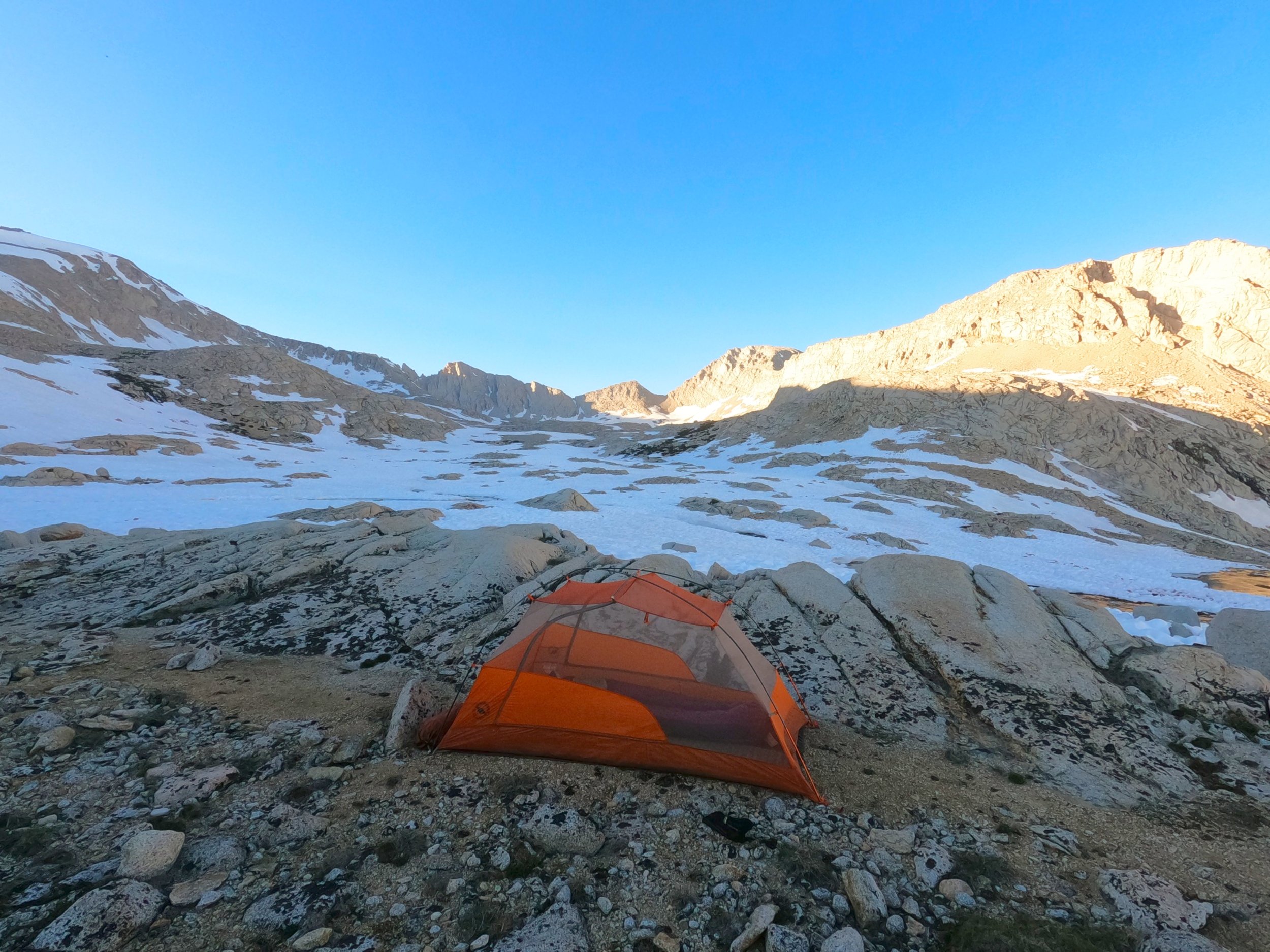
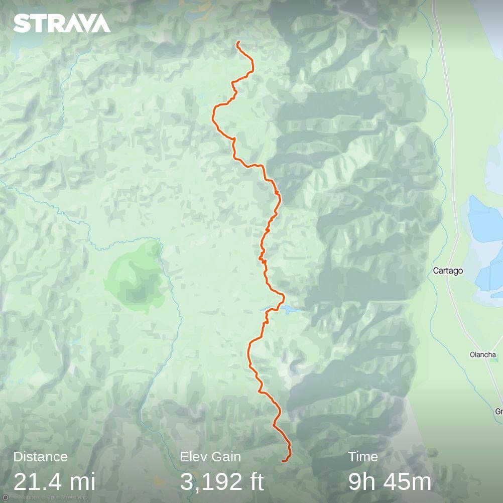
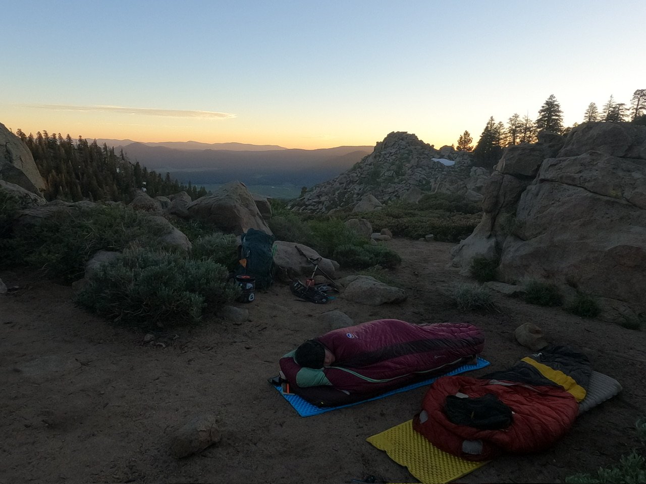
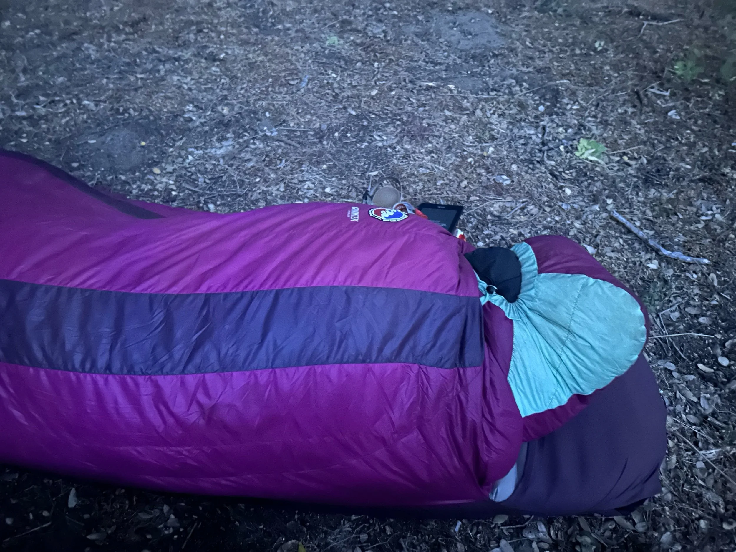
My alarm went off at midnight. I had kinda already been awake because the JMT couple in the tent next to us was up around 11 getting ready to go. At midnight I begrudgingly got out of bed and went to make some Cinnamon oatmeal - not my favorite breakfast by far but something simple and easy to prepare. The moon wasn’t up but it was so bright it was already starting to cast its own moonrise glow. Amanda dawdled for a while, really not wanting to get out of bed but eventually I heard her stir and start getting things together. 

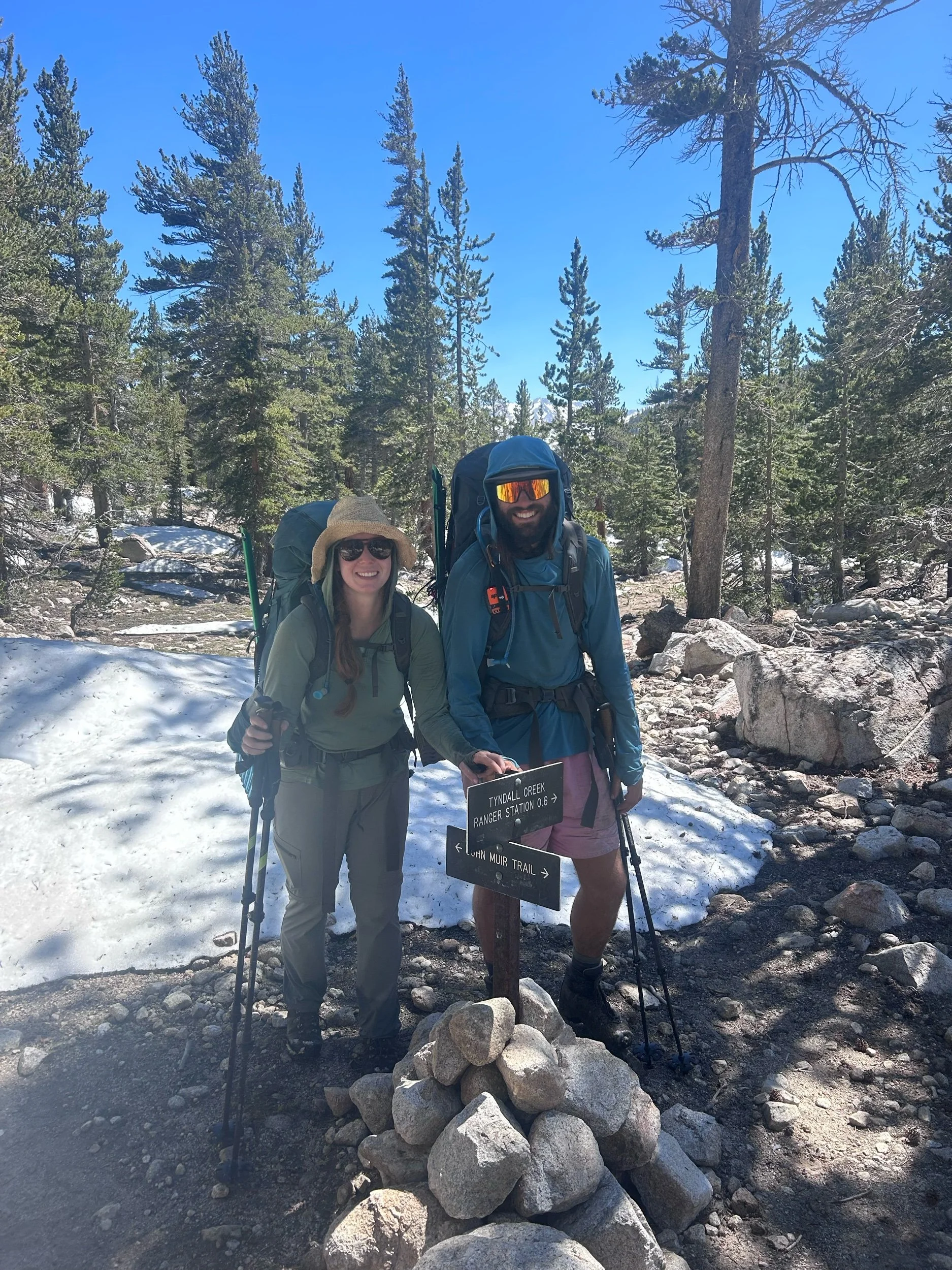
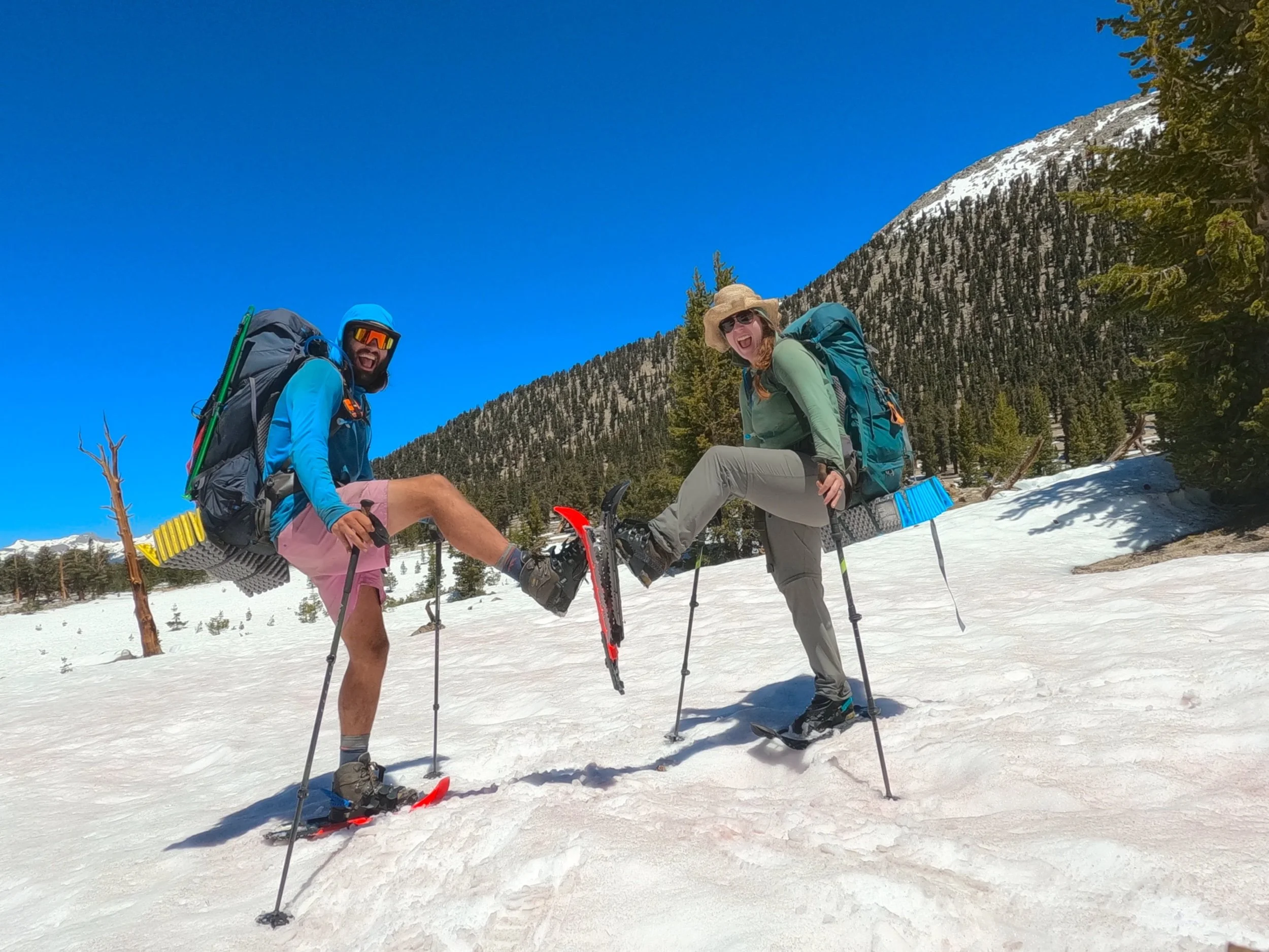
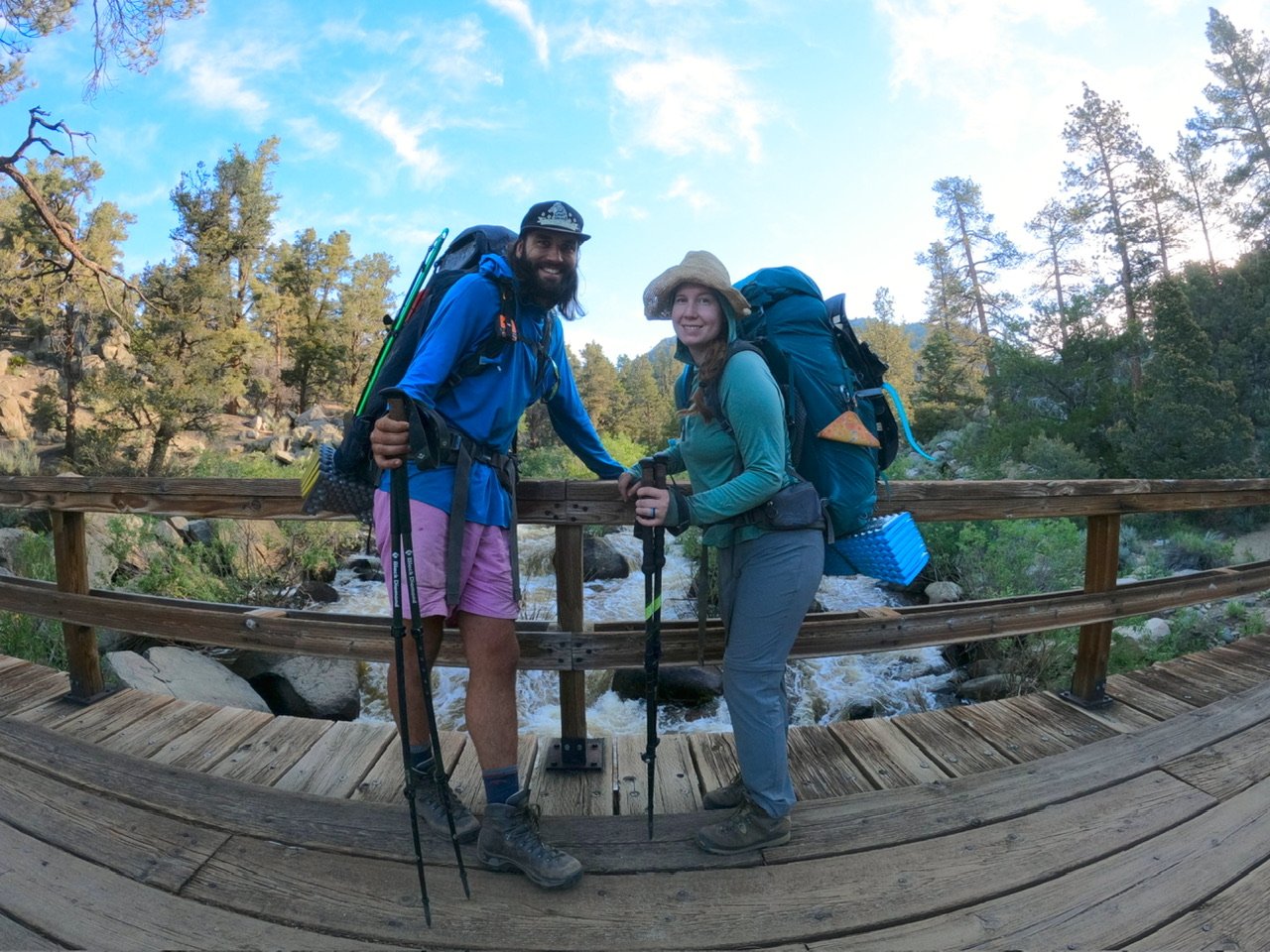
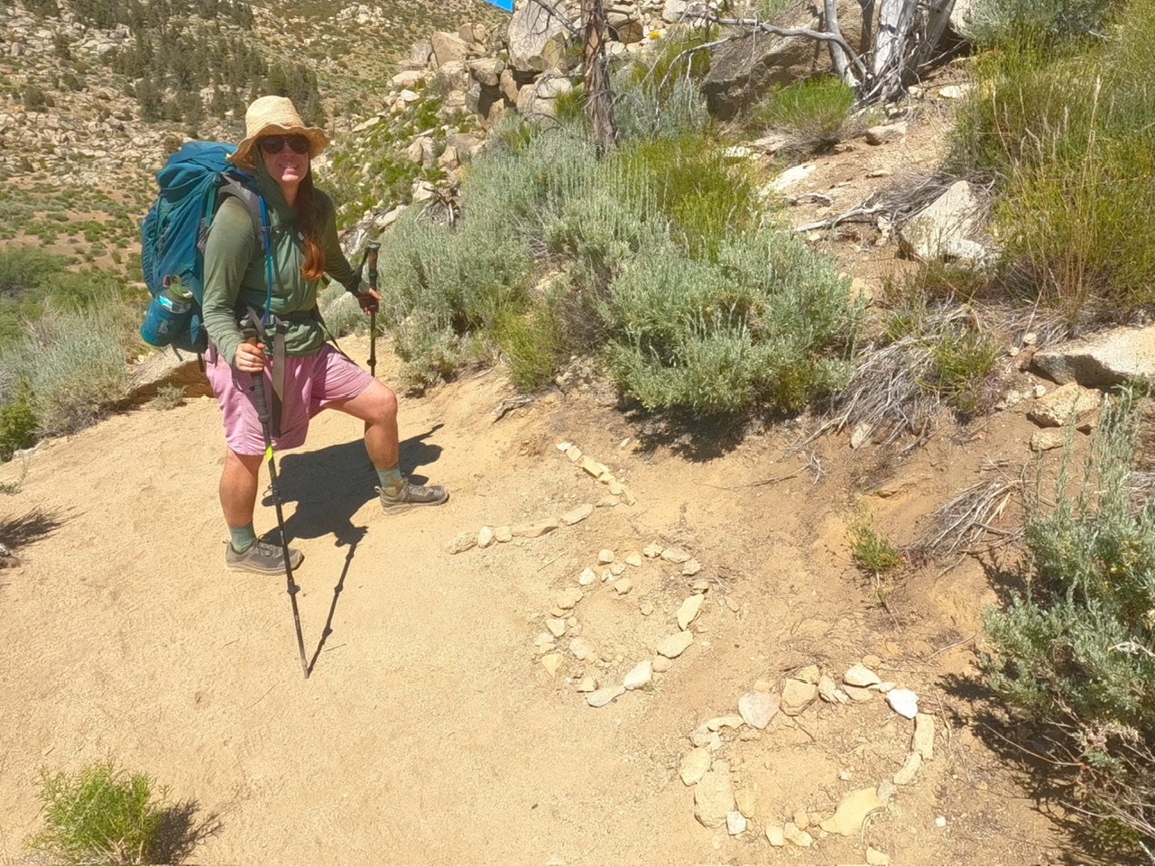
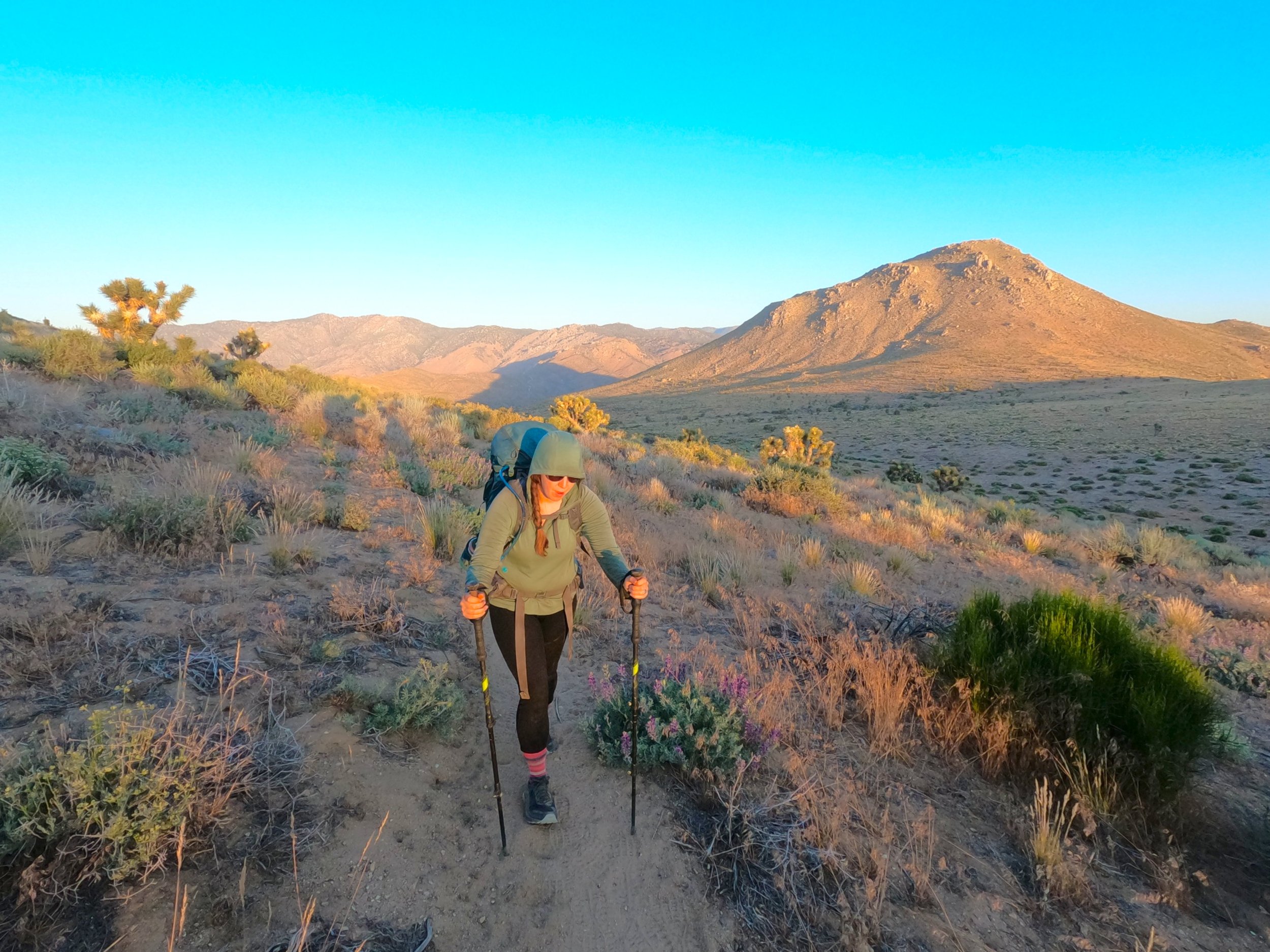
Today’s morning festivities were easy because we were leaving everything at basecamp and coming back. I was only taking a small summit bag with some snacks, ice axe, GoPro, Fitbit charger, 3 liters of water, sunscreen/lip balm and sunglasses - pretty standard set-up for a summit bid. About 20 minutes after I started making oatmeal Amanda was up and the JMT couple left, heading towards Whitney with their whole load. “Must be going out Whitney Portal,” I said to Amanda, nodding at their empty site. 

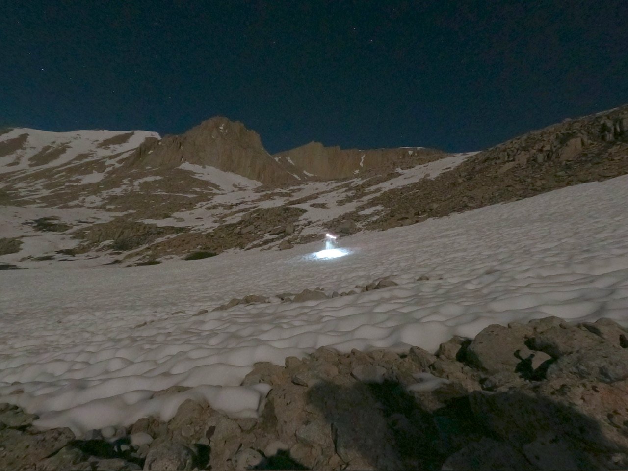
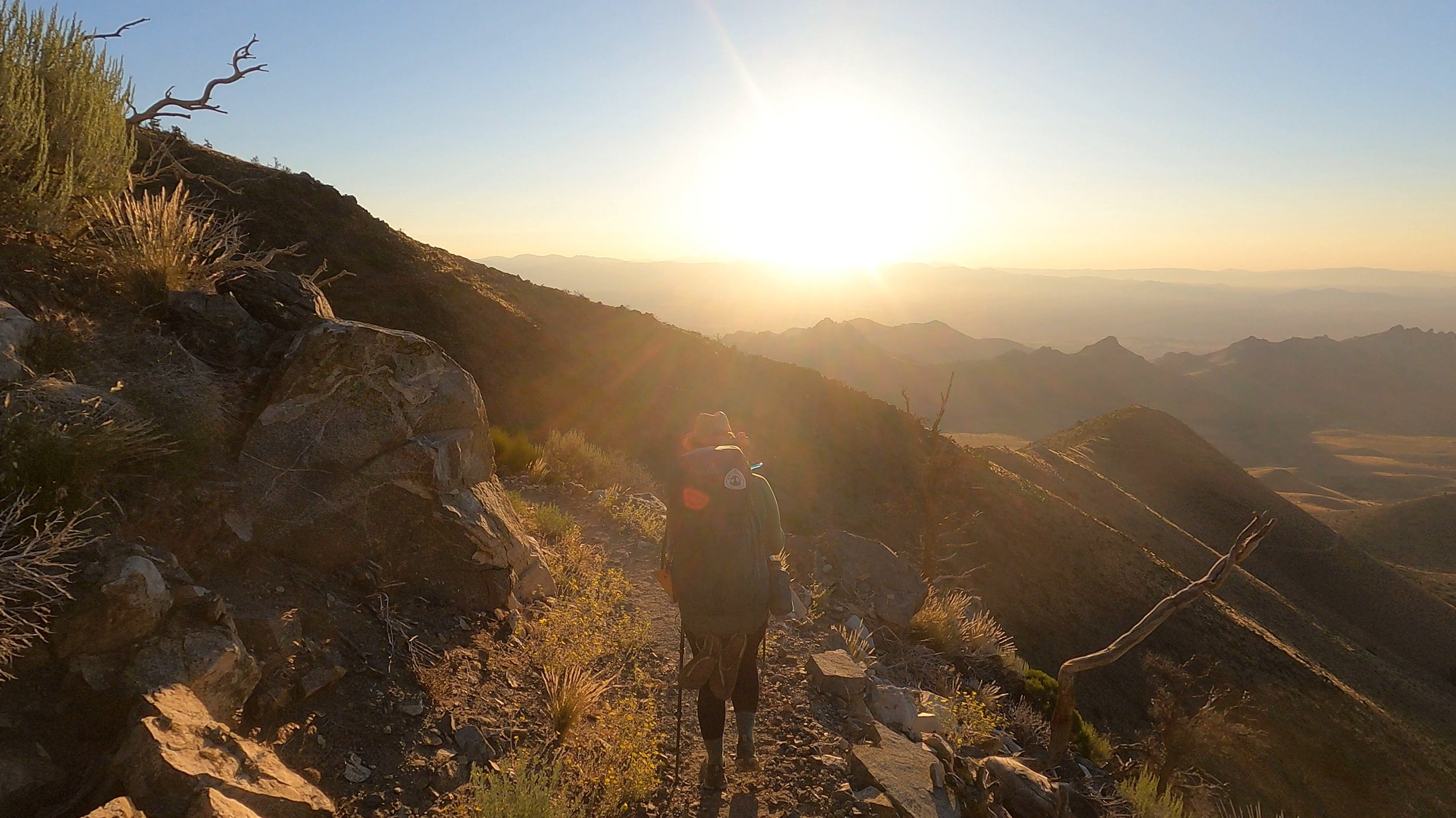
We finished eating and shouldered our prepared summit packs, relishing how light they were compared to our normal loads. As we were doing our last mental run-through, a red light came on in Wildfire’s tent signaling that he was also preparing to leave. We made our way out of the camp site and onto the JMT heading east towards Mount Whitney. The moon had finally risen and was casting lunar vibes throughout the forest. The trail went on for about a mile before we lost it in the snow. A massive avalanche had ripped through the Whitney creek area and loads of trees were down as well as excess snow. I followed the route on Gaia, my map app, and was able to navigate a way through the trees and snow. Every once in a while a snippet of the trail would show up signaling we were on the right path but, other than that, it was early morning route finding. 

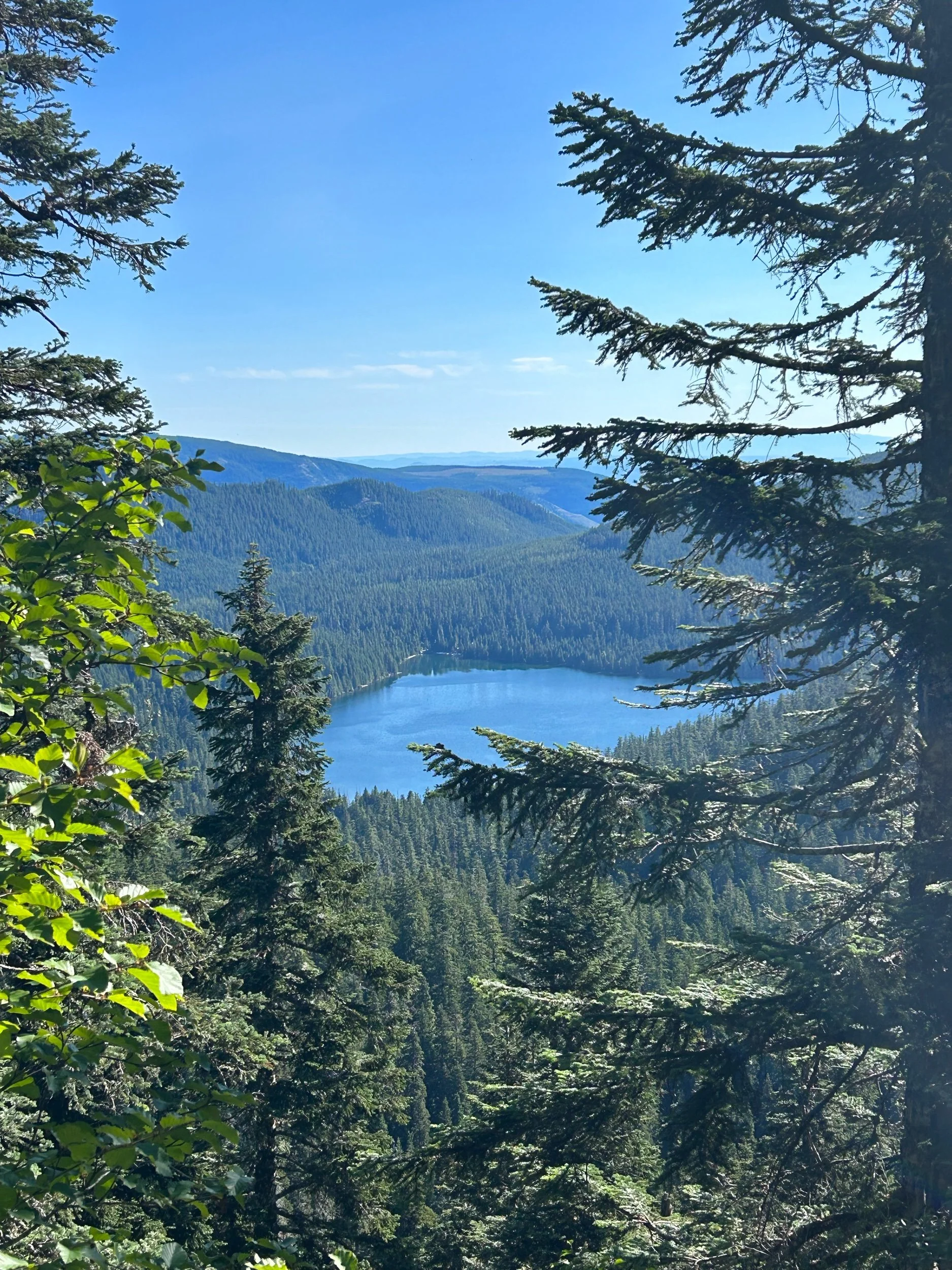
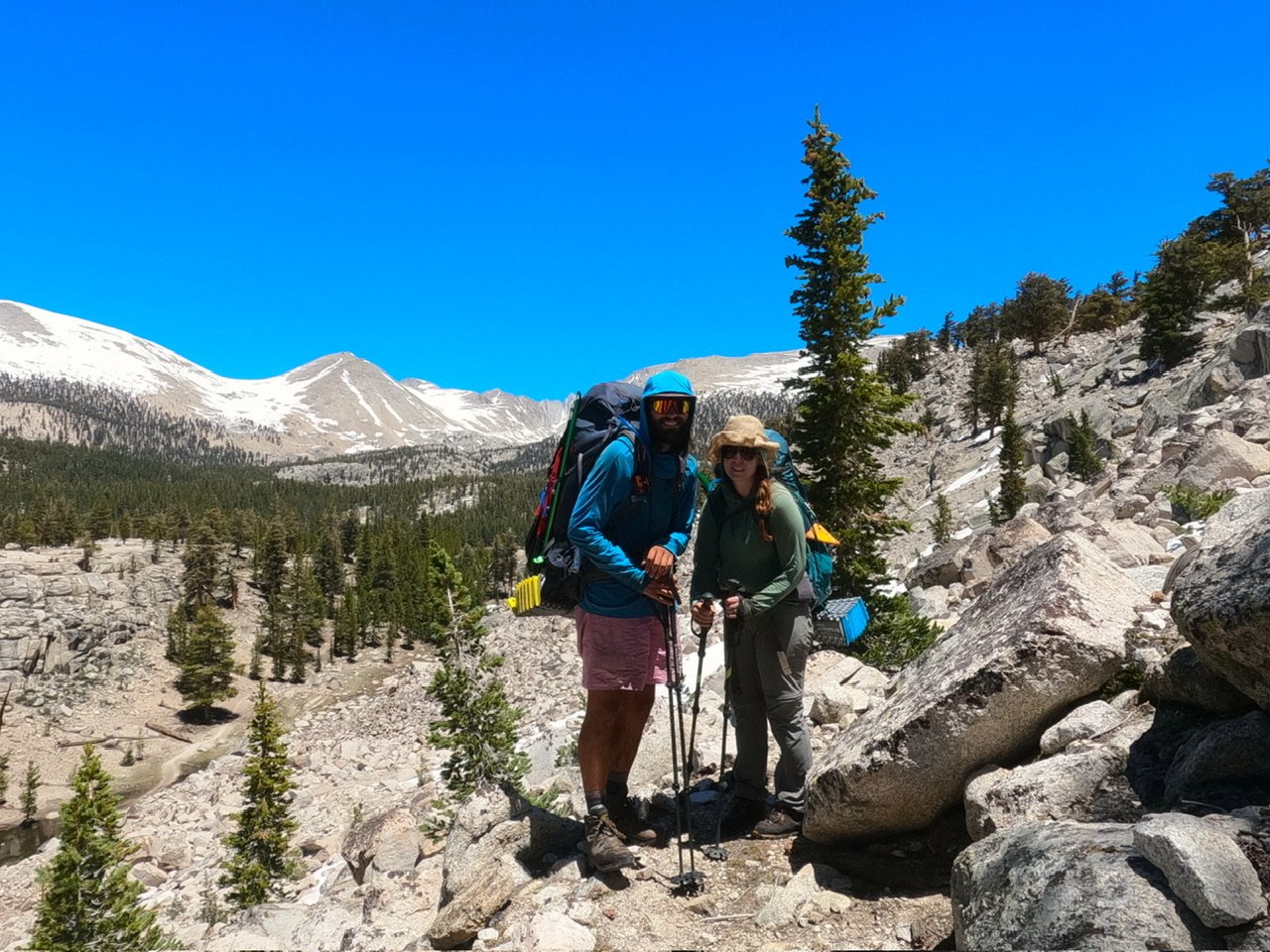
The JMT wound its way along some beautiful alpine lakes. PCT hikers were not allowed to camp east of the Crabtree ranger station, but JMT hikers could as this was the JMT and I was a little jealous of that because, wow, what an amazing view. The trail eventually wound up and out of the little valley of lakes into a massive drainage basin surrounded by peaks, including Mount Young, Mount Whitney and Mount Hitchcock. With the moon casting amazing light on these peaks it was one of the most ethereal sites I have ever seen. I stopped and took some epic night shots with the GoPro.

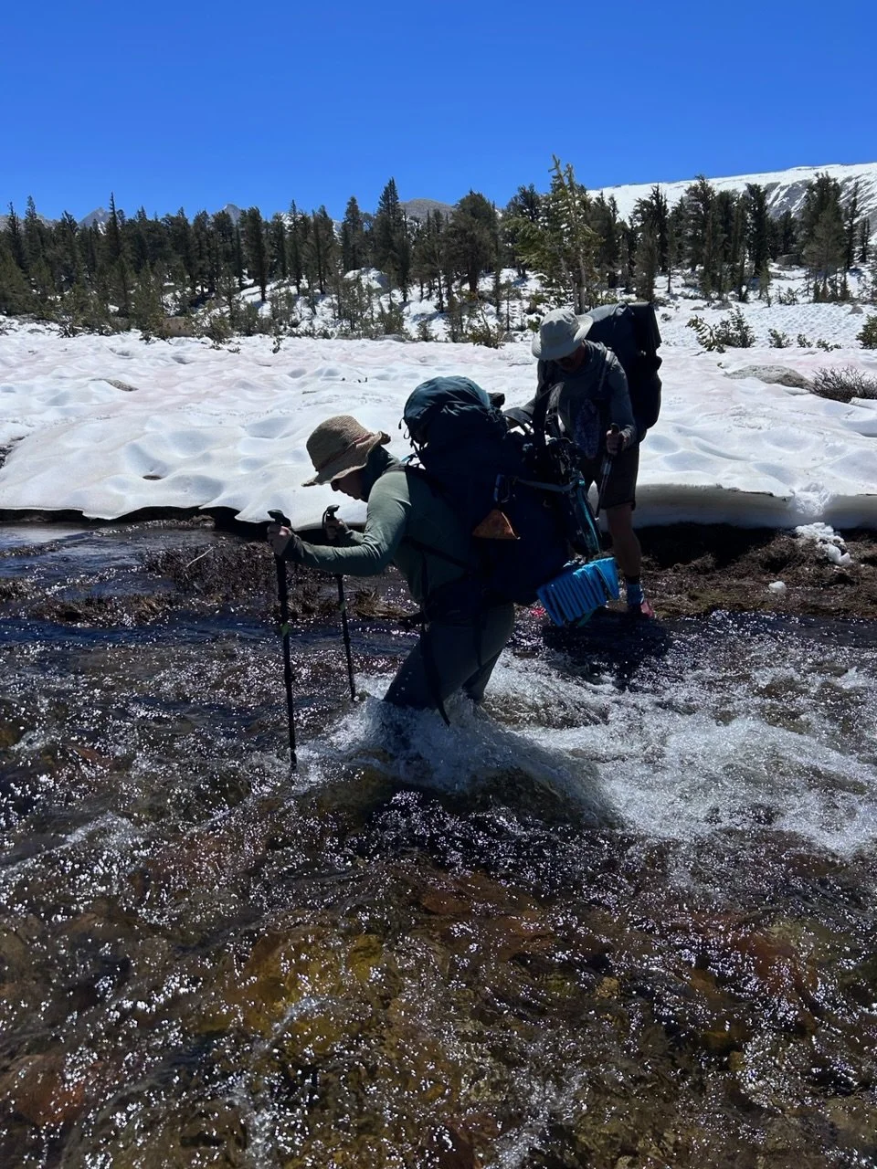
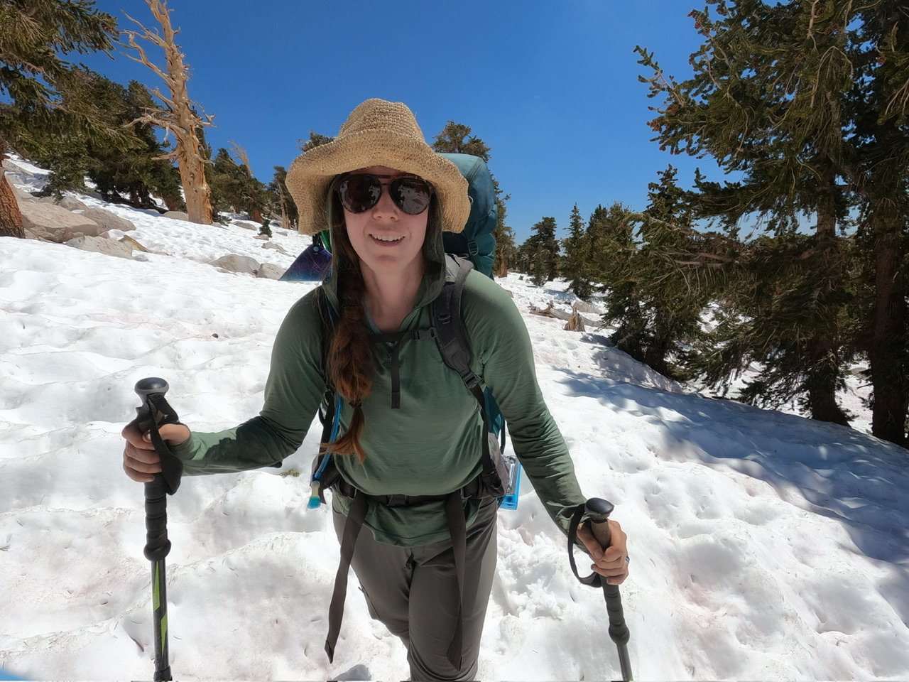
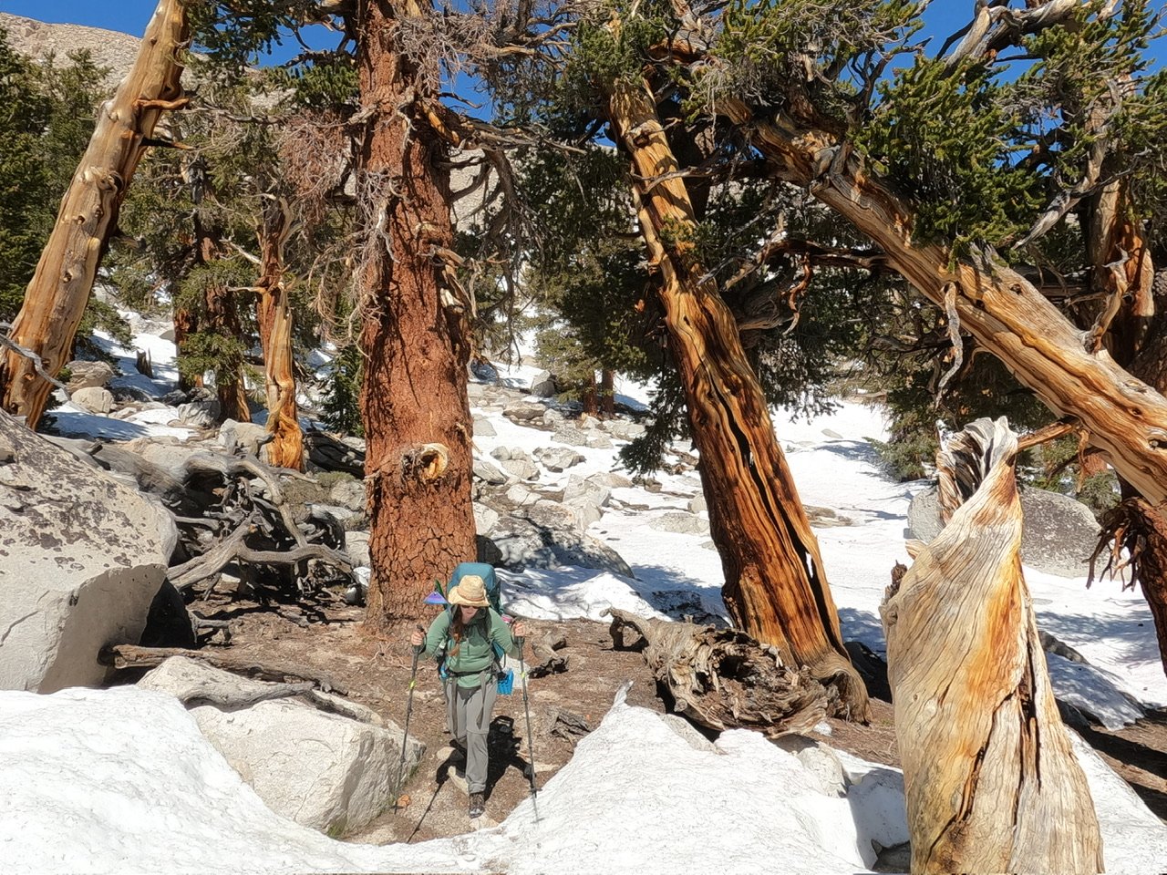
We eventually came to an expansive snowpack where navigation became less of an issue but something else took its place - sun cups. For those who are unfamiliar with these agonizing snow features, they are essentially large, deep, unevenly spaced cups in the snow that are caused by non-uniform melting by the ground beneath. They make for the worst surface to walk on I can think of because every step must be calculated and they usually collapse on you when warmed in the sun. Collapse of sun cups was not a major issue in the frozen morning and with Microspikes on we traveled decently well, however, two miles of uneven and uniform surface was a menace. We climbed up into the basin on the cupped snow. I could see the JMT couple ahead of us but for some reason they kept turning their headlamps off. We hugged the edge of the snow at the basin, aware that large bodies of water were present in the middle. After a little bit we started navigating up a series of ledges. 

On pretty much every alpine approach, navigating ledges is key as they are a common feature for most mountains. It’s not my favorite thing to do because you are often doing so in the dark without the advantage of looking down to see how they develop. It’s easy to get “cliffed out” or end up following a ledge that doesn’t go where you want. 

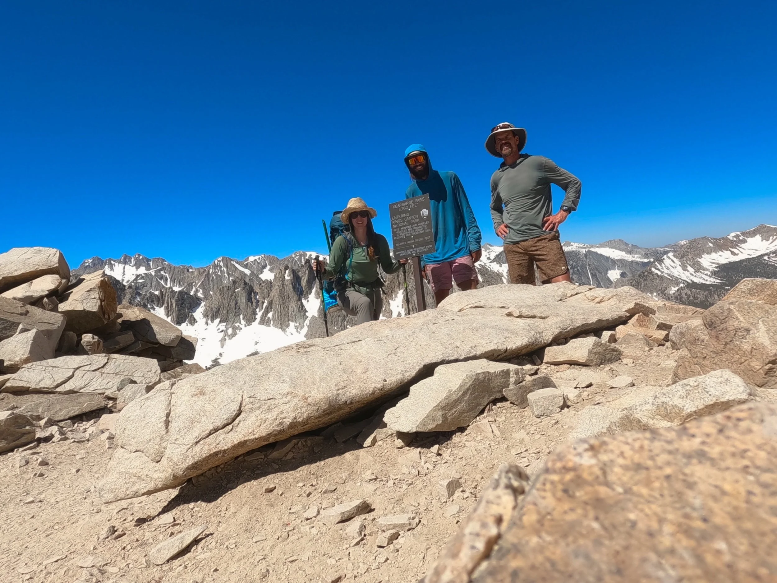
This morning I chose a different ledge than the sporadic headlamp duo ahead of us and managed to pick correctly as it led us up to the higher section of the basin where we could access the switchbacks up to the flanks of Mt. Whitney.

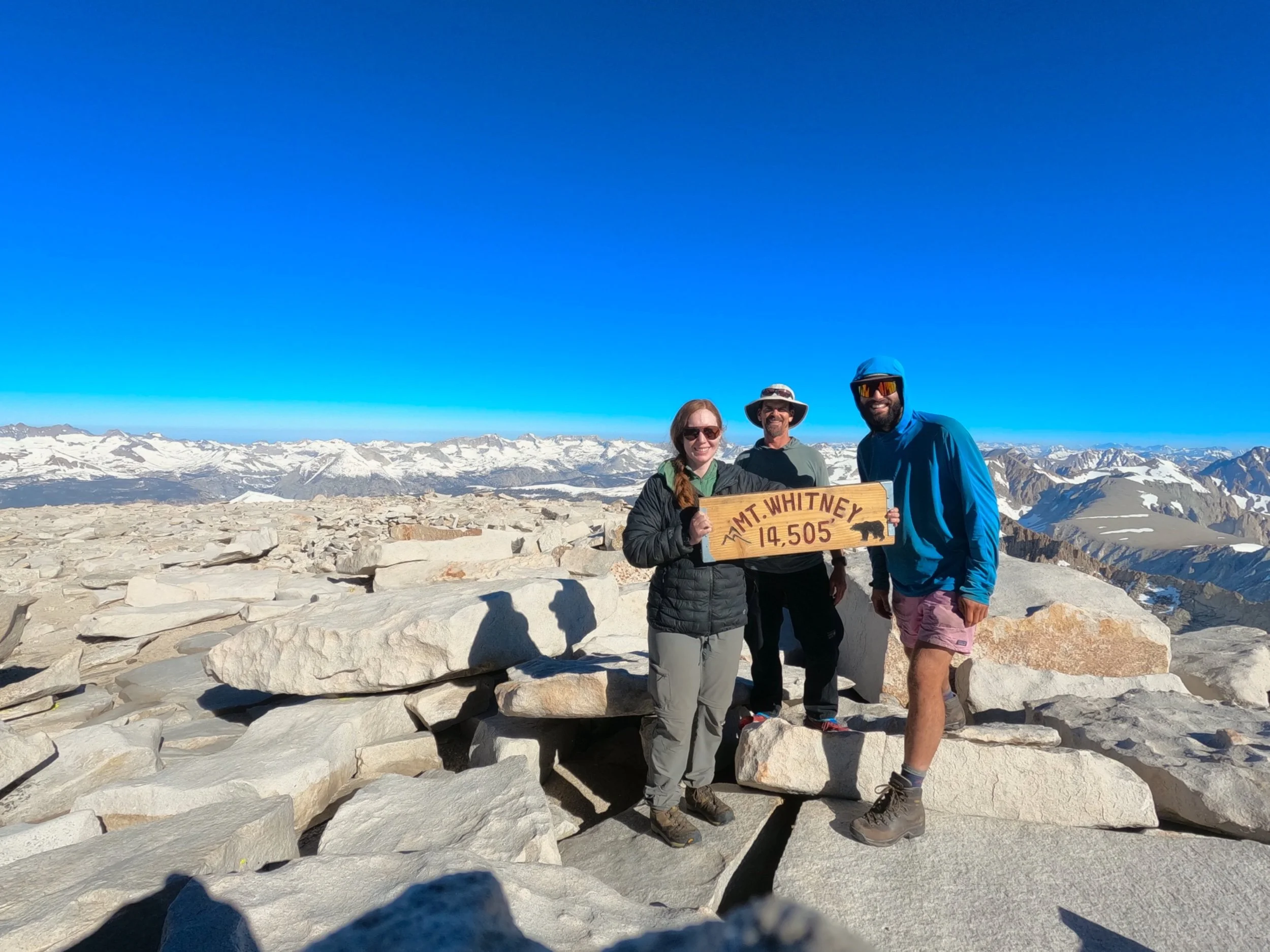
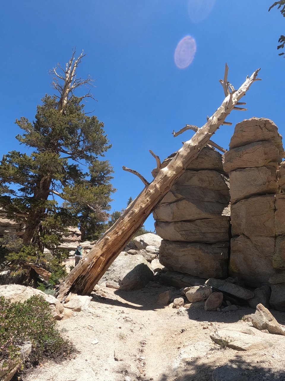
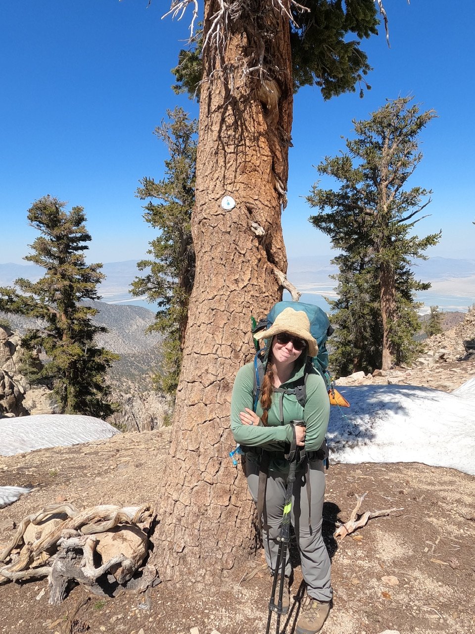
For those unfamiliar with Mt. Whitney, it is the highest mountain in the lower 48 states at just shy of 14,500 feet. During the normal climbing season, it is not considered a technical mountain. The JMT drives straight to the top of the mountain and, in a typical July, fit families can walk right up it. This was not a typical year though - snow was still very much consistent on the route, which brought us to the 3rd challenge, snow covered switchbacks. On the Whitney Creek approach, which was the route we were on, the JMT accesses the main ridge of the mountain by climbing about 25-30 switchbacks wrought into the scree and granite blocks of the mountain. It is a truly remarkable trail, the likes of which are no longer built in our parks. I cannot begin to describe the amount of work and effort that went into building or maintaining it. The challenge this year was that the switchbacks were covered in snow in some sections which means that climbers have to traverse these snow patches, some of which extend a thousand vertical feet below the patch being crossed. At 4 am we arrived at the switchbacks, just behind the JMT couple. We made our way up the first few and then came to the first snow patch. All 4 of us put our Microspikes back on and traversed the first snow patch, then took the spikes off for about a quarter mile, then put them on for the next snow patch and so on and so on. After the first 4 or 5 patches, the crossing became more menacing. Large run-outs below the patches meant that not arresting in the event of a fall became serious or fatal. On one such patch, the four of us decided to just cut the switchback and go straight up to the next one. It was light by this time so we started climbing, staying out of each other's potential rock fall. The scree and granite blocks of the Sierra are a little different than at home in the North Cascades - things move. As I made my way up through the steep field of blocks, trying to work on solid pieces not based in sand, I moved across a refrigerator sized block of granite that wiggled above me as I traversed around it. I haven’t had this happen much in the climbing i have done throughout my life and i sincerely hope it never does again, it is a very unnerving feeling. “Ok, no more scrambling,” I said to Amanda as we reached the next switchback - she just nodded in agreement. Fortunately, from there, we were close to trail saddle, where the traffic from Whitney Portal joins those from our side of the mountain. Here we continued on up a spectacular stretch of the JMT which runs along the length of Whitney ridge reverse to what we did far below in the sun cups. 

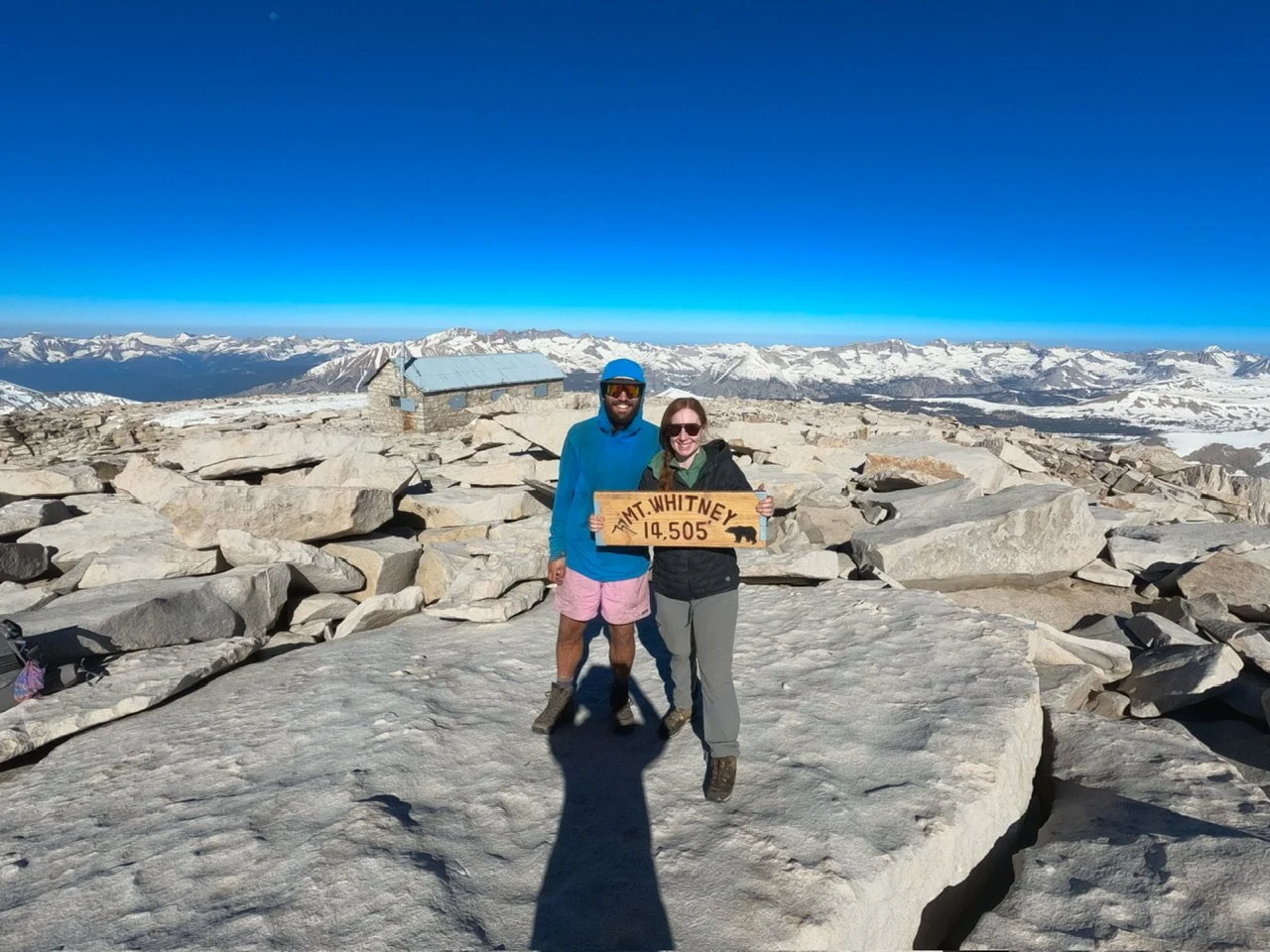
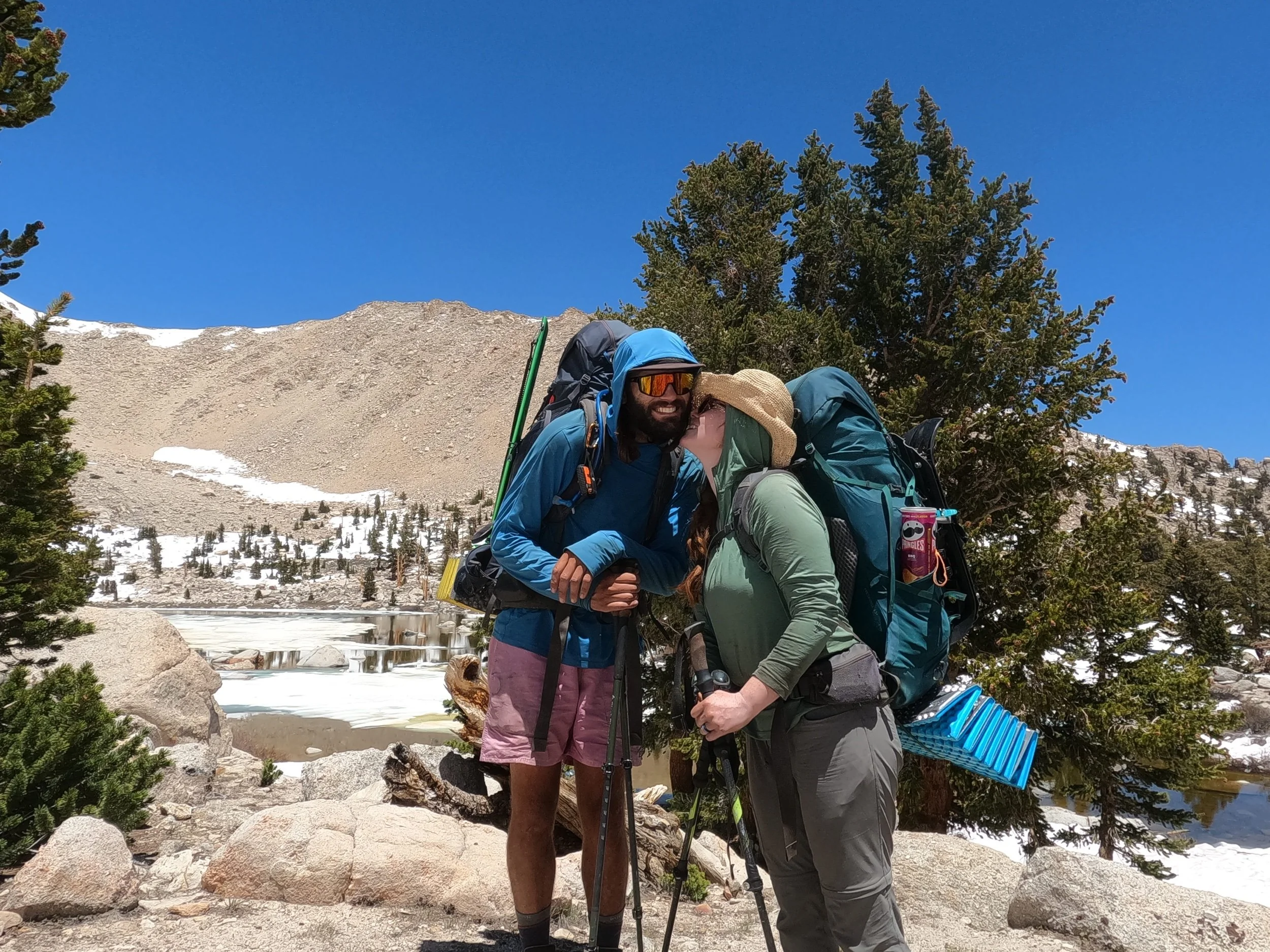
Whitney is a gorgeous mountain, brutal and beautiful all at the same time. It has a number of spires which lean out towards the east and make small saddles from which you can climb up to and look down over a 1000 feet - it is amazing. While the ridge up to Whitney is unique the summit itself is actually a little mundane. At the end of the ridge is a 500 foot tall lazy, flat dome composed of stacked rocks which makes up the summit. Usually the JMT makes a nice sweep up to it but, because of the snow, there is an actual boot pack which straight-lines to the peak. On our approach and way up this boot pack we ran into 2 guys on their way up as well from Whitney Portal and a French guy on his way down. We said hi to both and kept going. At around 8:30 we were on top and alone on this incredible peak with 360 views of the Sierra - it was amazing! Soon after, Wildfire showed up - I had seen his headlamp blinking below us as we finished the sun cup section. We hi-fived and took pictures. Amanda and I could have stayed up there forever - it was probably the best I have ever felt at that kind of altitude. We had cell service for the first time in about 5 days so we did a quick check-in but left soon after, wanting to get back through the sections below before the heat of the day really started destabilizing things. Actually, I discovered that my Wells Fargo account was slightly overdrawn and had to do a little banking at 14,000 feet - so that was cool. On our way down we said hi to the JMT couple and the two guys we had passed on the way up. We also signed the register at the Smithsonian Hut which stands on the summit and headed down. We didn’t see any of our friends' names on the register or the group of 7 which we thought was weird because we figured they were ahead of us.

The initial descent was largely uneventful. The Whitney Portal traffic was really picking up and we passed probably 8 groups on the way down, which made us really appreciate our alone time on the summit even more. Most of the Whitney Portal groups were talking about a group of 4 which had been stranded on the mountain all last night. Evidently they had expected there to be trees to make firewood and other amenities which are obviously not available on the mountain. One of the group had made a desperate attempt to get down early in the morning by glisading on the hard ice and had fallen a fair distance, somehow not hurting himself in the process. One group had the comment “this is the problem with having the tallest mountain in the lower 48 only 4 hours from LA.”

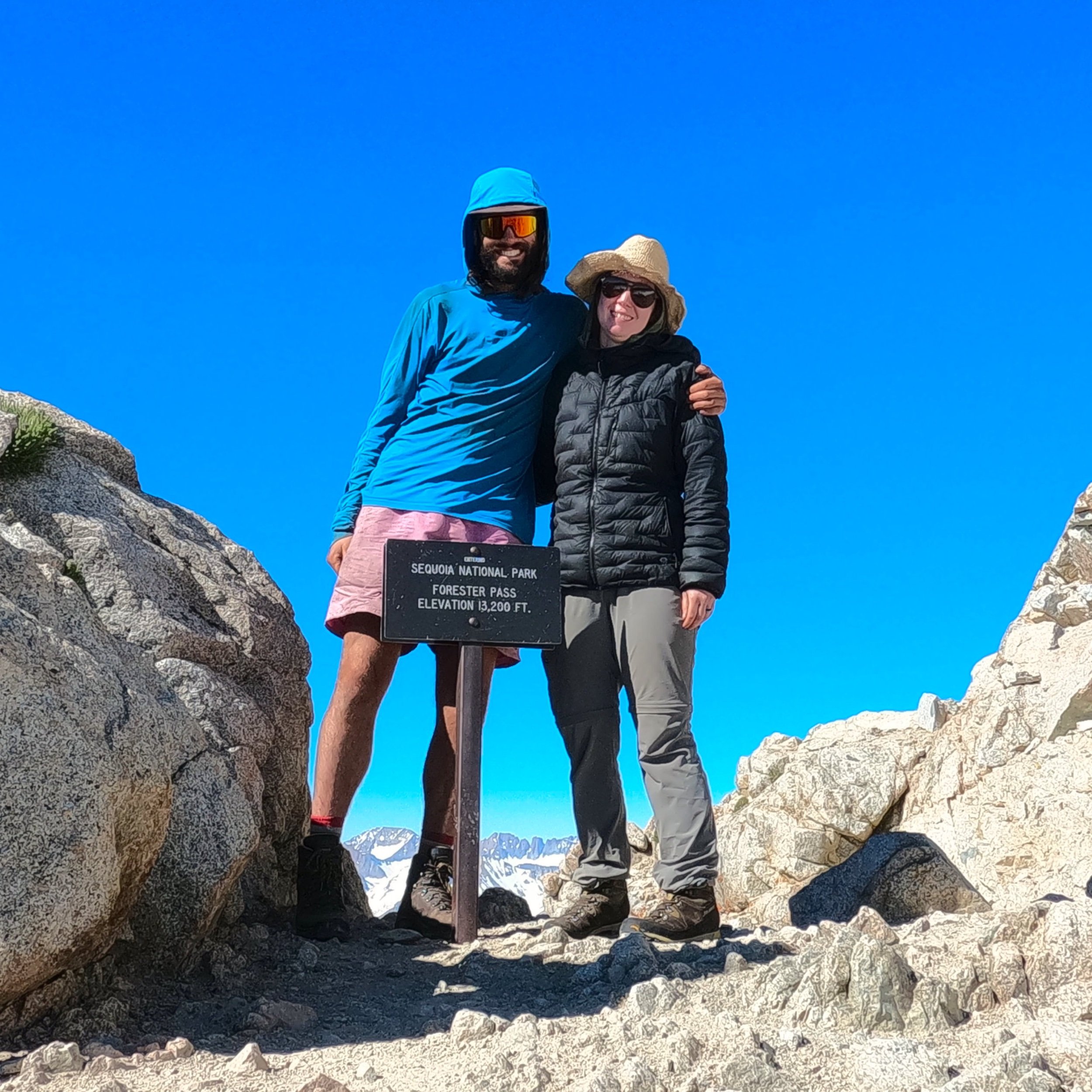
We got down to the trail junction where you can go to Whitney Portal or to Crabtree where we were camped. Here we said goodbye to the JMT couple and headed down the switchbacks. At the first snow covered switchback we decided not to down climb through the granite blocks because, you know, I don’t like to see something weighing a ton move when it shouldn’t, so we traversed on snow. This was just as harrowing. Amanda and I have both done a good amount of mountaineering, so we know the moves and how this kind of traverse should be done but this first traverse was over a “no-fall” zone, an area where a fall would likely be fatal. In these areas one would typically rope up but, as we had no rope, we did this using our ice axe for a self belay. It’s a good, solid technique but still very uncomfortable. It was at this moment I started remembering some of the notes I had read from other people doing this climb in FarOut. The snow covered sections were described as “sketchy,” “non-ideal,” and other Gen-Z’ish language which really made me realize not many people who had done this section had realized the inherent danger they were in while doing it. Whether it was from either the traverse itself or the free-spirited refrigerator sized granite blocks on the scramble. From there until the last ugly traverse both Amanda and I occupied ourselves with our own beta for this climb to share on FarOut. 

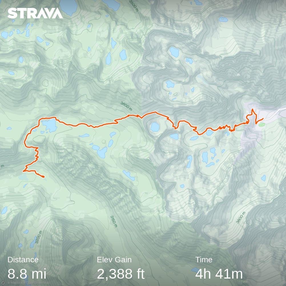
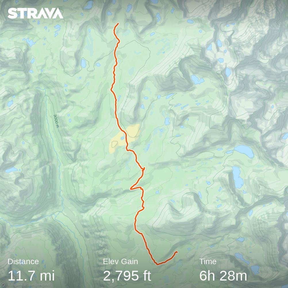
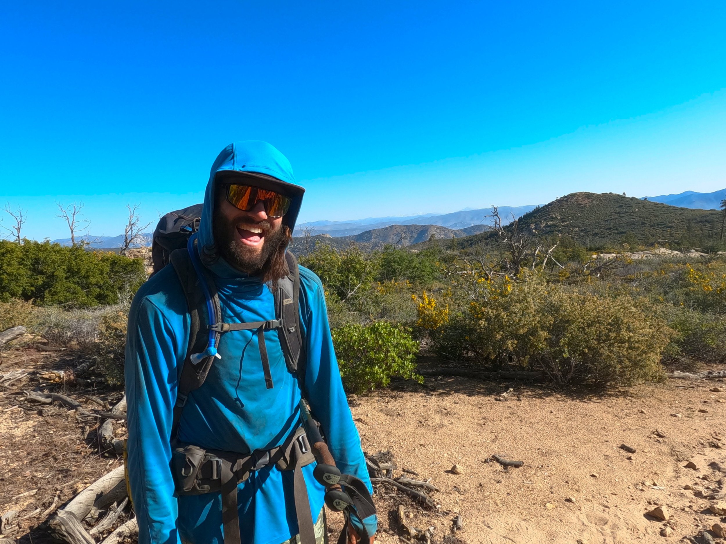
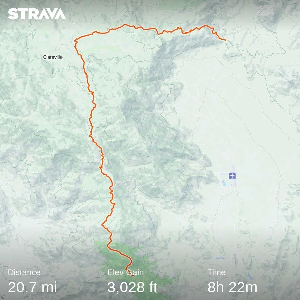
Eventually, after about 9 more traverses of diminishing consequence we reached the bottom of the switchbacks and Wildfire joined us, also voicing his discomfort with the snow covered switchbacks. From here we made the long approach back across the now soft and less stable suncups and into the navigation zone, eventually getting back to camp around 5 pm. It had been a much longer and committed climb than expected but we were so happy to have done it.

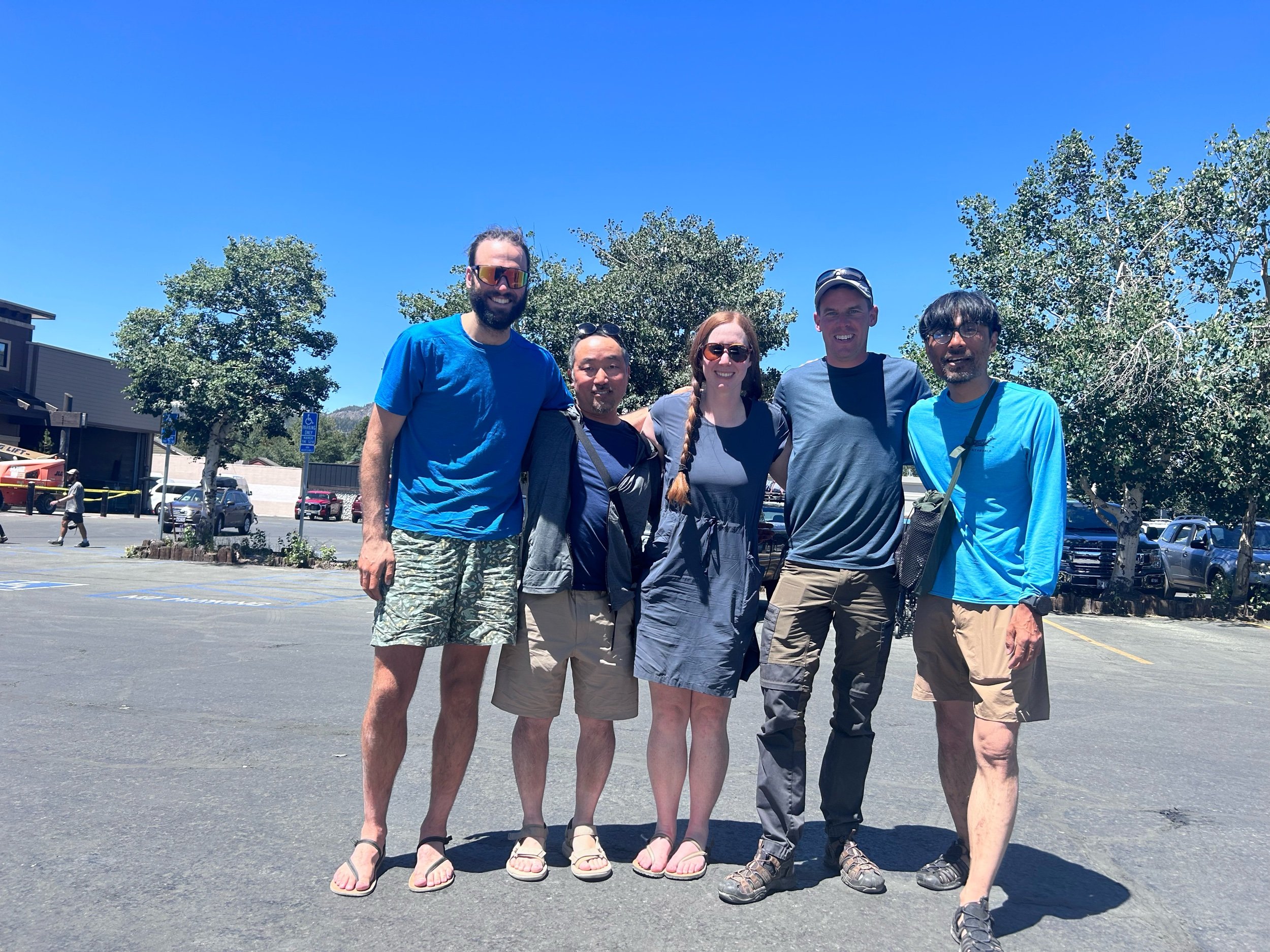
Back at camp I was surprised to catch sight of Izzy just arriving at camp. “Izzy” I shouted and she turned around and smiled as she said hello. Also with her were push-pop, UK Sam, Aspen and ET. In addition, the group of 7 we had camped with 2 nights before had also shown up. Turns out Izzy, Push-pop, Sam and ET had gotten off at Cottonwood pass literally an hour before we had gone through. They had been worried about having enough food and resupplied in Lone Pine - so we hadn’t fallen behind as far as we thought!

After catching up for about an hour and sharing info on the route we had dinner with Wildfire, recounting the day before turning in for some much needed sleep.

Day 51: Water Works

Day 51: Water Works

7/6/2023

Section: Milepost 756.4 to 768.2

Distance: 12.6 Miles  

Moving Time: 06:27 hrs

Elevation Gain: 2,385 ft

Click here for current location

Today will be short because i need to get up at midnight to do Whitney. Today’s stage winds northwest before dropping down into the Rock Creek valley making for the first major river crossing of the Sierra. From the Rock Creek valley, the PCT rises, eventually going over Guyot pass. From the pass it drops down a bit through a basin and eventually crosses Whitney Creek which was also a healthy crossing. Just after the creek the PCT joins with the JMT to go north. Here is where most people jump onto the JMT in order to climb Whitney.

Today started around 4:30 am. The group of 7 was up at 2 and on their way to take advantage of the solid, early morning snow. They were not quiet about leaving either. We woke up, had breakfast and were off a little after 5, also enjoying the good snow conditions. Wildfire left us behind pretty fast and we carried on by ourselves through a bunch of low hills before dropping down to Rock Creek. Here, Wildfire was waiting and had found a good place to cross near the Rock Creek ranger station. We followed him over and used a fallen log to cross a very healthy running river. On the other side we made a few more small crossings before circumventing a large meadow north and then west. We traveled about half a mile and found a nice rock to sit on and snack about 100 yards from where our game trail rejoined the actual PCT. The water is really running - these streams would almost be dry in a normal July but they are absolutely raging. 

After our snack, we tried to rejoin Wildfire but he must have taken off. We climbed a thousand feet before the grade tapered off through some beautiful groves of Sierra Juniper and then climbed another 500 feet to the top of Guyot pass where we took another quick break. We have acclimatized pretty well by now but those 11,000 foot passes always take the breath away. We wound down, the trail was much less snow covered than yesterday but there were still some spots. At one point we just straight-lined it down to a basin - Guyot Flat - and threw on the snowshoes to cross some flat snow. On the other side we helped each other put the shoes back in their holsters and continued on good dirt for another 3 miles where we came to Crabtree meadow and Whitney Creek. Whitney creek was also raging but where the PCT crossed it, it was nice and calm. Evidently not calm enough because Amanda took a spill halfway across and I was able to grab her so she could stabilize - got it on camera too so that should be forthcoming. We got across, Wildfire waiting on the other side and chuckling at our antics and Amanda laid her things out to dry. 

After about 20 minutes of drying we followed Wildfire up the PCT to were it joined the JMT, which was an exciting milestone, and turned right. A mile on led us to a beautiful campground where Wildfire was waiting for us. It was about 3:30 so we did our chores and ate dinner fast in order to get to bed at a good time for the midnight start. Probably not necessary but, gotta see the sunrise from the top of Whitney! 

As I was lying in bed, Amanda thought of a good name for herself - maybe as a placeholder or maybe permanent - River Dancer.

Day 50: Sequoia NP

Day 50: Sequoia NP

7/5/2023

Section: Milepost 744.2 to 756.4

Distance: 12.97 Miles  

Moving Time: 07:24 hrs

Elevation Gain: 2,352 ft

Click here for current location

Yea… that mileage isn’t great. Not great at all. And it took us all day to do, so that tell’s you all you need to know about how our day went. We both knew the Sierra was still in a rough state coming in, but I was very optimistic about what we could accomplish. The “curve” I have been following assumes the whole thing is done on clean trails and we found something very different today - snow in patches every 25 feet. There’s nothing technical or scary about it but it is slow - I watched our mile time go from 24 to 27 to 33 to 45 minutes and it killed me. This is why about 95 percent of people from Kennedy were not even attempting the Sierra - too slow, too many things to carry, can’t do the typical 30 mile day anymore, etc, etc. If this is what is in store for the next 5 days then our plan of going all the way to Muir Trail Ranch is kaput - we would have had to carry about 15 days of food in and that’s just not practical so, looks like we will be paying a visit to Bishop. One small hope I still hold on to is that, after we do Whitney in two days the stages become completely snow covered - there shouldn’t be too much of this patchy stuff and the snow shoes we have lugged from Kennedy may become more of the silver bullet I was hoping they would be. They aren’t worth much right now - we would have to put them on and take them off every 5 minutes - but if the core Sierra zone is solid snow then they might shine. Really won’t know for another couple of days.

The route today starts out on clean, snow free trail heading east from Dutch Meadow and climbing west towards Mulkey Pass and then Trail Pass. These two passes are one of the first “outs” of the Sierra - trails you can take to get down to 395 and all the towns along it. Logistically, these “outs” are tricky because they are a lot of extra mileage and elevation gain/loss which is why I had wanted to skip them all together and just go straight to Muir Trail Ranch which sits almost on the trail. Anyway, after Trail Pass the route switches back up the north side of Trail Peak and circumnavigates it, passing Poison Meadow. From there the PCT travels north towards Cottonwood Pass and then goes around the southern end of Chicken Spring Lake before crossing into Sequoia National Park. The path then descends beneath Cirque Peak, crossing a number of cirques while doing so, crosses Siberian Peak Trail and ends in a flat high basin.

We were up at 5 today. My FitBit is killing me. The watch is way more of a lifestyle watch than an adventure watch. If it dies on me than the time is off and i have to sync it with my iPhone to reset the time. Only problem is, the iPhone has to be connected to the internet to do that and i haven’t had internet since Kennedy meadows so I’m perpetually 2 hours behind. I’m getting a Suunto when we get to our next town, and I’m hoping Fitbit will take this Sense back. Anyway - the 4 am alarm I had set wen’t off at 6 am when we were finally on the trail so that was super helpful and we got up closer to 5. I force-fed myself some Quaker Oatmeal - one pack is all i could manage before leaving. 

Wildfire, Amanda and I were on the trail around 6:30. He got that name, we found out last night, by accidentally setting his pants on fire last year when he did the first 700 miles from Campo so, good name. We wound up out of camp and soon came to Mulkey Pass and then Trail Pass. As we entered the switchbacks I heard voices above me and looked up to see a few people 2 switchbacks above. We carried on and eventually hit our first patch of snow. The boots are great in the snow, really painful to walk longer distances in but so much better for snow. As we came up the last switchback we ran into two girls filtering water. We said hello and kept going, them following close behind. The patches were pretty annoying but we were still hopeful as we dodged and climbed over them. A half mile on we ran into the rest of the 2 girl’s group. We had briefly seen them on arrival in Kennedy Meadows - they were leaving as we were arriving. Sounds like they went down to Lone Pine out of Trail pass. We talked a little bit and then let them go ahead as we were stopping to eat a quick snack - that oatmeal did me dirty. Soon after them Wildfire showed up, he had stopped to adjust his back and let us go on and we continued onward. 

The rest of the morning we played hopescotch with both Wildfire and the group of 7. Half of their group was pretty fast but the other half was having trouble with the snow so we got spread out all over along the trail. I watched our mile time go down and down. I also forgot to eat until we got to Cottonwood pass which was several hours on so by the time we arrived I was pretty hangry. We also tried the snowshoes way earlier than we should have and they were very unhelpful and just cost us time. In any case, we got to Cottonwood pass and then Amanda and I decided to go on a little bit to a really nice alpine lake - Chicken Spring lake - where Wildfire joined us for lunch. 

We talked about how irritating the snow was and how slow we were going before filtering water and traversing uphill to catch the trail again. From there we continued our slog through inconsistent patches of snow, heading down hill. Everyone took a fall today, no one was saved. At the National Park boundary I really wanted to get a picture of the sign, but it was still under snow or on a tree that had fallen so we continued on, devastated. We talked to the two Germans in the group of 7 - one was from Bonn and we told him about our time in Germany. We descended about 2000 feet and eventually came to the basin. We were ahead of Wildfire but some of the front runners from the group of 7 were setting up at a campsite near a seasonal stream. We caught Wildfire as he went by and deliberated on our next move. It had been a brutal day. There was a campsite 1.5 miles down trail but no mention of water. We decided to stay since no one wanted to drycamp and 1.5 miles was not worth the risk of that. The other thing is we are 11.5 miles from Whitney basecamp and, since we are all going to climb Whitney, an extra 1.5 miles doesn’t really do us any good, so we called it, having gone all of 12.88 miles. It’s tough to articulate how frustrating it is to come off weeks of 20+ mile days only to fight hard for less than 13 but we could all feel each other's frustration. Much of the talk around dinner that night was about what could make things better and maybe farther on the snow would get more consistent. It’s not that the snow is bad, it’s just these sections of trail, separated by huge blobs of snow, that make it massively frustrating. We will get a better feel for how well we can travel on consistent snow the day after Whitney and that will figure into our decision to go north of Mammoth. After dinner we all turned in, agreeing on a 4 am wake-up and that tomorrow would be better.

Day 49: Bugs

Day 49: Bugs

7/4/2023

Section: Milepost 723.0 to 744.2

Distance: 21.43 Miles  

Moving Time: 09:45 hrs

Elevation Gain: 3,192 ft

Click here for current location

Today is going to be short because it was a long one and I don’t want to go to bed late. Also, happy 4th everyone!

Last night was a menace. We had expected the breeze that was whipping up in the evening to stick around which is why we initially set up to cowboy camp - thinking it would keep the bugs off of us. It did not and they were vengeful. Also, without the wind, despite being at 10,000 feet it was warm and I was dying in my bag but i couldn’t stick any limbs out because they would get devoured. So I sat there, sweating until about the 10th bug bit my face and said “f*** it - I’m putting the tent up,” which I did in the dark, without staking it. Amanda joined me a little after and then, at 3 am, wouldn’t you know it - the wind came howling back and whipped at our unstaked tent all night. At around 4 am we had had enough and just said screw it, got up and left. Wildfire was gone and we assumed he had grown tired of our antics and left earlier.

We made our way deeper north into the Inyo National forest. The mosquitos were relentless. Eventually, as we were passing under the west side of Olancha peak we ran across the 3 ladies we had ridden in the car to the trailhead at Kennedy Meadows with. We waved at them and continued on. Just beyond their campsite, Wildfire caught up to us. He had actually had an almost worse night than us and said he was getting bit so bad he got up at 3 and descended a few hundred feet where he thought about pitching his tent but instead decided to make coffee and stir in anger at the evening. We all laughed about what a terrible night it had been and then headed on, Wildfire going ahead. 

We started running into snow on a little further, still well frozen but not enough of it to warrant microspikes and eventually we headed down a hillside cutting the snow covered switchbacks which put us back close on Wildfire's tail. The trail wound down for a while until we reached a seasonal stream at 723.3 and stopped for a snack and water. The squeeze pouch has really developed some holes and it is all I can do to keep it from leaking as I filter. We sat and ate with Wildfire at the creek and took our boots off to give our feet a rest. The boots are brutal, especially compared to the trail runners but so much better in the snow. 

Eventually we all left and began the climb of the day, taking us up over 2000 feet to a dramatic ridge. It was a brutal climb in the heat of the day but I day dreamed about how we could expand Auto Train services in the United States one day which helped pass the time. We hopscotched with Wildfire as we climbed, eventually cresting at the top where we stopped for lunch and great views at the Owen’s valley - its wide reservoir of water far fuller than it had been in a long while.

From the top we desceneded a long way down to Ash meadow and then climbed a short bit to Dutch Meadow. Amanda told Wildfire and I we could go along and that I should set the tent up when I got there. The last 2 miles seemed to take forever but we made it. I filtered water and set up the tent and learned that Wildfire was an engineering consultan for the Aerospace industry. Eventually Amanda showed up and we ate dinner fending off Mosuitos the whole time before they drove us inside for the night.

Day 48: Into the Mountains

Day 48: Into the Mountains

7/3/2023

Section: Milepost 705.8 to 723.0

Distance: 17.95 Miles  

Moving Time: 08:14 hrs

Elevation Gain: 4,705 ft

Click here for current location

It amazed me all day how much the scenery changes along the first stage out of Kennedy Meadows. Literally, just two days before, we were in the desert and very much so as we left during a heat wave and in just this one day we are delivered to 10,000 feet in the Sierra and the difference is night and day. Amanda and I have hiked all over the world and almost nothing is as dramatic as the change in scenery we experienced today.

The stage today leaves the Kennedy Meadows campground in the Inyo National forest, heading due north along the east bank of the South Fork of the Kern River. Finally, water is no longer an issue - there’s plenty of it. The trail crosses into the South Sierra Wilderness and crosses the Kern River at mile marker 707.8 before climbing up into a small river valley east of Crag Peak. From the saddle at the top of the valley, the trail crosses Crag Creek and begins following it through Clover Meadow maintaining a large ridge to the east. This ridge necks down with an adjacent ridge on the west side and the trail clamours up through another saddle before opening grandly on a large meadow called Beck Meadow. The PCT then edges around a small hill to the east of Beck Meadow and meanders down to rejoin the South Fork of the Kern River where a bridge crosses over. The last part of the stage is a brutal climb up into Cow Canyon following along a small unnamed peak until it leaves the canyon at 10,000 feet, offering several nice camp sites.

Amanda and I were up at around 5 am this morning. We had slept well, but been woken up briefly by a group of Boy Scouts who went by quite noisely at midnight for some reason. We packed up and ate breakfast - trying to eat through the few things we weren’t stoked about and saving our favorites for later in the trip. After breakfast we headed out. We stopped to sign the trail register and say hi to UK Sam (Trip Hazard) who had arrived in the night and was packing his tent up. We asked him about Markus and Izzy and he said the last thing he saw before leaving the General Store was Markus with a 6-pack so, we’ll see how that goes. 

We started on the trail, which wove peacefully through pine trees on a solid trail. Everyone has said the trail gets vastly more logical and nice in the Sierra so we are excited to see it. It was fine in the desert but supposedly it’s supposed to get even better. We hiked on and soon UK Sam passed us. We are loaded down with 10 days of food and snow shoes so our moving average is going to be slow for a few days. We’ll make it up on them on the snowfields and when we don’t have to do the awful exit to Lone Pine. 

Further down the trail we came to a beautiful bridge over ther Kern River and took some pictures on it. Shortly after, we came across the boy scouts now heading back towards Kennedy Meadows - must have been some kind of night hike. We are still seeing lizards on the path but, sad to say, we have probably seen our last Regal Lizards - goodbye little dudes, you will be missed. After the Boy Scout encounter we started our first climb of the day into Beck Meadow and a short time later the scene opened on a beautiful moderate meadow which we began climbing into. About half way up and out of the meadow we stopped and pulled water. Several leaks have appeared in the squeeze bag but Amanda and I have agreed that, if the bag catastrophically fails we are just going to drink out of the streams. Sean and many others have said they have been doing it in the desert without any issue and that the Sierra is probably the cleanest section on the whole trail. We will see, filtering is such a pain but so is shitting your pants. After filtering, some snacks and a bag of Sour Patch kids we made our way up the trail, eventually cresting out of Beck Meadow and at the top looked down on a much more expansive meadow - Clover Meadow. We descended down and then meandered around a low hill in the middle of the meadow before the trail turned east briefly and made it’s way back down to the Kern River where another great bridge was located.

We took lunch at the bridge watching a bunch of swallows ride the wind below the bridge briefly ascending to feed young before going back out of get more food. “I wish I could have a personal Swallow to eat all the bugs that have been flying around me,” I said to Amanda. We sat and took advantage of a very flat, very level rock. Getting out of the backpacks is a chore now with all the crap and weight we have, but we help each other out and that makes it easier. We ate and talked about how exciting it is to be in the Sierra. I eventually walked down to get water and Izzy (Butter) showed up. We gave a little cheer and she sat and immediately swapped to sandals so she could sit on a rock in the river. We asked about Markus and she said he was somewhere behind but had had a bit of a late night and was probably going to be a while. We talked for a little bit and then Amanda and I said adieu, heading out over the bridge. 

After crossing the Kern we had around 5 miles and 2200 feet to climb. The nice part was that, now, the elevation and the cooling of last week’s heat wave made for mild temperatures to hike in. We made our way towards Cow Canyon, which is more of a tiny river valley than an actually canyon, and at the mouth were relieved to find plentiful shade along the river. The climbing transitioned from peaceful, to moderate, to difficult, to an all out assault over the course of about 2 hours. At the end we were dilvered into an alpine meadow with many rocks that looked extremely Sierra’ish and Amanda saw our first Marmot!! It looked like a chubby, miniature golden retriever and squinted at us with a bucked-tooth grin before running off. 

We climbed up to a set of campsites and Amanda said she was done for the day. I ran ahead to take a look at the second camp site, which was much better, and convinced her to climb a little more for great views out on the mountains. 

At the top, Amanda passed out in the sun and I did my typical exercises then went and got water - stumbling on a few more marmots. The breeze was keeping the bugs down which i was very happy for and at this altitude we decided on cowboy camping. I began making dinner, excited to eat through our food weight and a section hiker came through. I didn’t catch his name but he was from New Jersey. A friend had dropped him off at Cottonwood Lakes Trailhead so he could escape the heat of the desert but he had been just as devastated by the snow. “I’m done,” he said sheepishly “think i am going to go home and get some hikes done in the White’s (mountains) - but those snowshoes are going to be really helpful up there” before pulling out his phone and showing me the snow. It didn’t look terrible but the suncups were going to be a menace. Just as i was talking and enjoying my dinner Izzy and Markus came by. They didn’t want to interrupt but said they were going up to catch Sam and continued on saying they would see us tomorrow. Just after them, a 4th guy showed up and started looking around. The guy from New Jersey departed wishing us luck and we talked with the 4th guy. Amanda put it together pretty quick that this was Wildfire, whose wife had given us beers and food our first day out of Tehachapi. I got up to shake his hand and say how awesome his wife had been for trail-angeling. We talked a while more than Amanda and I started our wind-down activities, eventually getting in our sleeping bags. Tomorrow was going to be another big day and the day after that, the adventure was really going to begin.

Day 47: Kennedy Meadows NERO Day

Day 47: Kennedy Meadows NERO Day

7/2/2023

Section: Milepost 703.4 to 705.8

Distance: 2.48 Miles  

Moving Time: 01:04 hrs

Elevation Gain: 217 ft

Click here for current location

We managed to sleep in ‘till about 7. The sun was up and already things were warming as we headed down to the Grumpy Bear deck for some breakfast. At the deck we found some of the crew from last night already milling around waiting for the grill to open. At 8:30 sharp, the owner came out and announced it was time and we all charged the bar. The classic thing to get at Grumpy’s is the Hiker Breakfast. One massive, and i mean MASSIVE pancake with a side order of hash browns, sausage patty and eggs any style. They offer unlimited pancakes which is pretty hilarious because I don’t think anyone can manage the one they give you to start!

After breakfast we sat around talking about the things that needed to get done today before we left and we had all agreed that we would leave tonight and walk a few miles. It was nice to have a group to go into the Sierra with. There was Izzy (Butter) and Markus (Push Pop), a guy from Tennessee we met in William’s group back in Acton, Tyler (Aspen) and UK Sam (Trip Hazard). Many people are still skipping the Sierra but some are giving it a shot. I got out my phone and started making a list of things we needed to do today on Google sheets as Amanda rolled her eyes and Markus made some comment about me using a spreadsheet program for such a mundane task. “I use sheets for everything Markus - my life runs on sheets' I said with a smile. “Your name should just be Sheets,” Izzy said and I replied “Hey! I like that!” So, officially, my trail name is now and forever more - Sheets! 

After breakfast Amanda and I headed just up the street to Triple Crown Outfitters, a little gear shop run out of a container by a triple crowner who has done the PCT twice. Every year she runs this really well equipped little shop just next to Grumpy Bear’s and saves a lot of hikers butts. We had received a lot of packages from REI, thermarest and my parents but needed a few more things, so Amanda went inside while I waited outside. While outside I perused the many bulletin boards of info including beta on all the water crossings we had ahead of us by a guy named Andrew Skurka. I took note of the website and then went in after Amanda and picked up the bear box Philipp had ordered from the store. He wasn’t coming in until the 5th and the owner wasn’t going to be operating the store on that day. 

Back at Grumpy’s Jason, Lorena and Simon had showed up. Simon had taken a fall and had his arm in a sling but maintained it was no big deal. Lorena said Philipp was still a few days back and Simon took his bear box as they were sticking around until Philipp showed up. 

The rest of the day was mostly chores. I downloaded the KML file of all the river bypasses from the site I had seen at Triple Crown Outfitters, than finally took a shower and did the rest of my laundry. Amanda then laid out all of our things and organized our backpacks. A lot of people commented on the snowshoes. I think they can go either way - they will help us move fast in the late afternoon when the snow gets sloppy but if we are doing a lot of traverses they will be virtually useless. One thing is for sure - our bags are heavy. 

At around 1 we had lunch and then missed the 2 pm shuttle back to the general store so Amanda and I went and hitched a ride instead from a very nice couple from LA out doing some Freedom weekend backpacking. At the store I found two extra boxes that had not originally been given to me, one with Amanda’s new bear canister - critical for Yosemite - and about 8 meals we had ordered from REI. I sent our shoes and other miscellaneous items up to Mammoth now that we had our boots - thanks Mom and Dad! We finished off our provisions in the store and the two girls who worked for the PCT organization gave us a ride with 3 other hikers back to the trail head after stamping our permits. The rest of our group was going to come a little later that evening

At the trail head we thanked them and headed north. The backpacks were heavy and our feet were not as pleased with the boots as they were with the hiking shoes. We meandered about 2.3 miles north until we came to the Kennedy Meadows campground. The PCT girls were already there getting settled. We picked a spot and Amanda set up the tent while I went to get water. Our water bladder is leaking just a little so, maybe the standing-on-it trick isn’t such a great move after all. We had some Ramen as we weren’t too hungry after the giant burgers at Grumpy Bear’s and eventually the bugs drove us inside, but the landscape was finally looking like the Sierra and we are tremendously excited!

Day 46: The End of the Desert

Day 46: The End of the Desert

7/1/2023

Section: Milepost 682.3 to 703.4

Distance: 22.03 Miles  

Moving Time: 09:00 hrs

Elevation Gain: 3,864 ft

Click here for current location

Happy July 1st everyone!! It is a commonly held belief by all who hike the PCT that Kennedy Meadows marks the end of the desert and the beginning of the Sierra and the views of the Sierra seem to confirm that. The profound irony of our grand adventure here is this - the hottest day we have had on the PCT was day 1 in the desert, just outside of Campo and the second was today on our last day of the desert. Two appropriate bookends for the hottest section of this trail but I have to reiterate, again, that we have been exceedingly lucky in the desert. I‘m not sure we had a single day above 90 degrees - it could have been so much worse. This season has been tremendously mild in the southern section of the PCT.

We woke around 5 - my alarm didn’t go off but we were up anyway. Another great sleep which is digging into a major deficit we have developed on the trail. I had some more breakfast snacks - we loaded up in Lake Isabella and so I was going to town every snack session. Izzy left as we were finishing breakfast, Ben accompanying her for the first mile. We followed shortly after. Some people had arrived later in the evening last night and had arranged their tents along the road. Amanda and I made our way back down the trail and eventually arrived back at the road. From here we said hi to a couple who had slept there and then pushed on up the trail.

The first part of the day today was a consolidated climb for a little over 2800 feet and about 7 miles. Nice grade but consistently up. We meandered up in relative silence, lost in our own thoughts. At around noon, we stopped at a nice log and sat down for lunch. Despite reloading only about a day ago, I had done some good work on my food. Honestly, some real favorites have started to emerge as I travel on this trail.

  • Potato chips - I ate through a family size bag in less than 24 hours

  • Homestyle rice crispy treats - so glad Kellogg’s came out with these

  • Nature’s Bakery Fig Bars

  • Peanut Butter Filled Cliff Bars

After lunch we continued on down the trail. There are these grasshoppers in this area that make a high pitched buzzing sound when they take off and now that we have heard a rattlesnake rattle the two sound very similar. Needless to say, Amanda was very on edge for the warmer part of the day when these guys get to be really active. The trail continued to wind down to the mouth of a canyon we had climbed into, which amplified the heat, before it set us down into a wide open valley. This was the Rockhouse Basin through which the South Fork of the Kern River flowed, and it was flowing. We heard it before we saw it but eventually the trail drew up beside the swolen river where we found Izzy and UK Sam (Trip Hazard) chilling in some bushes nearby. 

We broke here for lunch, quickly finding the horse flies to be an absolute menace. I walked down to filter water. I have a new method where I stand on the squeeze bag lightly to get the water flowing through the filter and then finish off by rolling the squeeze bag up to pressure the rest of the water out - it’s lazy but it seems to work. After I had filtered out about 2 liters for both Amanda and I, I returned to find Izzy gearing up to leave. Trip Hazard was going to stick around till about 1:30. Amanda and I had some more snacks - Amanda is going to actually finish net positive on food for this segment and gave me some of her snacks. I had my last Homestyle Rice Crispy treat and we started packing up. 

The trail paralleled the Kern Riverall the way back to Kennedy Meadows, sometimes getting closer and other times winding away from it. The path meandered for a while and it wasn’t long before we saw Izzy’s tell tale silver sun-brella off in the desert. We caught up to her and passed as she paused for a break - it was hot and all Izzy said was “I’m so f***ing done with the desert.” We laughed and agreed before pressing on. It’s a sentiment we are all feeling as we close in on Kennedy Meadows. You have been fun desert but it's time for something new and I can see that new something off in the distance every day now. 

The path went up and down for a bit before passing through the west side of private property. We passed through two more gates and Sherman Pass Road came into view where we could see cars coming and going and weekend warriors setting up for the long 4th of July weekend. 

We reached the road and stopped for a while. We hadn’t really thought of what to do once we got here. Trip Hazard had mentioned a shuttle but we had no idea what times it came and there was virtually no service in Kennedy Meadows. Feeling a little let down that there was no massive procession of hundreds of people clapping for our momentous ascent out of the desert we begrudgingly began walking the road. Just as we were about to start complaining about tarmak trudging, a guy in a green Danger Ranger (Ford Ranger) came swinging around the bend. We threw our thumbs up in desperation and asked if we could get a lift. English was not the driver's first language but we were able to battle through a few misunderstandings to tell him we wanted to go to the General Store. He smiled and told us to hop into the bed of the truck. We thanked him profusely and jumped in and he took us the extra mile into the general store. 

We arrived at the General Store, which slightly larger than a gas station convenience mart. We found a large party in progress upon arrival. Eveidently there had been a 4th of July tractor parade and a band had been set up to perform on the back deck of the store. I got a beer and a Gatorade and Amanda got a Gatorade. I put my name down for the packages I was expecting to receive there. The clerk smiled and said it would be about 45 minutes to check for them. We relaxed in a side yard away from the music with some other hikers and enjoyed our drinks and the free Wi-Fi service. The small town tractor parade after party was quite a wild affair. There was a drunkenly officiated wedding at one point and one old lady walking around asking personal questions to the foreign hikers which I’m pretty sure they didn’t understand. Eventually Izzy showed up and we clapped for her before I went in to get my packages. There were 6 of them because REI had decided to send everything in separate packages as well as one large one from my parents with the snowshoes. Amanad and I considered getting some dinner but decided to wait for later in the evening. Just before 6 pm about 7 of us hikers, including Trip Hazard, Izzy, Aspen and Chicken Feed Backpack Man (Dumor) went down to the edge of the road expecting a shuttle from Grumpy Bear’s bar and grill. While the General Store might be where many hikers resupply, Grumpy Bear’s is where many of them stay the night and they run a shuttle from the trailhead to the bar, stopping at the General store to pick up anyone that might want to come spend some money at their establishment. The problem was that 6 o’clock came and went and no shuttle showed up. At around 6:30, Amanda spotted a big Dodge truck come into the parking lot and suggested we go ask if they could take us into Grumpy Bears. I walked over to the truck and offered 20 dollars to the guy, which he gladly accepted, and we all piled into the bed. 

The truck drove us 10 minutes (about 3 miles) down the road and deposited us in front of Grumpy Bears. We went inside and an overwhelmed bartender looked at us and said “Ok, we’re doing this out on the deck.”  Out on the deck the bartender gave us a long spiel about what went and didn’t go and gave us all wristbands before delivering some final, devastating news. “The owners and staff got crushed today given the festivities and shut the kitchen down early to take the afternoon off. I’m not even getting paid to be here, just volunteering to run the bar. Sorry but not sorry.” I immediately looked at Amanda to see her crestfallen face before asking “Will the kitchen be re-open for breakfast?” He confirmed that it would be and there would be all the pancakes we could eat at that time. So, instead of eating i got some more beers and ice cream and we sat out on the deck the rest of the night chatting with all the other hikers. At this point we have been hiking with the same people for more or less the last 2 weeks and know everyone pretty well which is nice. I wasn’t sure how long that was going to take to happen but happy to have a little crew now. I did some blogging and Amanda played some games with a newer group we were less familiar with. Around 11 pm we turned in - Amanda leaving a little earlier to go set up the tent and i follow a little after. I had had so much fun catching up with everyone I forgot to shower - that and Amanda had started using my other pair of pants today because her brand new SmartWool leggings had ripped holes all along the inner thigh in under 5 days. My baggies were the only things that offered any protection from chafing so, i had no clean pants to change into. 

I grabbed my things and left, saying goodnight to the few people still on the deck. Leaving the bar, I walked along a road back to the campground where I searched for Amanda’s tent spot, finally finding it. I set down my things and hopped into bed relishing our achievement of finally making it out of the desert.

Day 45: 1 Quarter of the Way

Day 45: 1 Quarter of the Way

6/30/2023

Section: Milepost 658.1 to 682.3

Distance: 25.13 Miles  

Moving Time: 11:01 hrs

Elevation Gain: 4,495 ft

Click here for current location

Today was a long one - it might have been Amanda’s longest day. We had been slightly behind schedule since Tehachapi since we came off at Willow Spring Roads instead of highway 58. This had put us about 10 miles behind and we had been trying to recover that ground. Today we started about 5 miles behind and were committed to making it back up and getting to Chimney Peak Campground, which had pit toilets and picnic tables. 

The stage today stays in the Owen’s Peak wilderness the entire time, winding northwest along the backside of the Mt Jenkins ridge before curling over a saddle and down into a small valley. From this low point the trail made it’s way over another small rise before descending again into a small confluence of two or three rivers. A highly appreciated facet of this stage is it marked the first time we didn’t need to do a long water carry or depend on water caches. Natural water is a wonderful thing to see. From the rivers a long rise, over 2000 feet, took us above a ridge east of Lamont Peak where it wound east before turning northwest and linking with the west side of a ridge then descended down to Chimney Peak campground which sits in a low meadow. 

We woke at 5, trying to get an early start. In lake Isabella, we had heard that it was potentially going to be triple digits over the weekend. We were pretty high up but that didn’t mean we were exempt from the temps so early starts were the move. We ate some basic breakfast bars and other items before getting the tent together and heading out. We had both slept hard the night before and felt very refreshed. I love the idea of cowboy camping but I also love getting a full night’s sleep. We passed by a plack for Jenkins, who the nearby peak was named for and who had died doing trail maintenance there. The sun came up and things started to warm. We made our way down off the ridge a bit before regaining another saddle. Here someone had left a “25%” at the 662.5 mile mark to demark one quarter of the way along the trail.

I have to say here, if you look at the trail map you would only think we were 1/8th of the way complete because we do so much weaving and winding north of LA, but we are and it is a pretty awesome achievement. If we’ve made it this far, we can definitely do the rest.

We descended a bit before climbing again over a small rise and descending down to Spanish Needle Creek. On the descent, we had a run in with a pretty scheisty squirrel. At the bottom we took a break. Here we had a large climb ahead of us so we stopped for lunch and to fill up on water. I ate some more Homestyle Rice Crispy treats and other less exciting foods before filtering some water. I also took the chance to wash my sun shirt - pretty disgusted at how much dirt came off of it, before taking it back to where Amanda was relaxing to hang dry. After lunch we pulled on our packs. “Ready to embrace the suck,'' I said, smiling to Amanda. “Let’s do it,” she said. 

We climbed for 2 hours in the hot sun. It was brutal. Amanda found an ear bud on the ground which I threw in my bottle holster before continuing on up. A mile or so on we ran into a Japanese hiker. Amanda told him about the ear bud at which point he reached for his left ear, a surprised look on his face. I pulled out the bud and gave it to him which put a huge smile on his face. We climbed on, going over several fallen logs. The climb went on and on and on but after another hour of hiking we came level to a pass and went through it. After passing through, we hiked another mile and took a quick break at a good sitting spot. Here Markus (Push-pop) caught up and I shouted “Is that who I think it is!!” The thing about Markus is, he takes breaks back in the bushes, usually napping for a few minutes so we typically pass him without knowing and then suddenly he will be passing us and we didn’t even realize we had gotten ahead of him.

We talked with Markus for a while before he carried on ahead of us and we followed after him, overcoming more groups of blow-down trees. We rounded the end of the drainage and turned north. There were a few groups of unknown hikers at the turn that we said hi to before moving on. From the turn, the trail started winding down and down and down. A wide valley developed on our west side and we eventually bottomed out and wound up and down before we came to Chimney creek. We crossed the creek and came to Canebrake road where we turned off the trail and headed northeast another 0.8 mile to Chimney Creek Road. 

At Chimney Creek Road we found Izzy and Markus. Izzy was setting up her tent and Markus was sitting at the picnic table. We said hi and started setting up our own camp adjacent to them. I set up the tent while Amanda pumped water. As we arranged things, a friend of Izzy’s named Ben showed up from Bozeman with his chocolate lab Billy and parked his car. Amanda came back and we joined Markus, Izzy and Ben at the picnic table. Ben had brought beer, sausages and pasta to share - total savior. We ate and talked for a while trying to convince Markus to stay around but he was done with the desert and dedicated to getting out of it. The stage tomorrow is technically considered the last desert stage and Markus was rabid to get it over with. 

Night eventually set in and Markus did leave. Amanda and I returned to our tent, got in and passed out. She has a rule - if I socialize, then no typing so I headed straight to bed listening to Izzy and Ben talk into the late evening.

Day 44: Lake Isabella Vortex

Day 44: Lake Isabella Vortex

6/29/2023

Section: Milepost 639.6 to 658.1

Distance: 18.3 Miles  

Moving Time: 07:04 hrs

Elevation Gain: 2,795 ft

Click here for current location

So, today’s stage was split in two sub stages around the town of Lake Isabella - a small town ~35 minutes west of Walker Pass. To cut down on weight leaving Tehachapi, Amanda and I had agreed to resupply in either Lake Isabella or Ridgecrest. Ridgecrest is a sister city, but approximately 34 minutes east of Walker Pass. What I can say to all PCT hikers looking at this stage is - just pack 2 extra dinners and snacks to get to Walker Pass. Both towns are out of the way and not hitch friendly. Lake Isabella isn’t really the friendliest - full stop - and it’s probably my least favorite resupply stop on the trail to date, beating out Cabazon and Cajon Pass. In fact, I am only writing up the first half of today because Amanda and I got here, resupplied, had lunch and then promptly got stranded by a ride I had set up. We called another one in, all the way from Ridgecrest but it is going to cost us 75 dollars to get back to the trailhead this evening and we won't get to camp till probably around 10 pm. Really irritating but - guess that’s life.

The stage today descends further from the high of Skinners Peak yesterday and takes place entirely in the expansive Kiavah Wilderness weaving north through expansive groves of Flannel bush before joining a road briefly and turning east. The trail continues on the road east for a while before jumping off and continuing on path for some time gaining a very thin saddle before dropping down to Walker Pass. From the pass the path climbs steeply up a wide hill on the north side of Walker Pass before reaching a nice, lofty campground on the ridge.

Amanda and I woke at around 4:30 - no sleep had really been had the night before. Cowboy camping is either amazing or terrible, there doesn’t seem to be any in-between. The problem is that Amanda and I already had sleeping bags coming into this trip. This, in itself, wasn’t really a problem. The problem was that they are both 15 degree bags and the nights are, at their lowest, 45 degrees. So, while sleeping on the trail, I don’t really use the sleeping bag in the way it was designed. I throw the bag over my body like a blanket and try to keep both arms and legs outside uncovered all night. In a tent this really isn’t a problem because, no bugs in the tent, but outside I get eaten alive. Our new policy is to continue tent camping until we are out of the desert, the bugs are better and the nights are cooler because last night was terrible. 

So, anyway, no sleep was really had last night and we set out early because the mosquitos were back out and hungry. We packed up quickly. Sticks, the girl who had a hurt knee and was helping out at Hiker Town, had shown up later in the evening last night and was still sleeping. We tried to be quiet as we packed up. We were out on the trail around 5:30, meandering around some low hills. The desert setting was still around but we hiked through low trees as we made our way through the morning. 

The trail made its way out and around some major hills and we eventually joined the road. Here we continued on. Roads on this trail have been miserable to hike on. You wouldn’t think so but these are definitely Off Road Recreation roads and they are riddled with large, loose stones which make the going very slow. At the road, the trees gave away to copious amounts of flannel bush brightly blooming yellow. We stopped for a restroom and snack break before continuing on. Thirty minutes later we came across a sign which put us back on a trail headed north.

The path continued its winding pattern, striving to stay on the same elevation. Eventually the trail turned north and started a long, winding descent to Walker Pass. As we continued down you could see, way below, the road and lots of traffic heading east and west. Again, the frustration of consistent grades set in as we knew the road was only a few miles away but we still had seven miles of descent to go in order to reach the road. We traveled down and down and came across a slew of Regal Lizards. Each one we stopped and commented on - all super chubby. We also talked to an elderly couple from Tehachapi who told us about our options for resupply from the pass and told us good luck on the travels north. Eventually we came down to Walker Pass Campground. There was water here but we were only about 10 minutes from the highway so we continued on and got to the road. Here there was a plaque for Joseph Rutherford Walker, who had originally found this pass through the mountains, and also a water cache. We were still good on water so we traded our shoes for sandals and headed out to the road to start hitching. 

There are two towns from Walker Pass that most hikers try to get to. Eastbound takes you to Ridgecrest and west heads to Onyx and then Lake Isabella. We had heard that Ridgecrest was a little better so we started hitching on the east bound lane. The problem here was that the tractor trailers reached the peak of the pass here and pulled onto the medium where we were hitching, running us off the road. After this had happened a few times, Amanda and I decided to swap to the west side of the highway where a passing lane had been made available and we could hitch without fear of getting smooshed. 

After about 10 minutes, a white Chevy pick-up truck showed up and an older guy with long white hair got out and started shifting things to make room. We got in and put our packs on the back seat. “Lake Isabella Von’s?” I asked our driver, Ted. “Yea, I can get you there,” he said with a grin.” Ted was pretty wild, complaining about the long haul truckers who he felt were degrading the speed on the highway and passing on double yellow lines. He didn’t wear a seatbelt and had an open Budweiser which he held in one hand as he drove. You kinda have to take what you get when hitching but Ted was super nice and we talked about classic rock as he drove. He was a big concert goer and had just purchased a 2006, 40’ motorhome which he insisted on showing us on his phone while he drove. California has some unique drivers. 

We reached Onyx in about 15 minutes and I was dismayed to find that we still had 30 minutes to Lake Isabella. 45 minutes off the trail one-way was just too far. He pointed to his house as we drove by and said if we didn’t get a ride back he would take us back. We drove along Lake Isabella which was very high - almost overflowing the newly renovated dam on the west side, if Ted was to be believed. “I’ve lived here 11 years and never seen it this high” he said. Eventually, we arrived at the Von’s (which is just a nice Albertsons for my friends in the northwest) and dropped us off. I dropped a 10 dollar bill on the console between Ted and I which he tried to deny but I wasn’t taking it back. We thanked him and headed to the shade in front of the Vons.

I went in first while Amanda watched our bags. I got a bunch of snacks - some chips, nuts, a beer and breakfast bars - before heading back out to Amanda so she could do her run. While she was inside I called the bus dispatch who informed me they only ran Monday, Wednesday and Friday… It was Thursday. I sent some texts out to a few trail angels and one guy, Mike, told me he could do 5 pm - it was noon. Amanda came out and I went back in briefly to get some Homestyle Rice Crispy treats - these are my trail cocaine - they are amazing. Classic Rice Crispy with unmelted mini-marshmallows distributed throughout. After the shopping spree Amanda and I contemplated what to do with our dilemma. This was supposed to be a quick trip but here we were basically stranded till 5. 

Looking on FarOut, Dena’s Diner was the popular stop in Lake Isabella so we made our way through some sketchy alleys to the popular spot. Eastern California is dramatically different then Western California. Small wild towns with fascinating people. We made it to the diner. I got a beer and burger and Amanda got one of their famous shakes. We told the waitress we were going to be there a while. She smiled and motioned around to the empty diner saying “No worries, not really that busy.” We proceeded with our typical proceedings when we get internet - uploading fresh GoPro videos, updating Strava names, etc. etc. We stayed there for 4 hours until 5 when I reached back out to Mike who proceeded to ghost me. 5 came and passed and then 5:30 and eventually I gave up and reached out to a trail angel who had contacted me at the pass, named Jaime. Jaime was in Ridgecrest, about an hour away, but instantly responded and said he would come save us from Isabella for 75 dollars. Amanda and I deliberated but decided it was worth it. Jaime said he was on his way and I got another beer while waiting.

At 7 Jaime showed up in a brand new RAV4 and we paid for our goods, thanked the staff and loaded our things into the back of the car. Jaime was a similarly interesting driver - frequently straying into the other lane while telling us about how he drives for Uber - glad I wasn't asked for a review because he was almost as bad as Ted. Jaime got us back up the pass and eventually pulled over to let us out. We thanked him for saving our butts and walked to the north side of the pass to organize our things, both commenting on the quality of California drivers. 

At 7:45 we were back on the trail slowly winding our way up the ridge north of the highway. The silver lining on this late start was that it was much cooler and we could climb in comfort. We wound up and up and, suddenly, Amanda stopped to examine the ground under her feet. “Scorpions!!” She exclaimed excitedly. We had hiked in the desert for over 40 days and not seen these poster-bugs of this environment and were both elated to find them. These were Striped Tail Scorpions and appeared to be very active in the evening. Almost as soon as she had spotted the first one, she saw another one and then another. “How have we missed these the whole time?” We both mused to each other.

The trail wound up and up. We passed the French guy and Taiwanese girl looking off at the beautiful sunset. We talked for a while and then continued on. Another hour brought us to a beautiful campground where we set up our tent. No more cowboy camping for us…especially given the scorpions, and had a quick snack before getting into the tent and passing out. Long day, with a much longer stop than expected. Think the lesson learned for those of you hiking the PCT - totally not worth resupplying from Walker Pass. Just carry two extra days of food and carry on through to Kennedy Meadows. 

Day 43: Kitty Litter Climbing

Day 43: Kitty Litter Climbing

6/28/2023

Section: Milepost 617.2 to 639.6

Distance:  20.33 Miles  

Moving Time: 08:31 hrs

Elevation Gain: 3,981 ft

Click here for current location

Today was long but very rewarding because, finally after 600 miles, we got our first glimpse of the Sierra! Way off in the distance, but not so far as to seem forever away, we got stellar views of some snow capped peaks north into the Golden Trout Wilderness - so that was awesome! 

Today’s stage was pretty much waterless except for one amazing cash about 2/3rds of the way through it. Honestly, if it weren’t for the trail angels keeping up the cache we stayed at last night and the intermediate one today, a hiker would have to walk from Landers Campground at mile 610 to McIver’s spring at mile 645 without water. 35 mile days are possible but i don’t know if you could carry enough water to get there and what a day it would be! The route today continues east under the watchful gaze of Mayan peak up a shallow valley and around the northern slopes of Pinion mountain. The landscape in the early parts of today is still very much desert as we pass through groves of beautiful Joshua trees and the path is like sand or kitty litter, very difficult and annoying to walk on. At mile 623 the trail crosses Dove spring road and turnes north, going up and down in elevation through several drainages until it makes a final climb up to Wyley’s knob. Here it sinks back down to meet road SC120 where the water cache is still in full swing - thank goodness. The last 3rd of the day is dedicated to a 1500 foot climb up and over Skinner’s peak on the back side of which one can finally view the Sierra before descending down the opposite side and onto a flat-ish plateau where we camped for the evening.

Amanda and I woke at 3:30. Actually we woke at 2:30 because a truck had come up the road and stopped which we thought was odd and concerning but around 3 am it seemed to leave so… maybe someone just coming back late from Taco Tuesday. We couldn’t really get back to sleep so we got up and packed our things up. We’ve kinda given up on hot breakfasts - it’s pretty time consuming and I don’t have the mental energy in the morning to do dishes so, we just eat fancy Fig Newton bars and get underway. At around 4:15 we were ready to start and on our way. I hate waking up in the early mornings but I love hiking in them. Something about being shrouded in the dark - you just worry about what’s right in front of you and that’s all. The darkness didn’t last for long though as a slow glow started lighting the eastern horizon. We crossed over a small road and continued climbing on the other side. As the sun started throwing more light everything was cast in beautiful shades of orange, pink and purple. I got some good videos of Amanda and the Joshua trees framed in the sunrise as it started to peak over the ridge ahead. We stopped shortly after for a second breakfast and…other morning routines, before continuing on.

Eventually the path delivered us to Dove Spring road and turned north, putting the rising sun on our right. The morning was cool but you could tell the heat was coming as we meandered into and out of little ravines. The trail crossed by an old mine with the old equipment rusting away. At mile 627 we started climbing on a consistently sandy path out from another forest service road in earnest towards Wyley’s Knob. The climb seemed to go on forever. In the distance we could see Push-pop making his way up the same grade in front of us. Around 11 we crested over “the knob” and started descending towards the water cache. The long winding trail seemed to descend forever but, the more I hike on this trail, the more it makes sense. The designers always tried to get from one high point of the next without giving up any more ground than necessary which sometimes translates to large traverses but never any more lost ground than is absolutely necessary. As we came down we passed a small stand of trees and said high to a couple. The guy seemed French and the woman seemed Japanese but they were tucked back under the tree and we kept moving.

The trail continued winding down while Amanda’s comments about how hungry she was continued winding up until suddenly, Amanda lept back from the step she had just taken. It took me a second to see it but, sure enough, coiled cup right on the left edge of the trail, a tan and reddish rattlesnake sat sunning itself. Amanda had gotten within 2 feet of it before noticing and it had not even rattled. In fact, the snake seemed completely unconcerned with our presence. Its head didn’t come up and it didn’t uncoil. We took a second to look for another path and rock hopped up on the right side to give the snake some space. We came down and still no movement until we started taking some pictures - not getting any closer to do so, to be clear - when suddenly, as if a timer had gone off in the snake's head, it calmly uncoiled and slithered off. No rattle, not really a care in the world. We watched it go, mesmerized, until it had disappeared all together. “Another sign the desert isn’t going away without a fight,” I said to Amanda “2 snakes in 2 days when we haven’t seen one since going up into Idylwild 2 weeks ago.” She grimmly nodded “Hope that is the last one.” 

A few minutes later brought us down to the bottom of the hill and the waiting water cash, as well as Push Pop and Izzy sitting in the shade. We picked out our own shade and got to work eating. I picked up a foot and a half long pepperoni in Tehachapi, which Amanda is disgusted by, but have now eaten down to about 9 inches. It disgusts me too. I’ve had way better pepperoni on this trip but this is the one I am stuck with and, with some sharp cheddar cheese, it’s not bad. I also put down some more snack bars and peanut butter nature valley cookie sandwiches then I got to work developing a song to leave Philipp in the trail register. See, Philipp is 2 or 3 days behind us and, as our favorite German on the trail (sorry Charlie), we have been leaving him songs in the registers. Amanda came up with the 2 and I was responsible for the next one. The song below, sung to the tune of Time by Pink Floyd, is what I developed.


Trudging away the miles that make up a dull stage

Clamor and climb through the sand with a sense of rage

Hiking around on this subpar ground with a big frown

Waiting for Phillip to lead me to shade


I sincerely hope he is reading these. Other people are probably going to wonder about our obsession with this one German guy as well. Anyway, we finished our snack and song writing, said “see ya soon” to Push-pop and Izzy and went over to the very nice water cache to fill up. I took on 5 liters and Amanda took on 4 before, begrudgingly, we began the 1500 foot climb in the afternoon sun. I stopped a short distance beyond to write out my lyrics in the register.

Surprisingly, the climb went very fast. I followed Amanda as the elevation melted away and soon we crossed over the southeastern shoulder of Skinners Peak. 

I am impressed how well and quickly our bodies have adapted to the daily punishment. Early on in this trip the climb we did today with 10 extra pounds of water during the hottest part of the day would have been grueling and brought our progress to a quick stop but today we just kind of arrived on top and looked around almost surprised that that was all. It’s a great feeling that is so subtle you almost don’t notice it - almost more the absence of fatigue that is expected than some new kind of feeling. We can do successive 20+ mile days now without too much trouble and that is really exciting… and also necessary down trail from Kennedy Meadows so - just in time.

Once on top we descended a short distance, then paused to take in the Sierra. I have enjoyed the desert. It has not been nearly as bad as I thought it would be temperature-wise and there have been no end of beautiful sunrises and fun little critters to see. The Regal Lizards have been my favorite, but seeing those mountains today put a big, stupid grin on my face. I have always loved the Sierra. They aren’t my home mountains anymore but they were for a long time and I have a considerable set of memories spanning the first 12 years of my life amongst them so, yea, I’m excited to be headed that way.

We walked on and another hour put us down into an expansive campground where I set out the ground tarp and we got to work making dinner. Tonight was mountain house Lasagna and it was delicious. Earlier in the season this campground would probably be pretty full but tonight we have it to ourselves. After dinner I do my yoga and some exercises before coming back to blow up the air mattress. We are cowboy camping tonight despite the awef flies. Hopefully they will go away when the sun goes down but, as for now, they are terrible. Another great day and one of the last few in the desert. Tomorrow is a mini town day and I am stoked to get some hot food not out of a bag!

Day 42: 6-Hundo!!

Day 42: 6-Hundo!!

6/27/2023

Section: Milepost 597.5 to 617.2

Distance:  20.72 Miles  

Moving Time:  08:22 hrs

Elevation Gain: 2,799 ft

Click here for current location

Last post for a while - going into the Sierra. See you in 2-3 weeks! Lots of new material at that time!

The hundo’s are really going by fast now! At 20+ mile days, that seems to happen. Today was much better - think the extra sleep helped and not dong a 34 mile day the day before was also probably a positive change. Today’s stage travels north for the first half of the stage before turning east for the second half. The trail starts in BLM land, then transitions into the Sequoia National forest for a bit - which is super exciting - before then crossing back into BLM land. Water was plentiful for the first half of the day but then got scarce after turning east.

We woke at around 5 and were going by 6, again aided by the lack of tent deconstruction. We descended a short distance to the bottom of the pass and then climbed back up the other side looking for Izzy and Push-pop without much luck. The trail wound around the west side of Weldon Peak and descended a short distance. We were back in the high desert forest and very happy to have big trees all around us, though, I am pretty sure none of them were actually Sequoia’s. 

The trail crossed through an easement and a road where someone had set-up a giant billboard with the 10 commandments on it so… thanks for that… and then, soon after, we came to the 600 mile sign written in pinecones. We took a picture and continued on. At mie 602, after skipping through some more easements, we came to the border of Sequoia National Forest and entered. The trail continued and a few miles on we came across the first of many water opportunities - Robin Bird Spring where we shed our backpacks and took a break to refill water. After a 20 minute break we headed on up the trail. 

The trail elevation was steady and perfectly groomed so we sped along north for some time. At various points we checked FarOut for water upcoming or data on campsites. On many of these features we were elated to see very imaginative commentary from Sloppy Joe who is the same Joe we traveled with during week 2 on the trip. It turns out that we are only about 4 days behind him and I am hoping we get to catch-up in the Sierra, but his commentary is absolute gold and he is a prolific commentator on FarOut. 

At mile 610 the trail turns east and we stopped at Landers Camp Ground which was a fabulous spot with plenty of shade. We found Push-pop and Izzy getting packed up to leave and talked to them for a while before filling our own water bags. It sounded like they did not have the best luck finding a site after ours last night and had bivvy’d to get out of the wind. After we filled our water we packed up and carried on. 

Not far out of Landers the scenery began to change…back to the desert. I had really hoped that we would get to keep the trees but it very much descends back into desert. We hiked on and at one point Amanda surprised a rattlesnake who sped off, rattling the whole time. Like a champ though, she continued out in front as the trail began to wind down around some ridges. As we wound down we heard some voices below us. “Damn, how are they keeping up that conversation going uphill so fast,” Amand asked me. The answer made itself apparent as 2 women came up the trail on horses with a third pack horse between them. We went off to the side and said hello and asked them how their day was. They smiled and said “Better now, but we had to work on getting these guys around some blowdown down below for almost an hour.” We told them sorry about that and that the rest of the trail up to Landers was in better shape before carrying on. Another 20 minutes brought us to the blow down they had talked about and - yea - I have no idea how they got the horses around it.

We descended for another 90 minutes, eventually reaching Kelso road where a huge water stash had been left. We found a group of 4, including the girl who had been left behind at Hikertown, reunited and staked out in some spots by the trail. Amanda and I deliberated on going on further for a while but decided to eat dinner first before deciding. We had some ramen and fought off red ants for about 45 minutes before deciding to wake up early the next morning instead of pushing on now. We found another tent site down the way and set-up our tent there, seeing more red ant evidence. I did my yoga and talked to the group of 4 about the UFO they had also seen leaving Hiker Town before Amanda and I turned in for the night

Day 41: Grind

Day 41: Grind

6/26/2023

Section: Milepost 578.1 to 597.5

Distance:  19.1 Miles  

Moving Time:  hrs

Elevation Gain: 3,123 ft

Click here for current location

I hated today. Today might be my least favorite day so far. I at least put it up there with day 34 and the day going by Silverwood Lake. The thing is, I’m not sure why it was so terrible. The way I have the itinerary set up, no day should be much harder or easier than the last at least from an elevation and mileage perspective. There are intangibles on the trail - things that I can't plan or account for. Trail surface and quality is one and that was terrible today but there was something more - I think today felt like we were just spinning our wheels and not really going anywhere. Could have also been the mileage I did the day before. It was up and down and around and always I looked back or at the map and it seemed like we hadn’t moved. Anyway, here is the tale of terrible day 41.

We woke at around 8 - that might have been one of the main problems, in retrospect. Late start days are always miserable. You feel like everyone has a head start on you and it’s already hot. Nothing like starting in the cool to get your legs under you properly. We made a quick breakfast and were on the road a little faster than usual due to the fact that we had cowboy camped and there was no tent to put away. I liked that part - think we will do that more in the future. We were hiking by a little after 9. I forgot to start my Strava so the mileage above is based on mapping. The PCT wound north in BLM land on an ORV recreation road which was miserable because of the copious amounts of large, loose stones everywhere. The sun was already baking the road. We have been miraculously lucky with cool weather this year, but still - a wide road in direct sun warms quickly. Eventually the road transitioned to trail and at mile 583 we came across one of the few water stops along the way. We filled up on about 4 liters a piece, knowing that we would have to dry camp later that night. This was another factor that probably added to the overall “sourness” of the day. We were kinda of the thinking that, after the viaduct, our water woes would be done - well, we are finding out the hard way the desert is going to be cruel right until it ends in Kennedy Meadows. 

We carried on and up a little ways from the stream was a spring where we found Push Pop chilling in some shade. We said hi and continued on. Above and behind us, the ever present “whomp” of wind turbines could be heard. They literally seemed to be everywhere. From the spring we descended a short way and then began meandering around ridges and up and over small passes for most of the rest of the day, paralleling a service road for the turbines on our right. The day was hot and I was really fighting fatigue but we carried on. 

At mile 594, we crossed a dirt road with a beautiful campground. Amanda and I both looked at each other, knowing we were about 6 miles behind schedule already and knowing we weren’t going to make it up today. “Let’s keep going,” I said. We passed Push-Pop on the back side of the campground. He and Izzy had just had a similar conversation and were carrying on as well.

From the campground, the trail rose to climb the east side of a ridge. The day was cooling and with it, the wind was coming up. We carried on up the hill, hating every vertical step. Towards the top of the climb we met Izzy who told us she had been walking backwards to help with some Achillis pain she was having. I said we were looking for a camping spot near Hamp William’s Pass and she said that her and Push Pop were as well.

We made our way along the east side of the ridge. Someone had done an incredible amount of work clearing what looked like an old war zone of blowdown off the trail. I guess lots of wind and dead trees will do that. As we neared the pass we found a bare patch of ground that was supposed to be the camp spot. Izzy came by and I offered to share but she was committed to getting closer to the pass. “And, if I keep going then so does Markus (Push Pop)” she said with a grin. We waved goodbye and after looking around a little more I found a much nicer spot just up the hill. As we moved up that way, Markus came by and just shook his head when we told him Izzy had kept going. “See you tomorrow,” he said with a wave.

Once all our things were at the new spot we got to work getting things in order. We left the tent in the backpack, committed to the cowboy camping life now and made dinner. Sean had given us 2 “Good-to-go'' freeze dried meals. Made in Maine these were meant to be high-style freeze dried food. Amanda had eaten hers the night before and said it was delicious and so I was excited. I had the Mexican Quinoa Bowl in Adobo sauce and - oh my lawd - it was delicious. Definitely will be ordering more of these for down the trail. Amanda and I had already ordered our 10 meals for Kennedy Meadows and were devastated we had not tried one of these before making that decision. After dinner, despite being super tired, I caught up on 3 days of blogging before passing out - hoping I didn’t wake up sometime in the night with a bear standing over me

Day 40: Saved my Spot

Day 40: Saved my Spot

6/25/2023

Section: Milepost 558.5 to 578.1

Distance: 33.35 Miles  

Moving Time: 11:577 hrs

Elevation Gain: 7,086 ft

Click here for current location

Wow, today was an adventure - not really the kind you wish for, but one none-the-less. For context, almost every hiker on the trail has some sort of GPS beacon. Most use the Garmin In-Reach Mini, but some of us are still kicking around with the Spot we have had since 2015 and that works just fine - when it is actually on your person. The idea of these little things is that you can share your location - kinda like the FindMyIphone app but distributed to a wider audience. Anyone who has clicked the “Click Here for Current Location” link I share above has seen the location as reported by my little Spot locator. The devices also have a nice SOS button you can click to have someone come get you in a helicopter which, thank god, Amanda and myself have never had to use. Anyway, today is the story of how I lost… and regained that little beacon.

We woke around 6:30 and started moving. The town day yesterday had been one of our more organized and the tidyness of our bags reflected that. At 7 we went down for some breakfast and all of the old people stared at us for the second day in a row. We aren’t that disheveled but there’s also not much going on in Tehachapi. After breakfast we went back up to the room. I attempted to organize an Uber without luck and we started calling down the list of trail angels we had snapped a picture of at the trailhead. On the second try someone picked up and an elderly lady on the other end said she would be delighted to come pick us up.

At around 8:15, a lovely woman arrived at the lobby of the Best Western and we loaded our things into her car before she drove 20 minutes back out to the Willow Springs Road trailhead, telling us all about her grandchildren on the way. At the trailhead I gave her 10 dollars and we unloaded our backpacks. We waved goodbye as she rolled out of the parking lot and, just like that, we were back on the trail.

From Willow Springs road, the PCT heads northeast, rising slowly up through the hundreds of surrounding turbines. The Boy Scouts manage the trail in this area and, have to say, they do a great job. The trail crested a few miles along and then started a long wind down to highway 58. Along the way, we hopscotched with the Czech and Slav pare Sam and Alesh as the trail switchbacks down to the highway. At the bottom we found a smiling woman in front of her Subaru offering drinks and fruit. She had just dropped her husband, Wildfire, off at the trailhead and saw us coming down so decided to offer a little trail magic. We thanked her profusely and I enjoyed a cold Pacifico while Amanda had a soda. We talked with her for a while before she departed, giving myself and the other guys another beer for the road.

After the switchbacks, the trail follows Cameron Road to highway 58 where it crosses the highway and comes to a water cache. Here the four of us refilled our water bladders and topped up our water bottles. It was another 20 miles to the next water… a phenomena that will not be a problem in a few more stages but will also not be missed as a facet of the desert. From the cache, we left the 2 guys who were going to take a lunch break and started down the trail. From the road the PCT stayed relatively flat for about 2 miles, paralleling the highway before turning north and up to climb into the Tehachapi mountains. The day was warm, though still much cooler than it should have been this time of year. Amanda and I began methodically climbing the switchbacks for about 1000 feet before taking a break under some Joshua trees. From the trees the grade lessened some and the trail proceeded in a more direct manner up a ridge before winding between some local hilltops. The wind was crazy which is why I may have done a quick check on my backpack to find, to my horror, an empty holster where my Spot GPS beacon should have been. “Amanda,” I shouted “I think the beacon fell off.” We stopped and I looked at the Spot app, thankful that I still had service. It appeared to have fallen off at the water cache and was still sending a signal from there. I quickly put out a notice to our parents that it had been lost and a comment out on the FarOut app to let people know that it was mine and see if someone was willing to bring it up. We carried on, but I couldn't let it go. Finally, Amanda said “do you just want to go down and get it?” The Spot was 6 miles back and 2400 feet down. “Kinda,” I said. We agreed on a campsite and I jettisoned my backpack in some bushes taking the daypack out of it as well as some water and snacks. Amanda continued on and I headed down.

The descent was brutal, knowing that i was in for a 30+ mile day and over 6000 feet of elevation gain. On the way down I ran into the younger guy with highlights that we had first met at Silverwood Lake a few weeks before and again at Tehachapi. When I told him about the Spot he grimaced and said “oh yea, i picked that up on the trail back near Willow Springs and set it in the hiker box. Sorry man, would have brought it up if i'd known it was yours.” I told him no worries and thanked him for grabbing it before continuing on. On the way down I ran into more people including Push Pop and Izzy who both light-heartedly told me I was going the wrong way. I explained the sitch and they told me good luck. 

It was sundown before I reached the bottom and dark by the time I had done the first 1000 feet back up. Thankfully I remembered my headlamp. The wind was insane as I climbed back up to the backpack. I had a run in with a bobcat and prayed that that was the largest cat I would see. I eventually reached Amanda at 11 pm. She had left her sticks out on the road, which the PCT was briefly following, for me to see. We cowboy camped that night, not worrying about the tent. The stars were amazing and I was so glad to be lying down after what will probably be the longest day I will do on the PCT.