6/30/2023
Section: Milepost 658.1 to 682.3
Distance: 25.13 Miles
Moving Time: 11:01 hrs
Elevation Gain: 4,495 ft
Click here for current location

Today was a long one - it might have been Amanda’s longest day. We had been slightly behind schedule since Tehachapi since we came off at Willow Spring Roads instead of highway 58. This had put us about 10 miles behind and we had been trying to recover that ground. Today we started about 5 miles behind and were committed to making it back up and getting to Chimney Peak Campground, which had pit toilets and picnic tables.
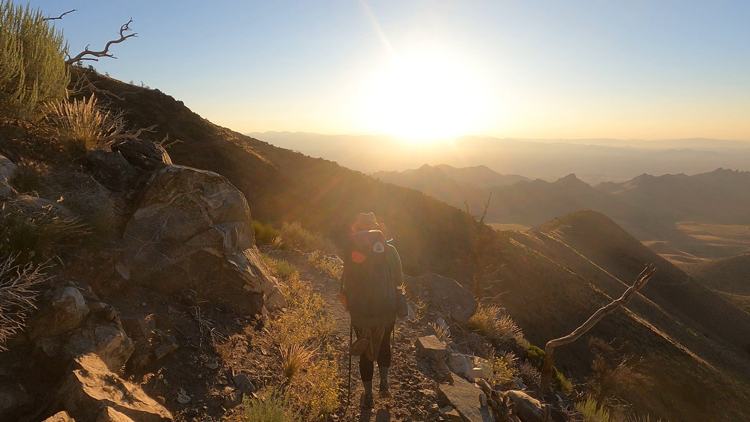
The stage today stays in the Owen’s Peak wilderness the entire time, winding northwest along the backside of the Mt Jenkins ridge before curling over a saddle and down into a small valley. From this low point the trail made it’s way over another small rise before descending again into a small confluence of two or three rivers. A highly appreciated facet of this stage is it marked the first time we didn’t need to do a long water carry or depend on water caches. Natural water is a wonderful thing to see. From the rivers a long rise, over 2000 feet, took us above a ridge east of Lamont Peak where it wound east before turning northwest and linking with the west side of a ridge then descended down to Chimney Peak campground which sits in a low meadow.
We woke at 5, trying to get an early start. In lake Isabella, we had heard that it was potentially going to be triple digits over the weekend. We were pretty high up but that didn’t mean we were exempt from the temps so early starts were the move. We ate some basic breakfast bars and other items before getting the tent together and heading out. We had both slept hard the night before and felt very refreshed. I love the idea of cowboy camping but I also love getting a full night’s sleep. We passed by a plack for Jenkins, who the nearby peak was named for and who had died doing trail maintenance there. The sun came up and things started to warm. We made our way down off the ridge a bit before regaining another saddle. Here someone had left a “25%” at the 662.5 mile mark to demark one quarter of the way along the trail.
I have to say here, if you look at the trail map you would only think we were 1/8th of the way complete because we do so much weaving and winding north of LA, but we are and it is a pretty awesome achievement. If we’ve made it this far, we can definitely do the rest.
We descended a bit before climbing again over a small rise and descending down to Spanish Needle Creek. On the descent, we had a run in with a pretty scheisty squirrel. At the bottom we took a break. Here we had a large climb ahead of us so we stopped for lunch and to fill up on water. I ate some more Homestyle Rice Crispy treats and other less exciting foods before filtering some water. I also took the chance to wash my sun shirt - pretty disgusted at how much dirt came off of it, before taking it back to where Amanda was relaxing to hang dry. After lunch we pulled on our packs. “Ready to embrace the suck,'' I said, smiling to Amanda. “Let’s do it,” she said.
We climbed for 2 hours in the hot sun. It was brutal. Amanda found an ear bud on the ground which I threw in my bottle holster before continuing on up. A mile or so on we ran into a Japanese hiker. Amanda told him about the ear bud at which point he reached for his left ear, a surprised look on his face. I pulled out the bud and gave it to him which put a huge smile on his face. We climbed on, going over several fallen logs. The climb went on and on and on but after another hour of hiking we came level to a pass and went through it. After passing through, we hiked another mile and took a quick break at a good sitting spot. Here Markus (Push-pop) caught up and I shouted “Is that who I think it is!!” The thing about Markus is, he takes breaks back in the bushes, usually napping for a few minutes so we typically pass him without knowing and then suddenly he will be passing us and we didn’t even realize we had gotten ahead of him.
We talked with Markus for a while before he carried on ahead of us and we followed after him, overcoming more groups of blow-down trees. We rounded the end of the drainage and turned north. There were a few groups of unknown hikers at the turn that we said hi to before moving on. From the turn, the trail started winding down and down and down. A wide valley developed on our west side and we eventually bottomed out and wound up and down before we came to Chimney creek. We crossed the creek and came to Canebrake road where we turned off the trail and headed northeast another 0.8 mile to Chimney Creek Road.
At Chimney Creek Road we found Izzy and Markus. Izzy was setting up her tent and Markus was sitting at the picnic table. We said hi and started setting up our own camp adjacent to them. I set up the tent while Amanda pumped water. As we arranged things, a friend of Izzy’s named Ben showed up from Bozeman with his chocolate lab Billy and parked his car. Amanda came back and we joined Markus, Izzy and Ben at the picnic table. Ben had brought beer, sausages and pasta to share - total savior. We ate and talked for a while trying to convince Markus to stay around but he was done with the desert and dedicated to getting out of it. The stage tomorrow is technically considered the last desert stage and Markus was rabid to get it over with.
Night eventually set in and Markus did leave. Amanda and I returned to our tent, got in and passed out. She has a rule - if I socialize, then no typing so I headed straight to bed listening to Izzy and Ben talk into the late evening.