7/5/2023
Section: Milepost 744.2 to 756.4
Distance: 12.97 Miles
Moving Time: 07:24 hrs
Elevation Gain: 2,352 ft
Click here for current location

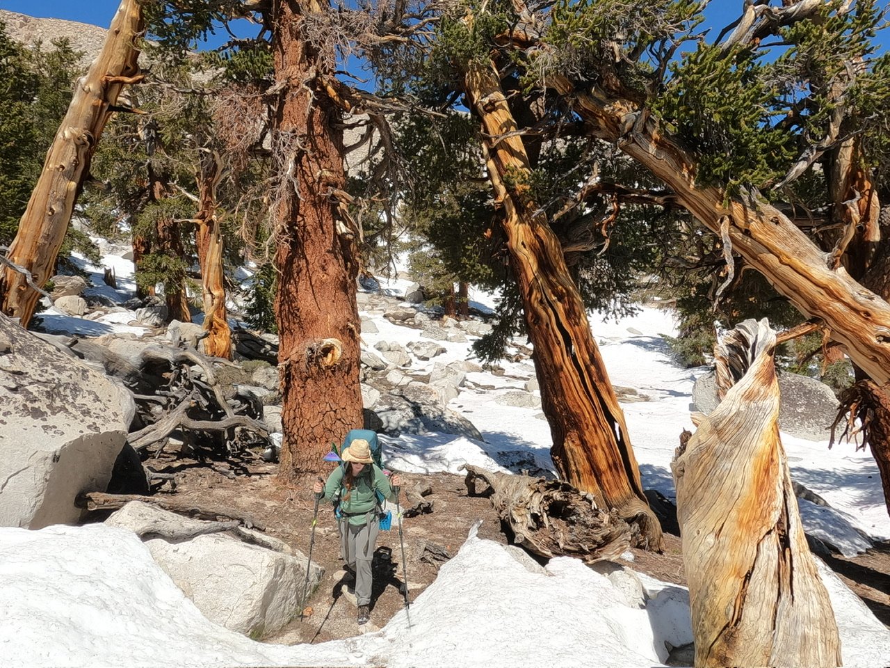
Yea… that mileage isn’t great. Not great at all. And it took us all day to do, so that tell’s you all you need to know about how our day went. We both knew the Sierra was still in a rough state coming in, but I was very optimistic about what we could accomplish. The “curve” I have been following assumes the whole thing is done on clean trails and we found something very different today - snow in patches every 25 feet. There’s nothing technical or scary about it but it is slow - I watched our mile time go from 24 to 27 to 33 to 45 minutes and it killed me. This is why about 95 percent of people from Kennedy were not even attempting the Sierra - too slow, too many things to carry, can’t do the typical 30 mile day anymore, etc, etc. If this is what is in store for the next 5 days then our plan of going all the way to Muir Trail Ranch is kaput - we would have had to carry about 15 days of food in and that’s just not practical so, looks like we will be paying a visit to Bishop. One small hope I still hold on to is that, after we do Whitney in two days the stages become completely snow covered - there shouldn’t be too much of this patchy stuff and the snow shoes we have lugged from Kennedy may become more of the silver bullet I was hoping they would be. They aren’t worth much right now - we would have to put them on and take them off every 5 minutes - but if the core Sierra zone is solid snow then they might shine. Really won’t know for another couple of days.
The route today starts out on clean, snow free trail heading east from Dutch Meadow and climbing west towards Mulkey Pass and then Trail Pass. These two passes are one of the first “outs” of the Sierra - trails you can take to get down to 395 and all the towns along it. Logistically, these “outs” are tricky because they are a lot of extra mileage and elevation gain/loss which is why I had wanted to skip them all together and just go straight to Muir Trail Ranch which sits almost on the trail. Anyway, after Trail Pass the route switches back up the north side of Trail Peak and circumnavigates it, passing Poison Meadow. From there the PCT travels north towards Cottonwood Pass and then goes around the southern end of Chicken Spring Lake before crossing into Sequoia National Park. The path then descends beneath Cirque Peak, crossing a number of cirques while doing so, crosses Siberian Peak Trail and ends in a flat high basin.
We were up at 5 today. My FitBit is killing me. The watch is way more of a lifestyle watch than an adventure watch. If it dies on me than the time is off and i have to sync it with my iPhone to reset the time. Only problem is, the iPhone has to be connected to the internet to do that and i haven’t had internet since Kennedy meadows so I’m perpetually 2 hours behind. I’m getting a Suunto when we get to our next town, and I’m hoping Fitbit will take this Sense back. Anyway - the 4 am alarm I had set wen’t off at 6 am when we were finally on the trail so that was super helpful and we got up closer to 5. I force-fed myself some Quaker Oatmeal - one pack is all i could manage before leaving.
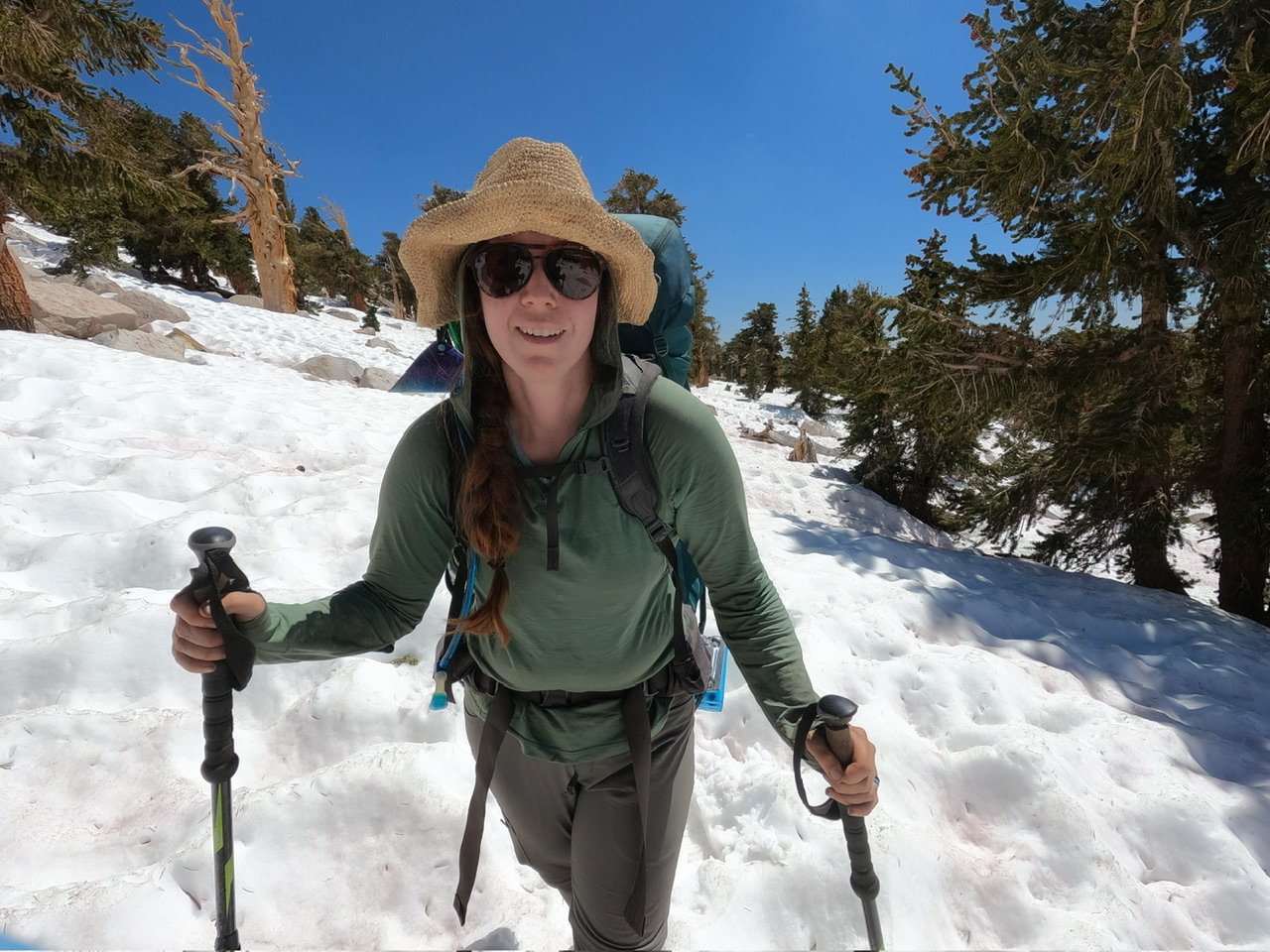
Wildfire, Amanda and I were on the trail around 6:30. He got that name, we found out last night, by accidentally setting his pants on fire last year when he did the first 700 miles from Campo so, good name. We wound up out of camp and soon came to Mulkey Pass and then Trail Pass. As we entered the switchbacks I heard voices above me and looked up to see a few people 2 switchbacks above. We carried on and eventually hit our first patch of snow. The boots are great in the snow, really painful to walk longer distances in but so much better for snow. As we came up the last switchback we ran into two girls filtering water. We said hello and kept going, them following close behind. The patches were pretty annoying but we were still hopeful as we dodged and climbed over them. A half mile on we ran into the rest of the 2 girl’s group. We had briefly seen them on arrival in Kennedy Meadows - they were leaving as we were arriving. Sounds like they went down to Lone Pine out of Trail pass. We talked a little bit and then let them go ahead as we were stopping to eat a quick snack - that oatmeal did me dirty. Soon after them Wildfire showed up, he had stopped to adjust his back and let us go on and we continued onward.
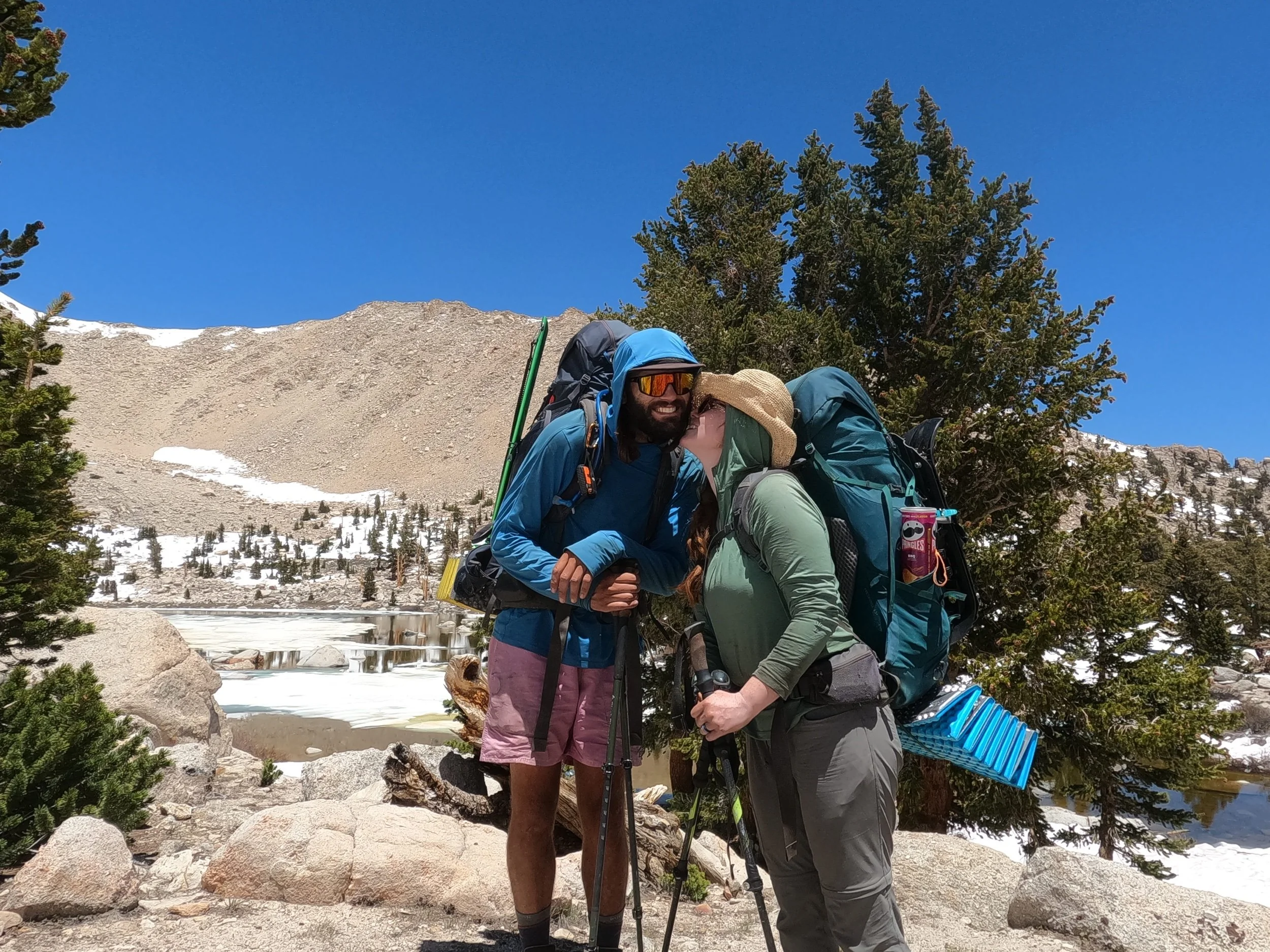
The rest of the morning we played hopescotch with both Wildfire and the group of 7. Half of their group was pretty fast but the other half was having trouble with the snow so we got spread out all over along the trail. I watched our mile time go down and down. I also forgot to eat until we got to Cottonwood pass which was several hours on so by the time we arrived I was pretty hangry. We also tried the snowshoes way earlier than we should have and they were very unhelpful and just cost us time. In any case, we got to Cottonwood pass and then Amanda and I decided to go on a little bit to a really nice alpine lake - Chicken Spring lake - where Wildfire joined us for lunch.
We talked about how irritating the snow was and how slow we were going before filtering water and traversing uphill to catch the trail again. From there we continued our slog through inconsistent patches of snow, heading down hill. Everyone took a fall today, no one was saved. At the National Park boundary I really wanted to get a picture of the sign, but it was still under snow or on a tree that had fallen so we continued on, devastated. We talked to the two Germans in the group of 7 - one was from Bonn and we told him about our time in Germany. We descended about 2000 feet and eventually came to the basin. We were ahead of Wildfire but some of the front runners from the group of 7 were setting up at a campsite near a seasonal stream. We caught Wildfire as he went by and deliberated on our next move. It had been a brutal day. There was a campsite 1.5 miles down trail but no mention of water. We decided to stay since no one wanted to drycamp and 1.5 miles was not worth the risk of that. The other thing is we are 11.5 miles from Whitney basecamp and, since we are all going to climb Whitney, an extra 1.5 miles doesn’t really do us any good, so we called it, having gone all of 12.88 miles. It’s tough to articulate how frustrating it is to come off weeks of 20+ mile days only to fight hard for less than 13 but we could all feel each other's frustration. Much of the talk around dinner that night was about what could make things better and maybe farther on the snow would get more consistent. It’s not that the snow is bad, it’s just these sections of trail, separated by huge blobs of snow, that make it massively frustrating. We will get a better feel for how well we can travel on consistent snow the day after Whitney and that will figure into our decision to go north of Mammoth. After dinner we all turned in, agreeing on a 4 am wake-up and that tomorrow would be better.