Day 39: Tehachapi Zero Day

Day 39: Tehachapi Zero Day

6/24/2023

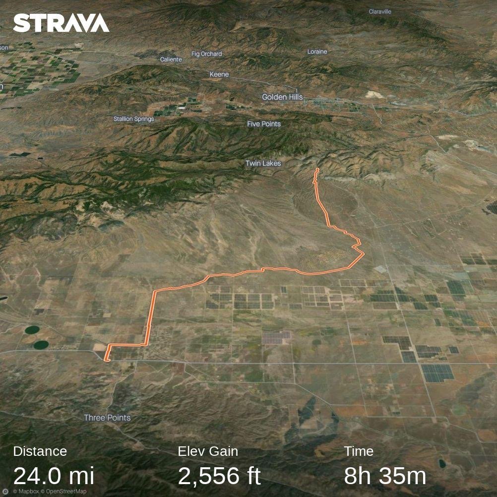
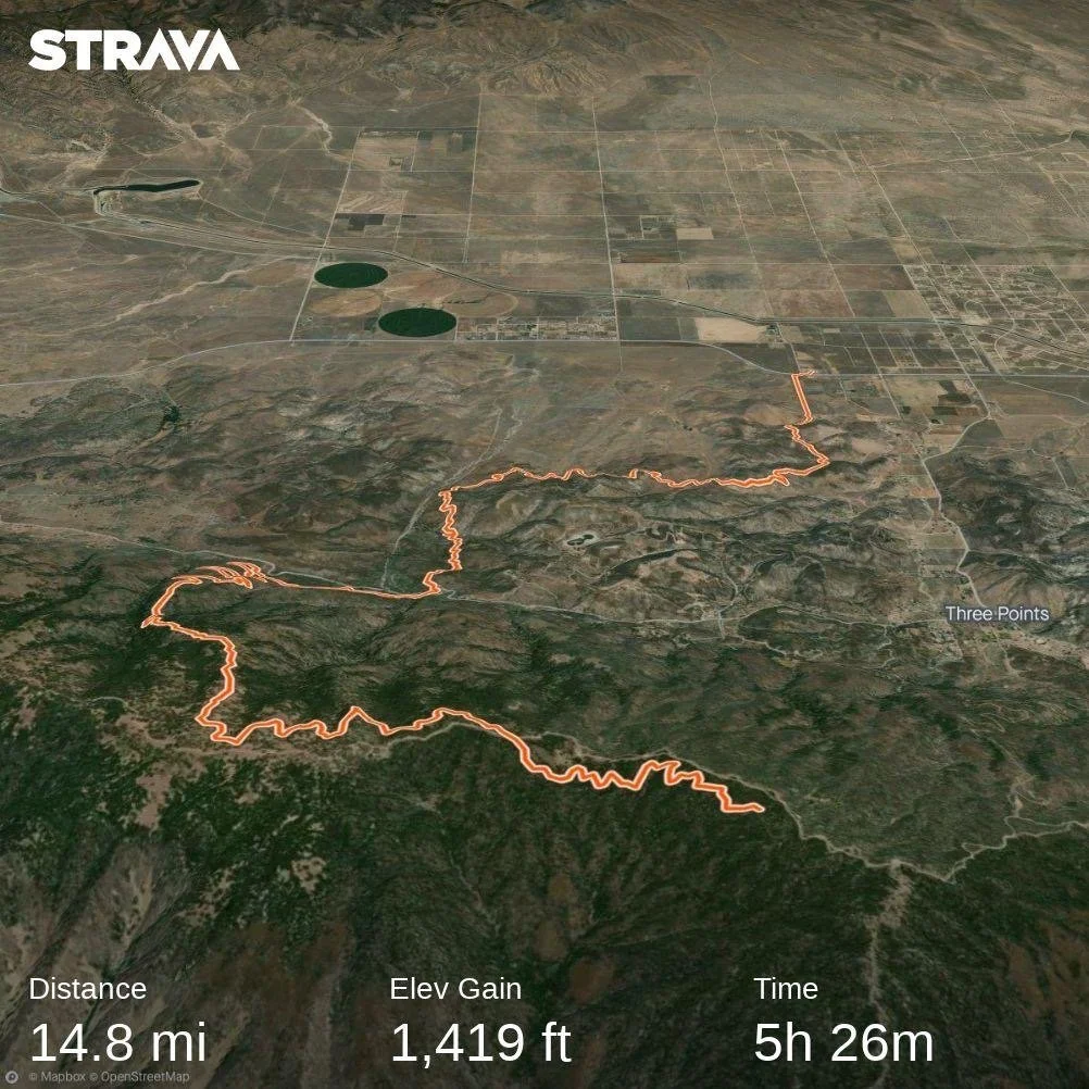
Section: Milepost 558.5 to 558.5

Distance: 0.00 Miles  

Moving Time: 0:00 hrs

Elevation Gain: 0 ft

Click here for current location

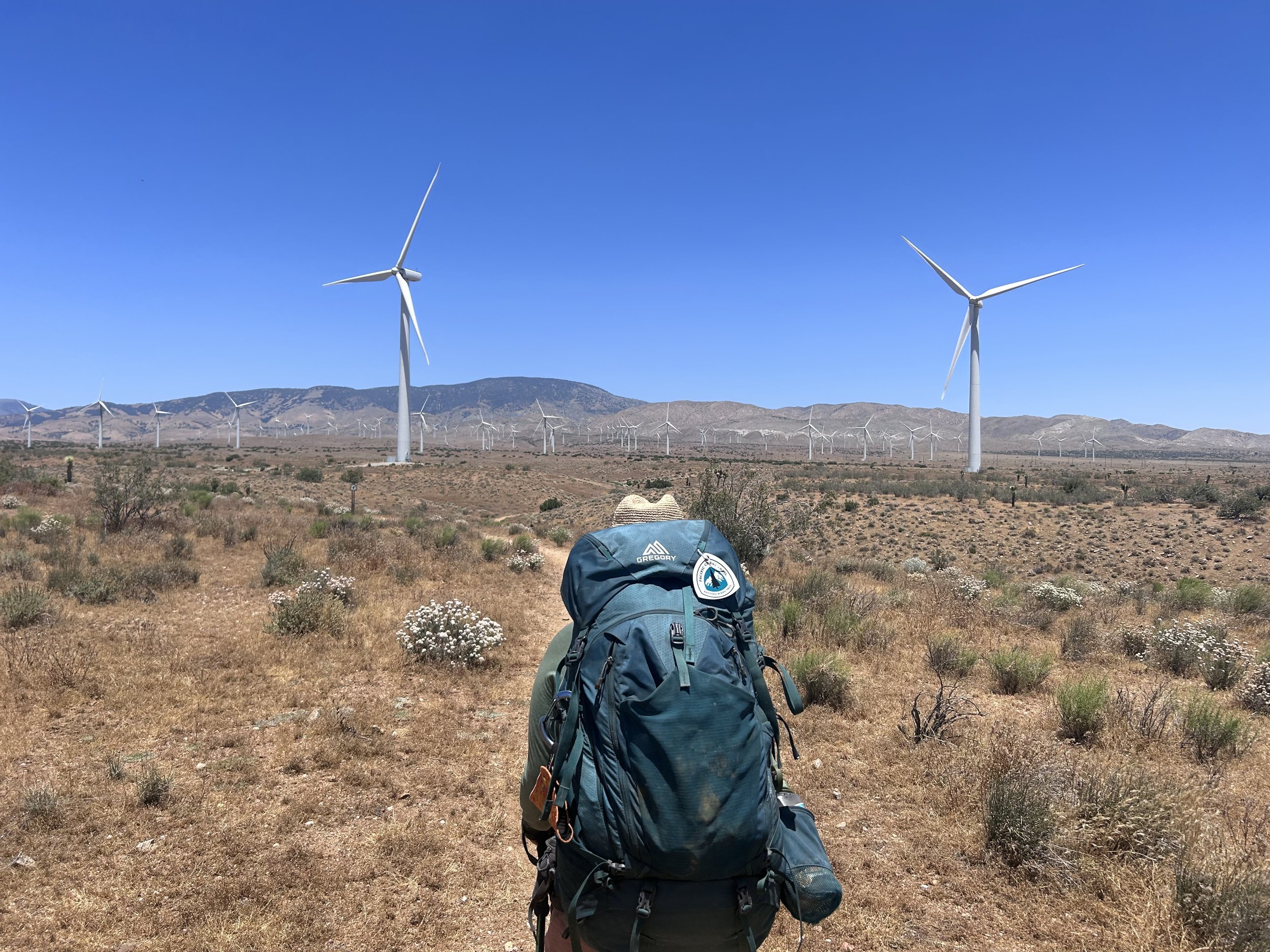
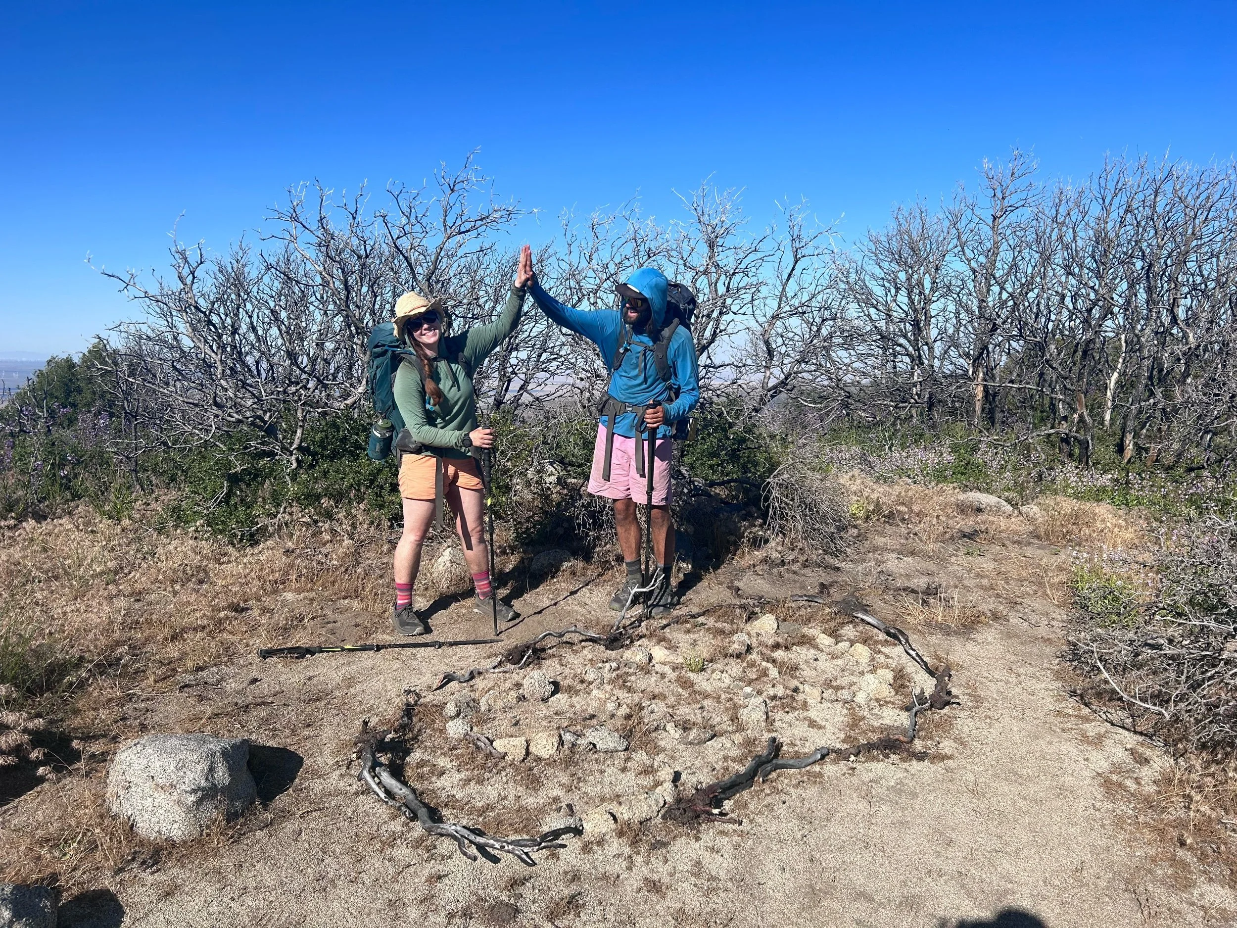
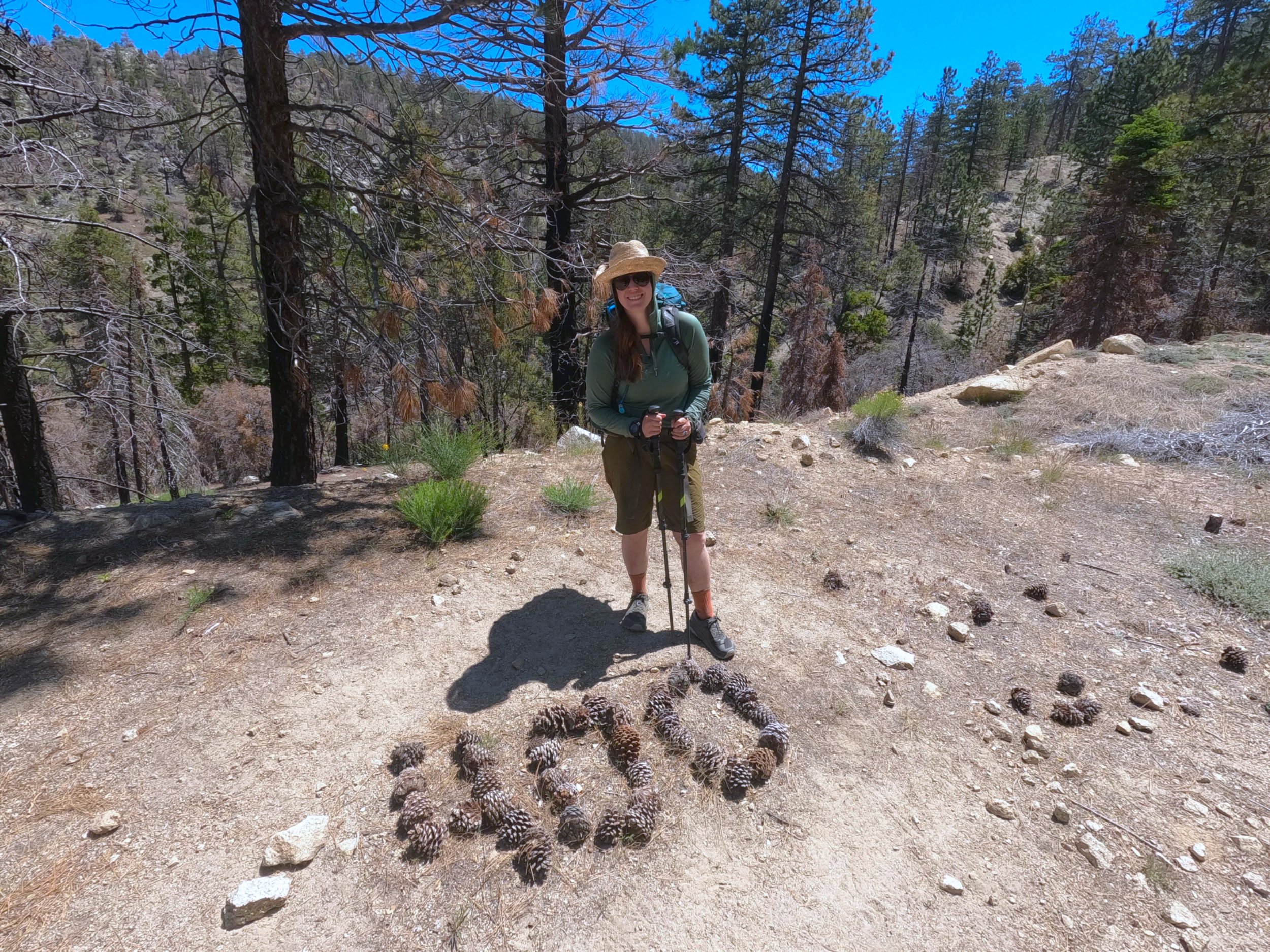
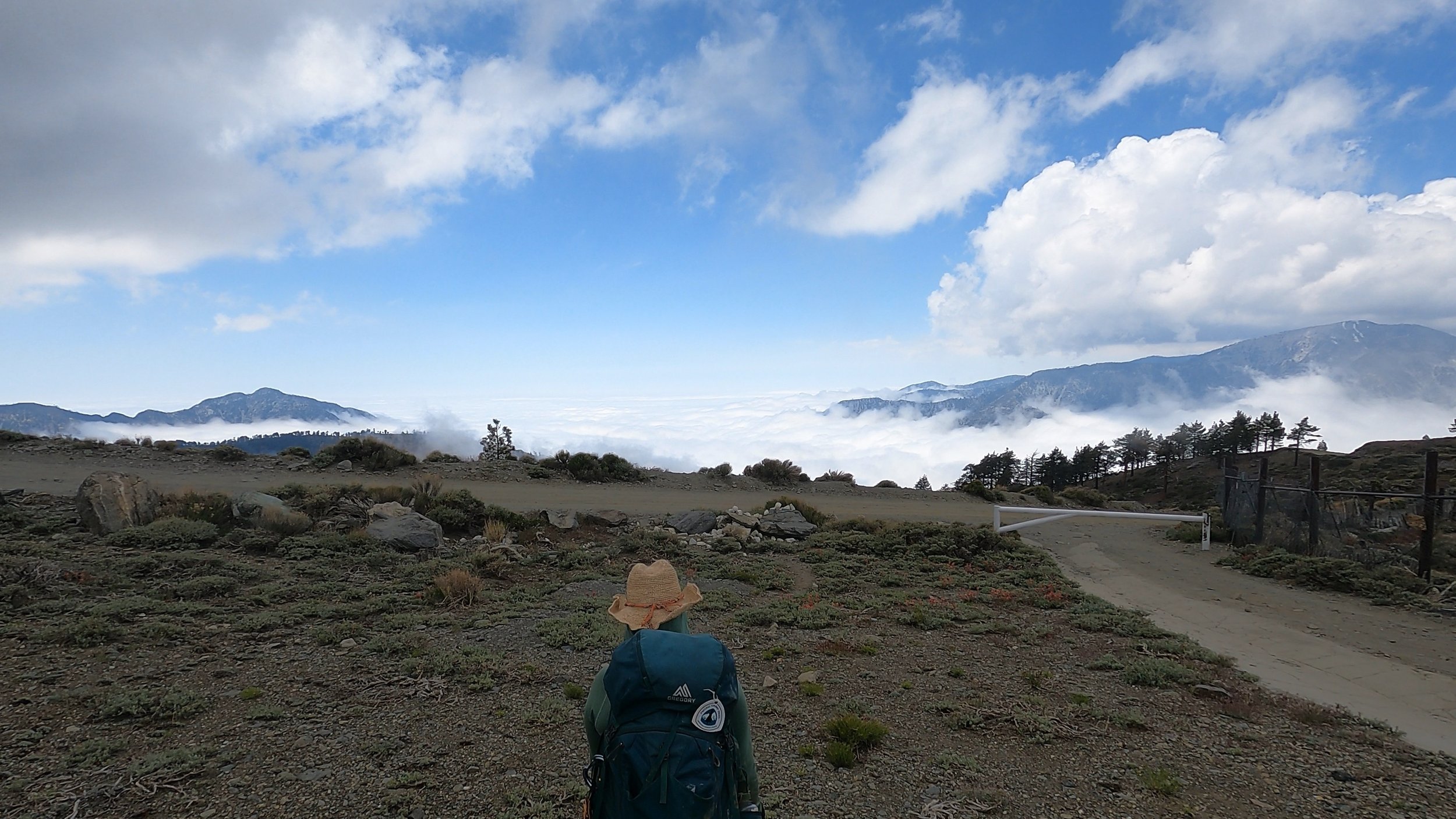
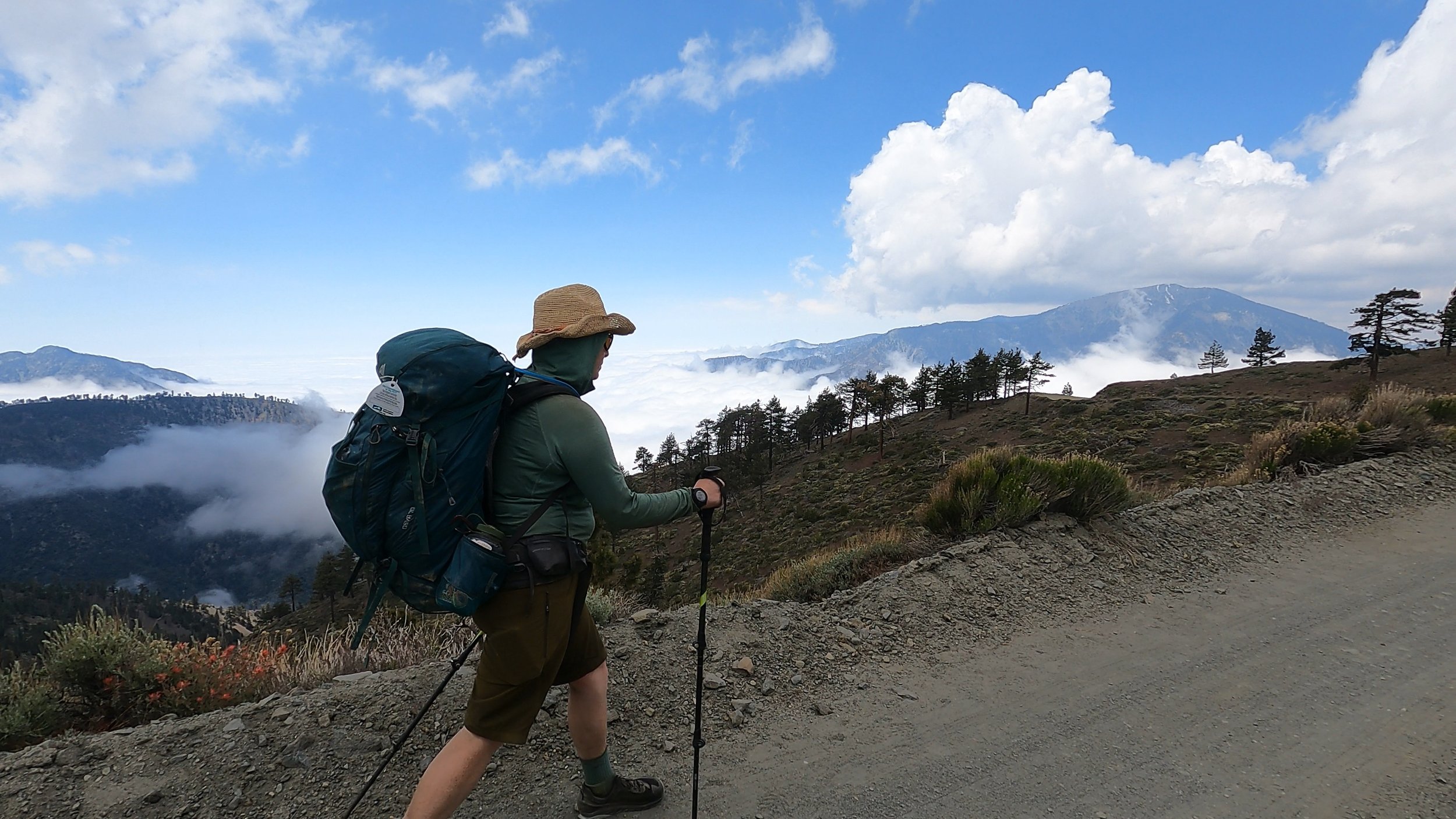
Going to keep this a little short and sweet because, due to some events that are in the story tomorrow, I have fallen a little behind on this blog and need to keep up. And, you know, it’s a zero day so just chores mostly.

Amanda and I woke up on a beautiful Saturday morning in Tehachapi. We had breakfast at the Best Western kitchen in the lobby with Sean before heading back up to our rooms to start the day. Sean stopped by shortly after to say goodbye as he was only Nero-ing. He had received a very large resupply box the day before from his wife and gave us half of it, including 4 freeze-dried meals and a bunch of snack bars. We tried to say no and that that was too much but he insisted he couldn’t carry that much and, since we hadn't resupplied, we agreed to take the excess off his hands. We also agreed to meet him in Kennedy Meadows where he was planning on leaving the trail to head up to Lassen and continue. 

After that Amanda and I split. Amanda was headed back to the post office to try and get her cousin Rachel’s resupply box (round 2) and I headed over to a nearby coffee shop to sync my GoPro media on what I was hoping was going to be a more open connection than the hotel’s. As I entered the coffee shop, I noticed Push Pop (Markus) sitting at a table. He waved and motioned me over. We sat and chatted for a while before he eventually left and I got to work on updating my blog while the GoPro sync’d up. I write up my stories on the trail in Google Docs but often don’t have the service to upload them until I am in town so I had a bit of a backlog to work through. It was about 15 minutes of diligent work before I looked down at my coffee and realized it wasn’t decaf. I have been avoiding coffee all-together on the trail and, on town days, try to stick to decaf, but it seems they had gotten my order wrong. “We’ll,” i said to myself “this should help with the blogging.” 

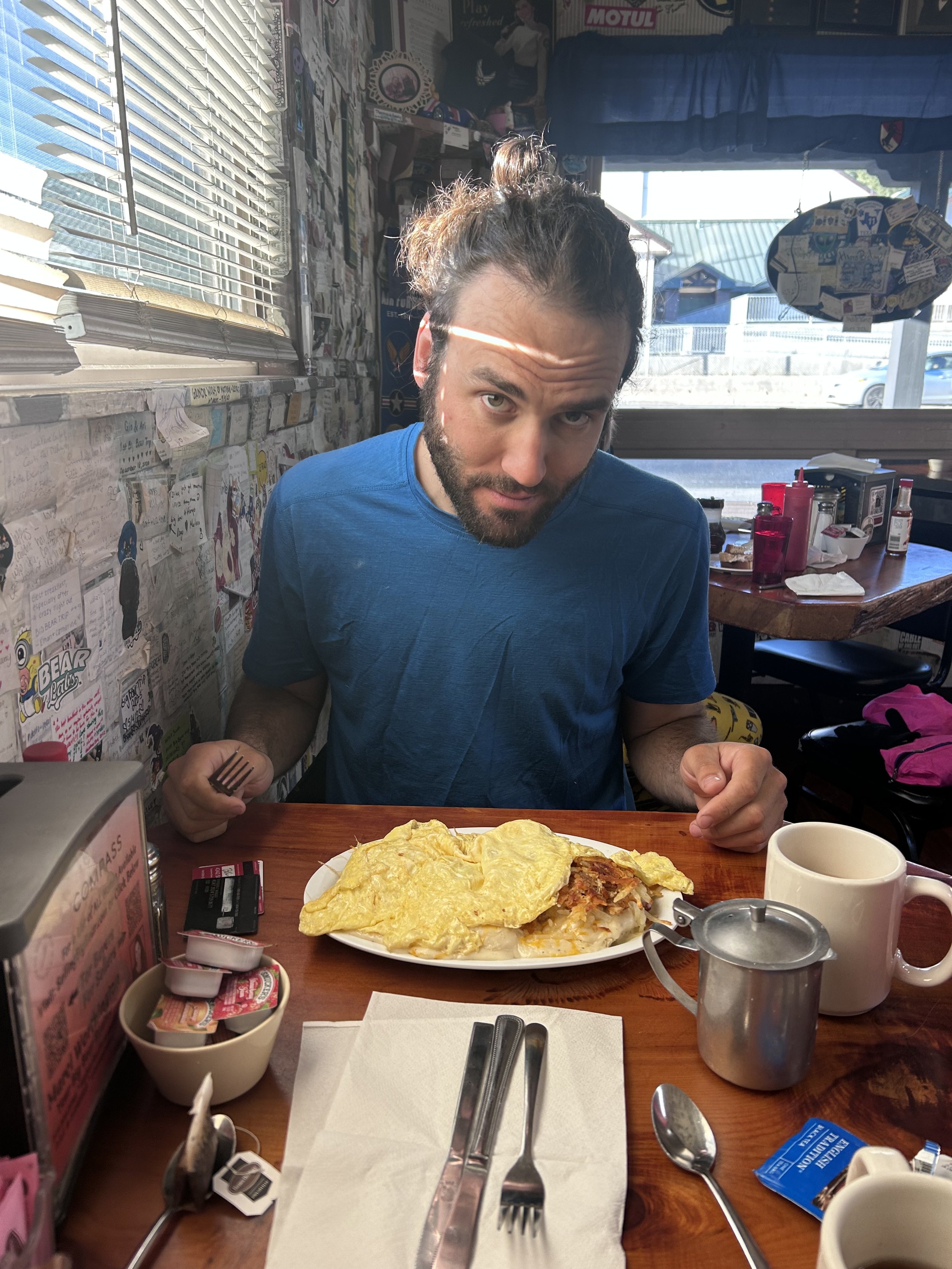
Two hours later Amanda dropped by. She had seen Jye and Vanessa and said goodbye to them. They were renting a car and heading up to the northern terminus. We decided to go to the German Style Bakery everyone in town was raving about and walked across the street. There I had a Cuban sandwich (super German) and Amanda had a turkey sandwich. We talked a bit about all the people heading off the trail and those staying on and about the rest of our day. After the meal, Amanda went back to the hotel and I went to get my beard trimmed up. The barber was on a quick lunch break so I waited for about 10 minutes before she showed up. She gave me a quick trim and told me all about her life before finishing up. I thanked her and paid before making my way back to the hotel. 

Once back, Amand and I headed to Walmart just on the west side of Tehachapi. There we loaded up on the few things that Sean hadn’t already provided us with and then heading back. On our way back we ran into Kevin and Alex who we had been hopscotching with us over the last few weeks. They said a bunch of people were in town and some were just coming in that evening and that they were headed to one of the 4 breweries in town. We smiled and wished them luck before heading back to our room and organizing our things. After parsing out all of our meals I took a soak in the tub and then Amanda and I headed to the pizza place in town - TK Pizza.

On arriving at TK Pizza we found the Kiwi’s already finishing up but they stayed to talk with us once they saw us arrive. We shared lots of stories about travel as well as our own backpacking adventures in New Zealand and about the trail so far. At around 9 pm we all decided to head back as Amanda and I were trying to get a pretty early start the next morning. The kiwis were staying in Tehachapi for two days to rest up but we told them we hoped we would see them down trail.

Back at the hotel, Amanda and I took another soak in the hot tub, enjoying the warmth before packing back up to bed. This will probably be the last time in a while before we are in an accommodation like this again - likely Mammoth which is a good 3 weeks down the trail!

Day 38: Turbine City!

Day 38: Turbine City!

6/23/2023

Section: Milepost 541.5 to 558.5

Distance: 17.19 Miles  

Moving Time: 06:26 hrs

Elevation Gain: 2,604 ft

Click here for current location

The stage today winds east, up and out of the small river depression we were delivered to the day before. At mile 544.5, it descends into another river valley before winding ~1700 feet up to the top of a north running ridge. On top, the path ambled across a number of low summits before turning northeast and easing itself down to the Tehachapi Willow Springs Road. My itinerary had us going beyond Tehachapi Willow Springs Road to Highway 58 but Sean and others were getting off at the earlier road and so we decided to do the same.

We woke up at around 6 am. The wind had been insane the night before, howling through the oak tree above our tent from about 11 pm to 2 am. I have been scarred about wind in tents since I took a group of friends up to the Bugaboos in British Columbia a few years back and we got caught in a massive thunderstorm. At the time there had been no good way to stake the tents on the granite shelf we were camping on and the whole thing was quite a catastrophe so last night's wind kept me staring up through the mesh at the waving limbs above us the whole time. To compensate, we slept in and several groups, including Push-Pop and Sean were up and out before us. 

Once we had eaten and packed up, we beelined directly up the hillside to rejoin the trail. Looking back, i could still see Jye (Tit Punch) and Vanessa (Sugar Momma) packing up. We hiked in relative silence most of the morning, but occasionally commented on the crazy wind and the far off turbines. At one point on one of the many dips into a side valley, I caught a glimpse of a lizard we had been looking for for some time. This was a Leopard Lizard. We had talked with Sean about another lizard, the WhipTail Lizard, which seemed to have some very “Leopard-like” markings on it’s side but he had assured us that was the Whip Tail, but today, as we meandered along under the warming sun, we caught a much larger lizard with leopard print skin and took a picture to confirm with Sean later.

Shortly after our lizard encounter, we came to the edge of a ridge and looked down to see switchbacks disappear below us only to reappear on the far side of a small valley. Deep below, at the bottom, we could see Sean’s tell-tale blue Patagonia running shirt making its way up the switchbacks on the other side. I took out a cliff bar and started munching as we made our way down into the valley. At the bottom, we crossed and began our climb, begrudging to a small degree how late we had started. The sun wasn’t even that bad which made me muse about what this hike must be like in a true, hot California summer. We climbed on and eventually caught up to Sean, who fell into step behind us. We excitedly told him about the Leopard lizard which he had also seen and confirmed that we had the species correct this time. We walked on, crossing through the long series of low summits on the ridge, talking on and off.

Far behind us we could see Jye and Ness just reaching the descent into the valley. We traveled on and eventually came to “the Oasis.” Here, on this little, random patch of land a group of trail angels had set up a picnic table with chairs and repository boxes for books and snacks. Delightedly, we sat and relaxed for a while, taking the chance to snack and refill water at the drums that had been left behind, all commenting on what a wonderful stop it was. We stopped for so long that Jye and Vanessa caught up to us and joined for a while before we headed out. Walking on, we continued to meander through the low summits of the ridge, still very much in the desert but a little higher than before. As we headed north, the wind turbines that dominate Tehachapi pass could be seen and, as the sun began to come down from its noon high, Jye and Vanessa caught up to us and joined our little group. Sean, Jye and I talked as we walked while the girls talked behind us. Jye and I talked about van life and our mutual love for wind turbines as the trail began to descend toward the Willow Springs Road. At one point, a day hiker came up going the opposite direction and we all said hi.

The trail continued to wind down, in a seemingly endless fashion as we entered the domain of the wind turbines. Looking up, these turbines were noticeably older than those we had walked amongst the day before with smaller blades and older looking bodies. Far off in the distance we could see an entire array of much smaller turbines spinning at much lower speeds. Jye and I talked about future plans on the trail. It sounds like both him and Vanessa are going to rent a car and drive to the Canadian border tomorrow to begin traveling SOBO as this is the typical time when most of the SOBO hikers are starting. I told him that was awesome and told him all about my favorite parts of the North Cascades. 

About an hour more finally brought us down to Willow Springs road and, at Jye and my insistence, we both crossed briefly to read the informational signs on the wind turbines themselves. It was an informational sidequest that I think we all appreciated in the end. Turns out Tehachapi was the site of an American wind turbine uprising, being one of the predominant sites of wind turbine development in the United States. There - I bet you just learned something awesome about wind turbines that you didn’t know before. Afterwards we moved out to the highway and put our thumbs up to see if we could get a ride. Sean looked at us all with our thumbs up in the air and laughed as he told us we were supposed to point our thumbs in the direction we wanted to go, not straight up and asked who had taught us that. “We learned it from your generation Sean!” I said with a grin to which he just laughed. A long line of cars went by without so much as a turn signal or brake light. “Tough crowd today,” Jye said. As the cars passed, the day hiker we had seen earlier crossed the road, looking at us curiously. He came over and asked if we needed a ride. We told him there were 5 of us as he pointed to his Lexus sedan. He assured us it wouldn’t be a problem and we all migrated over to his car. The boot of the car was surprisingly large and we smooshed our way into the back seat giving Sean the front. The Lexus was maxed out but it made its way down the pass just fine. The day hiker’s name was Dillon and he was from Idaho completing an internship in Lancaster as an electrical engineer for a wind turbine company. He took us to the post office where Amanda and I were expecting a package from Amanda’s cousin Rachel. Sean was also looking for a package from his wife. The post office staff was able to find Sean’s package but not Amanda’s, much to her chagrin. We committed to trying again the next day as we were zeroing in Tehachapi and went about calling an Uber to ride to the Best Western Plus where Amanda and I had used some credit card points to book a room. 

We arrived at the hotel, dropped our things and scrubbed ourselves clean before all walking down to Red House BBQ which many hikers before us had raved about on FarOut. We loaded up on classic bbq and I tried a few beers on tap. Jye and Vanessa joined us later and we apologized to Jye as he was a vegan but all of us had forgotten when choosing a place to eat. He seemed un-bothered by it and we talked late into the evening. Vanessa was a purser on a super yacht for a family down in Tennessee and had all sorts of fun tails from her job. We shared tales of our many travels and eventually we all realized how tired we were. We walked back to the hotel, stopping at a gas station (which Jye referred to as a “Servo” in Australian English) for some ice cream bars and other snacks. 

Back at the hotel, Amanda and I went out to try the hot tub for a bit before returning to our room to pass out on the wonderful mattress.

Day 37: The LA Viaduct

Day 37: The LA Viaduct

6/22/2023

Section: Milepost 517.6 to 541.5

Distance: 24.07 Miles  

Moving Time: 08:35 hrs

Elevation Gain: 2,556 ft

Click here for current location

So much had been said about this day. It is supposed to be, if not a beautiful stage, one of the more iconic ones. The LA Viaduct is a large underground pipe used to shuttle water around California and the PCT walks on top of it for a span of around 20 miles. In the early parts of the stage, the viaduct is above ground and the riveted panels that compose it are a notorious site referenced in many PCT blogs and stories. Typically, Antelope Valley, through which the viaduct runs, is extremely hot. At this point, in late June, it is not uncommon to see triple digit temperatures here but, as Sean and I had said to each other countless times yesterday, this was not a normal year and today temperatures were expected to be in the high 60’s. This was extremely fortunate for us because it really allowed folks hiking today to start whenever they wanted without fear of getting stuck without water in the middle of the 14 mile carry. This might have been why, despite Amanda and my best efforts, the 3 AM start time was actually 5 am.

We woke up and were ready by 5. I technically could have been ready at 3 because that gas station hot dog I ordered after the burger was not jiving with my stomach. I had gotten up at 1 and stepped outside, noting a massive red meteor in the sky, or a jet with afterburners on, and made my way to the restroom. We probably should have just gotten up then because I woke Amanda up anyway but we went back to sleep and got back up at around 4:15 instead.

We grabbed two glow sticks and I wrapped mine around my neck. It wasn’t truly an all night hike but might as well enjoy the early hours of the morning with some fun light tricks. All the other hikers today were going to start around 6 so we got a little jump on them. We crossed 270th Avenue and climbed a small berm on the opposite side before heading out on a long stretch north. We stopped and filled our water bladders to 2 liters at a small spigot before turning east again. Here, the aqueduct came into view next to us - a 20 foot wide span of water flowing lazily east with us. Eventually the straight lines we were following started to deviate a little bit and the aqueduct came to a stop. Here the trail turned north and continued on seemingly forever its surface now the iconic black metal, riveted section of viaduct. We began walking on the viaduct. Amanda commented that walking on the rivets felt like a mini massage. At one point we crossed over a gravel road intersection high above on the viaduct- i think PCT hikers were meant to get off and walk the road a bit before this but Amanda and I were committed.

As we hiked on, the viaduct eventually went completely underground and sections became concrete covered. Things started to get monotonous. There was no elevation change and very few directional changes. The few cars that came by became big events as we both became highly excitable at the smallest things. At mile 535 we came across our next water source. This was cottonwood creek and faucet and we stopped to fill our waters. Shortly after starting to enjoy our break Jai and Ness joined us. They had started about 30 minutes after us. Jai believed we really had started at 3 and incredulously asked what we had been doing all morning. He gave a laugh when he found out we had started at 5. Markus (Push Pop) showed up and then Sean as we were disembarking. We said good bye to everyone and that we would see them up the trail. We hiked on into the wind farm section of the viaduct and our voices were quickly drowned out by the subtle roar of about 100 turbines running above our heads. We walked in the roar for another 3 hours, the trail continuing on in its boring, straight trajectory until we had left the turbines behind. We wound our way up to a creek where a very nice camping area was located. Amanda and I set about putting our things together in the shade of a wonderful old oak tree. Jai came by as well as Ness but decided to camp further up the trail. We said we might join them before I settled down to write and make dinner. It was our longest day so far and also the flattest but it marks the beginning of the end of the desert. In 9 days we would be in Kennedy meadows and that will be it for the desert. Crazy that we have been on this trail for a month but what an experience it has been. 

Day 36: Hikertown Bound

Day 36: Hikertown Bound

6/21/2023

Section: Milepost 503.0 to 517.6

Distance: 14.80 Miles  

Moving Time: 05:26 hrs

Elevation Gain: 1,419 ft

Click here for current location

Today was pretty short and sweet and it had the benefit of ending in one of the most fascinating camping sites along the trail - Hikertown. The stage winds its way in a sort-of sideways “U” fashion ending the same longitude as it started but about 5 miles north. The path begins in the Angeles National forest and descends throughout the day until it is level with Antelope Canyon so that, tomorrow, we can cross the valley at one of the lowest points on the PCT and begin our climb up to Tehachapi. 

We woke…well, I woke around 5 and got up before eating my morning pop tart and watching Amanda slowly make her way out of the tent. After a bit of delay we joined Sean on the trail at around 6:45 (so, you do the math there) and were on our way. Amanda led and made great progress on a fairly level trajectory for the first 5 miles. The trail wound through medium oak trees and we saw limited people save for Collin, the French guy we had camped with a few nights before. Sean, Amanda and I talked about a lot of things from healthcare to habitats as we wound our way east and then North. 

At mile 506.5 the trail turned abruptly north and began winding down the grade again towards an intermediate plateau between the Angeles mountains and Antelope Valley. At the plateau, we followed a road and crossed a stream where we said high to the Collin who was filtering water and took a quick break. From the water stop we pressed on, eventually climbing a short bit and crossing the road. Sean told us all about a tree off the trail that had the largest nut in North America -the Buckeye Tree. After crossing the road, we wound through some low, grassy hills. The trail made some maddening twists and turns back on itself before eventually dropping us all the way down to the valley floor. Here, the trail straightened out and made a beeline north towards highway 138. The path widened and Amanda, Sean and myself were able to almost walk next to each other.

The trail dumped out on highway 138 and kitty corner to our exit we could see the ~2 acre complex of quirky miniature buildings that we knew to be hiker town. We waited for a break in the semi-trucks and ran across before crossing 270th street and climbing up the berm to enter hiker town’s gate. 

Once inside we were met by a zany miniature town of cartoon houses surrounding a double-wide house and porch on which a few hikers were already sitting and talking. We took note of a sign offering free rides up to Neenach market where you could do a lite resupply and get some food. As we rounded the porch we were called over to a garage/living area where a younger and older woman were already getting drinks and snacks going for Akira and Collin. I got a Tecate and Amanda and Sean got coconut waters. We sat and chatted for a while. Amanda prepaid for 2 showers and got us a stay in one of the whacky cabins then Sean called for the free Neenach market ride while Amanda and I put our stuff away in the cabin. By the time we were done the ride had arrived. We headed over and found Sean waiting in a golden, late 90’s Windstar van with a grumpy looking driver. We got in and Collin and Akira joined us, filling out the car. 

The ride took about 5 minutes and, as we exited the van, a set of 4 hikers got in, telling us we should get the hiker burger. We thanked them and entered the market like kids in a candy store. In our first round of purchases Sean got 3 Fantas, Amanda got 1 and I got a grape Fanta and a Stone IPA. We ordered a burger each and I went with jalapeño poppers over fries. Outside we found that Sean had already downed 2 Fantas and Amanda got to work on our own. Coming down out of the mountains today Fantas were a huge point of conversation so we were excited that Neenach market not only had them but had the cool old style Mexican Fantas. 

We talked for a while and found out that Akira was a truck driver in Japan and had heard about the trail on an apple podcast and had decided to do it. Our names were called and we got our burgers. They were excellent and came with a spare slice of ham bundled up inside. We ate in near silence for a few minutes after which we commented on how great burgers were. After we were done all of us made independent, haphazard trips back into the store to get a number of things including ice cream and circus peanuts. After we were all set, the driver took us back to Hiker Town and we congregated on the porch for the afternoon. I should say, I congregated while Amanda actually did chores which needed to be done, including her laundry and took a shower. 

A group that has been a day or two ahead of us for a while was at Hiker Town and headed out for the night. Night hiking wasn’t really necessary this week because of the unseasonably cool weather in Southern California but hiking the viaduct at night has become something of a tradition so many people still do it. This group was definitely getting amped up for the hike, downing 4Locos and smoking a ton of pot. At about 6 they finally got in gear and about 10 hikers headed out for the trail. One girl stayed behind, referencing a pain in her knee. She was going to hitch to Tehachapi and wait for her friends while she recovered. We talked some more and then Amanda and I headed to bed thinking we were going to try and get up around 3 and at least hike half of the viaduct in the dark. We said good night and I ran around to trying find Marta, who ran the place, to see if she could let me in to take a shower even though it was after hours. I got lucky and she let me take a quick shower after which I took some pictures of the little cabins and tried to write but it was getting late and I quit a little bit after starting. Finally, I laid down on a real mattress next to Amanda and fell asleep. 

Day 35: Poodle-dog Bush Dodging

Day 35: Poodle-dog Bush Dodging

6/20/2023

Section: Milepost 481.3 to 503.0

Distance: 18.35 Miles  

Moving Time: 06:46 hrs

Elevation Gain: 3,567 ft

Click here for current location

The stage today travels northwest all day and maintains within the boundaries of the Angeles National Forest. We were treated to beautiful views north of the Antelope Valley through which we would be crossing in 2 days via the Los Angeles Viaduct. The weather is unseasonably cool right now and has been since we started, for which we are extremely lucky and grateful as it looks like it will hold through our day on the viaduct. 

We slept in this morning and weren’t on the road until around 7. As we were packing up a hiker came up and said hi. His name was Han Solo as his last name was actually Han and he generally hiked alone. We talked to him for a while and then followed him out on the trail, a few minutes behind. The trail followed a ridge and forest service road for another mile before jumping both the ridge and road and descending a drainage down to Lake Hughes Road. As we descended, we passed by an older couple trail running and continued to wind in and out of depressions in the ridge to maintain a steady descent. The trail delivered us down to Lake Hughes road where some hikers choose to hitchhike into town to resupply. We did not need a resupply but did spend a little time at the trailhead hiker cache where I found a Pacifico and slipped it into my bag, Amanda rolling her eyes at me as I did so. As we left, I sent a few bucks via Venmo to the trail angel managing the cache as a thank you.

We crossed Lake Hughes Road and carried on up the first of several climbs today. As we climbed we saw Han Solo talking with someone in blue about 100 feet above us on a switchback and we carried on. As we came up to that switchback we were delighted to see Sean waiting for us. “I thought I saw you guys coming up so I waited!” He said as we both shouted “SEAN!!” We asked him about his stay as he had resupplied in Lake Hughes. “Good,” he said in response, “except I forgot yesterday is now a holiday and I got locked out of my airbnb!” We all laughed and carried on up the trail excitedly telling Sean how we had seen a roadrunner near Vasquez Rocks the day before.

The trail gained a ridge and maintained that ridge as it passed through new growth around a large burned area. The path under our feet was mostly sand, charred black in places. As we carried along we saw a lot of the plants that grow first out of a fire area in the desert such as Manzanita bushes. Another plant that was becoming more numerous and concerning was Poodledog Bush. Amanda, Sean and I had never heard of this notorious plant before hiking the PCT but it is mentioned highly in the commentary on FarOut and Sean had looked it up in Lake Hughes. Evidently its leaves have hairlike follicles that prick your skin as you go by causing a Poison Oak like rash. The weird part, Sean said, was that you could be pricked in one place and get a rash there and then get pricked a year later in a different place but the rash would come back in both areas - the new and the old. “Kinda like a zombie rash,” Sean added with a grin. 

As we came around a bend we were suddenly met with a section of trail inundated with poodle dog brush. “Walk carefully,” Amanda said before setting off. We picked our way through the patch, attempting to avoid contact. Sean had full length pants on but Amanda and I were both working with shorts so we made extra careful to not let the Marijuana looking leaves touch us. We made our way out of the patch and then carried on… into another patch and another. After 2 or 3 patches we came across a stump with a handwritten note stating “Fear not, trail crews have cleared Poodledog brush from here on out,” and they sure had. As we came on another section, there was clear evidence that bushes near the trail had been cleared of the bush where it impinged on the trail.

A few miles on we actually ran into the trail crew. 2 groups of about 15 people each were busily doing trail maintenance under the supervision of a ranger. We thanked the mostly young faces as we went by telling them the trail looked great. They smiled back and told us good luck. We came to a parking lot,  arriving on a freshly groomed trail to find 3 passenger vans with a logo stating the trail crews were volunteers from William S. Hart Union Highschool - so thanks for all the hard work William S. Hart Union Highschool!!! 

We carried on along the ridge and took a quick break at a forest road crossroads to have a snack before our final climb of the day. I am now taking large bites of pepperoni and then cheddar cheese to get a real charcuterie board effect in my mouth - it works. After our snack we started our climb. About 2 miles in we came across the 500 mile marker and stopped for some pictures and then climbed on. At the top we came to a road and a cistern where Amanda and I traded water bladder for tent and she went on to find a place to stake it. Sean and I met a Slav and Czech guy that Sean had told us about on top of the cistern and we talked for a while. The Slav was from Bratislava and was named Sam, the other guy's name I can’t remember but was from Prague. They were both nice to talk to. We talked about beer and how the Czech’s have the original Budweiser while pulling water out of the cistern.

After water filtering Sean and I made our way down to camp. Amanda had staked out a spot just up from Bear Campground which was an old abandoned campground we were targeting. She said that there were no good places and lots of red ants so she had come back up the trail a bit to find these spots. We settled down for our evening activities and talked while eating dinner. I pulled out the Pacifico telling Sean i had found it at the hiker box near Lake Hughes Road. He smiled and said “That’s good since I put it there!” Evidently, Sean had stayed with William’s group and gotten more trail magic the day before from William’s dad and encouraged the last of the Pacifico’s be left at the Lake Hughes Road hiker trail box. After dinner, Sean gingerly got into his sleeping bag, as he is still trying to heal his tailbone and I did my nightly exercises and yoga. The spot Amanda had picked was right near a large patch of beautiful red flowers which Sean said the hummingbirds loved and I had to agree as I watched about 15 male hummers viciously (as viciously as a 2 oz bird can be) fight over the patch of red flowers. Afterwards I came back for some reading and much needed sleep.

Day 34: Hiking in a Cloud

Day 34: Hiking in a Cloud

6/19/2023

Section: Milepost 463.9 to 481.3

Distance: 18.72 Miles  

Moving Time: 07:18 hrs

Elevation Gain: 2,657 ft

Click here for current location

So, I will be the first to admit, today’s stage has been my least favorite so far. We hiked in a cloud most of the day. Sean had told us a few ways ago that this summer has been cooler than usual so far and because of this, the marine layer off the Pacific travels further inland and sticks around all day. I truly feel bad for the folks in Santa Barbara or LA - I don't think there has been a single day on this trek since starting in mid-May that we have been able to see west down to the coast - it’s just been a solid wall of fog. Well, today, we got to walk in that wall of fog…almost all day. The stage today spends the entire time in the Angeles National forest traveling almost perfectly northwest all day. The only significant road crossing was the San Francisquito Canyon Road about 3⁄4 's of the way through the day.

Amanda and I woke around 5:30 am in a cloud, still tired from our late arrival the night before. I finally had my puffy so I threw that on, instantly compensating for the lost warmth of my sleeping bag. We packed up and ate a cold breakfast of…POPTARTS and then were on our way.

The trail meandered down from the ridge we had camped on the night before to the Bouquet Canyon Road - not really a canyon per say, but a nice, small road. From there we started our first climb of the day out of the road, the path painfully gaining very little ground over a long distance. With more food we were able to better regulate our blood sugar but, because of the bleak environment and not being able to see out very far, we were both less than our usual energetic selves. 

We continued on for the first half of the day with little worth noting. FarOut, the app we were using to get intel on the path ahead, had indicated that there was very little water, so we carried 3 liters apiece to get to a fire station on the San Francisquita Highway but that info turned out to be far from the truth as we passed about 10 streams throughout the day. Eventually we arrived at the fire station and searched around for a spigot. We ate some snacks before I screwed the Sawyer filter directly onto the spigot and filtered into our platypus’s (platypai?). While doing this I was stung by a fire ant but I did not retaliate against this act of violence because violence begets violence. I did verbally assault the ant but it didn’t seem to care. The sting still hurts even now that it's been 6 hours.

After we filled our water bags we delayed for a bit more before pulling our backpacks back on and heading up the trail. From the station the trail climbed up to a notch in a ridge where we passed through and suddenly, as if a curtain was pulled up on the world, we were able to see North out into the Antelope Valley - an amazing view after the blandness of the day. 

We hiked on another 4 miles before finding a camping spot near a forest service road. Campsites were strangely rare in this section of the trail but a few unofficial spots were scattered here and there. We set up camp and had some ramen for dinner before completing our typical evening activities and settling down to sleep. A meh day on the trail for sure, but those are bound to happen occasionally. 

Day 33: Thief in the Night

Day 33: Thief in the Night

6/18/2023

Section: Milepost 444.3 to 463.9

Distance: 20.91 Miles  

Moving Time: 09:01 hrs

Elevation Gain: 4,132 ft

Click here for current location

I woke at 2:30 this morning to the sound of rustling at the base of a tree 5 feet from our tent against which Amanda’s backpack was leaned. Silhouetted against the grainy light of a street lamp in the KOA, I saw a masked bandit tugging on a bag of Whisps which Amanda had strategically located in her easy access pouch for the next day’s adventure. I quickly reached over to the opposite side of the tent for a headlamp and flicked it on to reveal the inquisitive eyes of the raccoon staring back at me. He started coming towards me to which i said “No, go away trash panda!” That stopped him in his tracks and more name calling sent him on his way. From there on out, sleep was hard to come by. I should note here that Amanda and I are typically very conscious of our food storage and keep everything in the smell proof bags we brought, if not a bear canister where they are required. We had, on this occasion, tried to prep our bags for the next day by putting a few snacks in the easy-to -access side pouches of our bags. For context, an entire Carnitas buffet had been left out on two picnic tables across the road from our site - no idea why the raccoon wasn’t occupied by that alone for the entire night instead of our stuff, but whatever, he never came back so must have found some easier items to make off with.

After some tumultuous sleep which, in addition to the raccoon, included some bogens ripping through the campground on dirt bikes around midnight, we woke at 4:30 to get an early jump on the day. The idea was to get to Maria Bonita’s Mexican Restaurant at 11 for opening. We had pocket pies for breakfast and were out around a quarter to 6, catching Phillipp to say goodbye before leaving. He and some of the others were going to do laundry and then head across the hills to Agua Dulce a few hours after us.

We left the campground and then crossed the Santa Clara River before making our way up into the hills beyond. The trail crisscrossed through BLM land and the Angeles National Forest as we climbed into the range between Soledad Canyon and Agua Dulce. A couple of hours climbing brought us to the crest of the ridge before we began descending. In the distance we caught our first glimpses of Vasquez Rocks, the site of many famous movie scenes. The trail cut due north before heading west in parallel with I-14, eventually sinking below the berm on which the highway sat. The trail again turned north and directed us through an 8 foot drainage tunnel under the highway and on the other side, we were in Vasquez Rocks State Park.

We serpentined through Vasquez Rocks for about an hour taking in the beautiful rock formations caused by the San Andreas fault. Eventually we reached a horse parking trailhead and Amanda made a beeline for the restroom where she was cut-off by an older lady who was part of a larger group already in the parking lot. I sat and enjoyed some Dill Pickle sunflower seeds - David’s this time instead of Spits, much better - while watching my wife’s frustration mount waiting for the bathroom. When she finally came back we sat and snacked for a while and, suddenly, saw an animal we had been looking for this entire time. True to its namesake we saw it running on a small road next to our picnic table - a tall lanky bird with a little mohawk. The roadrunner didn’t stick around but I do think I heard a little “meep, meep” as it took off in a cloud of dust. “I hope we get to tell Sean we saw one,” Amanda said as we smiled at each other.

We made our way out of Vasquez Rocks and walked the Agua Dulce Canyon Road for a while until it delivered us to the front of Maria Bonita’s Mexican Restaurant. We were there about 15 minutes after opening but were still the first in attendance. As we put our things down I nearly put Amanda’s eye out with my trekking poles. You see, Amanda is incredibly conscious about trekking pole tip safety - fanatical could be another word to describe her feeling on the topic. I can’t tell you how many times I have been chided on this trip about keeping my pole tips down or not letting them “swing about.” Anyway, it finally came full circle today when I swung them towards her on accident just as she was bending down to get something out of her backpacks and “almost took her eye out.” Anyways, I told her I would write this down as having happened for posterity so there it is.

We were shown inside and given some chips and salsa which we started working on immediately. More chips came as the friendly waiter realized we weren’t messing around. Amanda ordered a burrito and I ordered Enchiladas Suez as well as a Mezcal Margarita which the waiter gave me a good natured hard time about. More chips were also brought. We stayed for two hours, catching up on blogs and stravas and just general communications. We each got a spare margarita on the house which put Amanda on the far side of tipsy. We paid and thanked the host profusely after filling our water bags for the second half stretch. 

Outside I ran across to the hardware store. I had broken my fork and we also needed wipes, neither of which were to be found. As I came out of the store, I saw Phillipp and the gang headed up to a trail angel’s house affectionately referred to as “The Oasis.” Down the road, coming up the other way were the Ride Brides, sans Tit Punch (Jye) and Sugar ‘Mama (Ness). I talked to them for a while and found out they were taking a zero day in Agua to resupply like Phillipp. I recommended Maria Bonita’s Mexican Restaurant before heading across the road back to Amanda.

We decided to visit the Oasis as we had heard that Farmer John, who ran the place, stocked a small resupply. We walked about a mile down the road before navigating a maze of fences and warning signs to get into the little compound. We found Phillipp, Charlie, Jason and Lorena as well as a few others already inside and they told me where to find the famous Farmer John. A kindly bald man came out and opened his resupply shack where I found two packs of “Dude Wipes” and paid for them. Amanda and I briefly considered sticking around with our little familiar bubble but, we do as the curve (which is what i refer to my daily mileage calculation as) commands. Plus, it is likely that most of this crew will catch up to us in the near future so we headed out.

Heading out was easier said than done. The day was in the mid-80s, we were facing another 10 miles and 2000 feet of elevation gain and, maybe most daunting of all, Amanda had eaten a massive burrito and put down 2 margaritas, which is 2 more than she can really have and still expect to function normally. That all being said, we headed off into the heat of the day, navigating city streets for about 2 miles before leaving Agua Dulce and climbing a forest service road. The trail eventually split from the road and began the aggravatingly slow climbing we are so familiar with now. It was incredibly slow going but a few hours brought us up through the dry, scrubby hills of Angeles National forest to the crest of Sierra Pelona where we dumped down the other side. Half a mile from camp we came across a spring where I traded the tent with Amand for her water bladder. I filled water while she went on to set up camp. After listening to “Time” by Pink Floyed about 5 times I had filled 8 liters of water and rejoined Amanda. Two others shared our camp, Collin from France and Akira from Japan who had been at Maria Bonita’s Mexican Restaurant with us earlier that day. Dinner was cheese and salami wrapped in Hatch Chili soft taco shells. Before bed i did my typical yoga and then retired to the tent. We are back under an approach path for LAX so, yay for more plane noises and hopefully less trash bandits! 

Day 32: Back to the Desert

Day 32: Back to the Desert

6/17/2023

Section: Mile post 430.4 to 444.3

Distance: 14.23 Miles  

Moving Time: 05:42 hrs

Elevation Gain: 1,098 ft

Click here for current location

Note: I am trying to get Squarespace’s Subscribe feature working below. If you are interested in receiving notifications for new stories go ahead and subscribe with the form at the bottom and hopefully I can get that feature working soon.

We are firmly back in the desert and, spoiler alert, I did not get my enchiladas…today. Our stage this morning took us along the border of the Angeles National Forest and the San Gabriel Mountains National Forest, occasionally straying into one or the other as it traveled west and then north towards Agua Dulce. It was a hot day, though nowhere near as hot as it could be this time of year on the edge of the Mojave desert, for which we were very thankful. There was no denying by the end of this day though - we were back in the desert and would be for at least another nine days.

We woke around 5:30 am. Some people who had camped by us were already hours gone but others were also just waking up. I got up and packed my things before making grits while Amanda organized her things in the tent. By the time we were ready to leave we were the last ones in the campground, Sean having left just before us. We migrated out to the road and then up to rejoin the PCT, Amanda telling me about how she had thought she had heard something dying in the night not far from our tent. “Glad it didn’t wake me up,” I joked as we made our way around the north side of Messenger Peak. Sean later told us he had heard it too and thought it was a screech owl. 

The day was already pretty warm. We made our way west staying on the opposite side of an east-west running ridge on a forest service road. As we approached the western reaches of the ridge, the afternoon’s path could be seen far below as a gray cut in a far off ridge. Before we reached those sections though we were delivered to an out-of-service ranger station. At this point we truly were on the last of our food reserves, though Sean had given us a spare salami the night before, evidently having overpacked for his next resupply at Lake Hughes. Thanks Sean!

We arrived at the North Fork Station and, speak of the devil, Sean was there taking a rest near some water jugs. He smiled and waved us over explaining that if we walked up to the gate in front of the station the custodian would likely bring us some trail magic. Sure enough, as we approached the station a kindly old man came out smiling and asked if we wanted a coke or Gatorade. We both smiled back and said Gatorade. He came back with 2 cold Kirkland Gatorade alternatives as well as a cliff bar and rice crispy apiece. We talked a little bit and he told us that the main wave of hikers was really starting to ease. Evidently no one had stayed at the station the night before, despite typically being a very popular spot, for the first time since the season had started. He also said we were lucky because, in another two weeks, it would likely be triple digit temperatures at the station. After conversing a while we both thanked him profusely before making our way back to the water station. Here we finished our Gatorades before making our own electrolyte mixtures and drinking those as well. Sean gave us each a Kirkland brand Kind bar and we had it along with the rice crispy treat and cliff bar. After a few minutes we all got up and headed on down the trail together. 

We talked for miles as we descended further and further into the desert. At times we passed through white sandy trail that shot the heat directly back up into our faces. Sean talked about his job on the board of the Sierra Club and we talked about ours as well as all the places we had each traveled to. The time passed quickly this way and eventually we reached our final water stop before the Soledad Canyon Road. Sean filled up and we carried on covering the last 3 miles in an hour and a half or so. 

The trail dropped down to the Soledad Canyon Road and, wouldn't you know it, more trail magic! The group that had stayed with us the night before at Messenger Flats was composed of about 8 people, one of which was named William. William’s dad had flown out from Maine and was trail angel-ing for these few stages. He had brought subway sandwiches, beer, drinks and lots of snacks! We joined the group in a covered gazebo type structure and chatted with them all for the better part of an hour. William’s dad was taking their bags up to Vasquez rocks for them so they could travel light and when he heard we were going into Acton for resupply he offered us a ride which we graciously accepted. We said goodbye to Sean and the rest and said we would catch-up in a few days.

We made a quick run into Acton and quickly resupplied, trying to not repeat the mistakes we made in Wrightwood. After collecting our haul, William’s dad took us back to the trailhead. We thanked him and hiked a quarter mile down the road to the KOA where many hikers stayed the night. There we did laundry and took showers, happy to separate ourselves from the dirt of the trail. We also received the package my parents sent us - thanks Mom and Dad! In it i found my Arcteryx puffy and the new Fitbit I had ordered as well as many tasty treats to supplement the shopping run. It always seems like too much stuff until you lay it out and take it in! Afterwards we set-up camp and Amanda watched our things while I headed back to the lobby to grab a pizza and chicken pot pie for Amanda. There I found Phillipp, Charlie and several others we had left in Wrightwood. We talked and caught up while I made the meals, happy to see some familiar faces. I helped Phillipp and the rest of them order pizza from the Acton Pizza restaurant and then headed back to Amanda where we settled down for the evening hoping for an earlier, and cooler, morning the next day. 

Day 31: Porsche Club

6/16/2023

Section: Mile post 411.8 to 430.4

Distance: 18.40 Miles  

Moving Time: 07:33 hrs

Elevation Gain: 2,533 ft

Click here for current location

Today’s stage seemed like it was going to be a little shorter and maybe a rest day, but that was an illusion. The stage started off on a high point as we descended from our lofty camping site on the northern flanks of Pacifico Mountain. From there the path wound down westward to meet highway 59 at the Mill Creek Summit. At this pass the trail turned upwards again breifly traveling due north before the trail wound back down in a southwestern trajectory running parallel with an old forest service road, 3N17, towards Big Buck Trail Camp. At the camp, the trail winds its way further west and downwards before a final climb to cap the day at Messenger Flats and a nice campground there. 

I did not sleep well last night. It’’s getting warm again as we descend to the desert and I never sleep well in the heat. Add to that a 15 degree bag and it really made for a topsy-turvey night. In any case, the mornings are getting light earlier as we cruise towards the summer equinox and this morning the light was there pretty much right at 5 o’clock. Amanda and I manage to get up around 5:45 and were packed and moving at 6. A few more tents had arrived in the night, though the only person we recognized stirring was Sean. We said high and that we would see him up trail.

We climbed another 300 feet to get over the shoulder of Pacifico Mountain then cruises down the long slide of a trail towards highway 59. The 5 miles flew by and nothing too notable transpired as we descended. Just as we were arriving at the highway we saw a handwritten cardboard sign stating that a short detour would deliver you to water but Amanda and I were good on the water as we had pumped the night before so we continued on down to the road and waiting pit toilets. As we descended we noted a large number of Porsche’s of varying ages lined up in a turnout across from the pit toilets. “Must be a car show,” Amanda said back to me. “Kinda looks like a Porsche convention,'' I replied. We sat our things at a picnic table near the pit toilets and took turns watching while the other did what they had to. “I was really hoping those Porsche guys might be having a grill out” Amanda stated flatly “there’s no limit to what I would pay for a hot dog right now.” Unfortunately, it looked like cars were the only thing going on at the pullout so we proceeded up the trail.

From the Mill Creek Summit pass the trail climbed steeply, punishing legs that we had let stay static for too long. The trail paralleled an old, paved forest service road, 3N17, for some time as it wound westward and then slightly south around a ridge. The day began warming up and we continued to climb. Overgrowth encroached on the path in many areas and at one point I wiped a tick off my forehead. So glad my arms and head were fully clothed as we hacked our way through the overgrowth. Eventually the path began dropping down to a drainage. We stopped and talked to a day hiker, giving him some beta on water spots southbound. Not too much further we stopped again and talked to another day hiker who told us there was a stream in about a quarter mile and one in 2 miles and that the 2 mile stream was probably better. We thanked him and carried on, stopping at the closer stream, more of a trickle really, to eat some of our last reserves of food. 

We shaved it a bit too short on food this time. We have one more full day to go before we reach my parents resupply and go into Acton for additional food but as I write this after dinner today I am down to 1 electrolyte packet, one fruit leather and a pouch of buffalo chicken and have been hungry the last 2 days as I try to space out my reserves. We don’t really know what happened, since the Wrightwood grocery store was one of the most hiker friendly stores we have been to but one thing is for sure, we are not going to make this mistake again. 

After a snack we carried on to the last water source before our dry camp and filled up on water. While we did so, Sean caught up to us and we talked about a whole multitude of things from hummingbirds to politics. He is a fascinating person to talk with and has traveled more than even we have, so it makes for lots of great conversation and story swapping. 

After water, we all hiked the last 4.5 miles up to Messenger Flats and tossed our things down. We talked and ate dinner as a group of about 8 other campers showed up. After 2 hours everyone was starting to retire to bed so we decided we would as well. Sean broke his tailbone coming off Jacinto so he joked that he was going to go practice sleeping and we laughed and wished him luck. I typed this as the sun set in a beautiful cascade of oranges and reds - dreaming of all the Enchilada's Verde I am going to eat tomorrow.

Day 30: 4-Hundo!!!

6/15/2023

Section: Mile post 394.0 to 411.8

Distance: 18.92 Miles  

Moving Time: 08:02 hrs

Elevation Gain: 3,430 ft

Click here for current location

Today’s stage started just inside the San Gabriel Mountains National Monument before briefly passing into the Pleasant View Ridge Wilderness and returning back into the San Gabriel Mountains National Monument at the end of the day.

Amanda and I woke around 5:45 to the cacophony of birds in the trees above our tent. I was not ready to get up yet but deflated my sleeping pad and rolled up what I could in the tent before exiting to meet another beautiful day. We had gotten a 3rd group into the campground during the night. I noticed a tan rain fly a few sites away. Amanda eventually got her things organized and we enjoyed some breakfast sitting at a picnic table. I had purchased two heavy pouch bean meals and ate my second one today. This one was a Cuban Garbanzo bean medley and was quite delicious. We finished packing and said good to Sean as he appeared to be a few minutes behind us and started for the northern exit of the campground.

We jumped on the Burkhart Trail. Remember, because of the frogs we had circumvented about 4 miles of the PCT and the Burkhart trail made up part of the bypass which returned us to the PCT proper. We eventually rejoined our beloved trail and headed due west. We came to the Cooper Canyon Trail Camp with another pit toilet option, which Amanda utilized, and Sean caught up to us. We chatted for a while with him about California and more animals before we headed up the trail and Sean also took an opportunity to use the bathroom. 

We wound up out of the Cooper Canyon Trail and eventually rejoined highway 2 where we took a break and got a picture in front of a giant “We Love Frogs” written with rocks next to the highway. As we crossed the highway Amanda saw a quick glimpse of a coyote but it didn’t stick around long enough for me to see 

The trail paralleled highway 2 for the middle half of the day but, because it was closed, it was very quiet. Apart from Sean, we didn’t see anyone the rest of the day. A bit beyond the first crossing we passed the 400 mile mark, denoted by a big “400” written in pine cones. About halfway through the highway section we stopped to treat water and carried on. At mile 403 we departed from highway 2 for the last time and headed due north. The trail briefly curved west before returning north at mile 405. It was at this point that I started thinking about food. Let me tell you about all the foods I am especially craving

  • Cornbread - no idea why but I am dying for some cornbread

  • Enchiladas - I am taking care of this in 2 days at Agua Dulce

  • Popcorn - just really want some theater popcorn

  • Chili - Like any chili - would go amazing with the Cornbread

  • Ballard Pizza Company Pepperoni Pizza - Had some at a Mariners game before I left and want some more real bad

  • Ice Cream - like any ice cream

To name a few… Food aside, the trail went by Sulfur Springs camp and began climbing northwest. With little gas left in the tank we somberly climbed the hill. At mile 411 we stopped to fill up on water as we would be dry camping - 9 liters total and made the last bit of our way to camp. The campsite is beautiful, one of my favorite, with a clear view out to the basin and Palmdale in the distance. Amanda and I made camp in a nicely sheltered ring, surprised to be the only ones here. This section, from Wrightwood to Agua Dulce, has been a lonely one. We hungrily ate dinner and I did my nightly yoga before crawling into bed for some reading and writing. No rain fly tonight, we tried last night to see if we could keep Amanda warmer but it seems to be warmer already so going to leave it off to look at the starts!

Day 29: Walking the Road for Frawgs

6/14/2023

Section: Mile post 374.0 to 394.0

Distance:  16.53 Miles  

Moving Time:  08:15 hrs

Elevation Gain:  4,676 ft

Click here for current location

Today’s stage starts with a healthy climb up to the summit of Baden-Powel, named after one of the creators of the Boy Scouts, before straddling a ridge for around half of the rest of the day. This ridge also constitutes the border between the San Gabriel Mountains National Monument and the Sheep Mountain Wilderness which we hopped between for most of the day. After dropping off the ridge we passing through Little Jimmy Campground where the PCT descends to highway 2, which is currently closed. From the highway, the path climbs back up another ridge before returning to the highway and paralleling it for 2 miles. After returning to the highway at mile 390 the PCT typically descends into a small valley but is currently closed here to give the California Mountain Yellow Legged Frogs a chance to rebuild their population. Out of the massive respect that I have for amphibians and animals everywhere, we walked highway 2 the last 4 miles to Buckhorn Campground.

We woke a little after 5 and got going pretty quickly. I had purchased some Cajun bean pouches for breakfast and they were heavy so I was happy to eat one for breakfast this morning. After breakfast we said goodbye to Anna and her mom, wishing them luck on their SOBO adventures, and wearily began our morning climb. We jumped on the switchbacks and didn’t stop until we reached Lamel Spring where I topped us up to 2 liters each and we kept going. About 700 feet from the top we hit consistent snow and so followed a boot pack that wasn’t messing around and straight lined it for the top. Once there, we took some pictures and ate a snack at the monument for Mr. Powel that is located near the summit. I’m at the point now where I could eat though my entire bag of food for a week in one sitting. I’m not even kidding - I could just sit and eat and eat till it is all gone. I did stop myself at a Power bar and fruit leather though and Amanda and I kept going. 

We continued on the ridge, trying to stay on the south and western facing aspects as much as possible to avoid the snow. We bagged Mt. Bunham and Throop peak as well on our way. The trail turned north and headed down to Little Jimmy Spring and campground. We refilled our water at the spring and took another break at the campground a little further down the trail. On our way between the spring and the campground we saw a SOBO hiker but, aside from her, the trail was very quiet today. 

After our break at Little Jimmy Camp, we dropped to the highway at Islip trailhead, where I took some very “Abby Roads-esque” pictures before, begrudgingly, we put in another 1500 feet of climbing over Mt. Williamson. Dropping down off the west side of Mt. Williamson, we returned to the road and then climbed a much smaller hill paralleling highway 2 on the southeast side before returning to it at the Eagle’s Roost Parking area. Here we went and took a look at the Frog sign and recorded a video pledging our solidarity with these little amphibians. After a short break we started the 4-mile road walk.

Walking on the road seems like it would be a nice, simple change of pace from the trail but, actually, it’s pretty miserable. The road is hard and unforgiving and the cyclist tat passed us both ways didn’t help. I wish I had wheels some times on this trail. We walked the center of the road for 4 miles. No cars made for an apocalyptic kind of feel. Just as our feet were really starting to protest, we reached the access road for Buckhorn campground and descended down to it. Because the highway is closed, this beautiful campground was eerily empty so we took the best spot by the river and proceeded to make a much needed dinner. I had some freeze-dried chicken fried rice and Amanda had some wild rice stew. Afterwards we conducted our typical evening activities. Another NOBO hiker named Sean came by and said hello. He was very knowledgeable about California Flora and Fauna so we talked with him a while about the animals we had seen and learned a lot. After a while Sean returned to his campsite and we got into our tent for the night, listening to the croaking of frogs.

Day 28: Wrightwood Nero Day

6/13/2023

Section: Milepost 369.3 to 374.0

Distance: 4.54 Miles  

Moving Time:  01:48 hrs

Elevation Gain: 455 ft

Click here for current location

For the first time our day off was a bit more relaxing. After the brewpub the night before we had run into some of the Ride Brides as well as Charlie and a few others at the local pizza place and talked well into the night so, this morning, we slept in…till about 7. At around 8 we went to the local favorite breakfast place - The Grizzly Cafe. …A lot of Grizzly Bear references for a state that hasn’t had grizzly bears in it for over 100 years. Anyway, breakfast was delightful. Amanda had what she called the best French Toast she had had on the trip so far and I had some excellent country fried steak and a side of pancakes. I did pretty good work on both, if I do say so myself.

After breakfast we did some errands. We first stopped at the local hardware store which had lots of hiking supplies inside. We spent over 35 dollars on snacks and meals so they threw in a 1 cent gas canister which was a great bonus. Then we headed to Jensen’s Foods which, to date, has to be one of the best grocery stores for hikers we have been in since this adventure began. So many hiker friendly meals. Between the hardware store and the grocery store, Wrightwood is a standout stop along the PCT. I still think Julien is my favorite stop so far, but Wrightwood is right on its heels. 

With reloaded stocks we headed back to the hotel. I gave my mom a call to coordinate the two specialized shipments we have coming up at the beginning of July. Snow equipment to Kennedy Meadows and our remote bucket resupply at Muir Trail Camp. Once that was worked out, we finished packing our bags and left the hotel. I went back down to the hardware store because I had heard they would replace Darn Tough socks if yours had holes in them and mine did. They were happy to do so for me but, regrettably, I seem to have the same size foot as every male on the trail so there were no more socks in stock for me. I took my socks back and went to rejoin Amanda who had gone out to find more postcards. We rejoined at the Village Grind Cafe where, surprise, surprise, we ran into John from Eugene again. We sat together at a table where I got a beer and Amanda got a smoothie and we both ordered cheese sandwiches. We talked for an hour during which I scheduled a ride with Dale back up the hill and at around 1:30 we split up, saying we would surely run into John again.

We headed to the post office and dropped off some cards before heading to the Hardware store where we waited for Dale. While there we ran into Jason and Lorena as well as some of the Ride Brides and PHILLIPP! We chatted for a while to catch up but Dale showed up at 2 and we bid adieu to meet him.

Dale took us back up to the trailhead at mile 369 and we got out and gave him 10 dollars. He stayed a while to see if any hikers we going up the hill the other direction needing a ride down and we did our warm-ups. After about 10 minutes Dale headed back down the road and we headed up the trail. 

We walked for an hour and a half while the path ran parallel to highway 2 towards Baden Powel. After a set of many switchbacks we were delivered to the road where we took a seat and debated our next move. As we arrived Anna, from New York, arrived hiking SOBO with her 72 year old mom who’s trail name was Sunshine and was from Spokane. The two were going to stay at the trailhead. The road was closed so no cars were going by and the trailhead was strangely quiet, making for a perfect camping spot. We decided to stay with them and pitched our tent near theirs on a gravel road behind the trailhead. 

We made dinner with them that night and talked for a long time. Sunshine had been working on the PCT since the 1960’s, before it was even official, and had about 2200 miles done and was trying to finish the section she hadn’t done yet and Anna was completing the section from Kennedy Meadows down to Campo. We talked until we were too cold and then retired to our tents wishing each other a good night and best of luck going forward.

Day 27: Ski Resort Hiking

6/12/2023

Section: Mile post 356.7 to 369.3

Distance: 12.46 Miles  

Moving Time: 05:06 hrs

Elevation Gain: 2,720 ft

Click here for current location

Today’s stage crosses out of the San Bernardino Wilderness and into the Angels Wilderness, traveling in a northwestern direction the entire day. I had intended to go farther today but landslides on highway 2 made it impossible to get a hitch where we had intended so we cut it short and caught a ride to Wrightwood for the night. Thinking we are going to do a NERO day in Wrightwood.

Amanda and I woke around 5:30 with the light and the birds. We could hear the Ontario girls stirring and starting to pack up their site so I flipped the valve on my Thermarest counter-clockwise to start the morning's activities. We were on the trail around 7 am, hiking upwards…and upwards…and upwards. Most of the climbing was consolidated to the first half of the day which, at least, meant that we were doing it in the cool of the day. We played hopscotch with the Ontario girls for a bit but eventually went on ahead. The trail transitioned from scrubby desert to large pines which we both appreciated. 

Eventually we reached the turn-off for the access trail to Wrightwood. Here, you could descend a couple thousand feet directly to Wrightwood but this would put our day at ~5 miles and we wanted to get a bit more in before we took our NERO day. Plus, the climb back out of Wrightwood would not be as nice as getting a ride back to where we left off, so we kept going. We took a break here. I have found now that I am pretty much always hungry and can’t go too long without food. I had heard of hiker hunger but now was starting to experience it first hand - it’s pretty brutal. I’m starting to look at my food bag now like - “I think I could eat this whole thing in one sitting.” 

We carried on from the junction and not far on we crossed our first water source in about 17 miles - a freshwater spring 500 feet below the trail. The nice part was that it was near a car camp with bathrooms and picnic tables. As we walked by, l looked at a backpack lying in the trail, clearly left by a hiker who had gone down to the spring to resupply on water. On the front was a logo for chicken feed which suggested that the owner had made the backpack out of a chicken feed bag. Amanda and I looked at each other in wonder before going on up the trail. Amanda chilled at a picnic table while I descended down with water bladders and the new filter. On the way down I met up with the guy with the chicken backpack and asked if I could take a picture of his backpack, which he gladly said yes too. He told me he had made the backpack and his own clothing, which was awesome. I reached the spring and located a clear stream of water coming out of a 2 inch pipe in the ground. I set up and started pumping while watching some red mohawked birds take baths in the effluent coming off the spring. I looked them up later but couldn’t identify them. After cleaning a couple liters I headed back up the trail and rejoined Amanda. We had a few more snacks and then headed on. Amanda was devastated that a family who had been packing up their RV had not offered her any snacks.

We maxed out our elevation a short distance more up the trail and then continued on through a few small “Camel Humps” in elevation. Looking down below we could see Big Pines and shortly down the trail we came upon the east side of Mountain High resort. Amanda stopped and took some pictures of the ski run names and we continued on. We passed by two large ponds with “No Trespassing” signs before descending towards highway 2.

We wound down to the highway and crossed the road where we took a quick break. From here we intended to carry on down the trail another 5 miles but I took a quick look at CalDOT before doing so. The worry I had was that the road could be closed a few miles down the road, in which case, no cars would be able to come up the road to get us. A few seconds of research showed that, indeed, the road was closed only a few miles ahead of the trailhead. This killed any plans we had for moving on so we started looking for a ride. A few minutes later Dale, who we had read about in the FarOut forums, showed up with some through hikers and said he would give us a ride. As he made the U-turn, the chicken bag backpack guy showed up and occupied the 4th seat as we headed down. Dale was wearing a Pivot Bikes hat so I struck up a conversation about mountain biking on the local slopes as we rode down.

Dale dropped us off at the hardware store where there were already about 10 hikers recharging their devices. We chilled until Amanda found us an accommodation for the night and then we took off. A 5 minute walk brought us to the hotel where we dropped our things and took much needed showers. Afterwards we went and got some lunch, grabbed some post cards and returned to the hotel to do some laundry. The hotel had these adorable miniature washing machines that could do about 10-12 items of clothing - just to get our clothes cleaned. Later that night we chilled at a local brewery where we filled out the cards and enjoyed some local brew before joining some of the ride brides at the local pizza place. Excellent end to a great day on the trail.

Day 26: Misty Climb

6/11/2023

Section: Mile post 341.9 to 356.7

Distance: 15.36 Miles  

Moving Time: 06:36 hrs

Elevation Gain: 3,981 ft

Click here for current location

Today’s stage lies entirely in the San Bernardino National Forest as it makes its way west toward Baden-Powel, Big Pines and Wrightwood. The day was unexpectedly short. As I mentioned before, the program I had written to design our itinerary converted every 1000 feet of elevation gain into a mile and added it to the mileage planned for a day. This means that, on the days where there is a lot of elevation gain the intended mileage will be shorter to compensate for going up. Today, my program had recognized approximately 6000 feet of elevation gain and reduced the mileage to compensate but, in reality, we only went up 4000 feet. Not sure what happened there but, looking ahead, it appears to be an anomaly. In any case, it made for a lighter day which is a good thing to have every once in awhile when you are walking 2700 miles.

We woke up on a mattress, which is something I have not appreciated as much in my life as I do now. The downside to the hotel though, aside from the fact that it looks like a drug front, was that a white light was on all night right in front of the window. Amanda and I woke many times, separately, thinking it was already 9 am because that light mimicked daylight so well. I’m not really sure, in the end, we sleep any better than we would have on the trail. After waking up I ate some grits and Amanda had the other half of her subway sandwich. When we were all fed and packed we gathered our things, turned in the keycard and headed for the highway. We considered “frogger-ing” our way back to McDonalds and making our way under the highway but instead took a right and went further out of town before descending an access road which paralleled the many railroad tracks back towards the trail. Side note about Cajon Pass - BNSF moves a MASSIVE amount of rail though here, it’s insane. Sitting at the McDonalds yesterday for an hour we saw probably 10 long trains go by and all night last night it was just constant trains. Thinking it must be one of the main arteries out of LA. 

We walked along the gravel road for about half an hour before it ran across the PCT on the west side of I-15 and from there we started climbing. The trail wound through some really cool rock formations that looked more at home in southern Utah before returning to the classic Southern California desert scrub we were used to. All morning we wound up higher into the mountains. An occasional look back left a devastating feeling of closeness to the highway despite all the walking that had been done. About 2 hours in, the trail turned northwest and maintained its elevation as a mile wide valley further west rose to that elevation. We eventually turned west directly into the valley where we ran across the first water cache between Cajon and highway 2. This section is another dry section requiring trail Angeles to fill water caches so we can make it and we were so thankful to find this one full. Here we ran back into Eva and Kayla who were just filling up. We asked them about their night and talked for a while. Amanda and I ate some of our saltier snacks and then drank a ton of water before refilling and the Ontario girls carried on. 

After the water cache we crossed the rest of the valley and continued our climb. I should note that almost all day was climbing, just not 6000 feet of climbing as expected. We carried on, the trail making dramatic switchbacks up the shrubby hillside. At one point we stopped to examine some strange fruit looking shapes growing on some of the trees. We thought they might be some sort of large berry but on closer inspection Amanda thought they might actually be blights on the tree. Further on we took a short break for a photo shoot which Amanda wanted to feature in a reel she was working on (stay tuned!) before we continued our slog uphill. 

The trail eventually crested the lower, eastern end of Upper Lytle Creek Ridge. Towards the top it crossed a gravel road which it would then parallel for this and tomorrow's stage. On the road Eva and Kayla were eating a hot lunch. We took a quick break and chatted with them before carrying on. Now on the ridge, the trail followed on the northern side as it rose upwards. We climbed through an old fire section, new growth already greening up the hillsides and crisscrossing the road in places. Eventually we saw Gobbler’s Knob come into view. Our campsite was located on the far side so we picked up our pace and another 15 minutes brought us to a 3 tent pad campsite. We surveyed and picked a flat spot off the trail. It was 3 pm and we made ourselves busy putting the tent up and getting things set up. Afterwards I took a nap and the Ontario girls showed up. We had a late afternoon reading session and around 6 made dinner as a little group and then be talked for an hour or so. We learned that Eva and Kayla had just graduated from college and were doing this trail before starting work which we thought was awesome. 

Afterwards we all retired to our tents. It was cooling down and we all wanted to read. Great to be back on the trail and not have a bright white light shining in on my face!

Day 25: The Golden Arches

6/10/2023

Section: Mile post 326.4 to 341.9

Distance: 16.29 Miles  

Moving Time: 06:27 hrs

Elevation Gain: 1,819 ft

Click here for current location

Didn’t really sleep last night - was way too hot. The sleeping bag I am using is rated for 15 degrees and I doubt it got much below 45 last night. We woke as the sun was rising over the lake and got ready - happy to have the assistance of a picnic table. Such a simple thing but certainly missed when it is gone. We both had grits with added sharp cheese and then packed, completed our warm-ups and were off.

The initial climb out of the little picnic area was a chore but we quickly got back on the PCT and headed south and west towards the western boundary of Silverlake State Park. About an hour brought us to highway 138 where we passed under and onto the western boundary of the state park. Along the way we heard a large party getting warmed up in the Baranca Group Campsite. “Should we go crash the party?” Amanda asked me. “No, we’ve got McDonalds to get to!” I cried.

The McDonalds at Cajon Pass may be one of the most famous fast-food stops along the PCT. It has been in operation for a long time and the hiking community is very familiar with its presence as a quick and easy stop enroute to Wrightwood or Agua Dulce. Amanda and I would not normally be excited about McDonalds but hiker hunger was starting to take hold and knowing the Golden Arches were waiting for us 13 miles down trail certainly quickened our pace.

Shortly after the party we passed out of the Silverwood Lake State Park and back into the San Bernardino National Forest. From here we completed most of our climbing for the day in a 3-4 mile stretch as the path wound up over Cleghorn Ridge and dropped down the north side. The trail throughout this segment was immaculate and we flew along it. Not too many crazy animal sightings - just the normal lizards and a few garter snakes. 

From the top of Cleghorn Ridge we begin a long descent into Cajon Pass, again winding in and out of little drainages. We stopped about 8 miles ahead of Cajon to top off water and have a snack before continuing on. At around mile 338 we came to a cleft ridge which fell away steeply just beyond the trail revealing exposed sandy soil on the opposite side. “This looks like Cappadocia,” Amanda exclaimed. “It certainly does” I agreed. The path wound us up above and around the steep sandy cliffs before downgrading us slowly to below the highway, which was now visible. 

The last mile and a half of today's segment winds through the Crowder Canyon on an old Wagon Road that was a precursor and, later, a short cut for highway 66 before arriving at Cajon Pass. Here, I snapped a picture of Amanda in front of the McDonalds sign and we sprinte up the road to Micky-D’s. Once there we sat down, getting a lot of looks from the present patrons. The staff is used to hikers coming in, but the clientele comes from all over and are likely not familiar with the PCT. Amanda got 2 McChickens, a large fry, sweet and sour sauces and a McFlurry. I gave McDonalds’ spicy crispy chicken a try and was, overall, pretty impressed. I also got 2 cheeseburgers (gotta enjoy the classics) but I think the patty’s have gotten thinner since the last time I was here. I also got some fries and an Oreo McFlurry. We ate and relaxed, talking to one of the staff as he mopped the floor behind us, then we had to make a decision. We could carry on 2 more miles or use our credit card points to stay in a seedy hotel across the highway - the Cajon Pass Inn. We deliberated for a while. We are ahead of schedule and the 2 extra miles wouldn’t really help us any tomorrow and might actually make the long water carry more complicated so we decided to stay a night in “luxury.” 

We headed out from McDonalds on roads devoid of sidewalks before playing frogger across higheway 138 which passed perpendicular to I-15. The pedestrian infrastructure in America is absolutely abysmal - really makes me miss how walkable everything was in Germany. The walk from McDonalds to the hotel is probably the scariest half mile we will do on the PCT!

Once at the hotel we ran into the two Ontario girls and chatted with them for a while. They were charging phones and making calls and had decided to do the 2 miles in that evening. We wished them luck and headed to our room for showers and to catch up on blogging. After a few hours we went back out to play frogger and get some Subway before coming back and passing out on a “nice” hotel bed. It feels a little like cheating but honestly, I don't care.

Day 24: Water Snakes and Chukar

6/9/2023

Section: Mile post 307.9 to 326.4

Distance: 18.49 Miles  

Moving Time: 07:43 hrs

Elevation Gain: 1,822 ft

Click here for current location

Today’s stage continues to wind along the banks of Deep Creek Canyon traveling north to the border of the San Bernardino National Forest and then west to the Mojave River Dam. From the dam, the path transitions to the banks of the West Fork of the Mojave River, heading west. In its final miles, today's stage diverges from the Mojave River and traverses southwest towards the Cedar Springs Dam and Silverwood Lake. The stage today ends on the banks of Silverwood Lake.

I woke up before my alarm clock. Not quite early enough before my alarm clock to actually go back to sleep - which is the worst. What woke me up was an extremely loud bird in the tree right above us - so, in a way, I did wake up to an alarm clock, just not the one I intended to. Wanting to get an earlier start on the day than previous stages and take advantage of the warmer mornings here at the lower elevation, Amanda and I both got up and got going without too much delay. We ate 2 packs of Quaker Instant grits on a big flat rock a few paces from our tent. We added some shredded Sharp Tillamook Cheddar for extra protein and washed everything off with boiled water afterwards. The two other girls who we camped nearby were already up and out as we put on our packs and headed off.

The morning was pretty uneventful. The trail in these stages winds in and out of drainages as it attempts to keep the elevation profile steady. “For the Horses,” I keep reminding Amanda. The day was starting to warm as we passed a day hiker on his way into the Hot Springs. He gave us some pointers on crossing Deep Creek just after the dam - evidently it was pretty deep. We thanked him and told him to enjoy the hot springs. After another 45 minutes or so the valley in front of us opened up and we could see out to Hesperia, Calfornia and the great flatness east of the Sierra.

The trail turned southwest and headed down to the dam, which was smaller than I had envisioned, looking on the map. We crossed a large spillway and then proceeded on the trail behind the dam proper. At this point we caught up to the two girls who had been camping next to us. I realized they were the same two girls we had passed on day 18 when we spent a good hour soaking in the river. We all looked at the deep crossing. The water wasn’t running fast but it looked to be 4 feet deep in some places. I took the first shot at it, wanting to let my feet dry on the other side. It came up to my waist but was passable and very refreshing. On the other side I tried to follow the day hiker's advice but think I had misunderstood his info on the exit point. I decided to just pick the one that looked best. On the other side I filmed as Amanda went and then the two girls. All made it across just fine but one of the two fell in shortly after entering,

On the other side we talked to them for a while. They were Eva and Kayla from Ontario and they had started April 13th. These last 4 or 5 days were all they had left to complete the PCT from Campo to Kennedy Meadows. From there they were thinking of heading to Northern California to give the Sierra some more dry time.

After drying off we said see you soon to Eva and Kayla and headed up the trail in our sandals, intending to walk our feet dry. The girls had told us they were hiking with some section hikers until one of them got bit by a rattlesnake which made us suddenly a little nervous walking through the tall grass in just sandals - like shoes would make any difference. 10 minutes later we pulled over at a campsite on the river and changed out sandals for shoes. I moleskinned a small blister on the right side of my right foot as the girls passed us and we headed on.

The trail eventually departed from the river and began winding along the outer edge of the San Bernardino range, again attempting to stay flat by entering and exiting every drainage we came across. We passed through the Deep Creek Hot Springs trailhead and got some Trail Magic, a clementine each from a weathered looking trail angel named Copper Tone. He told us he loved being a trail angel and used to do a lot more but takes it easy nowadays. We thanked him for the clementine and kept going. As we headed back up into the hills Amanda and I discussed what we were going to get at McDonalds tomorrow since the Cajon Pass McDonalds is a real bright spot on the trail between Big Bear and Wrightwood. Amanda is getting 2 McChickens and a McFlurry - though, Copper Tone mentioned that he used to do Root Beer Floats and that could be done at Mickey-D’s if one ordered some soft serve and got some fountain root beer so, we will see. We also agreed that we were craving Cinnamon Rolls and Old Fashioned Donuts, weirdly enough. I’m sure it won’t be the last thing we crave on this adventure.

Along one of the many dips the trail made into the hills, we startled some chubby Chukar. They ran along ahead of us, unsure how to get off the trail for a while before flying up into a tree to get out of our way. We carried on and crossed a stream. As I looked down I saw a little garter snake in one of the pools actually hunting water skimmers. It would swim underneath one and then strike up to the surface to grab one. I had never seen a snake do something like that and tried to get a video with my GoPro but scared it back into a bush before i coul get a decent shot.

Down trail we came to another river crossing and stopped here to eat and refill water. The girls from Ontario caught us and passed again as we ate. Amanda’s parents’ resupply had come with two new electrolyte packets - Liquid IV and Skratch Labs. I have decided Liquid IV and LMNT are the best - Noom and Skratch are not my fav’s. After lunch we traveled up the path more. Shortly out of our lunch break Amanda stopped and bent over a particularly sluggish Regal Horned Lizard. These guys are always the slowest lizards, sometimes not getting fully out of our way on the path. This one didn't even move. Amanda gave him a light pat on the back and said “Good lizard,” before moving on. 

We continued to zig and zag in and out of drainages before the trail finally dumped us down to flat ground as it wound through a series of government utility buildings behind the Cedar Springs dam. We wound through barbed wire fences for about 30 minutes before the trail cleared the west side of the dam and climbed up the hills hemming in Silverwood Lake. As we crested the small ridge, the lake came into sight. We clamored down the other side and, again, began winding in and out of drainages, this time facing the lake. Along the way we were nearly attacked by two dogs, a German Shepherd and, a little while later, some other, smaller mutt before the owners finally came up to call them back - which we both deeply enjoyed. “Love being in a State Park,” I said to Amanda with a grin. 

Another mile of walking brought us to a picnic area where there were a few hikers already sitting at a table. We dropped our things and ate a quick snack. The other hikes eventually left as they had only gotten a few miles in and were eager to hike on. We said goodbye and then started our evening choirs. Tonight we had good ol’ Idaho Potatoes - thanks Sandy - and found a secluded spot to set up the tent before winding down for the night. 

I know this was a long one for you readers but I have a picnic table to write on!

Day 23: Hot Spring Finishes

6/8/2023

Section: Mile post 285.6 to 307.9

Distance: 22.06 Miles  

Moving Time: 09:14 hrs

Elevation Gain:  1,314 ft

Click here for current location

Today’s stage shared it’s time along the banks of 2 rivers - Holcomb creek in the morning and Deep Creek in the afternoon. Both were some of the largest flowing rivers we have seen to date.

Amanda and I slept in again this morning. Didn’t mean to but I continue to notice that, without a puffy and only shorts, the mornings are especially cold which does not encourage early rising. By the time we had risen, eaten and packed, John had been gone for an hour and a half. We started the day tracing Holcomb creek as it wound its way east. The trail left Holcomb creek about a mile in only to rejoin its banks a few miles later. Amanda and I talked a bit as we hiked but after 6 or 7 miles fell into our own thoughts.

The day warmed and we left the banks of Holcomb creek and headed over a small saddle. Just before leaving the creek we encountered a number of nests inhabited by large, dark black bumble bee looking insects. We later identified them as California Carpenter Bees. They looked pretty nasty and we hurried past a number of their nests throughout the day. They always seemed to be located in some dead trees.

After crossing the saddle we dropped into Deep Creek and wound along its banks for a long while. At one point Amanda stopped suddenly in the path just before stepping on a large garter snake. The snake seemed unconcerned even when Amanda tried her tapping trick. Finally she went around the snake and it did seem to wake up as I passed it and slithered out of sight - I think it must have been how bad I smelled. We made our way on through a number of blow-downs. Amanda snaked out another ultra-lighter’s Essentia water bottle - this makes two left behind now on the trail. 

We stopped at a beatufully made bridge over a small gorge that dropped into Deep Creek. We had 5 miles to go and it was 5 pm. At our rate that was looking like a 7 pm arrival at a hot spring camp site that we really wanted to get to. “It will be totally worth it babe,” i said as we departed. An hour on we came across John’s tent with John himself sitting on a rock overlooking a confluence of Deep Creek. We talked for a bit - John wasn’t feeling up to the 2 extra miles to the hot spring but said he would see us the next day. We said goodbye and as we were crossing the feeder stream someone shouted out “Is that Amanda!!” I looked up to see Old Chris (Still feel bad that that is his name) coming over to say high. It had been almost 2 weeks since we had seen him but he had waited an extra day in Big Bear for his wife, Cathy, who was now hiking with him. He smiled and we fist bumped and talked for a while before he said he didn’t want to keep us and that we should keep on going.

The last 2 miles were excruciating but we eventually rounded a final ridge and ran into 3 girls coming up from the hot springs. Looking down I saw a number of tents and knew we had found it. We dropped down to the campsite and found a spot. It looked like 2 other unfamiliar PCT hikers and about 4 day hikers were already there. We quickly dropped our things, grabbed a towel and headed for the hot spring. There are a number of warm pools at Deep Spring but we saw one that was uninhabited and dipped in. The water was perfect. We stayed for the better part of an hour soaking our beat up lower limbs. I transitioned into the stream a few times for some hot-cold treatment but eventually hunger got the better of us.

Back by our tent we consumed 2 ramen packets a piece and I put down some bagged tuna before, nearly comatose, we stumbled to bed. Long day but a great way to finish.

Day 22: Fresh Kicks

6/7/2023

Section: Mile post 266.1 to 285.6

Distance: 19.18 Miles  

Moving Time: 07:38 hrs

Elevation Gain: 2,052  ft

Click here for current location

Minimal elevation gain today made for maximum distance. The trail heads in a true western direction on this stage as it skirts north of Big Bear and within the San Bernardino National Forest.

Amanda and I were up at 6 taking final showers and organizing our things. At 8 we were ready and headed out the door down to the post office where we shipped our shoes and the broken watch back to my parents. John met us at the parking lot and at 9 am sharp Tink showed up. It should be noted that the trail angel who gave us sandwiches two days before was called Momma Tinkan and that’s who we thought we were getting a ride from. Funny thing is that this Tink was actually the woman that gave us a ride into town on that same day. These two women were completely unaware of each other or their same names. Tink made the slow, windy way out Big Bear on Highway 18 as we told her all the places we visited while in town. She chatted along until we were up to the pass and she turned to let us out at the trailhead. We each gave her 5 bucks and she thanked us before leaving. We told John we were sure we would see him again and he headed off into the trees. Amadna and I had a quick snack and did our warm-ups before putting on our backpacks, tightening our new shoes and heading off after him. 

The day was pleasantly warm - not too hot or buggy. The trail was a dream, probably the best maintained section of trail we had been on the whole way so we made great time. We progressed west and eventually stopped for a quick snack about 7 miles in. The shoes were running just as dreamily as the trail. I did some minor adjustments but nothing too major. The Altras have an oversized toe box which addressed the only issue I had with my Hoka Speedgoats - that my little toe was getting subducted under the rest of the toes and I was getting minor blisters between my toes. The Altras seemed to have all the strengths of the Speedgoats without compromising on any other front. I was loving them. 

We continued on another 6 miles and got a chance to get water. I broke out the Sawyer filter and immediately realized i had been missing out. I loved the old pump but new designs and features definitely come with some wins. The system worked beautifully in addition to being a quarter of the weight of the old pump. All I had to do was fill a 1 liter bladder with dirty water and squeeze it through the filter straight into our water bladders - easy peezy. We went on, and came around a corner as a large brown dog ran up to us. After sniffing our hands it ran back up the trail and about 2 minutes later two trail runners came up the trail in a slow jog. These weren’t just ordinary trail runners though - one had a chainsaw and the other had a pair of limb snips. They were trail maintenance runners - running from blowdown to blowdown, cleaning the trail while also getting yoked! Amanda and I both smiled and thanked them for cleaning up. After they were out of earshot i joked to Amanda “Isn’t that the the exact definition of running with scissors?” She laughed and we carried on.

Eventually the trail delivered us into a small valley where our campsite was located - called Little Bear Springs. There we found a composting toilet and a nice clear spot under some tall trees where John had already parked for the night. We talked to him for a while about the good weather and strange absence of other hikers today, then Amanda and I set about our normal choirs. We had pouch salmon from Sandy and Ray as well as Idaho Potatoes before cleaning up and heading to bed. As I lay in bed I realized, after about 5 planes had gone overhead, that we were sleeping under the LAX approach path and that was going to make for a fun night.

Day 21: Big Bear Zero Day

6/6/2023

Section: Mile post 266.1 to 266.1

Distance:  0 Miles  

Moving Time: 0 hrs

Elevation Gain:  0 ft

Click here for current location

Not sure why but 0 days have been stressful. I think you accummulate a bunch of to-do’s on the trail and then have 1 day to get them all done. Go to the post office, go to the grocery store, do laundry, etc. etc. and before you know it the day is over and you have no idea if you got everything done. Big Bear was no exception to this and the fact that it is a much larger city than either Julien or Idyllwild made it even more so. It might have had something to do with losing power for half the day but can’t say that’s everything.

We tried to sleep in as usual and failed both getting up around 6 am. The good news was that the place everyone had been raving about for breakfast, the Grizzly Manor Cafe, was also open early. So, we got up and headed down the street, excited to see what was in store. We found the cafe to be a classic, hole-in-the-wall place sandwiched between a Denny’s and a Taco Bell - but the smells from outside were extremely promising. We stepped in and were greated by a smiling man in his mid-thirties who seemed to be the waiter and the chef all at once - managing a set of large cook-tops visible in the middle of the establishment. “Sit anywhere you like!!” He shouted at us as we came in. We took a two seater next to another couple hiking the PCT. His name was Bangarang and i couldn’t remember her name but he was the one who had gotten ants all up in his pants on the way to Idyllwild. We hadn’t really talked to them and they didn’t seem to be super chatty so we took our seats and perused the menu. Amanda ended up going with French Toast and I went with a plate called te “Blob” - scambled eggs, biscuits and gravey, and hash browns plus a side of grits. It was disgusting and wonderful all at the same time and I’m happy to say I did some good work on it. 

After breakfast, Amanda and I briefly went back to the AirBnB before taking a “divide and conquer” approach to the day. Amanda headed off to the post-office to get the resupply box her parents had sent us and I went the opposite direction to do laundry and pick up some odds-and-ends at the grocery store. Big Bear runs an awesome free shuttle which helped dramatically as distances in this town were far greater than Julien or Idyllwild. I made a stop at US Bank to grab some cash before stopping in at the laundromat. I unceremoniously dumped all of our laundry in before adding a box of Tide detergent to the mix and plugging in 8 quarters to make the machine start. While waiting for the laundry I went across the street to a small jerky shop and picked up some snacks for the next stage and then to the grocery store to grab some breakfasts - more grits - and get Amanda a bell pepper. Back at the laundromat I ran our clothes through another wash cycle and then into the drier. By the time everything was said and done it was already 1 pm and I headed back to the house. 

Once back, Amanda and I went out to replace some of the items that had broken or needed replacing/resupply. This included

  • New shoes for me - the Hokas were at ~400 miles

  • New shoes for Amanda - the minimal cushion Altras were only getting her about 8-12 miles

  • New gas canister

  • New water filter

  • New pants for Amanda

  • Sunscreen

  • Hand Sanitizer

We started at Goldsmiths where we both found great shoe replacements. Amanda and I both went with the Altra Olympus - wide toe box and plenty of cushion for two people each operating on replaced ACL’s. I was also able to get more butane there. Next, we headed to the far side of the Big Bear Village to Big Bear Sporting goods. We broke down and went with the fad, purchasing a Sawyer Filtration system. One more quick stop at Walgreens got us sunscreen and hand sanitizer. We stopped and got smoothies in the village before heading back to the BnB. On our way out of the village we saw Charlie (one of the German sisters), as well as Phillip and some other people we knew. We crossed the street and said hi to them. I guess Charlie’s sister Sophia had decided to drop off the trail and head to LA to see friends so Charlie was on her own now and Phillip was waiting until Friday for a new tent and sleeping pad to show up. They all said they were going to Taco Tuesday in the evening at Azteca’s and that we should join them. We said we probably would and see you later as we headed back to the cabin.

Once back i had one more brautwurst. I hadn’t had a chance to eat since breakfast. Then I worked out our insurance direct deposit debacle that we hadn’t had time to fix since we had left, while Amanda arranged for a ride the next morning. Then we relaxed in the hot tube for over an hour before getting dressed and heading to Azteca. We decided to walk and that was a mistake because this Mexican Restaraunt was way out of town. We hiked over two miles and I totally get the irony in saying that, but when you aren’t expecting it it’s annoying. We finally got there and sat next to John who I had told about this clandestine Taco Tuesday event earlier. Lorena and Jason were there as well as Phillip and Charlie and the Kiwi’s and a few new faces. We talked and enjoyed some excellent food - the Kiwi’s came and joined us and we traded stories about traveling the world. Eventually it got late and we walked back with Phillip and John - trying to hail a ride on the way to no avail. Eventually we made it back. The ride was scheduled for 9 am the next morning so we decided to leave all remaining chores for the morning and headed to bed - hoping we had gotten everything done today that was needed.

Day 20: The Big Turn West

6/5/2023

Section: Mile post 232.9 to 266.1

Distance:  18.03 Miles  

Moving Time: 07:17 hrs

Elevation Gain:  1,407 ft

Click here for current location


Today’s route wasn’t too exciting except that it marks a major feature on the map. If you look at a map of the PCT, about an 1/8th of the way up California the trail takes a noticeable turn west to stay in the San Bernardino mountains north of Los Angeles. Today, we made that turn which is cool to see because, while our progress is still small compared to the entirety of the trail, it’s something you can actually identify. The path today follows solidly in the San Bernardino Mountains National Forest transitioning from tall pines into a high desert brush as we approached Big Bear. 

Amanda and I had meant to be up by 4 and on the trail by 5 but amanda hit the snooze for 10 minutes, than another 10 minutes, then reset the alarm for 5 and we didn’t actually get up until 6. Once up, it was pretty cold. I am on the verge of asking my parents to send my puffy to our next resupply because, while I warm up real quick on the trail, the hour or so it takes to get ready is pretty miserable above 4000 feet. 

We set out 10 minutes before 7. Amanda’s backup watch, the Garmin 5S I got her for her birthday about 7 years ago, had failed completely on me so i recorded the day on my phone. Add it to the list of things that finally gave up the ghost in the early days of this trip. We started off in high pines. “This looks a lot like Bend,” I said to Amanda. “Or Leavenworth,” she answered. “Or just anywhere on the east side of the Cascades,” I joked back. The trail ran due north and soon we could hear cars through the trees as it paralleled highway 38 south of Big Bear. We began crossing a number of dirt roads as the trail ran through an easement on the west side of someone's property. Eventually we arrived at Onyx Peak, where some trail angels had left a water cash. We decided to keep going, having made the 4 liters from yesterday last pretty well. 

The trail continued to parallel the road as it started to make its turn west. In the distance we got the first glimpse of Big Bear and Baldwin lake. From here the path descended into a creek bed with water flowing on our left side. This was Arastre Creek and as we followed it we came across the Arastre Equestrian Camp where we stopped for a bathroom break and a snack. I managed to tape up the Pur Water Filter enough to prevent further leaking and managed to get about 2 liters pumped into our water bladders.We rested for about 45 minutes before putting our packs back on and heading out. 

We had gotten the food really close to perfect this time. I was down to the last bit of my trail mix and some nut squares and Amanda was also down to the last bit of food she had. These are the best feeling days because, with little water and food left, the packs are super light and you can fly down the trail. The route stayed in the creek bed for another mile before it started to head out of the west side. Here we made a mistake, or, I think it was a mistake. In my GPS app, the trail reaches a road, crosses it and heads up the west side of the Arastre ravine but after checking a mile up the trail, I realized that FarOut - the app most everyone is using for orientation - shows the trail going up the east side of the ravine after following the road a little way. Sure enough, looking across the ravine, I could make out a well defined trail winding down closer to the river as we made our way higher above it. We decided to stay on our current path as it converged with the other path in about a mile and, sure enough, a mile on a poorly defined trail delivered us back to the PCT. I’m not sure I would have wanted to do the other path, in retrospect - it lost a healthy amount of elevation for seemingly no reason. 

From the point where the two paths converged the trail left the tall Jeffrey and Sugar Pines behind and entered a high, scrubby landscape. We weaved around and above small hills for another 5 miles before we arrived at a junction for the “Eye of God.” I had been raving to Amanda all day about going to see this ancient megalith which is a sacred tribal landmark for the native Yuhaaviatam peoples. Supposedly it was a giant dome of quartz that came out of the ground and was easily accessible from the trail. At the junction we turned off - Amanda a little less than enthused as the end of the day was only about 3 miles away. After taking a wrong turn and leading us about a ¼ mile down the wrong road, we rerouted and arrived at the dome. I have to say, it was underwhelming. A giant mound of white rock coming out of the ground was cool to see, but nothing to write home about (though, admittedly, i am writing about it here so…). We took some pictures than wound back up the road to the junction. 

From the junction, we continued on, now heading more west than north. Amanda’s feet were really starting to hurt her - the low drop shoes providing little cushion against the day’s many steps. We weaved through a number of low hills and eventually the sound of passing cars signaled that highway 18 was nearby. Soon we arrived at a trailhead with lots of PCT information plastered to it, including phone numbers for rides into town. We flipped open the registration box and were elated to find some rice crispy treats inside. We took one and shared it. As we wandered into the trailhead parking lot we found two older ladies with the backs of their cars open and two additional PCT hikers standing beside them. This was Trail Magic provided by Momma Tink who was local to Big Bear and had been providing Sandwiches and Iced Tea to tired hikers for the last 5 years. She gave us each a Chicken Salad Sandwich, some Cheetos and an Iced Tea. We sat and chatted for a while. The other hikers were from the UK and had started around May 10th. As we finished our sandwiches and thanked Tink for her hospitality a woman in a black Ford Ranger dropped off some hikers across the way. I jogged across the highway and asked if she was going back into town and if she could take us. She said of course and Amanda and I grabbed our bags to go with her.

20 minutes brought us into town. Our ride told us all about Big Bear and quite a lot about the trees in the area. Eventually we reached our destination, a Von’s Grocery store in a large strip mall a little ways from the Big Bear village. I pushed 5 dollars onto our driver and we both thanked her profusely. We jumped out and Amanda watched our bags while I went in to get stuff for guacamole, s'mores as well as beer and bratwursts. After, we headed over to the Starbucks to wait for the local bus to take us down the road to our AirBnB. 

As we approached the bus stop I was surprised to see a couple sitting there wearing some familiar looking bucket hats. “Joe and Jane!!” I shouted as we approached. They smiled and waved and we joined them on the curb to wait for the bus. They were finishing up their zero day at a time share that Joe’s family owned in Big Bear village and had actually offered us a stay there but we hadn’t had service to know about it before we got the AirBnB. We talked for a while and eventually the bus showed up. We got on and it wound us around Big Bear before we got off near our AirBnB. We said goodby to Joe and Jane, hoping this wasn’t the last time we would run into them and walked 5 minutes to our tiny cabin. 

Once there we took showers and jumped in the hot tub - one of the main reasons we had gotten the AirBnB. We staid in until we couldn’t take the heat anymore than made guacamole and roasted marshmellows and bratwurst over the fire. It…was…epic. Afterwards, too tired to do much else we passed out in the tiny cabin.