Day 82: Blowdown Slowdown

8/6/2023

Section: Milepost 1801.7 to 1774.6

Total Trail Miles: 1164.7

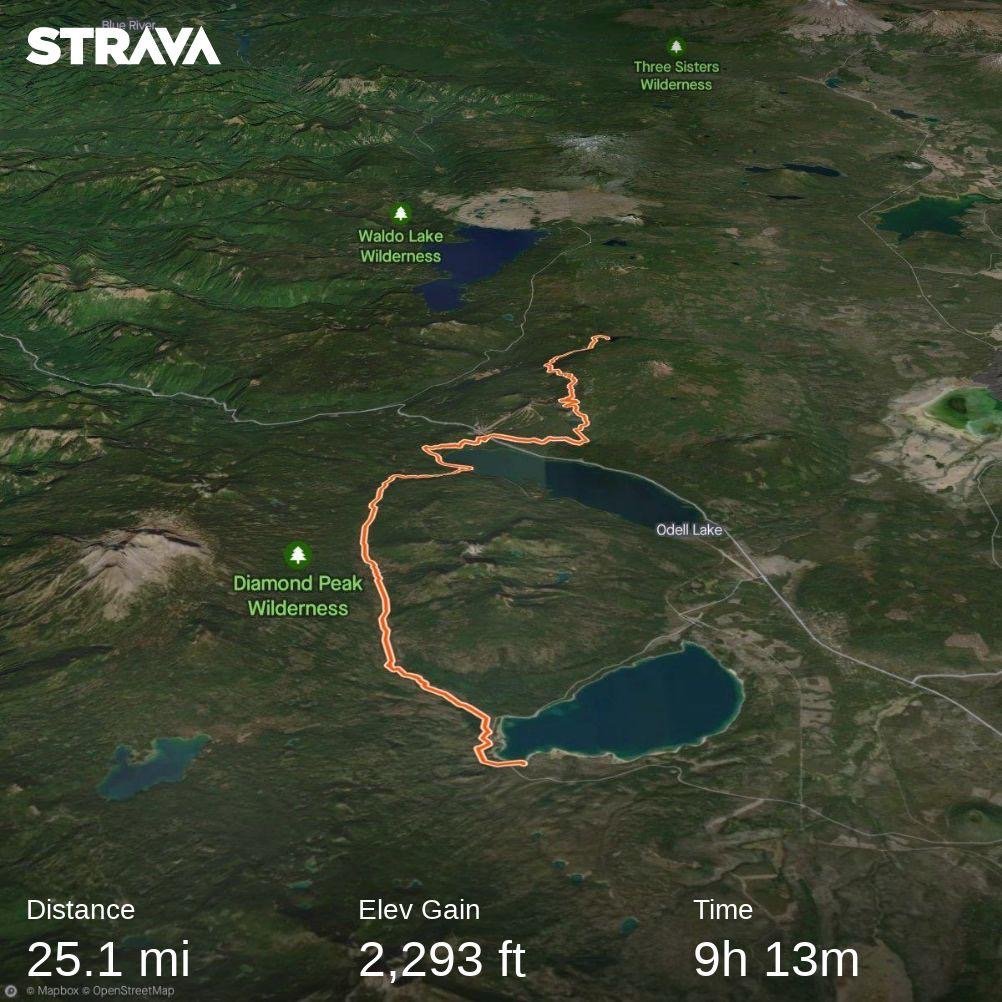
Distance: 27.8 Miles  

Moving Time: 11:18 hrs

Elevation Gain: 2551 ft

Click here for current location

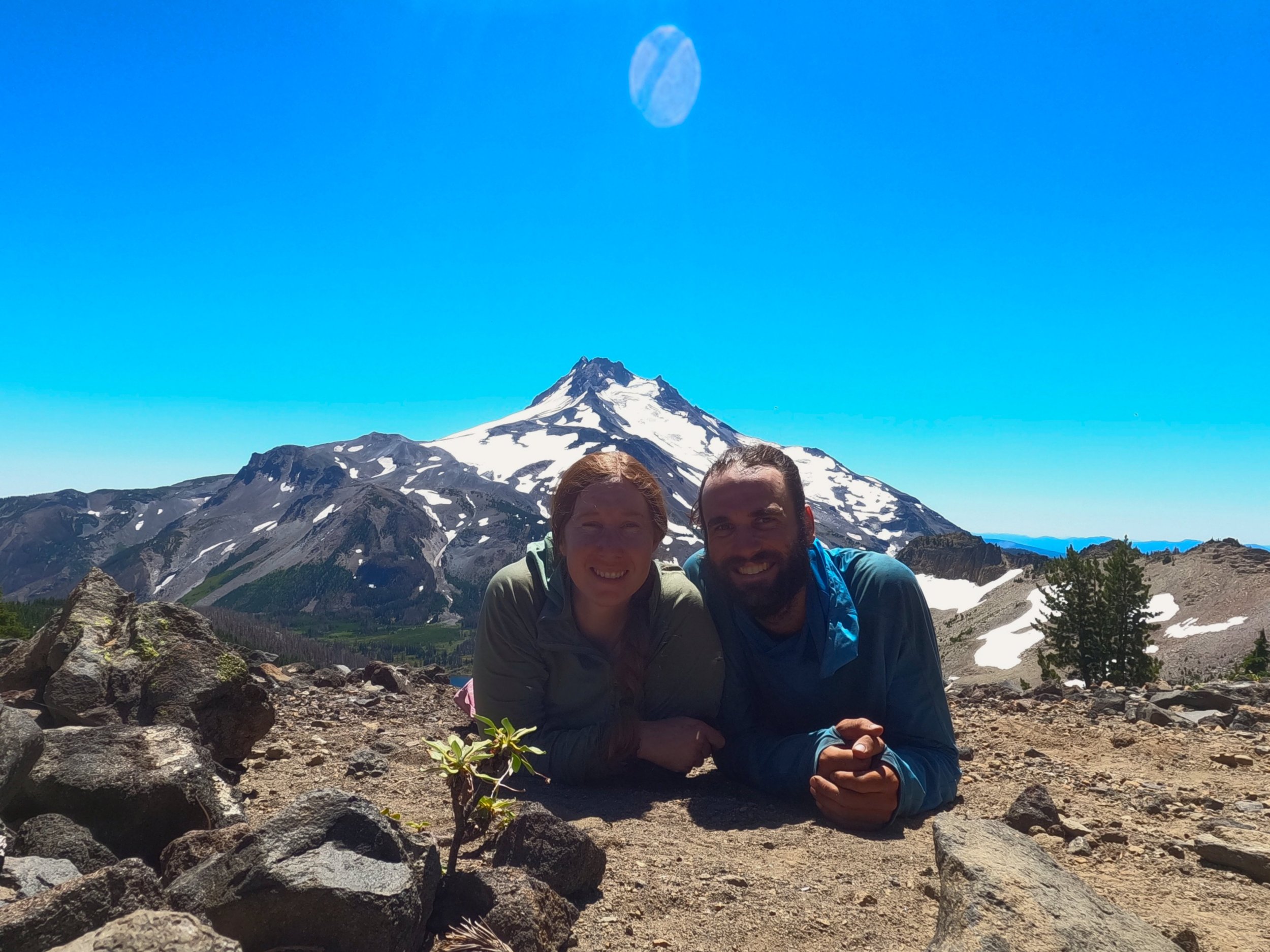
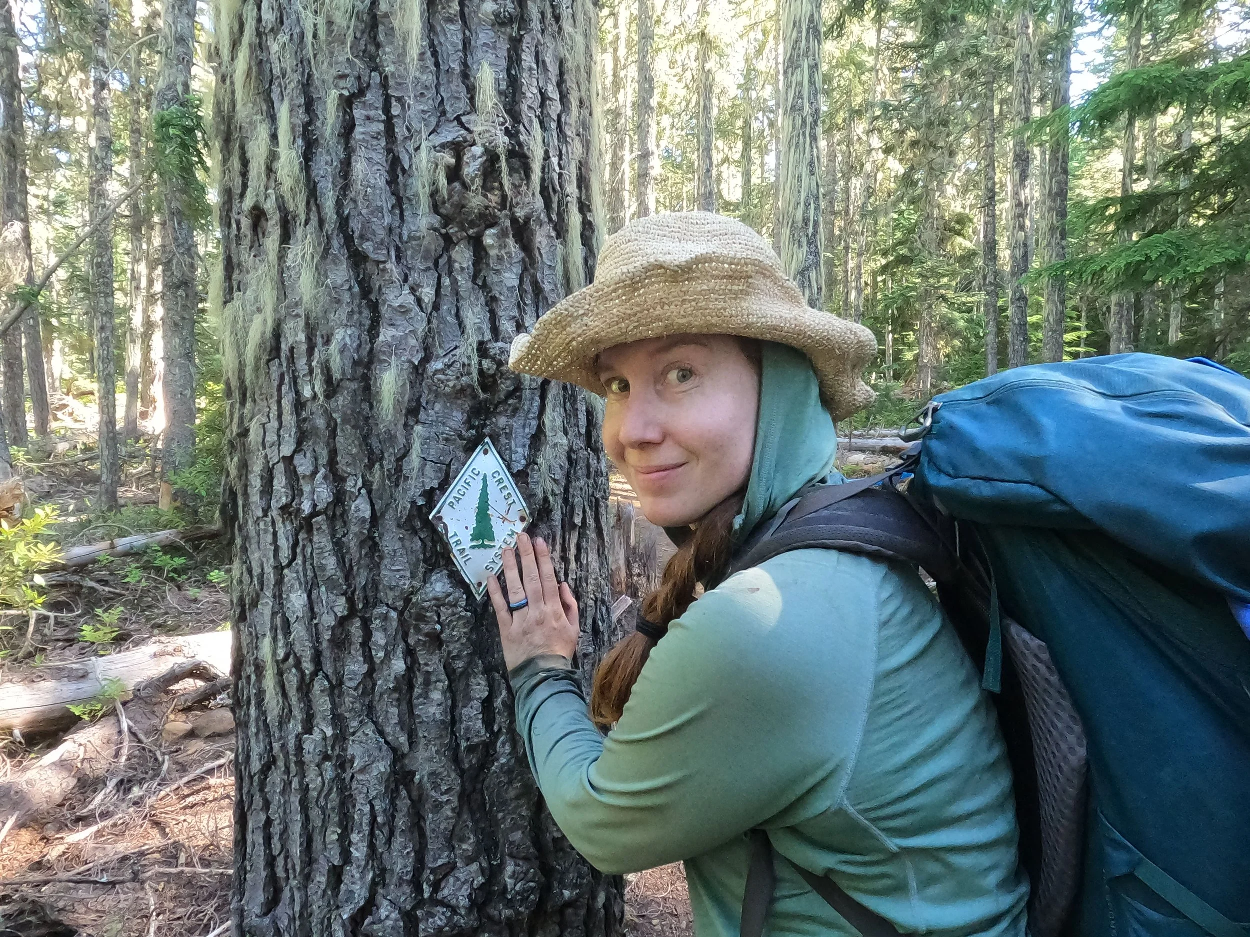
Today’s stage starts where it had left off, in the Seven Lakes Basin and makes a bold climb in the morning up through slate gardens to cruise over 3 passes in a row staying below Devils Peak, Lucifer Peak and Slate Butte. From Slate Butte, the trail follows a ridgeline south and passes west of the Sky Lakes basin. The trail then winds south around Island Lake and spends the last half of the day circumnavigating the east side of Mt. Mcloughlin. The camp for the night was less than a mile from Highway 140, on the Cascade Canal.

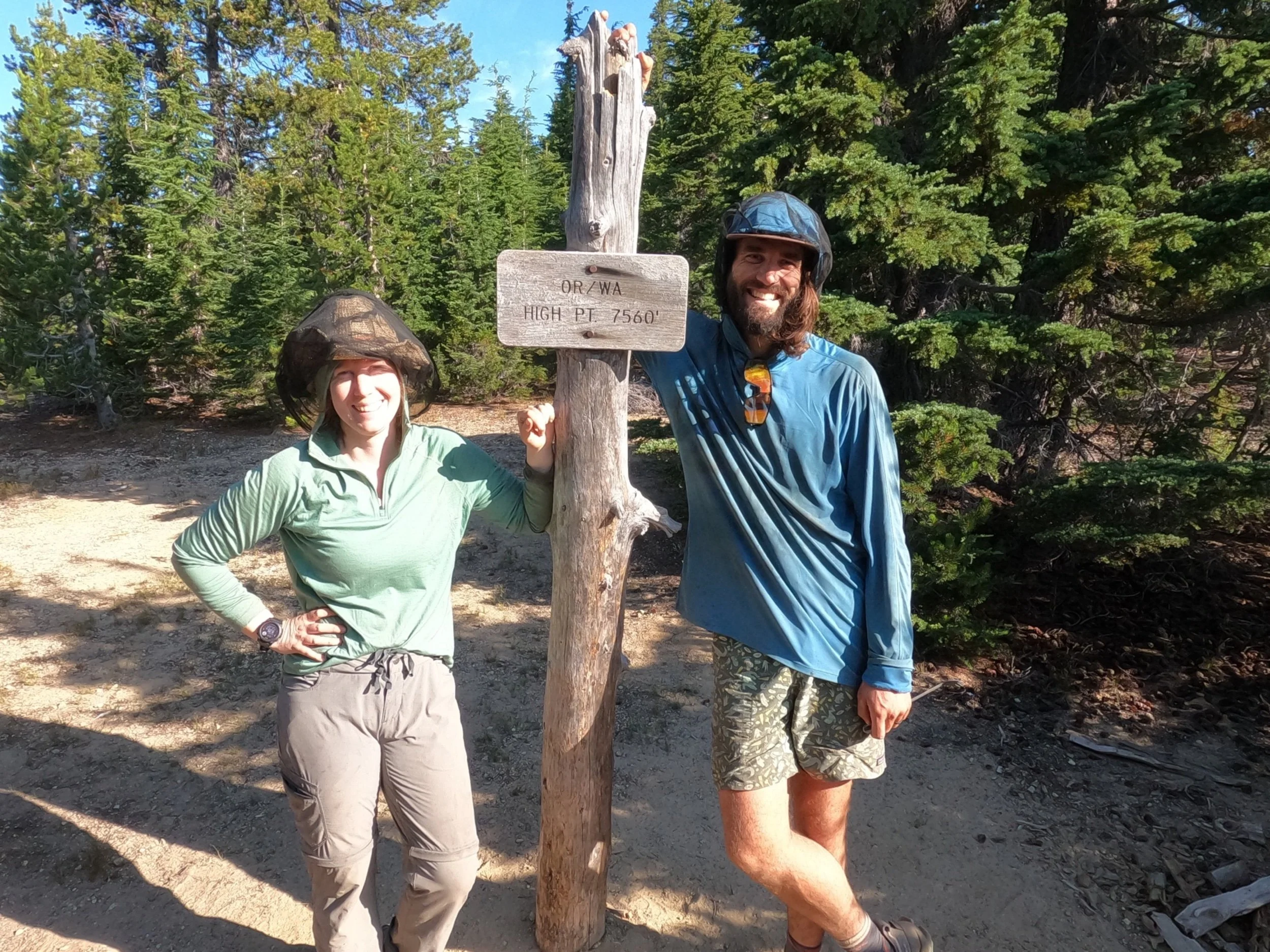
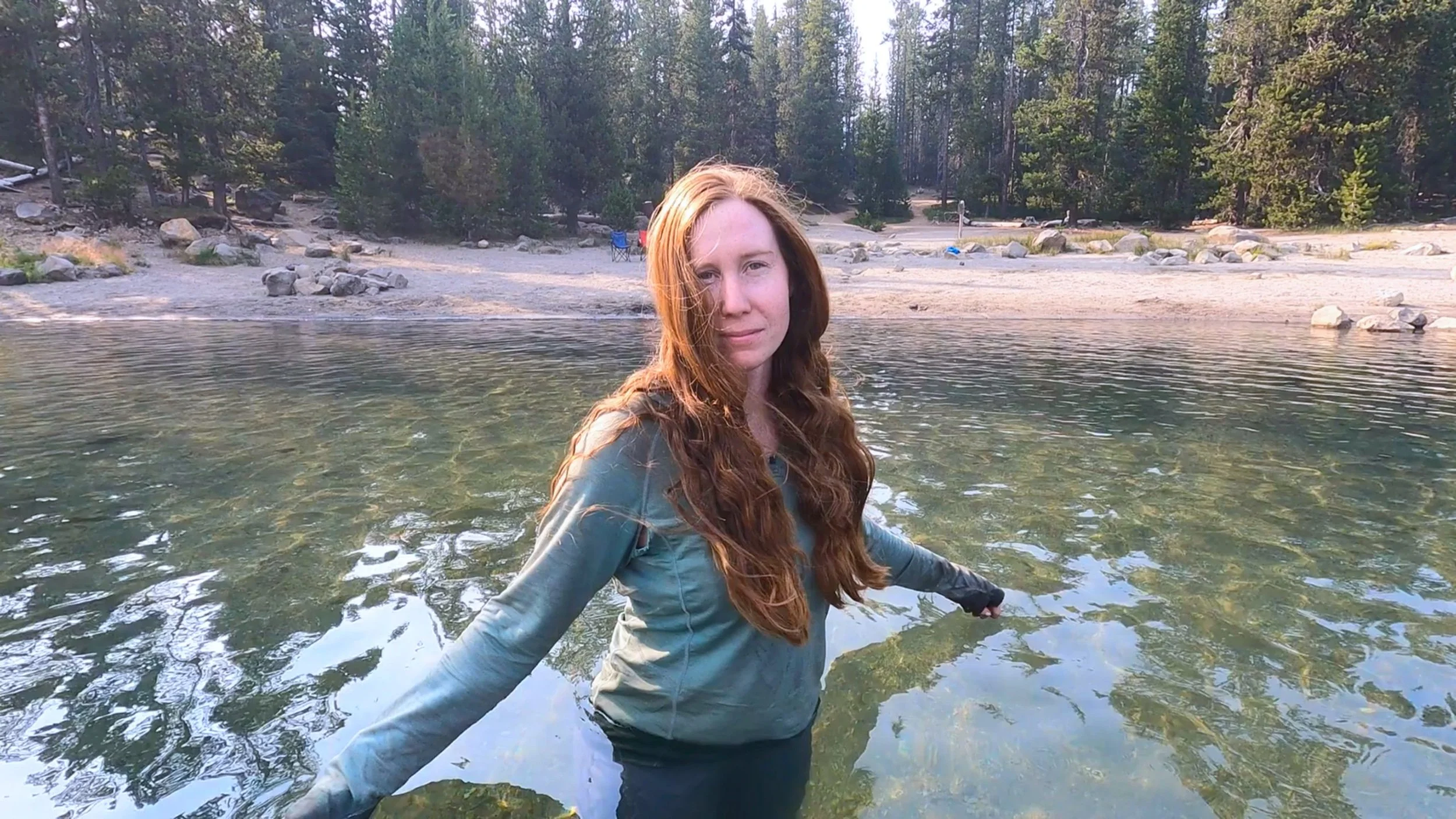
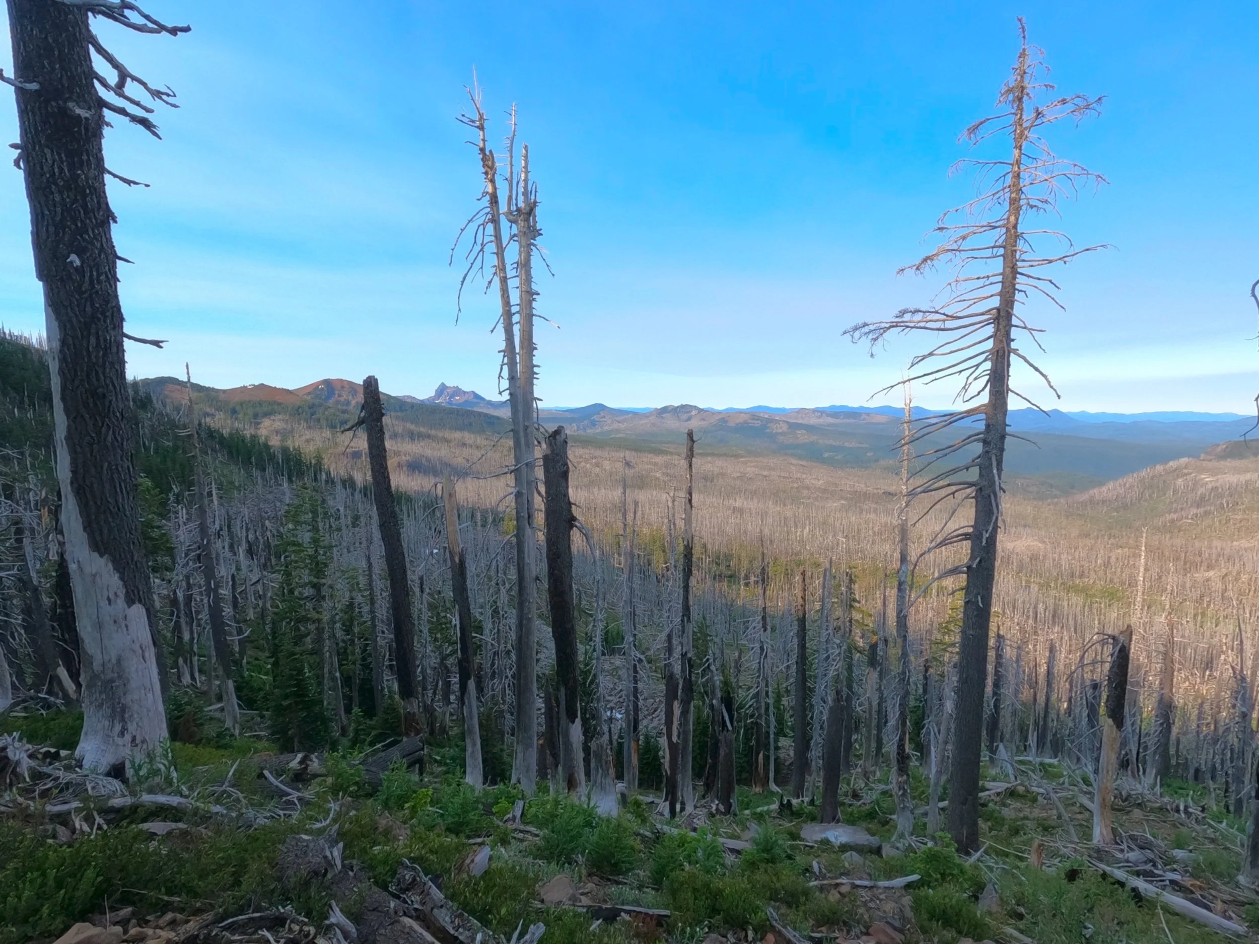
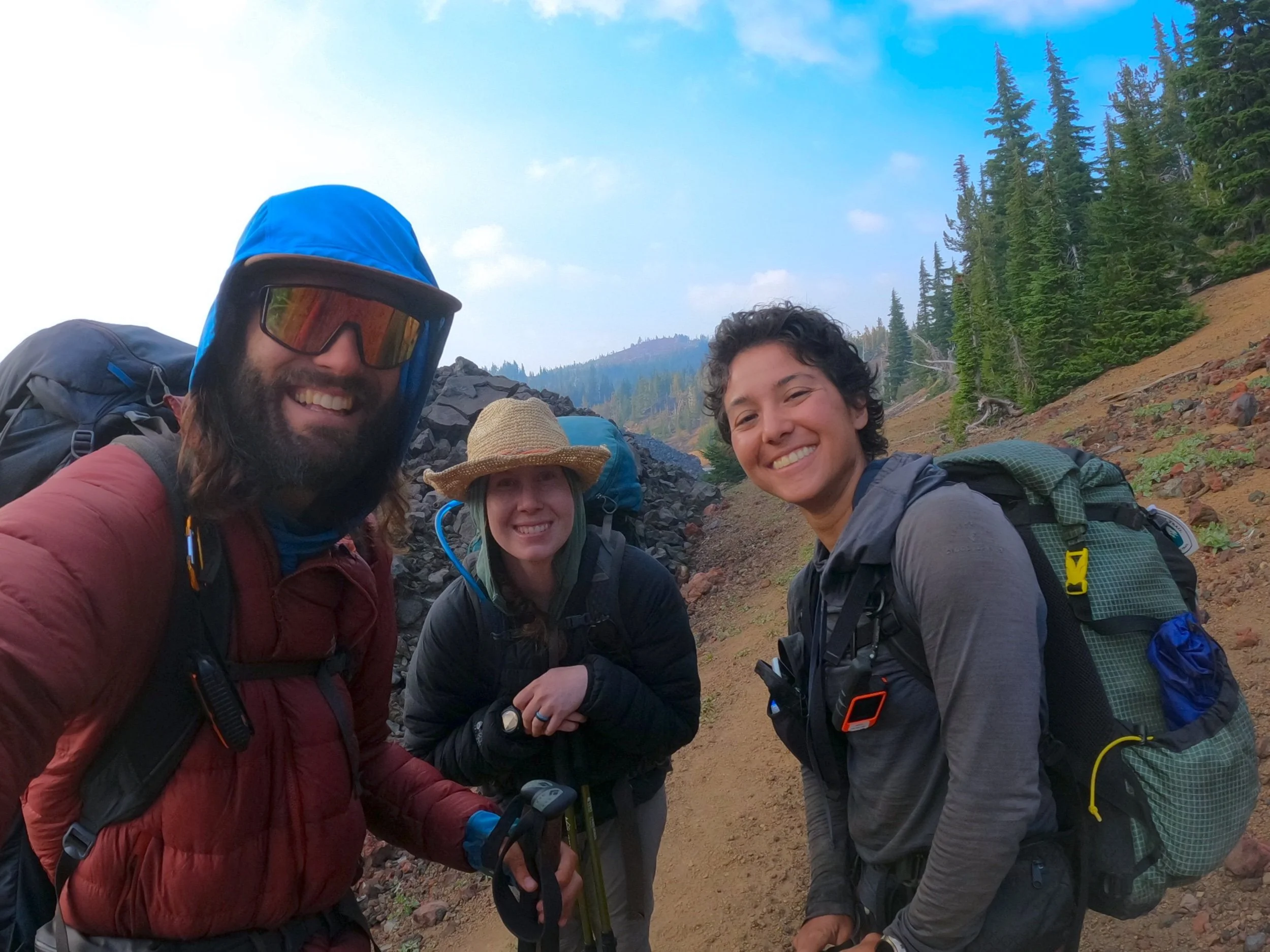
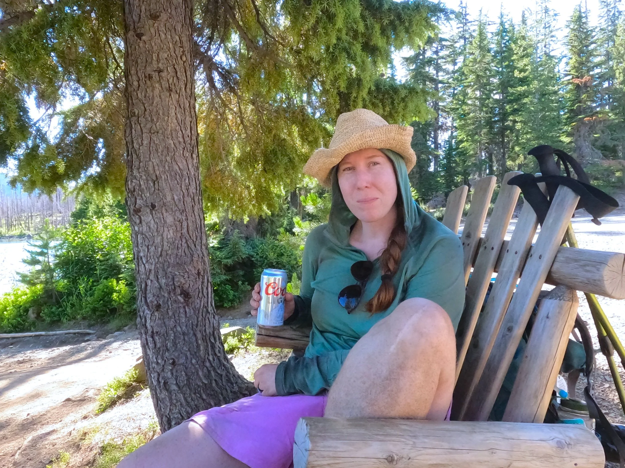
We woke in the morning and got our things together. There were still many little frogs out and about and we did our best to not step on the little guys. After some tea and our warm-ups we were ready to go. The sky was actually gray which was the first time we had seen it like that it in..well, maybe we hadn’t seen it like that on trail at all yet. The path wound up and up, eventually leaving the treeline and continuing through a shale garden on a stony pathway. The warning squeaks of Pika’s rained down on us as we climbed. I caught a funny looking toad that Amanda had noted and we identified it using Amanda’s identification app. We let the little guy go and continued on, finally attaining the first pass. From here the trail stayed high on the ridge as we wound our way east and south. Along the way, we ran into a couple from Scotland and talked with them for a while, telling them about all the wonderful places to visit on-trail in Oregon. We said goodbye and continued on. From the high shale lookouts we got some good views, which was epic. 

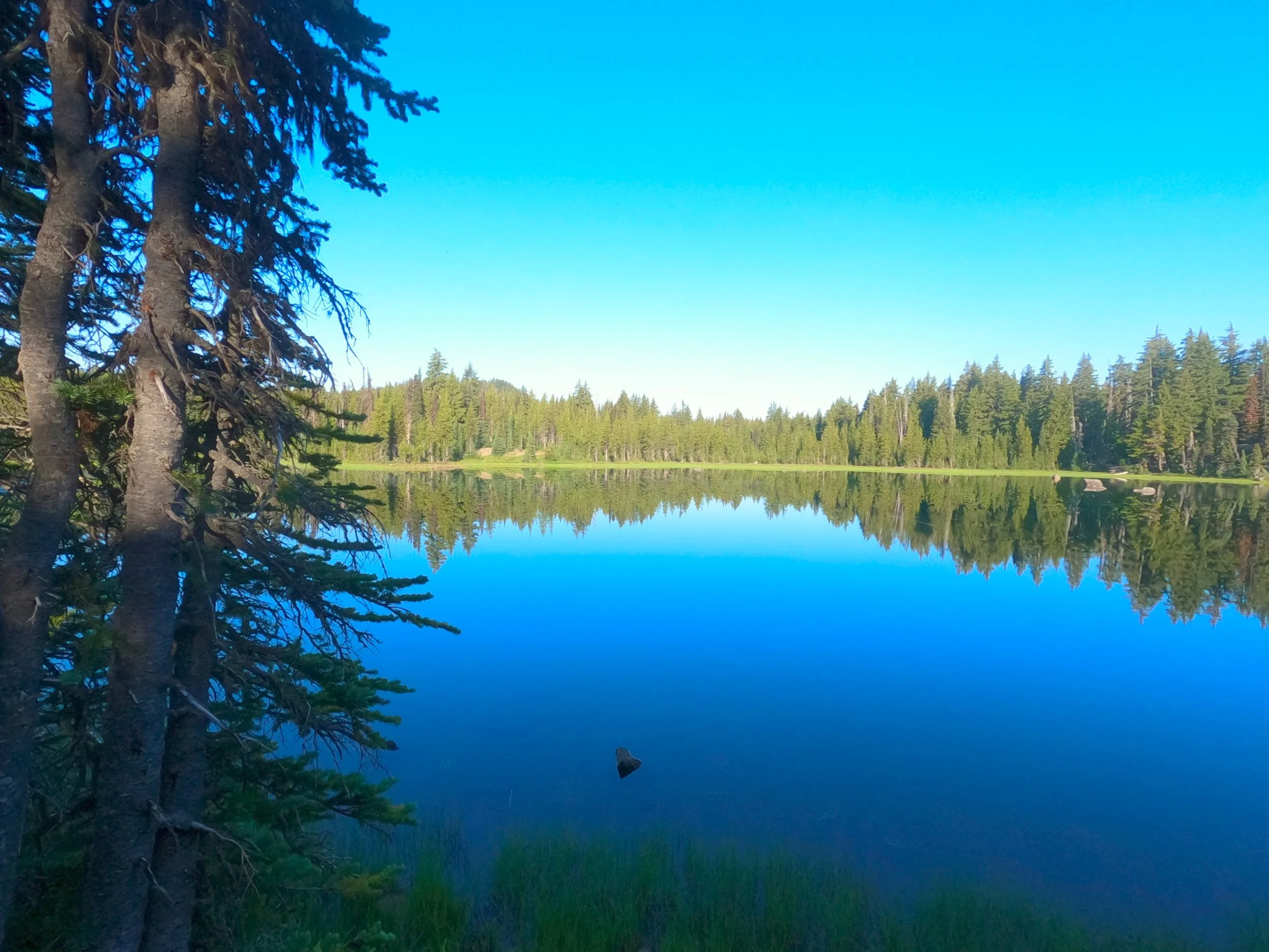
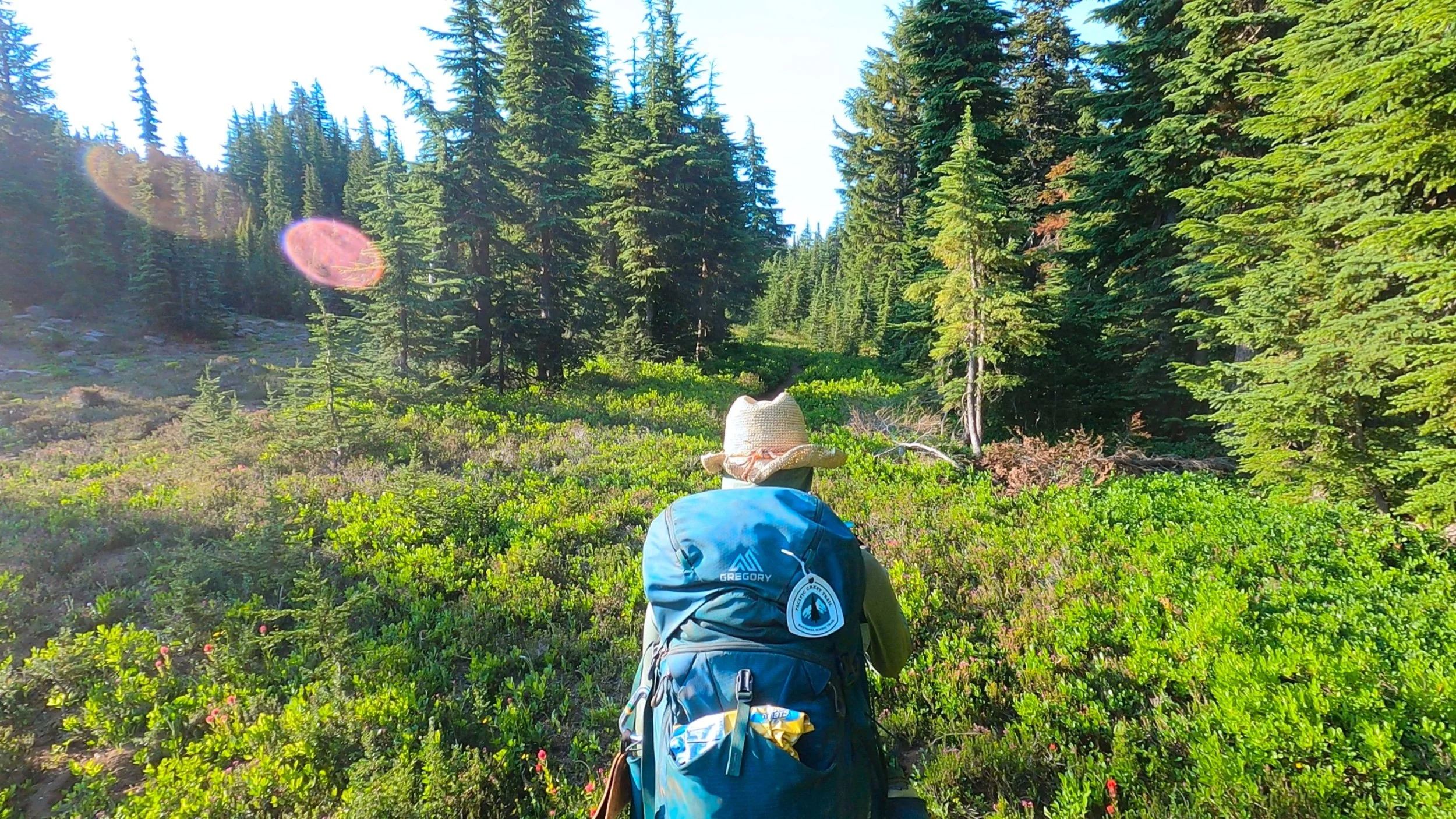
After about 2 more small passes the trail descended shortly to a south running ridge which we followed for some time, taking in beautiful views of the Sky Lakes basin below. Probably so many good swimming spots but we weren’t going to descend a few thousand feet to make that happen. After a while we passed Island Lake and, while swatting at a cloud of mosquitoes, ran into the young Estonian girl who had ridden with us in the bed of the PCTA workers truck out of Kennedy Meadows. She was hiking with another European guy who had a massive backpack on. We talked with them for a while, promising a culinary adventure in the state ahead of them and reminiscing about the Sierra before going our separate ways. Not far after her, we ran into another woman, Serpent, who had been in the bed of that same pick-up truck. We told her we had seen the Estonian girl and she smiled, saying they had been hopscotching each other for the last 100 miles or so.

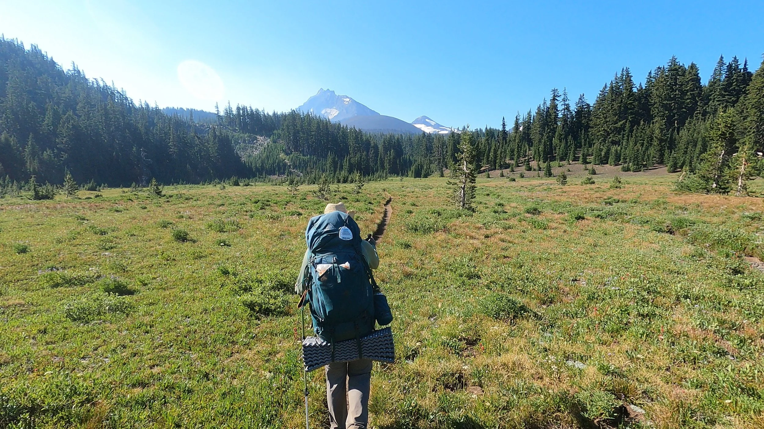
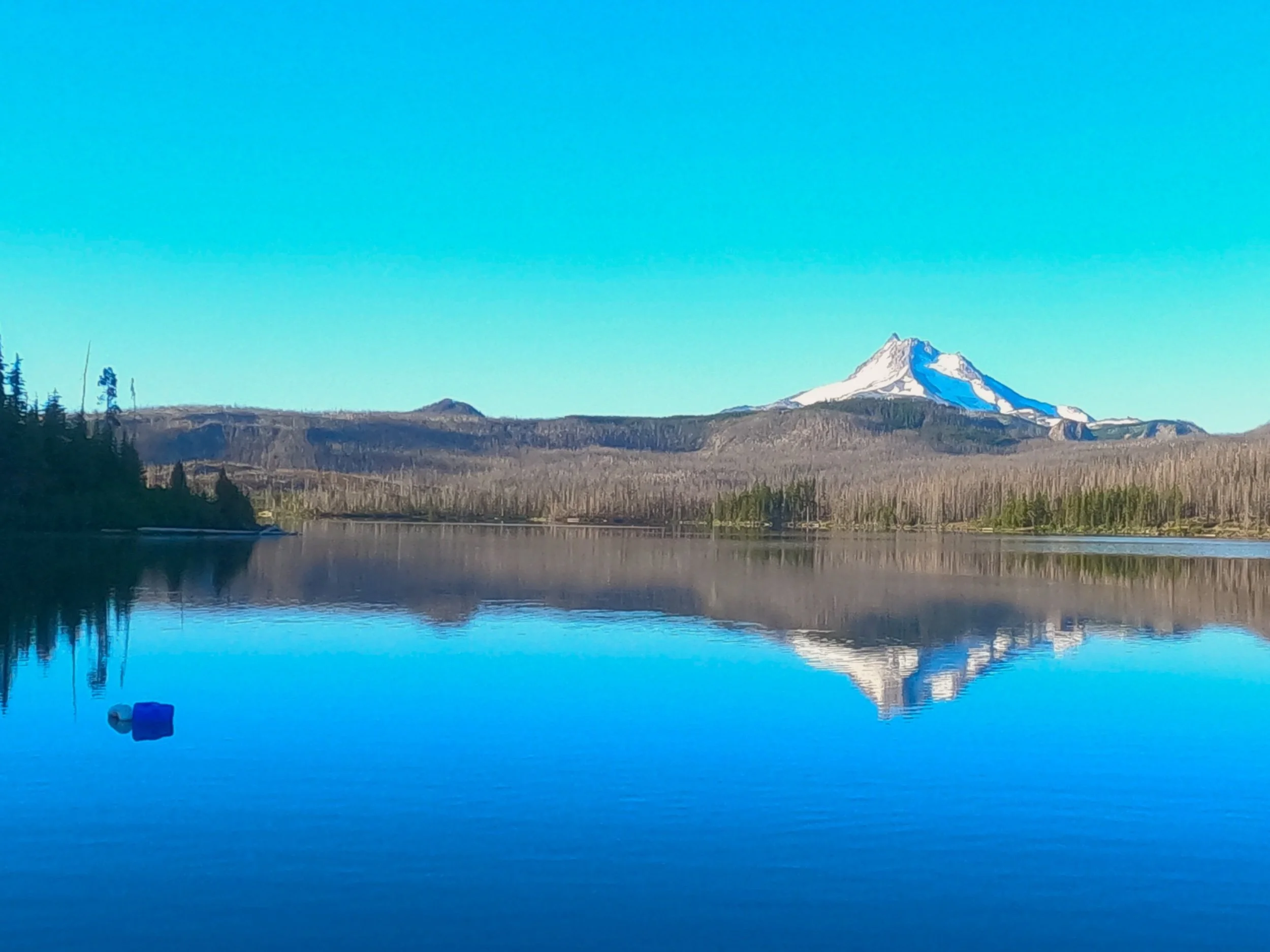
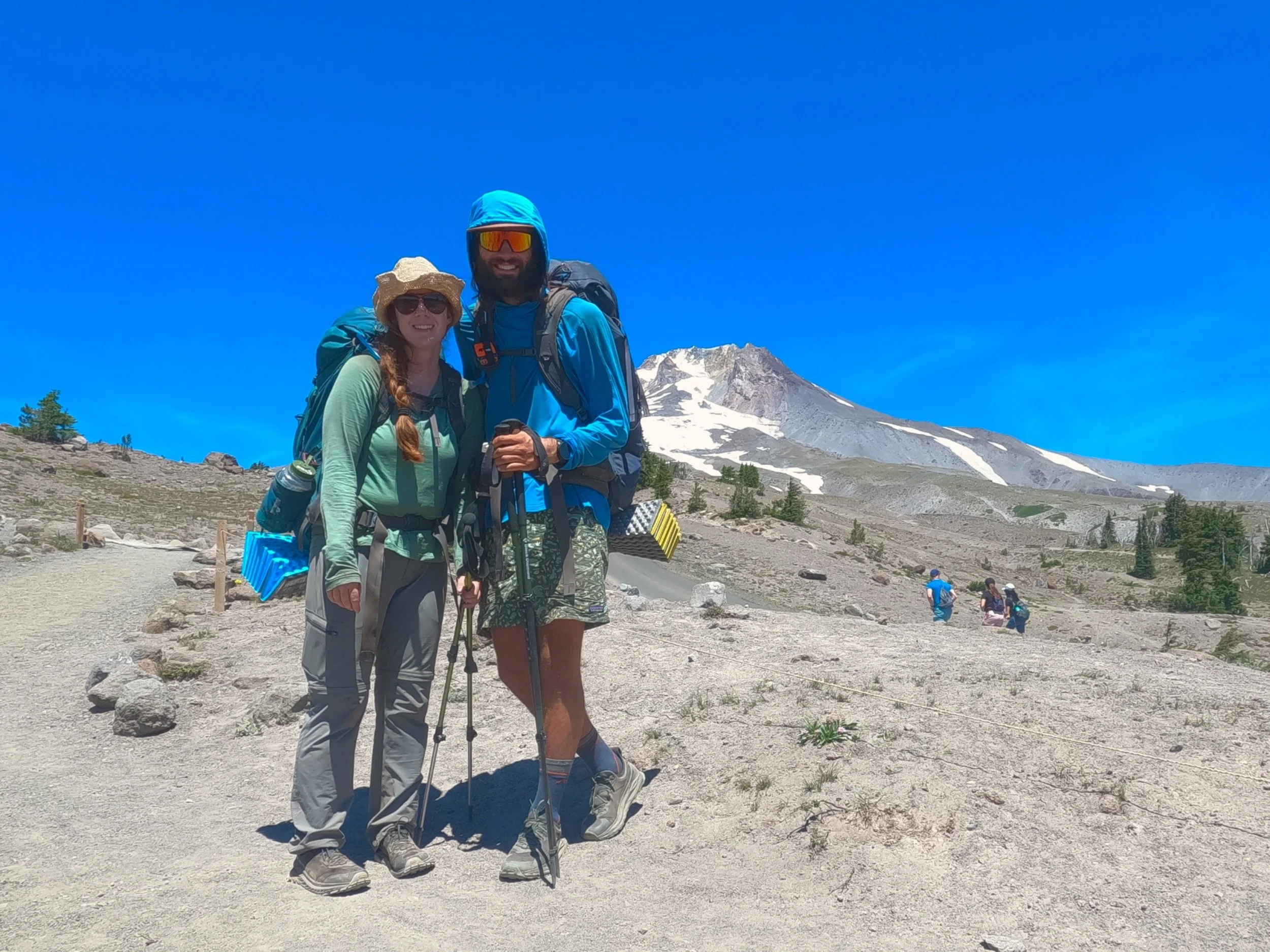
The last 3rd of the day was spent circumnavigating Mt. Mcloughlin which loomed large on our right as we headed south. I did the math, as I often do toward the end of the day to calculate out when we would be at camp. The evaluation came out to just before 9 pm, far after sunset. I begrudgingly told Amanda she had to hold off on any further Huckleberry stops, despite the fact that, as we headed south, the bushes were ever more laden with ripe berries. We walked on and on and, eventually, the sun set on us and we continued to walk. Towards the end I popped in my headphones and listened to Odesza while looking up at the massive Douglas Fir trees and staying back from Amanda - it was oddly peaceful. 

Eventually, the sound of the Cascade Canal could be heard. We rounded a corner and a massive creek, big enough to activate Sierra Creek PTSD, came into view. We followed it downhill and, a bit further, several small tent sites were located. We stopped at the first one and I attempted to do a little reconnaissance on some further down the trail. “Let’s just check a few more downtrail,” I said to Amanda. In no uncertain words, which included some swearing, Amanda told me that we were stopping at these tent sites and we set our packs down. As we set up that night, a deer who was just a little too friendly started walking around our site, sniffing our packs and the tent. We had heard that this might happen. The deer are very salt deficient and look for stuff to lick - including backpackers equipment. We made dinner and fended off the dear. I ran down to the river and grabbed 2 liters of water to filter overnight before we turned in and passed out, attributing all the snaps and pops to the overly friendly deer. 

Day 81: New Kicks

8/5/2023

Section: Milepost 1822.7 to 1801.7

Total Trail Miles: 1137.6

Distance: 20.84 Miles  

Moving Time: 08:10

Elevation Gain: 2577 ft

Click here for current location

This morning’s breakfast was epic because it consisted of lucky charms and whipping cream! That’s right folks, bringing back an early COVID favorite that Amanda finally told me I had to quit circa April of 2020 but today, because I am supremely calorie deficient, I brought back the old favorite and it was oh so appreciated.

Today’s route starts with a stout climb up out of the Mazama village before taking off south towards the southern border of Crater Lake National park. The route meanders around the western end of Pumice Flat, keeping the elevation gains minimal. At the park border the trail passes to the west of Goose Nest mountain and gains a north-south running ridge which eventually routes around Goose Egg peak. The trail then drives straight south through a massif containing Lone Wolf, Ruth, Ethel and Maude peaks before crossing Honeymoon creek and eventually attaining the seven lakes basin where we slept for the night.

We woke this morning around 6 and packed up. Around 7 we made our way to the general store where we planned on eating some cereal Amanda had gotten for us at the store the night before. At the store though, we broke down and decided to go back to Annie Creek Restaurant for their breakfast. We wound around the front, initially dismayed by the dark interior until we realized that that is just how it looks and that it was indeed open. Inside, we both ordered biscuits and gravy and Amanda got tea while I got a coffee before sitting at the same table we had sat with my parents at. The biscuits were good, if a little “Microwave dinner-y” but we ate with gusto. Afterwards Amanda still had my lucky charms and I still had some hunger so I went back to the front counter, refilled my coffee, purchased 6 teas and asked if I could just buy a cup full of half and half. She said there was no half-and-half to be had but she could get me some whipping cream, which put a stupid grin on my face. “I’ll take that,” I said. Back at the table I ripped open the lucky charms and poured in the whipping cream while Amanda just shook her head, but in the end she took the remainder of the cream for her applejacks - I think she gets the hype now.

After breakfast, we paid and made our way out of the village, stopping just outside to stretch. The path ahead was pretty water-less so we were both carrying 3 liters and a full pack which made it heavy. After stretching, we made the short but stout climb out of Mazama and regained the PCT. From the junction, the trail meandered very gently up and down as we cruised through the immaculately maintained trails of Crater Lake. 

About an hour in we ran into Ranger Corbin and, wow, let me tell you - what a babe. He was maybe the nicest ranger I have met in my life and we talked for about 30 minutes. Evidently, the massive thunderstorm we had walked through the day before had knocked out all the repeaters in the park but he had learned via one-way communication that there were a few spot fires around. He assured us, though, that the park's fire crew, who had been growing antsy in June and July, were very ready to finally get out and fight some fire. As if to drive the point home, a helicopter with a bucket flew over us on its way to one. Ranger Corbin was out checking on the Stuart Falls/Pumice Flat trail, as it was a catastrophe and he was marking it for the trail crews. We talked for a few more minutes and then he wished us luck and we parted ways. I wrote something in FarOut to the effect of “10 out of 10, would be rescued from a burning building by ranger Corbin. 

We continued on and most of the rest of the day passed relatively uneventfully. The new shoes were breaking and I was careful to not repeat the mistakes of the past and pull out the eyelets while tightening them. We exited the park and then climbed up through the massif, before descending the opposite side. The blowdown got really bad after exiting the park and we slowed down quite a bit. 

At the end of the day we climbed up into the 7 lakes basin and camped near a healthy stream. It took most of the day and was starting to darken by the time we identified our camp spot. We had some delicious Good-to-go meals and tried to ignore the very creaky tree as we turned in for the night. Just before going into the tent we noticed lots of tiny frogs all around which sang us to sleep. 

Some immaculate Crater Lake Trails!

Day 80: Crater Lake

8/4/2023

Section: Milepost 1840.2 to 1822.7

Total Trail Miles: 1116.7/2650

Distance: 13.7 Miles  

Moving Time: 05:21

Elevation Gain: 1877 ft

Click here for current location

Today's stage makes its way on the Crater Lake Rim trail up to the rim of the lake itself. Once on the rim, the trail proceeds counter-clockwise, edging along the southern rim before reaching the main visitor center on the southwest side. Once there, the Dutton Creek trail is used to connect back to the pct, south of the visitor center. The stage ends today at Mazama village in the southern half of the park. 

I cut my foot open last night frantically trying to get the rainfly one. That’s right - for the first time since May, we were rained on and I wasn't ready for it. The cut wasn’t bad but it was irritating. Point is, we slept in just a little bit. We were meeting my dad and mom at Mazama village around noon but I was somewhat confident we could still make it even if we slept in a bit.

We got up and did not have tea, because we were out, which was devastating. Our morning activities garnered a few squeaks from the Pikas but other than that we were on our way without delay. The trail climbed up and out of the basin on the northern side of the park. I stopped briefly when I got service to make sure but Tdap immunization was still current - don’t want to die from tetanus out here, that would be stupid. Amanda just rolled her eyes at me when she found out that’s why we were stopping. About 2 hours of climbing brought us to the rim and we looked down at the bluest lake I’ve ever seen. I should say, I’ve seen this lake several times but the color always stuns me. 

We took some pictures but had to keep moving. My parents were leaving Corvallis soon and it wasn’t going to take that long for them to get down to Crater and we still had a ways to go. We descended a bit on the rim trail and talked with a group from South Dakota who were interested in the trail. The Rim trail is a bit more volatile than the PCT - lot’s of steep ups and downs but many epic views of the lake. As we walked I ate some peanut butter. I have a new method where I keep the peanut butter jar in my water bottle holster and the spoon hangs from my left shoulder strap and stays strapped down by the sunglasses loop - really nifty. 

2 more hours brought us to the lodge and we made a brief stop at the gift shop for some post cards and to people watch - so many clean tourists. I got some coffee and chips and Amanda got my dad a card. It’s 70 days till his 70th birthday today so, gotta remind him. From the visitor center we walked across the parking lot and descended on the Dutton creek trail. Thunder echoed in the distance as we moved down the trail. For some reason, Dutton creek had been forgotten by the park’s trail crews and was in terrible shape. We slowed way down, which was concerning because we were already going to be late to meet my parents…and then - the thunder storm hit. About 30 minutes into the connector trail hail began to fall, gently at first and then - total gail. We frantically put the rain covers on our backpacks, not even bothering it get into them for our own rain gear before making our way through the hail. Water began flowing down the trail and the sky was lighting up nearby followed by huge cracks of thunder. This went on for about 5 minute before, as rapidly as it ad appeared, it disappeared. 30 more minutes of walking and the sun came out, beginning to dry out soaked clothes.

We hacked our way through more blowdown as we made our way down the Dutton trail. Suddenly, we saw another hiker coming through the blowdown. “Honey Cheddar!” Amanda yelled as a young guy looked up at us. Honey Cheddar had been in William’s group down near Acton. William was the guy who had Hemophilia and Spigot, who we had seen a few days before, was also part of that group. We talked with Cheddar for a while before saying goodbye and to enjoy the rim trail. Shortly after talking with him we rejoined the PCT and things got much better blowdown wise.

From the junction we continued on south and then eventually took a connector trail a mile down to Mazama village.

Mazama village is a popular spot on the PCT for hikers. They have free camping, showers and laundry - all of which we desperately needed. As we pulled into the parking lot I saw my dad and gave him a big hug. Amanda did the same, issuing a warning that she was very stinky. We swung around to the front of Annie Creek grill and did the same for my mom who was sitting and reading. Afterwards, we went inside and ordered dinner. I went with a classic burger and beer combo. We sat and talked with my parents for a couple hours. After, Amanda made the executive decision that we were staying the night as it was down pouring again and 4 o’clock already. We went across the parking lot to the general store to collect the package my mom had sent earlier, not knowing she would be down to see me in person during the collection. This was cool ‘cause she got to see us open one of her hiker boxes and organize the things. We went through the box and pulled out the things we wanted. The exces we put back in a bag for them to ship at a later date. 

After that they had to leave back for home. We said goodbye and thanked them again before heading into the campground to set up our tent. Later that night we got dinner, took a shower and did laundry. It had been 10 days since we had done the latter 2, and were in dire need of both. After that, we passed out in the campground having completed one of our wettest days on the trail.

Day 79: Oregon-Washington High Point

Day 79: Oregon-Washington High Point

8/3/2023

Section: Milepost 1867.0 to 1838.6

Total Trail Miles: 1100.7

Distance: 24.6 Miles  

Moving Time: 09:09

Elevation Gain: 2746 ft

Click here for current location

Today was super long - we knew it would be but man it was tough. My feet are starting to come out of my shoes which are disintegrating with every step. 800 miles is too much for trail runners. Water and scarcity of camping sites necessitated this long run but glad to have it done with.

The stage today starts at the saddle between Maldu and Miller lake. It travels south, gaining the highest point in Oregon and Washington near Tipsoo peak before passing west of Sawtooth ridge and wrapping around Mt. Theilson. From Mt. Theilson the trail drops way down to highway 138 and the northern border of Crater Lake National park before meandering through the lowlands of the northern park and eventually reaching the turn-off for the Rim Trail Alternate. I would say the Rim Trail is probably the most popular alternate for the PCT, almost everyone does it. The day ends just past the turn-off for the Grouse Hill Backcountry site.

We woke and continued our tea routine - it’s nice, not as much caffeine as coffee so a bit more mellow energy. By the time we had had our tea and packed up, the Swedish lady, Solo, was up and off. We find that a lot of people get about 90% ready in their tent, including eating, before stepping outside to avoid getting eaten alive by the mosquitos. This necessitates keeping your food in your tent though which comes with other risks, like getting eaten by something much larger than mosquitos. We started at a quarter past 6, wanted to get a jump on what we knew would be a long day. 

The trail was crisp and clear as we started southbound. We sped along a well groomed trail and reached the high point around 8 am. Here we stopped and talked with a few groups of guys, one of which had the best trail name - “Post-Holone” like post holing but sounding like Post Molone. He was from Seattle and offered us some Southern Comfort for getting to the high point which we declined given the hour - not that that has really stopped me on this trip. He took our picture and we talked for a while. Post was from Ballard in Seattle and knew all the places that we had picked up visiting our friends Josh and Maddy there. 

We left Post and continued on down. It’s not exactly downhill from there but it did descend for some time to a really nice creek running off the side of Mt. Theilson. I have told Amanda this a few times but, I am very unfamiliar with everything in Oregon south of Eugene. Like, draw a horizontal line across Oregon through Eugene and it might as well be Northern California for me. This goes for the mountains - I don’t know any of them south of Bachelor but, wow, are there some beatiful ones. Mt. Theilson is one of them. It looks like a mini Matterhorn - incredibly sharp and the views of it from the PCT are epic. We stopped at the stream and I filtered for myself. Amanda is drinking less water than she should because she forgets so she turned down the offer for me to filter. We said hi to some others who had stopped to filter there and continued on.

From the creek we climbed a few hundred feet up to a ridge running off the flank of Mt. Theilson. There were some Scottish guys at the crest eyeing Theilson and asked us if we knew anything about the climb. Comments on FarOut had indicated that it was a solid climb until the summit pyramid where a potential climber had to do about 50 feet of class 5 climbing unprotected. I relayed this to them, the information was received with confused looks and I broke it down in more simple terms which they finally understood. We left the Scots behind and descended a long, long way before the path flattened out and delivered us to a forest service road just north of highway 138 which defines the north side of Crater Lake. There we found a Canadian guy from near Skaha Bluffs in Penticton, BC and a huge water cash. We took a nice long break here and topped up on water. Crazy thing is that I think this water cash and others in the area are provided by a trail angel named Devil Fish who was the same guy doing the really critical caches in the desert near Tehachapi. So if you are reading this Devil Fish - thank you so much! 

We moved on, saying by to the guy from BC and another one who had showed up. The trail quickly reached 138 and we crossed it, taking a picture at the park boundary before heading into Oregon’s only major national park! Once in the park, the trail got clear really quick. The park service has their own trail maintenance crews and they are really good. We cruised through the northern reaches of the park, Amanda listening to her book and I listening to music. It really was the green tunnel in all its glory. We ran into a few people but not many and eventually we came to the junction of the PCT with the Rim Trail. Here we followed the PCT for another 0.4 miles to another trailhead where Devil Fish had left another cache and topped off. Then we reversed ourselves back to the junction and went up the Rim Trail a little while to the Grouse Hill Backcountry site where we made camp for the night. Best part of this camp is it sits on the edge of a big scree field and all into the evening the silence was regularly split by the squeaks of Pikas!

Day 78: Windigo Pass

Day 78: Windigo Pass

8/2/2023

Section: Milepost 1891.7 to 1867.0

Total Trail Miles: 1072.3

Distance: 22.3 Miles  

Moving Time: 08:23

Elevation Gain: 3281 ft

Click here for current location

Today’s stage leaves from Spring Camp at Crescent lake and makes it’s way up to Windigo Pass on the Oldenberge Lake Trail. At Windigo pass the popular alternate rejoins the PCT and continues south along a high ridge under Windigo Butte and Mule Peak. The end of the stage is at a saddle with Maldu lake on the west side and Miller Lake on the east.

We woke fairly early but, like many mornings recently, snoozed a fair bit. Eventually, we got up and had TEA! That’s right, we enjoyed a hot beverage this morning with a little bit of caffeine which was oh so nice. We were on our way just as the families who let us stay in the group site alongside them were starting to rise. 

We exited the campground and got on the Oldenberge lake trail which climbed steadily up from Crescent lake. The Mozzie’s (as the Australians on FarOut call them) were out and about but we moved quickly enough to keep them off. A few hours brought us to the pass and we did the last ¾ mile on a Forrest service road.

At the pass we found a well stocked water cache managed by a guy named Devil Fish. Fun fact - I think this is the same guy who managed the caches south of Tehachapi - he is an absolute saint. We took off our packs at the cache and enjoyed a nice long break there. A few other hikers were there but they weren’t much for the talking so Amanda and I conversed amongst ourselves and watched the scheisty chipmunks try to steal food with smiles on our faces. 

Eventually, the other 3 hikers left and we got our things together and did the same, heading in the opposite direction. As we were leaving, an older guy on an adventure bike pulled up and we talked with him for a while. He was doing the Trans-American Adventure Trail (TAT for short) and had started in Northern Carolina about 40 days ago. We swapped stories and wished him luck before heading on up the ridge.

We walked the ridge for about an hour before we ran into Spigot. For those who forgot - Spigot was with a group of about 7 people we started hopscotching with a few stages before Acton, CA and the KOA there. She recognized us and we caught up for a while. She had jumped off the trail around Agua Dulce and spent a week back at home somewhere in New England before restarting the trail at the California/Oregon border. She told us all about what the rest of the group had been up to and we swapped beta about the trail behind and in front of us. Eventually we went on our way. The smoke from the fire east of Eugene began to blow in as we made our way along the ridge. Amanda decided to put in her audiobook. We are really in the green tunnel now and the monotony is getting bad so she decided for the last few miles it would do. 

The rest of the day was pretty uneventful. We met a guy named Stage Coach who told us about the saddle between Miller and Maldu lake before continuing on South, we saw a fat grouse and we also saw the guy who was helping in the kitchen at Grumpy Bears in Kennedy Meadows. 

Another hour brought us to the saddle and we decided we didn’t have time to go on so we made our way down to the lake to get water. I told Amanda she had to take a rinse in the lake and I followed after her. We saw a big ol’ Frawg and some baby ducks and eventually eased back up the hill. At the top we said hello to “Solo,” an older hiker from Sweden and had dinner. We were a long way from where we wanted to get the next day so went to bed without delay looking forward to an early start the next morning, despite a late arrival.

Day 77: Old Friends

Day 77: Old Friends

8/1/2023

Section: Milepost 1918.6 to 1891.7

Total Trail Miles: 1047.6

Distance: 25.16 Miles  

Moving Time: 09:10 hrs

Elevation Gain: 2292 ft

Click here for current location

Today, we ran into a bunch of old friends from the southern sections of California and we kicked ass on the mileage so, good day over all.

The stage today winds south from Charlton lake through the Willamette National Forest eventually passing Rosary Lake and pulpit Rock before coming to Willamette Pass. Just before the pass, the trail turns due west and crosses the road before tracing along the western edge of Odell Lake. Here, most PCT hikers take a 1.4 mile detour to Shelter Cove where there is a small resort and campground which is hiker friendly and serves pizza, burgers and amazing lemonade. From the resort an alternate route has become popular using the Whitefish Creek trail to Crescent Lake before (tomorrow) it rejoins the PCT at Windigo Pass.

Amanda and I woke at 5:30 and snoozed ‘till about 6. It had been a very still night and we had slept well. We got up, completed our chores and were on the trail by 7, quickly reconnecting with the PCT and headed south. We hiked quickly. This section is perfect and you can really cruise down it. No more lava rock, minimal blowdown, just soft loamy trail and green canopies for miles. We flew south saying high to all the NOBO’s coming up from northern CA and eventually reached the Maiden Peak saddle where we stopped for a quick snack, taking in gorgeous views south towards Crater Lake and down at the Rosary Lakes. We had some coconut meat chunks and I had a RXN bar before we began our descent. 

As we approached Willamette pass I noticed two NOBO’s that looked very familiar. These were the Ontario girls, Eva and Kayla, that we had met near Deep Creek hot springs and we talked and caught up with them for some time. These encounters are always fun and usually involve recounting the highlights of the travels since we had disconnected and those on the trail ahead of the other people. They told us about Seid Valley and an alternate trail coming up after shelter cove. We talked for a while but they were attempting a 24 hour sprint to Elk Lake and had to keep moving. We said our goodbyes and went our separate ways. 

A few minutes on put us down to Willamette pass. Being back here reminded me of the only other time I have been to this pass and that was about 17 years ago, taking my middle sister, Katie, on her first backpacking trip. I remember that trip because it was 14 degrees when we got out of the car, windy and there was about 2 feet of fresh powder on the trail. We had brought snowshoes on that trip, the same ones we used in the Sierra a month ago, but even still, we only managed to do about three quarters of a mile that day and didn’t get out of earshot of the highway. Katie froze to death the entire time - it’s a wonder she ever went outside again. 

We crossed the road and went up a short climb. All the paths are marked with blue diamonds high up on the trees for snowshoeing. This is the same in many of the Oregon passes - they all make great snowshoeing areas. The trail climbed and we passed along a steep ledge. We reached a road and departed from the PCT, descending down a grade to a railroad crossing and eventually came to another road. We walked south down it, throwing our thumbs out for a hitch. Eventually, a VW van with a couple in the front pulled over and told us to get in. They were from Mexico and had just renovated the van for a trip up the west coast. They gave us a ride the rest of the way in.

Shelter Cove is a campground, marina and resort. We aimed for the resort, saying thank you to the couple for the ride and pulling our packs over to a PCT designated area. I set my solar panel up in the sun to charge, eyeing the very full outlets on the side of the building. As I came around I saw Amanda talking to a guy in a blue shirt. “Sean!” I yelled as I navigated the steps up to the deck. He turned and I gave him a big hug. We had contemplated skipping Shelter Cove altogether but now I was glad we had decided not to. Amanda and I ordered a pizza and lemonades and then went down to the table Sean was at to catch-up. We talked about all sorts of things, the Sierra, Northern California, Northern Oregon, etc. until I heard our number called. I got up, with the lemonades for refill, and retrieved the pizza and Amanda and I crushed it as Sean regaled us with all the characters he had met on the trail. Eventually through, Amanda and I had to keep moving. I went to refill waters as Amanda took care of our trash. We met back at the hiker area to get our things together. We said a final goodbye to Sean and that we would reach out to him when we were back in Northern California and made our way out of the Shelter Cove.

We did not hike back up the road to catch the PCT, instead deciding to take the alternate route to Crescent Lake that everyone was raving about. The alternate route left from the other side of the campground, crossed the railroad tracks and made its way back into the woods. As we were going back in a couple forestry workers were coming out with a huge crosscut saw. We thanked them for their work and they asked us where we were going. “Up Whitefish Creek Trail to Crescent lake,” I said. The guy replied “well, the last 4 miles should at least be clear for you.” We thanked them again and continued on. The trail climbed up and we ran into some blowdown. Crossing through one I got stung on the back of my calf. I didn’t see what did it but I got a nasty welt from whatever it was. Just as i was about to curse everyone who had suggested this route, the blowdown cleared and we sailed up into a beautiful area with lots of small lakes. We saw many PCT hikers coming down the trail, all excited to get to Shelter Cove. We crested at the lake section and descended down to Crescent lake. Our feet were really starting to dog as we came down the hill but we could make out fresh cuts where the forestry pair had been at work. Eventually the trail leveled out and we took a right on the horse trail. We walked this for about a mile and the mosquitos got bad. Eventually we bailed on the trail and took the road, still being hampered by the Dracula bugs.

We came to the Oldenberge Lake Trail and took a side trail into Spring camp. Sean had told us he camped here last night at the group site where a large family that had rented out the whole set of sites had welcomed him and a few others with beer and chips. Our welcome was warm enough, but involved a lot less beer and chips than I had been made to believe. We set-up in an empty site, happy to at least have bathrooms and a picnic table. We completed our nightly activities. I went down to the beach on Crescent lake for my yoga and clensing swim before coming back to the campsite. On the way back I was offered some Romane Lettuce so… that was at least something. Amanda and I fell asleep laughing about the leafy greens that night.

Day 76: Oregon Trail Magic

Day 76: Oregon Trail Magic

7/31/2023

Section: Milepost 1931.6 to 1918.6

Total Trail Miles: 1020.7

Distance: 18.81 Miles  

Moving Time: 06:48 hrs

Elevation Gain: 2283 ft

Click here for current location

Today, we got some epic trail magic from a few people who have been doing it for a long time - it was epic. 

The path today leads in from as far as Ray was willing to take the truck back up the epically bad forest service road to Irish and Taylor lake. From the trailhead at Irish Lake, the PCT leads past Taylor lake and heads up and south through some very recent fire - the same fire that caused a lot of the 2022 cohort to skip this section all-together. The section eventually crests at Charlton Butte before descending through more bad burn to Charlton lake where the trail magic was waiting. The trail crosses near the west banks of Charlton lake and climbs around 1000 feet around the twins before descending to the “Eugene-to-Pacific-Crest-Trail” junction where it ends in a small little jaunt to the banks of Bobby Lake.

We woke late today. The alarm was set for 6 and I snoozed until about 6:30. We eventually got up and, unlike yesterday, started breaking everything down. No slacking today. By the time we were getting things organized Ray and Sandy were up and making coffee in the percolator. We had coffee and Amanda worked on putting the excess resupply box together for a second resupply that the Porters could send us down the road while also taking what we needed to get to Crater Lake. After that, we walked down to the resort because Sandy said the breakfast they had had there the day before was excellent but, alas, it was closed on Monday so we turned around and headed back to the camper. There, Sandy broke out some smoked salmon and smoked Gouda and we ended up eating like kings anyways, getting good and full despite the closed resort kitchen. After eating, we loaded up our bags, did a walk around the campground and headed out. Ray returned us to nearly where the Porters had driven to the day before which left us about a 5 mile approach to the trailhead. We hugged and took some pictures and said goodbye to the dogs before watching Barney pull back onto the terrible road and head east. Amanda and I did our warm-ups and headed off in the opposite direction.

We walked surprisingly fast up the road, given the return to normal heavy bags and the really silty surface. The fire had been hot here and the ground was accordingly ashy. We made the 5 miles in under 2 hours and turned back onto the PCT. I really dislike approach hiking, it's a lot of work for not really progressing on the main goal which is hiking the PCT. 

About a mile or so of walking in peaceful green trees along Taylor lake soon gave way to Armageddon. The fire in 2022 was still very fresh and this section of the PCT must have been extremely hot because there was nothing left alive and the trees were extensively burned - down into the roots in some places. A very bleak atmosphere to walk through for sure. We carried on at a blistering pace and at one point a SOBO hiker had to get our attention to let us know there was a Y and we had taken a different way than where he was coming from. We talked to him for a little while and he was excited to inform us that there was trail magic about 3 miles ahead at Charlton lake and it was really good. We told him thank you and continued on at an even quicker pace, wanting to get there before it left.

We came upon a few more hikers who told us about the trail magic and eventually the trail started to drop around the Twins. Green trees could be seen up ahead and, eventually, we reached them and started meandering down through them. We crossed a much nicer forest road and were excited to see a van and Subaru - but no trail magic. Further on we went and soon came upon a hand painted sign of a genie which stated “Trail magic this way.” Not long after, we found it. 3 hikers and a middle aged couple waited for us, beckoning us excitedly to come in, which we were happy to do. This was “Ducky’s Mom” and “Ducky’s Dad,” two trail angels from Eugene who had been doing this since their son had done the trail in 2016. They had had to pick a different location last year because of the fire but were happy to be back in this area. They had sodas, hot dogs, chips, grapes and Oreos and were fantastic to talk with. We talked with them and the other hikers. Some more NOBO’s showed up as we were eating and we talked with them as well. According to Ducky’s Dad, they come out about 3 times a week and try to have about 70 hot dogs and 50 drinks available a day - this is good beta for Amand and I who want to do this next year. Eventually Amand and I signed the guest book and the bench the Ducky’s Dad had made and bid adieu. 

We decided to head for Bobby Lake, which was about 7 miles away. We broke out the mosquito nets that Sandy had brought, happy to get a respite from the bugs in our face. Along the last 7 miles we excitedly told every hiker we crossed paths with about the trail magic but other than that, hiked in relative silence keeping our speed up through the whole thing. At one point we stopped so Amanda could get a picture of me in front of the Waldo Lake sign. Eventually the turn-off for Bobby Lake came into view and we took it, Amand found a nice French pocket knife on the ground after the turn and about 10 minutes more brought us to the lake.

Bobby lake is gorgeous - maybe one of my favorite camp sites. We made ourselves busy with the typical chores. The mosquitos weren’t terrible and the nets helped. I did my exercises and then skinny dipped in the lake, removing all of the dirt that had accumulated on the silty road that day. We ate some Ichiban noodles and eventually turned in for the night looking forward to what we think will be a long consistent stretch of hiking in August.

Day 75: 1000 Miles

Day 75: 1000 Miles

7/30/2023

Section: Milepost 1953.6 to 1931.6

Total Trail Miles: 1007.7 

Distance: 25.67 Miles  

Moving Time: 10:16 hrs

Elevation Gain: 2465 ft

Click here for current location

Today we slack-packed and it was a glorious way to ring in 1000 miles on the PCT. For those who are unfamiliar with the term, Slack-packing is when you get a car-assist to carry most of your gear through a stage that you then walk through with the bare minimum essentials - water and food mostly. With the Porters nearby we were able to take part in this time-honored slacking activity and made good use of it, putting in one of our longest days on the trail.

The stage today leaves from the Elk Lake campground, crosses the Cascade Lakes Highway and makes it’s way up on the trail demarked only as #3 for 2 miles until it rejoins the PCT. From the junction, the PCT meanders along the same elevation headed west until it reaches mile marker 1949 and turns south. This region is full of small lakes and ponds which all make for wonderful dips and horrible mosquitos. The trail continues south, heading past a turn-off for the Mink Lake Trail and passing Cliff and Horseshoe lake. At Horseshoe lake, the PCT turns back west and passes by Mac Lake and S Lake before again correcting south. At the junction for the Snowshoe Lake trail, the lakes disappear and the trail climbs a bit dropping beneath Little Round Top mountain before maintaining under an imposing ridge to the north. The trail travels several miles from there before the lakes return and it passes Brahma lake. The stage ends at Irish and Taylor campground where a very primitive road services a similarly primitive campground and trailhead.

We got up at 5 today. Ray, Amanda’s dad, had already awoken and started the percolator making coffee and, when I smelled that, I knew I could get up too. Amanda lollygagged a bit but we were aided by the fact that we didn’t really need to pack anything up - everything was staying at the campsite for the day while we hiked and we were returning that night. By the time we were fully up and starting to pack up the few things we were taking that day, Ray had bacon ready. We ate and Ray and I drank coffee. Sandy, Amanda’s mom, made an appearance but was also planning on sleeping in a bit. By 6:30 am, we were ready to leave. Amanda and I with our tiny packs and Ray had the two dogs - Libby and Ted. We said goodbye to Sandy and walked out of Elk Camp, crossed the highway and headed up Trail #3 to the PCT. Ray kept up pretty well as we sped up the trail, feeling like feathers without our big backpacks. The trail weaved upwards and the dogs ran around like nuts. Eventually we reached the PCT and took a picture with Ray in front of the sign. We talked through the plan again. We thought we would get to Iris and Taylor lake around 5 pm and Ray said they would probably leave around 2 and just enjoy the lake if they got there a little early. 

We parted ways - well actually the Chessie, Ted, ran after us about a mile into the trail and we had to convince him to go back to Ray, which he eventually did. We sped down the trail, averaging nearly 3 miles per hour. “This is like when you put track spikes on for the first time - super light and fast,” I said to Amanda.

We came to the lakes region. Every time we came upon a North Bounder they gave our packs a raised eyebrow. I had to explain quite a few times that we were slack-packing which always made them smile. We passed through the lakes region quickly. There was some blow-down and Amanda’s back is still not allowing for Limbo moves, though it is getting much better every day. At one point we passed a NOBO girl who asked if there were any lakes ahead. We looked at her quizzically given all the lakes we were expecting ahead of ourselves before telling her about Elk Lake. “It’s a little off the trail, but really worth it if you are looking for a swim.”

We continued on and the NOBO’s dropped off a bit. About halfway through the day we took a break at Mac Lake where a very nice camping area made for a good lunch spot. I took a dip and scrubbed the dirt off of my feet. These lakes are all crystal clear and gorgeous as well as warm - you can stay in them for 10-15 minutes no problem. 

After lunch we continued on, passing under Little Round Top mountain and the ridge before passing into the other realm of lakes. Some were ugly little mosquito pits but most were good sized with crystal clear water. 

We soon arrived on the west end of Irish lake and about 10 minutes more brought us to the trailhead at the base of the lake. We walked out to the road and my heart sank looking at it. See, i had expected it to be a standard, well taken care of, gravel forest service road. Ray and Sandy had brought their late 80’s, 4x4 2500 Ford pick-up truck and it was very capable, but it also had a camper on it. The road was, to say the least, not a standard forest road - it was a Jeep trail and a bad one at that. I realize pretty fast that, unless it got better closer to the campsite they probably didn’t make it up that far.

We headed toward the campsite, the road looking worse and worse the farther we went in. As we approached Irish and Taylor campground, I started to really despair when, suddenly, the brown form of Libby passed from under a tree and raced towards me. “Libs!” I shouted and soon saw Sandy and Ray walking with Ted towards me. “How about this road,” Ray teased as they came up. “A lot worse than I thought it would be,” I said back. “Well, you haven’t seen anything yet.” It turns out that they had attempted to come up but the road got really bad about 3 miles back and they had stopped and walked the rest of the way. We took a small break at Irish lake. Ray had brought a beer with him for me and we took some pictures on the shore. The campground was really nice and, because of the horrer story of a road to get to it, it was very secluded. 

We knew it was going to be a while getting back. We weren’t going to be doing the 3 miles an hour we had been logging most of the day so we headed down the road. About 2 hours of walking through a very burned out section brought us back down to the purple truck, affectionately known in the family as Barney. From there, Ray expertly navigated back down the road in 4-wheel low before passing by little Cultus lake and returning to Elk lake.

That night Ray and Sandy made us steaks. We had them with Corn-on-the-Cob, “Adult” pasta salad, melon, and tomatoe salad. It was a feast fit for our 1000 mile milestone and we dug in accordingly. Afterwards we enjoyed talking around the fire but I eventually went down to the lake for yoga and a quick dip and we all headed off to bed.

Day 74: Porter Zero Day

Day 74: Porter Zero Day

7/29/2023

Section: Milepost 1953.6 to 1953.6

Total Trail Miles: 985.7

Distance: 0.00 Miles  

Moving Time: 00:00 hrs

Elevation Gain: 0 ft

Click here for current location

Today was another zero day - they are really adding up and i think July is not going to be our most successful month by far but it was really relaxing. We woke around 8 am and the Porters made us some delicious breakfast - eggs, sausage and coffee. It was amazing. Afterwards I took their two dogs, Ted and Libby, down to the lake and played fetch in the water for the better part of an hour. I took a swim as well before coming back to dry off at the campsite. We charged up our things in the cab of the truck and at 11:55 cracked a few brews while sitting around the site and talking. At around 2 pm I walked down to the resort to get some mustard and we played in the water again on my return. After, we made some bratwurst and had those with pasta salad and potato chips while we looked through the goodies Sandy and Ray brought down to supplement our hiking meals. In the evening we returned to the resort and had beers on the back deck while listening to live music and then came back for some wild Sockeye salmon and corn on the cob. I did my yoga and went for an evening swim before retiring to go to sleep. If today's entry sounds quipped it’s because Amanda told me I have 5 minutes to write this before she starts to get - and I quote here - “angry.”

Day 73: Elk Lake

Day 73: Elk Lake

7/28/2023

Section: Milepost 1963.1 to 1953.6

Total Trail Miles: 985.7

Distance: 10.99 Miles  

Moving Time: 04:35 hrs

Elevation Gain: 905 ft

Click here for current location

I actually got up nearly on time today. Alarm went off at 5 am and I pushed snooze once and then deflated my sleeping pad. I have a pretty good set-up in place now. In the evenings I do my yoga and then set the Z-lite sleeping pad in front of the tent so that I can stage all my things, like shoes, sandals, and everything that needs to come out to the tent in the morning on it, so this morning was a breeze. I got out and Amanda followed about 20 minutes later. I never realized it but it’s all the little details that make up how fast you get up in the morning - like leaving a little bit of water in the jet boil so that you have it ready to boil for cleaning off your toothbrush or letting the last liter of water gravity filter overnight into your platypus so it’s ready to go - these are the details on the fringes that make the difference in shaving 20-30 minutes off in the morning. 

Eventually Amanda was also fed and ready to go. As she finished up her last few details I went into the woods to take care of some of my morning business. As I was finishing up I heard something crashing through the trees nearby. We had also heard something around 2 am - loud enough that Amanda asked me “what was that?” I know that she didn’t honestly expect me to know but I answered “I have no idea, probably a deer.” Well, turns out, yes, it was a deer. A young buck approached me as I was finishing my business, totally unaware that I was there. I stood up and it froze, caught off-guard by my presence. This is the thing that bothers me about wild animals. When I am in the wild, I assume the native creatures are far more aware than me - better smell, better hearing, just better everything. I considered this as I stood 5 feet away from this young buck like “look, you were stupid enough to literally walk right into me, don’t make your problems mine,” then it took a moment while I looked away to crash off into the underbrush again. Actually, it made its way up to Amanda and then, taken by surprise at her presence there, tore off west into the underbrush. Not sure, honestly, how it has survived this long. 

After the morning festivities we eventually got our collective rears in gear and were off, headed south. Amanda was making about 2.4 miles/hour in her pained state. Looking on WebMD (which is usually successful in telling you that you have a terminal illness) it sounded like a classic back sprain would heal itself in 1-2 weeks with moderate exercise suggested. It seemed like backpacking counted for that so we had decided to continue on carefully.

Amanda made her way north, traveling west of the Rock Mesa, a large lava rock shelf that stood tall south of the south sister. The walking was nice as we traveled through open meadows. The fire east of Eugene was casting smoke but it only became an issue in the afternoons - the mornings were very clear and nice. We made decent time as Amanda led the way past Sisters lake where a group of women camping there said hello.

Sisters lake is connected to about 5 other lakes in close proximity, making a perfect breeding ground for mosquitos which came out in droves and made our lives a living hell. From the lakes we retreated up Koosah Mountain. At the top we took a break. Amanda’s back was really bothering her and we had great views up at Mt. Bachelor which, just about 8 months ago, we had been skiing from a different angle. We took a 30 minute break and enjoyed some snacks before heading on down the trail. On top we talked to a girl from Ontario for a while who had gone to school at University of Vancouver and was familiar with the lower mainland and Bellingham. We wound our way down. Amanda was walking pretty well given the back pains. Soon we arrived at the first exit for Elk Lake but decided to stay on the PCT - we are purists when it is convenient and continued on to the second turn-off. Here we took the exit and wound down through burned area to the Elk Lake trailhead. From the trailhead we crossed and walked up Cascade Lakes Highway until we hit Elk Lake.

The plan was to arrive at the Elk Lake campground early on a Friday and secure one of the remaining “First Come, First Serve'' campsites. When we got to Fish Lake campground, however, we found none of these available and far less designated than Rec.gov would suggest, which upset me a little bit. None-the-less, as we were walking back from our search for a free campsite, a group in campsite 7 suggested we look at campsite 8 because the people who had it for the long weekend had not shown up and it was now noon so, technically, the site was free. As we approached we saw the folks from site 9 had gotten a jumpstart on our plans and were positioning camp chairs in the site. We talked to them for a while and, when they found out we were PCT hikers, said they would gladly give up the site for us. In fact they gave us lemonade and nut snacks to boot - really nice people. We sat and talked to them for a while before they headed off in their VW camper van for a new location and we sat there filling out a reservation form to take over the campsite. Amanda’s parents were coming down from Kennewick which was the main reason for trying to get a good site, but Oregon in the summer is tough on the weekends, at any of these campgrounds - we got super lucky with the good graces of those nice folks from Eugene. 

After we had secured the site, we walked down to the Elk Lake resort for some lunch. We were shown into a somewhat shabby eating area and I ordered some beer and Amanda got a seltzer before we ordered burgers for each (Amanda went with Elk). As we ate, we talked to a pair of older woman in there late 50’s, early 60’s. One was from Santa Barbara and the other was from Olympia. They had been hiking together from Southern Oregon and were a blast to talk with. We told them our story about flipping north and they said they hadn’t even tried the Sierra given they were at Kennedy Meadows in late May. After lunch we returned to the campsite, happy to see that the people who hadn't shown up yesterday seemed to have no intention of showing up today. We went for a swim in Elk lake and then I did some blogging. 

Later that night, we returned to the resort for dinner. The restaurant was much calmer. We then came back with some S’more supplies and I got a fire going. Ray and Sandy are about 30 minutes out as I write this and we are going to stay up until their arrival, but not much after because I am ready to pass out!

Day 72: The Three Sisters

Day 72: The Three Sisters

7/27/2023

Section: Milepost 1980.3 to 1963.1

Total Trail Miles: 976.2

Distance: 17.53 Miles  

Moving Time: 08:15 hrs

Elevation Gain: 2795 ft

Click here for current location

Amanda’s back was better today and after a few tentative steps she was cruising in the morning so - spoiler alert, we moved on south today, if a little slow.

The stage today spends the entire time going around the west side of the Three Sisters - 3 imposing mountains smack dab in the middle of Oregon. The path out today leads around the Yapoah Crater before heading south past Minnie Scott Spring. Shortly after the spring, the PCT climbs up to a short pass - Opie Dilldock Pass - on lava rock before descending from the pass on a long series of tiny switchbacks. From the pass the trail progresses west for about a mile before turning back south to run parallel to the 3 sisters. The PCT passes through the Obsidian area punctuated by an excess of it’s namesake in the area as well as a beautiful falls. From there the trail continues south eventually passing by a small lake which is great for swimming before descending into the Mesa Creek valley and climbing out the other side where the stage ends east of Mesa springs.

I tried so hard to get up at 5 this morning but ended up snoozing for an hour. This put us on the trail at 6 with Amanda tentatively trying out her back. No shooting pains today so we proceeded slowely up the initial climb of the day. The trail wound up and eventually flattened out, allowing us to speed up a little bit. Every blowdown was tense, hoping that no sudden twisting re-aggravated her back. We proceeded on and began running into the NOBO’s. Each one told us of a brutal descent we had upcoming on lava rock. Eventually, we got to the top and looked down - honestly, it wasn't that bad, just a bunch of short little switchbacks making their way down. It kinda looked like that famous street in San Francisco that switches all the way down to the main boulevard. We cruised down, talking to a few NOBO’s on the way. 

The trail proceeded around the Sisters, calmly climbing and dropping through the old glacial moraine. The lava rock eventually gave up and we were back to loam, but continued to take it slowly to ensure we didn’t push Amnda’s back too hard.

After a while, we came to a spot we had been shooting for, for an afternoon break - a small pond which everyone on FarOut were outraged about because of its pond classification. While small, the “pond’s” setting was beautiful, right under the South Sister and the comments all suggested it should be upgraded to a lake. We agreed as we stripped down to swimware level undergarments and jumped in. The lake, like all lakes in eastern Oregon, was crystal clear and the perfect temperature. We swam for about 15 minutes before getting out and drying off. I found my custom monster mix bag had been torn into by a chipmunk while we were away but, fortunately, i didn’t have much left for the bandit to steal. 

We got back on the trail and hiked for another 2-3 hours before setting up camp and settling down for the evening after some focused stretching.

Day 71: Back Pains

Day 71: Back Pains

7/26/2023

Section: Milepost 1980.3 to 1980.3

Total Trail Miles: 959.0

Distance: 0 Miles  

Moving Time: 00:00 hrs

Elevation Gain: 0 ft

Click here for current location


Today we woke up at 5:45 in the frost and Amanda promptly pulled a muscle in her back. Literally, nothing different about today, but she bent down to get something out of her backpack and couldn’t stand up again. She was done for the rest of the day. She stretched and rolled and I worked on the spot a bit and around 12 am we tried to walk and she had shooting pains down her back so we stopped. This is the part that sucks, we really don’t understand what would have caused it. We’ve been doing this for 2 months and a thousand miles but for some reason, this happened today. Maybe it is the new shoes she now has or maybe it was the lava rocks from yesterday but whatever it was we are stuck in the water until she feels better. 

We spent most of the day reading and sleeping, figuring we could catch-up on those activities. I finished the 3rd installment of the Wheel of Time series - not sure I’m super into it, Robert Jordan has a somewhat improvisational way of writing that is getting old, but I’m going to give it one more book. At 5 pm I set-up the tent again and went back up to Little Matthieu Lake for water and to redirect Amanda’s parents to a new weekend destination where we could meet them. My dad had noted that we hadn’t moved all day and had reached out to ask if we were ok. Thanks for checking dad! I told him we were fine and left it at that, didn’t want anyone to get worried. I filled the waters and came back. We had ramen this evening, both feeling unworthy of a full freeze dried meal and then headed to bed. Really hoping her back is better tomorrow. If not, we will go back to Bend to see a chiropractor.

Day 70: Pursuing Lu

Day 70: Pursuing Lu

7/25/2023

Section: Milepost 1996.1 to 1980.3

Total Trail Miles: 959.0

Distance: 15.84 Miles  

Moving Time: 08:00 hrs

Elevation Gain: 3,197 ft

Click here for current location

A month and a half before we started this trail, a very dear friend of ours, who is also one of our co-workers, set foot in Campo, California to begin her own PCT adventure. One of the silver linings of the flip that we did is that we knew there was a chance we would get to see her again and, today, towards the very end - we ran into Amy Lu!

The stage today begins at the Big Lake Youth Camp and proceeds south, rejoining the PCT a mile on. The day crosses over 2 small ridges as it passes the western edges of Mt. Jefferson. As the trail rounds the southern flank of Jefferson it turns due south and proceeds towards Bellknap Crater and Little Bellknap. Here the trail comes upon a massive expanse of Lava Rock as it climbs to the saddle between the two Bellknaps. Once through the saddle the path drops to McKenzie Pass Highway through more lava fields, eventually passing by a trailhead. Once across the highway, the path continues through lava fields, past a turn-off for Lava Lake Campground and makes the final climb of the day to Scott Pass and Little Matthieu Lake. A campground just half a mile past the lake marks the end of the day.

I tried to get up at 5:45 am, but ended up snoozing. You, reader, are probably sick of hearing about my snoozing escapades but I just can’t wrap my head around why it is so hard to get up. The night had pulled drizzle up onto the shore and everything was damp, which was just wonderful because it made the ultra fine black sand stick to everything as we attempted to get packed up. I left the ground tarp outside of the tent - it was a lost cause. The guy who had copied my yoga routine last night was already gone but the other guy who had arrived at the beach with us was still sleeping. We got everything together and tip-toed back to the front entrance of the youth camp where we found a few other hikers milling around and some free coffee. I’m still working on my separation from Coffee but showed some serious weakness in Bend - I love Sister’s Coffee Co. We talked with the others a bit. It sounded like the highly touted free breakfast at the camp wasn’t going to be ready until like 8:30 and we weren’t interested in waiting so we set off around 7:30, headed south. 

There is currently a moderately sized fire just east of Eugene, on the western slopes of the Cascades. Not close enough to be a major concern for us but the plume coming off the fire is moving right overhead and has been since yesterday - which sucks. All the more reason to get out of Oregon before we are too deep into August - I have a little more faith in California’s fire response given they are more geared up for it. The trail weaved up and out of the big lake area through mostly younger growth and some older fire sections. Blow-down was minimal which was awesome. Not much of note in this section. We ran into some NOBO’s, the excitement at a hot breakfast clear on their faces. Soon, we were up and over the first 1000 foot climb and started back down. At the bottom of the trail, we turned from speedy loam to lava rock.

Lava Rock is a staple of Central Oregon - I had kinda forgotten. You can go on whole Lava Tube tours here from Santiam, McKenzie and many other passes through the mountain but this was the first real run-in we had had with it on the trail and I gotta say, not ranking very high on the walk-ability. It downright sucks. It’s sharp, it’s uneven and it’s all loose. Amanda and my moving time took a huge dive as we began our second thousand foot climb of the day. An older English couple walked by and I made a joke about how much I loved walking on the stuff at which point the guy said somberly “well, there’s lots more ahead of you,” which I kinda wish I hadn’t heard. We climbed our way up, up and up until we reached the saddle between the two Bellknap’s and took a picture. Out in front of us was, probably, a beautiful view of the 3 Sisters but today it was a hazy mirage of them instead, kinda pretty in its own right but far from crystal clear. Really want to come back down here and climb those. We began our descent, running into a guy on his way to climb the smaller Bellknap and eventually reached the trailhead. Here we found a mostly-empty water cash, so I guess we are back in an area where we need to start thinking about that again and proceeded on Lava Rock down to McKenzie Pass highway.

At the higway we crossed and started making our way up the 3rd thousand foot climb of the day. The going was incredibly slow. Amanda got new shoes and, while they are better than the Altras she had, the sizing said she needed to be a half size larger and she felt as though her feet were swimming a bit. We clamored on and soon came to the turn-off for Lava Lake Campground. Amy Lu had informed us that this is where she was trying to get that evening. We sat and took a break while considering what to do. It was 3 pm and unlikely that she was stopping so early so we assumed she was ahead of us. With no service, it was impossible to check so we continued on. We made our way up the final grade of the day. The trail transitioned off of lava, which helped with our speed but off to our left, massive fields could be seen. I said something like “Wow, I’m really glad i wasn’t here 150 million years ago!” Which, to be honest, wasn't really that funny. Eventually we arrived at the junction for Matthieu Lake trail and continued on the PCT, soon arriving at Little Matthieu Lake which, we were not allowed to stay at. We filtered water and talked to a guy from Palm Springs who said he knew Amy and thought she was behind somewhere. We finished our filtering and continued on down the path. Just as we were beginning to worry I saw a lone figure coming of the trail. I did a little walking stick wiggle in the air and the figure returned the wiggle with a smile. “Think that’s Amy!” I said excitedly to Amanda. It definitly was and there were hugs all around as we excitedly said hi. We chilled on the trail and talked for about half an hour. There are so many stories to tell, especially when everyone has been through the same areas and lots of beta to communicate about the road ahead. We shared each other’s trail names and talked about the horrers of the Sierra. We took pictures with each other and eventually said goodbye and that we would catch-up in the Fall either in the Sierra or back at home in Bellingham and then she was gone. It revitalized us to talk to her though. It’s great to have someone else who’s close out on the trail, even if you aren’t hiking with them. About 5 minutes later we arrived at our spot for the night and set up. The sand was finally, mostly gone as i set it up. We had some Good-to-Go meals, Gumbo for me and smoked chili for Amanda. It’s good but Amanda’s dad is bringing smoked Salmon to Elk lake this weekend and I am excited about that. We talked and ate and eventually turned in for the night. It was a fight to get up this morning so hoping it will be easier tomorrow.  

Day 69: Amanda’s Birthday

Day 69: Amanda’s Birthday

7/24/2023

Section: Milepost 2002.1 to 1996.1

Total Trail Miles: 943.2

Distance: 4.96 Miles  

Moving Time: 01:52 hrs

Elevation Gain: 187 ft

Click here for current location

It was Amanda’s birthday today and what better way to celebrate than a float on the Deschutes river! We woke around 6 and I got up. I had a muffin that Amanda and Claire had brought back from the Bachelorette party followed by some of the custom monster mix I had made over the weekend. I am telling you, the Trader Joe’s mini peanuts really pop. Eventually Claire and John got up. Sheldon had come back from the Farewell Concert around 2 am so was still sleeping. John made some eggs and then left. Claire and I ran down into Redmond and got some coffees and by the time we were back, Amanda was fully up. I asked Claire if I could take her car into Bend and she said sure. Amanda and I got together some things that we thought we would need for floating the river and set off shortly after 8. The air quality was pretty rough - some fires on the western slopes of the Cascades were pouring smoke into Bend, degrading the air quality.

We made a stop at one of our favorite cafe’s in Bend - Sparrow Cafe. This place serves these Ocean Rolls which are cardimum spiced sweet rolls - they are the best. We got one each and then went to Big O Bagels for some protein. After getting our bagel fix it was about 11 and warm enough to float so we left for the “Park and Float” just a few blocks away. When we arrived we were devastated to find it closed. Because it was a Monday and because the air quality was pretty bad, the employees who rented out the tubes and ran the shuttle had been sent home so we went to Walmart to get our own and came back about an hour later.

We put in at Riverbend Park and mosied on down the Deschutes at about a mile an hour for one hour. At the end we rode the rapids down the Fish Ladder and got out at McKay park. I had managed to submerge my phone and Claire’s Subaru fob but both seemed to be working. From our departure point we walked back to the car and drove back to Claire and John’s house. 

Back at the house, we took showers and started organizing our things. This took a little longer because all of our stuff had been distributed around their place. We did a last bit of laundry and by the time we had everything back in order, John returned, bringing with him the 6 freeze dried meals that I had left in his car all day. Once everything was together, we said goodbye to John and Sheldon and Claire drove us back up highway 20, through Sisters and dropped us off back at the trailhead. We took some selfies and thanked her for all she had helped us with over our 4 day hiatus then we all hugged and Amanda and I set off.

We hiked almost 5 miles to Big Lake Youth Camp who are extremely hiker friendly and offer a camping area for hikers. Once there, the camp doctor helped us find everything. We called the host to try and check in but no luck so some fellow PCT’rs helped us find the camping area. Once there, we found a gorgeous spot right on the beach and settled in for the night. I sang happy birthday to Amanda while she finished her Ocean Role, we did some yoga and then got some sleep listening to small waves lap the beach a few feet from our tent.

Day 65-68: Mid-Summer Bend Break

Day 65-68: Mid-Summer Bend Break

7/20 - 7/23/2023

Section: Milepost 2002.1

Total Trail Miles: 891.0

Distance: 0 Miles  

Moving Time: 0 hrs

Elevation Gain: 0 ft

Click here shere for current location


So…we took a mid-summer’s break in Bend. We weren’t necessarily planning on it but it happened and it was very nice. My sister, Claire, is getting married in October and the break allowed for Amand to attend her bachelorette party and for me to get some golf in with my soon-to-be brother-in-law. 

On Friday, we woke up around 6. Still can’t sleep in even when we have a nice mattress to do so. John and Claire and John’s roommate, Sheldon, went off to work and Amanda and I stuck around to annoy Claire on her work-from-home routines. We mostly caught up on blogging and I worked on replanning the rest of Oregon and California. Around mid-Morning, Amanda and I borrowed Claire’s car to run into Bend. We went to the Mill District to visit the REI where Amanda tried to get new shoes and I picked up some miscellaneous things we needed. REI had been crushed by a mid-summer rush of PCT backpackers and there were barely any shoes to be had for Amanda. We left REI and headed downtown where we were able to go to a running store and Amanda got hooked up with some Topo’s - a running shoe much like the Altra Olympos but one half size larger to give her feet some room.

After shoe shopping, we stopped by one of our favorite restaurants in Bend - Active Culture - a great place for anyone in the area, I highly recommend it. After, we made a short stop at WINCO and Trader Joe’s to resupply before returning to Redmond. That night Claire made us Chicken and Waffles (my request). They were delicious and we relaxed into the evening before heading to bed.

Friday was pretty similar. Claire, Amanda and I went into Bend. I got my back sugared (that’s right, sugared) and the girls went shoe shopping for the bachelorette party. I also took the chance to wash our sleeping bags which were absolutely putrid and checked out SunRiver Brewing, across the street, while waiting on the laundry. We returned to Redmond around 4 pm and Amanda and Claire headed for Carlton, Oregon where this state has just a tiny bit of wine production. That night John and I had some leftovers for dinner before heading to bed.

The next morning we headed up to Prineville for 18 holes of golf on a beautiful Saturday. John beat me, but only by a few strokes. It was a great course and an awesome time. After, we went back into Bend for lunch in the Mill District and then checked in for a suite fitting on our way back to Redmond. That night, John made some steaks on the smoker and we watched My Octopus Teacher and They Cloned Tyron on Netflix - both excellent movies, would highly recommend.

The next morning we relaxed at the house and waited for the girls to come back. There was a massive concert happening in Redmond called the Farewell Festival and Sheldon had weekend tickets so was out most of the time. I worked on rerouting us back south through California while John worked on some house projects. The girls eventually came home and we went out for lunch at a food truck pavilion in the middle of Redmond before returning home for the afternoon. That night, John made some chicken on this smoker and we played cornhole into the evening before eventually passing out later that night, enjoying an extended time on a mattress. 

Day 64: Sisters, Or

Day 64: Sisters, Or

7/19/2023

Section: Milepost 2025.1 to 2002.1

Total Trail Miles: 937.2

Distance: 24.41 Miles  

Moving Time: 10:44 hrs

Elevation Gain: 2,736 ft

Click here for current locations

Ah, today I knew we were getting out and I was so excited. Bend might be the highlight resupply stop on the whole trail. Growing up in Oregon I've been there many times and now that I have a sister living in Redmond, I've returned many times as an adult. It is a craft brew Mecca with incredible food and we were planning on at least 3 days there so it was going to be epic! 

The route today starts in the mosquito hell of a small clearing we had left off on, on the western slopes of Mt. Jefferson. From there the PCT skirts a high ridgeline around the southern flanks of the mountain with incredible views south to Mt. Washington, 3-Fingered Jack and the 3 Sisters. The path then passes under Rock Pile Peak before continuing east around 3-Findgered Jack, however, beta from the NOBO’s coming out of Santiam suggested that we divert off the PCT at Minto pass and drop down to the Old Summit Trail 4014 at Wasco lake and head south on that because of apocalyptic blowdown on the parallel section of the PCT, which is what we did. From Wasco Lake the Old Summit trail winds east to the Jack Lake trailhead before turning south and making it’s way around the lower flanks of 3-Fingered Jack in a way very reminiscent of some earlier desert sections. The path then goes up and over a ridge before dropping around the west end of square lake and paralleling highway 20 all the way to the parking lot. 

We woke to the high pitched whine of…mosquitos, a whole swarm of them all desperately trying to get through the mesh to reach us. I have never been so thankful for such fragile fabric but knew, at the same time, I was going to have to go outside. Some people ditch their rain gear until later in the season but I was oh so happy to have my rain pants for exiting the tent. We did all that we could inside before venturing into the fray and once we were out we wasted no time getting packed up and on our way. Once we were moving the mosquitos fell off, ever so slightly but they still got some bites in. I don’t know what it is but it’s like, one fresh bite makes all the old ones itch even more.

We made our way up to the ridge line and the cross wind helped cut the bugs down a bit. We walked along the ridge line for some time as we rounded the southern end of Mt. Jefferson. Some folks had camped on the ridge and, I gotta say, I was a little jealous - great views, less bugs. As we came off the ridge line we ran into some folks who made a point to tell us about the alternate path on Old Summit trail. One girl told us that she had taken the PCT and her friend had taken the alternate and she wished she had done the same. “It’s like Pick Up Sticks starting here in a few miles,” she said to us with a smile. We walked on, Amanda teaching me about the Pick Up Sticks reference which was totally lost on me. Further on we ran into more NOBO’s also touting the alternate route. “Okay,” i said to Amanda, “not missing that alternate I guess.” 

Eventually, we came to the beginning of the blowdown. Today’s stage featured pretty much every stage of fire regrowth from fresh fire to older fire with young trees coming back to 20-30 year old fire with pretty large trees making a steady come-back. At first it was only a few logs that we had to handle but then it got worse, and then worse again. Our speed dropped below a mile an hour as we hurdled log after downed log - it was brutal. At one point we went about a quarter mile off trail to avoid what was a catastrophic mass of trees and limbs. Ironically, as we neared Minto pass though, the blowdown started to clear up and there were signs the forest service had been out. At the junction, we looked at each other and decided to take the alternate despite the sudden clearing of down trees. “We’ll never know if we made the right decision,” Amanda lamented as we dropped a couple hundred feet to Wasco lake. 

At the lake we decided to fill up on water. As i gravity filtered water I took a long swim in the lake. It was wonderful. After hiking past beautiful alpine lakes in the Sierra that would have been brutal to swim in it is so nice to swim throughout Oregon. I scrubbed the trail dirt off my legs and feet and goaded Amanda to come in before getting out. I went to flip water bladders and caught movement on the edge of the lake. There, in the shallows, I caught sight of another Garter Snake hunting for little insects on the surface. She quickly swam away once she noticed she had an audience but that is the second garter snake I have seen on this trip hunting in the water. A site  I had never seen before. Looking it up later it sounds like this is fairly normal behavior for them.

We eventually cleared out of Wasco lake and made our way up the trail, the imposing silhouette of 3-fingered Jack slowly disappearing as we dropped lower. We ran into a group of 5 mid-40’s women walking their dogs back to the Jack Lake trailhead. Walking is actually a bit of an overstatement as the dogs were resting at every shady spot the ladies walked by. Huskies don’t do well in the heat. They were super nice but we ended up hopscotching them a few times because the dogs needed a lot of breaks. At one point they asked if I had a good map of the area and I said that I did and they asked if I could tell them how close to the trailhead they were. “About 0.55 miles,'' I responded with a smile. They thanked me and Amanda and I walked on. 

At the trailhead, Amanda used the restroom and I texted my mom an update. She was picking us up at the Santiam trailhead to take us into Sisters to a new tap house that had just popped up - Ski Inn Taphouse. I told her we were still a few hours away and Amanda and I got hiking. From the trailhead the trees opened up onto another fire zone and we found ourselves walking amongst a plant that I had been pretty sure I wasn't going to see after the desert - Manzanitas… tons of them and overgrown well into the trail. We hacked our way through groves of Manzanita as views into eastern Oregon opened wide to our left. Out in the distance I could make out Madras and Black Butte which I hadn’t seen in a long time. Amanda’s feet started to hurt really bad and we slowed down. We’ve had our current shoes since Big Bear and they are definitely nearing or over 500 miles at this point. We hiked on, me encouraging Amanda to go a little faster since I had read the taphouse closed at 8 pm, which is a dumb time in my opinion. 

At square lake Amanda was pretty fed up with me waiting and told me to “just go ahead please” so i did and made my way up and out of Square lake. At the top I spooked something large crashing through the underbrush so I waited for her to show up and we walked for a mile together before I went ahead. My mom had brought one of my favorite IPA’s - “Sticky Hands” from Corvallis and I knew it was waiting in the car for me. The highway was loud and obvious as I finished the last mile down to the trailhead. My mom had hiked up about half a mile and I gave her a big hug as I came down. We talked for a while and then she gave me the keys so I could drop my bag at the car and she waited for Amanda. They came up as I was walking back up the trail.

From Santiam Pass my mom drove us down to Sisters, talking to Amanda about getting new shoes. Once there we ran inside Ski Inn taphouse and they said that of course they could feed us. Amanda and I both got the burrito and my mom got pulled pork. I stuffed myself uncomfortably on my meal, and then the rest of both Amanda’s and my mom’s. We had considered slack packing the section between Santiam and McKenzie pass the next day, my mom offering to take the rest of our gear to my sister’s place in Redmond, but Amanda said she couldn’t do it with the shoes she had so we decided to got to straight to Claire’s the next day. We returned to the hotel and enjoyed the hot tub before turning in for the night - so excited for a comfy mattress and a few good days off!

Day 63: Bugs from Hell

Day 63: Bugs from Hell

7/18/2023

Section: Milepost 2048.3 to 2025.1

Total Trail Miles: 914.2

Distance: 22.68 Miles  

Moving Time: 11:03 hrs

Elevation Gain: 4183 ft

Click here for current location

We woke around 5 on the banks of Olallie lak and snoozed a few times before getting out of the tent. The younger camp next to us were getting ready. You could tell that they had been living with bugs for a while longer than we had because they got 90 percent ready before ever stepping foot out of their tents. We weren’t so smart and collected a few bites before leaving camp. Before we left I went out to the dock running out from the front of the general store and snapped a few pictures of Mt. Jefferson reflected off the lake - not too bad for a GoPro. 

We made our way back up the forest service road and eventually came to the PCT trailhead and got on. The PCT wound through an impressive series of little lakes before making it’s way past Ruddy Hill. The burn in this area was expansive and sad. The Lion’s Head fire was brutal but the silver lining was that we got non-stop views of Jefferson up and to the left of us. The trail climbed and eventually passed another forest service road near Breitenbush lake and then passed below Pyramid Butte. 

From Pyramid Butte the trail turned into a dedicated climb up to Park Ridge which was a long east-west running ridge north of Mt. Jefferson. We crossed through a few small lava and snow fields before gaining the ridge. Here we took a break with breathtaking views of Mt. Jefferson and ate a quick lunch. We had some service so we checked in on a few things and eventually left. From the ridge we dropped down and I gave my mom a quick call. She was picking us up from Santiam Pass the next day and I was hoping she could bring us a few things. After the call I sent her a list of items which included one of my favorite IPA’s - Sticky Hands from Block 15 in Corvallis and we continued on our way. The trail wound down to the lower flanks of Mt. Jefferson and, just as we ran out of water, we came across a stream with several hikers refilling at it. This was the South Fork of the Breitenbush River and we stopped to filter here.

I gotta say, i’ not sure I am sold on the Sawyer Filter - it takes forever. If you have time you can gravity filter but if you want to fill up and go, I much prefer the old pump I had. The sawyers are slow and sitting there squeezing them is a drag. Fortunately I filled my time talking to this older guy from Vermont about world travel. We’d been to some cool places so it was fun to hear all the sights he had seen. Soon enough the water was filtered and he was on his way. Amanda and I followed close behind, headed the opposite direction. 

We traversed west and south around the northwest flanks of Jefferson, crossing Russel creek - shout out to Rachel and Rene’s Golden Retriever who goes by the same name. The area here was burned pretty badly and views from the flanks of Jefferson showed clearly how extensive it had been. We passed the turn-off for Woodpecker trail and then did a tricky little crossing at Milk creek. 

Here, Amanda turned on the afterburners. The trail got smooth and she rocketed the last 4 miles in the quickest sprint I think I have seen from her on this trip. Don’t know what it was but she was fast. I think we did the last 4 miles in close to an hour and that was all uphill. At the top, though, the bugs became an absolute menace. We found a campsite in a meadow and immediately donned rain gear, soon finding out why everyone was already in their tents. Amanda boiled water and I frantically set the tent up. I’ve never been driven inside by bugs but that is what happened here. We ate inside and I dreaded having to go back outside to move the food and used containers away. Every time I went out or came in I dragged 5 more in and then Amanda and I had to go on a killing spree to make the inside safe again - really ugly. We fell asleep that night to the incessant buzz of angry insects on the other side of the mesh.

Day 62: Olallie Lake Sprint

Day 62: Olallie Lake Sprint

7/17/2023

Section: Milepost 2067.3 to 2048.3

Total Trail Miles: 891.0

Distance: 19.56 Miles  

Moving Time: 07:37 hrs

Elevation Gain: 3,185 ft

Click here for current location

So here we are, 2 months on the trail, what an achievement. Would have liked to still be going Northbound through the Sierra at this point, but the 1000-year snowpack year is what we were dealt. As it is, I am happy to be back in my second home state and cruising south through the Cascades. Oregon really is a stunning place - I feel like it always plays second fiddle to its northern and southern neighbors, but it has incredible scenery, and it’s a lot quieter than both Washington and California.

Today’s stage continues south through warm Springs Indian reservation, past the eastern flanks of South Pinhead Butte, then through Lemti meadow and Slow Creek. At mile 2051.9 the PCT crosses near Jude Lake and then crosses back into the Mt. Hood wilderness and a major burn zone from the 2020 Lion’s Head fire. The last 4 miles of the stage are in this major burn zone which is quite depressing but eventually delivers you to the Olallie Lake Resort, which is over 100 years old and maintains a nice, cash-only general store for all of your hiking needs. 

We slept in this morning. Yesterday was pretty draining, and I just couldn’t make the 5 am wake-up call work, so we slept in till 6. Also, we were not murdered in our sleep by spirits of the dead, so that was a plus. Amanda gave me one of her breakfast protein pucks, which were less satisfying than she had hoped. I found them to be pretty good and very filling. We packed up and were on the trail at 7:45, but were actually not the last ones out of the campground. 

The trail was incredibly flat. We did a bit of climbing in the morning, but it was almost imperceptible. That’s the thing we have heard and are really starting to believe about Oregon - it is relatively flat, and you can really fly through it. We hiked in relative silence for the first 7 miles. The green tunnel was strong today - there were a few small glimpses back at Mt. Hood and a few forward at Mt. Jefferson, but, other than that - super closed in.

Around lunch, we stopped in a clearing for some food and Amanda and I shared a 100 mg caffeine electrolyte mix which really energized us before continuing on. There are a lot more people on the trail now. It’s crazy I never noticed this while living here, but I remind myself that most of my outdoor escapades were in the Coastal range or the west side of the cascades so I never would have seen all this traffic before but, wow, so many people. We are catching the NOBO bubble of people who started in early April and there are a lot of them. 

Eventually, we reached Jude Lake and crossed out of the Indian reservation into Mt. Hood National Forest. Mt. Jefferson was big on the horizon - definitely want to climb that next summer, it’s beautiful. We came to the burn zone. It is one of the worst we have seen on the trail. I remember the Lion’s Head fire. It was started by a Utility company not shutting down some of their lines and I remember the pictures of burned out SUV’s on forest service roads and so many people being evacuated. It was incredibly sobering to see the 3-year-old remnants even now.

We hiked through the burn zone for around 90 minutes before we were delivered to the Olallie lake resort, about 500 yds down a forest service road off the trail. Here we entered the general store and were delighted to find a good assortment of hiker meals and snacks. We made a little pile at the counter and asked if she could ring us up to know where we were. The general store was cash only and we had only pulled 100 dollars out at Mt. Hood. She did, and we found out we were over our 100 dollars. I traded out a hiker meal for some Ramen so I could get two beers, and then we realized my mom was going to likely give us a ride into Sisters on the 19th, so we didn’t even need one of the Mountain Houses which made room for a 3rd beer. In the end we spent around 96 dollars but got everything we could think we needed. We are only 3 days from Bend after all. After our shopping spree we sat in 2 lazy chairs at the end of a dock with Mt. Jefferson in the background enjoying some cold drinks and Otter Pops. It was wonderful.

After our lazy afternoon retreat, we found the little campground west of the General store and put down our tent. We made dinner and then talked with some NOBO’s who were also camping. Eventually, though, not wanted to repeat the snoozing escapades from this morning, we retreated to the tent for a good nights’ sleep.

Day 61: Mt. Hood 50k

Day 61: Mt. Hood 50k

7/16/2023

Section: Milepost 2090.7 to 2067.3

Total Trail Miles: 872.0

Distance: 24.76 Miles  

Moving Time: 10:02 hrs

Elevation Gain: 2,127 ft

Click here ://uglyamericanadventures.com/paydenandamandahikethepctfor current location

My iPhone is dying here, so this will be short. Not much to talk about today anyway.

We woke at 5 am and were on the trail by 6 - Roadrunner started moving as I was about to hit the snooze one more time and inspired me to get my rear in gear. We hiked for some time up and out of the lake and over a shallow saddle that dumped us back on the PCT. From there it was pretty flat - and I mean very flat for most of the rest of the day.

We went through a trailhead parking lot and both stopped to use the toilets before continuing on. We crossed a road and found ourselves on the course for the annual Mt. Hood 50k. For about 10 miles we dodged runners, about 150 of them, until the PCT departed from the course. We did get to hit up the aid stations for snacks, which was pretty cool - thanks guys!

After we turned off from the race, we continued on for some time to Timothy lake. There we jumped in and had a little swim, the water was perfect. We restarted hiking and made it a few miles before we ran into Carol. Carol was an interesting personality - one of the more grating personalities we had experienced on the trail. Her first words to us were “you must not be thru-hikers, you look way too clean,” said in a way that had zero levity in it. Amanda smiled and responded that, yes, we were and that we had just taken a dip in the lake. Carol responded that she wished she had taken the time to do that, with zero actual desire reflected in her voice. I love this trail, I’ll say that right now, but there are some sub-cultures along the way that are just plain toxic - and this is one of them, the way-too competitive, the how-many-miles-are-you-doing-per-day type that seem to have zero interest in actually disconnecting and enjoying nature. For some reason, Carol did not read into our rather terse responses to her conversation and decided to hike with us for several miles. At one point, when she was able to break away from talking about herself, she asked us where we were flipping from. “The Sierra,” I said, “it was brutal.” “Oh yea, I just assumed the only people going in there were the ones with zero snow experience, and I skipped it all-together.” To which we responded that we were both mountaineers and wanted to see if it was passable - she had zero feel for social queues. We walked for about 20 minutes listening to long stories of Carol’s skiing escapades - I had to ask her where she was from 3 times before she finally realized I wasn’t interested in where she had been skiing the last 3 years - and eventually Amanda sat down to “tie her shoe” and Carol kept walking. We said goodbye and I thanked Amanda for the excuse to stop. 99% of people on this trail are awesome, but you always find some of the more interesting ones along the way.

We hiked on through the green tunnel. I gotta say, I lived in Oregon for 10 years and, yea, never noticed how close in the tree canopies are. We crossed into the Warm Springs Indian reservation and continued south. The campground we were headed to was supposedly haunted based on the commentary from FarOut and, as we got close, I could see why. Oregon has these Douglas Fir groves that, when younger, grow very close together and give off an almost stifling vibe, and that was very apparent here. We reached the campsite and, though I am not superstitious, I was happy to see a few other tents already in position. 

We set up and I got water. I am gravity filtering through the Sawyer with the new CNOC bag, and it is super convenient. We had dinner and then decided to go to bed. Amanda wasn’t having my typing that evening, so I am writing this one day late

Day 60: Timba Line Breakfast

Day 60: Timba Line Breakfast

7/15/2023

Section: Milepost 2104.7 to 2090.7

Total Trail Miles: 848.6

Distance: 14.91 Miles  

Moving Time: 06:39 hrs

Elevation Gain: 2,105 ft

Click here for current location

Ok, so - we got vortexed today. I have been so excited since starting out from Cascade Locks because I knew that, somewhere down the road, we were going to get the Timberline Lodge Buffet Breakfast. Little context here - some hikers believe that the buffet breakfast offered at the Timberline lodge is one of the best along the trail - and it’s endless. In all my years living in Oregon, I’d never had a meal here, much less been inside. I was stoked to give it a try with my hiker hunger. So this morning, when I woke at 5 am, I had a little extra pep in my step as we headed out.

Today’s stage wound south around the bottom of Hood, staying pretty high on its flanks. Timberline lodge is at around 6000 feet, so little elevation can be afforded. The path leads into and out of several moraines as is common with hikes around the PNW volcanoes, but eventually leads under some of the higher lifts and down to the lodge. From the lodge, the path drops way down, over 2000 feet to the more normal cascade elevation while heading south. Eventually it crosses highway 35, and then it continues south towards Bird Butte and Twin lakes, where the day draws to a close.

We were on our way by 6 today. I had made a reservation for 9 am at Timberline lodge and didn’t want to miss it, so we were motivated. The trail dropped from our camping spot a bit before climbing up to the lower flanks of the mountain. An hour of hiking brought us into the open, and soon we could see the lifts heading up to the glacier, with an occasional passenger riding along. This gave us hope and we quickened our pace. About half a mile from the lodge we dropped into a small moraine and out the other side, passed under the lifts and soon after the wonderful site of the lodge came into view. 

Timberline lodge is beautiful, looking out on Mt. Jefferson to the south and supporting incredible views of the south side of Mt. Hood. I can’t believe I had never spent any appreciable time here, growing up in Oregon. As the lodge came into view, we gave an excited sigh and practically skipped down the access trail to the backside of the lodge. We dropped our bags with the other hikers’ bags and went into the dining room and up to the front to be seated. The host sat us close to Roadrunner and her friends. Amanda got some tea and the specialty French toast, and I ordered a light beer and decaf coffee. On the first round I got salmon, biscuits and gravy, sausage and some Honeydew Mellon. When that was over, I went back for a waffle and ordered a second beer. Finally, on the third run, I got more biscuits and gravy and some chocolate bread with whip cream. It was all so incredibly delicious - and we loved every second of it. We sat for several hours just reveling in the wonderful food, but eventually had to give up our table. 

We made our way out into the common area of the lodge. The staff there is incredibly hiker friendly and there are plenty of outlets, Wi-Fi and comfy chairs. Amanda and I agreed we should give our tummy’s some time to rest, so I caught up on my blogging with a 3rd beer while Amanda did some social media-ing. It was around noon by the time we were finally ready to leave, and I had had my fill of people watching. 

At 1 pm, we restarted and lethargically made our way out. Fortunately, the rest of the stage was downhill, so we could practically role. There was a good amount of blowdown that I got to watch Amanda navigate, but other than that, we made good time. We reached highway 35 and played a high stakes game of frogger with the cars going way too fast and continued on the other side. Another 2 hours brought us to the junction of Twin Lakes. I had caught Roadrunner saying it was supposed to be an excellent place to camp, so we turned off here and hiked through crowds of weekend warriors returning from a swim Saturday on our way down.

Another 30 minutes brought us down and Roadrunner waved us over. We set up near her,  and Amanda and I went over to swim in the lake and clean up. We came out and Roadrunner’s friends Yeti and Raccoon from Hudson Bay showed up. Soon after, Clutch arrived. We ate by the water and Clutch shared some drama about Yogi who runs TCO in Kennedy Meadows and Jay-Go who is a trail angel in that area. Amanda had one of the first unsatisfying Good-To-Go meals which was surprising and afterward I cleaned up while Amanda went to use the pedal toilet that was available by the lake. We turned in around 8:30 pm, agreeing to be up around 5 for a much less exciting breakfast.