8/3/2023
Section: Milepost 1867.0 to 1838.6
Total Trail Miles: 1100.7
Distance: 24.6 Miles
Moving Time: 09:09
Elevation Gain: 2746 ft
Click here for current location

Today was super long - we knew it would be but man it was tough. My feet are starting to come out of my shoes which are disintegrating with every step. 800 miles is too much for trail runners. Water and scarcity of camping sites necessitated this long run but glad to have it done with.
The stage today starts at the saddle between Maldu and Miller lake. It travels south, gaining the highest point in Oregon and Washington near Tipsoo peak before passing west of Sawtooth ridge and wrapping around Mt. Theilson. From Mt. Theilson the trail drops way down to highway 138 and the northern border of Crater Lake National park before meandering through the lowlands of the northern park and eventually reaching the turn-off for the Rim Trail Alternate. I would say the Rim Trail is probably the most popular alternate for the PCT, almost everyone does it. The day ends just past the turn-off for the Grouse Hill Backcountry site.
We woke and continued our tea routine - it’s nice, not as much caffeine as coffee so a bit more mellow energy. By the time we had had our tea and packed up, the Swedish lady, Solo, was up and off. We find that a lot of people get about 90% ready in their tent, including eating, before stepping outside to avoid getting eaten alive by the mosquitos. This necessitates keeping your food in your tent though which comes with other risks, like getting eaten by something much larger than mosquitos. We started at a quarter past 6, wanted to get a jump on what we knew would be a long day.
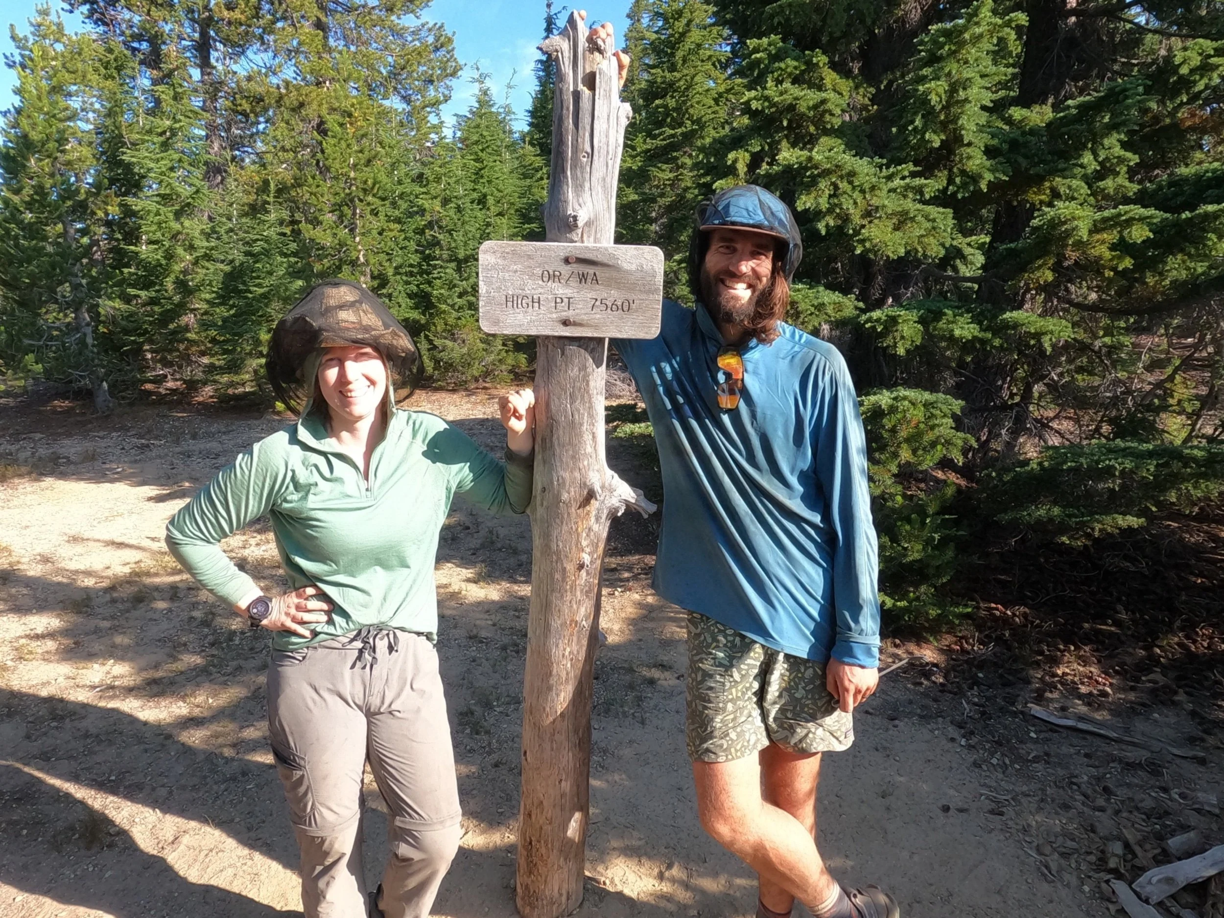
The trail was crisp and clear as we started southbound. We sped along a well groomed trail and reached the high point around 8 am. Here we stopped and talked with a few groups of guys, one of which had the best trail name - “Post-Holone” like post holing but sounding like Post Molone. He was from Seattle and offered us some Southern Comfort for getting to the high point which we declined given the hour - not that that has really stopped me on this trip. He took our picture and we talked for a while. Post was from Ballard in Seattle and knew all the places that we had picked up visiting our friends Josh and Maddy there.
We left Post and continued on down. It’s not exactly downhill from there but it did descend for some time to a really nice creek running off the side of Mt. Theilson. I have told Amanda this a few times but, I am very unfamiliar with everything in Oregon south of Eugene. Like, draw a horizontal line across Oregon through Eugene and it might as well be Northern California for me. This goes for the mountains - I don’t know any of them south of Bachelor but, wow, are there some beatiful ones. Mt. Theilson is one of them. It looks like a mini Matterhorn - incredibly sharp and the views of it from the PCT are epic. We stopped at the stream and I filtered for myself. Amanda is drinking less water than she should because she forgets so she turned down the offer for me to filter. We said hi to some others who had stopped to filter there and continued on.
From the creek we climbed a few hundred feet up to a ridge running off the flank of Mt. Theilson. There were some Scottish guys at the crest eyeing Theilson and asked us if we knew anything about the climb. Comments on FarOut had indicated that it was a solid climb until the summit pyramid where a potential climber had to do about 50 feet of class 5 climbing unprotected. I relayed this to them, the information was received with confused looks and I broke it down in more simple terms which they finally understood. We left the Scots behind and descended a long, long way before the path flattened out and delivered us to a forest service road just north of highway 138 which defines the north side of Crater Lake. There we found a Canadian guy from near Skaha Bluffs in Penticton, BC and a huge water cash. We took a nice long break here and topped up on water. Crazy thing is that I think this water cash and others in the area are provided by a trail angel named Devil Fish who was the same guy doing the really critical caches in the desert near Tehachapi. So if you are reading this Devil Fish - thank you so much!
We moved on, saying by to the guy from BC and another one who had showed up. The trail quickly reached 138 and we crossed it, taking a picture at the park boundary before heading into Oregon’s only major national park! Once in the park, the trail got clear really quick. The park service has their own trail maintenance crews and they are really good. We cruised through the northern reaches of the park, Amanda listening to her book and I listening to music. It really was the green tunnel in all its glory. We ran into a few people but not many and eventually we came to the junction of the PCT with the Rim Trail. Here we followed the PCT for another 0.4 miles to another trailhead where Devil Fish had left another cache and topped off. Then we reversed ourselves back to the junction and went up the Rim Trail a little while to the Grouse Hill Backcountry site where we made camp for the night. Best part of this camp is it sits on the edge of a big scree field and all into the evening the silence was regularly split by the squeaks of Pikas!


