Day 31: Porsche Club

6/16/2023

Section: Mile post 411.8 to 430.4

Distance: 18.40 Miles  

Moving Time: 07:33 hrs

Elevation Gain: 2,533 ft

Click here for current location

Today’s stage seemed like it was going to be a little shorter and maybe a rest day, but that was an illusion. The stage started off on a high point as we descended from our lofty camping site on the northern flanks of Pacifico Mountain. From there the path wound down westward to meet highway 59 at the Mill Creek Summit. At this pass the trail turned upwards again breifly traveling due north before the trail wound back down in a southwestern trajectory running parallel with an old forest service road, 3N17, towards Big Buck Trail Camp. At the camp, the trail winds its way further west and downwards before a final climb to cap the day at Messenger Flats and a nice campground there. 

I did not sleep well last night. It’’s getting warm again as we descend to the desert and I never sleep well in the heat. Add to that a 15 degree bag and it really made for a topsy-turvey night. In any case, the mornings are getting light earlier as we cruise towards the summer equinox and this morning the light was there pretty much right at 5 o’clock. Amanda and I manage to get up around 5:45 and were packed and moving at 6. A few more tents had arrived in the night, though the only person we recognized stirring was Sean. We said high and that we would see him up trail.

We climbed another 300 feet to get over the shoulder of Pacifico Mountain then cruises down the long slide of a trail towards highway 59. The 5 miles flew by and nothing too notable transpired as we descended. Just as we were arriving at the highway we saw a handwritten cardboard sign stating that a short detour would deliver you to water but Amanda and I were good on the water as we had pumped the night before so we continued on down to the road and waiting pit toilets. As we descended we noted a large number of Porsche’s of varying ages lined up in a turnout across from the pit toilets. “Must be a car show,” Amanda said back to me. “Kinda looks like a Porsche convention,'' I replied. We sat our things at a picnic table near the pit toilets and took turns watching while the other did what they had to. “I was really hoping those Porsche guys might be having a grill out” Amanda stated flatly “there’s no limit to what I would pay for a hot dog right now.” Unfortunately, it looked like cars were the only thing going on at the pullout so we proceeded up the trail.

From the Mill Creek Summit pass the trail climbed steeply, punishing legs that we had let stay static for too long. The trail paralleled an old, paved forest service road, 3N17, for some time as it wound westward and then slightly south around a ridge. The day began warming up and we continued to climb. Overgrowth encroached on the path in many areas and at one point I wiped a tick off my forehead. So glad my arms and head were fully clothed as we hacked our way through the overgrowth. Eventually the path began dropping down to a drainage. We stopped and talked to a day hiker, giving him some beta on water spots southbound. Not too much further we stopped again and talked to another day hiker who told us there was a stream in about a quarter mile and one in 2 miles and that the 2 mile stream was probably better. We thanked him and carried on, stopping at the closer stream, more of a trickle really, to eat some of our last reserves of food. 

We shaved it a bit too short on food this time. We have one more full day to go before we reach my parents resupply and go into Acton for additional food but as I write this after dinner today I am down to 1 electrolyte packet, one fruit leather and a pouch of buffalo chicken and have been hungry the last 2 days as I try to space out my reserves. We don’t really know what happened, since the Wrightwood grocery store was one of the most hiker friendly stores we have been to but one thing is for sure, we are not going to make this mistake again. 

After a snack we carried on to the last water source before our dry camp and filled up on water. While we did so, Sean caught up to us and we talked about a whole multitude of things from hummingbirds to politics. He is a fascinating person to talk with and has traveled more than even we have, so it makes for lots of great conversation and story swapping. 

After water, we all hiked the last 4.5 miles up to Messenger Flats and tossed our things down. We talked and ate dinner as a group of about 8 other campers showed up. After 2 hours everyone was starting to retire to bed so we decided we would as well. Sean broke his tailbone coming off Jacinto so he joked that he was going to go practice sleeping and we laughed and wished him luck. I typed this as the sun set in a beautiful cascade of oranges and reds - dreaming of all the Enchilada's Verde I am going to eat tomorrow.

Day 30: 4-Hundo!!!

6/15/2023

Section: Mile post 394.0 to 411.8

Distance: 18.92 Miles  

Moving Time: 08:02 hrs

Elevation Gain: 3,430 ft

Click here for current location

Today’s stage started just inside the San Gabriel Mountains National Monument before briefly passing into the Pleasant View Ridge Wilderness and returning back into the San Gabriel Mountains National Monument at the end of the day.

Amanda and I woke around 5:45 to the cacophony of birds in the trees above our tent. I was not ready to get up yet but deflated my sleeping pad and rolled up what I could in the tent before exiting to meet another beautiful day. We had gotten a 3rd group into the campground during the night. I noticed a tan rain fly a few sites away. Amanda eventually got her things organized and we enjoyed some breakfast sitting at a picnic table. I had purchased two heavy pouch bean meals and ate my second one today. This one was a Cuban Garbanzo bean medley and was quite delicious. We finished packing and said good to Sean as he appeared to be a few minutes behind us and started for the northern exit of the campground.

We jumped on the Burkhart Trail. Remember, because of the frogs we had circumvented about 4 miles of the PCT and the Burkhart trail made up part of the bypass which returned us to the PCT proper. We eventually rejoined our beloved trail and headed due west. We came to the Cooper Canyon Trail Camp with another pit toilet option, which Amanda utilized, and Sean caught up to us. We chatted for a while with him about California and more animals before we headed up the trail and Sean also took an opportunity to use the bathroom. 

We wound up out of the Cooper Canyon Trail and eventually rejoined highway 2 where we took a break and got a picture in front of a giant “We Love Frogs” written with rocks next to the highway. As we crossed the highway Amanda saw a quick glimpse of a coyote but it didn’t stick around long enough for me to see 

The trail paralleled highway 2 for the middle half of the day but, because it was closed, it was very quiet. Apart from Sean, we didn’t see anyone the rest of the day. A bit beyond the first crossing we passed the 400 mile mark, denoted by a big “400” written in pine cones. About halfway through the highway section we stopped to treat water and carried on. At mile 403 we departed from highway 2 for the last time and headed due north. The trail briefly curved west before returning north at mile 405. It was at this point that I started thinking about food. Let me tell you about all the foods I am especially craving

  • Cornbread - no idea why but I am dying for some cornbread

  • Enchiladas - I am taking care of this in 2 days at Agua Dulce

  • Popcorn - just really want some theater popcorn

  • Chili - Like any chili - would go amazing with the Cornbread

  • Ballard Pizza Company Pepperoni Pizza - Had some at a Mariners game before I left and want some more real bad

  • Ice Cream - like any ice cream

To name a few… Food aside, the trail went by Sulfur Springs camp and began climbing northwest. With little gas left in the tank we somberly climbed the hill. At mile 411 we stopped to fill up on water as we would be dry camping - 9 liters total and made the last bit of our way to camp. The campsite is beautiful, one of my favorite, with a clear view out to the basin and Palmdale in the distance. Amanda and I made camp in a nicely sheltered ring, surprised to be the only ones here. This section, from Wrightwood to Agua Dulce, has been a lonely one. We hungrily ate dinner and I did my nightly yoga before crawling into bed for some reading and writing. No rain fly tonight, we tried last night to see if we could keep Amanda warmer but it seems to be warmer already so going to leave it off to look at the starts!

Day 29: Walking the Road for Frawgs

6/14/2023

Section: Mile post 374.0 to 394.0

Distance:  16.53 Miles  

Moving Time:  08:15 hrs

Elevation Gain:  4,676 ft

Click here for current location

Today’s stage starts with a healthy climb up to the summit of Baden-Powel, named after one of the creators of the Boy Scouts, before straddling a ridge for around half of the rest of the day. This ridge also constitutes the border between the San Gabriel Mountains National Monument and the Sheep Mountain Wilderness which we hopped between for most of the day. After dropping off the ridge we passing through Little Jimmy Campground where the PCT descends to highway 2, which is currently closed. From the highway, the path climbs back up another ridge before returning to the highway and paralleling it for 2 miles. After returning to the highway at mile 390 the PCT typically descends into a small valley but is currently closed here to give the California Mountain Yellow Legged Frogs a chance to rebuild their population. Out of the massive respect that I have for amphibians and animals everywhere, we walked highway 2 the last 4 miles to Buckhorn Campground.

We woke a little after 5 and got going pretty quickly. I had purchased some Cajun bean pouches for breakfast and they were heavy so I was happy to eat one for breakfast this morning. After breakfast we said goodbye to Anna and her mom, wishing them luck on their SOBO adventures, and wearily began our morning climb. We jumped on the switchbacks and didn’t stop until we reached Lamel Spring where I topped us up to 2 liters each and we kept going. About 700 feet from the top we hit consistent snow and so followed a boot pack that wasn’t messing around and straight lined it for the top. Once there, we took some pictures and ate a snack at the monument for Mr. Powel that is located near the summit. I’m at the point now where I could eat though my entire bag of food for a week in one sitting. I’m not even kidding - I could just sit and eat and eat till it is all gone. I did stop myself at a Power bar and fruit leather though and Amanda and I kept going. 

We continued on the ridge, trying to stay on the south and western facing aspects as much as possible to avoid the snow. We bagged Mt. Bunham and Throop peak as well on our way. The trail turned north and headed down to Little Jimmy Spring and campground. We refilled our water at the spring and took another break at the campground a little further down the trail. On our way between the spring and the campground we saw a SOBO hiker but, aside from her, the trail was very quiet today. 

After our break at Little Jimmy Camp, we dropped to the highway at Islip trailhead, where I took some very “Abby Roads-esque” pictures before, begrudgingly, we put in another 1500 feet of climbing over Mt. Williamson. Dropping down off the west side of Mt. Williamson, we returned to the road and then climbed a much smaller hill paralleling highway 2 on the southeast side before returning to it at the Eagle’s Roost Parking area. Here we went and took a look at the Frog sign and recorded a video pledging our solidarity with these little amphibians. After a short break we started the 4-mile road walk.

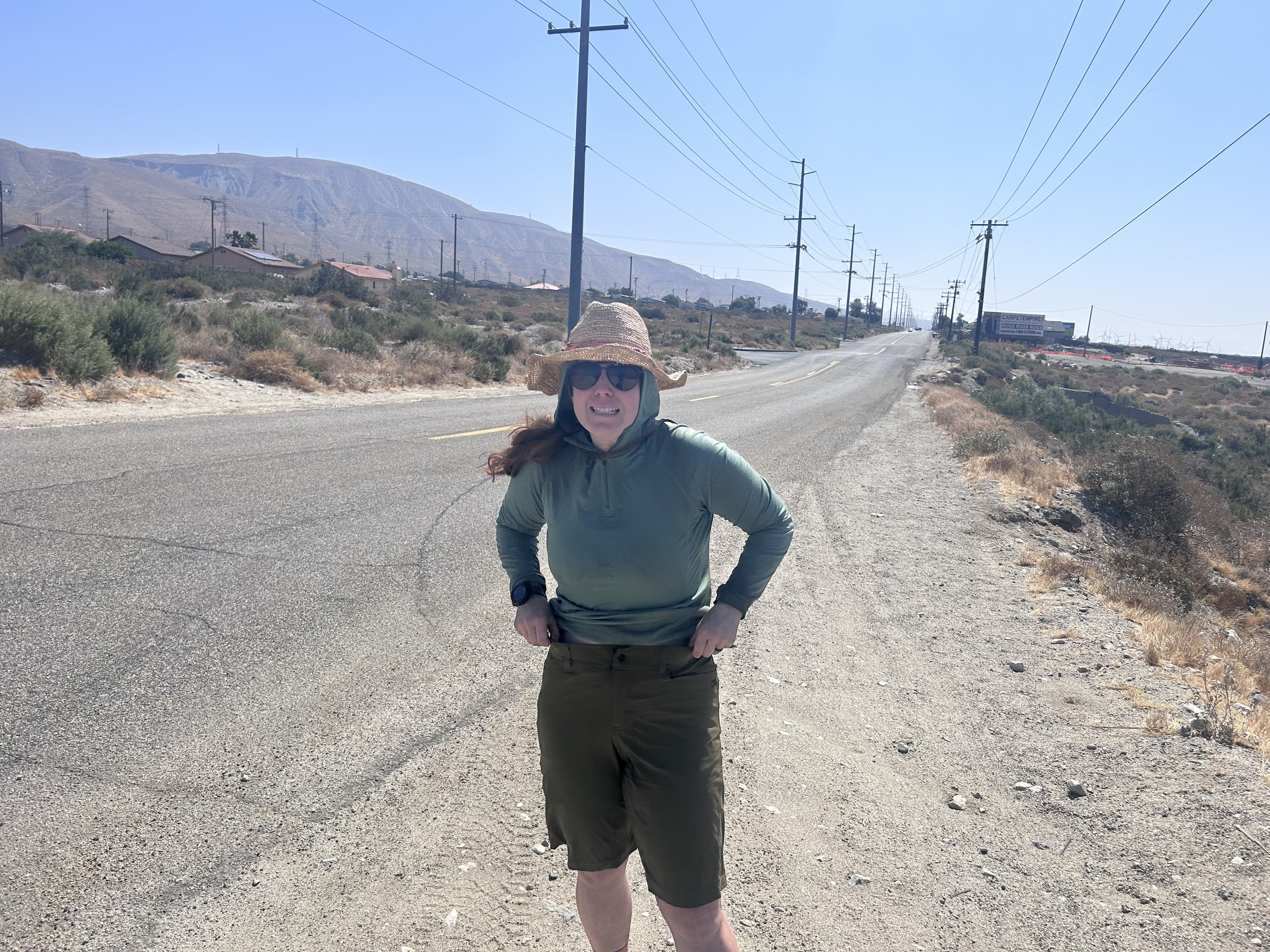
Walking on the road seems like it would be a nice, simple change of pace from the trail but, actually, it’s pretty miserable. The road is hard and unforgiving and the cyclist tat passed us both ways didn’t help. I wish I had wheels some times on this trail. We walked the center of the road for 4 miles. No cars made for an apocalyptic kind of feel. Just as our feet were really starting to protest, we reached the access road for Buckhorn campground and descended down to it. Because the highway is closed, this beautiful campground was eerily empty so we took the best spot by the river and proceeded to make a much needed dinner. I had some freeze-dried chicken fried rice and Amanda had some wild rice stew. Afterwards we conducted our typical evening activities. Another NOBO hiker named Sean came by and said hello. He was very knowledgeable about California Flora and Fauna so we talked with him a while about the animals we had seen and learned a lot. After a while Sean returned to his campsite and we got into our tent for the night, listening to the croaking of frogs.

Day 28: Wrightwood Nero Day

6/13/2023

Section: Milepost 369.3 to 374.0

Distance: 4.54 Miles  

Moving Time:  01:48 hrs

Elevation Gain: 455 ft

Click here for current location

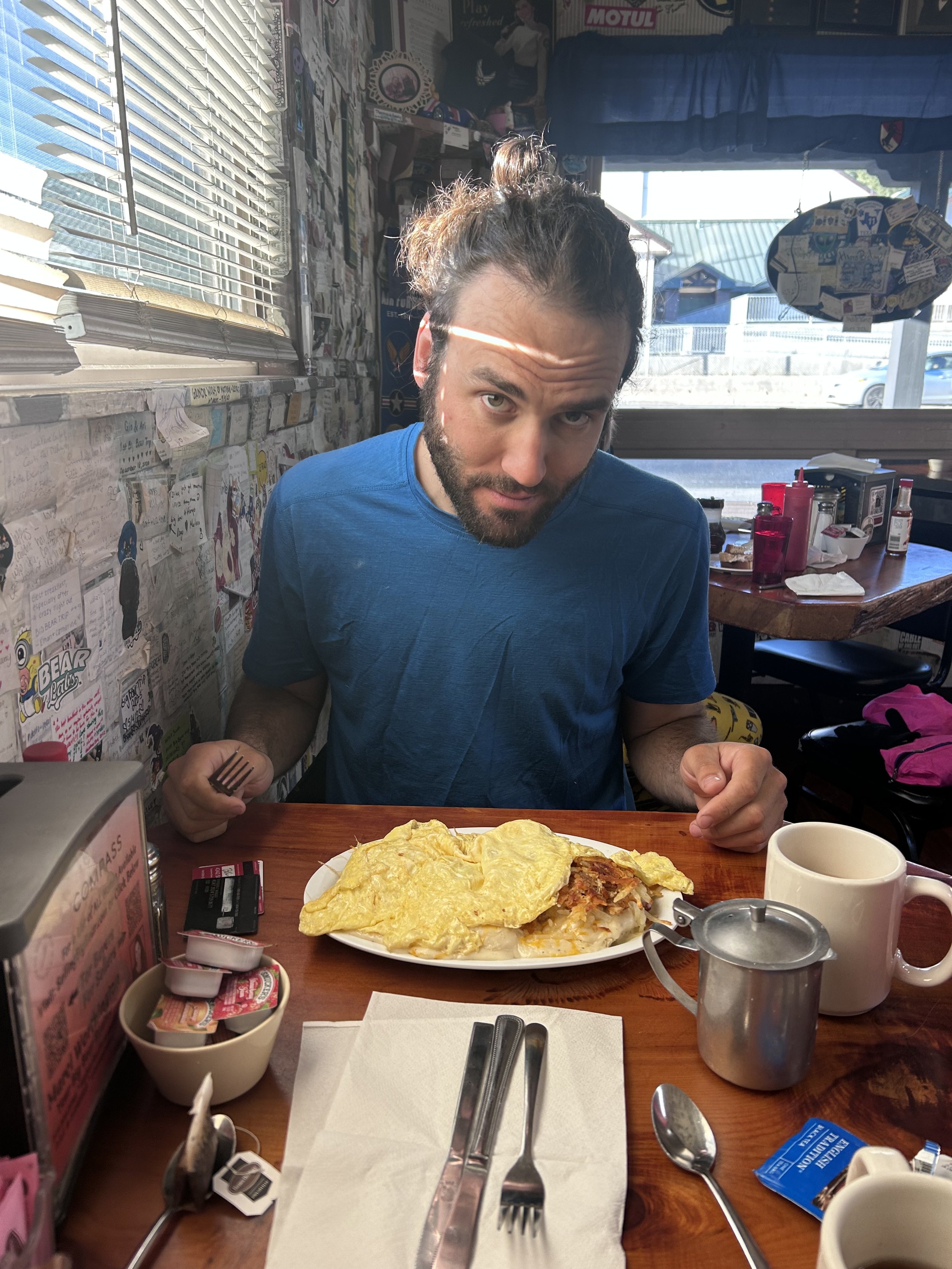
For the first time our day off was a bit more relaxing. After the brewpub the night before we had run into some of the Ride Brides as well as Charlie and a few others at the local pizza place and talked well into the night so, this morning, we slept in…till about 7. At around 8 we went to the local favorite breakfast place - The Grizzly Cafe. …A lot of Grizzly Bear references for a state that hasn’t had grizzly bears in it for over 100 years. Anyway, breakfast was delightful. Amanda had what she called the best French Toast she had had on the trip so far and I had some excellent country fried steak and a side of pancakes. I did pretty good work on both, if I do say so myself.

After breakfast we did some errands. We first stopped at the local hardware store which had lots of hiking supplies inside. We spent over 35 dollars on snacks and meals so they threw in a 1 cent gas canister which was a great bonus. Then we headed to Jensen’s Foods which, to date, has to be one of the best grocery stores for hikers we have been in since this adventure began. So many hiker friendly meals. Between the hardware store and the grocery store, Wrightwood is a standout stop along the PCT. I still think Julien is my favorite stop so far, but Wrightwood is right on its heels. 

With reloaded stocks we headed back to the hotel. I gave my mom a call to coordinate the two specialized shipments we have coming up at the beginning of July. Snow equipment to Kennedy Meadows and our remote bucket resupply at Muir Trail Camp. Once that was worked out, we finished packing our bags and left the hotel. I went back down to the hardware store because I had heard they would replace Darn Tough socks if yours had holes in them and mine did. They were happy to do so for me but, regrettably, I seem to have the same size foot as every male on the trail so there were no more socks in stock for me. I took my socks back and went to rejoin Amanda who had gone out to find more postcards. We rejoined at the Village Grind Cafe where, surprise, surprise, we ran into John from Eugene again. We sat together at a table where I got a beer and Amanda got a smoothie and we both ordered cheese sandwiches. We talked for an hour during which I scheduled a ride with Dale back up the hill and at around 1:30 we split up, saying we would surely run into John again.

We headed to the post office and dropped off some cards before heading to the Hardware store where we waited for Dale. While there we ran into Jason and Lorena as well as some of the Ride Brides and PHILLIPP! We chatted for a while to catch up but Dale showed up at 2 and we bid adieu to meet him.

Dale took us back up to the trailhead at mile 369 and we got out and gave him 10 dollars. He stayed a while to see if any hikers we going up the hill the other direction needing a ride down and we did our warm-ups. After about 10 minutes Dale headed back down the road and we headed up the trail. 

We walked for an hour and a half while the path ran parallel to highway 2 towards Baden Powel. After a set of many switchbacks we were delivered to the road where we took a seat and debated our next move. As we arrived Anna, from New York, arrived hiking SOBO with her 72 year old mom who’s trail name was Sunshine and was from Spokane. The two were going to stay at the trailhead. The road was closed so no cars were going by and the trailhead was strangely quiet, making for a perfect camping spot. We decided to stay with them and pitched our tent near theirs on a gravel road behind the trailhead. 

We made dinner with them that night and talked for a long time. Sunshine had been working on the PCT since the 1960’s, before it was even official, and had about 2200 miles done and was trying to finish the section she hadn’t done yet and Anna was completing the section from Kennedy Meadows down to Campo. We talked until we were too cold and then retired to our tents wishing each other a good night and best of luck going forward.

Day 27: Ski Resort Hiking

6/12/2023

Section: Mile post 356.7 to 369.3

Distance: 12.46 Miles  

Moving Time: 05:06 hrs

Elevation Gain: 2,720 ft

Click here for current location

Today’s stage crosses out of the San Bernardino Wilderness and into the Angels Wilderness, traveling in a northwestern direction the entire day. I had intended to go farther today but landslides on highway 2 made it impossible to get a hitch where we had intended so we cut it short and caught a ride to Wrightwood for the night. Thinking we are going to do a NERO day in Wrightwood.

Amanda and I woke around 5:30 with the light and the birds. We could hear the Ontario girls stirring and starting to pack up their site so I flipped the valve on my Thermarest counter-clockwise to start the morning's activities. We were on the trail around 7 am, hiking upwards…and upwards…and upwards. Most of the climbing was consolidated to the first half of the day which, at least, meant that we were doing it in the cool of the day. We played hopscotch with the Ontario girls for a bit but eventually went on ahead. The trail transitioned from scrubby desert to large pines which we both appreciated. 

Eventually we reached the turn-off for the access trail to Wrightwood. Here, you could descend a couple thousand feet directly to Wrightwood but this would put our day at ~5 miles and we wanted to get a bit more in before we took our NERO day. Plus, the climb back out of Wrightwood would not be as nice as getting a ride back to where we left off, so we kept going. We took a break here. I have found now that I am pretty much always hungry and can’t go too long without food. I had heard of hiker hunger but now was starting to experience it first hand - it’s pretty brutal. I’m starting to look at my food bag now like - “I think I could eat this whole thing in one sitting.” 

We carried on from the junction and not far on we crossed our first water source in about 17 miles - a freshwater spring 500 feet below the trail. The nice part was that it was near a car camp with bathrooms and picnic tables. As we walked by, l looked at a backpack lying in the trail, clearly left by a hiker who had gone down to the spring to resupply on water. On the front was a logo for chicken feed which suggested that the owner had made the backpack out of a chicken feed bag. Amanda and I looked at each other in wonder before going on up the trail. Amanda chilled at a picnic table while I descended down with water bladders and the new filter. On the way down I met up with the guy with the chicken backpack and asked if I could take a picture of his backpack, which he gladly said yes too. He told me he had made the backpack and his own clothing, which was awesome. I reached the spring and located a clear stream of water coming out of a 2 inch pipe in the ground. I set up and started pumping while watching some red mohawked birds take baths in the effluent coming off the spring. I looked them up later but couldn’t identify them. After cleaning a couple liters I headed back up the trail and rejoined Amanda. We had a few more snacks and then headed on. Amanda was devastated that a family who had been packing up their RV had not offered her any snacks.

We maxed out our elevation a short distance more up the trail and then continued on through a few small “Camel Humps” in elevation. Looking down below we could see Big Pines and shortly down the trail we came upon the east side of Mountain High resort. Amanda stopped and took some pictures of the ski run names and we continued on. We passed by two large ponds with “No Trespassing” signs before descending towards highway 2.

We wound down to the highway and crossed the road where we took a quick break. From here we intended to carry on down the trail another 5 miles but I took a quick look at CalDOT before doing so. The worry I had was that the road could be closed a few miles down the road, in which case, no cars would be able to come up the road to get us. A few seconds of research showed that, indeed, the road was closed only a few miles ahead of the trailhead. This killed any plans we had for moving on so we started looking for a ride. A few minutes later Dale, who we had read about in the FarOut forums, showed up with some through hikers and said he would give us a ride. As he made the U-turn, the chicken bag backpack guy showed up and occupied the 4th seat as we headed down. Dale was wearing a Pivot Bikes hat so I struck up a conversation about mountain biking on the local slopes as we rode down.

Dale dropped us off at the hardware store where there were already about 10 hikers recharging their devices. We chilled until Amanda found us an accommodation for the night and then we took off. A 5 minute walk brought us to the hotel where we dropped our things and took much needed showers. Afterwards we went and got some lunch, grabbed some post cards and returned to the hotel to do some laundry. The hotel had these adorable miniature washing machines that could do about 10-12 items of clothing - just to get our clothes cleaned. Later that night we chilled at a local brewery where we filled out the cards and enjoyed some local brew before joining some of the ride brides at the local pizza place. Excellent end to a great day on the trail.

Day 26: Misty Climb

6/11/2023

Section: Mile post 341.9 to 356.7

Distance: 15.36 Miles  

Moving Time: 06:36 hrs

Elevation Gain: 3,981 ft

Click here for current location

Today’s stage lies entirely in the San Bernardino National Forest as it makes its way west toward Baden-Powel, Big Pines and Wrightwood. The day was unexpectedly short. As I mentioned before, the program I had written to design our itinerary converted every 1000 feet of elevation gain into a mile and added it to the mileage planned for a day. This means that, on the days where there is a lot of elevation gain the intended mileage will be shorter to compensate for going up. Today, my program had recognized approximately 6000 feet of elevation gain and reduced the mileage to compensate but, in reality, we only went up 4000 feet. Not sure what happened there but, looking ahead, it appears to be an anomaly. In any case, it made for a lighter day which is a good thing to have every once in awhile when you are walking 2700 miles.

We woke up on a mattress, which is something I have not appreciated as much in my life as I do now. The downside to the hotel though, aside from the fact that it looks like a drug front, was that a white light was on all night right in front of the window. Amanda and I woke many times, separately, thinking it was already 9 am because that light mimicked daylight so well. I’m not really sure, in the end, we sleep any better than we would have on the trail. After waking up I ate some grits and Amanda had the other half of her subway sandwich. When we were all fed and packed we gathered our things, turned in the keycard and headed for the highway. We considered “frogger-ing” our way back to McDonalds and making our way under the highway but instead took a right and went further out of town before descending an access road which paralleled the many railroad tracks back towards the trail. Side note about Cajon Pass - BNSF moves a MASSIVE amount of rail though here, it’s insane. Sitting at the McDonalds yesterday for an hour we saw probably 10 long trains go by and all night last night it was just constant trains. Thinking it must be one of the main arteries out of LA. 

We walked along the gravel road for about half an hour before it ran across the PCT on the west side of I-15 and from there we started climbing. The trail wound through some really cool rock formations that looked more at home in southern Utah before returning to the classic Southern California desert scrub we were used to. All morning we wound up higher into the mountains. An occasional look back left a devastating feeling of closeness to the highway despite all the walking that had been done. About 2 hours in, the trail turned northwest and maintained its elevation as a mile wide valley further west rose to that elevation. We eventually turned west directly into the valley where we ran across the first water cache between Cajon and highway 2. This section is another dry section requiring trail Angeles to fill water caches so we can make it and we were so thankful to find this one full. Here we ran back into Eva and Kayla who were just filling up. We asked them about their night and talked for a while. Amanda and I ate some of our saltier snacks and then drank a ton of water before refilling and the Ontario girls carried on. 

After the water cache we crossed the rest of the valley and continued our climb. I should note that almost all day was climbing, just not 6000 feet of climbing as expected. We carried on, the trail making dramatic switchbacks up the shrubby hillside. At one point we stopped to examine some strange fruit looking shapes growing on some of the trees. We thought they might be some sort of large berry but on closer inspection Amanda thought they might actually be blights on the tree. Further on we took a short break for a photo shoot which Amanda wanted to feature in a reel she was working on (stay tuned!) before we continued our slog uphill. 

The trail eventually crested the lower, eastern end of Upper Lytle Creek Ridge. Towards the top it crossed a gravel road which it would then parallel for this and tomorrow's stage. On the road Eva and Kayla were eating a hot lunch. We took a quick break and chatted with them before carrying on. Now on the ridge, the trail followed on the northern side as it rose upwards. We climbed through an old fire section, new growth already greening up the hillsides and crisscrossing the road in places. Eventually we saw Gobbler’s Knob come into view. Our campsite was located on the far side so we picked up our pace and another 15 minutes brought us to a 3 tent pad campsite. We surveyed and picked a flat spot off the trail. It was 3 pm and we made ourselves busy putting the tent up and getting things set up. Afterwards I took a nap and the Ontario girls showed up. We had a late afternoon reading session and around 6 made dinner as a little group and then be talked for an hour or so. We learned that Eva and Kayla had just graduated from college and were doing this trail before starting work which we thought was awesome. 

Afterwards we all retired to our tents. It was cooling down and we all wanted to read. Great to be back on the trail and not have a bright white light shining in on my face!

Day 25: The Golden Arches

6/10/2023

Section: Mile post 326.4 to 341.9

Distance: 16.29 Miles  

Moving Time: 06:27 hrs

Elevation Gain: 1,819 ft

Click here for current location

Didn’t really sleep last night - was way too hot. The sleeping bag I am using is rated for 15 degrees and I doubt it got much below 45 last night. We woke as the sun was rising over the lake and got ready - happy to have the assistance of a picnic table. Such a simple thing but certainly missed when it is gone. We both had grits with added sharp cheese and then packed, completed our warm-ups and were off.

The initial climb out of the little picnic area was a chore but we quickly got back on the PCT and headed south and west towards the western boundary of Silverlake State Park. About an hour brought us to highway 138 where we passed under and onto the western boundary of the state park. Along the way we heard a large party getting warmed up in the Baranca Group Campsite. “Should we go crash the party?” Amanda asked me. “No, we’ve got McDonalds to get to!” I cried.

The McDonalds at Cajon Pass may be one of the most famous fast-food stops along the PCT. It has been in operation for a long time and the hiking community is very familiar with its presence as a quick and easy stop enroute to Wrightwood or Agua Dulce. Amanda and I would not normally be excited about McDonalds but hiker hunger was starting to take hold and knowing the Golden Arches were waiting for us 13 miles down trail certainly quickened our pace.

Shortly after the party we passed out of the Silverwood Lake State Park and back into the San Bernardino National Forest. From here we completed most of our climbing for the day in a 3-4 mile stretch as the path wound up over Cleghorn Ridge and dropped down the north side. The trail throughout this segment was immaculate and we flew along it. Not too many crazy animal sightings - just the normal lizards and a few garter snakes. 

From the top of Cleghorn Ridge we begin a long descent into Cajon Pass, again winding in and out of little drainages. We stopped about 8 miles ahead of Cajon to top off water and have a snack before continuing on. At around mile 338 we came to a cleft ridge which fell away steeply just beyond the trail revealing exposed sandy soil on the opposite side. “This looks like Cappadocia,” Amanda exclaimed. “It certainly does” I agreed. The path wound us up above and around the steep sandy cliffs before downgrading us slowly to below the highway, which was now visible. 

The last mile and a half of today's segment winds through the Crowder Canyon on an old Wagon Road that was a precursor and, later, a short cut for highway 66 before arriving at Cajon Pass. Here, I snapped a picture of Amanda in front of the McDonalds sign and we sprinte up the road to Micky-D’s. Once there we sat down, getting a lot of looks from the present patrons. The staff is used to hikers coming in, but the clientele comes from all over and are likely not familiar with the PCT. Amanda got 2 McChickens, a large fry, sweet and sour sauces and a McFlurry. I gave McDonalds’ spicy crispy chicken a try and was, overall, pretty impressed. I also got 2 cheeseburgers (gotta enjoy the classics) but I think the patty’s have gotten thinner since the last time I was here. I also got some fries and an Oreo McFlurry. We ate and relaxed, talking to one of the staff as he mopped the floor behind us, then we had to make a decision. We could carry on 2 more miles or use our credit card points to stay in a seedy hotel across the highway - the Cajon Pass Inn. We deliberated for a while. We are ahead of schedule and the 2 extra miles wouldn’t really help us any tomorrow and might actually make the long water carry more complicated so we decided to stay a night in “luxury.” 

We headed out from McDonalds on roads devoid of sidewalks before playing frogger across higheway 138 which passed perpendicular to I-15. The pedestrian infrastructure in America is absolutely abysmal - really makes me miss how walkable everything was in Germany. The walk from McDonalds to the hotel is probably the scariest half mile we will do on the PCT!

Once at the hotel we ran into the two Ontario girls and chatted with them for a while. They were charging phones and making calls and had decided to do the 2 miles in that evening. We wished them luck and headed to our room for showers and to catch up on blogging. After a few hours we went back out to play frogger and get some Subway before coming back and passing out on a “nice” hotel bed. It feels a little like cheating but honestly, I don't care.

Day 24: Water Snakes and Chukar

6/9/2023

Section: Mile post 307.9 to 326.4

Distance: 18.49 Miles  

Moving Time: 07:43 hrs

Elevation Gain: 1,822 ft

Click here for current location

Today’s stage continues to wind along the banks of Deep Creek Canyon traveling north to the border of the San Bernardino National Forest and then west to the Mojave River Dam. From the dam, the path transitions to the banks of the West Fork of the Mojave River, heading west. In its final miles, today's stage diverges from the Mojave River and traverses southwest towards the Cedar Springs Dam and Silverwood Lake. The stage today ends on the banks of Silverwood Lake.

I woke up before my alarm clock. Not quite early enough before my alarm clock to actually go back to sleep - which is the worst. What woke me up was an extremely loud bird in the tree right above us - so, in a way, I did wake up to an alarm clock, just not the one I intended to. Wanting to get an earlier start on the day than previous stages and take advantage of the warmer mornings here at the lower elevation, Amanda and I both got up and got going without too much delay. We ate 2 packs of Quaker Instant grits on a big flat rock a few paces from our tent. We added some shredded Sharp Tillamook Cheddar for extra protein and washed everything off with boiled water afterwards. The two other girls who we camped nearby were already up and out as we put on our packs and headed off.

The morning was pretty uneventful. The trail in these stages winds in and out of drainages as it attempts to keep the elevation profile steady. “For the Horses,” I keep reminding Amanda. The day was starting to warm as we passed a day hiker on his way into the Hot Springs. He gave us some pointers on crossing Deep Creek just after the dam - evidently it was pretty deep. We thanked him and told him to enjoy the hot springs. After another 45 minutes or so the valley in front of us opened up and we could see out to Hesperia, Calfornia and the great flatness east of the Sierra.

The trail turned southwest and headed down to the dam, which was smaller than I had envisioned, looking on the map. We crossed a large spillway and then proceeded on the trail behind the dam proper. At this point we caught up to the two girls who had been camping next to us. I realized they were the same two girls we had passed on day 18 when we spent a good hour soaking in the river. We all looked at the deep crossing. The water wasn’t running fast but it looked to be 4 feet deep in some places. I took the first shot at it, wanting to let my feet dry on the other side. It came up to my waist but was passable and very refreshing. On the other side I tried to follow the day hiker's advice but think I had misunderstood his info on the exit point. I decided to just pick the one that looked best. On the other side I filmed as Amanda went and then the two girls. All made it across just fine but one of the two fell in shortly after entering,

On the other side we talked to them for a while. They were Eva and Kayla from Ontario and they had started April 13th. These last 4 or 5 days were all they had left to complete the PCT from Campo to Kennedy Meadows. From there they were thinking of heading to Northern California to give the Sierra some more dry time.

After drying off we said see you soon to Eva and Kayla and headed up the trail in our sandals, intending to walk our feet dry. The girls had told us they were hiking with some section hikers until one of them got bit by a rattlesnake which made us suddenly a little nervous walking through the tall grass in just sandals - like shoes would make any difference. 10 minutes later we pulled over at a campsite on the river and changed out sandals for shoes. I moleskinned a small blister on the right side of my right foot as the girls passed us and we headed on.

The trail eventually departed from the river and began winding along the outer edge of the San Bernardino range, again attempting to stay flat by entering and exiting every drainage we came across. We passed through the Deep Creek Hot Springs trailhead and got some Trail Magic, a clementine each from a weathered looking trail angel named Copper Tone. He told us he loved being a trail angel and used to do a lot more but takes it easy nowadays. We thanked him for the clementine and kept going. As we headed back up into the hills Amanda and I discussed what we were going to get at McDonalds tomorrow since the Cajon Pass McDonalds is a real bright spot on the trail between Big Bear and Wrightwood. Amanda is getting 2 McChickens and a McFlurry - though, Copper Tone mentioned that he used to do Root Beer Floats and that could be done at Mickey-D’s if one ordered some soft serve and got some fountain root beer so, we will see. We also agreed that we were craving Cinnamon Rolls and Old Fashioned Donuts, weirdly enough. I’m sure it won’t be the last thing we crave on this adventure.

Along one of the many dips the trail made into the hills, we startled some chubby Chukar. They ran along ahead of us, unsure how to get off the trail for a while before flying up into a tree to get out of our way. We carried on and crossed a stream. As I looked down I saw a little garter snake in one of the pools actually hunting water skimmers. It would swim underneath one and then strike up to the surface to grab one. I had never seen a snake do something like that and tried to get a video with my GoPro but scared it back into a bush before i coul get a decent shot.

Down trail we came to another river crossing and stopped here to eat and refill water. The girls from Ontario caught us and passed again as we ate. Amanda’s parents’ resupply had come with two new electrolyte packets - Liquid IV and Skratch Labs. I have decided Liquid IV and LMNT are the best - Noom and Skratch are not my fav’s. After lunch we traveled up the path more. Shortly out of our lunch break Amanda stopped and bent over a particularly sluggish Regal Horned Lizard. These guys are always the slowest lizards, sometimes not getting fully out of our way on the path. This one didn't even move. Amanda gave him a light pat on the back and said “Good lizard,” before moving on. 

We continued to zig and zag in and out of drainages before the trail finally dumped us down to flat ground as it wound through a series of government utility buildings behind the Cedar Springs dam. We wound through barbed wire fences for about 30 minutes before the trail cleared the west side of the dam and climbed up the hills hemming in Silverwood Lake. As we crested the small ridge, the lake came into sight. We clamored down the other side and, again, began winding in and out of drainages, this time facing the lake. Along the way we were nearly attacked by two dogs, a German Shepherd and, a little while later, some other, smaller mutt before the owners finally came up to call them back - which we both deeply enjoyed. “Love being in a State Park,” I said to Amanda with a grin. 

Another mile of walking brought us to a picnic area where there were a few hikers already sitting at a table. We dropped our things and ate a quick snack. The other hikes eventually left as they had only gotten a few miles in and were eager to hike on. We said goodbye and then started our evening choirs. Tonight we had good ol’ Idaho Potatoes - thanks Sandy - and found a secluded spot to set up the tent before winding down for the night. 

I know this was a long one for you readers but I have a picnic table to write on!

Day 23: Hot Spring Finishes

6/8/2023

Section: Mile post 285.6 to 307.9

Distance: 22.06 Miles  

Moving Time: 09:14 hrs

Elevation Gain:  1,314 ft

Click here for current location

Today’s stage shared it’s time along the banks of 2 rivers - Holcomb creek in the morning and Deep Creek in the afternoon. Both were some of the largest flowing rivers we have seen to date.

Amanda and I slept in again this morning. Didn’t mean to but I continue to notice that, without a puffy and only shorts, the mornings are especially cold which does not encourage early rising. By the time we had risen, eaten and packed, John had been gone for an hour and a half. We started the day tracing Holcomb creek as it wound its way east. The trail left Holcomb creek about a mile in only to rejoin its banks a few miles later. Amanda and I talked a bit as we hiked but after 6 or 7 miles fell into our own thoughts.

The day warmed and we left the banks of Holcomb creek and headed over a small saddle. Just before leaving the creek we encountered a number of nests inhabited by large, dark black bumble bee looking insects. We later identified them as California Carpenter Bees. They looked pretty nasty and we hurried past a number of their nests throughout the day. They always seemed to be located in some dead trees.

After crossing the saddle we dropped into Deep Creek and wound along its banks for a long while. At one point Amanda stopped suddenly in the path just before stepping on a large garter snake. The snake seemed unconcerned even when Amanda tried her tapping trick. Finally she went around the snake and it did seem to wake up as I passed it and slithered out of sight - I think it must have been how bad I smelled. We made our way on through a number of blow-downs. Amanda snaked out another ultra-lighter’s Essentia water bottle - this makes two left behind now on the trail. 

We stopped at a beatufully made bridge over a small gorge that dropped into Deep Creek. We had 5 miles to go and it was 5 pm. At our rate that was looking like a 7 pm arrival at a hot spring camp site that we really wanted to get to. “It will be totally worth it babe,” i said as we departed. An hour on we came across John’s tent with John himself sitting on a rock overlooking a confluence of Deep Creek. We talked for a bit - John wasn’t feeling up to the 2 extra miles to the hot spring but said he would see us the next day. We said goodbye and as we were crossing the feeder stream someone shouted out “Is that Amanda!!” I looked up to see Old Chris (Still feel bad that that is his name) coming over to say high. It had been almost 2 weeks since we had seen him but he had waited an extra day in Big Bear for his wife, Cathy, who was now hiking with him. He smiled and we fist bumped and talked for a while before he said he didn’t want to keep us and that we should keep on going.

The last 2 miles were excruciating but we eventually rounded a final ridge and ran into 3 girls coming up from the hot springs. Looking down I saw a number of tents and knew we had found it. We dropped down to the campsite and found a spot. It looked like 2 other unfamiliar PCT hikers and about 4 day hikers were already there. We quickly dropped our things, grabbed a towel and headed for the hot spring. There are a number of warm pools at Deep Spring but we saw one that was uninhabited and dipped in. The water was perfect. We stayed for the better part of an hour soaking our beat up lower limbs. I transitioned into the stream a few times for some hot-cold treatment but eventually hunger got the better of us.

Back by our tent we consumed 2 ramen packets a piece and I put down some bagged tuna before, nearly comatose, we stumbled to bed. Long day but a great way to finish.

Day 22: Fresh Kicks

6/7/2023

Section: Mile post 266.1 to 285.6

Distance: 19.18 Miles  

Moving Time: 07:38 hrs

Elevation Gain: 2,052  ft

Click here for current location

Minimal elevation gain today made for maximum distance. The trail heads in a true western direction on this stage as it skirts north of Big Bear and within the San Bernardino National Forest.

Amanda and I were up at 6 taking final showers and organizing our things. At 8 we were ready and headed out the door down to the post office where we shipped our shoes and the broken watch back to my parents. John met us at the parking lot and at 9 am sharp Tink showed up. It should be noted that the trail angel who gave us sandwiches two days before was called Momma Tinkan and that’s who we thought we were getting a ride from. Funny thing is that this Tink was actually the woman that gave us a ride into town on that same day. These two women were completely unaware of each other or their same names. Tink made the slow, windy way out Big Bear on Highway 18 as we told her all the places we visited while in town. She chatted along until we were up to the pass and she turned to let us out at the trailhead. We each gave her 5 bucks and she thanked us before leaving. We told John we were sure we would see him again and he headed off into the trees. Amadna and I had a quick snack and did our warm-ups before putting on our backpacks, tightening our new shoes and heading off after him. 

The day was pleasantly warm - not too hot or buggy. The trail was a dream, probably the best maintained section of trail we had been on the whole way so we made great time. We progressed west and eventually stopped for a quick snack about 7 miles in. The shoes were running just as dreamily as the trail. I did some minor adjustments but nothing too major. The Altras have an oversized toe box which addressed the only issue I had with my Hoka Speedgoats - that my little toe was getting subducted under the rest of the toes and I was getting minor blisters between my toes. The Altras seemed to have all the strengths of the Speedgoats without compromising on any other front. I was loving them. 

We continued on another 6 miles and got a chance to get water. I broke out the Sawyer filter and immediately realized i had been missing out. I loved the old pump but new designs and features definitely come with some wins. The system worked beautifully in addition to being a quarter of the weight of the old pump. All I had to do was fill a 1 liter bladder with dirty water and squeeze it through the filter straight into our water bladders - easy peezy. We went on, and came around a corner as a large brown dog ran up to us. After sniffing our hands it ran back up the trail and about 2 minutes later two trail runners came up the trail in a slow jog. These weren’t just ordinary trail runners though - one had a chainsaw and the other had a pair of limb snips. They were trail maintenance runners - running from blowdown to blowdown, cleaning the trail while also getting yoked! Amanda and I both smiled and thanked them for cleaning up. After they were out of earshot i joked to Amanda “Isn’t that the the exact definition of running with scissors?” She laughed and we carried on.

Eventually the trail delivered us into a small valley where our campsite was located - called Little Bear Springs. There we found a composting toilet and a nice clear spot under some tall trees where John had already parked for the night. We talked to him for a while about the good weather and strange absence of other hikers today, then Amanda and I set about our normal choirs. We had pouch salmon from Sandy and Ray as well as Idaho Potatoes before cleaning up and heading to bed. As I lay in bed I realized, after about 5 planes had gone overhead, that we were sleeping under the LAX approach path and that was going to make for a fun night.

Day 21: Big Bear Zero Day

6/6/2023

Section: Mile post 266.1 to 266.1

Distance:  0 Miles  

Moving Time: 0 hrs

Elevation Gain:  0 ft

Click here for current location

Not sure why but 0 days have been stressful. I think you accummulate a bunch of to-do’s on the trail and then have 1 day to get them all done. Go to the post office, go to the grocery store, do laundry, etc. etc. and before you know it the day is over and you have no idea if you got everything done. Big Bear was no exception to this and the fact that it is a much larger city than either Julien or Idyllwild made it even more so. It might have had something to do with losing power for half the day but can’t say that’s everything.

We tried to sleep in as usual and failed both getting up around 6 am. The good news was that the place everyone had been raving about for breakfast, the Grizzly Manor Cafe, was also open early. So, we got up and headed down the street, excited to see what was in store. We found the cafe to be a classic, hole-in-the-wall place sandwiched between a Denny’s and a Taco Bell - but the smells from outside were extremely promising. We stepped in and were greated by a smiling man in his mid-thirties who seemed to be the waiter and the chef all at once - managing a set of large cook-tops visible in the middle of the establishment. “Sit anywhere you like!!” He shouted at us as we came in. We took a two seater next to another couple hiking the PCT. His name was Bangarang and i couldn’t remember her name but he was the one who had gotten ants all up in his pants on the way to Idyllwild. We hadn’t really talked to them and they didn’t seem to be super chatty so we took our seats and perused the menu. Amanda ended up going with French Toast and I went with a plate called te “Blob” - scambled eggs, biscuits and gravey, and hash browns plus a side of grits. It was disgusting and wonderful all at the same time and I’m happy to say I did some good work on it. 

After breakfast, Amanda and I briefly went back to the AirBnB before taking a “divide and conquer” approach to the day. Amanda headed off to the post-office to get the resupply box her parents had sent us and I went the opposite direction to do laundry and pick up some odds-and-ends at the grocery store. Big Bear runs an awesome free shuttle which helped dramatically as distances in this town were far greater than Julien or Idyllwild. I made a stop at US Bank to grab some cash before stopping in at the laundromat. I unceremoniously dumped all of our laundry in before adding a box of Tide detergent to the mix and plugging in 8 quarters to make the machine start. While waiting for the laundry I went across the street to a small jerky shop and picked up some snacks for the next stage and then to the grocery store to grab some breakfasts - more grits - and get Amanda a bell pepper. Back at the laundromat I ran our clothes through another wash cycle and then into the drier. By the time everything was said and done it was already 1 pm and I headed back to the house. 

Once back, Amanda and I went out to replace some of the items that had broken or needed replacing/resupply. This included

  • New shoes for me - the Hokas were at ~400 miles

  • New shoes for Amanda - the minimal cushion Altras were only getting her about 8-12 miles

  • New gas canister

  • New water filter

  • New pants for Amanda

  • Sunscreen

  • Hand Sanitizer

We started at Goldsmiths where we both found great shoe replacements. Amanda and I both went with the Altra Olympus - wide toe box and plenty of cushion for two people each operating on replaced ACL’s. I was also able to get more butane there. Next, we headed to the far side of the Big Bear Village to Big Bear Sporting goods. We broke down and went with the fad, purchasing a Sawyer Filtration system. One more quick stop at Walgreens got us sunscreen and hand sanitizer. We stopped and got smoothies in the village before heading back to the BnB. On our way out of the village we saw Charlie (one of the German sisters), as well as Phillip and some other people we knew. We crossed the street and said hi to them. I guess Charlie’s sister Sophia had decided to drop off the trail and head to LA to see friends so Charlie was on her own now and Phillip was waiting until Friday for a new tent and sleeping pad to show up. They all said they were going to Taco Tuesday in the evening at Azteca’s and that we should join them. We said we probably would and see you later as we headed back to the cabin.

Once back i had one more brautwurst. I hadn’t had a chance to eat since breakfast. Then I worked out our insurance direct deposit debacle that we hadn’t had time to fix since we had left, while Amanda arranged for a ride the next morning. Then we relaxed in the hot tube for over an hour before getting dressed and heading to Azteca. We decided to walk and that was a mistake because this Mexican Restaraunt was way out of town. We hiked over two miles and I totally get the irony in saying that, but when you aren’t expecting it it’s annoying. We finally got there and sat next to John who I had told about this clandestine Taco Tuesday event earlier. Lorena and Jason were there as well as Phillip and Charlie and the Kiwi’s and a few new faces. We talked and enjoyed some excellent food - the Kiwi’s came and joined us and we traded stories about traveling the world. Eventually it got late and we walked back with Phillip and John - trying to hail a ride on the way to no avail. Eventually we made it back. The ride was scheduled for 9 am the next morning so we decided to leave all remaining chores for the morning and headed to bed - hoping we had gotten everything done today that was needed.

Day 20: The Big Turn West

6/5/2023

Section: Mile post 232.9 to 266.1

Distance:  18.03 Miles  

Moving Time: 07:17 hrs

Elevation Gain:  1,407 ft

Click here for current location


Today’s route wasn’t too exciting except that it marks a major feature on the map. If you look at a map of the PCT, about an 1/8th of the way up California the trail takes a noticeable turn west to stay in the San Bernardino mountains north of Los Angeles. Today, we made that turn which is cool to see because, while our progress is still small compared to the entirety of the trail, it’s something you can actually identify. The path today follows solidly in the San Bernardino Mountains National Forest transitioning from tall pines into a high desert brush as we approached Big Bear. 

Amanda and I had meant to be up by 4 and on the trail by 5 but amanda hit the snooze for 10 minutes, than another 10 minutes, then reset the alarm for 5 and we didn’t actually get up until 6. Once up, it was pretty cold. I am on the verge of asking my parents to send my puffy to our next resupply because, while I warm up real quick on the trail, the hour or so it takes to get ready is pretty miserable above 4000 feet. 

We set out 10 minutes before 7. Amanda’s backup watch, the Garmin 5S I got her for her birthday about 7 years ago, had failed completely on me so i recorded the day on my phone. Add it to the list of things that finally gave up the ghost in the early days of this trip. We started off in high pines. “This looks a lot like Bend,” I said to Amanda. “Or Leavenworth,” she answered. “Or just anywhere on the east side of the Cascades,” I joked back. The trail ran due north and soon we could hear cars through the trees as it paralleled highway 38 south of Big Bear. We began crossing a number of dirt roads as the trail ran through an easement on the west side of someone's property. Eventually we arrived at Onyx Peak, where some trail angels had left a water cash. We decided to keep going, having made the 4 liters from yesterday last pretty well. 

The trail continued to parallel the road as it started to make its turn west. In the distance we got the first glimpse of Big Bear and Baldwin lake. From here the path descended into a creek bed with water flowing on our left side. This was Arastre Creek and as we followed it we came across the Arastre Equestrian Camp where we stopped for a bathroom break and a snack. I managed to tape up the Pur Water Filter enough to prevent further leaking and managed to get about 2 liters pumped into our water bladders.We rested for about 45 minutes before putting our packs back on and heading out. 

We had gotten the food really close to perfect this time. I was down to the last bit of my trail mix and some nut squares and Amanda was also down to the last bit of food she had. These are the best feeling days because, with little water and food left, the packs are super light and you can fly down the trail. The route stayed in the creek bed for another mile before it started to head out of the west side. Here we made a mistake, or, I think it was a mistake. In my GPS app, the trail reaches a road, crosses it and heads up the west side of the Arastre ravine but after checking a mile up the trail, I realized that FarOut - the app most everyone is using for orientation - shows the trail going up the east side of the ravine after following the road a little way. Sure enough, looking across the ravine, I could make out a well defined trail winding down closer to the river as we made our way higher above it. We decided to stay on our current path as it converged with the other path in about a mile and, sure enough, a mile on a poorly defined trail delivered us back to the PCT. I’m not sure I would have wanted to do the other path, in retrospect - it lost a healthy amount of elevation for seemingly no reason. 

From the point where the two paths converged the trail left the tall Jeffrey and Sugar Pines behind and entered a high, scrubby landscape. We weaved around and above small hills for another 5 miles before we arrived at a junction for the “Eye of God.” I had been raving to Amanda all day about going to see this ancient megalith which is a sacred tribal landmark for the native Yuhaaviatam peoples. Supposedly it was a giant dome of quartz that came out of the ground and was easily accessible from the trail. At the junction we turned off - Amanda a little less than enthused as the end of the day was only about 3 miles away. After taking a wrong turn and leading us about a ¼ mile down the wrong road, we rerouted and arrived at the dome. I have to say, it was underwhelming. A giant mound of white rock coming out of the ground was cool to see, but nothing to write home about (though, admittedly, i am writing about it here so…). We took some pictures than wound back up the road to the junction. 

From the junction, we continued on, now heading more west than north. Amanda’s feet were really starting to hurt her - the low drop shoes providing little cushion against the day’s many steps. We weaved through a number of low hills and eventually the sound of passing cars signaled that highway 18 was nearby. Soon we arrived at a trailhead with lots of PCT information plastered to it, including phone numbers for rides into town. We flipped open the registration box and were elated to find some rice crispy treats inside. We took one and shared it. As we wandered into the trailhead parking lot we found two older ladies with the backs of their cars open and two additional PCT hikers standing beside them. This was Trail Magic provided by Momma Tink who was local to Big Bear and had been providing Sandwiches and Iced Tea to tired hikers for the last 5 years. She gave us each a Chicken Salad Sandwich, some Cheetos and an Iced Tea. We sat and chatted for a while. The other hikers were from the UK and had started around May 10th. As we finished our sandwiches and thanked Tink for her hospitality a woman in a black Ford Ranger dropped off some hikers across the way. I jogged across the highway and asked if she was going back into town and if she could take us. She said of course and Amanda and I grabbed our bags to go with her.

20 minutes brought us into town. Our ride told us all about Big Bear and quite a lot about the trees in the area. Eventually we reached our destination, a Von’s Grocery store in a large strip mall a little ways from the Big Bear village. I pushed 5 dollars onto our driver and we both thanked her profusely. We jumped out and Amanda watched our bags while I went in to get stuff for guacamole, s'mores as well as beer and bratwursts. After, we headed over to the Starbucks to wait for the local bus to take us down the road to our AirBnB. 

As we approached the bus stop I was surprised to see a couple sitting there wearing some familiar looking bucket hats. “Joe and Jane!!” I shouted as we approached. They smiled and waved and we joined them on the curb to wait for the bus. They were finishing up their zero day at a time share that Joe’s family owned in Big Bear village and had actually offered us a stay there but we hadn’t had service to know about it before we got the AirBnB. We talked for a while and eventually the bus showed up. We got on and it wound us around Big Bear before we got off near our AirBnB. We said goodby to Joe and Jane, hoping this wasn’t the last time we would run into them and walked 5 minutes to our tiny cabin. 

Once there we took showers and jumped in the hot tub - one of the main reasons we had gotten the AirBnB. We staid in until we couldn’t take the heat anymore than made guacamole and roasted marshmellows and bratwurst over the fire. It…was…epic. Afterwards, too tired to do much else we passed out in the tiny cabin. 

Day 19: Zig and Zag

6/4/2023

Section: Mile post 218.5 to 232.9

Distance:  14.37 Miles  

Moving Time: 07:16 hrs

Elevation Gain: 4,672 ft

Click here for current location

Today’s route is an odd one. The trail gets hemmed in by a large east-west running ridge too steep to go straight over so it deviates west and circumnavigates the head wall in order to come back around east on its back side. It’s funny looking at it on a map after several stages of moving in a due northerly direction as the trail suddenly juts west only to jut east again several miles later. Today was also another big climbing day which my itinerary had accounted for by dropping the mileage into the mid-teens. 

Amanda and i woke at 3 am after a good nights rest. We had passed out around 8 the night before only to be awoken around 9:30 by Tit Punch and the Ride Brides marching past our tent with headlamps. We rose, had a cold breakfast (finished off that date bar finally) and got underway.

We climbed in the dark continuing to follow on either side of Mission Creek as it ramped towards its source in the mountains. The way turned from north to nortwest as we wound through the low shrubs of the desert. Suddenly Amanda stopped and stepped off the trail. We had heard of a bear in the area but as I looked down the trail I saw what appeared to be some sort of desert cat looking back at us - need to look that up when we have service in Big Bear. We continued on, passing some tents and people slowly waking up and the trail turned true west as it continued to climb.

The path made its way up onto the sides of the river valley, aided by a number of switchbacks, and then began following contour lines rising along the lower flanks of a large ridge, climbing ever higher. The desert look began to give away to more of an open oak forest feel before the pines started to appear. The sun came up and began to light the sky as Amanda and I continued to wind up towards Mission Spring, the source of our familiar creek. 

Eventually, we reached the spring which was located near a very nice horse camp. This was the last water for 16 miles so we filled our 3-liter bladders full and added a liter in each of our bottles. It was here that a truly unfortunate event happened. As I stated in another post, some of the equipment we are using is very old - not many items but some. One of these items is a water filter that my dad and I got for one of our first ever backpacking trips in Rainer National Park when i was 14. That makes this filter about 18 years old and it has served without issue through probably 8 or 9 filters and 100’s of gallons pumped. It’s so old that it was actually built by Pur before Pur sold the design to Katadyn but since Katadyn kept the filter cartridges the same, i kept using it. Anyway - the plunger housing actually sprung a leak in its casing today and i think the pump, which has filtered water on every continent save Antarctica, is finally toast. I will have to build a shrine for it when this is all said and done. Add this to the list of ran-till-failed items on this trip, along with Amanda’s 7 year-old Garmin Fenix 5s and two very old platypus water bladders.

After a delectably long break we continued on, the trail turning north and continuing to climb now through tall, beautiful pine trees. After a short distance and 2 road crossings the trail turned east again. Here, we were passed by Jai (Tit Punch himself) who said the girls were behind him but moving slow today before conntinuing on. As we continued east we ran into a gentleman from New Hamsire who, in his retirement, was just doing all the long trails in America section by section. We continued east, heading for the Old Big Bear Elementary school, now a cabin for rental through the US Forest Service. As we closed in on a mile, 3 mountain bikers passed us going the other way. “I didn’t think they were supposed to be on the trail” i said to Amanda. Another 15 minutes brought us to the cabin, just as Martin from Idyllwild appeard behind us. We dropped our packs in the shade and went to check it out. 

The cabin gave of some serious creeper vibes. Almost every square inch had been engraved with something and there were some creepy catipillar figurines on the mantelpiece. Jai was inside resting his feet. I headed back out hoping to offload some trash in a proper receptical but no luck was to be had on that front. Amanda and I sat in the shade for about an hour eating and napping. The rest of the Ride Brides showed up as well as a number of single male hikers whom we had not met. 

At 2:30 we got our things and continued up the trail. Several long switchbacks led us to the top of a ridge where one of the few marked campsites in this section of the trail were located. We set up camp in the shade of 3 large pine trees and read and relaxed throughout the afternoon before calling it a day. Tomorrow is Big Bear and I’m making myself some s’mores there!!!

Day 18: Nature’s Bathhouse

6/3/2023

Section: Mile post 218.5 to 232.9

Distance: 14.70 Miles  

Moving Time: 06:54 hrs

Elevation Gain: 3.796 ft

Click here for current location

Today’s stage winds up the Whitewater River valley before jumping a ridge line and dropping into the Mission Creek River Valley. The whole day is spent on BLM land and the trail quality is well kept here.

I woke well rested and a bit surprised to be so - I think my body is finally getting to the point where it doesn’t need to be perfectly comfortable to pass out any more. Better late than never i suppose. It was a later start than usual - we weren’t ready to go until just after 7, which was sad because today was hot. By the time we were packed up “Tit Punch and the Ride Brides” had already come down the switchbacks and were talking to John in front of our campsite. John had stayed across the river at a very nice car camp complete with picnic tables and pit toilets - if I had only known… 

We set out after the large group up the Whitewater river valley for about a mile to a point where the trail crossed the river. There “Tit Punch and the Ride Brides” were eating a second breakfast on the other side. Amanda crossed up river in her shoes and I swapped out the Hokas for my Earth Runner sandals to go across. On the other side we continued on, me staying in the sandals to give them a shot. I figured I would wear them until they became uncomfortable than transition back to the Hokas.

The trail began to climb out of the Whitewater river valley up the side of a ridge. Some of the Ride Brides began to catch-up with us and we talked to them a bit as they did. Ruby, who is from Tasmania, talked to us about Nepal for a while and we talked to Lisa from Germany about our time in Essen. The sandals were staying comfy so they stayed on.

Eventually the trail reached the top of the ridge and did some annoying up and down for a while. We passed John who was trying to optimize his   umbrella location and indicated he would catch-up later. The trail reached the end of the ridge and descended, via a long set of switchbacks, into the Mission Creek valley. We wound ourselves down and then traveled a bit up the river. 

At the first crossing we found the “Ride Brides” cleaning up in the creek and joined them, taking a seat on the opposite bank. We spent a solid hour and a half in the water and washed most of the clothes that we could take off. It was wonderful. We talked to a SOBO hiker who was finishing this section from Walker Pass before taking a couple days siesta at her house in Phoenix by the pool. She had, just earlier that day, seen a rattlesnake and a bear. Eventually, John showed up and sat with me in the river before Amanda and I decided we needed to head on. We packed up ahead of everyone else, bid adieu, and headed on up the trail.

After the creek siesta, the trail hopped the river probably 20 more times. I kept my sandals on and we made slow progress as the day got really hot. The trail climbed to about 5000 feet where we made one final push up over a headland and dropped back into the river valley. Here we set up camp, took another bath in the creek, ate and headed to bed planning on getting up early for a a brutal climb..

Day 17: In-and-Out

6/2/2023

Section: Mile post 200.5 to 218.5

Distance: 18.3 Miles  

Moving Time: 08:21 hrs

Elevation Gain: 2.766 ft

Click here for current location

I actually slept last night. I know that’s not something too earthshattering but I’ve had some issues getting a full nights sleep in the tent so it was amazing to close my eyes and actually fade out to nothing. It was much less pleasant when the alarm shattered the void at 4 am. I snoozed for about 20 minutes before deflating my sleeping bag and getting up. At the adjacent camp spot i heard John doing the same. Amanda followed suit shortly after and an hour later we were packed up and off - John in the lead by about 15 minutes again.

Today’s stage finally brought us down off the Jacinto Massif and onto the I-10 which sits in a dry river valley riddled with wind turbines. We set off, determined to complete the seemingly endless series of switchbacks and about 15 minutes of walking delivered us down to the group site where the trail family of girls and Jai, who affectionately referred to themselves as “Tit Punch and the Ride Brides,” were camped. We found their camp in various stages of preparation for the day and called out good morning to them. They waved back and we went on our way. 

Another hour passed and most of the Ride Bride team passed us as well as Kevin and Alex, sans Jaycob. These were the guys, along with a few others from the Italian night in Idyllwild, who stayed on the Mt. Jacento summit two nights before. Eventually we bottomed out, on level with Whitewater and the I-10 and transitioned to an asphalt  road. The “Ride Brides'' were snacking but Amanda and I weren’t ready to eat so we carried on. 

We traveled about 2 more miles in a dry, sandy river bed, feeling the calories burn in the sand. The trail was demarcated with brown posts painted yellow on top to keep us on track through the winding fingers of the river bed. We passed under some high voltage lines and Amanda stopped to take a video as the wind was howling through the valley - hence the wind turbines.

As we approached the I-10 we ran into a few hikers hiking south bound. We wished them luck and, as they passed, i looked up at Mt. Jacento. “Yikes,” i said to Amanda “I don’t envy them!” A short distance later the Ride Brides caught up to us as we passed under the 10. On the walls of the underpass were giant poster boards adhered to the concrete walls where many before us had signed their name. I whipped out my sharpie and wrote “Walking home!! Payden W. And Amanda P. Bellingham, Wa” as Amanda signed the log book and looked for our friend, Amy Lu’s, name. I shared my Sharpie with the “Ride Brides” and called an Uber to Tamarack Road just beyond the underpass. 5 minutes later a Red Chevy Camero with a scorpion license plate cover showed up and a smiling man beckoned us to put our things in the trunk. Our first stop was the Cabazon Post office, about 10 minutes west on the I-10. We stopped there and I taped two shipping boxes together to send our ice axes, microspikes and gaiters back to my parents house. From there we caught another Uber to the Hadley’s Food Market which was AMAZING. The place was like a Trader Joe’s on steroids. Amanda went in first and got all sorts of goodies including cooked bacon for breakfast. I went in and almost, ALMOST purchased a 2 pound jar of Spicey deviled eggs but settled for a Dogfish Head IPA instead. We both could have spent hours in that store. 

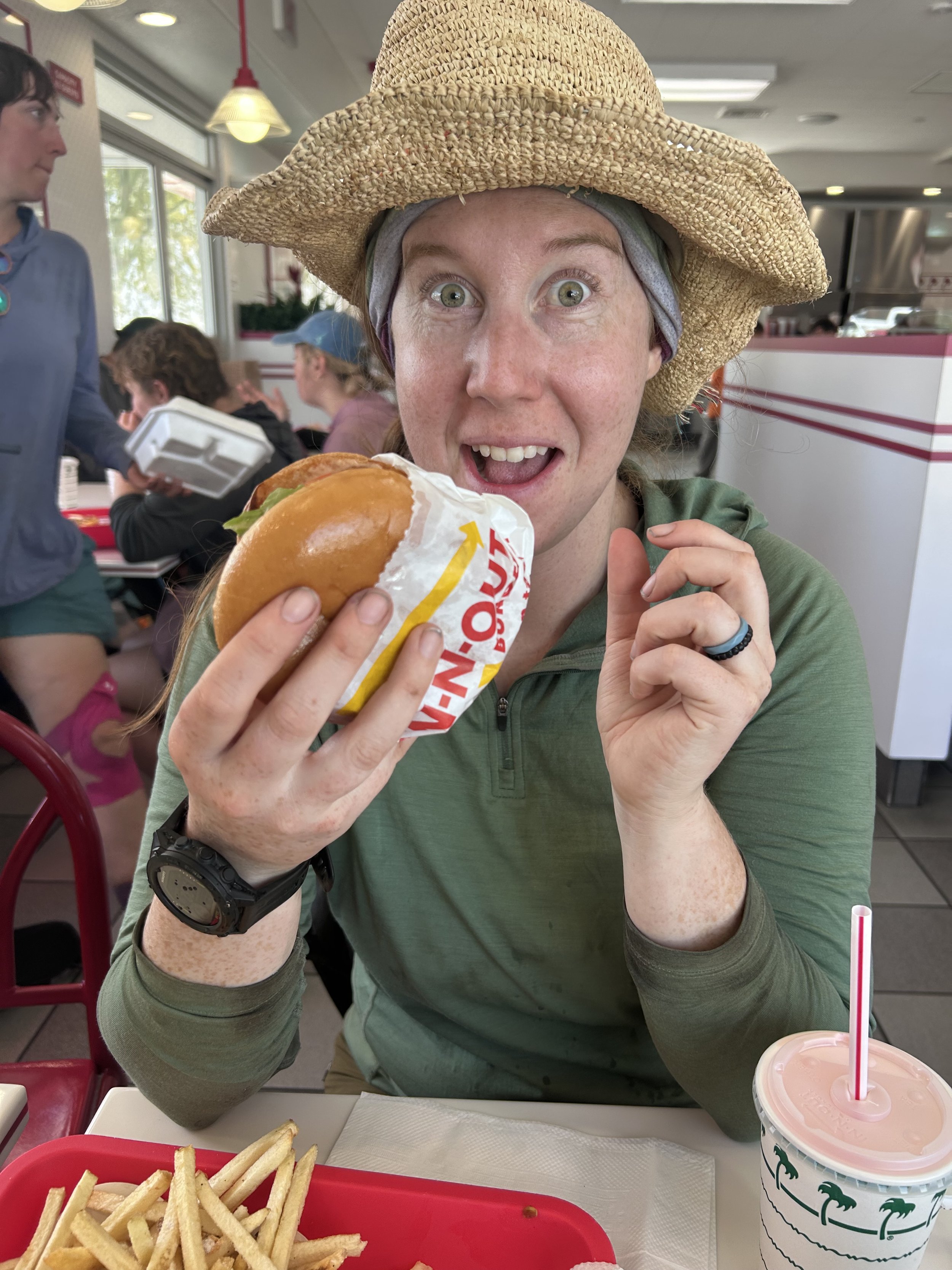
From the grocery resupply we headed for In-n-Out Burger. I mean, it’s a staple of California - you gotta! There we caught up with the Ride Brides again as I enjoyed my double-double and Amanda had a regular cheese burger. No need for the secret menu today. After we ate, we bid adieu to the Ride Brides and made one last stop to Chipotle where we got burritos for dinner and stuffed them down with our water which we refilled from the fountain soda machine.

The Uber back took a little while to find us but eventually did and took us ten minutes back to Tamarack Road. From there we set our stravas and started walking. The trail travelled up and around the North Side of the town of Whitewater eventually entering a small east running ravine. Here we ran into an older gentleman waiting out the sun in the shade of an info sign. He told us there was a ranger station up ahead but he coulnd’t remember how far. We thanked him and kept going, climbing higher in the ravine which eventually turned north. We climbed on for another hour eventually reaching a saddle and going over the other side. This is where Amanda’s 2 liters of water ran out with about 5 miles to go. We shared from there on out.

The trail dipped down into another ravine and slowely climbed out of that one before heading up high on a ridge. We reached a sign that confirmed the existence of this so called ranger station and after a sort amount more we saw down into a deep and wide valley which looked like a very old glacial morain. We entered a long set of switchbacks that took us off the ridge and down into the moraine. At one point, towards the bottom, Amanda made a sudden stop. Up ahead a Coastal Rosey Boa sat in the path trying to absorb the last bit of warmth from it before the sun set. We gave Rosey a wide berth and proceeded to the bottom of the moraine. 

We decided to camp right where the trail bottomed out as it hosted many spots out in the various sand banks of the river. Before doing anything we sat down and hungrely consumed our burritos, hoping that not too much time had passed to make them go south on us. I also pulled out my beer and shared it with Amanda. After eating, i set out to pump water and Amanda started setting up the tent. After water i did my yoga and came back to drink some more water. We did the rest of our chores and started to notice lots of little frogs everywhere. We caught one and Amanda’s app identified it as some sort of toad. Finally, we both turned in for the night, agreeing that 5 would be a perfectly agreeable wake-up time.

Day 16: Side Hill Slippin’

6/1/2023

Section: Mile post 186.4 to 200.5

Distance: 15.09 Miles  

Moving Time: 7:25 hrs

Elevation Gain: 2,513 ft

Click here for current location

A lot of information was available about today's stage and that is because of a section called Fuller Ridge. Typically a fairly benign section, California’s off-the-chart snow year had left it snow covered late into the year. The trail sticks to the eastern aspect of the ridge for most of it and there is a little exposure to contend with so, with snow sticking around this late, Fuller Ridge was a huge point of conversation, especially among those on the trail with limited snow travel experience. It was one of those things where I felt that it was probably still going to be benign but had to see it to believe it. Beyond Fuller Ridge the trail strays into the San Bernardino National Forest before returning to the San Jacinto Wilderness on its long, long, loooong slide down to I-10.

Amanda and I slept in this morning. See, it happens every once in a while - though, I should say, we slept in ‘till about 6 before getting up. It was mostly so the day would get a small chance to warm up. I am still without a puffy which isn’t a problem most mornings but at around 9000 feet this morning - it definitely was. I frantically ran around, conducting the usual chores and trying to stay warm and by around 7 we were up and off - John leaving just before us. We went about 30 paces before running into snow. We hurdled a few small sections before it became common enough to warrant the Microspikes and, hey, if you got them they might as well be on your feet instead of in the backpack. We continued on, crossing more sections including one that had a slightly more exciting amount of exposure than normal but all-in-all, more annoying than anything. 

After getting onto Fuller ridge and passing through a few small campgrounds, the trail continued on the western aspect of the ridge and the snow ran out. Amanda and I removed our micro spikes and continued on. The trail switch backed down and back up the western side of the ridge and eventually returned to the eastern side where the snow returned with a vengeance and to stay. From mile 188 until we reached the Fuller Ridge Trailhead at mile 190 Amanda and I fought the good fight against the snow. It was 2 miles of miserable slush covered side hilling. I love everything about my trail runners - they are super comfortable and cause minimal blisters but I would have given anything to have my Asolo hiking boots for this section, just to have a mid-shank boot that would drive and plunge step halfway decently. I think Amanda and I were lucky to have done about a mile per hour in this section as we post-holed and slid our way across Fuller Ridge. While never really dangerous, it was downright annoying. In the last quarter mile snow was replaced with an eye-raising amount of blow-down which took us off trail to avoid massive tree barracades - but, eventually, we were delivered into the Fuller Ridge Trail parking lot.

I arrived shortly before Amanda and encountered a group of about 10 women hikers standing and sitting around a picnic bench which I was encouraged to see. Amanda and I had talked about this for the last few days. We hadn’t seen that many women on the trail. Lots of single guys in groups between 1 and 3, a few couples and families and a few single women hikers but very limited. This had surprised us a bit because PCT.org had listed the gender breakdown at something like 43% identifying as female but that was not jiving with what we were observing so I was happy to see this group upon arriving out of the hellish landscape above. 

I introduced myself and then was promptly overwhelmed by about 10 names. Amanda arrived next to me just as the last few trail names were being said. This was the first true “Trail Family” we had encountered and they were hilarious. We chatted with them for some time and discovered that they had started the day before us. We asked about Phillip and John and found out that Phillip was a ways ahead of us and John was about 15 minutes ahead. Shortly after they broke out a hodgepodge of instruments including a recorder, a jaw harp, a kazoo and a harmonica to play us a quick serenade and were off.

Amanda and I stuck around a bit, still laughing and had a quick snack before packing our own bags and heading off. From the Fuller Ridge Trailhead the path descended through less and less dense trees - Sugar and Jeffry Pine as Amanda identified them. The Jeffry pines have these huge beautiful cones that they drop all over the forest floor while the Sugar pines drop smaller, denser cones. Eventually the trees opened up while Amanda and I had a civil discourse about what I had said the distance was for today and we could see all the way down to I-10 and back up to the summit of Jacento. From here the trail wound endlessly down towards the Snow Creek Drainage. The trail, as i said before, is designed with equestrians in mind so it has one or of the most gentle grades i have ever seen. This is at times wonderful and others it's just downright annoying and this descent was a little bit of both. We tossed and turned on the open hillside for several hours catching sight of lots of reptilian wildlife and taking a few breaks before arriving at a campsite at mile 200.5. And who did we find already in one of the sites? Who else but John from Eugene who came out to say hello. 

I went on down to filter water while Amanda set up camp. This evening we enjoyed the superb culinary delight that is Top Ramen (Thanks Mom and Dad). I did my typical yoga and as I did so, the Trail Family from before trickled past our site, a little less pep in their step than earlier, but not much. Evidently, we had passed them at an earlier water stop which they had gone off trail to utilize and we had skipped and were now catching up. We talked with a few of them and said we would see them in the morning. Later, Amanda and I completed our evening chores and crawled into bed - looking forward to some better trail consistency in the next 4-500 miles but not looking forward to the heat.

Day 15: Mt. Jacinto

5/31/202

Section: Mile post 179.4 to 186.4

Distance: 13 Miles  

Moving Time: 8:38 hrs

Elevation Gain: 4,439 ft

Click here for current location

Another point that Amanda and I had deliberated on was climbing Mt. Jacinto. Mt. Jacinto is one of the largest mountains in Southern California and a popular side-quest for PCT hikers, as it does not lie directly on the PCT but isn’t a huge deviation to get to. We ultimately decided to do it because it was just now getting to a condition where it could be climbed and we were a day ahead of schedule. Today’s stage was mostly focused on Mt. Jacinto also reconnected with the PCT at milepost 185 and we hiked a bit beyond that. Actually, “hiked” is an understatement - we hacked through horrible snow drifts for a few miles after 185 before saying screw-it and pitching our tent.

The morning alarm clock kicked me out of an incredibly deep sleep which left me in a sour mood. We woke and packed up the remaining things we had into our backpack before doing one final check through and heading to the front of the Inn. As we rounded the corner we recognized Phillip’s lanky frame making his way up the street and then turned to the front office to see - surprise surprise - John from Eugene sitting on a bench waiting for the same ride. The driver had informed me that another person would be joining us and I should have expected John because he is always showing up out of the blue when we began worrying we had lost him. Amanda and I have decided that his alternate trail name should be Houdini for this exact reason. 

Not long after our rendezvous the driver, Les, showed up and we loaded up his car. Les drove us the windy two miles up to Humber Park Trailhead chatting the whole way. At the top, we got out, paid him 10 bucks a piece and Amanda and I started our stretches as Les continued to talk about all the people he had given rides to over the years. Finally we were able to disengage, start our stravas and head up the trail.

I thought the group might split up but we were all keen to stay together and so we found ourselves at Saddle Junction in our little group eating some snacks about an hour later. After snacking we continued to climb on the PCT for a while before splitting off on the Wellman’s-Cinnega trail heading up to a higher junction for Mt. Jacinto. As we climbed we noted it was mostly just us. One other PCT hiker sprinted past us but that was about it this early in the day. Another hour brought us into an increasingly consistent number of snow patches and the Wellman divide junction where we found the trail and started up to Mt. Jacinto. The going became slow as snow became a more permanent aspect of the trail and the altitude began to take its toll. We lost the trail a few times but we’re always able to reconnect with it. About two and a half hours of climbing brought us up to the saddle under the summit and another 30 minutes brought us to the top. 

The view from the summit was amazing. Palm Springs was enjoying some typical sunshine while the entire ocean facing section of Southern California was shrouded in a thick marine layer. We stayed on top for about an hour and a half taking pictures and eating. Two women from Whistler showed up, just day hiking and we talked to them for a while. Eventually we all had to admit it was time to retreat from the top. Phillip and John headed straight down on the opposite flank for the mountain we had come up looking to reconnect with the PCT farther up than we had left off. Amanda and I did the same but made a quick detour to see the Mt. Jacinto emergency hut on our way down. A really cool old lodging with 2 bunk beds. Some of the groups we had heard were starting later in the day after us were considering crashing in the hut that same evening for the experience. 

From the hut, Amanda and I made our way down. You know how some things are immediately annoying and other things take a little time to get annoying? The snow today was the latter and, wow, did it get annoying. Amanda and I have done a lot of snow travel over the years but it is usually on a mountain and early in the morning when there is plenty of grip. Today was a nightmare. Slushy snow in trail runners is not a good combo. Our pace slowed to under a mile an hour in some places as we glisaded, slipped and slid for 2000 vertical feet. We broke through snow bridges and fell multiple times but just when we were about to lose it we arrived at the PCT. Two sketchy river crossings later we were at our campsite enjoying some freeze dried Mac and Cheese. It was a brutal day but one of Amanda’s favorites in retrospect. Glad to have gotten up a mountain and glad to be sleeping under the stars again.

Day 14: Idylwild Zero Day

5/30/2023

Section: Mile post 179.4 to 179.4

Distance: 0.00 Miles  

Moving Time: 00:00 hrs

Elevation Gain: 0 ft

Click here for location

Amanda and I deliberated hard on this one in the days leading up to Idylwild. You get in this groove on the trail and, weirdly enough, taking a zero day almost becomes difficult. You have made friends, you are in a little trail family and if you stop and the others don’t you might not see them again. So the decision was a tough one but given the brutal climb out of the Pines-to-Paradise highway to get to Idylwild and the fact that many of the folks we were hiking with were also electing to do a zero day we decided to take one as well. 

We tried to sleep in on this Tuesday Zero day but only managed to make it to about 7 am. We had both passed out around 8 the night before, despite trying to get some reading in, so the early morning wasn’t really a surprise.

We elected to go get breakfast at the Red Kettle which was just a few blocks into town. Amanda got some French Toast and I got a decent waffle with a half order of biscuits and gravey on the side. As we ate we saw Joe and Jane walk by and they eventually came back for breakfast and sat next to us. We talked for a long time about the previous day, plans for the next few days and so on. Joe and Jane were taking a Nero and so were going to leave that same day in the evening. As we sat and chatted Phillip texted me and said he was coming as well. He showed up about 10 minutes later and sat at an adjacent table. Amanda and I eventually finished up and the four of us decided it would be best to give up our table for someone else to be seated. We said goodbye to them and Phillip and headed to the post office - the first of many chores.

I had ordered a cornucopia of items from REI to the Idylwild Post Office including, Micro Spikes, a new water bladder to replace the one that finally failed on me, and some light gaiters for my Hokas. In addition, my parents had sent us our ice axes as well as some ramens and Trader Joe’s goodies. Amanda had had less luck getting Amazon to send some electrolytes as a general delivery to the post office so we did not get those, unfortunately. LMNT electrolytes are the best - closest thing to Gatoraid we have been able to find.

Like kids on Christmas, we took our packages home and excitedly opened them, arranging our goodies next to our gear. After cleaning up the packaging we made a list of things we needed for resupply and headed back into Idyllwild. We started with the local gear shop where Amanda replaced the pants she had started with but now had a giant hole in the butt with a new pair. I got a set of new liner socks to replace the ones that I had had for about 10 years and were now full of holes themselves. I also tried to find something to replace the torn eyelet on my Hoka Speedgoats but had no luck there. From the gear shop we went looking for postcards. We visited a few of the local shops to put together a good collection of Idyllwild post cards and stickers. As we stepped outside we both realized that we were, miraculously, hungrey again. Seeing Jane and Joe at a nearby ice cream shoppe we asked if they had any suggestions for lunch. They mentioned a Mexican restaurant up the street called La Casita. We thanked them and wished them luck on their short hike that night before heading up the road. On the way we ran into Phillip again and he said he was headed for a post lunch beer at the Idylwild Brewery in an hour or so and I agreed to join him.

At the restaurant we sat outside, enjoying the lovely spring day. Amanda ordered a burrito and i got some of the best Enchilada Verde’s i have ever had. We talked to an older couple there while we ate about the PCT. They were very curious about all the general things - how did we resupply, where did we start from, how long was it going to take, etc? We happily answered their questions until they left and then finished our meal. 

After lunch I went to back to the Idylwild brewery and met up with Phillip and another guy named Martin from London. We talked for about an hour until Amanda rejoined from her writing frenzy. At lunch i had coordinated a pick-up from the hotel the next morning and i offered Martin and Phillip a spot. Phillip said yes but Martin was not going to receive his package at the post office in time and was going to be waylaid in Idylwild for another day so he declined. We paid for our beers and Phillip, Amanda and I headed across the street to stock up on groceries. 

The Idylwild market was massively picked through, so we had heard, because of the hikers and we found that to be very true. I tried to find Phillip grits because I had been raving about them at the brewery but could only find a bulk box of them so said we would have to try again in Big Bear. Amanda and I found several goodies, including Tillamook Sharp Cheddar cheese before I left, while she was checking out, to go send a few more things back to my parents in Corvallis. 

Amanda and I rendezvoused back at the cabin and I went outside to pack up some of the things I had left out to dry. Just as I was folding up the tent the Swiss Family Robinsons came around the corner looking tired but in good spirits. It turns out they had taken a day off in Palm Springs and were just getting into Idyllwild. We talked for a while and Amanda gave the two kids some Goldfish Crackers. As they left I got a text from Phillip saying that a bunch of hikers were getting together at the local Italian restaurant and asking if Amanda and I wanted to come. We said yes and spent the time between getting everything packed for the early start the next morning.

At 6 we arrived at Ferro, the Italian restaurant of Idylwild, and were seated at a large table with about 12 other people. There were Jason and Lorena from Knoxville, the two Kiwis - Vicky and Julien, the three guys that had passed us two days before on the first stage out of the Pines-to-Palms highway, Phillip and the two German Sisters - Charlie and Sophie. We talked and ate until about 8:30 when the group disbanded to get things ready for the next day.

Back at the cabin I desperately tried to get caught up on my blog but sleep could not be put off any longer and I forfeited after two days’ narrative and headed to bed.

Day 13: Obstacle Course Climb

5/29/2023

Section: Mile post 165.8 to 179.4

Distance: 17.31 Miles  

Moving Time: 08:47 hrs

Elevation Gain: 6,729 ft

Click here for location


Look at that altitude gain… just look at it. That was brutal. If you consider every 1000 feet is equal to a mile this was our hardest day. Add in the crazy amount of blow-down across the trail and it definitely was. Today’s stage took us higher on the north-south spine running up to Mt. Jacinto. The trail, while poorly maintained this early in the season, is a masterpiece - no doubt about that. It spends most of the day jumping across the spine and winding up higher and higher before ultimately dropping down to Saddle Junction where an access trail delivered us to Humber Park at the northern boundary of Idyllwild. The scenery becomes something you would expect to see in Yosemite, which is a wonder this far south in California. Rocky and gorgeous this area holds a promise of many incredible vistas yet to come in the Sierra. 


We woke at 4, not wanting to repeat yesterday’s mistake. I actually woke up at 3 and then couldn’t get back to sleep. Where we had camped was surrounded by many dead trees and, while we were both convinced that the large boulder would shield us from the surrounding widowmakers, a strong wind had risen in the early hours of the morning and I was becoming less sure of our decision. At 3:45 I deflated my air mattress and Amanda followed suit about 10 minutes later. We were on the trail around 4:30 relishing the cool mountain air and not missing the hot sunlight.

We made our way across the saddle we had camped out of the way of the night before and started up the other side. The trail continued in a strong northern fashion. At the base of Apache peak we ran into a small group of guys just waking up and said hello to them as we rounded the eastern side. As we continued on, the trail wound ever up and up and we encountered more and more hikers that were obviously on the final day of their 3-day Memorial weekend holiday. We also encountered more and more downed trees across the trail. These trees required a number of acrobatic moves to avoid and go around, deviating from the typical soothing grade of the trail. These interruptions hampered any momentum built up on our approach to them and considerably slowed our day. 

We wound higher and higher, continuing to overcome frequent fallen trees in the path. As the sun really started to warm the day I noticed a considerable increase of lizards out and about on the rocks which made me happy to see. The trail began to take on a carved look as if hewed out of the granite hillside. Exposure on our left and right side began to increase. “I can see why this section would have been tricky in the snow about a month ago,” I said to Amanda looking down into a deep gully that dropped precipitously from my vantage point on the trail.

We reached a notch at the top of a rise where the path passed through granite risers on each side and young Chris caught us. “Chris,” we yelled on seeing him. He smiled and we chatted for a while about the nature of the path and exposure. We all agreed it was a beautiful trail and he took off ahead, commenting on the altitude still to be gained. Amanda and I took a picture and continued on.

The elevation never seemed to let up. I looked at my watch and it said 4000 feet of gain and then looked down and it seemed to jump every time by steps of 500. Eventually we reached a set of switchbacks before rounding the nose of a ridge and hit our first snow patch. Just beyond it was the final saddle marking the end of the major climbing for the day. “Thank god,” Amanda remarked. We stopped beyond the snow patch to melt snow for water as we were close to out and still had 6 miles to go. The irony of this move was that, just 5 minutes later we crossed a beautiful running stream where we pumped additional water and had lunch. Here, Phillip caught up to us and we talked for a while. He said he was headed into Idylwild and would catch us there. 

From the stream we descended a bit before climbing up the western flanks of Tahquitz peak. The trail here is a little frustrating because there seems to be no reason why it can’t cut across the basin below the peak and head straight to Saddle Junction and we were, admittedly, absolutely done with climbing but we committed to it and about 30 minutes of climbing brought us to the final high point of the day. As we navigated the final snow patch at the high point a number of rangers came around the corner and asked “Are you hiking the PCT? Are you the couple from Bellingham?” We smiled and said yes and asked how they had heard about us. They explained that they had talked to Don the day before and he had told them about us. We talked with them for a while about the fire which had decimated many of the trees in the area. I told them I wanted to see Max, the Golden Retriever Mayor of Idyllwild. They laughed and said that might be hard because he only came out on the weekends. After a while we said adieu, wanting to get on and finish the seemingly endless day.

We descended off the flanks of Tahquitz peak, glissading in a few spots over tenacious snowfields and eventually reached saddle junction. It was at this point I noticed a sharp pain growing in my calf muscle and at the junction I stole Amanda’s cork ball to massage it out. The massage gave me about 15 minutes of relief as we descended down to Humber Park on the Devil’s Slide trail. We switchbacked down loathing the elevation gain we were losing which we had worked so hard to accumulate all day. “It’s only 1600 feet, it will be fine” I kept telling myself. About a mile down I stopped to massage again and then Amanda and I ran into our first equestrian heading up.

Another 30 minutes brought us to the bottom, me hobbling after many attempts to massage my problems away. At the bottom we hitched a ride with a really nice local couple down further to the Idyllwild Inn where I had booked two nights for Amanda and I. We thanked the couple and forced 5 dollars on them for enduring our stench and ran inside to check in. 

We got a small cabin where we cleaned up, continuing to be amazed at the amount of dirt that can accumulate on the human body, and dropped off a load of laundry at the office for cleaning. Afterwards we headed across the street to the Idylwild brewery everyone had been admint about us going to. I had a burger and Amanda had a chicken sandwich, both of which tasted like the best food we had ever had. Afterwards, barely able to keep our eyes open, we read for a while and passed out on a mattress that felt like heaven.

Day 12: The Climb

5/28/2023

Section: Mile post 151.8 to 165.8

Distance: 15.15 Miles  

Moving Time: 07:08 hrs

Elevation Gain: 3,517 ft

Click here for location

And so begins the climb up to Idylwild. Today’s stage starts out in the beautiful San Bernardino National Forest and stays within those boundaries for the entire day. The desert setting continues to be captivating as the landscape takes on a more bolder-y vibe looking more and more like a dryer version of Bishop with giant rocks wherever you look. Today’s stage winds itself out of the low point along the Pines-to-Palms highway and eventually gains the lower flanks of a spine which we will travel along all the way to Saddle Junction, the exit to get down to Idylwild.

I woke up with a small hangover. This was super unfortunate and something that seems to be far more prone to happen now that I am in my 30’s than it was just 3 or 4 years ago. I should have said no to that last Hornito’s shot but, this isn’t a Taylor Swift song and i did, so - time to get up and face it i guess. The tent had accumulated a lot of condensation in the night being situated out in an open field and was a mess to clean up. We had decided to sleep in a bit, till about 6, given the previous evening's festivities so the sun was above the horizon by the time we were up. Amanda left to use the bathroom and came back as I was getting things put away. She looked at me solemnly but with a small smile said “you better get down to the house now… there are chickens in the backyard.” With a smile on my face I made my way down to see the greatest of all wildlife so far - 2 Orpingtons and a Rhode Island Red. I tried to catch one of them while the bathroom cleared but they were pretty quick. I was not the only one to try and fail on this. 

After, I headed back up to the field and saw that Amanda had packed her things. By then it was about 7:30. Chris and Nikola came up and said goodbye. Nikola told Amanda that if she saw anything he had forgotten to please grab it for him. Joe and Jane also caught a ride with a guy named Shaggy up to the trailhead. Amanda and I watched both of them go and considered our options. “The Paradise Valley Cafe opens in about 30 minutes” I said with a grin. “Okay, fine, let’s do it,” she agreed.

At 8 we crossed the Pines-to-Paradise highway and sat ourselves at a table as the waitresses busied themselves with coffee and waters. Rebel from Port Townsend joined as well as Travis from Iowa and another Swiss woman who we had seen off and on. We ordered various plates - I got a Huevos Rancheros - and talked about various things. Travis had an ultralight camp chair which I was pretty jealous of given that I was pretty tired of sitting in the dirt. At some point, one of the waitresses came to the middle of the patio we were eating on and made an announcement. Evidently, someone inside had purchased everyone’s meal. A total of about 20 people had their meal paid for. We all shouted and clapped for the nameless donor as a thanks for our meal. After we were done eating we bid goodbye to our table mates and made our way out to the front parking lot.

Just as we arrived at the side of the road, I saw a white Jeep Cherokee leaving the parking lot and flung my thumb up to them. The Jeep made a haphazard stop in the parking lot and Amanda and I ran to catch it. It was Richard himself and he beckoned for us to put our backpacks in the back where there was just enough space to get them in. We joined his brother and nephew in the Jeep on a 5 minute ride up the trailhead - glad that we didn’t have to tack an extra mile onto an already long day. At the trailhead we dumped out thanking Richard not only for the ride but for the stay the night before. From there, we tightened our shoelaces, started our stravas and hit the trail.

The first few miles of this, the 13th day, was packed with many interruptions. There were restroom breaks, there were snack breaks and there were blister popping and bandaging breaks. On this last stop, to pop and repair a blister on my left small toe all under Amanda's disapproving eye, I went to tighten my shoes and one of the eyelets split - the shoelace pulling straight through. “Damn,” I thought “these aren’t that old” before remembering that, while the mileage on them was low, they were about 3 years old. Fortunately, the position of the break wasn’t detrimental and I was able to make the shoes work. 

We went on, the trail switchbacking through some large boulder fields as it attained the southern end of a long ridge. A group of 3 guys passed us, Jaycob, Alex and a 3rd guy with long hair, weaving their way through the boulder fields. We talked briefly but were all interested in getting some miles in before the sun really started to heat things. Shortly after that we passed our first water source and passed the group of 3 again as we had enough water to get us a little higher on the ridge. 

We climbed for a time in the sun, begrudging with every step our late start until we came upon an intersection with both crossways heading down to a separate spring. “We should get water here,” I said to Amanda “we’ll do a full fill and that should get us most of the way to Idylwilde.” The water options between the Pines-to-Paradise highway and Idylwild were fairly numerous but almost all involved a steep descent of 500-1000 feet down to springs off the side of the ridge and I wasn't keen to do that more than was necessary. As we deliberated Travis passed us waiving as he did so.

I made the descent, hating every step, to the spring and was devastated to find a disgusting looking cattle trough fed by a sad trickle of water coming out of a ¾” pipe. “This is it?” I said in disbelief. I stood there for about 5 minutes deciding what to do. The filter had cleaned water for us on almost every continent on earth without fail but the water in front of me still sparked some doubts. In the end, the climb up and back down to another source just seemed abominable and I decided that, if I could filter from the exact spot where the fresh water was dumping in it would be fine. I filtered about 2 liters before Amanda showed up and voiced some very familiar thoughts but the cleaned water looked good and smelled fine so i kept going. After about 15 minutes, Amanda and I returned up the long, 500 foot slog to the saddle with 9 liters of water prepared to keep moving. 

From the saddle at mile 162 we continued upwards, the sun really beating us down this late in the day. “I miss our alpine starts,” I said begrudgingly. As we rounded a small bend in the trail, Amanda came to a sudden stop. In the bushes off to the right of us sat an adolescent rattlesnake taking advantage of the midday sun. This one wasn’t rattling but, as Amanda recalled her walking stick drumming exercise, it woke up and made its way across the trail. This one, unlike the Rattlesnake we had encountered a week ago, was a classic Diamond Back but, like the other one, was in no hurry to get out of our way. We hurried past the part where it had disappeared.

From the rattlesnake encounter the trail steepend considerably. We climbed hard, gaining elevation. As we did so, Phillip passed us as well as a number of other people. We caught up to them later at a nice shady spot which we commented on. “Not so nice when you finally see the ant infestation,” Travis nodded to one of the other guys frantically wiping down his pants on a nearby rock. We all laughed and Amanda and I continued on.

The climbing passed through another steep section before it gained the top of the long ridge we had been working on since the beginning of the morning. The group passed us again as we toiled under the sun only for us to leapfrog them one more time at another spring junction just up the way. This is the arithmetic that comes up here in the desert with water in tricky places. Amanda and I had opted to do large water carries which meant more weight but less side trips down to pull more water. The other option was to carry less weight, travel faster but make more trips up and down to low land springs. I don’t honestly know which is better but I was happy to only make one descent down for water.

We continued on, the trail traveling in a descidedly northern fashion, hoping that we would run into Jane and Joe somewhere up ahead. At this point, Amanda’s feet were really starting to hurt, the zero drop shoe putting her footbeds to the test. I had traveled a little ahead and was making my way up a short rise when a familiar, tall and lanky figure with a wide brimmed hat came into sight. “Don” I shouted. He looked up with a reserved smile as I came up. “I’m out,” is all he said. “I’m sorry to tell you that way but I can’t shake this cold and my wife is starting to worry. My son-in-law is going to pick me up at Paradise Valley Cafe tomorrow.” I told him I was so sorry and that we had really enjoyed hiking with him. At that point Amanda came up and voiced her condolences as well. We really liked Don and it was sad to see him go but he wanted to get through the desert before temperatures really started to rise and was convinced that the cold would not allow him to do that. We told him about the group behind us and wished him luck on his journey home before parting ways. I think this is the hardest part of the PCT. The most wonderful part is meeting amazing people from all backgrounds, areas and walks of life but the hardest part is sometimes seeing them for the last time.

Amanda and I walked on, a little less pep in our step. We decided to camp on the backside of a large saddle leaving the climb up for the following morning. Amanda’s feet were killing her as we rounded the last of about 15 switchbacks. It was a cute little campsite in the shadow of a house-sized boulder looking over Palm Springs and the Coachella valley. We conducted our usual evening activities, an occasional gust of wind from the saddle buffeting our tent but otherwise settled easily into the evening. We went to sleep just as the first lights of the huge city below us blinked to life.

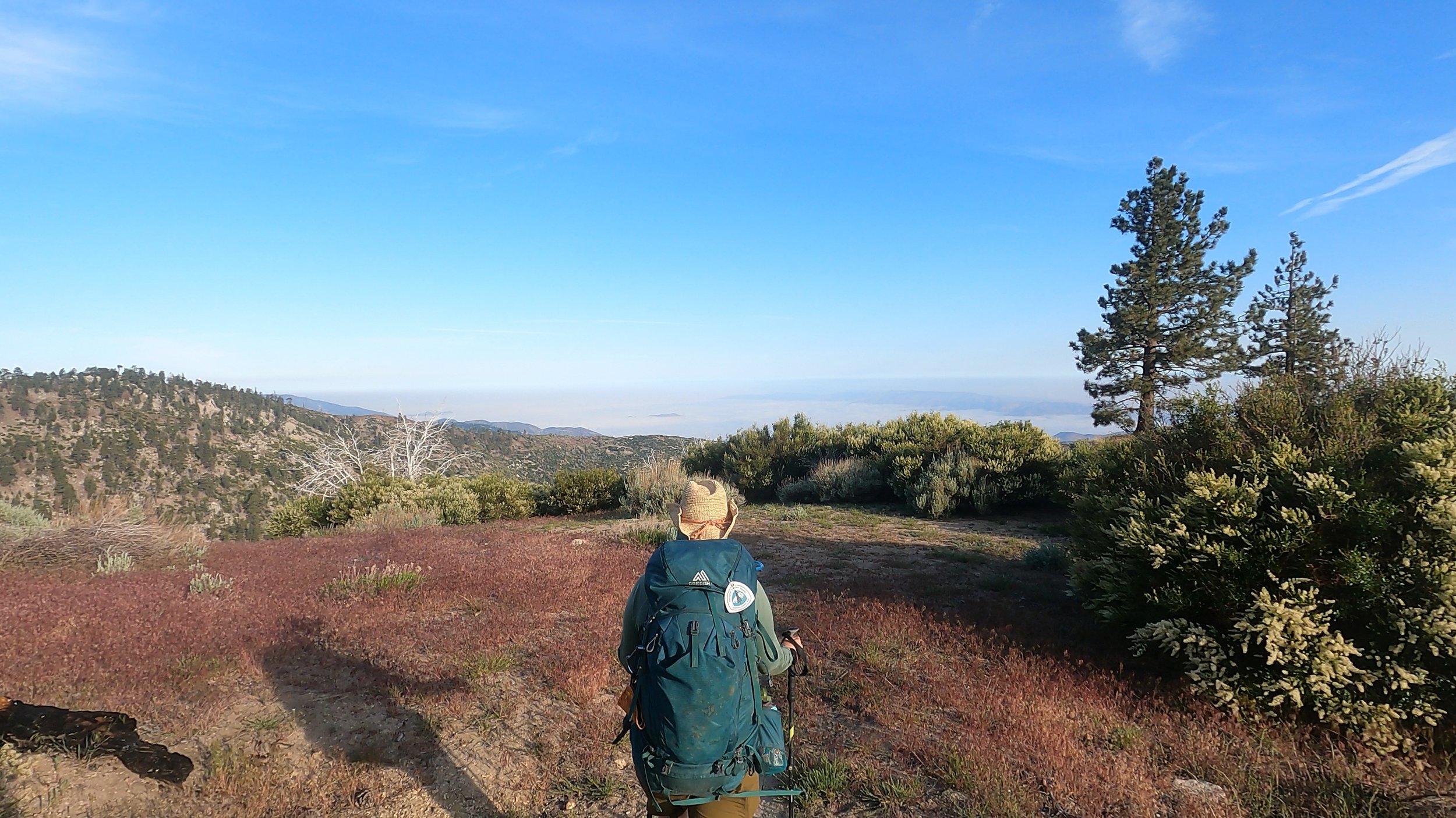
Video Block
Double-click here to add a video by URL or embed code. Learn more