Day 19: Zig and Zag

6/4/2023

Section: Mile post 218.5 to 232.9

Distance:  14.37 Miles  

Moving Time: 07:16 hrs

Elevation Gain: 4,672 ft

Click here for current location

Today’s route is an odd one. The trail gets hemmed in by a large east-west running ridge too steep to go straight over so it deviates west and circumnavigates the head wall in order to come back around east on its back side. It’s funny looking at it on a map after several stages of moving in a due northerly direction as the trail suddenly juts west only to jut east again several miles later. Today was also another big climbing day which my itinerary had accounted for by dropping the mileage into the mid-teens. 

Amanda and i woke at 3 am after a good nights rest. We had passed out around 8 the night before only to be awoken around 9:30 by Tit Punch and the Ride Brides marching past our tent with headlamps. We rose, had a cold breakfast (finished off that date bar finally) and got underway.

We climbed in the dark continuing to follow on either side of Mission Creek as it ramped towards its source in the mountains. The way turned from north to nortwest as we wound through the low shrubs of the desert. Suddenly Amanda stopped and stepped off the trail. We had heard of a bear in the area but as I looked down the trail I saw what appeared to be some sort of desert cat looking back at us - need to look that up when we have service in Big Bear. We continued on, passing some tents and people slowly waking up and the trail turned true west as it continued to climb.

The path made its way up onto the sides of the river valley, aided by a number of switchbacks, and then began following contour lines rising along the lower flanks of a large ridge, climbing ever higher. The desert look began to give away to more of an open oak forest feel before the pines started to appear. The sun came up and began to light the sky as Amanda and I continued to wind up towards Mission Spring, the source of our familiar creek. 

Eventually, we reached the spring which was located near a very nice horse camp. This was the last water for 16 miles so we filled our 3-liter bladders full and added a liter in each of our bottles. It was here that a truly unfortunate event happened. As I stated in another post, some of the equipment we are using is very old - not many items but some. One of these items is a water filter that my dad and I got for one of our first ever backpacking trips in Rainer National Park when i was 14. That makes this filter about 18 years old and it has served without issue through probably 8 or 9 filters and 100’s of gallons pumped. It’s so old that it was actually built by Pur before Pur sold the design to Katadyn but since Katadyn kept the filter cartridges the same, i kept using it. Anyway - the plunger housing actually sprung a leak in its casing today and i think the pump, which has filtered water on every continent save Antarctica, is finally toast. I will have to build a shrine for it when this is all said and done. Add this to the list of ran-till-failed items on this trip, along with Amanda’s 7 year-old Garmin Fenix 5s and two very old platypus water bladders.

After a delectably long break we continued on, the trail turning north and continuing to climb now through tall, beautiful pine trees. After a short distance and 2 road crossings the trail turned east again. Here, we were passed by Jai (Tit Punch himself) who said the girls were behind him but moving slow today before conntinuing on. As we continued east we ran into a gentleman from New Hamsire who, in his retirement, was just doing all the long trails in America section by section. We continued east, heading for the Old Big Bear Elementary school, now a cabin for rental through the US Forest Service. As we closed in on a mile, 3 mountain bikers passed us going the other way. “I didn’t think they were supposed to be on the trail” i said to Amanda. Another 15 minutes brought us to the cabin, just as Martin from Idyllwild appeard behind us. We dropped our packs in the shade and went to check it out. 

The cabin gave of some serious creeper vibes. Almost every square inch had been engraved with something and there were some creepy catipillar figurines on the mantelpiece. Jai was inside resting his feet. I headed back out hoping to offload some trash in a proper receptical but no luck was to be had on that front. Amanda and I sat in the shade for about an hour eating and napping. The rest of the Ride Brides showed up as well as a number of single male hikers whom we had not met. 

At 2:30 we got our things and continued up the trail. Several long switchbacks led us to the top of a ridge where one of the few marked campsites in this section of the trail were located. We set up camp in the shade of 3 large pine trees and read and relaxed throughout the afternoon before calling it a day. Tomorrow is Big Bear and I’m making myself some s’mores there!!!

Day 18: Nature’s Bathhouse

6/3/2023

Section: Mile post 218.5 to 232.9

Distance: 14.70 Miles  

Moving Time: 06:54 hrs

Elevation Gain: 3.796 ft

Click here for current location

Today’s stage winds up the Whitewater River valley before jumping a ridge line and dropping into the Mission Creek River Valley. The whole day is spent on BLM land and the trail quality is well kept here.

I woke well rested and a bit surprised to be so - I think my body is finally getting to the point where it doesn’t need to be perfectly comfortable to pass out any more. Better late than never i suppose. It was a later start than usual - we weren’t ready to go until just after 7, which was sad because today was hot. By the time we were packed up “Tit Punch and the Ride Brides” had already come down the switchbacks and were talking to John in front of our campsite. John had stayed across the river at a very nice car camp complete with picnic tables and pit toilets - if I had only known… 

We set out after the large group up the Whitewater river valley for about a mile to a point where the trail crossed the river. There “Tit Punch and the Ride Brides” were eating a second breakfast on the other side. Amanda crossed up river in her shoes and I swapped out the Hokas for my Earth Runner sandals to go across. On the other side we continued on, me staying in the sandals to give them a shot. I figured I would wear them until they became uncomfortable than transition back to the Hokas.

The trail began to climb out of the Whitewater river valley up the side of a ridge. Some of the Ride Brides began to catch-up with us and we talked to them a bit as they did. Ruby, who is from Tasmania, talked to us about Nepal for a while and we talked to Lisa from Germany about our time in Essen. The sandals were staying comfy so they stayed on.

Eventually the trail reached the top of the ridge and did some annoying up and down for a while. We passed John who was trying to optimize his   umbrella location and indicated he would catch-up later. The trail reached the end of the ridge and descended, via a long set of switchbacks, into the Mission Creek valley. We wound ourselves down and then traveled a bit up the river. 

At the first crossing we found the “Ride Brides” cleaning up in the creek and joined them, taking a seat on the opposite bank. We spent a solid hour and a half in the water and washed most of the clothes that we could take off. It was wonderful. We talked to a SOBO hiker who was finishing this section from Walker Pass before taking a couple days siesta at her house in Phoenix by the pool. She had, just earlier that day, seen a rattlesnake and a bear. Eventually, John showed up and sat with me in the river before Amanda and I decided we needed to head on. We packed up ahead of everyone else, bid adieu, and headed on up the trail.

After the creek siesta, the trail hopped the river probably 20 more times. I kept my sandals on and we made slow progress as the day got really hot. The trail climbed to about 5000 feet where we made one final push up over a headland and dropped back into the river valley. Here we set up camp, took another bath in the creek, ate and headed to bed planning on getting up early for a a brutal climb..

Day 17: In-and-Out

6/2/2023

Section: Mile post 200.5 to 218.5

Distance: 18.3 Miles  

Moving Time: 08:21 hrs

Elevation Gain: 2.766 ft

Click here for current location

I actually slept last night. I know that’s not something too earthshattering but I’ve had some issues getting a full nights sleep in the tent so it was amazing to close my eyes and actually fade out to nothing. It was much less pleasant when the alarm shattered the void at 4 am. I snoozed for about 20 minutes before deflating my sleeping bag and getting up. At the adjacent camp spot i heard John doing the same. Amanda followed suit shortly after and an hour later we were packed up and off - John in the lead by about 15 minutes again.

Today’s stage finally brought us down off the Jacinto Massif and onto the I-10 which sits in a dry river valley riddled with wind turbines. We set off, determined to complete the seemingly endless series of switchbacks and about 15 minutes of walking delivered us down to the group site where the trail family of girls and Jai, who affectionately referred to themselves as “Tit Punch and the Ride Brides,” were camped. We found their camp in various stages of preparation for the day and called out good morning to them. They waved back and we went on our way. 

Another hour passed and most of the Ride Bride team passed us as well as Kevin and Alex, sans Jaycob. These were the guys, along with a few others from the Italian night in Idyllwild, who stayed on the Mt. Jacento summit two nights before. Eventually we bottomed out, on level with Whitewater and the I-10 and transitioned to an asphalt  road. The “Ride Brides'' were snacking but Amanda and I weren’t ready to eat so we carried on. 

We traveled about 2 more miles in a dry, sandy river bed, feeling the calories burn in the sand. The trail was demarcated with brown posts painted yellow on top to keep us on track through the winding fingers of the river bed. We passed under some high voltage lines and Amanda stopped to take a video as the wind was howling through the valley - hence the wind turbines.

As we approached the I-10 we ran into a few hikers hiking south bound. We wished them luck and, as they passed, i looked up at Mt. Jacento. “Yikes,” i said to Amanda “I don’t envy them!” A short distance later the Ride Brides caught up to us as we passed under the 10. On the walls of the underpass were giant poster boards adhered to the concrete walls where many before us had signed their name. I whipped out my sharpie and wrote “Walking home!! Payden W. And Amanda P. Bellingham, Wa” as Amanda signed the log book and looked for our friend, Amy Lu’s, name. I shared my Sharpie with the “Ride Brides” and called an Uber to Tamarack Road just beyond the underpass. 5 minutes later a Red Chevy Camero with a scorpion license plate cover showed up and a smiling man beckoned us to put our things in the trunk. Our first stop was the Cabazon Post office, about 10 minutes west on the I-10. We stopped there and I taped two shipping boxes together to send our ice axes, microspikes and gaiters back to my parents house. From there we caught another Uber to the Hadley’s Food Market which was AMAZING. The place was like a Trader Joe’s on steroids. Amanda went in first and got all sorts of goodies including cooked bacon for breakfast. I went in and almost, ALMOST purchased a 2 pound jar of Spicey deviled eggs but settled for a Dogfish Head IPA instead. We both could have spent hours in that store. 

From the grocery resupply we headed for In-n-Out Burger. I mean, it’s a staple of California - you gotta! There we caught up with the Ride Brides again as I enjoyed my double-double and Amanda had a regular cheese burger. No need for the secret menu today. After we ate, we bid adieu to the Ride Brides and made one last stop to Chipotle where we got burritos for dinner and stuffed them down with our water which we refilled from the fountain soda machine.

The Uber back took a little while to find us but eventually did and took us ten minutes back to Tamarack Road. From there we set our stravas and started walking. The trail travelled up and around the North Side of the town of Whitewater eventually entering a small east running ravine. Here we ran into an older gentleman waiting out the sun in the shade of an info sign. He told us there was a ranger station up ahead but he coulnd’t remember how far. We thanked him and kept going, climbing higher in the ravine which eventually turned north. We climbed on for another hour eventually reaching a saddle and going over the other side. This is where Amanda’s 2 liters of water ran out with about 5 miles to go. We shared from there on out.

The trail dipped down into another ravine and slowely climbed out of that one before heading up high on a ridge. We reached a sign that confirmed the existence of this so called ranger station and after a sort amount more we saw down into a deep and wide valley which looked like a very old glacial morain. We entered a long set of switchbacks that took us off the ridge and down into the moraine. At one point, towards the bottom, Amanda made a sudden stop. Up ahead a Coastal Rosey Boa sat in the path trying to absorb the last bit of warmth from it before the sun set. We gave Rosey a wide berth and proceeded to the bottom of the moraine. 

We decided to camp right where the trail bottomed out as it hosted many spots out in the various sand banks of the river. Before doing anything we sat down and hungrely consumed our burritos, hoping that not too much time had passed to make them go south on us. I also pulled out my beer and shared it with Amanda. After eating, i set out to pump water and Amanda started setting up the tent. After water i did my yoga and came back to drink some more water. We did the rest of our chores and started to notice lots of little frogs everywhere. We caught one and Amanda’s app identified it as some sort of toad. Finally, we both turned in for the night, agreeing that 5 would be a perfectly agreeable wake-up time.

Day 16: Side Hill Slippin’

6/1/2023

Section: Mile post 186.4 to 200.5

Distance: 15.09 Miles  

Moving Time: 7:25 hrs

Elevation Gain: 2,513 ft

Click here for current location

A lot of information was available about today's stage and that is because of a section called Fuller Ridge. Typically a fairly benign section, California’s off-the-chart snow year had left it snow covered late into the year. The trail sticks to the eastern aspect of the ridge for most of it and there is a little exposure to contend with so, with snow sticking around this late, Fuller Ridge was a huge point of conversation, especially among those on the trail with limited snow travel experience. It was one of those things where I felt that it was probably still going to be benign but had to see it to believe it. Beyond Fuller Ridge the trail strays into the San Bernardino National Forest before returning to the San Jacinto Wilderness on its long, long, loooong slide down to I-10.

Amanda and I slept in this morning. See, it happens every once in a while - though, I should say, we slept in ‘till about 6 before getting up. It was mostly so the day would get a small chance to warm up. I am still without a puffy which isn’t a problem most mornings but at around 9000 feet this morning - it definitely was. I frantically ran around, conducting the usual chores and trying to stay warm and by around 7 we were up and off - John leaving just before us. We went about 30 paces before running into snow. We hurdled a few small sections before it became common enough to warrant the Microspikes and, hey, if you got them they might as well be on your feet instead of in the backpack. We continued on, crossing more sections including one that had a slightly more exciting amount of exposure than normal but all-in-all, more annoying than anything. 

After getting onto Fuller ridge and passing through a few small campgrounds, the trail continued on the western aspect of the ridge and the snow ran out. Amanda and I removed our micro spikes and continued on. The trail switch backed down and back up the western side of the ridge and eventually returned to the eastern side where the snow returned with a vengeance and to stay. From mile 188 until we reached the Fuller Ridge Trailhead at mile 190 Amanda and I fought the good fight against the snow. It was 2 miles of miserable slush covered side hilling. I love everything about my trail runners - they are super comfortable and cause minimal blisters but I would have given anything to have my Asolo hiking boots for this section, just to have a mid-shank boot that would drive and plunge step halfway decently. I think Amanda and I were lucky to have done about a mile per hour in this section as we post-holed and slid our way across Fuller Ridge. While never really dangerous, it was downright annoying. In the last quarter mile snow was replaced with an eye-raising amount of blow-down which took us off trail to avoid massive tree barracades - but, eventually, we were delivered into the Fuller Ridge Trail parking lot.

I arrived shortly before Amanda and encountered a group of about 10 women hikers standing and sitting around a picnic bench which I was encouraged to see. Amanda and I had talked about this for the last few days. We hadn’t seen that many women on the trail. Lots of single guys in groups between 1 and 3, a few couples and families and a few single women hikers but very limited. This had surprised us a bit because PCT.org had listed the gender breakdown at something like 43% identifying as female but that was not jiving with what we were observing so I was happy to see this group upon arriving out of the hellish landscape above. 

I introduced myself and then was promptly overwhelmed by about 10 names. Amanda arrived next to me just as the last few trail names were being said. This was the first true “Trail Family” we had encountered and they were hilarious. We chatted with them for some time and discovered that they had started the day before us. We asked about Phillip and John and found out that Phillip was a ways ahead of us and John was about 15 minutes ahead. Shortly after they broke out a hodgepodge of instruments including a recorder, a jaw harp, a kazoo and a harmonica to play us a quick serenade and were off.

Amanda and I stuck around a bit, still laughing and had a quick snack before packing our own bags and heading off. From the Fuller Ridge Trailhead the path descended through less and less dense trees - Sugar and Jeffry Pine as Amanda identified them. The Jeffry pines have these huge beautiful cones that they drop all over the forest floor while the Sugar pines drop smaller, denser cones. Eventually the trees opened up while Amanda and I had a civil discourse about what I had said the distance was for today and we could see all the way down to I-10 and back up to the summit of Jacento. From here the trail wound endlessly down towards the Snow Creek Drainage. The trail, as i said before, is designed with equestrians in mind so it has one or of the most gentle grades i have ever seen. This is at times wonderful and others it's just downright annoying and this descent was a little bit of both. We tossed and turned on the open hillside for several hours catching sight of lots of reptilian wildlife and taking a few breaks before arriving at a campsite at mile 200.5. And who did we find already in one of the sites? Who else but John from Eugene who came out to say hello. 

I went on down to filter water while Amanda set up camp. This evening we enjoyed the superb culinary delight that is Top Ramen (Thanks Mom and Dad). I did my typical yoga and as I did so, the Trail Family from before trickled past our site, a little less pep in their step than earlier, but not much. Evidently, we had passed them at an earlier water stop which they had gone off trail to utilize and we had skipped and were now catching up. We talked with a few of them and said we would see them in the morning. Later, Amanda and I completed our evening chores and crawled into bed - looking forward to some better trail consistency in the next 4-500 miles but not looking forward to the heat.

Day 15: Mt. Jacinto

5/31/202

Section: Mile post 179.4 to 186.4

Distance: 13 Miles  

Moving Time: 8:38 hrs

Elevation Gain: 4,439 ft

Click here for current location

Another point that Amanda and I had deliberated on was climbing Mt. Jacinto. Mt. Jacinto is one of the largest mountains in Southern California and a popular side-quest for PCT hikers, as it does not lie directly on the PCT but isn’t a huge deviation to get to. We ultimately decided to do it because it was just now getting to a condition where it could be climbed and we were a day ahead of schedule. Today’s stage was mostly focused on Mt. Jacinto also reconnected with the PCT at milepost 185 and we hiked a bit beyond that. Actually, “hiked” is an understatement - we hacked through horrible snow drifts for a few miles after 185 before saying screw-it and pitching our tent.

The morning alarm clock kicked me out of an incredibly deep sleep which left me in a sour mood. We woke and packed up the remaining things we had into our backpack before doing one final check through and heading to the front of the Inn. As we rounded the corner we recognized Phillip’s lanky frame making his way up the street and then turned to the front office to see - surprise surprise - John from Eugene sitting on a bench waiting for the same ride. The driver had informed me that another person would be joining us and I should have expected John because he is always showing up out of the blue when we began worrying we had lost him. Amanda and I have decided that his alternate trail name should be Houdini for this exact reason. 

Not long after our rendezvous the driver, Les, showed up and we loaded up his car. Les drove us the windy two miles up to Humber Park Trailhead chatting the whole way. At the top, we got out, paid him 10 bucks a piece and Amanda and I started our stretches as Les continued to talk about all the people he had given rides to over the years. Finally we were able to disengage, start our stravas and head up the trail.

I thought the group might split up but we were all keen to stay together and so we found ourselves at Saddle Junction in our little group eating some snacks about an hour later. After snacking we continued to climb on the PCT for a while before splitting off on the Wellman’s-Cinnega trail heading up to a higher junction for Mt. Jacinto. As we climbed we noted it was mostly just us. One other PCT hiker sprinted past us but that was about it this early in the day. Another hour brought us into an increasingly consistent number of snow patches and the Wellman divide junction where we found the trail and started up to Mt. Jacinto. The going became slow as snow became a more permanent aspect of the trail and the altitude began to take its toll. We lost the trail a few times but we’re always able to reconnect with it. About two and a half hours of climbing brought us up to the saddle under the summit and another 30 minutes brought us to the top. 

The view from the summit was amazing. Palm Springs was enjoying some typical sunshine while the entire ocean facing section of Southern California was shrouded in a thick marine layer. We stayed on top for about an hour and a half taking pictures and eating. Two women from Whistler showed up, just day hiking and we talked to them for a while. Eventually we all had to admit it was time to retreat from the top. Phillip and John headed straight down on the opposite flank for the mountain we had come up looking to reconnect with the PCT farther up than we had left off. Amanda and I did the same but made a quick detour to see the Mt. Jacinto emergency hut on our way down. A really cool old lodging with 2 bunk beds. Some of the groups we had heard were starting later in the day after us were considering crashing in the hut that same evening for the experience. 

From the hut, Amanda and I made our way down. You know how some things are immediately annoying and other things take a little time to get annoying? The snow today was the latter and, wow, did it get annoying. Amanda and I have done a lot of snow travel over the years but it is usually on a mountain and early in the morning when there is plenty of grip. Today was a nightmare. Slushy snow in trail runners is not a good combo. Our pace slowed to under a mile an hour in some places as we glisaded, slipped and slid for 2000 vertical feet. We broke through snow bridges and fell multiple times but just when we were about to lose it we arrived at the PCT. Two sketchy river crossings later we were at our campsite enjoying some freeze dried Mac and Cheese. It was a brutal day but one of Amanda’s favorites in retrospect. Glad to have gotten up a mountain and glad to be sleeping under the stars again.

Day 14: Idylwild Zero Day

5/30/2023

Section: Mile post 179.4 to 179.4

Distance: 0.00 Miles  

Moving Time: 00:00 hrs

Elevation Gain: 0 ft

Click here for location

Amanda and I deliberated hard on this one in the days leading up to Idylwild. You get in this groove on the trail and, weirdly enough, taking a zero day almost becomes difficult. You have made friends, you are in a little trail family and if you stop and the others don’t you might not see them again. So the decision was a tough one but given the brutal climb out of the Pines-to-Paradise highway to get to Idylwild and the fact that many of the folks we were hiking with were also electing to do a zero day we decided to take one as well. 

We tried to sleep in on this Tuesday Zero day but only managed to make it to about 7 am. We had both passed out around 8 the night before, despite trying to get some reading in, so the early morning wasn’t really a surprise.

We elected to go get breakfast at the Red Kettle which was just a few blocks into town. Amanda got some French Toast and I got a decent waffle with a half order of biscuits and gravey on the side. As we ate we saw Joe and Jane walk by and they eventually came back for breakfast and sat next to us. We talked for a long time about the previous day, plans for the next few days and so on. Joe and Jane were taking a Nero and so were going to leave that same day in the evening. As we sat and chatted Phillip texted me and said he was coming as well. He showed up about 10 minutes later and sat at an adjacent table. Amanda and I eventually finished up and the four of us decided it would be best to give up our table for someone else to be seated. We said goodbye to them and Phillip and headed to the post office - the first of many chores.

I had ordered a cornucopia of items from REI to the Idylwild Post Office including, Micro Spikes, a new water bladder to replace the one that finally failed on me, and some light gaiters for my Hokas. In addition, my parents had sent us our ice axes as well as some ramens and Trader Joe’s goodies. Amanda had had less luck getting Amazon to send some electrolytes as a general delivery to the post office so we did not get those, unfortunately. LMNT electrolytes are the best - closest thing to Gatoraid we have been able to find.

Like kids on Christmas, we took our packages home and excitedly opened them, arranging our goodies next to our gear. After cleaning up the packaging we made a list of things we needed for resupply and headed back into Idyllwild. We started with the local gear shop where Amanda replaced the pants she had started with but now had a giant hole in the butt with a new pair. I got a set of new liner socks to replace the ones that I had had for about 10 years and were now full of holes themselves. I also tried to find something to replace the torn eyelet on my Hoka Speedgoats but had no luck there. From the gear shop we went looking for postcards. We visited a few of the local shops to put together a good collection of Idyllwild post cards and stickers. As we stepped outside we both realized that we were, miraculously, hungrey again. Seeing Jane and Joe at a nearby ice cream shoppe we asked if they had any suggestions for lunch. They mentioned a Mexican restaurant up the street called La Casita. We thanked them and wished them luck on their short hike that night before heading up the road. On the way we ran into Phillip again and he said he was headed for a post lunch beer at the Idylwild Brewery in an hour or so and I agreed to join him.

At the restaurant we sat outside, enjoying the lovely spring day. Amanda ordered a burrito and i got some of the best Enchilada Verde’s i have ever had. We talked to an older couple there while we ate about the PCT. They were very curious about all the general things - how did we resupply, where did we start from, how long was it going to take, etc? We happily answered their questions until they left and then finished our meal. 

After lunch I went to back to the Idylwild brewery and met up with Phillip and another guy named Martin from London. We talked for about an hour until Amanda rejoined from her writing frenzy. At lunch i had coordinated a pick-up from the hotel the next morning and i offered Martin and Phillip a spot. Phillip said yes but Martin was not going to receive his package at the post office in time and was going to be waylaid in Idylwild for another day so he declined. We paid for our beers and Phillip, Amanda and I headed across the street to stock up on groceries. 

The Idylwild market was massively picked through, so we had heard, because of the hikers and we found that to be very true. I tried to find Phillip grits because I had been raving about them at the brewery but could only find a bulk box of them so said we would have to try again in Big Bear. Amanda and I found several goodies, including Tillamook Sharp Cheddar cheese before I left, while she was checking out, to go send a few more things back to my parents in Corvallis. 

Amanda and I rendezvoused back at the cabin and I went outside to pack up some of the things I had left out to dry. Just as I was folding up the tent the Swiss Family Robinsons came around the corner looking tired but in good spirits. It turns out they had taken a day off in Palm Springs and were just getting into Idyllwild. We talked for a while and Amanda gave the two kids some Goldfish Crackers. As they left I got a text from Phillip saying that a bunch of hikers were getting together at the local Italian restaurant and asking if Amanda and I wanted to come. We said yes and spent the time between getting everything packed for the early start the next morning.

At 6 we arrived at Ferro, the Italian restaurant of Idylwild, and were seated at a large table with about 12 other people. There were Jason and Lorena from Knoxville, the two Kiwis - Vicky and Julien, the three guys that had passed us two days before on the first stage out of the Pines-to-Palms highway, Phillip and the two German Sisters - Charlie and Sophie. We talked and ate until about 8:30 when the group disbanded to get things ready for the next day.

Back at the cabin I desperately tried to get caught up on my blog but sleep could not be put off any longer and I forfeited after two days’ narrative and headed to bed.

Day 13: Obstacle Course Climb

5/29/2023

Section: Mile post 165.8 to 179.4

Distance: 17.31 Miles  

Moving Time: 08:47 hrs

Elevation Gain: 6,729 ft

Click here for location


Look at that altitude gain… just look at it. That was brutal. If you consider every 1000 feet is equal to a mile this was our hardest day. Add in the crazy amount of blow-down across the trail and it definitely was. Today’s stage took us higher on the north-south spine running up to Mt. Jacinto. The trail, while poorly maintained this early in the season, is a masterpiece - no doubt about that. It spends most of the day jumping across the spine and winding up higher and higher before ultimately dropping down to Saddle Junction where an access trail delivered us to Humber Park at the northern boundary of Idyllwild. The scenery becomes something you would expect to see in Yosemite, which is a wonder this far south in California. Rocky and gorgeous this area holds a promise of many incredible vistas yet to come in the Sierra. 


We woke at 4, not wanting to repeat yesterday’s mistake. I actually woke up at 3 and then couldn’t get back to sleep. Where we had camped was surrounded by many dead trees and, while we were both convinced that the large boulder would shield us from the surrounding widowmakers, a strong wind had risen in the early hours of the morning and I was becoming less sure of our decision. At 3:45 I deflated my air mattress and Amanda followed suit about 10 minutes later. We were on the trail around 4:30 relishing the cool mountain air and not missing the hot sunlight.

We made our way across the saddle we had camped out of the way of the night before and started up the other side. The trail continued in a strong northern fashion. At the base of Apache peak we ran into a small group of guys just waking up and said hello to them as we rounded the eastern side. As we continued on, the trail wound ever up and up and we encountered more and more hikers that were obviously on the final day of their 3-day Memorial weekend holiday. We also encountered more and more downed trees across the trail. These trees required a number of acrobatic moves to avoid and go around, deviating from the typical soothing grade of the trail. These interruptions hampered any momentum built up on our approach to them and considerably slowed our day. 

We wound higher and higher, continuing to overcome frequent fallen trees in the path. As the sun really started to warm the day I noticed a considerable increase of lizards out and about on the rocks which made me happy to see. The trail began to take on a carved look as if hewed out of the granite hillside. Exposure on our left and right side began to increase. “I can see why this section would have been tricky in the snow about a month ago,” I said to Amanda looking down into a deep gully that dropped precipitously from my vantage point on the trail.

We reached a notch at the top of a rise where the path passed through granite risers on each side and young Chris caught us. “Chris,” we yelled on seeing him. He smiled and we chatted for a while about the nature of the path and exposure. We all agreed it was a beautiful trail and he took off ahead, commenting on the altitude still to be gained. Amanda and I took a picture and continued on.

The elevation never seemed to let up. I looked at my watch and it said 4000 feet of gain and then looked down and it seemed to jump every time by steps of 500. Eventually we reached a set of switchbacks before rounding the nose of a ridge and hit our first snow patch. Just beyond it was the final saddle marking the end of the major climbing for the day. “Thank god,” Amanda remarked. We stopped beyond the snow patch to melt snow for water as we were close to out and still had 6 miles to go. The irony of this move was that, just 5 minutes later we crossed a beautiful running stream where we pumped additional water and had lunch. Here, Phillip caught up to us and we talked for a while. He said he was headed into Idylwild and would catch us there. 

From the stream we descended a bit before climbing up the western flanks of Tahquitz peak. The trail here is a little frustrating because there seems to be no reason why it can’t cut across the basin below the peak and head straight to Saddle Junction and we were, admittedly, absolutely done with climbing but we committed to it and about 30 minutes of climbing brought us to the final high point of the day. As we navigated the final snow patch at the high point a number of rangers came around the corner and asked “Are you hiking the PCT? Are you the couple from Bellingham?” We smiled and said yes and asked how they had heard about us. They explained that they had talked to Don the day before and he had told them about us. We talked with them for a while about the fire which had decimated many of the trees in the area. I told them I wanted to see Max, the Golden Retriever Mayor of Idyllwild. They laughed and said that might be hard because he only came out on the weekends. After a while we said adieu, wanting to get on and finish the seemingly endless day.

We descended off the flanks of Tahquitz peak, glissading in a few spots over tenacious snowfields and eventually reached saddle junction. It was at this point I noticed a sharp pain growing in my calf muscle and at the junction I stole Amanda’s cork ball to massage it out. The massage gave me about 15 minutes of relief as we descended down to Humber Park on the Devil’s Slide trail. We switchbacked down loathing the elevation gain we were losing which we had worked so hard to accumulate all day. “It’s only 1600 feet, it will be fine” I kept telling myself. About a mile down I stopped to massage again and then Amanda and I ran into our first equestrian heading up.

Another 30 minutes brought us to the bottom, me hobbling after many attempts to massage my problems away. At the bottom we hitched a ride with a really nice local couple down further to the Idyllwild Inn where I had booked two nights for Amanda and I. We thanked the couple and forced 5 dollars on them for enduring our stench and ran inside to check in. 

We got a small cabin where we cleaned up, continuing to be amazed at the amount of dirt that can accumulate on the human body, and dropped off a load of laundry at the office for cleaning. Afterwards we headed across the street to the Idylwild brewery everyone had been admint about us going to. I had a burger and Amanda had a chicken sandwich, both of which tasted like the best food we had ever had. Afterwards, barely able to keep our eyes open, we read for a while and passed out on a mattress that felt like heaven.

Day 12: The Climb

5/28/2023

Section: Mile post 151.8 to 165.8

Distance: 15.15 Miles  

Moving Time: 07:08 hrs

Elevation Gain: 3,517 ft

Click here for location

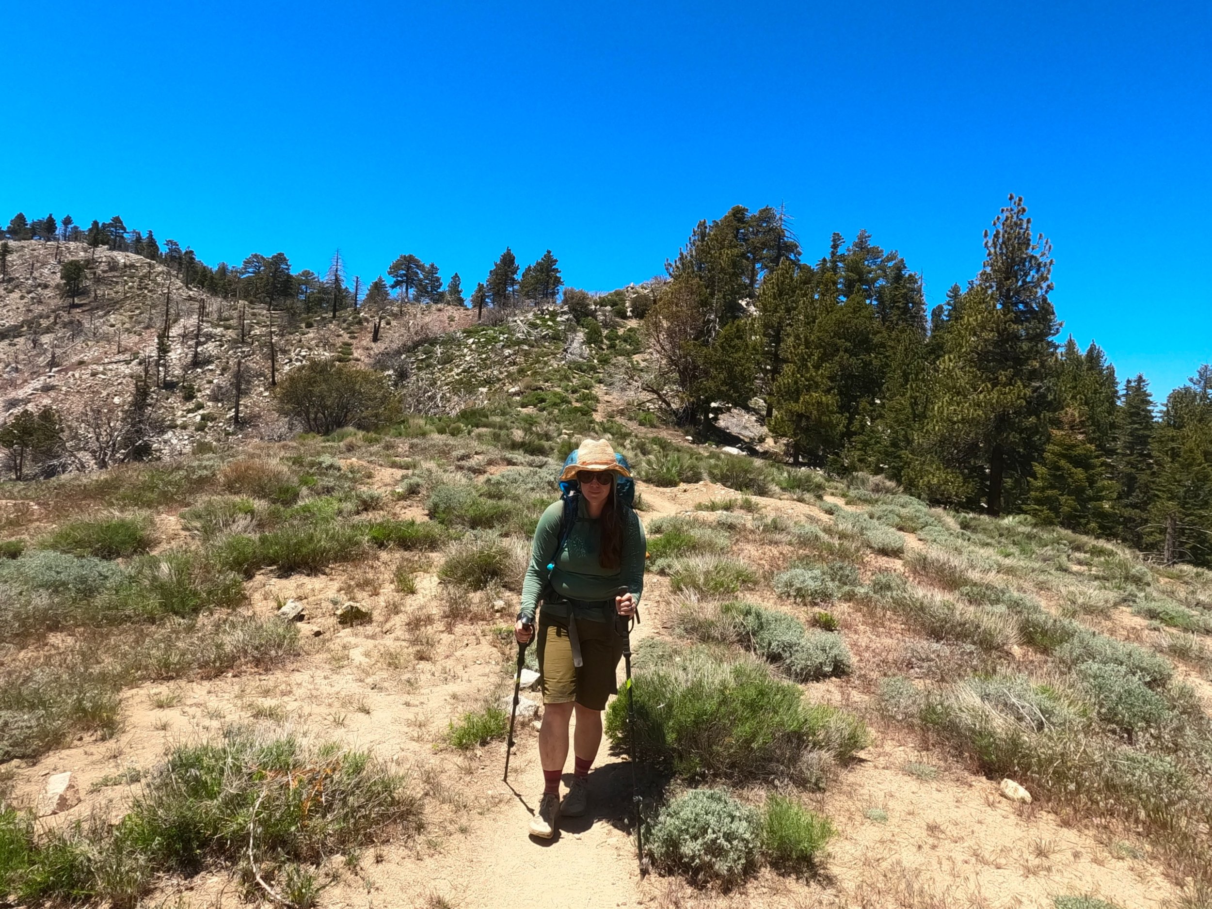
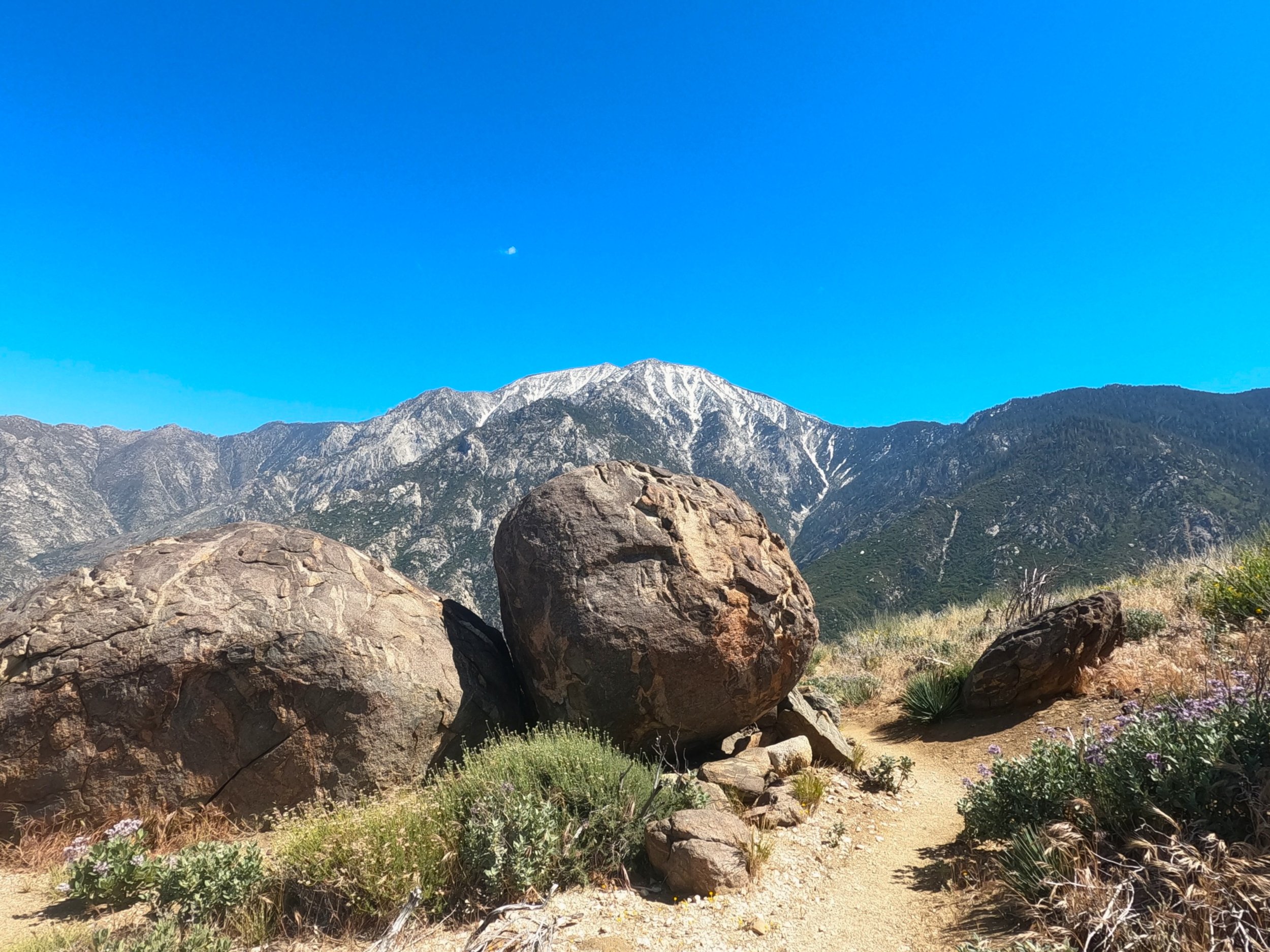
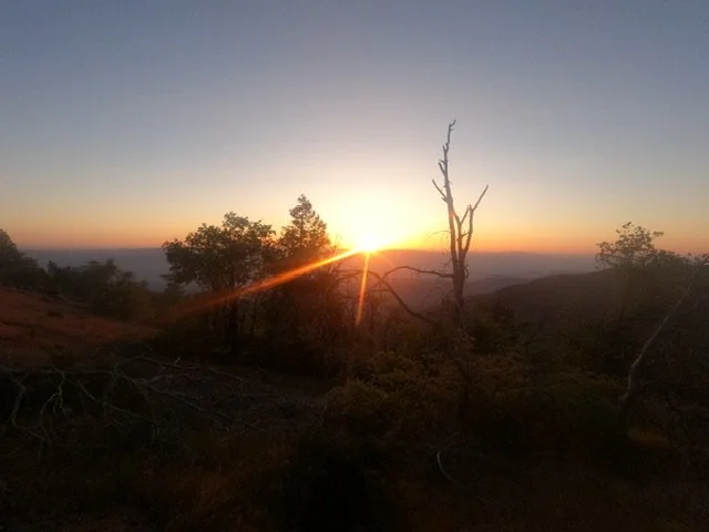
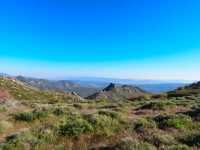
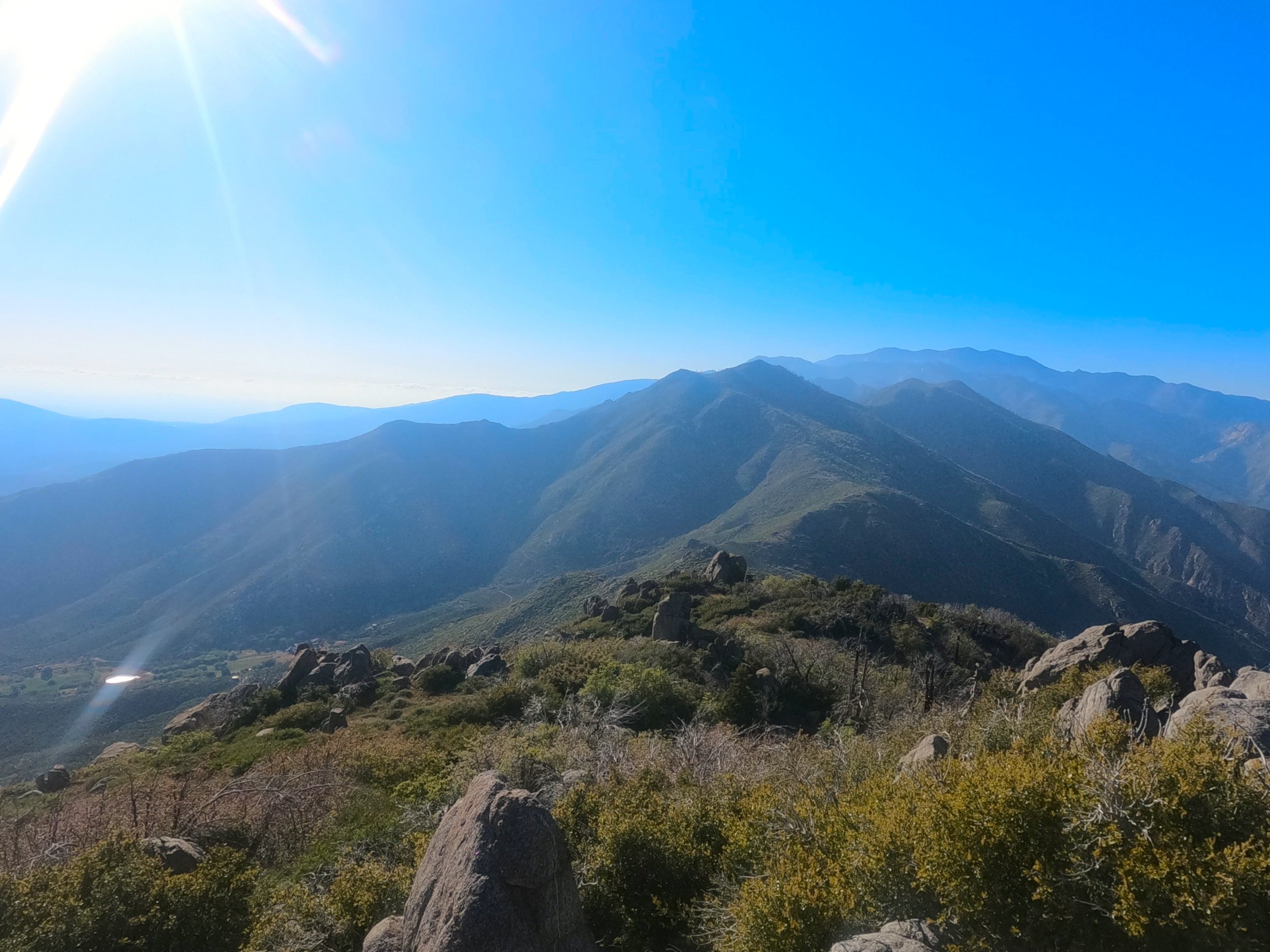
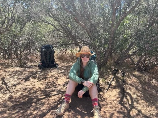
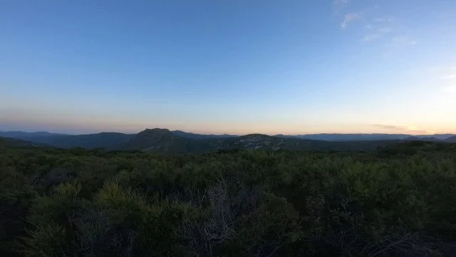
And so begins the climb up to Idylwild. Today’s stage starts out in the beautiful San Bernardino National Forest and stays within those boundaries for the entire day. The desert setting continues to be captivating as the landscape takes on a more bolder-y vibe looking more and more like a dryer version of Bishop with giant rocks wherever you look. Today’s stage winds itself out of the low point along the Pines-to-Palms highway and eventually gains the lower flanks of a spine which we will travel along all the way to Saddle Junction, the exit to get down to Idylwild.

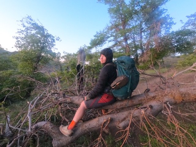
I woke up with a small hangover. This was super unfortunate and something that seems to be far more prone to happen now that I am in my 30’s than it was just 3 or 4 years ago. I should have said no to that last Hornito’s shot but, this isn’t a Taylor Swift song and i did, so - time to get up and face it i guess. The tent had accumulated a lot of condensation in the night being situated out in an open field and was a mess to clean up. We had decided to sleep in a bit, till about 6, given the previous evening's festivities so the sun was above the horizon by the time we were up. Amanda left to use the bathroom and came back as I was getting things put away. She looked at me solemnly but with a small smile said “you better get down to the house now… there are chickens in the backyard.” With a smile on my face I made my way down to see the greatest of all wildlife so far - 2 Orpingtons and a Rhode Island Red. I tried to catch one of them while the bathroom cleared but they were pretty quick. I was not the only one to try and fail on this. 

After, I headed back up to the field and saw that Amanda had packed her things. By then it was about 7:30. Chris and Nikola came up and said goodbye. Nikola told Amanda that if she saw anything he had forgotten to please grab it for him. Joe and Jane also caught a ride with a guy named Shaggy up to the trailhead. Amanda and I watched both of them go and considered our options. “The Paradise Valley Cafe opens in about 30 minutes” I said with a grin. “Okay, fine, let’s do it,” she agreed.

At 8 we crossed the Pines-to-Paradise highway and sat ourselves at a table as the waitresses busied themselves with coffee and waters. Rebel from Port Townsend joined as well as Travis from Iowa and another Swiss woman who we had seen off and on. We ordered various plates - I got a Huevos Rancheros - and talked about various things. Travis had an ultralight camp chair which I was pretty jealous of given that I was pretty tired of sitting in the dirt. At some point, one of the waitresses came to the middle of the patio we were eating on and made an announcement. Evidently, someone inside had purchased everyone’s meal. A total of about 20 people had their meal paid for. We all shouted and clapped for the nameless donor as a thanks for our meal. After we were done eating we bid goodbye to our table mates and made our way out to the front parking lot.

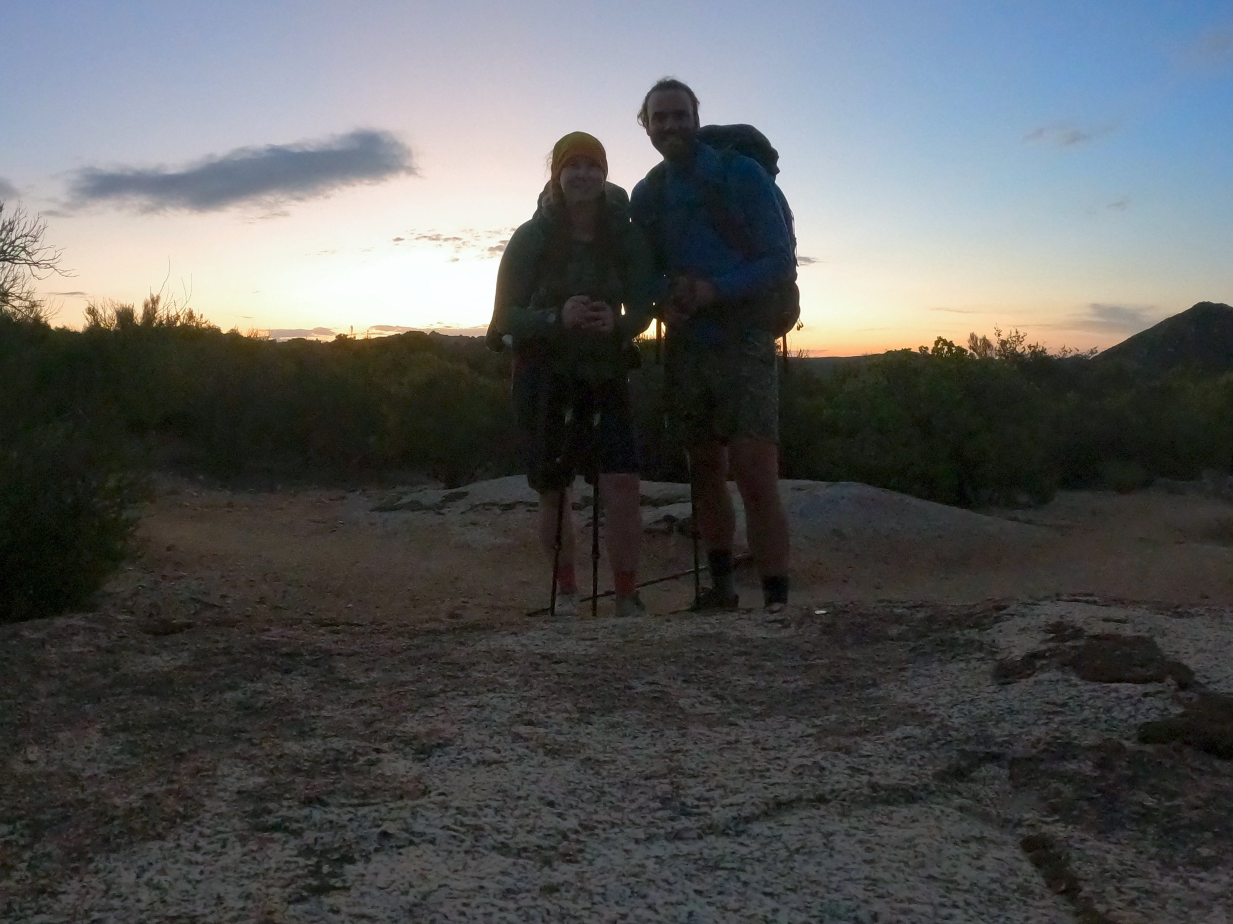
Just as we arrived at the side of the road, I saw a white Jeep Cherokee leaving the parking lot and flung my thumb up to them. The Jeep made a haphazard stop in the parking lot and Amanda and I ran to catch it. It was Richard himself and he beckoned for us to put our backpacks in the back where there was just enough space to get them in. We joined his brother and nephew in the Jeep on a 5 minute ride up the trailhead - glad that we didn’t have to tack an extra mile onto an already long day. At the trailhead we dumped out thanking Richard not only for the ride but for the stay the night before. From there, we tightened our shoelaces, started our stravas and hit the trail.

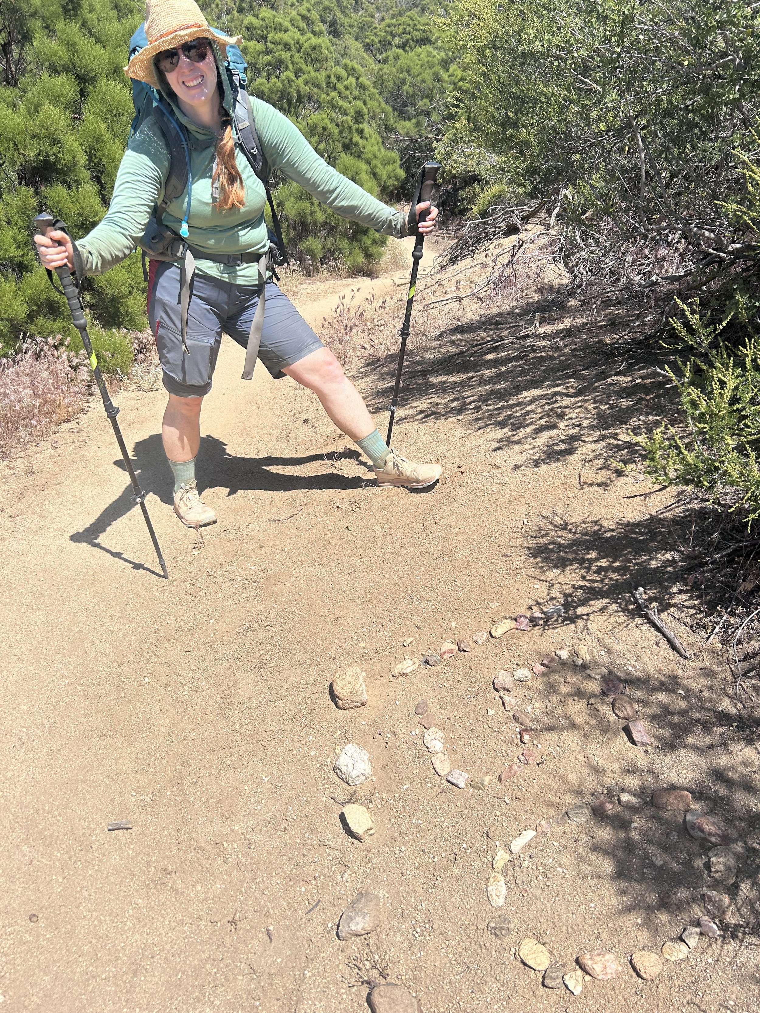
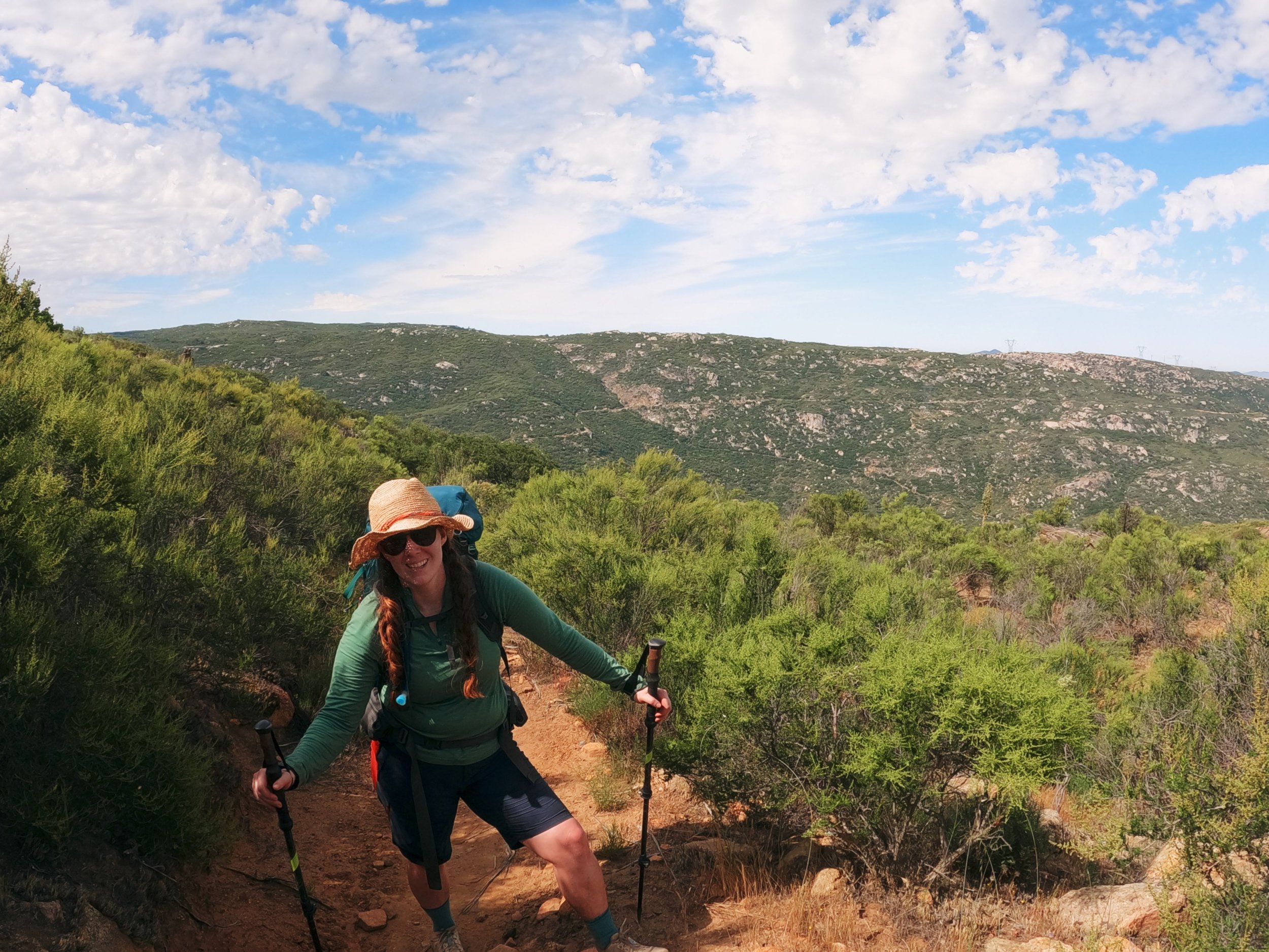
The first few miles of this, the 13th day, was packed with many interruptions. There were restroom breaks, there were snack breaks and there were blister popping and bandaging breaks. On this last stop, to pop and repair a blister on my left small toe all under Amanda's disapproving eye, I went to tighten my shoes and one of the eyelets split - the shoelace pulling straight through. “Damn,” I thought “these aren’t that old” before remembering that, while the mileage on them was low, they were about 3 years old. Fortunately, the position of the break wasn’t detrimental and I was able to make the shoes work. 

We went on, the trail switchbacking through some large boulder fields as it attained the southern end of a long ridge. A group of 3 guys passed us, Jaycob, Alex and a 3rd guy with long hair, weaving their way through the boulder fields. We talked briefly but were all interested in getting some miles in before the sun really started to heat things. Shortly after that we passed our first water source and passed the group of 3 again as we had enough water to get us a little higher on the ridge. 

We climbed for a time in the sun, begrudging with every step our late start until we came upon an intersection with both crossways heading down to a separate spring. “We should get water here,” I said to Amanda “we’ll do a full fill and that should get us most of the way to Idylwilde.” The water options between the Pines-to-Paradise highway and Idylwild were fairly numerous but almost all involved a steep descent of 500-1000 feet down to springs off the side of the ridge and I wasn't keen to do that more than was necessary. As we deliberated Travis passed us waiving as he did so.

I made the descent, hating every step, to the spring and was devastated to find a disgusting looking cattle trough fed by a sad trickle of water coming out of a ¾” pipe. “This is it?” I said in disbelief. I stood there for about 5 minutes deciding what to do. The filter had cleaned water for us on almost every continent on earth without fail but the water in front of me still sparked some doubts. In the end, the climb up and back down to another source just seemed abominable and I decided that, if I could filter from the exact spot where the fresh water was dumping in it would be fine. I filtered about 2 liters before Amanda showed up and voiced some very familiar thoughts but the cleaned water looked good and smelled fine so i kept going. After about 15 minutes, Amanda and I returned up the long, 500 foot slog to the saddle with 9 liters of water prepared to keep moving. 

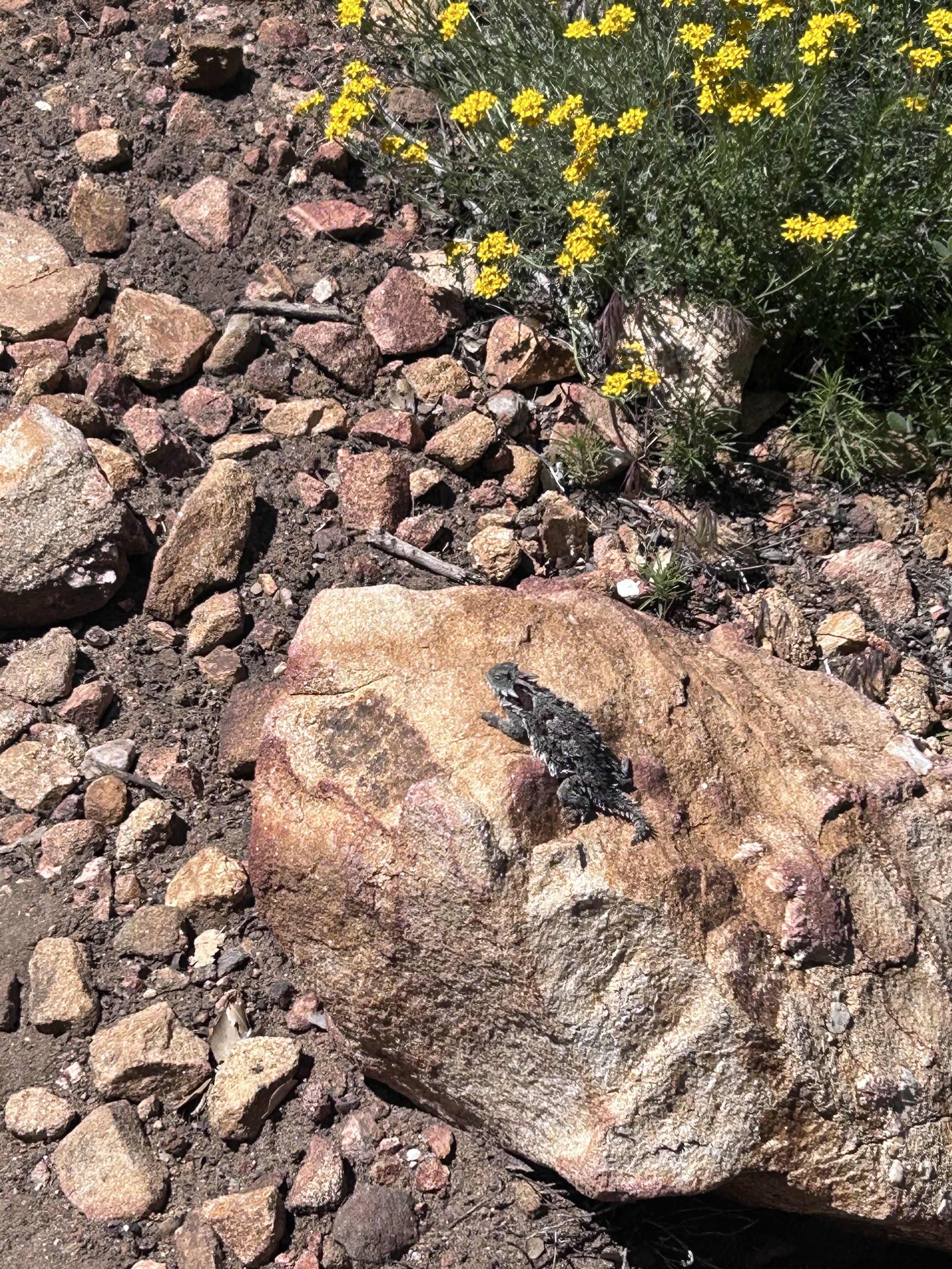
From the saddle at mile 162 we continued upwards, the sun really beating us down this late in the day. “I miss our alpine starts,” I said begrudgingly. As we rounded a small bend in the trail, Amanda came to a sudden stop. In the bushes off to the right of us sat an adolescent rattlesnake taking advantage of the midday sun. This one wasn’t rattling but, as Amanda recalled her walking stick drumming exercise, it woke up and made its way across the trail. This one, unlike the Rattlesnake we had encountered a week ago, was a classic Diamond Back but, like the other one, was in no hurry to get out of our way. We hurried past the part where it had disappeared.

From the rattlesnake encounter the trail steepend considerably. We climbed hard, gaining elevation. As we did so, Phillip passed us as well as a number of other people. We caught up to them later at a nice shady spot which we commented on. “Not so nice when you finally see the ant infestation,” Travis nodded to one of the other guys frantically wiping down his pants on a nearby rock. We all laughed and Amanda and I continued on.

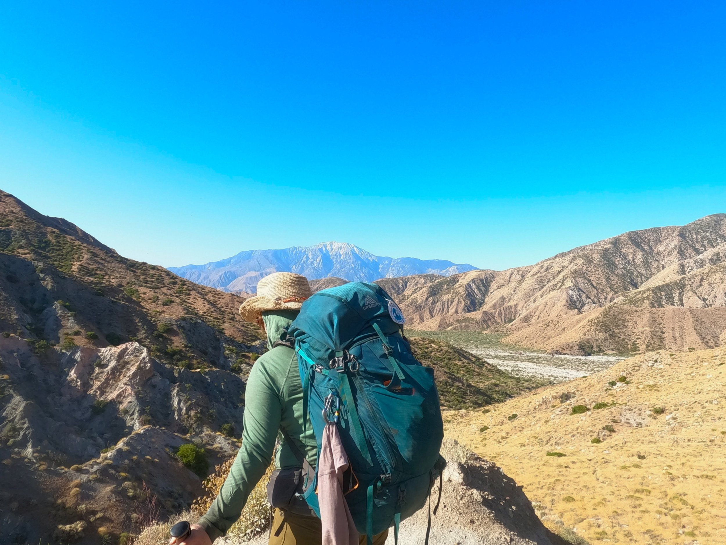
The climbing passed through another steep section before it gained the top of the long ridge we had been working on since the beginning of the morning. The group passed us again as we toiled under the sun only for us to leapfrog them one more time at another spring junction just up the way. This is the arithmetic that comes up here in the desert with water in tricky places. Amanda and I had opted to do large water carries which meant more weight but less side trips down to pull more water. The other option was to carry less weight, travel faster but make more trips up and down to low land springs. I don’t honestly know which is better but I was happy to only make one descent down for water.

We continued on, the trail traveling in a descidedly northern fashion, hoping that we would run into Jane and Joe somewhere up ahead. At this point, Amanda’s feet were really starting to hurt, the zero drop shoe putting her footbeds to the test. I had traveled a little ahead and was making my way up a short rise when a familiar, tall and lanky figure with a wide brimmed hat came into sight. “Don” I shouted. He looked up with a reserved smile as I came up. “I’m out,” is all he said. “I’m sorry to tell you that way but I can’t shake this cold and my wife is starting to worry. My son-in-law is going to pick me up at Paradise Valley Cafe tomorrow.” I told him I was so sorry and that we had really enjoyed hiking with him. At that point Amanda came up and voiced her condolences as well. We really liked Don and it was sad to see him go but he wanted to get through the desert before temperatures really started to rise and was convinced that the cold would not allow him to do that. We told him about the group behind us and wished him luck on his journey home before parting ways. I think this is the hardest part of the PCT. The most wonderful part is meeting amazing people from all backgrounds, areas and walks of life but the hardest part is sometimes seeing them for the last time.

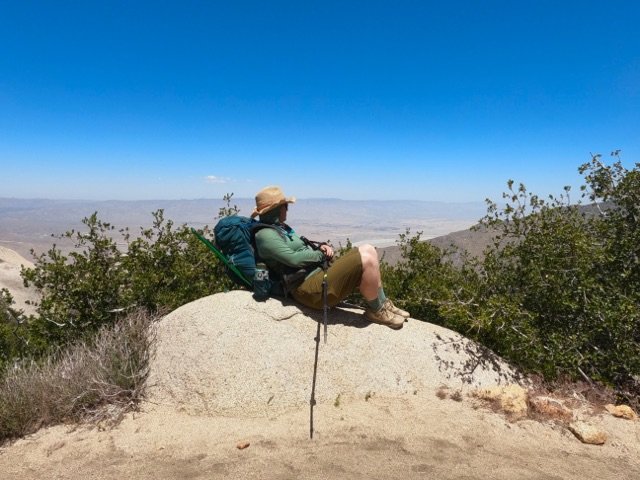
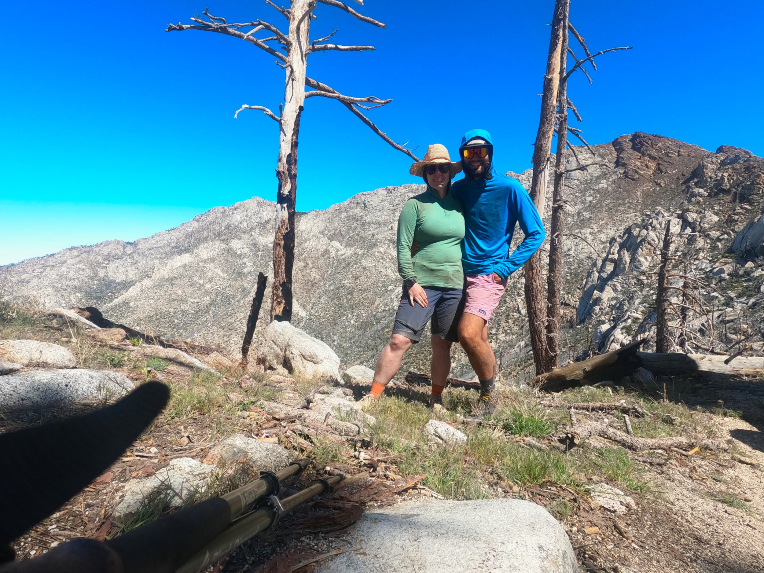
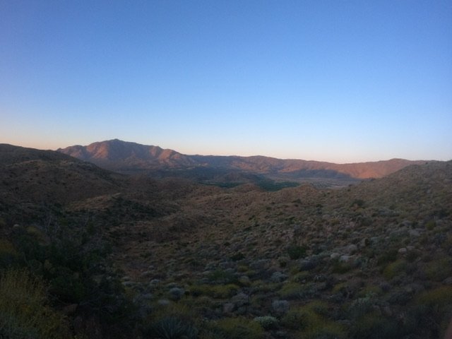
Amanda and I walked on, a little less pep in our step. We decided to camp on the backside of a large saddle leaving the climb up for the following morning. Amanda’s feet were killing her as we rounded the last of about 15 switchbacks. It was a cute little campsite in the shadow of a house-sized boulder looking over Palm Springs and the Coachella valley. We conducted our usual evening activities, an occasional gust of wind from the saddle buffeting our tent but otherwise settled easily into the evening. We went to sleep just as the first lights of the huge city below us blinked to life.

Video Block
Double-click here to add a video by URL or embed code. Learn more

Day 11: Water

5/27/2023

Section: Mile post 131.4 to 151.8

Distance:  21.42 Miles  

Moving Time: 09:03 hrs

Elevation Gain: 3,743 ft

Click here for location

In the desert, this trail really boils down to water - getting it, rationing it and making it to the next resupply. The first half of today’s 21 mile stretch ran through the Anza-Borrego Desert State Wilderness before transitioning into the Anza-Borrego Desert State Park and Santa Rosa Mountains State Wilderness and finally finishing in the San Bernardino National Forest. Through this entire stage there are only 3 functional water locations and only one is considered optimal - a volunteer-run water station before the final sections of the stage. Amanda and I need up not needing any of the stations but this was largely due to our early start and extra water from Mikes place the day before - but it was close and we were both thirsty at the end of it!

We awoke at 4. Two other groups had come in after us the night before and set up camp. One girl had considered cowboy camping but, upon finding a tarantula in the middle of the camp on arrival, opted to set up her tent. The other guy we didn’t really meet and kept to himself. We packed up as quietly as possible using the red lights on our headlamps to keep the infusion to a minimum. After some blueberries and cream oatmeal we got on our way. 

The day began with a descent out of the hills. On our way we passed Joe and Jen who i have affectionately started referring to as the GI’s (GI Joe & GI Jane). They had only made it about a quarter of a mile down the trail before deciding to call it a day. They were just starting to get their morning started so we said hi and kept moving down the trail. As the trail descended further into the lower hills we ran across Rebel again and Travis. Travis had brought a hyperlight chair and I made it known to him that I was pretty jealous. 

The trail eventually bottomed out and made its way east, skirting the Terwilliger Valley and meandering up and down through hills and canyons. The sun came up and began warming the day and Amanda and I stopped at a cistern that, theoretically, had water but it was yellow water that stank - plus you had to worry about the cistern collapsing and dumping you in! We had a snack here - I am still working on my pepperoni stick - and talked to a day hiker that was coming through. 

From the cistern the trail ramped onto the southern flanks of a north-west running ridge as it progressed up in elevation. We began up and stopped after about a mile for another snack break. At this point, the GI’s caught up to us and we talked for a little while. I asked them if they had seen Mary’s - the volunteer-run water station that was supposed to be a major lifeline for trekkers in this section. Joe said he had not but that he thought it was going to be up here in a little bit. They continued on and Amanda and I finished up our break and followed them.

The trail continued to wind up and eventually we encountered a paper plate in the middle of the trail that said “Mary’s.” We looked left and just off the trial was a blue tarp shelter with water containers. Both Travis and the GI’s were there. Amanda and I both had a liter and a half of water left and about 5 miles to go. General rule of thumb is that 1 liter will get you 4 miles so we decided to go for it, knowing that a fully stocked cafe/grill was waiting for us on the other end.

We sprinted off up the trail as it wound itself higher and higher on the ridge, eventually topping out and descending down the other side. From there the trail wound down into a shallow canyon. It was the heat of the day but I forced myself to only take a few sips at a time, conserving water for the long walk out. The trail wound way down into the canyon and at the bottom I waited for Amanda and transferred the rest of the water in my water sack into my Nalgene and then added my final electrolyte mix. “This is it - last liter, let’s hope it makes it,” before taking a big slug, shouldering my bag and speeding it to catch Amanda. I caught her the top of the climb out of the ravine and we turned north, meandering through a series of low hills before I saw the final grade progressing up another 500 feet and crossing over to the Pines-to-Palms highway. I could make out Travis, who had passed us just before the ravine, already making his way up. “That looks like way more than 500 feet,” Amanda said sourly, looking at me sideways. “A burger and beer on the other side babe,” is all I said before taking off. 

We made our way to and eventually onto the long grade winding up the southside of Lookout Mountain. Both of our feet hurt pretty bad and I had, somehow, only now started getting the first blister of the trip on my left little toe. This is a miracle that I can only attribute to the trail runners. I know that if i had been wearing my Asolos up to this point my feet would be destroyed. The grade continued up traveling west but eventually traversing north where it crested a small saddle and I took the last swig of my electrolyte mixture. “All downhill from here,'' I thought to myself. 

From the crest we wound down through some Manzaneta trees and pines - the sounds of the highway literally music to my ears. At the bottom, we came to a power line road which we took west. Amanda, sensing my excitement, told me to go ahead and get us a table and I took off. It took me about 15 minutes to cover the .9 miles to the cafe. I would have skipped if my feet were capable. Once there I threw my pack down in front of the porch and took in the dusty mess of hikers sitting around. The two German sisters who we had last seen pulling up out of Scissors Crossing were there. John from Eugene, Or was also there - he had stayed at the RV park instead of going into Julien because they had a pool. Travis was there with a woman from Switzerland already enjoying a burger and beer. There were also a number of other guys I hadn't seen before and the 3rd member of our camping spot group from the night before. I found an empty table and sat down requesting a second menu for Amanda. Not long after Amanda showed up and sat down. As she did, I heard someone shout my name and looked around to see Joe and Jannes coming out of a car. They came over and we hugged all around saying we weren’t sure we were going to see them again. A popular thing to do is actually to hitch from this crossing of the Pines-to-Palms highway up to Idylwild and resupply before the two days in the mountains between. We talked for a while and eventually Jannes and Joe headed out - they were going to get a few miles in before setting up camp. We told them we hoped to see them again and waved goodbye. 

Also at the cafe were Tammy and Tom - the older couple from our vanpool in to Campo. Tom forlornly told me that they were done with the trail because the bottoms of Tammy’s feet were covered in blisters. We both gave her a hug and told her we were sorry before they too left for the evening. Amidst all of this we also talked with Chris and Nikola who were staying across the road at “Rick’s Place,” a popular resting place on the trail run by a guy who basically gives free reign of his home to hikers who want to shower, do laundry and stay in the lot next to his house. We said we would definitely be staying there that night and they took off.

The burger arrived and, Oh my lawd, it tasted so good. The GI’s and Rebel arrived and sat with us, also ordering burgers and refreshments. The night went on and many of the hikers retreated back to their accommodation for the evening - many going across the street. At one point another guy showed up and bought us a round of beers. We invited him to our table and he told us that he had done the PCT north and south in a single season - called Yo-yoing the PCT - a few years back. We were amazed and had lots of questions for him, not the least being, how do you get to Canada and say, let’s do that again. We laughed  and talked for a while before Amanda and I decided to go make up our bed for the evening. We said goodbye and headed across the street.

The setting that we were met with across the street was really quite something. I would describe it like that scene from Pinokeo where all the boys are running wild in that carnival. People taking showers, washing clothes, there were pugs running around as well as tequila shots. We tried to avoid the fray but I did get pulled into a Hornitos shot. “This is nuts,” I commented to Joe and Jane outside. Eventually though Amanda and I were able to get our things together and set up. I tried to write up my blog but was too exhausted and instead passed out into a dreamless sleep

Day 10: Up and Over

5/26/2023

Section: Mile post 114.7 to 131.4

Distance: 17.05 Miles  

Moving Time:  07:16 hrs

Elevation Gain: 4,085 ft

Click here for location

Today’s stage starts in the Cleveland National Forest and crosses into the Anza-Borrego Desert State Wilderness during the second half of the say. The stage climbs and winds through a long series of rocky hills as the terrain takes on more of a Joshua Tree vibe

I’m starting to sleep better on the air mattress. We both have a Thermarest NeoAir but the baffles near the head of mine have started to let go leaving the head of my air mattress looking like it has a built in air pillow. Not bad except for the fact that more are starting to let go. If the ones that have currently released are the only ones that will than this Thermarest will make it. If any more go however, I might have to replace it somewhere here soon. Anyway, despite sleeping better and better in a tent, it’s still not perfect. Last night something brushed against the tent around 1 am and i was up like a shot to see what it was. I never located the offending animal/Amanda’s hand but that kept me up for another 45 minutes. So when 4 am rolled around i was not about getting up. I laid there and snoozed for 30 minutes before, regretting it deeply, twisting the valve on my thermarest to start the morning.

We woke and prepared as we always do be were ready to leave around 5:15, the sun already lighting the cloudy skies above. We made the tricky crossing from our sandbar tent site to the trail and were off. The trail in this section is not the best maintained we have seen so far and the foliage around the river is actively trying to take back over. Amanda and I made more than one bad turn. We crossed and re-crossed the river about 4 times before the trail finally pulled up and out of the river valley snaking it’s way to a better view of yesterday’s stage. Before we left the tree’s we crossed through a larger campsite where we saw Phillip still in his tent. 

Once out of the river gulley the trail started it’s slow ascent which would be maintained most of the day up through the stoney hills of the Cleveland National Forest. At one point an ultra hiker snuck up on us and we let him by. Shortly after we stopped for a snack and Phillip from Cologne showed up. We noticed that Phillip had a habit of always showing up just as one or the other of us was about to pee. In this case it was both of us. We talked to Phillip fo a while while having our second breakfast and eventually he was off with a promise to see us at the Mike’s Place - one of the few water resupplies in this stage. After Phillip was a woman named Rebel from Port Townsend. We talked to her for a while and she kept walking. After the various encounters and snacks we hauled up our bags and continued on our march upwards.

We hiked on through the stoney landscape. Amanda and I have been playing a game each day where the first person to spot a lizard is deemed the Lizard Queen or King. Today we both spotted a lizard at the same time so the crown was shared. We made a brief stop to put on some sunscreen and then carried on, passing Rebel again. This was a theme today, we leapfrogged Rebel about 4 times before reaching mikes. 

The sun continued to rise and temperatures with it. At around 11 am we rounded a gulley and ran into some day hikers who we shared a few words with before continuing on. Shortly after our encounter we came across the sign for Mikes.

Water is feast or famine here in the early stages of the trek. Yesterday there was plenty of it but today there is almost none as well as tomorrow. This is where a few really great people make a huge diffference. One of them is Mike who maintains a few Brewer’s vats of water near his small ranch about 0.2 miles from the trail. We stopped here from 11 to about 1 pm to get fresh water and enjoy some lunch. At the water stop we ran into John (Long Trail) from Eugene again for the first time since Julien. He said he had gone to the RV Resort instead of Julien because they had a pool and he was very excited about that. Also there was Phillip who was excited to see us as well as one of the Czech guys - the other was evidently far off ahead. We relaxed at Mike’s for a time but then got antsy and decided to leave. On our way out we ran into Jane and her boyfriend Joe who was back from his work check-in and both were keen to get to the water stop. 

From Mikes the trail snaked back up for another 800 feet before cresting a shallow saddle and wandering down the north side of the Anza-Borrego Desert State Wilderness. On the way down Amanda got “Rollin on the River” stuck in my head which I adapted for some of my reptilian friends

Small Lizard keep on runnin’

Big Lizard keep on sunnin’

Lizard, Lizard, Lizaaaaard in the desert

This kept me going as we descended about 1000 feet to the campsite for the night. Once there we made dinner immediately, both hungry from the day’s escapades before setting up camp. Hints be me all about is going to a big day and everyone is trying to get to the Paradise Valley Cafe for dinner - 19 miles and 3000 feet of elevation gain - we will see!

Day 9: A-hundo!!!

5/25/2023

Section: Mile post 96.5 to 114.7

Distance: 20.7 Miles  

Moving Time: 8:31 hrs

Elevation Gain: 2,150 ft

Click here for location

Today’s stage led out of the San Felipe Hills Research Area and into a wide, flat plane at the head of the Bergstrom Canyon where we stopped for a lunch break in the town of Warner Springs. In the last part of the stage we climbed into the Cleveland National Forest along the Agua Caliente Creek.

Our early morning start was miserable this morning. I had done a lot of research on weather before this trip. I even went so far as to build a python program which found the nearest weather station to every planned campsite along the route and calculated average 10-year high and low temperatures for the planned day of the year we were going to stay at the site. So when the output of all this work suggested that the minimum temperature we were going to experience for the first 90 percent of the trip was the mid-40’s I made the bold decision to leave my puffy at home as well as all long pants. That decision hurt this morning when we woke up on a solitary ridge with a marine layer of fog blowing over the top at 10 miles per hour. To be honest, both Amanda and I were thinking of just letting the sun come out before we got up but neither of us voiced this opinion at the time so… we just got up as usual. 

I ran around camp trying to stay warm while packing everything up. Amanda and I now have a pretty good excercise worked out in the morning. I get up first, deflate my pad, tie up the door and remove all of my things while Amanda snoozes for another 10 minutes. Once my stuff is outside she is free to work inside the tent…where it is still nice and warm…to prepare her things for removal. Once our little dance was complete we ate a quick breakfast - the last of the small block of Tillamook Sharp Cheddar with Salami on a tortilla. After this, desperately wanting to warm up, we starting down the hill.

Amanda was a speed demon this morning, probably tying to run from the cold. We made good time descending down out of the San Felipe Hills. I kept looking during our harried evactuation for the 100 mile marker that i knew should be coming up soon. Suddenly, as we rounded a bend, there it was. A neat stack of stones denoting 100 miles in! We took a picture and I joked to Amanda “Now we just have to do that 25 more times!” We continued our descent, winding through the northern drainages of the San Felipe Hills until we arrived at the bottom where a large camp was situated around a cattle water trough fed by a natural stream. I should note that we saw about 4 more 100 mile markers shortly after the first one which certainly looked the most legit.

As we came into camp, a guy shouted at us to take a look at one of the trees where one of the few original Pacific Crest Trail badges sat deeply imbedded in the bark. “This is the last one in California,” he said reverently “there isn’t another one ‘till Oregon.” We took some pictures to remember it by and then headed for the water. I pumped while Amanda wandered off to use the restroom and Phillip from Cologne came up to say high. We talked while i pumped and he indicated that he was going into Montezuma for a resupply. Montezuma is a newer resupply point that can be shuttled from mile point 101.2 on the S22. Amanda had been interested in seeing the resupply as the owner followed her on Instagram but we decided to keep going. Phillip eventually went back to start packing and Amanda came back. I redistributed our water containers and we headed off, shouting that we would see Phillip later in the day.

We crossed over S22 and wound our way up over a small ridge. Once on top we looked north over a vast grassland section of the trail - it looked like a sea of yellow. On our descent down Amanda helped a little garter snake of the trail. At the bottom we headed out into the grass, noticing some cows in the distance. As was tradition for us we both insisted on saying cow in German bringing back some fond memories on the Italian Alta Via 2 which we completed in 2021 and featured many cow-centric stories. 

Most of the mid-morning was spent swimming through the vast sea of yellow. Halfway through ou crossing we took a very short side-trip to see Eagle Rock which is a sacred place for the Kuupangaxwhichem people and does have an uncanny resemblance to an eagle. We took some pictures here before heading out - amanda again helping a small garter snake off the trail. 

About an hour more brought us by some more cows and into the outskirts of Warner Springs. The last 2 miles coming into town is a shaded section that passes through some beautiful stands of California Oak tree. This brought back a flood of memories I have as a boy playing in steams surrounded by these same trees and was arguably one of the most pretty and pleasant section on the trail so far! 

We stopped by the Warner Springs Informational Center only to find out that it was closed from 7 to 3 pm week days. “Kind of dumb hours for an informational center” i mused to Amanda. “Oh man, they even had otter pops available” she cried in response. We had not planned on stopping at the small resupply center in Warner Springs as it was just a gas station and a mile off trail but when i saw otter pops had been missed because of Warner Spring’s terrible information hours i decided it was worth the walk. Amanda stayed with the bags while i made the mile walk into town. On the way in I ran into a few hikers including Nikola from Reno who we had not seen since Julien. At the gas station I picked up two Sierra Nevada Pale Ales, a Strawberry ice cream bar for Amanda, two hot dogs and some more trail mixes for our run to Idyllwild. On the walk back I considered hitching but no good shoulders where to be seen so decided against it.

Once back Amanda told me the ice cream bar was the exact one she had been dreaming about so, got some huge points for that. I enjoyed my hot dog and when it was all done we decided to get 5 more miles in for a site that was next to a small steam in the Cleveland National Forest.

We headed off from route 79 traveling northeast. The path crossed a turbid looking stream before traveling along its north shore for a while. Eventually the path trued to north and wound up into a basin above the road before moseying back alongside the stream. Here we found our campsite with two other hikers taking a break alongside in the shade of some oak trees. We said high and i went ahead to do some scouting for more sites. I found a wonderful campsite on a sandbar in the middle of the river and told Amanda we should take it. We said by to the two in the shade and set up camp on the sand bar. I traveled up river and washed off the soot and grime from the day and then got the tent going. That night we enjoyed some shepphards pie and the Sierra Nevadas before heading to bed. As we were lying in our tent Phillip showed up and said hi. He was interested in staying but had heard there were better sites than what was left at our campsite ahead and was going to go another quarter mile to check it out.

As I write this I am looking forward to falling asleep listening to the gurgling water and incessant croaking of frogs all around us.

Day 8: Trail Magic

5/24/2023

Section: Mile post 80.6 to 96.5

Distance: 16.5 Miles

Moving Time: 6:47 hrs

Elevation Gain: 2,828 ft

Click here for location


We we’re up at 4, deciding to sleep in a bit since the temperatures were supposed to come down this week and 3 seemed a bit excessive. At 4 we woke and made busy with preparing for the day. Phillip also woke around the same time and started his preparations. Today’s breakfast was a new one - sharp cheddar cheese and pepperoni all wrapped in a tortilla. We had seen Joe doing it a few days back and had to give it a try. After breakfast we did our industrial athlete workout, picked up a few more things and were off. 

The trail today was absolutely perfect for just about the whole day. No steep grades and no stony pathways - we could glide. Phillip stayed with us for some time in the early hours but eventually took off ahead. We kept up our own good pace throughout the morning, faster than we have so far on this journey. We both also felt great, finally starting to observe the trail legs take shape.

The sun eventually came up, making for another stunning set of views as we passed the two Czechs in their camp. The trail continued to meander through drainages and around hillsides, always steadily climbing along the contour lines. About 2 hours in we took a break and had a quick snack. Here the 2 Czech guys passed us and we continued on after them. 

The day began to heat as we continued to wind our way through the San Felipe Hills study area. Just before we reached our one water stop for the stage, I heard a scream behind me. Making my way up the trail I saw Amanda coming down with a smile on her face. She had seen a Garter Snake and had, with recent run-ins with scarier serpents in recent days, wafted in what could be considered an appropriate way.

At mile 91.2 we walked through a gate with big signs saying water on the other side. We meandered down a side trail for about half a mile before coming on a scene of activity. As we approached we could see Phillip, the two Slavic guys and a host of local volunteers unloading water jugs onto a series of shaded pallets. Amanda and I joined in helping move the last few jugs out of the car. 

This section of the trail has very little water. From Scissors Crossing at mile post 77 to mile post 101 there is only one spot to get water and that is here and this water is delivered by volunteers in 3 Liter jugs every 2 weeks. We were very lucky to get to see them here and, because of our good luck and elbow grease, we were rewarded with cookies and fancy fig newtons. Gotta love trail mail. The volunteers are generally from San Diego and are led by an older lady who did the trail in the 90’s. We chatted with them for a while and at one point i asked about all the airplanes that had been flying overhead. One older guy looked at me and said “There’s an airbase at San Diego - have you seen an older movie, it was called Top Gun? Not the new one but an older one?” To which i replied “Do you mean, have i seen the greatest film ever produced by man-kind? Yes i have, I’ve even seen Kenny Loggin’s music video for Danger Zone!” Which got everyone laughing. The older guy continued “Well that base used to be in San Diego - it was moved Nevada a few years ago but there is still some naval activity and this trail is right on the flight path.” We continued to talk some more and one of the other volunteers told us how one of the main reasons we have the PCT as it is today is because of a number of large horse lobby’s who, at the time, were very powerful in congress and helped get the support needed to complete the trail. That is why it has such incredible and consistant grades, because it was designed with horses in mind and they generally try to keep horse tails under a certain grade which is why it is one of the nicest trails to hike in the world.

The volunteers eventually left and we filled our bottles before covering the pallets with a tarp as requested. We then took a midday Siesta in the shade of a nearby bush until around 2 pm. At 2 pm, a couple from Knocksville, Tennessy stopped by and recognized Phillip. We talked to them for a while before Amanda and I headed back out on the trail.

At this point, because of our efforts the day before and the fact that we were developing trail legs a little fast than i had anticipated we were a whole half stage ahead of plan but we carried on anyway as we were starting to feel some good momentum. We walked for another 5 miles as the trail slowly made it’s way meandering in a northwest fashion. We passed by another gate as well as a small man-made cave. Eventually we had to decide whether to continue on another 5 miles or stop at one of the last camping options for the night in a shallow saddle between two hills. We elected to stop and pitched camp. I had some delicious freeze-dried Hatch Chille Mac and Cheese using some of the last bit of Tillamook Cheddar as an additive. After, i did some yoga and we prepped for bed. Somewhere along the line Phillip passed though and asked if we would stay with him down to the next water source. We said we were staying put but that we would see him down there tomorrow. 

Today’s trail was some of the best we have been on so far. The sections in the San Felipe Hills Reasearch Area are hot but stunning and so well maintained. This made a difference that was most notable in our speed over the course of the day. All-in-all we are starting to feel really good during the days. A midday break also seems to stave-off the worst heat of the day and allows us to tack on 5-6 miles to the progress realized in the morning. We are starting to get a good cadence and that is super encouraging.

Day 7: NERO Day 1

5/23/2023

Section: Mile post 77.1 to 80.6

Distance: 3.46 Miles

Moving Time: 1:33 hrs

Elevation Gain: 1,230 ft

Click here for location

On the PCT we have now learned that there are ZERO days and NERO days. A ZERO day is truly a day where no hiking happens and a NERO day is a day where only a little hiking is done, usually to maximize time off your feet while still getting to a strategic spot on the trail for the next day. Today was a NERO day.

We slept in…as much as we could but it only amounted to about 7 am, though the bed was so nice we lounged for a bit before making our way down for breakfast. Breakfast was two courses, granola and milk before maple peach waffles. Everything was excellent. After eating we went back up to our room and collected our things. I did some research on San Jacinto to understand if we were going to need some snow gear in Idyllwild. Looking like we might, I called my parents to organize a box for us then ordered new water bladders off REI to replace the 15 year old ones that had just started leaking on us. Finally, we grabbed our bags and returned the key back downstairs. 

We had a few errands to run today including mailing back some items that we weren’t using. These things included headphones, pole protectors, straps, and an extra shirt I wasn't using. After the post office Amanda and I stopped briefly at the Julien Wolf Center and were devastated to find this was only a gift shop for the actual wolf center that is 5 miles outside of Julien. From the fake wolf center we went to the Julien Gear shop to find a stand-in water bladder until Idyllwild. Here we also found that they were selling decently priced dehydrated meals and purchased 6 for the long stretch in front of us - remember how we had run down to exactly zero in the stretch here from Mt. Laguna. We also purchased a number of snacks and fresh gas canister before shoveling our haul into our day packs and bidding adieu to the lovely lady at the counter. After, we headed to Jack’s grocery to complete our food. 3000 calories a day for 6 days equates to quite a bit of food but cheese definitely helps fill that gap. 

Back at the hotel we organized the food into our bags before reheating our pizza from the day before and enjoying it in the common room.From the hotel we did one last lap around town and stopped once more at the Julien Beer Company for one more watermelon salad. Here we ran into a girl named Jane from Cincinnati, Ohio. We talked with her for a while about the trail and how tough it was to get the 6 months off needed to do the PCT. Once we had eaten it was time to hit the trail again!

We walked out of town the way we had come in. Amanda stopped by the post office to send a few more things home and i went to the Julien Public Library to print our California fire permit. Evidently the rangers like to check to see if you have the physical copy on you. After, we played the Bride Ride game again and hitched back down to Scissors Crossing with an equally nice guy from town. After arriving we forced 10 dollars on him before saying goodbye and heading down under the overpass where we reconnected with the trail. Here we found two German sisters who we talked to for a while and who indicated they were going to wait for the sun to set a bit before setting off. We wished them luck and started up.

The trail out of Scissors is fantastic. Someone did some excellent work planning and building the trail. It turns what is a terrible climb into a nice, steady grade back up into the mountains. We worked on the climb for about 90 minutes before finding a nice tent site in a drainage which was already shaded and set up our tent. The German sisters came by and then 2 guys also passed by speaking a Slavic language. We heated up some ramen and ate and eventually Phillip from Cologne arrived and asked if he could stay by us for the night. We said of course and then talked for a while. Amanda pointed out that the Yucca currently growing long stalks out of the ground looked like giant asparagus which we all agreed it did.

Night came on quickly and I saw my first bat. Eventually we all decided to head to bed for the long trek to water the next morning.

Day 6: Julien!

5/22/2023

Section: Mile post 63.1 to 77.1

Distance: 13.7 Miles

Moving Time: 6:11 hrs

Elevation Gain: 2,254 ft

Click here for location

We considered giving ourselves a bit of a sleep-in on this, the 6th day of our PCT experience but decided the mornings were just too nice to give up so, at 4 am we were back on the trail. The path started off with a climb up the same road I had descended the day before to get water. I had to catch Amanda and turn her around as she went down the road in the wrong way. 

Once we were righted we headed up away from camp climbing about 200 feet before turning off the road and back onto the path proper.The day proceeded to meander in and out of ravines as it made an effort to reduce elevation change. As we continued a slow ascent I looked back into the valley where our camp was and noted a small spot of light ascending behind us. “I wonder if we woke up Joe and he just decided to get on with it,” I mused to Amanda. “I bet he did,” she joked back. 

In the same way many of our mornings had gone we traveled for about 4-5 miles before calling a stop to snack quickly. This was day 2 out of Mt. Laguna and we had estimated food about perfectly, being down to just some snack nuts and dehydrated peanut butter. We stopped and I brought out one of our MSR camp mugs, added some dry peanut butter and water to the correct consistency. I took a first bite and, honestly, not that bad. We ate for a bit and sure enough, Joe did show up making a joke about how he didn’t see the point in going back to sleep. We wished him luck and said we would catch him in Julien before he continued on and we made ready to leave as well. 

The trail continued it’s wandering path along a ridge heading due north before turning north-west. In the distance as the day lighted we could see traffic making its way through Scissors Crossing - a scissor-like confluence of roads from which we expected to hitch to Julien. As the day started to heat up, the trail took on a frustrating habit of wandering either down into drainage trenches or way back into them to keep the elevation constant. This, combined with the heat, made for a challenging stretch of trail. We fought on through the heat of the day, the flat approach across the valley to Scissors Crossing always just below us but the trail seemed to never descend into it. Finally, after dipping into one final drainage it made a hard turn north and dropped dramatically onto the valley floor. 

From the valley floor we crawled through cactus and low bushes, our feet on fire but encouraged by the increasing sound of traffic. Just before we turned west along the road we were passed by a younger Australian guy named Andrew and then Old Chris flew by us with a smile and encouraging word. 10 more minutes delivered us to the road where we organized our bags and swapped trail runners for sandals. Andrew came down the road and asked if he could hitchhike with us and we said of course and then Amanda got to work getting us a car. 

We had experienced this in Yosemite backpacking with my sister. Getting cars was difficult when i was visible on the road, but when it was just Katie and Amanda with their thumbs out, things seemed to get much easier. We had learned on this trip that this method was called - Ride Bride - where a female hiker could get cars to pull over at which point she would ask if there was “space for just a few more friends.” After about 10 minutes this method bore fruit as an older lady pulled over in a 15 year old Chevy 2500 and we jumped in. I took shotgun while Amanda and Andrew jumped in the back seat. As the truck began up the grade to Julien we shared our story so far with our ride. While we never learned her name we found out that she lived down in the valley near scissors crossing and had worked at the San Diego Zoo’s animal park which is not far from Julien. She said that she usually drove a small Fiat and couldn’t usually get hikers but that this time she was able to because of the truck. Also in the front seat with me was her dog, which was the Target dog and after getting in promptly laid across my lap and drooled on my hand the rest of the ride. Super nice dog and actually was on it’s way for a check-up in Julien which is why we had the ride at all. 

About 20 minutes took us up the grade to Julien. Our driver showed us where we could get free pie as Julien is known for its pie and asked where we wanted to be dropped off. We said we wanted to go to the Julien Beer company which, as it happened, was where she was headed. At the end of town she pulled over and we all got out offering her 10 dollars for gas which she said “Absolutely not” to. I said, “Well, at least let us buy you a beer!” Which she did acquiesce to. 

Julien is a fabulous little town, very similar to Sisters, Oregon or Winthrop, Washington, with it’s own selection of adorable little bars and pizza places and Julien Beer company is the jewel of the strip. Amazing beer selection and incredible pizza, bbq and watermelon salad - though, a hungry PCT hiker is probably not the best judge of culinary quality. In any case Amanda and I both ordered a 16” pizza and I got their house IPA which was excellent. We sat at a table with Young Chris, Old Chris, Nikola, Whatever, Jannes and Andrew. I brought our driver her beer and we all sat around for about 2 hours talking and laughing. 

Amanda eventually called a hotel called the Goldrush on the main strip and got us our room and after everyone had wandered off we took our things down the street to get situated. A nice lady let us into the hotel and got us checked in. I asked about laundry and she explained that, because all of Julien was on septic, there was no laundry mat but that we could wash our things in the basin in our room. She also took the remnants of our pizza to a fridge in the back before leading us up to our room. 

Though tiny, the place was comfortable and quaint. We dropped our things and took the most wonderful step of the day so far - a shower! We washed our clothes, amazed that so much dirt could come out of such a small amount of apparel and then had to go get our free slice of pie. There are 3 pie shops in Julien but Mom’s Pie serves free slices of pie a la mode to PCT hikers! Amanda got a berry mix crumble with vanilla ice cream and i had been dreaming about Strawberry Rhubarb which i was extatic to see was available so i went with that. After pie we went back out onto the street and saw Joe sitting in front of Jack’s Groceries. We sat and talked with him lamenting that he had not been at the great pizza fiesta earlier that day. He smiled and gave us a hard time about not inviting him but then said he had eaten at the Italian Place down the road. We talked for a bit under an hour before he stated that he was on his way back up to Scissors Crossing to continue on. We said we would miss him and that maybe our paths would meet again.

This is one of the bittersweet things i am noticing about the PCT - you make connections but, because everyone is moving at slightly different paces, those connections get broken as people move on or fall back. It makes for a fluid set of friends but, eventually, i think we will fall into more or less a groove. 

Back at the hotel, we took care of our usual nightly activities and then headed down to the common room to write and chat with a few folks that came down. Joining us were young Chris and Don showed up having hitched from Mt. Laguna. Another hiker named Hazel also came down to chat as well as Dale from South Carolina. Finally the parents from a group I am calling “The Swiss Family Robinson” because they are Swiss and hiking with a 10 and 12 year old son and daughter, showed up. I talked with them about climbing for about an hour before we all decided to turn in for the night.

The first town was an absolute success. Julien is not to be missed even if you are not hiking the PCT - wonderful food and people. 

Day 5: Catipillar Death Row

Section: Mile post 47.1 to 63.1

Distance: 16 Miles

Moving Time: 7:38 hrs

Elevation Gain: 3,445 ft

Click here for location


We woke at 3 am, my watch vibrating the same time Amanda’s alarm went off. We layed in bed staring up at the stars for a while before I opened the valve on my air mattress which was the sign that I wasn’t going back. We packed and even warmed some water for oatmeal and grits on the empty parking spot for the campsite. At 4 am we were ready to go - warm-ups and all - and set out from the campground.

The stars were amazing and we heard an owl in the distance. We rejoined the trail where we departed the day before and took a left. The trail continued to round its way through a series of low hills and bluffs staying close by the S1. My REI sun shirt - which i had not initially bought into - kept me just warm enough as the cool breeze ran up the small valleys. It was really continuing to impress me, especially in the sun, negating the need to constantly smear sunscreen on my already dirty skin. Eventually the sun started to make its slow march up in the sky and I couldn’t stop taking pictures as the light continued to illuminate the hills around us in beautiful ways. 

After a time we came into the Pioneer Square Picnic area to use the restroom and found Young Chris sitting on a picnic table. We sat and talked a while before using the restrooms and continuing on. From the picnic area the trail proceeded for a short time on an old road grade with a disturbingly large number of memorials on the rocks next to the trail. 

2 miles down the trail Chris, Nikola and another guy who’s trail name was “Whatever” caught up to us and we chatted for a while before they sped on past. Another mile on we all stopped to pump water and John caught up with us. We relaxed by the creek, enjoying a little shade before heading out. As we hiked a larger and larger number of caterpillars could be seen on the ground, some already tragically crushed. The further we went down trai the more dense they got. I desperately tried to miss them but know I squished a few. Amanda used an app on her phone to identify them as tent caterpillar moths. “At some point in the next few weeks,” I thought “this place is going to be inundated with moths.”

At mile 14 we came to a camp positioned closest to the end point for the day. We stopped and recouperated for a couple minutes. The camp had water but it was half a mile above us in a nearby parking lot. We could stay here or drive on another 4 miles to a campsite with water. Begrudgingly, we decided to head on out to get to better water and lessen the load off ourselves for the next day.

We hiked for 4 more miles, somewhat rested from our short break. The catapillars had at least abated but the sun was at it’s hottest as we made our way along a number of small ridges. In the last mile the trail tilted sharply down eventually delivering us to a nice open camp in a small valley. In this last section another hiker named Matt passed by us on his way to the same site. Once we arrived in camp i looked around and worried for a minute that FarOut had led me astray noting no water but Matt, seeing my consternation, assured me there was a running stream about a quarter mile down the trail. 

I loaded up my Gregorie’s integrated daypack with all the water bladders we had, said hi to John who had already set up at an adjacent site and went to pump while Amanda set up camp. On the way back I said hi to Old Chris and Joe who had arrived and were on their way to do the same. Old Chris mentioned some overlanders who had said hi but not offered him any beer. We both smiled and laughed and i headed back to camp. After some time a girl from the Czech Rpublic arrived and we talked to her for a while. Her name was Anishka and she was on an incredible adventure. This was her first time away from home and the flight to America was her first ever. She was pushing about 10 miles a day and intended to finish the whole thing before the summer was finished. Joe, Amanda and I sat around for another hour or so talking and laughing but at 7 we started winding down and completing our nightly activities before turning in for the night.

Day 4: Sit-down Breakfast!

Date: 5/20/2023

Section: Mile post 31.6 to 47.1

Distance: 15.8 Miles

Moving Time: 7:37 hrs

Elevation Gain: 4,796 ft

Song Stuck in Head: “I Think We’re Alone Now” - Tiffany

Click here for location

Day 4 started as all others had so far, with a 3 am alarm - though Amanda had replaced the eerie Stranger Things tone for a nicer “ascending chords” vibe which was slightly less jarring. We were up, fed and on the trail by 4 heading north towards Mt. Laguna. The path was annoyingly stony as we committed to a small early climb. We picked our way through the stones in the dark hoping to see another owl, but none materialized throughout the morning. We did stumble upon a small vole who seemed lost and totally unconcerned with our lording over him. After trying to help him for some time we gave up.

The trail maintained a fairly direct northerly path throughout the day making small gains and losses in elevation but never really changing dramatically. Eventually the sun started to come up but, for the first time since the beginning, was obscured by a small cloud front to the east of us. We rounded a ridge and passed by two occupied campsites as well as Don from Missoula in the middle of the trail looking for his cell phone. ”Is that Payden and Amanda?” We heard a German accented voice call out. It was Jannes. “Guten Morgen!” I called back. We stopped and chatted with Don for a while but kept moving as he frantically returned to searching for his phone. 

The trail switchbacked up a ridge after the tent sites before heading due north. As we finished the climb we were passed by Jannes and then young Chris who stopped and chatted for a bit as it was our first time meeting. Both went on and the day began to light. We were surprised to see pine trees in the valley just below us. We hadn’t expected to see these kinds of trees for at least the first month into the trek but yet, here they were. We continued on and eventually descended a short distance into more pine trees, the wonderful smell enveloping us as we dove deeper. At this point, something else began to fall that we had not expected to see for a while - rain - which we soaked in, loving every cooling drop. Day hikers started popping up on the trail and the distant rumble of recreational vehicles could also be heard on roads that criss-crossed the trail.

At around 8 miles we came to a turn-off from the trail to Burnt Rancheria Campground and took it. At the turn-off a stash-box of goodies had been left by some trail angels. I eyed the rice krispies hungry but decided to move on, figuring there might be those more in need. The hike through the campground seemed to take forever, probably because I smelled bacon and desperately wanted some but eventually we dumped out onto the S1 and took a left almost immediately noting our destination - Pine House Tavern and Cafe. My heart dropped when I noticed the “Closed” sign on the front door but quickly dissipated when the proprietor came out to swap the sign for an “Open” one. Happily, Amanda and I went inside and noted a table already occupied by Young Chris, who we found out was from Lynwood, and Jannes. As we came they motioned us to sit and we happily took a seat. 

The proprietor of the Pine House Tavern and Cafe was French and playing some fantastic tunes as we perused the menu. Amanda decided on French Toast and potatoes and I went for Pancakes and potatoes as well as decaf coffee - i am trying to quit coffee altogether on this trip but decided just the caffeine part would be fine to skip for this meal. Also following Chris and Jannes’s lead i ordered an Elysian Hazy IPA, ‘cause it was about lunch time for us. We sat and chatted while the food was prepared. As it arrived, Don showed up and sat as well as a younger guy named Andy from Orange County. The pancakes were insanely good. I know it's only been 4 days on trail but I was starving and the sweet deliciousness of pancakes as well as coffee and beer was intoxicating. Amanda and I probably put our meals down in under 10 minutes. After breakfast we paid and collectively decided to go down the road to the general store for some supplies. There we purchased two more instant meals as well as some snacks - i got some jerky and spicy peanuts and Amanda got some cheeze-its.

After we paid we made me more stop at the Mt. Laguna ranger station to use the restrooms and purchase some stickers and post cards before rejoining the PCT and heading north. Amanda also turned in our bear spray there as we really didn’t need it. We hiked through-out the afternoon. The path turned west, north of Mt. Laguna and passed over a number of small hills before we reached a trail junction. This was where our 4th day was supposed to end but we decided to continue on a bit further to reach Laguna Campground which was on of the few places that accommodated camping of any kind in the Laguna Recreation Area. 

We walked in and picked out an empty site. I begrudgingly paid 32 dollars for it but we were both wrecked and ready to chill for the afternoon. We ate some of our snacks and i went to see about the showers, devastated to find they took quarters. I came back and Amanda, now recharged a bit, went off to find a camp host for quarters. After she left, John showed up and i invited him to stay the night. Amanda came back and flagged down a staff member in a golf cart who was able to change cash for quarters. 

Just as th quarter exchange was going down i noted Nikola and another guy walking below. I walked down and invited them up as well. The second guy was named Joe and he was from Portland from which he had ridden his bike to reach the trail head in Campo. Amanda went off to take a shower and Joe, Nikola, John and I talked and laughed for a couple hours - Amanda joining after coming back from the showers.

After a while i went to take my own shower and then came back for dinner. We ate our Pad Thai, Joe had some tortillas with Colby Jack cheese, John had some beans and potatoes and Nikola had some cold ramen. We talked a bit more and then eventually turned in joking about waking everyone up in the morning.

Video Block
Double-click here to add a video by URL or embed code. Learn more
Video Block
Double-click here to add a video by URL or embed code. Learn more

Day 3: Who-Who’s there?

Date: 5/19/2023

Section: Mile post 20.0 to 31.6

Distance: 12.97 Miles

Moving Time: 6:34 hrs

Elevation Gain: 3,035 ft

Song Stuck in Head: “CUFF” - Beyonce

Click here for location

We started in the dark again, both really loving the cool California air that can only be found so early in the morning. At 3 am we were up and moving around, trying to not be so loud as to wake up Luba, one of our neighbors who had come in later in the evening the night before and set up next to us. At around 3:45 we were fully up and fed before backtracking a bit to the ranger station to make use of the bathroom. 

From Lake Morena state park we headed north along the long dried-up shore of the Morena reservoir. The reservoir itself was actually doing quite well given the historic snowpack but its shores once went far up almost next to the campground - the same shores that we now walked along in the early morning hours. At that hour only a few dogs barked at us as we pulled our way up out of Lake Morena and into the surrounding area. The track initially went through some annoying cheat grass but eventually widened to a very walkable track. As we came over a rise we heard the familiar call of an owl and, looking up, noted a large silhouette outlined in the night sky. “The owls alone are worth getting up for!” I called ahead to Amanda.  

From Lake Morena the trail climbed a bit before dropping down to a road which it then ran along for a mile. At the mile the trail turned due east and meandered through a flat grassy area for another few miles before we came to a full stream where I pulled off my boots and traded them for my “Earth Runner” sandals. At the other side I decided to leave them on as it was only half a mile to Grand Oaks horse camp. At the camp Amanda and I rested for a bit and ate some food before moving on. Right before we left John (Long Trail) caught up to us and chatted for a while

From the horse camp we crossed under I-8 and started on the main climb of the day. By this time the morning was in full swing and the day was starting to heat. The track continued on perfect grade slowly rising above the highway along a number of ridges. Amanda and I briefly stopped once more near a Manzanita tree to polish off the rest of the Chia-Snacks my mom had given us before we left and then continued on. 

We climbed or another 2 hours and eventually crossed near Kitchen creek which offered some amazing swimming opportunities but decided the 200 foot descent wasn’t worth it given the hot and dusty afternoon. There would certainly be more swimming holes on this trip. From Kitchen Creek the trail crossed another road and then proceeded along a long ridge eventually coming to a more open basin with a small, treed canyon running through it. We had originally intended to go to Cibbets campground for the night having heard that the more optimally positioned campground in the canyon had no water but, upon arrival, we found a healthy stream and large oak trees for shade so we decided to stay the night. 

We set up camp, contending with a constant swarm of black flies. I took a rinse bath in the creek which was difficult with only about 4 inches of water to work with. After we had cleaned up and had another snack we retreated from the flies to read in our tent. John eventually arrived and set up under an adjacent oak tree. Throughout the evening more hikers arrived including Nikola from Reno, Chris from California and Nick from outside of Toronto.

A number of backpacking styles is becoming apparent as we continue on this hike. One is the young-to-mid 20’s sprint style of hiking with a backpack that looks like something I would have taken to grade school growing up. Hyperlight tent, minimal sleeping pad, ultralight backpack without a top section or any major frame. These individuals are doing something like 20-30 miles a day to start and sporting pack weights under 15 pounds - trying to minimize time in camp, maximize time on trail and really owning the “dirtbag” style. Then there are the classic’s - not quite external frame packs but older internal frames with MSR conventional stoves or even more classic alcohol stoves. Lots of food, lots of equipment - prepared for all eventualities. The ages on the trail seem to break down to either under 30 or over 60, with a few exceptions and far more individuals than couples so far. All-in-all there seems to be a vast spectrum of experience levels on the trail, from first time backpackers to those with lots of experience on the trail.

Several more PCT hikers passed through in the evening. Don from Missoula and Jannes from Bavaria stopped to chat for a while and asked about a 3rd hiker named Chris (or Young Chris - to distinguish from old Chris) who we thought we had also seen come through. Both Don and Jannes decided to keep moving, citing some campground up the trail a little further. After a while we were happy to see Luba from Brooklyn arrive. We sat around fighting the flies together and trading cheese crisps for dried clementines. Eventually Amanda and I took our leave looking forward to an early morning start and having enjoyed another fabulous day on the trail. 

Amanda stepping into the morning

Passing under Kumeyaay Highway

Day 2: Rattlesnake Standoff

Date: 5/18/2023

Section: Mile post 7.7 to 20.0

Distance: 12.3 Miles

Moving Time: 6.04 hrs

Elevation Gain: 2,480 ft

Click here for location

We were up at 3 am true to our promise to begin today with an alpine style start. The heat of yesterday had enforced a need to try and finish up around noon and we were committed to making it happen. We decided not to cook, both wanting to make the most of the precious cool breeze all around us, but instead ate some trail mix. After the tent was put away and we had convinced ourselves that nothing was left behind we started our Stravas and were off. 

The red blinking lights of far off wind turbines could be seen in the distance as we made our way along the ridge we had stopped on the day before. After about 10 minutes the trail began to switchback up to a saddle above the campsite. We slowed a little due to the rocky nature of the trail in this section but were brought to the saddle after about 20 minutes of climbing. From here the trail traveled out onto a broad plateau and the trail became flatter. Amanda and I accelerated as we passed the end point we were meant to get to the day before. Sections of wet trail suggested a spring or some other water source above but we were still okay for water so we continued on. At one of these damp sections Amanda suddenly stopped and pointed. In the middle of the damp section of trail a tiny Flammulated Owl sat looking back at us - it’s big eyes studying our two forms in the dark. After a while we moved closer and it flew off allowing us to continue on the trail.

After the owl encounter the trail turned due north and continued for another 2 miles before turning west as the Hauser Creek canyon took shape below. At 5:45 the sun started to light the sky and the birds began to sing. This is my favorite part of the day - the world is waking up and everything transitions from incredibly still to sudden activity. Just as we neared the end of the valley run and began to work on the set of large switchbacks that would deliver us down into Hauser creek, John (Long Trail) caught up to us. We chatted for a while and he said that he had heard us go by but wanted to sleep a little longer. We smiled and wished him luck and that maybe we would see him at the Lake Morena store later. The trail dropped off the first switchback to a road and followed the road for the duration of the second switchback before transitioning back to a single-track trail. The first whisps of heat were starting to come through and Amanda and I looked at each other nervously. 

30 minutes or so of descent brought us into a shady section of trail at the valley with many campsites. “I bet this is where most of our cohort stayed last night,” I said to Amanda. A little further on and we found Hauser creek where we stopped for a much needed break and some water. Fighting off hordes of biting flies I took a quick dip in the creek and then pumped a few liters of water for each of us. We sat and relaxed for a time before donning our sun shirts and begrudgingly shouldering our packs, the long climb of the day before us.

 From the creek we crossed a road and then started climbing, the day’s temperature making a slow but sure rise with us. As we climbed blue-belly and alligator lizards frantically ran out of our way, seeming to always be caught surprised by our approach. About 15 minutes into the climb I led us around a corner and stopped dead in my tracks as something much larger than a lizard slithered off the track. This motion was followed quickly by a medium pitched buzzing sound from the snake which quickly identified it as a rattlesnake. Later on we better identified it as a Western Diamond-back rattlesnake. Despite initially moving a short distance off the trail the snake didn’t seem to be interested in going much farther. I eyed the embankment on the opposite side which was not going to allow us room to bypass the snake. It was a standoff. We waited for about 10 minutes, throwing objects in the snakes area and stomping up close to it to see if it would move to no avail. Finally, Amanda began drumming the ground with her trekking poles as we approached which, for some reason, was the magic ticket. The snake warily made its way into the underbrush clearing our path forward.

It was only about 5 minutes later that, our nerves ratcheted to 11, we rounded the trail to encounter another snake. This one was also lazy but appeared to be non-venomous. Not wanting to take chances I gently encouraged what we later found was a California Racer off the trail so that we could continue. We never really got comfortable the rest of the day - every rustle in the bushes brought screams and sudden recoiling but that was the last snake we saw - only lizards. In addition to the 2 snakes we also saw several horned lizards which I stopped to call-out every time I saw a new one.

The climb continued and eventually flattened out as the path turned east and then north, meandering around a series of small stone hills. It was at this point that Amanda and I were both feeling pretty done with the day. This always seems to be the case - we always find ourselves feeling like it’s the end 1-2 miles before it actually is. The day had come up to temperature and I was thankful that we had at least finished the climb. Just as the heat was really starting to slow us down the path began to descend bringing us closer and closer to Lake Morena. Eventually, we were dumped out on flat ground in the vicinity of the Lake Morena State Park which we found to be highly accommodating to PCT hikers.

Once in the park, I talked to a ranger who kindly directed me to the far side of the park where a special PCT area had been set up. “You are welcome to stay as long as you like, even overnight. Just let me know if you want an actual site and I can get you hooked up.” We thanked him and walked over, breathing a collective sigh of relief to be dropping our packs and freeing our feet. “You wanna do the last ⅓ mile out to the other campground?” I asked Amanda. “Nope” is all she said back.  “Sounds good - we’ll tack it on tomorrow,” I replied. A donation box for PCT hikers had been left in the gazebo nearby and we found and cooked a box of macaroni and cheese. Clouds were moving and there were expected to be some late afternoon thunderstorms but for the moment, we were just happy to have a reprieve from the sun and a chance to let our nerves cool off after an exciting day.

Sound on!

Day 1: Setting Out

Mile Post 0 to 7.7

7.91 Miles

3:36 hrs

1,194 Ft Gain


Click here for location

Can’t say i slept all that well and Amanda confirmed it easily this morning. Sleeping in the heat is going to be difficult for me, it’s never something I have enjoyed. Add to it screech owls, coyotes and a bird that honestly sounds exactly like a late 90’s car alarm and it made for a really long night. None-the-less, we were up and out of our tents this morning at 6 am gathering back under the shelter for a nice breakfast of oatmeal, donuts and half toasted bagels. We milled around for a time talking before our collective anxiety about starting took over and, one by one, we started off towards the trailhead. 


Amanda and I left about middle of the pack, making our way up the road. Towards the top we noted a collection of cars and two rangers sitting at a table near the terminus columns. We strolled up, signed the log book and asked if one of the rangers would be willing to take some more pictures of us. She smiled and said yes before snapping a few on my GoPro. From there Amanda and i turned and looked at each other. Trying to capture the gravity of the moment in my mind I said “shall we be off,” and we both turned and headed down the hill back towards camp. It’s hard to believe such a little act would be kicking off such an incredible journey but I suppose that’s how these things always start. We made our way back to the camp where we stopped momentarily so I could purchase a California Fire Permit with the camp's WiFi. Once that was done Amanda and I were on our way again making our way through the low hills around Campo heading north.


The trail continued to wind north but eventually turned west and crossed highway 94. From here we crossed over a set of railroad tracks with an encouraging sign stating “Canada 2567 miles, Mexico 3.” “Got a long way to go,” I thought to myself. From the railroad tracks the path started to climb and the day started to heat up. At the first water crossing we stopped and some of the latter groups caught up to us. We talked as we filled and I passed out some of the brownies my mom had made and we had forgotten to take out before starting. After filling we continued on up, sticking with some of the others for a while and talking as we walked. After a while Amanda and I stopped to take some pictures and the others continued on. 


We had decided to keep our first weeks’ itineraries pretty short wanting to give our legs enough time to acclimatize. Today was only going to be about 8.8 miles plus a couple thousand feet of elevation gain to a single campsite identified on the FarOut app. At about 3.5 hours in we passed most of the groups at another watering hole and about half an hour later we arrived at our camp.


The day was about 88 degrees and there was nowhere to hide from the sun. I set-up just the rain fly for some shade and we attempted to lie under that for some time as many of our cohort passed above us. At some point I realized we were just baking under the fly and went to look for some shade which I found just above the tent site next to a rock. Amanda and I moved to the new spot and chilled on the cool rocks for several hours, mutually agreeing to an alpine start the next day. 


Eventually the sun dipped low enough to make dinner. I tried, unsuccessfully, to catch a lizard and we made dinner. Once we saw the tent was in shadow and everything had been cleaned up we headed for it to escape the bugs, read and get some sleep for an early and, hopefully, cooler start.

The Dusty Road to Campo

Day 0: 5/16/2023

Los Angeles, California to Campo, Califorina

Click here for location

Amanda and I woke early on the 16th - PCT Eve - in order to get back to Union Station and catch the Surfliner Amtrak service to San Diego. At 5 am we ratcheted ourselves out of bed and got busy organizing our things before heading down to the lobby and checking out of the room. Once outside we headed for the subway system, dismayed to find the nearest entrance closed. As I prepped Uber, Amanda asked a nearby security guard if there was any other entrance open. He pointed across the street to a more conventional entrance.

Once inside we purchased a ticket and then frantically fumbled around the various platforms until we found the red line back to Union Station just as the train was pulling up. We hopped on and rode 4 stations back to Union Station where we once again fumbled around until we found the correct platform. Gotta give it to the Germans, they knew how to organize a public transit system. A kindly looking man motioned us to a coach car where we stepped up and inside and found a west facing set of empty seats.

Unfortunately, I had learned the day before that, due to a landslide, the Surfliner was running a bypass bus from Irvine to Oceanside, California which would split the trip into 3 legs. None-the-less, 10 minutes after the train embarked I headed down to the cafe car to grab a coffee and then settled in for our 45 minute trip to Irvine.

The misty coast flew by and before I knew it we pulled into Irvine and were jockeyed off to a set of waiting buses. From Irvine, a bus took us down 101 to Oceanside while I neared the end of the 1st book in the “Wheel in Time” series. At Oceanside we transferred back to another Surfliner Train and headed on down to San Diego which we arrived at around 9:30 AM.

In San Diego we had coordinated to meet an old friend, Mark, who had moved while we were living in Germany. We had decided on meeting at a cafe called Madi in north-central San Diego, so Amanda and I hopped on the #10 bus and then walked 8 city blocks north to a very hip looking cafe.

We sat on the porch and enjoyed what we both felt would be our last artisanal coffees for a while before Mark showed up and we both got up for hugs. We caught up at the cafe for a few hours before our schedule necessitated a departure. Mark graciously agreed to take us to a nearby transit station where we said our goodbyes and embarked on a streetcar back to the Old Town Transit station.

At the Old Town Transit station we spotted a group of people decked out in hiking gear and backpacks. “I bet that’s our pick-up spot” I told Amanda and we headed that way. Once there we met a retired couple, Tammy and Steve, from Lower Michigan who were doing the first 500 miles or so of the PCT and also working on the AT. We also met a girl from Quebec and another from Elensburg, Wa. Just as the white transit shuttle showed up, another guy in his mid-to-late 20’s showed up jovially holding the largest burrito I had ever seen in a hand, smiling and saying “just made it!” He introduced himself as Calvin from Denver and at that point, one final guy stood up from a bench and also came over to get in the van.

Together we were greeted by our driver, a nice man who ran the shuttle service who indicated we would be making a stop at REI and then at a grocery store an hour later in Campo. We piled in and drove about 20 minutes before landing at the San Diego REI. Here, I purchased another multi-adapter cord to replace the one I broke on the train the day before and Amanda got some fruit leathers. We all returned to the van and put in an order for sandwiches at the Campo store as we pulled away from the parking lot.

For the next hour I talked with Steve about our respective industries until the van pulled off onto increasingly dusty roads and eventually deposited us in front of the Green Store in Campo. Inside we purchased cold drinks, candy and picked up our sandwiches before returning to the van and driving the last five miles to the equestrian camp run by the shuttle.

Once at the camp, we offloaded our backpacks and organized them under a nearby shelter. There were a few other hikers in our small cohort nearby and we made easy conversation with them, while reorganizing our things and eating the sandwiches. After we were organized, Amanda, myself, Calvin and another guy from Portland, Oregon named John (Long Trail) played Cornhole, which Calvin and I won. Amanda and I then picked a spot to set-up our tent before hiking up to the southern terminus to take some pictures and stick our hands through the border wall.

After we came down we both did some writing before the shuttle staff gave us an orientation on the trail and some information about tomorrow's breakfast which they would be providing. I only heard about half of it as i watched a small tarantula inch closer and closer to my backpack

After the orientation Amanda and I sat and talked but eventually headed to our tents with the others to brush our teeth and organize for bed - excited as any Christmas Eve I can remember for the great adventure to start!