5/25/2023
Section: Mile post 96.5 to 114.7
Distance: 20.7 Miles
Moving Time: 8:31 hrs
Elevation Gain: 2,150 ft
Click here for location
Today’s stage led out of the San Felipe Hills Research Area and into a wide, flat plane at the head of the Bergstrom Canyon where we stopped for a lunch break in the town of Warner Springs. In the last part of the stage we climbed into the Cleveland National Forest along the Agua Caliente Creek.
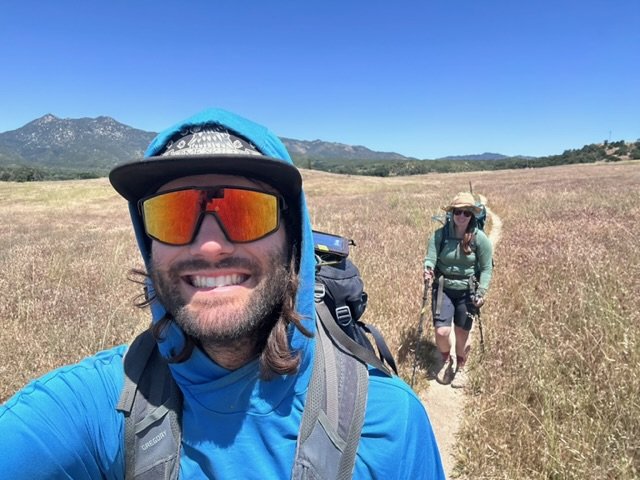
Our early morning start was miserable this morning. I had done a lot of research on weather before this trip. I even went so far as to build a python program which found the nearest weather station to every planned campsite along the route and calculated average 10-year high and low temperatures for the planned day of the year we were going to stay at the site. So when the output of all this work suggested that the minimum temperature we were going to experience for the first 90 percent of the trip was the mid-40’s I made the bold decision to leave my puffy at home as well as all long pants. That decision hurt this morning when we woke up on a solitary ridge with a marine layer of fog blowing over the top at 10 miles per hour. To be honest, both Amanda and I were thinking of just letting the sun come out before we got up but neither of us voiced this opinion at the time so… we just got up as usual.
I ran around camp trying to stay warm while packing everything up. Amanda and I now have a pretty good excercise worked out in the morning. I get up first, deflate my pad, tie up the door and remove all of my things while Amanda snoozes for another 10 minutes. Once my stuff is outside she is free to work inside the tent…where it is still nice and warm…to prepare her things for removal. Once our little dance was complete we ate a quick breakfast - the last of the small block of Tillamook Sharp Cheddar with Salami on a tortilla. After this, desperately wanting to warm up, we starting down the hill.
Amanda was a speed demon this morning, probably tying to run from the cold. We made good time descending down out of the San Felipe Hills. I kept looking during our harried evactuation for the 100 mile marker that i knew should be coming up soon. Suddenly, as we rounded a bend, there it was. A neat stack of stones denoting 100 miles in! We took a picture and I joked to Amanda “Now we just have to do that 25 more times!” We continued our descent, winding through the northern drainages of the San Felipe Hills until we arrived at the bottom where a large camp was situated around a cattle water trough fed by a natural stream. I should note that we saw about 4 more 100 mile markers shortly after the first one which certainly looked the most legit.
As we came into camp, a guy shouted at us to take a look at one of the trees where one of the few original Pacific Crest Trail badges sat deeply imbedded in the bark. “This is the last one in California,” he said reverently “there isn’t another one ‘till Oregon.” We took some pictures to remember it by and then headed for the water. I pumped while Amanda wandered off to use the restroom and Phillip from Cologne came up to say high. We talked while i pumped and he indicated that he was going into Montezuma for a resupply. Montezuma is a newer resupply point that can be shuttled from mile point 101.2 on the S22. Amanda had been interested in seeing the resupply as the owner followed her on Instagram but we decided to keep going. Phillip eventually went back to start packing and Amanda came back. I redistributed our water containers and we headed off, shouting that we would see Phillip later in the day.
We crossed over S22 and wound our way up over a small ridge. Once on top we looked north over a vast grassland section of the trail - it looked like a sea of yellow. On our descent down Amanda helped a little garter snake of the trail. At the bottom we headed out into the grass, noticing some cows in the distance. As was tradition for us we both insisted on saying cow in German bringing back some fond memories on the Italian Alta Via 2 which we completed in 2021 and featured many cow-centric stories.
Most of the mid-morning was spent swimming through the vast sea of yellow. Halfway through ou crossing we took a very short side-trip to see Eagle Rock which is a sacred place for the Kuupangaxwhichem people and does have an uncanny resemblance to an eagle. We took some pictures here before heading out - amanda again helping a small garter snake off the trail.
About an hour more brought us by some more cows and into the outskirts of Warner Springs. The last 2 miles coming into town is a shaded section that passes through some beautiful stands of California Oak tree. This brought back a flood of memories I have as a boy playing in steams surrounded by these same trees and was arguably one of the most pretty and pleasant section on the trail so far!
We stopped by the Warner Springs Informational Center only to find out that it was closed from 7 to 3 pm week days. “Kind of dumb hours for an informational center” i mused to Amanda. “Oh man, they even had otter pops available” she cried in response. We had not planned on stopping at the small resupply center in Warner Springs as it was just a gas station and a mile off trail but when i saw otter pops had been missed because of Warner Spring’s terrible information hours i decided it was worth the walk. Amanda stayed with the bags while i made the mile walk into town. On the way in I ran into a few hikers including Nikola from Reno who we had not seen since Julien. At the gas station I picked up two Sierra Nevada Pale Ales, a Strawberry ice cream bar for Amanda, two hot dogs and some more trail mixes for our run to Idyllwild. On the walk back I considered hitching but no good shoulders where to be seen so decided against it.
Once back Amanda told me the ice cream bar was the exact one she had been dreaming about so, got some huge points for that. I enjoyed my hot dog and when it was all done we decided to get 5 more miles in for a site that was next to a small steam in the Cleveland National Forest.
We headed off from route 79 traveling northeast. The path crossed a turbid looking stream before traveling along its north shore for a while. Eventually the path trued to north and wound up into a basin above the road before moseying back alongside the stream. Here we found our campsite with two other hikers taking a break alongside in the shade of some oak trees. We said high and i went ahead to do some scouting for more sites. I found a wonderful campsite on a sandbar in the middle of the river and told Amanda we should take it. We said by to the two in the shade and set up camp on the sand bar. I traveled up river and washed off the soot and grime from the day and then got the tent going. That night we enjoyed some shepphards pie and the Sierra Nevadas before heading to bed. As we were lying in our tent Phillip showed up and said hi. He was interested in staying but had heard there were better sites than what was left at our campsite ahead and was going to go another quarter mile to check it out.
As I write this I am looking forward to falling asleep listening to the gurgling water and incessant croaking of frogs all around us.