6/2/2023
Section: Mile post 200.5 to 218.5
Distance: 18.3 Miles
Moving Time: 08:21 hrs
Elevation Gain: 2.766 ft
Click here for current location
I actually slept last night. I know that’s not something too earthshattering but I’ve had some issues getting a full nights sleep in the tent so it was amazing to close my eyes and actually fade out to nothing. It was much less pleasant when the alarm shattered the void at 4 am. I snoozed for about 20 minutes before deflating my sleeping bag and getting up. At the adjacent camp spot i heard John doing the same. Amanda followed suit shortly after and an hour later we were packed up and off - John in the lead by about 15 minutes again.
Today’s stage finally brought us down off the Jacinto Massif and onto the I-10 which sits in a dry river valley riddled with wind turbines. We set off, determined to complete the seemingly endless series of switchbacks and about 15 minutes of walking delivered us down to the group site where the trail family of girls and Jai, who affectionately referred to themselves as “Tit Punch and the Ride Brides,” were camped. We found their camp in various stages of preparation for the day and called out good morning to them. They waved back and we went on our way.
Another hour passed and most of the Ride Bride team passed us as well as Kevin and Alex, sans Jaycob. These were the guys, along with a few others from the Italian night in Idyllwild, who stayed on the Mt. Jacento summit two nights before. Eventually we bottomed out, on level with Whitewater and the I-10 and transitioned to an asphalt road. The “Ride Brides'' were snacking but Amanda and I weren’t ready to eat so we carried on.
We traveled about 2 more miles in a dry, sandy river bed, feeling the calories burn in the sand. The trail was demarcated with brown posts painted yellow on top to keep us on track through the winding fingers of the river bed. We passed under some high voltage lines and Amanda stopped to take a video as the wind was howling through the valley - hence the wind turbines.
As we approached the I-10 we ran into a few hikers hiking south bound. We wished them luck and, as they passed, i looked up at Mt. Jacento. “Yikes,” i said to Amanda “I don’t envy them!” A short distance later the Ride Brides caught up to us as we passed under the 10. On the walls of the underpass were giant poster boards adhered to the concrete walls where many before us had signed their name. I whipped out my sharpie and wrote “Walking home!! Payden W. And Amanda P. Bellingham, Wa” as Amanda signed the log book and looked for our friend, Amy Lu’s, name. I shared my Sharpie with the “Ride Brides” and called an Uber to Tamarack Road just beyond the underpass. 5 minutes later a Red Chevy Camero with a scorpion license plate cover showed up and a smiling man beckoned us to put our things in the trunk. Our first stop was the Cabazon Post office, about 10 minutes west on the I-10. We stopped there and I taped two shipping boxes together to send our ice axes, microspikes and gaiters back to my parents house. From there we caught another Uber to the Hadley’s Food Market which was AMAZING. The place was like a Trader Joe’s on steroids. Amanda went in first and got all sorts of goodies including cooked bacon for breakfast. I went in and almost, ALMOST purchased a 2 pound jar of Spicey deviled eggs but settled for a Dogfish Head IPA instead. We both could have spent hours in that store.
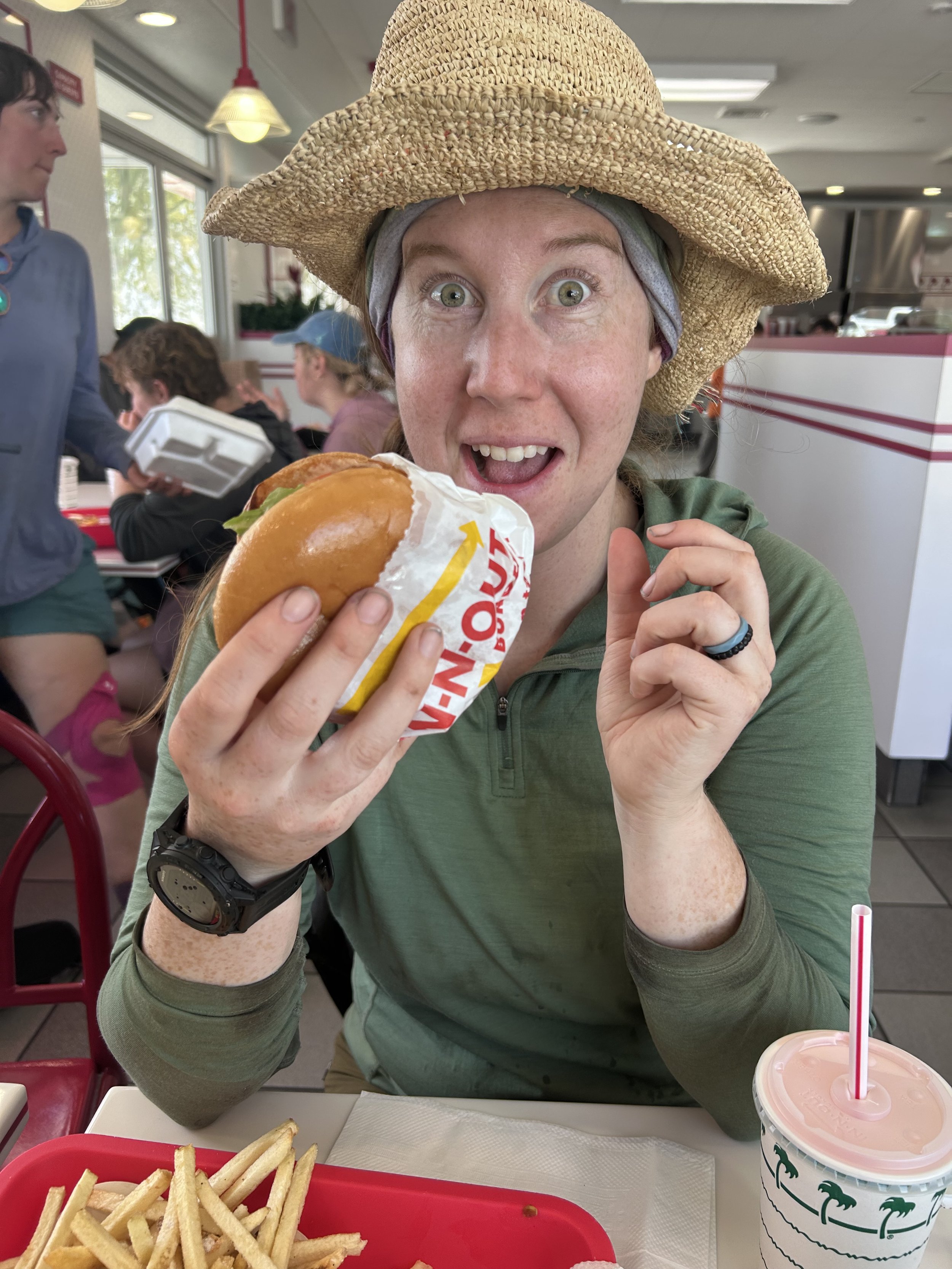
From the grocery resupply we headed for In-n-Out Burger. I mean, it’s a staple of California - you gotta! There we caught up with the Ride Brides again as I enjoyed my double-double and Amanda had a regular cheese burger. No need for the secret menu today. After we ate, we bid adieu to the Ride Brides and made one last stop to Chipotle where we got burritos for dinner and stuffed them down with our water which we refilled from the fountain soda machine.
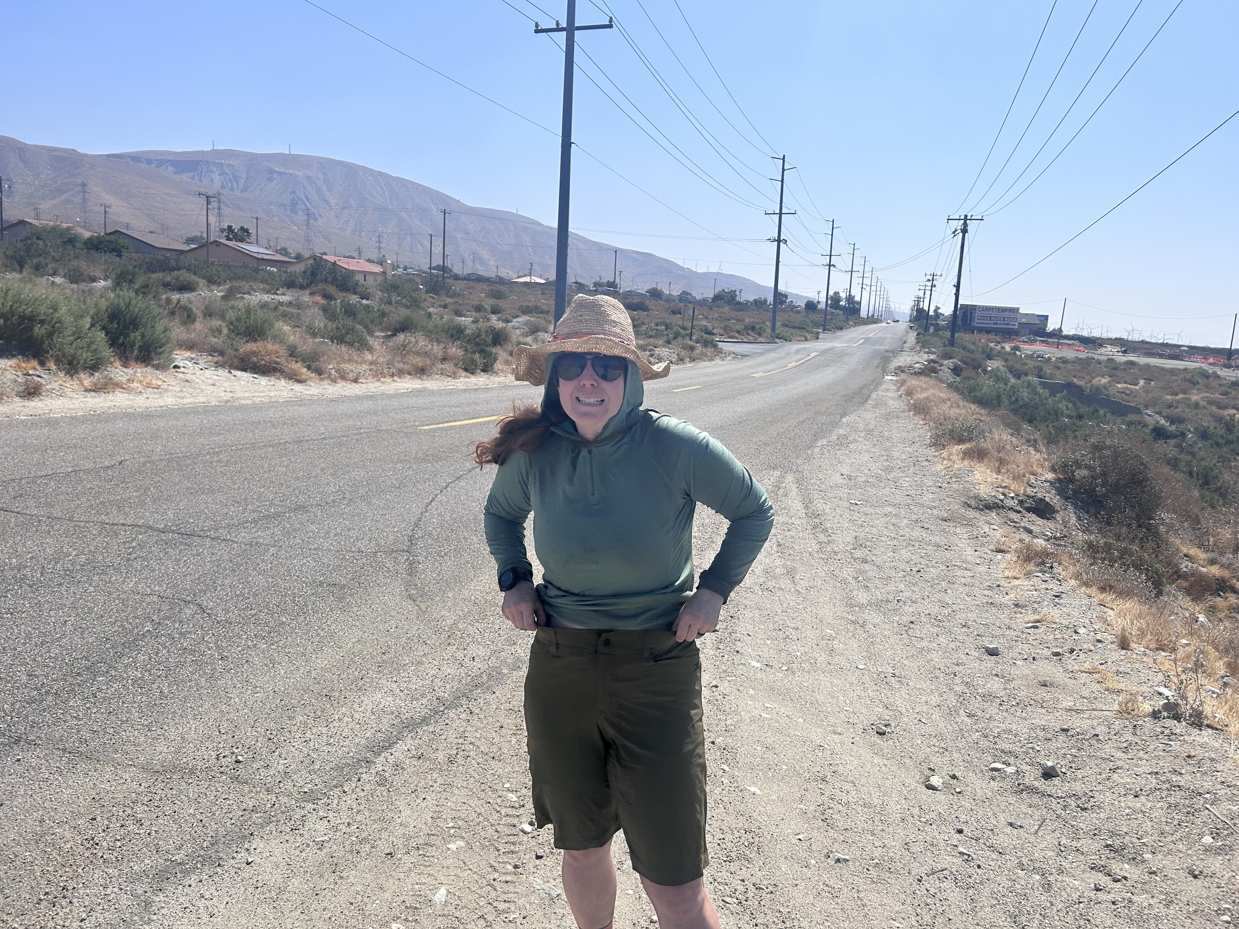
The Uber back took a little while to find us but eventually did and took us ten minutes back to Tamarack Road. From there we set our stravas and started walking. The trail travelled up and around the North Side of the town of Whitewater eventually entering a small east running ravine. Here we ran into an older gentleman waiting out the sun in the shade of an info sign. He told us there was a ranger station up ahead but he coulnd’t remember how far. We thanked him and kept going, climbing higher in the ravine which eventually turned north. We climbed on for another hour eventually reaching a saddle and going over the other side. This is where Amanda’s 2 liters of water ran out with about 5 miles to go. We shared from there on out.
The trail dipped down into another ravine and slowely climbed out of that one before heading up high on a ridge. We reached a sign that confirmed the existence of this so called ranger station and after a sort amount more we saw down into a deep and wide valley which looked like a very old glacial morain. We entered a long set of switchbacks that took us off the ridge and down into the moraine. At one point, towards the bottom, Amanda made a sudden stop. Up ahead a Coastal Rosey Boa sat in the path trying to absorb the last bit of warmth from it before the sun set. We gave Rosey a wide berth and proceeded to the bottom of the moraine.
We decided to camp right where the trail bottomed out as it hosted many spots out in the various sand banks of the river. Before doing anything we sat down and hungrely consumed our burritos, hoping that not too much time had passed to make them go south on us. I also pulled out my beer and shared it with Amanda. After eating, i set out to pump water and Amanda started setting up the tent. After water i did my yoga and came back to drink some more water. We did the rest of our chores and started to notice lots of little frogs everywhere. We caught one and Amanda’s app identified it as some sort of toad. Finally, we both turned in for the night, agreeing that 5 would be a perfectly agreeable wake-up time.