6/15/2023
Section: Mile post 394.0 to 411.8
Distance: 18.92 Miles
Moving Time: 08:02 hrs
Elevation Gain: 3,430 ft
Click here for current location
Today’s stage started just inside the San Gabriel Mountains National Monument before briefly passing into the Pleasant View Ridge Wilderness and returning back into the San Gabriel Mountains National Monument at the end of the day.
Amanda and I woke around 5:45 to the cacophony of birds in the trees above our tent. I was not ready to get up yet but deflated my sleeping pad and rolled up what I could in the tent before exiting to meet another beautiful day. We had gotten a 3rd group into the campground during the night. I noticed a tan rain fly a few sites away. Amanda eventually got her things organized and we enjoyed some breakfast sitting at a picnic table. I had purchased two heavy pouch bean meals and ate my second one today. This one was a Cuban Garbanzo bean medley and was quite delicious. We finished packing and said good to Sean as he appeared to be a few minutes behind us and started for the northern exit of the campground.
We jumped on the Burkhart Trail. Remember, because of the frogs we had circumvented about 4 miles of the PCT and the Burkhart trail made up part of the bypass which returned us to the PCT proper. We eventually rejoined our beloved trail and headed due west. We came to the Cooper Canyon Trail Camp with another pit toilet option, which Amanda utilized, and Sean caught up to us. We chatted for a while with him about California and more animals before we headed up the trail and Sean also took an opportunity to use the bathroom.
We wound up out of the Cooper Canyon Trail and eventually rejoined highway 2 where we took a break and got a picture in front of a giant “We Love Frogs” written with rocks next to the highway. As we crossed the highway Amanda saw a quick glimpse of a coyote but it didn’t stick around long enough for me to see
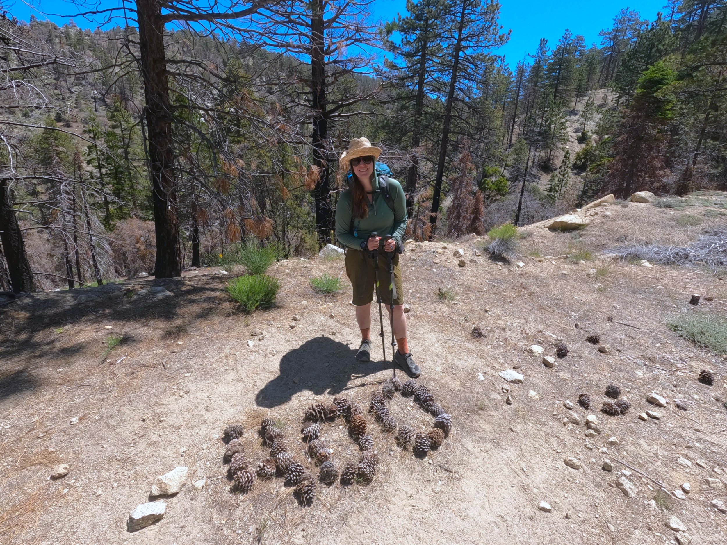
The trail paralleled highway 2 for the middle half of the day but, because it was closed, it was very quiet. Apart from Sean, we didn’t see anyone the rest of the day. A bit beyond the first crossing we passed the 400 mile mark, denoted by a big “400” written in pine cones. About halfway through the highway section we stopped to treat water and carried on. At mile 403 we departed from highway 2 for the last time and headed due north. The trail briefly curved west before returning north at mile 405. It was at this point that I started thinking about food. Let me tell you about all the foods I am especially craving
Cornbread - no idea why but I am dying for some cornbread
Enchiladas - I am taking care of this in 2 days at Agua Dulce
Popcorn - just really want some theater popcorn
Chili - Like any chili - would go amazing with the Cornbread
Ballard Pizza Company Pepperoni Pizza - Had some at a Mariners game before I left and want some more real bad
Ice Cream - like any ice cream
To name a few… Food aside, the trail went by Sulfur Springs camp and began climbing northwest. With little gas left in the tank we somberly climbed the hill. At mile 411 we stopped to fill up on water as we would be dry camping - 9 liters total and made the last bit of our way to camp. The campsite is beautiful, one of my favorite, with a clear view out to the basin and Palmdale in the distance. Amanda and I made camp in a nicely sheltered ring, surprised to be the only ones here. This section, from Wrightwood to Agua Dulce, has been a lonely one. We hungrily ate dinner and I did my nightly yoga before crawling into bed for some reading and writing. No rain fly tonight, we tried last night to see if we could keep Amanda warmer but it seems to be warmer already so going to leave it off to look at the starts!