9/5/2023
Section: Milepost 1178.3 to 1148.3
Total Trail Miles: 1791/2650
Distance: 30.65 Miles
Moving Time: 12:06 hrs
Elevation Gain: 4898 ft
Click here for current location
BIGGEST MILEAGE ON THE TRAIL SO FAR!!! So cool to get over 30 miles, and we WORKED at it! This section is absolutely gorgeous and the first day that I can say, without a doubt, we are firmly in the Sierra.
The path today starts from the saddle we ended at the night before at the head of Jones Valley and proceeds south-southeast. The first 12 miles is composed of a maddening up and down between 7600 and 8200 feet. At 4.4 miles in, the path turns distinctly east and passes through Lacey Creek Campground at Meadow Lake Road before climbing back up the nose of a northeast running ridge and continuing on east. At around 10 miles, the PCT passes below the quintessential granite cirque of White Rock Lake before turning south and climbing up to the day’s high point below Basin Peak. From this highpoint, the trail descends rapidly down to I-80 through a shrubby basin riddled with beautiful white granite boulders. The PCT crosses I-80 near Boreal Mountain Resort and continues south, serpentining through more gorgeous granite. At Donner Pass Road the day’s route bottoms out before making a heroic climb out of Donner Pass, skirting the boundary of Sugar Ski Bowl and following a ridge south to Anderson Peak where the stage ends.
Today was an exciting day because we were going to get to Donner Ski Ranch and that meant FREE BEER so, we were up and getting ready around 5:30 am - the sun already getting up and about. I enjoyed some oatmeal and a hot coffee before we rounded up our things and set off. The early part of the day passed without too much incident. The granite was starting to become common and the air was really starting to smell differently as we truly entered the high sierra. The other giveaway that we were starting to get into the true Sierra was the elevation. We hadn’t seen days that stuck around in the mid-7000’s since we had left this area earlier in the summer.
We hiked throughout the morning discussing how well we were sleeping and how nice it was to be consistently dry. Eventually we topped out near Basin Peak and stopped to eat some lunch. The day was sunny and the perfect temperature for hiking. On restarting we decided to go to headphones for some books on tape. I have just started reading “Assembling California,” by John McPhee, which is a perfect book to be reading right now because it is all about the geological formation of California. It’s so perfect that, about 20 minutes down the trail, just as John starts recounting the beginning of his geological trip across California at Truckee on I-80, I-80 came into sight! We wound our way down to the big road through a gorgeous open basin riddled with giant, white granite boulders. Along the way I started to see lizards again which had been gone too long from our trail days. We passed a few day hikers along the way who gave us a wave and kept going, stopping a few times to marvel at the big ‘ol Foxtail pines that had, seemingly, sprung up out of nowhere.
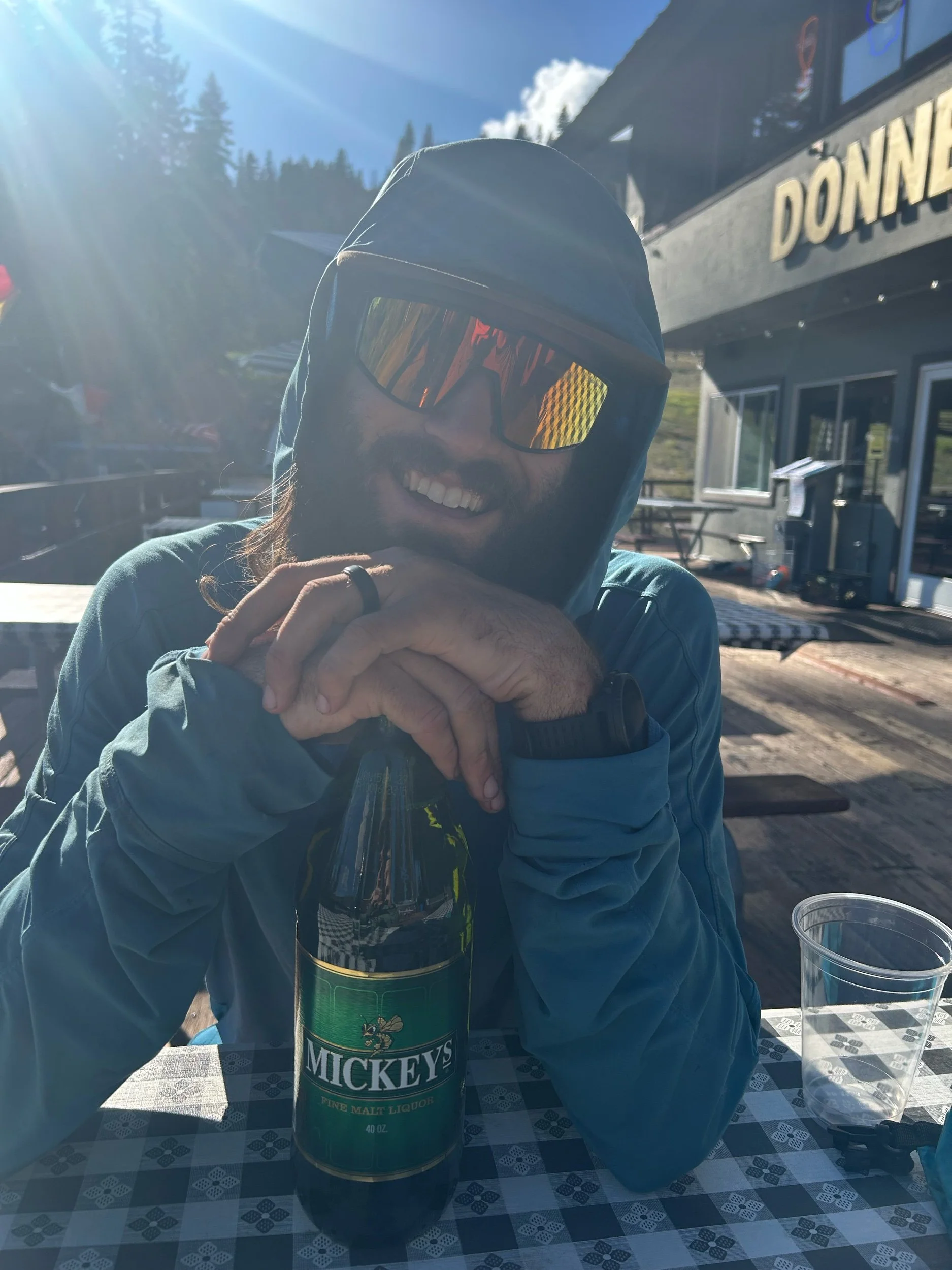
The path paralleled I-80 for a while but eventually passed under it before undulating its way through small alpine lakes and giant boulder fields, then passing under some well bolted crags and dropping down to Donner Pass Road. Here, we excitedly turned onto the road and sprinted up to Donner Ski Ranch. The excitement here was not only the chance to get a great burger but, also, a free 40 oz Mickey’s! That’s right, show your PCT permit at the Donner Ski Ranch and you get 40 free ounces of malt liquor! We arrived at the Donner Ski ranch in the mid-late afternoon and dropped our stuff on the porch before entering, ordering our burgers and getting our ice cold drinks. We sat on the deck while waiting for our food, marveling at the change of scenery in front of us. It really was incredible to see the Cascades give away to a very different landscape and it felt so good to be inching our way back to where we had bailed what seemed like ages before.
Eventually our burgers came and we scarfed them down. I put a good dent in my Mickeys before deciding another burger was in order. Amanda agreed and we ordered two more. After we were done with them we discussed how much further we had in us. We agreed we could do 7 more to get to 30 and red-shouldering our packs and heading on out. We hiked back down Donner Pass Road and turned right, back onto the PCT, and started another stout grade up under the Mount Judah Express rising from Sugar Bowl Resort. We climbed and climbed, eventually passing under Mt. Judah and serpentined along a ridge towards Anderson Peak. The sun set on us and we continued to hike. On and on we went until Amanda finally said she was done. We were a ways from any good camping so we found a clear spot and set up our tent off the trail a little ways. We weren’t hungry or energetic enough to make a formal meal so we ate some snacks we had before doing some yoga and passing out happy to have reached our first 30 mile day and finally be in the true high country of the Sierra.

