
Trekked September 2025
Written October 2025
Intro
Every year millions of dollars and thousands of volunteer hours go into maintaining a 211-mile stretch of trail between the Yosemite Valley and Whitney Portals. This trail, known as the John Muir Trail, crosses 6 major passes over 12,000 feet and traverses through some of the most beautiful and stark wilderness in North America. It is meticulously cared for, rock steps lovingly laid down by California Conservation Core volunteers such that a determined thru-hiker can cross 2 maybe even 3 of these behemoth passes in a single day, covering 40-50 miles along the way.
When Amanda and I completed the JMT as part of the PCT during the Fall of 2023, I couldn’t help but wonder what passing through the high, shale filled mountains of the Sierra would be like without such a trail. Two years later, I got a chance to find out when we shouldered our packs and stepped out onto the Pamir Trail in Tajikistan.

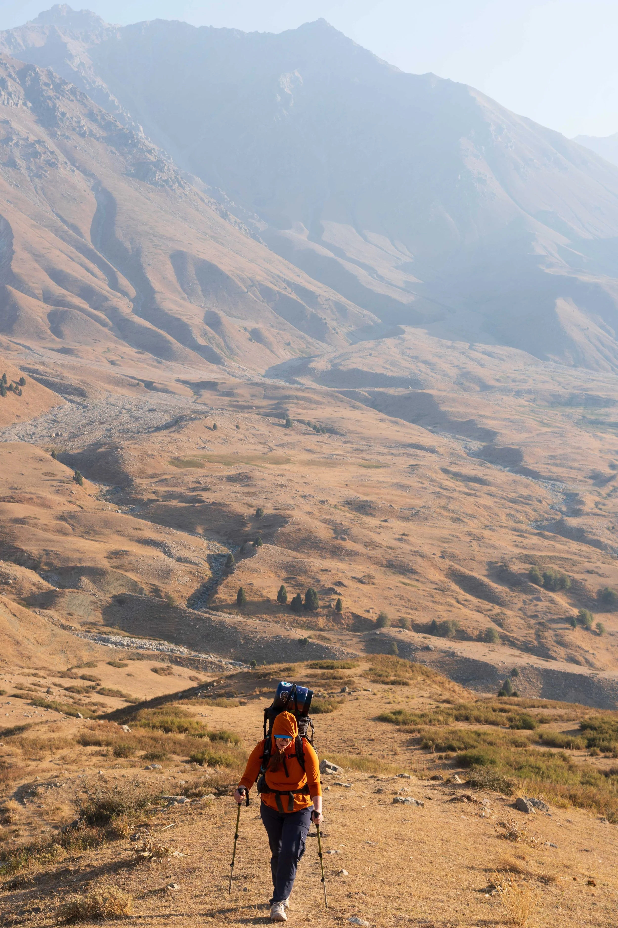
Amanda ascending Kaynar pass

Lone boulder in the Zombar River Valley

New Zpacks travel sack - see how it works!

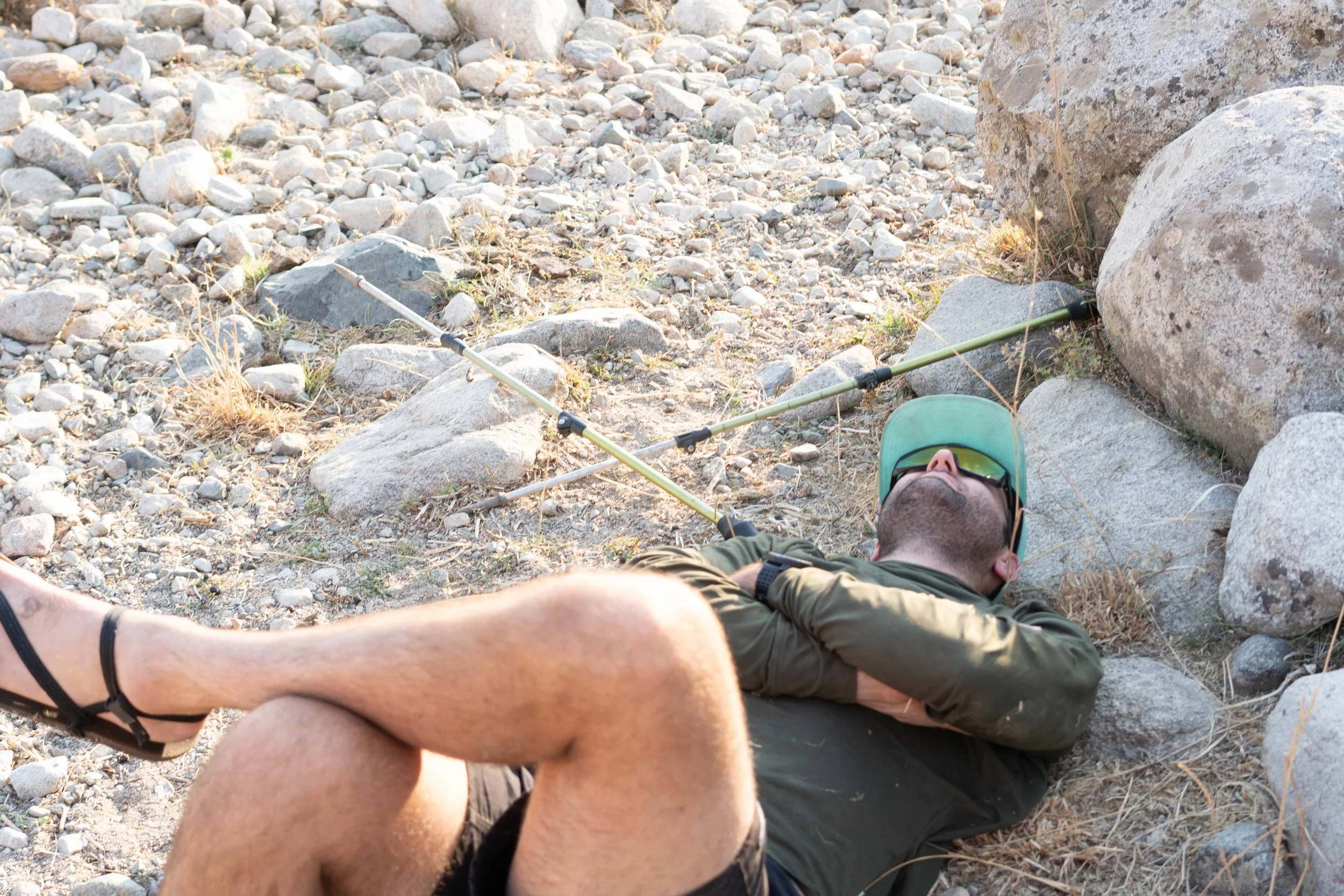
Not sleepy at all!

Love me a good Lada!

Amanda recovering well after being admonished

Taking in what was once the worlds tallest flagpole

Looking at the National Museum of Tajikistan
Day 0: Dushanbe, Tajikistan
September 8th, 2025
My eyes fluttered open as our Turkish Air flight touched down on the runway at Dushanbe International Airport. I don’t usually sleep well, or at all, on airplanes - I swear to god Economy class is built to punish me for being over 6 feet tall, but after being awake for over 24 hours I could have probably slept folded into a box.
We deboarded and Amanda and I passed through customs without issue. This was the first stamp in my new passport which I had gotten just a week before we left. We collected our things from the belt, happy to see the new Zpacks dyneema travel sacks had kept all of our stuff together through whatever goes on behind the scenes of the airport check-in walls. We left the airport, dodging the frantic calls of the taxi drivers and making our way onto the city streets.
We walked along the wide soviet-style road, headed in the direction of the Green House Hostel. There were some city workers lazily cleaning leaves and refuse off the sidewalk as well as some teenagers loitering outside a few convenience stores but, otherwise, the only concern we had were the little bats that zoomed out of low hanging trees at us. “I really hope we don’t have to put our rabies vaccine to the test this early in the trip,” I said to Amanda, ducking as a little furry mass fluttered over my head. We continued to walk on for another mile, eventually reaching the dimly lit hostel via a side street. We were greeted by a young guy who got us checked in. Turkish Airlines had cancelled our flight out on Friday and in my attempt to cancel and re-book a private room I had actually just ended up canceling the reservation all-together so, this evening, Amanda and I were at the mercy of whatever was available. Fortunately, there was one remaining bed in a female dorm and a final spot in a mixed dorm. I left Amanda in the lobby as the host showed me to my spot, explaining where the bathroom and other amenities were along the way. I only half listened - I was cooked. Once he finally got me to my place, I thanked him before quickly getting my stuff secured and passing out on the lumpy mattress.
We slept in till about 9 am before getting up. Four middle-aged Dutch travelers who had been on our flight had come in about 20 minutes after us but I hadn't gotten up for more than a few minutes to say hello before passing out, otherwise I slept well through the night. Amanda and I met in the lobby and asked the day host for a place to go get breakfast. He recommended the Moose Cafe about half a mile back the way we had come in the early hours of the morning. We thanked him and headed out.
As we made our way to the cafe the style of Dushanbe made itself very apparent. Faux glitz and glam seemed to drip off every building and facade like it was attempting to appear very high class but no one was believing it. After about 10 minutes of walking we arrived at the strip-mall style entrance of the Moose Cafe and went inside. Amanda got shakshuka and I got some oatmeal, not wanting to push my culinary luck too far this early in the trip. I also got a Russian Style coffee called Raf which was delicious. Actually, the whole meal was surprisingly good. After eating, we made our way back to the hostel, stopping to pick up some water and a few other snacks from a nearby grocery store.
Out front, the 4 Dutch travelers, one of which had had an entire conversation with me topless in the dorm room that morning before Amanda and I had left, were talking with a man in front of a Land Cruiser. They were headed to Iskanderkul the next day which, ironically, was the mid-point Amanda and I had selected for our trek, but we weren’t going to be there for at least another 4-5 days. We wished them luck and then ducked back into the hostel before migrating our things up to the private room which was now available for us to take. We organized our affects in the room as neither of us had really had a chance to on arrival.
Once all our things were accounted for we decided to make a larger excursion into the city. Dushanbe isn’t really known for having much of note for tourists but there was a large city center that we had heard had some interesting statues and museums so we set out into the heat of the day to find out what the it had to offer. We walked about a mile and a half before stopping to eat at Traktir “Konservator” which was, supposedly, a Ukrainian restaurant. We cautiously entered an empty eating area but soon were shown to a table by a nice man who provided us with some English menus. Amanda got some Pierogies and I settled for some basic lentil soup. We talked about how sterile we were finding Dushanbe, like being behind the Iron Curtain had sucked all of the identity out of it. The food was okay and after about 45 minutes we paid, thanked the host and made our way deeper into the city.
We started with a walk past the statue of Ismoil Somoni, the first century Samanid amir of Transoxiana who consolidated much of the land in present day Tajikistan during his rule, from Samarkand. Amanda was briefly yelled at by the guard as she made her way up the steps to take a closer look at the statue. Evidently, us mere mortals are not permitted to approach on the burgundy-red stonework platform Ismoil sits upon. Nevertheless, we snapped some pictures and moved on into Rudaki Park. The park was fascinating. A moderately well tended copy of many parks we had strolled through in major cities throughout Europe but dotted with heavily soviet influenced structures and fountains gave the feeling of an empty city putting on a grand front. In the middle of the park stands what was briefly, between 2011 and 2014, the world's tallest flagpole, proudly displaying the Tajikistani flag.
We walked across the park, trying not to get lost navigating its myriad curving paths, to arrive at the National Museum of Dushanbe. We paid and went inside following the well marked path down to the starting point on the lower floor. Amanda and I passed through thousands of years of history trying to take it all in. Honestly, something was up with the lighting because I kept getting weird dizzy spells trying to focus on pot shards and taxidermy animals. At one point we stopped to observe a stuffed bear, just to understand what we could expect to be concerned about in the mountains. I was happy to see it was no larger than our typical North American black bear. “Phew, glad to see it’s not Grizzly sized!” I commented to Amanda.
After about 90 minutes walking through quiet displays Amanda and I decided by consensus that we were done with the history lesson. The place was BIG and getting through it would have probably taken another 90 minutes at least but we wanted to get back to the hostel and rest before heading out the next day. We left and re-navigated through the park. My phone was almost dead so Amanda navigated back. We decided to stop at a Lebanese restaurant called Al Sham and finally had some good food for dinner. Leave it to the Lebanese to deliver in what was a bit of a culinary wasteland. We enjoyed an excellent meal in a courtyard setting watching locals walk by. All the restaurants had Russian pilsner style beer which was… terrible.
Afterwards, we made our way back to the hostel. On the main street a few blocks away we stopped at an ATM pavilion and played my favorite game in foreign countries - ATM roulette. Which machine is going to accept my card? Which machine is going to take my card and never give it back!? I tried three machines and got success on the third attempt. The exchange rate was roughly 10-to-1 Somoni-to-Dollars which was mercifully easy to remember. After collecting our cash, we headed back to the hostel and relaxed in the common area. I texted our driver for the ride up to Luchob the next day and he responded immediately indicating that he would be there at 7 the next day.
We headed to bed around 8 pm, still trying to recover from the marathon travel we undertook to get to Tajikistan. Everything was in order. We got some reading in before passing out, excited to get started the next day.
Day 1: Luchob to Ghofilobod
September 9th, 2025
We woke just before 6 am - no alarm clock needed given the fact that our internal clocks were still set to Pacific Standard Time. The first rays of the light were starting to cast themselves across the city as we got our gear wrangled into our bags and made one last use of a functioning bathroom. We clomped down four stories of stairs in the shabby Nike sliders that had been provided to discourage wearing shoes inside and arrived at the common area of the Green House hostel. We had settled up the night before so when I received a WhatsApp notification from our driver, Vadim, at 6:41 Amanda and I put our packs on, took one last look around at everything and headed out to the car.
Vadim was waiting for us in a black Toyota van with his son in the passenger seat. He took our bags and set them in the back trunk before motioning us to get inside. We drove out of Dushanbe, the small side streets giving way to wide, Soviet style roads and then a highway as the van sped north. We passed a large power station on the way out which I had seen in an Instagram post from an Australian guy who is currently walking around the globe and had walked out of Dushanbe this way the November before. Originally I had considered walking out of the capital city but decided against it given the limited time we had to cross the Fann Mountains. We came to a scary looking check-point with a few large military men holding Kalashnikovs but Vadim smiled and made a joke with one of them like they were friends and they motioned us through.
From the roundabout, the roads started to slim back down as we ascended into the mountain villages north of Dushanbe. We climbed up for another 20 minutes, the road at times giving way to crushed rock until the Toyota came to a small bridge, passed over and I told Vadim he could stop where we were. He could have likely kept going but the road started to look very sketchy and I doubted driving would be any faster than us walking. We were also eager to start hiking.
We stepped out of the van into the early morning light. I paid Vadim and thanked him for the drive. He smiled, took the money and then disappeared back the way we had come. We were officially there, at the head of our Pamir trek. We got going on our typical pre-hike routine. I started up our new Garmin InReach which I was already finding was a vast improvement on the old Spot we used to use. Amanda did some last minute re-packing of her things and then we both did our classic morning stretches that have been our routine since our Dolomites trek in 2021. Once completed, we smiled at each other, took a quick picture and, hearing a dog start barking in an adjacent yard, got underway.
The climbing was stout to begin with. A heavily switchbacked road led up and up out of Luchob onto the upper banks of a river gorge. As we climbed, a few boys on dirtbikes passed us, heading on into the mountains. We cleared the first few switchbacks and could see shepherds moving cows into town on a path about 400 feet below us. The path continued on through some more outskirts of Luchob, the steep start slowly giving out to a more moderate grade about 3 miles in. By the time we reached the grade’s inflection point it was 90 degrees and we could feel the heat. We stopped to drink water and snack for a bit. “It’s so hazy,” Amanda said, motioning back the way we had come down the valley. Indeed there was an incessant haze in the air that I thought might have cleared up as we left the lowlands of Dushanbe behind, but it seemed to permeate well into the mountains.
After about 5-10 minutes we reshouldered our bags and continued onwards. The road maintained a steady grade but with occasional, maddening drops into small side drainages that would then require a localized climb to get back out of. Down and up we dipped for several miles. Above us, the constant buzzing of the high powered electrical lines sizzled as we made our way further into the mountains. I should mention here that this section isn’t actually the Pamir Trail - we were going to connect with it later that day for a very short distance before making camp. The current path we were on, I believe, was an access road for power line maintenance.
We continued on the road for another 4-5 miles and ran into one group of shepherds moving cows back towards Luchob around midday. They attempted to speak with us but did not know English and Amanda and my Russian is non-existent so we communicated with a lot of hand motion that really didn’t move the conversation along. They smiled and moved on and we did the same, waiting for the cows to clear the road before getting back onto it.
At about 10 miles in, the trail descended to within access of the river and we made another stop to fill water bladders. I hadn’t really been drinking enough and the heat of the day was starting to get to me. One of the problems is that my bladder was sitting too low in my backpack and the sip-tube wasn’t long enough to make itself very accessible so I had to crane my neck extra hard to get to it, which meant I wasn't drinking as much water as I probably should have been. I filled both our bladders and dunked my shirt and hat in the water to give me some temporary reprieve from the heat of the day and we continued on.
A little further on we crossed the river and the wide, flat road gave way to a much smaller, much less consistent stock trail. We learned very quickly that the trail we were to follow was not going to be as consistent or of the same quality as anything we had hiked before. The path followed close to the river on the east side and was, effectively, whatever the sheep had in mind as they made their way along the river. In places, shepherds had patched together little bridges to cover spots where the bank had washed out. The trail was constantly climbing and dropping, climbing and dropping as we made our way up the river. After crossing the river it made a broad arc, turning northwest and began to steepen again. That’s when things started to hurt.
I’ve only ever had heat exhaustion once in my life and that was the day we climbed out of the Seiad Valley in California on day 89 of the Pacific Crest Trail. It was actually a very similar experience, it was hot and we had a long, ugly climb up a river gorge for most of the day. On this day, I had not drank enough water and it was hotter than I think we gave it credit for. So it was about this time, 11-12 miles in and starting on the final, steep climb of the day, that I began to fade. I had been fighting a little bit of nausea most of the day but it started to ratchet up, a small headache was brewing in my head and I couldn't push the pace well at all. Amanda seemed to be in a similar space.
The trail continued its maddening up and down nonsense. At mile 12 I saw a lizard and pointed it out to Amanda. She made an attempt to be excited about it but, truthfully, we were both roasted and neither of us could get excited about me being the lizard king on this particular day.
The last 3 miles turned into a bit of a death march. We broke away from the “tree-line” around mile 13 leaving behind the sparse Juniper trees the trail had weaved through below about 6000 feet which offered very little shade from the heat of the day. Our pace slowed to below 2 miles an hour and the copious rest breaks we took seemed to be less and less effective. “What is going on,” I said to Amanda at one point “We are only at like 6000 feet - i’m dying here.” “It’s the heat,” she responded “I think it was a lot hotter than we expected today.”
At fourteen and a half miles in, the gorge opened up onto a sheep-shit strewn grassy basin. In the middle was a ramshackle livestock pen. As we made our way up and past it a shepherd came out and shook my hand. He wouldn’t really look or acknowledge Amanda. We had noted this with the other shepherds already - I don’t think they see many women in the mountains. I smiled back at him the best I could but was in so much pain, I told him my name, gave a forced smile and kept walking. He waved goodbye to us as we kept moving. We eventually settled on a rock on the other side of the grassy area. “1-mile to go,” I panted to Amanda, “it should be just up there a bit” pointing to a series of rolling hills just ahead of us. We mutually agreed that once we started we would just keep going until we found a spot, no more stops. I knew in my mind that the next stop would be it for the day - I wasn't going to be able to get myself up again.
So we set off, making our way up the series of rollers that I knew my salvation must be on the other side of. Occasionally, I would stop and moan to myself between breaths until the pain subsided. I wasn’t throwing up yet but I could tell it wasn’t far off.
The trail snaked its way through the rollers. I looked back every once in a while to make sure Amanda was still in sight. Mercifully, a confluence of little rivers came into view about 200 yards away and I lurched towards it. I reached it, forcing down the bile that was rising in my throat and threw down my back followed by myself. I laid there, in the sheep shit that was literally everywhere, panting and trying to bring the world back to symmetry. Shortly after, Amanda arrived, and set her things down asking if I was okay. “I think so babe, just need to lay here for a bit,” I replied weekly “I’ve never been hit like this before.” I wanted to keep laying down but knew I needed water. Reluctantly, I rose, found our Sawyer filter and made my way down to the little confluence. There I filled the squeeze bag, which had a pinhole leak, and drank straight from it through the filter. I downed a liter that way before filling another in Amanda's nalgene and bringing it back for her. The next hour was just kinda more of the same, filling and drinking, filling and drinking. Slowly, things began to refocus and I started to feel better. Good enough to excitedly tell Amanda about the little dipper bird I had seen in the creek on the 3rd or 4th fill.
Once we were both feeling better, we settled into our typical evening routine. Amanda set-up the tent and I got water boiling for dinner. Some shepherds moved in the hills around us and the constant bleat of sheep could be heard echoing all over. The sun started to go down as we tried to find a spot to sit with our dinner that wasn’t totally inundated with sheep poop, eventually settling on a small set of rocks that made for alright back rests.
We talked as we ate, recounting how miserable the last few miles had been. I was confident that things would get better now that we had reached the actual Pamir Trail. I was sure that today had been bad because we were not on the true route. We also talked about the route tomorrow. There were two passes we could take, the Khonaqo-Luchob Pass and the Kaynar pass. The Khonaqo-Luchob Pass was the more direct route and the one that was officially on the Pamir trail but it was 12,188 feet. After the day we had just had and given that we were still not fully acclimatized, a 5000 foot climb to over 12000 feet the next morning seemed unwise. The Kaynar pass, while only 9000 feet, was unknown. I had found no beta on it and the original developer of the Pamir Trail whom I had sent a flurry of questions to ahead of our trek, knew nothing about it - we would be doing it blind. In the end, we decided the Kaynar pass would be a better option but we would keep it open till we started in the morning.
After dinner we packed up and organized our things. We were having a tough time making it past about 7 pm because of the time change. I took a dip in the creek which further added to my recovery. The water was cool, really cool and so refreshing. After, I climbed into bed, boasting about my quick creek dip and we read for about an hour before passing out, the whistles and shouts of shepherds still ringing out in the otherwise empty mountains.

Ready for pick-up

The day’s starting point

Morning goats

Amanda with the bear can inside the backpack…

Juniper tree

Lil’ Lizard

Amanda pciking-up a friend along the way

Coo Crossing!

The ups and downs
Just need a minute…

Surounded by sheep
Amanda early in the approach to Kaynar

View up to Konaqo-Luchob pass which we chose to skip

Mmmhm, that good good mineral sunscreen

Still a long way to go

View from the top of Kaynar Pass

New Boot Goofin on the pass


Juniper along the Konaqo River

Finally on a solid path along the Konaqo River
Day 2: Kaynar pass
September 10th, 2025
Well, we definitely weren’t adjusted to the new time zone. We woke at 5:20 after a pretty fitful night’s sleep. It didn’t help that we were in the midst of a full moon and it lit the little valley we were in up like day all night. Amanda had been smart and just thrown a buff over her eyes but I couldn’t find mine and didn’t want to go rooting around in my stuff so just kinda suffered through.
We woke and started packing up our things, trying to keep the sheep shit from getting into all of our stuff. I had brought along my favorite breakfast protein pucks which were… a fond reminder of the hundreds I had eaten on the PCT two years ago. By around 7 we were packed and completing our warm-ups. “All set?” I said to Amanda. “Let’s do it!” she replied.
Almost immediately, we took a wrong turn. We intended to cross the little stream north of our location but found no good spots to do so. Both of us were in agreement that we were not going to get our feet wet this early in the day, especially with all the climbing we had ahead of us. So we turned around and followed the creek down past our campsite until we found a better crossing where we could avoid damp feet. We crossed and made our way across the small creek basin before arriving at the climb. There were parallel troughs running down from Kaynar Pass divided by a small sharkfin ridge. We pulled our way into the southern trough and continued climbing. The pass didn’t waste any time getting steep and we were quickly huffing up 20-25% grades, making our way over roller after roller.
The next 2 hours were just a slog, pushing straight up the pass. The sheep don’t really believe in switchbacks and, since they build the trail, a Pamir Hiker has to climb straight-up like they do. We were much better at drinking water today, stopping a few times to refill at a few tiny streams on the way up. Near the top we heard dogs and caught a few glimpses of them and their shepherds about half a mile off.
We reached the top of Kaynar Pass at around 9:30, glad to have gotten the climb out of the way before the heat of the day hit. The pass itself was a gentle roll-over covered in sheep shit. Like, I swear, every sheep that went over Kaynar held it in until the top and then just dumped everything before heading down. We took a few seconds to look back on where we had come and where we were going before quickly taking off down the opposite side knowing we still had a long way to go.
The opposite side was just as steep but, this time, downhill. We picked our way down the dreadful grade, trying to follow contours that lessened the burden on our knees. A few times we crossed some ugly ravines which slowed us, bringing our overall speed down to not much more than we had attained on the climb.
A little over half a mile into the descent we arrived at an impassable ravine. Let me restate - it had been used many times but no-one with any sense of preservation would have looked at it without at least some sense of concern. The way down was sketchy but doable but the climb out was nearly a sheer wall that the sheep had chiseled a 4-6” path into. In sections, even the little trail they had managed had clearly washed out recently. Amanda and I sat, looking down on it. “Well shit, that’s not going to work,” I let out. Both of us agreed that attempting it was not an option. We spent a minute looking at the map on my phone and decided we would descend into the ravine and follow it to where it joined a larger river bed and then make our way down that to a point where it appeared the contours were more approachable.
We picked our way down into the ravine. That alone was unnerving, the trail occasionally giving out on us. At the bottom, we turned down hill and followed the little streambed out to a larger, primary ravine, eyeing the ascent out, which confirmed our decision to avoid it was the correct one. Once in the ravine, we continued to pick our way down through the river bed, making agonizing speed down into the confluence with the larger creek bed. Once there, we regrouped and continued on, tiptoeing through the slippery creek bed checking up and to our right for a way out. After 10 minutes, which felt like an hour, I located the break in topography which might deliver us back up to the ridge we had previously been on. I pointed to the sketchy looking ascent saying “I think this is our way out.” Amanda gave me a questioning look but nodded her agreement. We crawled up, making a careful climb up the actively disintegrating ravine wall. Slowly, we gained altitude, navigating a few no fall zones and using the trees to take breaks between the exposed spots. We regained the ridge around 10:30 and took a quick break to let our minds rest, watching some wild horses below us as we snacked on Mike ‘n Ikes and BBQ Kettle chips.
From our return to the ridge, the grade relaxed a little. It was still very much still downhill but the reduced grade was appreciated. We continued down to a sharper section of the ridge which eventually sank into the main river bed and crossed over to the north side of the valley before beginning a traverse along the northern side of the valley. It was here that I saw a SKINK! It was also here, about a quarter mile into the traverse, that Amanda asked a good question about the path ahead. The route I had mapped held on to our altitude by traversing above the valley and cutting the corner we were approaching down to the larger river valley north of the confluence. Amanda pointed out that the trail had already been bad and the traverse was likely washed out in several places ahead, so it might be better to drop into the river bed now and follow it to the confluence. Given how much uncertainty in the trail we had already experienced I agreed and we returned to the river bed and continued downward.
We descended another 500 feet to the confluence of Kanyar and Khonaqo river, spotting some cows along the river. The path then turned north and we hiked up the river about a mile before finding a nice place to stop under some juniper trees along the river. It was covered in shit but we relished being on flat ground and took the opportunity to fill our water bladders. While we were refilling, a younger shepherd passed us with a little Easton backpack. He gave us a thumbs up and a smile and we returned it.
After we were full, we reshouldered our packs, shaking our legs out and continued up the now gentle gradient along the Konaqo river. Here the path was excellent and we were able to make fairly good time. The first 2-3 miles meandered along its banks, navigating around the occasional Juniper tree thriving by the water's edge. As with everywhere else in proximity to water, the banks were covered in little black pellets. For a while we were able to keep the young shepherd in our sites but, after 2-3 miles, the river valley steepened and we slowed, quickly losing him and his Easton backpack. We wound up a short hanging valley and continued to climb. As ridiculous as it sounded, I had originally planned on going over two passes today, the Kaynar pass we had just crossed over and the Konaqo pass which we were slowly approaching. That was obviously not happening.
The trail continued its relentless climb upward. Here, it did become a legitimate trail and we made better speed, not having to constantly pick a single path out of a matrix of options. The sun started to go down and we were soon immersed in evening light as it set behind the high peaks above us. Amanda and I stopped briefly to discuss how far we would go today. We were pretty spent, the route finding and grades of the day having taken it out of us. I proposed to her that we should shoot for a shepherd's cabin about two miles up where the path over the Konaqo-Luchob pass would join ours. Technically we hadn't been on the Pamir today as the true Pamir goes over Konaqo-Luchob pass. I couldn't help but wonder if the higher pass, while more elevation gain, would have been a more reliable pull and potentially gotten us further on the day. As it was, the distance we had so far covered was pitiful 7 miles in as many hours. Compared to our PCT days, it was a joke. Amanda indicated that she would be up for trying to push to the shepherd's hut but if we found a good place before then, she was ready to stop.
We continued on and, a little further up, ran into a shepherd bringing a donkey down from higher up in the valley. He tried to speak to us in Tajik and we tried responding in English. It didn't work either way, though he continued to try for another couple minutes before eventually giving up. We both went our separate ways with a smile and a wave. A little further on Amanda saw the tiniest lizard we had ever observed and we stopped to gawk at it. The lizard must have been a good omen because, just beyond, we ran into a beautiful campsite. I wanted to keep going but Amanda put her foot down, stating that she had walked far enough and she wanted to stay here for the night. I agreed, despite my disappointment at the day’s progress. Two days in a row had ended in rough conditions - heat exhaustion yesterday and short mileage today, well short of our expected destination. We were slowly learning how challenging the Pamir trail was.
We set-up camp, again, surrounded by sheep pellets. There was a wonderfully flat spot for our tent which made for easy set-up and a small creek ran by the site down to the Konaqo River, below. I went over and filled our dirty water bladder before bringing it back to start boiling. Amanda and I had brought some of our favorite freeze dried meals from the PCT along for this trip, knowing that finding local food on the trail was going to be difficult. Tonight was Buffalo Mac & Cheese for me which I was super excited about. After dinner we chatted a bit out on a rock before getting into our sleeping bags in the tent. There were no bugs, thank god, so the itching was minimal. I took a ginger candy from Amanda's stash. I had found these little candies super helpful for the nausea, which seemed to have been pervasive over the last two days. After a short read and a good night kiss I passed out, the bright moon casting ghostly light on the high mountain walls all about us. Tomorrow would be pass #2 - the Konaqo Pass.
Day 3: Konaqo Pass
September 11th, 2025
We woke on day 3, confident that things would get better. We would soon be on the true Pamir trail, it would be more reliable, there would be switch backs, things would go well. Positivity for the win!
We were up at 5 am again, no sleeping in when you go to bed at 7. The moon had been at it again last night, almost as bright as day. I wish I had my GoPro for a time lapse. I had brought my Sony Alpha 6500 but the battery had died day one so now I was just carrying a one pound brick. Love me my reliable electronics! So we were down to phones and going easy on those because they were back-up if my Suunto gave out, which it wasn't going to because its a fucking BEAST. Love my Vertical. Anyway, I put down my god-awful breakfast puck and Amanda had some ramen, then we got the tent away, did our exercises and were off. It was a new day, a fresh start. We pushed further up the valley and crossed up and over another short hanging valley wall. I spotted the shepherd's hut up ahead and pointed it out to Amanda. It was at this point that we heard the barking.
The scariest moments of my life have seemed to develop in one of two ways - they are either instantaneous, like watching a cam walk its way out of the crack 10 feet below you or the raft you are on come over onto your head in the middle of a class 4 rapid, or they are slow, like following a long traverse on to an increasingly exposed ridge in 2 feet of snow until you find yourself in a situation where the unknown in front of you is more enticing than going backwards. The dog incident on day 3 of the Pamir trail was one of the former, though I can remember details of it happening in slow motion when I think back on it. Regardless, Amanda and I both agree it is one of the top 5 scariest situations we have ever had together. We came up over a rise and heard the barking out in front of us. The wind was at our backs and it occurred to me that they had likely been smelling us for a while. We spotted the white and black forms when they were about 50 yards out, making a bee-line for us. Amanda and I both stopped and I heard her say "well, at least they are wagging their tails!” The last shred of hope we had that they would be "nice doggies" quickly evaporated as they arrived, encircling us while rage barking. I could literally see the spittle projecting from their months as they took turns lunging at us. We spent a few moments between fight and flight before I instructed Amanda to stay still and stare at the ground. At this point a total of 6 dogs were surrounding us and in a mad frenzy. I knew that if we showed any weakness, gave any opening they would be on us. They were in pack mode now and looking for a way to take us down. We stood very still and slowly, painfully the barks started to subside. After about 5 minutes they had calmed to a point where the barking had stopped altogether. They just stood staring at us. It was at that point Amanda made the mistake of looking up and they started right back up, the fear redoubling in both of us. "Don't move babe" I said, hoping that whoever's dogs these were would come investigate but starting to legitimately worry this pack was out here on their own, in which case we were well and truly fucked. "I can't stand very much longer Payden, my legs are starting to shake," Amanda whispered to me. I started searching my limited periphery for a rock or any thing we could get up onto but there was nothing. "So... fight it is," I thought to myself, not liking our chances. Best case, we would be calling a helicopter, if Tajikistan even had helicopters. I tried not to think about the worst case. I saw Amanda’s leg start to shake and tensed to take the large black dog in front of me out first when, out of nowhere, a young shepherd ran up and started yelling at the dogs. He made some vocalization that sounded like "Haji!," "Haji!” and slowly, very slowly, I raised my eyes and looked at him. He was looking at us in bewilderment like "Why didn't you just tell them to go away?" I smiled at him and made a small bow of gratitude that I had seen done several times after arriving in the country. He just continued to stare as I slowly started back on the path, Amanda tentatively following behind me. The dogs started up again but the shepphard cut them back down with another command. We walked for about half a mile, escorted by the shepherd, until we were past the hut and headed up the valley. As he fell back the dogs began to pursue again but he was able to recall them and we made a quick pace to get the hell away from the hut.
"What... the fuck... was that" Amanda said when we were in the clear. "Jesus CHRIST," I responded, "new fear unlocked." "I thought we were dead," Amanda said "I couldn't have stood much longer." "Where was that easter egg in the trail beta!?" I asked no one in particular. We found a spot and sat for a time, letting our heart rates decelerate, and taking the chance to have second breakfast. When we had both calmed down we started back into our ascent, ears now wide open for any barking in the distance. We made steady progress, arcing into the massive head of a barren valley. Here we made a big turn due west and got a good look up into Konaqo pass. I can't really say why, but the scale of the Fann mountains had just felt increasingly massive over the last two days. In terms of elevation, the Fanns are a close analogue to the Sierra but they felt so much bigger in that moment, looking at the 2000' climb in front of us. I looked worriedly at Amanda, who hadn't been feeling great even before the hounds of hell. “You all good to start?”, I asked. "Yea, let's do it,” she responded. So we started off, the path quickly breaking into a maze of possible options and steepening significantly as we left the majestic basin behind. We climbed for 90 minutes at less than a mile an hour. At times, Amanda would go into her 20/20 routine - 20 steps, rest for 20 seconds. The grade ranged between 20 & 30% and was relentless. We passed over an impossible looking head wall that the sheep had picked a path through and gave me serious anxiety about the descent on the other side and eventually arrived at a barren cirque.
At this point Amanda was starting to fade and I was starting to worry about our altitude exposure. We weren't super high but above 3500 meters the lack of oxygen can really start to cause problems. We found a flat spot and put down our packs. As I was looking up into the pass, I spotted a little black fox darting between the boulders. I pointed it out to Amanda. She didn't respond but I caught the moment she spotted it as well. "I'm going to go get some water," I said. She nodded in reply and I set off through the refrigerator sized boulders to a point where I could get water access. I stopped at the edge of the murky lake and filled our bladders, the glacial till quickly fouling the Sawyer. I headed back and met Amanda, who was looking better but, at this point, the altitude was starting to hit me as well. "You okay to keep moving babe?" I asked, handing her the water. "Yea, I’m okay, just going to be slow:" "Slow's ok," I replied "just as long as we get over." "How do we get up that thing?” she said, gesturing to another impossible headwall. "The sheep will show us the way," I responded with a weak smile.
We headed off through the boulder field at a snail's pace, carefully navigating the gaps between the boulders. Further on, we dropped onto the pitiful remains of a glacial moraine and then started up a loose, steep scree field. Towards the top, Amanda went back to her 20/20 rule and I went ahead to survey the pass. At the pass I had my second panic attack of the day because, on initial inspection, there was no way we were getting down alive. It was stupid steep. Little sheep prints were clearly coming up but there was no way we were going down. Fortunately, on a closer inspection of the map, the traveled part of the pass appeared to be another 200' above us. Amanda came up behind me, a look of dismay on her face as she gazed down the pass. "It's further up babe,” I said to her. "I am going to keep going then," she replied. I followed her up and we quickly reached the upper crossing. I kept eyeing cracks in the ridge that fell into emptiness and desperately hoped none of them were our passage through. It occurred to me, as we made our way up to an unknown descent, how nice it had been to go over Forrester and Donohue and all the other well planned, well maintained passes in the Sierra, secure in the knowledge that a discreet and achievable pass was before you. Here, I honestly had no idea. People had said that the passes were okay because livestock used them but I was starting to understand that sheep are capable of some incredible feats of alpine agility that might outpace us. I mean, four legs, a low center of gravity and no pack actually counts for quite a bit. I hadn't really thought about what would happen if we couldn't get through.
At the top, we took a careful look over the edge and I descended a bit while Amanda rested. Relief coursed through me as I found the grade to be steep, about as steep as I knew Amanda would be okay with, but passable. "Okay,” I said, coming back to the top, "it's steep but doable." I set my Iphone up to take a timed photo of us with the epic backdrop of Khojalokan peak in the background and, after it was done, we high-tailed it down. And it went down - straight fucking down. We really didn't high-tale anything because it was so steep we had to inch-worm our way down. The whole time rocks and debris fell from the peaks around us making soft knocking sounds as they fell thousands of feet to shatter on rock gardens below. Looking back up at the pass it was hard to not see it as a loose deck of cards ready to come down on our heads. At one point, three grouse-like creatures took off from the pass, screeching as they did, and glided miles off down into the pass. "I wish I could do that," I said to Amanda.
The descent went on forever. I would detail it but, honestly, it was just tip-toeing down thousands of feet at a 25% grade, so, pure misery. I have never wanted a switchback so bad in my life. Along the way there were entrances to fairly large dens in the rocks. We never saw an animal and they couldn't all be foxes. Guess I should have paid more attention at the natural history museum in Dushanbe. Around 4 pm we reached the valley, which was a gorgeous wide basin much like the one we had hiked through after the dog encounter. The grade, mercifully, levelled out and we walked west across it. We followed a river and, soon after, were confronted with a confluence of several mountain streams we had to cross. We searched for a good place that would keep our feet dry but found none so, our 3ʳᵈ trial of the day was a creek crossing. We found a spot that looked okay. I crossed, dropped my pack and came back across to get Amanda's. We got across without issue and celebrated on the other side. I wanted to go further as it had been another sub-10 mile day but Amanda brought up a good point about running into dogs late and we found a gorgeous spot to set up camp instead. It was covered in shit but absolutely beautiful, otherwise.
We sat after getting the tent up just kinda de-stressing. I looked back up into Khonago pass. "It doesn't look bad from here," I said, "you wouldn't know how brutal it is if you hadn't just descended it." We ate a big meal that night and chatted about the day. There was a ton to discuss - the dogs, the pass, the grade, the river crossing, it had been a real adventure. After dinner and relaxation, I found a quiet eddy in the nearby river to dunk myself in - checking for shepherds before stripping out of my baggies and completing a quick dip. I crawled into the tent, giving Amanda a kiss on her buff-covered head. I wrote and read and eventually fell asleep, prepared for the moon this evening with a buff of my own.

Peacefull morning just before the dog encounter

Heading up the valley

Making the turn west across the head of the valley

Starting the ascent to Konaqo Pass

Beautiful blue skies!

Nearing the pass

At the top with Khojalokan Peak in the background

Some beautiful spires

Looking back up into the northern apprach to Konaqo

An all-time favorite campsite under Khojalokan Peak

Dinner time!

Sunset on Khojalokan Peak

Happy to be walking and not hiding

First look at Payron Lake… and the broken fields of rock to get to it

Amanda pulling herself out of that good, good water

Looking down on the confluence

Happy to almost be done
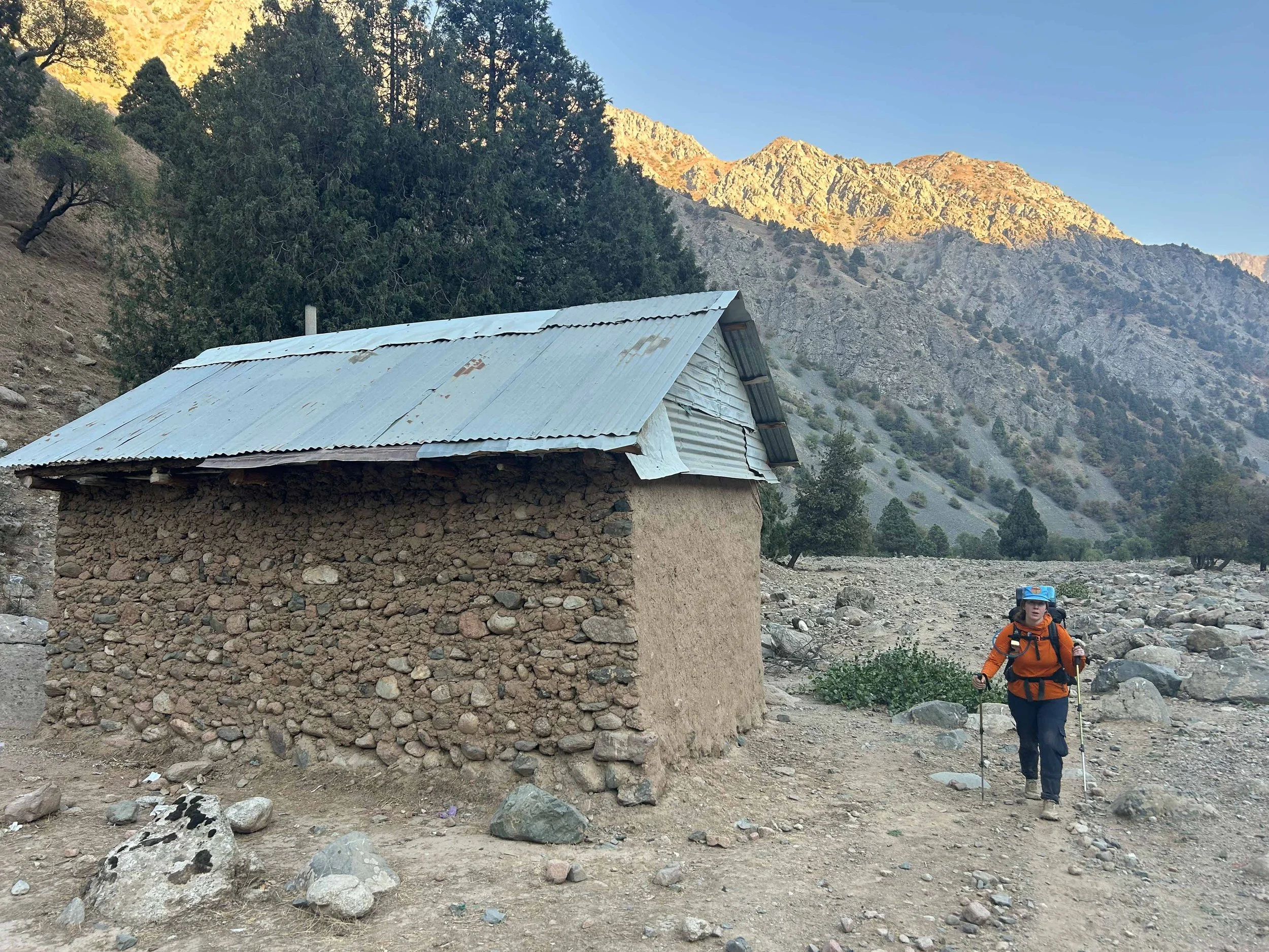
Abandoned sheppherd’s hut
Day 4: Along the Payron
September 12Th, 2025
My air mattress was over inflated last night. Not a problem I typically have but guess I got a little too excited with the pump sack while setting up the night before. Amanda slept well though and, honestly, that's all that matters. We were up super early again today. Amanda enjoyed a morning ramen while I tried to put down another protein puck. As we ate I took a look down the valley and was dismayed to see sheep moving up our way. There went our optimism for the day. "Shit," Amanda said "I thought today would be a good day!” The rule of thumb we had constructed in our heads was that sheep = dogs. We packed up, nervously looking for shapes on the rise in front of us.
After we were packed and our warm-ups were complete we took a few minutes to talk about our plan. "Lets head for the rocks, take a look, and then move forward based on what we see,” motioning to a rise about 100 yards in front of us. We took off and had just reached a smaller, intermediate rock garden when we heard the barking. The wind was, again, at our backs so they knew we were out there but not where. "Up on the rock," I said to Amanda, pointing to a fairly high rock on our left, "I'm going to try and make it up to the rise." I sprinted to a tall rock at the top of the rise and carried my momentum to the top, surveying the land before me. Sure enough, two large Alabay dogs were sitting in the grass barking in our direction. They saw me and reintensified their vocalizations, but made no move to get closer. I sat on top of the rock for about 5 minutes before calling Amanda up, while I watched our friends, below, ready to give her warning if they shifted. They made no move though and we were soon both safely on top. We sat on the rock for about an hour, screaming our heads off trying to get a shepherd to come up the valley and call them off. Two dogs were much more manageable than six but getting bit by one would likely mean needing a rabis shot within 24 hours and that would mean a helicopter ride, if one could actually be summoned. So, we sat and screamed. I threw a jerky stick at one of the dogs to see if it could be appeased but it just sniffed it and left it alone. I’ve never seen a dog turn down jerky. These definitely weren’t homegrown golden retrievers.
After about an hour of screaming, the hounds of hell lost interest and slunk off back towards the sheep. We took another 10 minutes finagling Amanda down off the rock. It had been a lot easier to get up than down. Once we were both down and ready to move, we tentatively moved on into the valley, keeping our ears open for barks. Fortunately, this area of the valley had plenty of good rocks which we could quickly scramble up if needed. Soon after, we spotted the likely reason for the dogs' disappearance. A lone shepherd walking about 500' above us on a northern slope of the valley. We waved at him and he waved back, continuing his path east. Just as we thought we were out of trouble, we came over a rise and spotted another shepherd's hut. As we approached we spotted a shepherd making food out front. We waved and he waved but just as we were about to continue on 3 more dogs ran from behind the hut, making a b-line for us and barking. The shepherd made a half effort to call them back, then redoubled his efforts when he saw his initial calls hadn't done anything. We scrambled up onto a rock and waited but this shepherd seemed less interested in helping us out. He turned his attention to us and yelled something in Tajik that I interpreted to "Tell them to go away and walk on - you'll be fine," with an edge of frustration. We stood for a while in a stand-off with the dogs before gingerly getting down from the rock.
As we turned to walk away from the dogs, they charged again. At that point, I was done. This was bullshit; what were we supposed to do - spend the next three days sitting on rocks treed, waiting to be rescued. I turned and screamed and screamed, charging back at them, filled with rage at the sheer stupidity of it all. I looked for a rock or anything to pick up but and, in the next moment, realized it wouldn't be needed as the dogs halted their charge. We turned and slowly walked on. The dogs made a few more charges but we soon left their general vicinity and they lost interest. "Fuuuuuck," I said to Amanda "I thought this would be the day things turned around." "Yea, " she replied, "having to worry about this for the next three days is not going to be fun." We dropped off a hanging valley and into the grand, wide Payron river valley. The rest of the morning passed without incident as we cruised along sheep trails through stubby grass, occasionally scaring up chukkar along the side of the trail. Our progress was occasionally held up as we passed through heavy stone gardens, picking our way through baby heads and loose stones. We also had a few stream crossings that went by uneventfully. About 4 miles in, the valley walls steepened and we started traversing fairly sheer valley sides on loose sheep trails which we found heavily washed out in places. About a mile on we descended to the Payron and got water, taking some time to relax. We carried on along the Payron for a mile or so before returning to the traverse again.
The two miles beyond, to Payron Lake, were almost entirely rock gardens and scree fields in open sun. It was sheer misery. Our pace dropped back to under a mile per hour as we navigated quarter-mile stretches of ankle rollers and toegrabbers. We found that the sheep were pretty good at focusing on a single path through the rock gardens, but I think nimble hooves are not great at sweeping the trail clear like in, say, the Marble Madness or Desolation Wilderness, which this felt very similar to. In those places, thousands of human steps had beat down, over 50-100 years, a clear path through similar long stretches of shale and stones. We hit the lake at about 8 miles in. It was a beautiful azure blue color and we walked high above it for about the last half mile, really wanting to get down to it but never seeming to descend. At the far western edge, the Pamir finally delivered us down to the shore and we stopped to refill water and take a break. It was nice but covered in trash. We debated moving off trail around the lake but decided we were exhausted, and it probably wasn't worth it. So, instead, we took about an hour break where we were. Amanda dunked herself in the murky shoreline and I finished off my Salt & Vinegar Kettle chips. I took a look at the map again. All day and since coming down Khanoqo Pass I had been battling a growing anxiety about going over the final pass before reaching Saratoq - Mura Pass. I had been told it was challenging but doable. We had considered bringing axes but, instead, opted for micro-spikes. The grade down Khanoqo had been vastly more steep than I had expected and would be next to impossible without crampons and tools, given that all the glaciers up here seemed to be hard ice. So, I found myself frantically comparing Mura and Khanoqo at the same scale, side-by-side. Mura looked less steep, which was good, but it was also clearly glacier covered. Beta had suggested there were no crevasses but that wasn't what I was worried about. How steep was it on the ice? Were we going to get stuck at the top of this pass? Would the spikes without an axe be enough?
Our lunch eventually ended. We were way behind on both the day and the trip. Our jump-out at Saratog was looking more and more like a necessity. We reshouldered our packs and put our shoes back on, our socks finally dry after an earlier stream crossing. Payron Lake was formed at the outlet of a steep hanging valley which we now had to get down. We began the steep descent and Amanda quickly felt a blister come to life. We stopped in the shade of a Juniper tree so she could readjust her shoe, before carrying on. We crushed downward, seemingly forever, navigating a few sections of sketchy wash-out. Along the way we ran into 3 hunters with backpacking gear making their way up to the lake. We waved and smiled at them and they did the same back. Shortly after I spotted where the ridge we had had on our right descended to the confluence of the Payron and Kapamof rivers. "There's where we are headed," I said to Amanda, pointing at it in the distance. Another hour of traversing and descending brought us down to the confluence, along a shady river walk, where we stopped for a break. Out in the middle of the wide open space two donkeys were picketed, but we didn't see any shepherds. At that point it was almost 5 pm. We decided to press on and stop at the first good site. As we made our way north I caught a glimpse of wild boar on the other side of the Kapamof River. As cool as they were to see, I was really hoping we wouldn't run into any on our side. I'd rather run into a bear honestly, Amanda and I have run into plenty of bears together and they typically flee from hikers but I've only ever heard horror stories about boar.
The wide, open confluence started to funnel into a more typical river valley, the trail hugging the east side of it as we went along. At this point, Amanda and I were catapillaring. I would scout ahead for a spot then wait for her to catch up. We made our way like this through another mile of sketchy wash-out sections before going up over a rise and spotting a nice flat section by the river. We wound our way down to our prospective campsite, both exhausted and then did a little optimizing around tent-pad spots. We set-up for about 30 minutes, getting dinner going and the tent put up. This was the lowest we would be sleeping on our trek, 6000 feet, and it was a nice change of scenery from the high, stark spots we had been camping so far. Not that we don't enjoy those places, it's just nice to have trees around sometimes. Eventually, the bats came out, their frantic flapping carving lines across the dimming light. I went to go grab another water fill to filter and found a nice eddy to dunk myself in before returning. Once back, I went out one more time to stow the bear cans. We had been dodging scat piles that were definitively bear since we reached the confluence and were both happy to have brought the cans. Once back, I took another look at my side-by-side pass view to convince myself that Mura Pass was going to be ok, did some light reading and passed-out.
Day 5: Mura Approach
I didn't sleep well again last night. The moon has just been brutal - no way around it. There was also an exceptionally dry tree somewhere towards the back of our camp which made some truly horrifying noises throughout the night. So, between a second sun and nightmare on Elm street, I didn't sleep exceptionally well.
We were up and out of camp around 7 am. Amanda had seen a blue scorpion during her rock replacement activities which I was pretty jealous of. We continued up the Quaratogh river at a good pace. About 1 hour in we crossed the Jalchin river as it made its way to join the Quaratogh. Here we ran into some shepherds making their way down river. They had two donkeys each outfitted with mesh saddles. Each saddle had large canvas pockets built into it and in those pockets sat some wide-eyed little lambs. It was adorable. The group also had an Alabay dog with them which Amanda and I side-eyed nervously but it paid us very little attention and we were able to relax as it made its way past our gathering. We talked to the shepherds for a little bit, or we tried to. Again, the thing we were really starting to understand is that, under the Iron Curtain, Russian dominated as the second language, not English, so there was really no talking. We were able to articulate that we were going to Mura and then out to Saratog. At that, they informed us we were going the wrong way and that it was 6 more days to Saratog. We just smiled, made the classic little bowing motion that was ubiquitous on the trail so far and continued on. Amanda looked questioningly at me after we had hiked on a bit, concerned with the 6-day warning the shepherds had left us with. “The map hasn't been wrong yet," I said "It may be under-selling the apparent effort of this venture but it's been accurate."
From the Jalchin river we turned northwest and continued our slow and steady ascent. This was some of the nicer hiking we had done on the trail and we relished in it. Another hour on, the steep walls of the river valley started to give way to a more open gorge. The sky got bigger and we started to get views back up into the alpine. At around 9 AM we reach the main confluence where the South Zombar and Diakhandara come together in a massive North-South running river. We nervously looked around for sheep upon arriving in this vast, open area but found it completely empty. We pushed up a steep rise and stopped beneath a juniper tree by a stream and took an early lunch, enjoying the last of the cool morning air. I hadn't made a whole lot of progress on my Mike-and-Ikes so I pawed a few of those into my mouth while Amanda played with a cool praying mantis she had found in the shade. After 30 minutes or so we got back up and shook our limbs out. Now it was time to push into the pass. From this confluence the trail turned north along the river that ultimately ran up to Mura. I held on to a sick hope that we might get over today despite the fact that we still had 6 miles and 5000 feet of elevation to put away before we even got to it. No, there was no way we were going to get that done.. The way I had decided to look at this trail was to take whatever I thought was achievable in a given increment of time and cut it in half.
So, we set off and almost immediately came to a bridge. It was a great little bridge and we made a big show of going over it because it was one of the few signs of a purposeful path we had seen in the last 5 days. Once across the South Zombar, we kept close to its west bank as the trail began a more committed climb. We soon left the shade of the juniper trees and stalked out into the warm sunlight. Behind us we were treated to views of the vast sprawling Hazorkhana passes and surrounding mountains. It was a terrific sight. We continued to climb and soon found ourselves up above the valley on a shelf. We looked across at a much wider shelf on the north side and I kinda wished we were taking that way up as I traced its progression towards Mura Pass. We were soon diverted into a little gully and just like that the nice forest walk we had been and turned back into a survival hike. We went straight up the open gully and crossed a small tributary stream. I was really starting to heat up so I dunked my upper half-in. Amanda followed suit and only noticed the leeches after she came back out. That led to a few minutes of frantically looking over each other to make sure neither of us had picked up any hitchhikers.
From the leech spot, the climb was back to 20-30% grade. We scrambled our way through rock basins and gullies for the next two hours at less than a mile an hour. At one point, we got far enough into the basin that the pass came into sight far above us. "That looks steep," Amanda said furtively. "It always looks worse from far away babe, we'll be fine." It wasn't this side I was worried about but she was right, even this south side looked steep. We stopped for a break below an impossible looking headwall at 9300 feet. "Can you do another 1200 feet babe? I'd like to get as close to the pass as we can and I think there is a nice place to camp up there." Nothing on the map specified a camp but the topo made it look like there were two more little hanging valleys and the lower one, which was on the other side of this headwall, appeared to have some good flat space in it. "I think so," Amanda replied "this thing looks awful though" gesturing to the thousand feet of broken, black rock in front of us. "20/20 rule?" I asked. She nodded in response. We started up the wall and were soon pleased to find that, in extreme cases even sheep will break down and do switchbacks. All the way up we were able to follow little, tight switchbacks.
An hour brought us to where the grade started to give way and we were soon on a hard rock shelf looking into our little hanging valley. Initially a few spots looked like viable options but I soon found that they were on a layer of mud. Amanda, who was now spent, waited while I ran around the square mile valley looking for a spot and oh, did I find one. Just to the side of a little stream I found some solid ground to pitch the tent. Was it covered in sheep shit? Of course, but that was just kinda normal now. I waved Amanda over and we got set up. We ate our dinners in the falling light at nearly 11,000 feet, looking up at a now much less scary looking pass. In its own right it was a paradise, a spot that anywhere in North America we probably would be sharing with 10 other people but here in Tajikistan, we had all to ourselves. After dinner, we sat and talked. We had decided to jump out at Saratoq, assuming we got out tomorrow and were pretty excited about that. We also talked about how we had gotten lucky with dogs today as there had been almost none. Amanda soon went to bed and I stayed out enjoying the sky for some time before joining her, hoping that our journey through Mura the next day would be uneventful.


Amanda headed out of Murdochen where we ate lunch

Morning before the trek over Mura

Amanda looking epic as usual

Top of Mura

Looking back south across the pass

Icy descent

That sweet sweet relief

Not getting easier

Love me a good Rock Garden

Zombar river valley

It’s giving Bishop vibes

Old rock hedgerow

There be bears!
Day 6: Mura Pass
Usually I don't sleep super well before a pass or summit day. Anxiety gets me in the night and I find myself just staring at the ceiling or the sky thinking about all the ways things could go wrong. But last night was all good. It might have been the beat-down of a climb we undertook the day before to get here, or the lack of dogs in the area that could have descended on our tent in the night - I don't know, all I know is that I slept well and that was wonderful. We were up at 5 though. I don't think there was a single day on this trip we didn't go to bed later than 8pm or wake up much after 5 am. I mean, there's not much to do after the sun goes down. Sometimes Amanda and I try to play cards on these little adventures but I had left our favorite, Sprawlopolis, at home on this one. So we got up at 5. The sun was just starting to kiss the peaks and the alpenglow was in full effect. It was all immensely beautiful.
The water running by our tent was perfectly clear. That rule about crossing bad streams in the morning to capitalize on low flow, that's totally true. I took the opportunity to fill our bladders. I had been back flushing the Sawyer after filtering the last couple days and it had helped alot. Now, with a clean filter and clean water it was super fast. I returned to camp to find Amanda eating a really sad looking granola bar. "Out of Ramen?" I asked. "Yea, last one was yesterday." She responded. I forced down my protein puck and had some wonderful Starbucks Via while folding the tent up. We were in a hurry to get up to the pass and see what was on the other side. When everything was packed up we did our classic warm-ups before getting under our packs and heading up. The nice thing about where we had camped was that we only had about 1500' to climb and the rest of the day was downhill. Those 1500' were stout though - like straight up. There was a nice bench about 700 feet above where we had slept where we would get a chance to rest.
We took that first climb following Amanda's 20/20 rule, sometimes letting it out to 20/50 since it was early and we were both feeling good. As with many of the head-walls we had gone up and over so far, this one looked impassable until we got into it, then it started to make sense. We zigged and zagged our way up and, after about an hour, found ourselves on the bench above. The bench was actually the rim of a very nice, very large cirque just before Mura Pass. There is a campsite listed at the cirque but I knew Amanda and I were going to be hard pressed to get here yesterday. Still, it would have been an equally cool place to sleep. We rested on the rim of the cirque for about ten minutes. I spent the time scanning our traverse across the boulder-strewn mountain side, attempting to identify the best way across. From here, all that stood between us and the pass was this traverse. This was the section we had looked at from way down the pass yesterday in fear of how steep it appeared. From here though, up close, it was totally fine. After a good rest, we carried on. The traverse was a bit steep when we got out onto it and meandered towards an especially large boulder about 100 yards in front of us. We neared the boulder and then passed on the downhill side. Another quarter of a mile brought us to the pass. Towards the saddle, the slope did drop steeply below us, to the left. If there had been snow or glacier it would have been a little spicier but, as it was, the sure-footed sheep path plugged right along and I was soon delivered to the pass.
I got to the saddle a few minutes before Amanda, wanting to get an early preview of the way down. At first glance it was steep but, as I studied it closer I could see a series of ramp sections in the glacier that could get us down. I was very happy to have packed the microspikes, but it was still going to be hairy. Amanda reached the pass as I ended my study. "Is this it?" she queried "I thought we had like 500 feet to go!" "Nope, this is it babe - I think there is a decent way down there," I replied, pointing to the path I had selected. We took some time on the pass to recoup. The way down looked doable and was, at this point, less scary looking than Konaqo pass. We snapped some pictures of ourselves before reshouldering our packs and making the steep, short drop to the top of the glacier. The Mura glacier expanded out before us in a wide valley. Once onto the ice, we unpacked our micro-spikes and fitted them onto our trail runners. They hadn't seen usage since the PCT about 2 years earlier but, fortunately, were still in good shape. From the top, center of Mura glacier we followed a ramp down skier's right that gently descended towards the moraine on the north side of the glacier. There was sheep shit everywhere. The ramp eventually ran out and we turned downhill, squaring ourselves with the main descent of the glacier. We had about 700 feet to descend at about a 15-ish degree angle. We began the descent and it was here that things started to get spicey. The glacier, as I said, was hard ice. The descent we were on is standard fare for just about any mountain in our home range of the North Cascades but the difference is we typically have on crampons, an ice axe, and are plunge-stepping into 8 inches of nice, crusty glacial snow. Here, we were pushing the micro-spikes to just about the edge of what they could do on the hard, blue ice of Mura glacier. Every step we took down the spikes would initially engage but then, as you fully weighted the step, they would shift slightly, spiking a small adrenaline response as our bodies prepared themselves for a fall. About 200 of these very short steps later, our composure was starting to wear thin. About halfway down, I watched as Amanda navigated through a hairy section. She took a step and I watched her foot shift about half an inch before the spikes caught and locked in. I could see on her face that she was done, as she froze in place. Maybe if we had been climbing this pass instead of descending or had had proper equipment or hadn't been running from dogs for the last 3 days she would have weathered through this last gauntlet but, as it was, I started to see the panic rising in her. I quickly climbed up to her and put my hand on her shoulder. "Your fine babe, we're fine, you got this," I said to her, feeling her starting to shake. "We are going to take your backpack off, okay?" She nodded in response and I very carefully took her backpack from her shoulders and gently slid it on a path down the last 200 feet of the glacier. It quickly picked up speed but, miraculously, avoided a tumble till the very end. It even kept the beer can attached. Without the backpack, Amanda was able to get past this last section. The rest was still sketchy but we inched our way down and, slowly, the grade started to give out. After probably 90 minutes of some of the most harrowing descent I have ever done, we reached the bottom. We collected Amanda's shit-covered backpack and found a nice flat rock to rest on for a while. At one point in our reverie we both just started laughing at the sheer absurdity of the last 6 days - this trail had surprised us and it seemed, the surprises just kept coming. We also had to laugh because, while we might have been out of the danger zone, what lay before us was several thousand feet of rock gardens with no obvious way through.
Once we had gotten our heart rates under control again, we set out into the hellish landscape of refrigerator sized rocks. Here, I gotta say, the sheep did good work. The top was super steep, as we passed through a series of hanging valleys, but our wooly friends did carve a nice little path through what appeared to be an impassable mine field of broken rock. Cairns also started showing up, which helped guide us through the boulder field. Down and down we dropped, turning back every once in a while to find the little notch we had come through farther and farther away. After about two hours of rock hopping and steep descent, we arrived at a final hanging valley before the drop down to the much larger and more inviting Zombar valley. Here, we refilled our water bladders and took time to look back on what we had come down. "God, that would be an ugly climb" I said, weaving my eyes up through the nightmare of sheep trails heading to the glacier. "I think it's worse coming down!” Amanda replied which I agreed with.
Once we had refilled waters and replenished our caloric deficit, we got back under our packs and descended the final hanging valley to the mighty Zombar river valley. This was the most visually impressive valley we had been in so far. Close to a mile across and hemmed in by massive peaks, it forced a contrast that was truly breathtaking. We came to a large cut near the head of the valley and spent half an hour finding a way across the crumbling sides. Once across, we were in the valley proper and, for only the second or third time on this trip, made some wicked good time. As fast as we were though I couldn't help but think how fast I would have been on my mountain bike. It was perfect terrain for it too. We cruised for a couple of hours, stopping once at a large boulder in the center of the valley that looked like it belonged in a Rock & Ice article about Bishop, California. The valley was long and, even at a good pace, took us about 2 hours to work our way down. At the far end, we crossed what looked like an old rock hedgerow where maybe sheep had once been fenced into the lower part of the valley. We stopped and took some pictures before beginning a long, dull descent to the Mura river. About halfway down this descent we stopped for another break and were met by a shepherd bringing a few mules and grain up the valley. As in many cases before, we "talked" to him for some time. I was able to articulate that we were going to Saratoq, and then to Panjakent. He gave us some of his wafer cookies and I tried to give him some of my Mike 'n Ikes but he politely turned them down. At one point, he also put his phone in my hand and was able to communicate that he wanted my phone number and that he would call me in Panjakent. I nervously gave it over to him, fairly confident it wouldn't work without the country code in front of it. We talked for a bit longer, learning along the way that our new friend had come across a bear just an hour before down along the Mura river. We eventually got our shoes back on and said goodbye before we set off down the hill and he continued on uphill with his mules. Another 30 minutes took us down to the confluence of the Mura and Zomber rivers. We found a good place to cross and began a traverse on the other side. The traverse took us high above the river and, again, we were constantly presented with a labyrinth of sheep trails to choose from. An hour of picking our way through the trees brought us to the outskirts of a 4- hut village called Sarikoden, where we could see a large herd of goats and sheep being moved into the hills. "We are a little low babe and it looks like the trail is above us," I said, referencing my watch, "lets go uphill a bit." We turned uphill and picked our way through some small bushes. I didn't know if there would be dogs with this herd, but if there were I felt better being uphill of them.
We soon reconnected with the trail and continued our traverse. Eventually we ran into the herd moving uphill and I was happy to see shepherds moving amongst them. We stopped and let the animals pass in front of us and a shepherd came up and shook our hands with a broken smile. Once the sheep had passed we continued on. Just as we were coming into the little village we looked down and saw a full-on party going on by the river. A van and family had made its way out to the Mura river for what appeared to be a barbeque and dance party. We stood and watched for a while before deciding to move on. The afternoon was starting to get late and we really wanted to make Saratoq before it got dark. We passed into the little village of Sarikoden which, as I said, was little more than a shepherd's outpost. There were 4 little donkeys hitched to a post that we said hi to as we passed. From Sarikoden, the trail turned to road before dropping into the large Mura river drainage. Here we made good time, especially drawn by the promise of food and a shower. We cruised along the road beside the Mura river wondering, in places, how the van had made it through. There were trees everywhere here and we rested in their shade every once in a while. There were also a number of professional looking bridges across the Mura we both figured were for moving sheep across it at times of higher water. We cruised along the road and soon, started to see more signs of human life. We saw an old Lada parked on the side of the road and eventually came upon a man cracking sunflower seeds. He waved and we talked for a few seconds. He offered us tea and we smiled and thanked him but indicated that we needed to get to Saratoq before continuing on.
Soon after we walked by a large Dacha that looked like the pictures of the homestay I was aiming for, called Dillover's homestay, but the map suggested it was further into town. We walked on and Saratoq started to take shape around us. Soon we were within city limits proper and headed towards what I hoped would be their salvation. We were stopped by two boys who were able to ask, in English, "where are you going?" "Dillovar's homesday?" I asked with a smile. "This way," they said to me before taking off down a street. I checked my Suunto, it did, indeed, seem like the place. A minute later we were led into a home courtyard and a woman came out to greet us. We explained what we needed and she made a call. I took a moment to check my own phone which was still service-less. The woman got off the phone and was able to say -"he is coming here now." 5 minutes later, a man who described himself as Dillovar's brother arrived and explained in some very confusing terms, our options regarding accommodations for the night. It sounded like there were some other people at the newer guest house so we opted for that as we had been missing other travelers for the last 8 days and Saratoq was a bit more desolate than we had expected.
Dillover's brother got us piled into his van and returned up the road we had walked in on - much to our chagrin. Sure enough, we headed right to the newly built dacha we had originally thought might be the guest house. Once there we were shown to a very nice, four bed dorm room that was all ours for the night. It even had a bathroom complete with a shower. Dillovar’s brother then showed us to a common eating room and asked what time he wanted dinner. We said 6 and then I asked if it would be possible to get a taxi to Panjakent. My phone wasn't working so calling a car up from there wasn't going to be an option. Dillovar's brother said he would ask around and be able to give us a price at dinner. Before heading back to our room I bought a big, plastic bottle of beer to put in the fridge so it would be cool by 6. Back in the room Amanda and I got organized and cleaned up. We were filthy. Amanda took a shower and I went out to send our In-Reach check-in. The In-Reach, by the way, had been fantastic. I was able to send and receive texts along the whole trail. As I was sending my check-in and downing the last of my Salt and Vinegar Kettle chips, two women showed up returning from a day trip, followed by a very friendly dog. Having had enough canine interaction on this trip, I returned inside and took a shower myself.
At 6, we headed to the common area for dinner. The two women were there as well as a guy of indeterminable age at our table. Oddly enough the table settings were arranged such that we were as far from each other as possible, spread across the room. We sat and talked just between the two of us for a while before eventually introducing ourselves to our table companion. His name was Stijn and he was from the Netherlands. We told him our favorite little village in all of Europe was Gouda, which he thought was very funny. As we so often find on these travels, Stijn was very well travelled and we found ourselves swapping stories on just about every continent. At 7, dinner came. There was a nice salad and then a delicious soup which we housed quickly. I got my plastic jug 'o beer out of the fridge. It was pretty terrible but appreciated despite that. Something is just wrong about drinking beer out of a plastic bottle. We continued talking with Stijn and found out he was looking for a ride to Panjakent the next day as well. Dillovar's brother had quoted us about 140 USD to get to Panjakent and the taxi had a spare seat so we offered it to Stijn and he said he would be happy to come with us. We continued to talk way into the night. Stijn was one of those wonderful people you meet traveling that’s full of character and carefully considered opinions. He had endless stories and had been to many of the same places we had. We talked about La Paz and Mostar, Leh and Addis. It was wonderful, reliving our memories with someone who had walked our same steps and, in some cases, 10-20 years before we had.
Eventually, we ran out of steam and bid Stijn good night, making our way back to the room. I rain back through the day in my head, like I often do on such epic days, thinking about the pass, way up there in the darkness where we had been. Nothing but the wind and moonlight on the rocks and nothing of us left there except some footprints and our memories. I got into bed then and tried to read a bit but quickly succumbed to sleep, happy to be over Mura and headed north the next day.
Day 7: Lada Ride to Penjakent
I slept hard that night. The drop in apprehension regarding the trials and tribulations of the following day really let my mind wind down and I slept for like nine hours. We woke and got some breakfast, happy to see Stijn at our table as we clopped into the dining area. He had a tiny little backpack - not unlike the one the shepherd who had passed us on day 2 had been wearing. I suspected that was his entire kit, his whole life in that little backpack, and I was impressed. I mean, Amanda and I travel light but our 35 liter Cotopaxis still pack a pretty good amount of space. We ate breakfast together. It was eggs and the ubiquitous little hot dog things that I swear to god are served at every hostel, home stay and hotel from Ushuaia to Bodo. While we ate, Dillovar's brother dropped by to say that our driver was on his way and would be ready whenever we were. We thanked him and finished up, returning to our rooms to pack-up.
We were ready in about ten minutes, well practiced at this point and almost entirely out of food. We still had a freeze dried meal apiece and I still had about a pound of Mike 'n Ikes but, aside from that, we were low on the provisions. We came outside just in time to see a very old, very beat-up Lada arrive in the drive way. "Your car is here!" Dillovar's brother shouted at us. "You have got to be kidding," I said to Amanda. To be clear, I love Lada's. I've always found Soviet culture fascinating, especially their architecture and cars, and I had loved seeing the opaque little cold war-era autos zipping around Dushanbe and in Saratoq, but we had 140 miles in front of us on roads that I knew were terrifying in the best of cars. This thing looked like it was one pot-hole away from losing its entire rear-end. We nervously approached the car. Stijn was already loading his backpack into the trunk and we followed suit. Amanda and I then piled in the back seat giving Stijn the front. We waved goodbye to Dillovar's brother, thanking him again for the stay and were soon jetting away from the dacha, the little Lada-that-could coughing and sputtering along the dilapidated roads.
We made a pit stop on the way out of Saratoq so our driver could change into something more formal. Once outside the city limits, we quickly came to Lake Iskanderkul. This was an incredibly popular attraction and the reason I thought Saratoq might have been more popular. We had seen more than a few advertisements in Dushanbe talking about day trips to the lake. That being said, it was beautiful and Amanda, Stijn and I admired it as we made our way along the single lane, gravel road etched above its banks. From the lake, the road made a steep, switchback ascent about 1000', which I figured the Lada would never do but, as had already happened a few times, it rewrote what I thought Soviet engineering was capable of. More terrifying than the Lada was the massive German hand-me-down semi trucks coming down the death-defying grade. After we climbed up from Iskanderkuhl, the road followed high above the Iskander Darya river for miles, passing through a number of small towns until it arrived at the RB801 highway. Here we turned left and followed the Fan Darya river. We stopped briefly in Sarvoda for gas and I tried to get into a supermarket for a snack but no luck as it was closed for lunch. Sarvoda was where I had considered being dropped to catch public transit and it looked possible but I was glad not to have to hassle with it. There was no way to tell where any of the taxis were going.
After about 20 minutes in Sarvoda, we all returned to the Lada and continued our harrowing journey down the Fan Darya. It was a truly impressive road with steep canyon walls rising on each side. Stijn took my camera a few times to get pictures of the river but with the lens I had, it really didn't do the road justice. An hour of winding roads brought us out of the mountains and into the town of Khushikat where we randomly stopped to wash the car. Another hour brought us into Penjakent where the taxi dropped us near the center of town. Amanda, Stijn and I walked to the hostel where a girl met us and got us checked in. Stijn decided he wanted a room of his own saying that he had had his fill of hostels. We found out then that he was 52 years old, which astounded me because I seriously thought he was in his late 30's. We said goodbye after trading contact info and got our things sorted. We relaxed in the hostel throughout the late afternoon. It wasn't too busy. Amanda sold our fresh Sawyer filter to a Chinese girl who was doing her first backpacking trip up the 7 lakes route which. At first I was worried for her because, honestly, Tajikistan is a rough place to figure out backpacking, but the 7-lakes route is actually a good spot to try it out due to all the roads and lots of guest houses. There were also two Germans there from Nuremberg that had been bike packing for several months through the 'Stans and I talked to them for a while because I really want to come back to do some bikepacking. As good as the trekking might be in Tajikistan, the bikepacking opportunities look epic. They were pretty bad-ass and had been all through Tajikistan and told me all about their route and the challenges. There were also a couple guys from Lebanon who we talked to for a while.
Eventually, it got late and we said goodnight. Happy to have made it to our destination and survived on a small section of the Pamir trail.
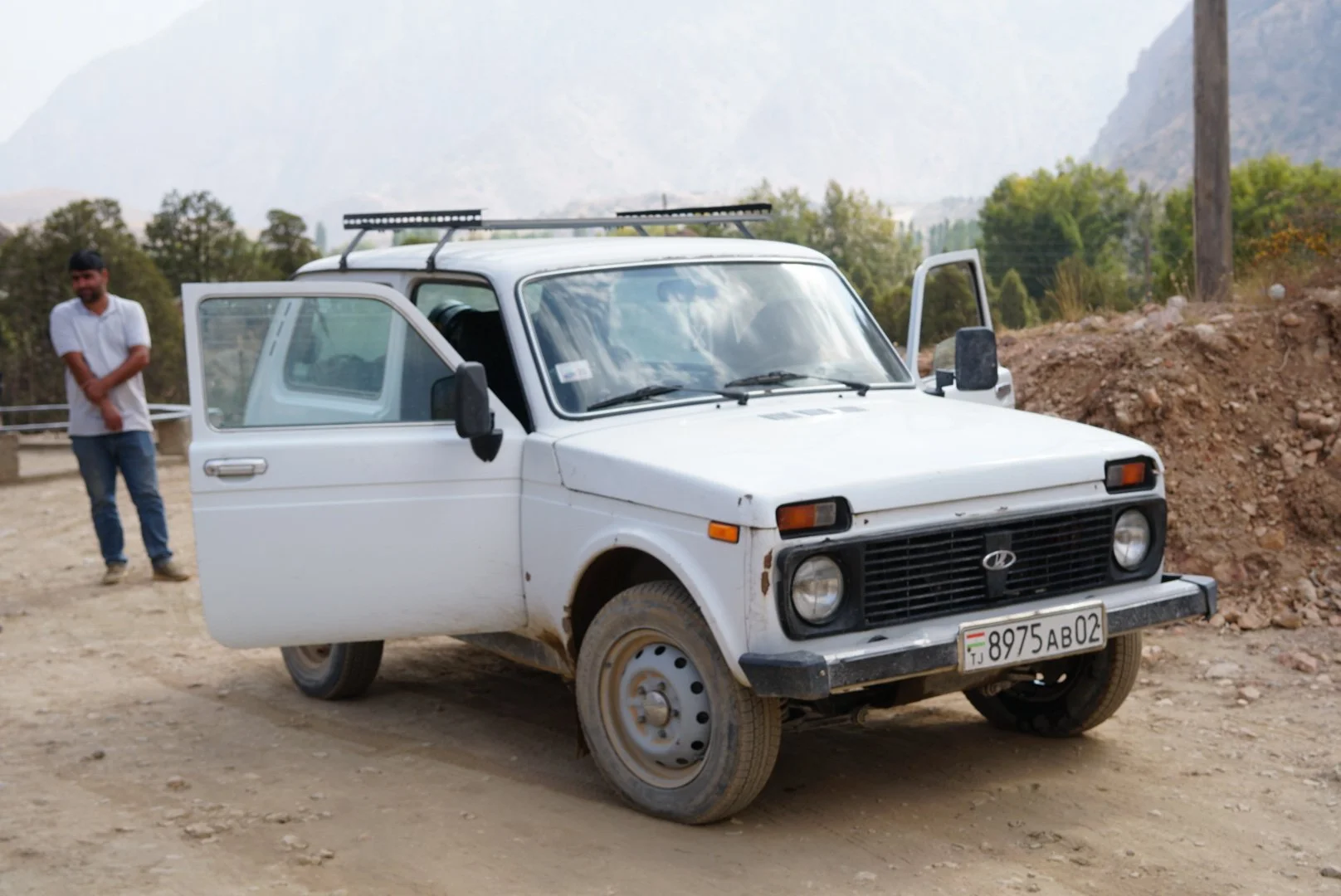
Our surprisingly trusty stead

Lil’ skeptisism shining through about our ride.

Mid-morning sustinance

The Zerafshan River Valley

The bikepacking rigs in Tajikistan are built different

Lazy Cat at our Hostel in Samarkad

Sick Sheep Bro!
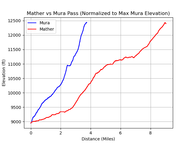

Registrand square in Samarkand

Amanda the Pious in Hazrat Khizr Mosque, Samarkand

It’s not a true trip if someone doesn’t get a dibilitating stomach flu

View of Bibi-Khanym Mosque, Samarkand

The Good, The Bad and The Ugly
Key Points to Consider
Livestock Guard Dogs: I'm convinced my phone listens to my conversations because after we were home about a week and had told our dog story a few times (see day 3), I started seeing Instagram stories of hikers running into sheep dogs throughout Central Asia. They were all the same Allabay dogs we had run into. In fact, one guy who I follow, whose stories had inspired me to look into the Pamir trail, almost got mauled in Georgia in a very similar incident to ours. The dogs are... passionate about their jobs and I've heard all the stuff about "being firm" and "standing up to them" but if you are alone and get surrounded by 5-6 of these animals I can tell you, trying to shout them down does absolutely nothing. Really, the only thing that will get you out of it is a shepherd coming to save you. This is typically a good bet because sheep, dogs and shepherds usually stick together but I was constantly worried about running into a rogue pack without something to deter them. Given that, I might look into some sort of deterrent to take with me if considering this trail. Bear spray was one thing I had thought of bringing ahead of this trip, mainly for bears though. I don't know how a shepherd would react to his dogs being sprayed so a better option might be a dog whistle or something using sound. Definitely look for something. The other strategy we got in the habit of doing was constantly searching for a high-point we could get up onto as we hiked - a rock or tree - and trying to always keep those options close by.
Shit: It's a livestock trail. There is shit everywhere. Not going to belabour that point but be prepared for it.
Navigation: This isn't a positive or negative, just a note. This trail is, mostly, not marked. In some long rock garden sections there are cairns the shepherds have put up to follow but don't expect cute little Dolomite style red and white trail markers. There is rarely something to confirm you are on the right path. There are sheep trails to follow but they weave all through the mountains so it shouldn't be expected that the path you are on is the correct one. For those into navigation or orienteering this is actually a fun challenge. I utilized my Suunto Vertical to keep us going in the right direction and double checked our progress on my iphone using Gaia gps one or twice a day. In contrast, you really don't realize how much a well defined trail takes the pressure off you. Without one, your day is a constant set of questions - "do we go up here or later on?", "Do we drop down to the river now or in another mile?” It's miles of these questions and it can be slow and exhausting, but it also adds to the sense of adventure.
The Passes: One cool aspect of the Pamir trail is that you get to go over a pass every 1- 3 days. These are usually around 4000 meters and offer great vantage points of the Pamir trail. It's a different feel from some of the more popular Himalayan treks, where the entire trek is a build-up to go over a single, large pass. That being said, there are a few aspects of the Pamir passes that are good to know before you go.
The first is grade. The grades on the climb up to and down from these passes are heinous. For context, the graph on the side compares the last 3500 feet of Mura pass with Mather pass on the JMT, in the Sierra-Nevada. Both are about the same height and approach elevation. The main difference is that Mather gains its altitude in twice the distance, making for a much gentler approach. On all passes we went over between Luchob and Saratq, the grade averaged between 20 and 30%. This doesn't sound like much but it is a brutal climb once you are on it.
The second aspect to note for passes on the Pamir are the glaciers. Assuming you are going over in the dry months (July-early October), you will find these passes devoid of free snow. On passes with a permanent glacier, what this means is there will be hard ice on the path up to or down from the pass. We would strongly recommend micro-spikes for these sections, at least, or ultra light crampons if you want to be extra careful. An axe would have been a comfort but without free snow i'm not sure how much it would have actually accomplished. Self arrest might not have been possible on the way down from Mura.
On the note about glaciers, they seem to be located, predominantly, on the north and west sides of passes. What this means is that if you are hiking the Pamir in the traditional direction (ie. North to South and West to East) you will be ascending most glaciated sections instead of descending, which is easier. Climbing ice is almost always easier, from a balance and stability standpoint. If you do decide to utilize crampons, you will be able to better make use of the toespikes if climbing the ice instead of descending.
Altitude: I expect most people familiar with trekking understand altitude and its impact on health but I thought it would be good to include a few notes here. When climbing over 3000 meters it is important to consider the effects of altitude sickness. Given many passes are over 4000 meters you will likely encounter, at least, moderate altitude effects. A good rule of thumb Amanda and I have followed in the past is to limit net elevation gain per day to 500 meters while trekking above 3000 meters. Note that this number is the net gain - basically the value of "Finish elevation" minus "start Elevation" should be below 500 meters. That does not mean your midday elevation cannot be higher and, many days, it will be. The phrase often referenced is "Trek high, camp low.” After your first 3-5 days this rule will become less important as your body adjusts to the average elevation.
Wildlife: I mentioned the dogs earlier as well as the sheep, but the Pamir trail does feature a wide variety of natural characters which you should be aware of. The two that could be a problem are bears and boar. For bears, Amanda and I followed standard procedures. We talked throughout the day, especially in the low areas where we saw scat, and carried a bearcan. Many Ultralite Hikers hate carrying a bear can. On the PCT, in sections where bear cans were required, you would think they were being forced to donate a kidney instead of carrying a few extra ounces but, honestly, they aren't that bad. I generally stuff my soft goods in them for added protection while carrying them during the day.
Boars were new to us because, honestly, Amanda and I don't know much about them. They don't feature highly in the flora and fauna of the Pacific Northwest. All I can say is they killed Old Yeller and that movie fucked me up so, I don't mess with boars. Look elsewhere for info on what to do if you run into them and do look into it because I honestly believe they are more dangerous than bears.
Leeches were a surprise, especially when I discovered them after dunking myself in the river multiple times. Be prepared for what to do if you get one on you. We were also encouraged to get Tick Encephalitis shots ahead of our travels to central Asia though, we never saw a tick or found them on us.
Sheppherds: As I said earlier, this is a desolate hike. You won't run into many other hikers. You will run into sheppards. We found them to all be very kind and curious. They will try to talk with you and, unless you speak Tajik or Russian, this will almost certainly be a one sided conversation. They may also offer you food - what you choose to do there is up to you. As with all other travel, please be kind and respectful to the locals. If you can do that it will be returned.
Water: Most of this trail follows a river so we never ran into water scarcity issues. Sometimes the river you are hiking by is difficult to access but, in general, it is always there. We hiked the Pamir in the driest season and had no issues getting water. As always, bring a filter.
Getting there/Getting out: Airport options are limited. Dushanbe is your best bet in the country for arriving. If you are looking for access further north, consider flying into Samarkand and making the land border crossing to Pajekent (if it is open - check beforehand). There is also considerably good rail (by American standards) across central asia, so be sure to look at that for additional arrival options. For local transport throughout the rail network, your options are more limited. Amanda and I usually try to leverage local, public transit but in the Pamirs this is a little tricky to utilize, especially if you are limited on time. We used car hire to get into the trail heads and get out from the trail. We did see some signs of mini-bus service. They were very common on the larger highways so there are likely opportunities to utilize them but I can't say how deep into the mountains they go. For areas where the Pamir crosses the main highways, mini-bases are probably the way to go.
Weather: We had gorgeous weather all seven days we were in the mountains. Sunny and about 18°C without much fluctuation. What you experience will, obviously, differ depending on the time of year you hike and where you are. As always, weather in the mountains can be unpredictable and you should be prepared for precipitation. If you choose to forgo rain shells it is advised you have a rain cover for your tent and are prepared to stop and set it up in the event of a storm. Nighttime temps were not much lower than daytime temps. I spent more time sleeping on top of my bag than in it. Consider a light sleeping bag if trekking in the summer months.
Gear: No special gear is needed for the Panin trail beyond what was mentioned in the pass section (spikes, axe, etc.). If you are using an ultralite tent (non-freestanding) there is typically good ground for staking it down, at least on the sections we hiked. It is a little rocky but we were always able to stake our Big Agness down.
We carried an In-Reach and were always in coverage.
One note on filtering water. In many areas the streams have a high concentration of glacial till, so we clogged our filter quite often. Be prepared to back flush.We did not have the syringe with us to do this but were able to utilize our platypus bladders instead because we had a hose arrangement that allowed for it.
Fuel is challenging to get. We were able to purchase butane at our hostel, Greenhouse Hostel, in Dushanbe. In Africa I have had good luck carrying my liquid fuel stove and running Kerosene. The same could probably be done in Tajikistan.
Food: There are good grocery stores in Dushanbe where you can stock-up on food. Outside Dushanbe it is more challenging. Options are typically gas station style little stores with chips and candy. Sometimes there are more local shops which have lentils or rice to restock on. Lentils are great, they go a long way. In general, restocking on food outside of Dushanbe should be expected to be more challenging.
Final Word: To summarize, the Pamir trail is a beautiful and challenging trail, not highly suited for beginners. You should know what you are doing and be sufficiently self-dependent. For an experienced thru-hiker it is an epic hike to test yourself against and will likely only get more popular in the years to come