
Trekked September 2022
Written Spring 2023
Intro
I had been infatuated with northern India for a long time. Situated in a volatile region between India, China and Pakistan, the provinces of Ladakh, Jammu and Kashmir held an almost legendary status in my mind. The trip here started with a book I received for my birthday by Lonely Planet called “Epic Hikes of the World.” While admittedly a pretty cliché name, it’s pages contained ideas for a whole host of epic adventures. One trip I kept flipping back through while sitting on the couch in our heavily industrial expat hometown of Essen, Germany was the Markha Valley trek, situated in western Ladakh. So, at the end of 2022, with our return to the USA imminent and at the end of a long series of weekend trips, Amanda and I decided to make the flight to Asia for one last big adventure before we headed home. In this trip we encountered a land unlike anything we had seen before which we are still desperate to get back to.

Cairns marking the path to Twin Tigu Lakes

Amanda, me and 3 friends on top of Kongmaru la Pass

Security and Customs - the two necessary evils of travel

Looking south on Lower Leh towards the airport

Amanda looking skeptical at the Farm to Table advertisement

View from the back of Tsetan Guest House

Amanda’s skepticism continues on the guesthouse patio

River just down from Tsetan Guest House

Classic Tibetan Prayer Wheels
Day -1: Essen, DE to Leh, India
September 9th, 2022
Relative to North America, Germany is certainly closer to India, but that didn’t make the jet setting any less exhausting. We started out from the Essen train station, just a few blocks from our apartment at 4:30 pm on September 9th, the sporty looking DB ICE train rolling up to Platz #2 right on time in classic German fashion. From here we travelled south, winding through the dense infrastructure of the Ruhrgebiet until we reached Köln where the countryside opens up and the train could finally make some good time.
At Frankfurt Flughafen we disembarked and made the very familiar hike to the terminal, passing through customs and security. After a quick dinner in one of the ridiculously few restaurants at FRA we headed to the gate where we informed that a broken water line on the plane was going to cause some delay. This was concerning because, despite having a 3.5 hr lay-over in New Delhi, we had heard that the transit between terminals was lengthy and hectic. An hour and a half after the expected departure of 21:15 we finally boarded the plane and 45 minutes later we were rolling onto the tarmac.
At about 8 hours in the air, I was able to get some descent sleep before touching down in New Delhi. Taking a peek out the window over Pakistan I was amazed to see some of the most desolate and incredible mountains I have ever laid eyes on – they seemed to go on forever. Once off the plane we found our bags and began another hike from the international to domestic terminal which took about 30 minutes in some very muggy conditions, worried the entire time about making the connection. Once at the domestic terminal we found our airline, rechecked our bags for Leh and navigated some much less stringent security. Once through security we ran to our gate and arrived just as the last few people were boarding. Amanda and I smiled at each other with a sigh of relief as we handed over our ticket and passport to the boarding agent.
Quick note about the Leh, Ladakh and the transit there. There are 2 main airlines that operate between New Delhi and Leh, SpiceJet and IndiGo. Both are priced about the same but, having taken both, IndiGo is a bit better. From New Delhi it is about an hour and a half over landscape that transitions from the lush western side of the Himalaya to its dry and arid eastern side. It should also be noted that Leh, Jummar and Kashmir are to native Indians what Alaska is to Americans – a landscape for wild adventure and the great outdoors. Most of the people we met in transit and once in the province where from all over India - all looking to get outdoors in the Himalaya. All of India is on the same time zone so you don’t have to worry about a time change once you are in the country. The airport is technically a military airport. In fact, all Leh is heavily militarized as it is one of the primary outposts in Northern India for the Indian Military and it boarders China.
We touched down at 1 pm. As we taxied to the terminal the flight staff reminded everyone several times to not take pictures out the window in several languages. Once off the plane we were shuttled onto buses which took us to the terminal. At the terminal we were inundated with signs in many languages reinforcing the dangers of altitude sickness and asked to register with the local tourism board. After navigating a highly confusing entry form we found our bags and headed outside to find an ATM. After taking out approximately 100 dollars’ worth of Rupees we found a lot full of small white and grey vans outfitted with roof racks. Sticking out like a sore thumb we were accosted by taxi drivers but eventually were able to connect with one who was more than happy to take us up to our guest house. We breathlessly thanked the driver as he tossed our duffels on top and motioned us into the van with a smile.
Leh is built in an almost terraced fashion on a hillside with the airport sitting at the bottom where the landscape opens onto a river valley. Amanda and I had reserved a room at the Tsetan Guest House which sits towards the top of Leh. We smiled at each other as the taxi navigated the chaos, heading ever upwards. It wasn’t quite as crazy as Kathmandu or Addis but it didn’t fail to thrill. The streets narrowed from throughfares to alleys until the taxi stopped at a dead-end. Here, the driver turned to us with a smile and beckoned for us to get out. I counted out rupees as he pulled our bags down and after paying him we walked down a small footpath before noting the sign for Tsetan Guest House and turned left. After opening a gate and walking through, the path opened onto a small yard and the quaint and inviting sight of the guest house. We were met by the very cheery proprietor who welcomed us and showed us to our accommodation – a descent one bed room with shelving and power. We thanked him and tiredly dropped our things on the floor before collapsing on the bed.
Now is a good time to talk about altitude. Leh sits at 11,483 feet (3524 meters). There are not many major airports in the world that operate at this elevation, and it is easy to forget how high you are. Amanda and I have only been to a few that compare, namely La Paz, Bolivia at 11,893 ft and Quito, Ecuador at 9350 ft. Be very careful, elevation sickness is nasty and there is no easy solution for it. Because of the military, Leh is uniquely leveraged to help tourists in a bad situation, however, no major trek or climbing venture should be committed to without a day or two acclimatizing here. The city is nice, if a little rough around the edges, and is worth this time to enjoy in its own right.
After collapsing on the bed we slept for about an hour before forcing ourselves to wake up and head back out to the patio where a pot of mint tea was waiting. By now we were starting to notice the elevation. A small set of stairs was more than enough to take our breath away and standing up too fast caused stars. We sat at the table and enjoyed the tea before asking the proprietor for directions to a nearby restaurant and atm. We hit the ATM first as it sat lower in elevation than the restaurant. After pulling out ~200 dollars worth of rupees we begrudgingly turned back uphill and slowly made our way to the restaurant, laughing at how out of breath we were.
At the restaurant we both ordered some vegetarian Indian food, our favorite – black dahl (Dahl Makhani) was a pleasant surprise to find. After eating we headed back to the guest house. Once there we worked with the proprietor to coordinate dinner later that night. The guest house serves a family style meal so we put ourselves on the docket as interested and retired to our room. Later, I came out and talked with some Russians who were visiting to ride motorbikes around Ladakh. This would become a theme for those staying at the guest house – lots of people had come to ride bikes throughout the Himalaya on the very well-established highway system the Indian government had set-up. After a good conversation I went back to the room to read and organize some of our trekking gear. At around 6 pm that night we headed back out to the patio for dinner and were treated to some excellent Indian food. After dinner we found ourselves exhausted and retired for bed so happy to have made our connection and to be, once again, in the heart of the Himalayas.
Day 0: Leh, India
September 10th, 2022
Distance: 2.17 Miles
Elevation Gain: 597 ft
Moving Time: 1:03 Hrs
Total Time: 1:49 Hrs
Weather: Clear. 61°F. 4.3 mph winds.
Little warm-up hike to the Shanti Stupa before heading for the main event!
We woke late on the 10th giving our bodies plenty of time to sleep and continue acclimatizing. Before heading out for breakfast we broke out the fingertip pulse oximeter we had brought to measure saturated blood oxygen, curious to see how we were doing at almost 12,000 feet. We found ourselves in the mid-80’s which we had read was probably normal given our sudden change in altitude.
We had a simple breakfast at Tsetan Guest House before working with the proprietor to coordinate a ride out to the trailhead the next morning. We decide to leave at around 6 am to get a jump on the day. We also asked him about good day trips to try and help with acclimatization. He suggested a hike to the Shanti Stupa, a religious site on the hillside north of Leh. We thanked him before heading down the road to a small coffee shop to see what could be found.
After coffee we continued into the center of Leh to pick-up a few things we thought we might need on the trek. Downtown Leh is a busy place with many restaurants and outdoor gear stores as well as touristy targeted shops selling everything from rugs to miniature prayer wheels. We stopped in to get some tea and a toothbrush as I had forgotten mine. I also needed a fuel canister for our jet boil but no luck was to be had in this department despite making the rounds to almost all of the outdoor gear branded stores. By that time it was lunch and Amanda and I decided, against our best judgment, to eat at a local restaurant with an open porch looking out at the arid landscape around us. As is typical while traveling, we stuck with vegetarian options and enjoyed some excellent local cuisine.
After lunch we begrudgingly made our way back up to Tsetan Guest House stopping once again to pull more money out of an ATM machine. Once back we packed a small bag with a camera and some water, trying desperately to overhydrate throughout the day and set out on foot again to the Shanti Stupa. We walked along streets noting several similar looking tourists here in the late stages of the shoulder season and passing under a seemingly endless string of Tibetan prayer flags. 15 minutes of relatively flat walking brought us to the Yurthung Road where a path led up to the Shanti Stupa. We paused to catch our breath smiling at each other about how strange altitude always seems to feel and then started up the stairs. The climb gains around 370 feet which we accomplished in 20 minutes with plenty of breather stops on the way up. Once on top, we were treated to amazing sites of Leh, the surrounding mountains and the Stupa itself with the Turning Wheel of Dharma facing south. We made several laps of the Stupa and asked another group of tourists if they could take our picture with Leh behind. After we had seen all we could see, we made our retreat back down the hill, stopping in at a café beneath the Stupa to enjoy some honey-lemon ginger tea. About 10 minutes brought us back down to the Yurthung Road and another half mile walk returned us to the Tsetan Guest House around 18:30.
We arrived back at our room in time before dinner to organize our things for tomorrow. Dinner was, again, some wonderful local food served family style after which Amanda returned to her room to read and write and I talked with some Australians who had come to Ladakh to ride motorcycles throughout the region. I talked with the Australians into the mid-evening before returning to the room, doing some last minute gear checks and passing out – hoping that we had done all we could to acclimatize ourselves for the coming venture.

Amanda on the main promenade of Leh

Prayer flags over a street in Leh

Amanda and I with Leh behind

Shanti Stupa

Amanda at the Zanskar River Bridge

Trail on left and asphalt road on the right

The western head of the Markha Valley

Thank God for sunscreen
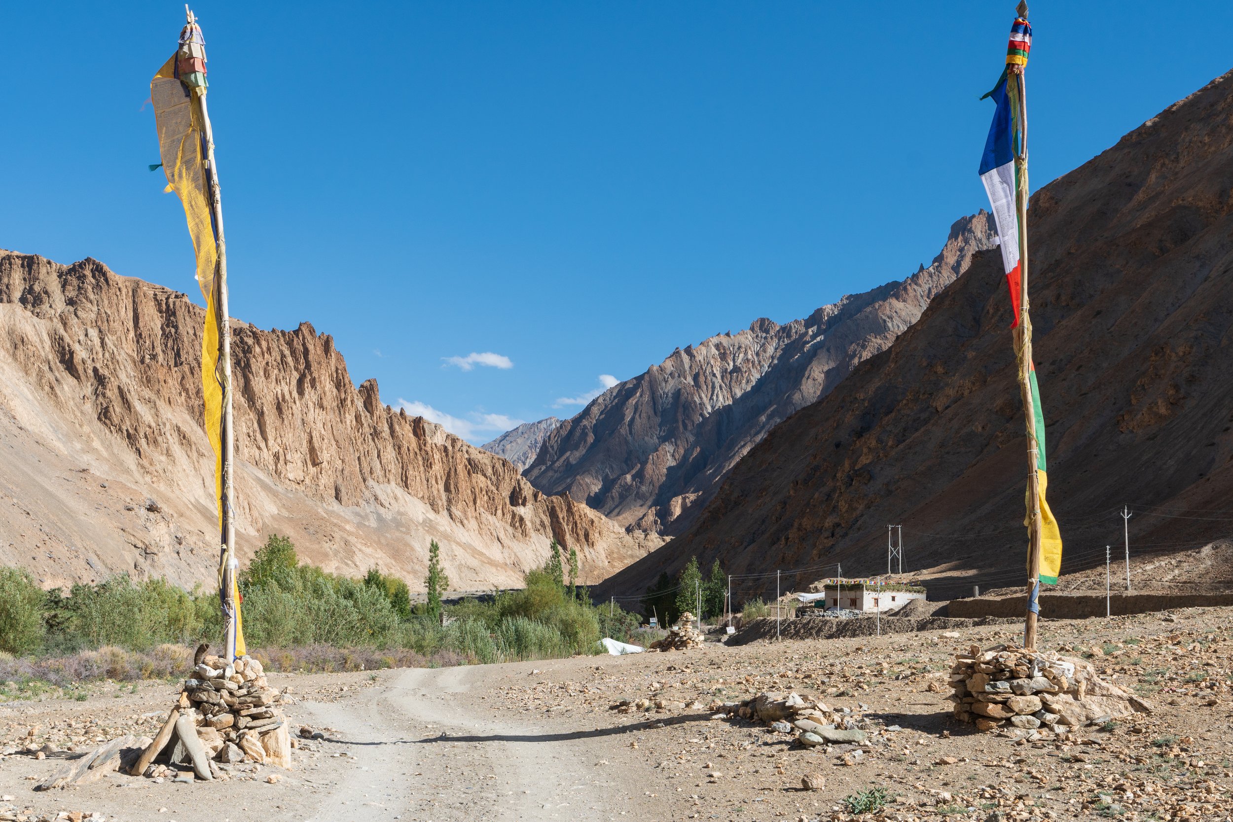
Flags marking the true Markha Valley

Amanda before our descent to the river

Looking back up the valley

Night 1 accommodation

Night 1 accommodation
Day 1: Zanskar River Bridge to Sara
September 11th, 2022
Distance: 12.20 Miles
Elevation Gain: 1997 ft
Moving Time: 5:10 Hrs
Total Time: 8:01 Hrs
Weather: Clear. 44°F. 3.3 mph winds.
Some shoulder season woes.
We awoke at 5:30 ready to start the day. A quick organization session wrapped up any loose items needed overnight as we rolled up our things into two bags, backpacks with us and duffle bags sticking behind at the guest house. The proprietor met us outside and kindly showed us to a storage room where we deposited the duffels before shuffling outside where we had a quick, porridge based meal. Before heading up to the property entrance I paid a portion of our total cost. The proprietor and I had discussed the night before and he had kindly encouraged me to keep most of our funds for any payments needed over the course of our trip and pay the rest when we returned. I thanked him again for this arrangement as he took over the cash and helped us towards the exit.
Once outside we found a ubiquitous little Toyota van idling and a kindly looking driver smiling inside. The driver helped pitch our backpacks up onto the roof rack and beckoned us inside. We waved back at the guest house proprietor as the van backed out, turned and headed down the road out of Leh. The driver twisted and turned through small side streets before reaching the road we had crossed the day before to get to the stupa, Yurthung Road. From here the van took us back down, past the airport and into the Indus River valley on the Srinagar-Ladakh Road. On the way we passed a seemingly endless series of military compounds all dedicated to different branches of the Indian Military as well as many, many fuel trucks plying the highway. Once we had reached the same elevation as the river, the road turned northwest and started heading away from Leh.
One aspect of interest here. Most roads and bridges in this area are built by the BRO (Border Roads Organization) who have done an incredible job connecting people throughout the region through some brutal stretches of country. This is why Ladakh is one of the most popular places in the Himalaya and the world to come ride motorcycles – because the BRO have connected everything on good quality asphalt. If you look out the window during the ride you will notice a seemingly endless series of witty signs encouraging safe and sober driving. I’m not sure how effective they are but they are fun to read.
Eventually the sprawling military complex gave way to an open river valley as our driver continued west, occasionally overtaking trucks with a polite honk on the horn. At about 30 minutes in, the road switch-backed down a grade towards the river, eventually dropping directly onto the north shore. Here our driver turned off the main road and onto the Zanskar Valley road. From here the taxi crossed over the Leg Zanskar Bridge east of the confluence and continued along the south side of the river heading south and west towards Chilling.
Once on the Zanskar Valley road it became apparent that the BRO had a much more difficult job keeping the steep walls of the Himalaya from encroaching. Several bridge projects could be seen as well as a bungee jumping office, but overall things seemed very quiet. Another 45 minutes of snaking along the river brought us into a very empty looking Chilling. “Maybe everyone’s asleep,” I nervously commented to Amanda.
A few minutes south of Chilling we came across a large BRO worker tent camp, most of the residents still asleep. It was towards the far end of this camp that the taxi driver pulled to the side of the road near a gantry bridge and said with a grin “We here!” We thanked him and stepped out looking around. A few of the BRO employees who had just woken up looked over curiously but otherwise, took no notice of us. The taxi driver pulled our bags down and laid them against a concrete embankment. Amanda and I thanked him, and he was off, leaving us in the middle of the Himalayas.
We started a quick sunscreen application session as the sun had just come up over the mountains around us. After that we did some stretches, which garnered some more curious looks from the BRO workforce, started our stravas and headed off – a little concerned about the lack of other people around.
Now would be a good time to note that we did not start where most Markha Valley trekkers begin nowadays. The Lonely Planet article was written before the road had been extended past the bridge. As we have observed elsewhere, like the Annapurna Circuit, some routes follow natural contours that also make for good road building. Somewhat sadly, these amazing treks are quickly being paved over so that the small villages along them can be better serviced. This is the case for about half of the Marka Valley trek. While not all of this road is paved, the early sections are and it is now more popular to simply pay a taxi to take you Skiu or even as far as Sara.
Amanda and I crossed the bridge and made our way next to the black tarmac. The path diverged from the road following trails shaped by shepherds moving sheep and cows into and out of Markha valley. From here the trail became very steep, gaining ~500 feet in ¼ of a mile. At a mile in the trail drops off again before beginning a steady climb which would characterize the rest of the day. Here the trail rejoins the road, now dirt and gravel instead of asphalt, which we would walk on for some time.
At 2 miles we encountered a small but empty settlement with a giant prayer wheel, which Amanda and I both took the chance to spin. This was the town of Kaya and it is first here that the lush head of the Markha valley can be observed – a rare green stretch in an otherwise dry, arid landscape. Another mile and a half brought us to Skyu. Here there is a large monastery as well as a female run café that serves coffee and small snacks, including popcorn! We stopped here as it was about a third of the way through our planned itinerary. Inside we were waited on by two elderly ladies who we communicated our order to by pointing at pictures on the laminated menu. Shortly after we arrived a French trekker came in and ordered some tea. He sat next to us, and we talked for a while. He had just come over the Granda La pass which is another popular trek starting on the Leh side of the frontage range which runs parallel to the Indus river on the south side. He told us a story of a Swiss hiker he had met who had started walking in Basil, the small border town in northern Switzerland, and walked to Ladakh through Iran and Afghanistan and was continuing to Southeast Asia. It never fails to amaze me the kind of people and stories you hear while traveling. After our snack we bid good luck to the French trekker and thanked the two ladies running the café before continuing east.
We climbed at a steady pace along the river occasionally passing through small settlements but no more major villages. Occasionally a taxi would pass us taking hikers into and out of the valley. This was heartening to see as I was beginning to think we were the only ones who had decided to try this trek in the shoulder season. Though high, Amanda and I were pleased to find our lungs seemed to be holding up just fine. As we climbed further into the lush valley, more and more farms seemed to sprout up around us and an occasional cow could be seen.
At 9.5 miles we crossed the Markha river and continued along its southern bank. It was here that I began looking for accommodation. I had originally planned to stay at the settlement of Nakding which was supposed to have at least one homestay. After crossing the river we came across the tent camping site of Hamdursa. Amanda looked questioningly at me, but I indicated that we should continue on to Nakding as it was just a little further. At a little under 11 miles the settlement of Nakding came into site, down and off the road a ways. As a I looked on there appeared to be no signs of activity and nothing suggesting an open homestay was operating. Amanda and I stopped for a snack and to discuss what to do next. We had seen some people at the tent site about 1 mile back though it had also appeared closed so we decided to backtrack and check it out.
After finishing our snacks, we reshouldered our backpacks and retreated down the road. Just as we rounded a bend, and the camp site came into view we noticed a group of 2 girls coming up the road with a guide. We smiled at each other, and I asked where they were headed for the night. They indicated that they had started in Skyu and were headed for Sara where there were several Homestays open. Amanda and I begrudgingly looked at each other knowing that Sara was a bit farther than we wanted to go that day but, without any other options, chose to follow the group east.
Another 2 miles brought us into Sara. As we approached, we were diverted on a side trail that ran to one of the smaller homestays. We arrived on the step and were ambushed by a short, elderly proprietor who brought us inside and made us tea. We attempted to indicate that we were looking for another group and that we were not ready to unpack but received a blank stare in return. After tea and some knock-off Oreo cookies we looked at each other, trying to decide whether to pay and run or stay for the night. I did some reconnaissance down the road and found a much larger homestay which seemed to be hosting several other groups of day hikers. Feeling terrible, we paid the nice lady for the tea and indicated we were going to keep going. We reshouldered our backpacks and headed down the hill into Sara eventually reaching the larger homestay in the middle of the town – Sara-Pa Homestay.
We passed through the open gate, closing it behind us and walked through a garden to the front porch. After a few minutes of searching, we found someone who was able to direct us to a room running into the guide we had met earlier. Our room was a simple 10 by 20 foot space with several mattresses on the floor.
I should note here that, if you arrive in Ladakh looking to do some trekking and Nepal is your baseline for accommodation on route you will be disappointed. The homestays in northern India are nice and the people are incredibly accommodating but there is nothing here like the heavily commercialized Tea Houses in Nepal. This area gets dramatically less trekkers and is not set-up in the same way. The upside of this is that you get a very authentic experience and a better understanding of what living in these areas is actually like. Remember to be polite and respectful, the places you will stay are likely be someone’s home that they have adapted to host trekkers.
After setting up our room we headed for the kitchen as it was getting late in the day and found some locals serving tea and preparing dinner. The outer perimeter of the kitchen/dining room was lined with couches, and we took a seat in the corner. There was an older German couple there that we had seen pass us in a taxi earlier that day and we chatted with them about living in the Ruhrgebiet. I don’t know why but it always made Germans laugh to find out that two Americans had moved all the way across the Atlantic only to live in the Ruhr area – a reaction we never quite understood. A while later the two English girls came in and sat by us. We introduced ourselves and they said their names were Sam and Amy and they had arrived in India shortly before us. Amy had run the Leh Marathon, for which we had seen a ton of banners and flags about on arrival, one day after arriving which was incredible to all of us given the altitude change. As we talked, we learned that they were expat teachers living in Malaysia and a third friend of theirs was also in Ladakh but had gotten food poisoning and was going to come in the next morning by taxi. Eventually, dinner was served – a delicious cornucopia of different local dahls and vegetables. We hungrily ate while swapping travel stories with Sam and Amy. After the meal we continued to talk and then eventually bid good night to our newfound friends. Back in the room, Amanda and I did some writing and reading before exhaustion kicked in and we passed out.
Day 2: Sara to Markha
September 12th, 2022
Distance: 6.06 Miles
Elevation Gain: 922 ft
Moving Time: 2:42 Hrs
Total Time: 3:54 Hrs
Weather: Clear. 44°F. 3.3 mph winds.
Much shorter trek today, trying to keep that gain below 1000 ft at this altitude
In the morning we organized our things and I realized that the water pump was no longer with us. “Shoot,” I said “I think I left it along the river yesterday after we pumped.” Amanda just rolled her eyes before saying “Well, it’s only half a mile back – you better go get it.” I left, walking quickly down to the river and back to the same spot we had stopped the day before. Our water pump’s storage bag is grey and roughly the same size as the stones on which it was sitting which is maybe why I didn’t see it until I was standing directly over it. I smiled to myself and picked it up before speeding back to the homestay
Once back I joined Amanda in the kitchen for some basic flat-bread breakfast served with a variety of jams and jelly. Here we met Sam and Amy and discovered that their third friend, Saron, was coming in by taxi that morning. After breakfast we receive our lunch for the day. The lunch costs a little extra but is worth it, usually consisting of more of the same bread that came with breakfast as well as a boiled egg, some cheese and a variety of candies.
It should be noted here that, all inclusive – the stay and meals – costs less than 10 dollars a day. We took quite a bit of money but really didn’t use much. The most expensive location is the day before the pass which is more around 20 dollars but this accounts for the remoteness of the location and difficulty in getting supplies brought up.
After breakfast we paid for our stay and returned to our rooms to grab our things. As we shouldered our bags, we heard a taxi show up indicating that Saron had likely arrived. We went out to meet the English group before saying goodbye – joking that they would probably catch us in an hour or so.
The day starts out with a short climb and then a shorter descent before crossing the river at ~1.5 miles in. From here the trail climbs another 200 feet in ~2 miles to the where a small tributary, the Phoche Nala river, descends out of the mountains. It is here that we observed one of the first Mani stone walls. These walls, roughly 1 meter high and composed of stacked stones, are topped with additional flat stone tablets inscribed with prayers in sunken relief. Observing Buddhist custom, Amanda and I ensured to walk along the left side of the wall as we passed along, marveling at the beautiful writing. Shortly after, we found a small temple associated with the Mani wall and stopped for a quick snack.
We continued, amazed by the contrast between the lush river valley and stark arid mountain sides divided by the road we were walking. At 3.5 miles we came across the small settlement of Thinles-Pa. A nice, elevated section of the trail gave Amanda and I a good location to take a picture looking down onto the river. From here we descended to the river and looked across seeing the trail continue on the other side. We smiled at each other and took off our shoes. I stepped in and turned saying, “not too bad” which I regretted about 15 yards across. On the other side, we paused for a minute and decided to just finish off the day in our sandals. After tying our shoes off to our backpacks we carried on.
Shortly after crossing the river we came upon a sign stating
Welcome to Markha. After crossing the bridge within ten minutes there are 10 home stay available and also holy monastery. Thank you and visit again.
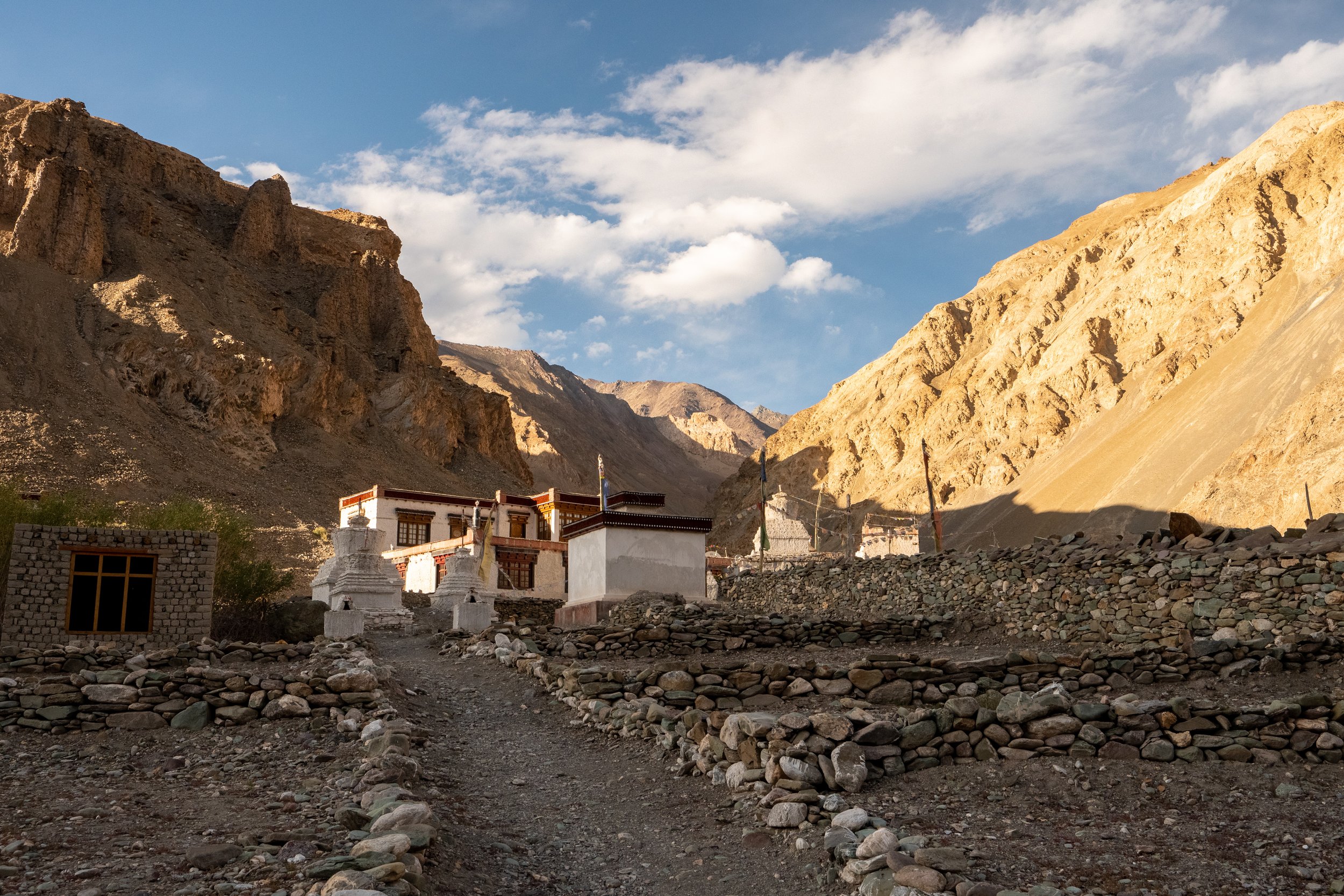
We carried on, encouraged by the sign and eventually came to a bridge. After crossing the trail diverged, the left branch switching up a ridge that descended into the valley in front of us while the right branch appeared to end-run that same ridge. We decided to go right, wanting to see what was on the other side of the ridge and, really, just not wanting to climb any unnecessary elevation. On the other side we descended into a shallow moraine with just a little trickle of water coming down from the mountains this time of year. “Where is the village?” Amanda asked looking around. Just above the lip of the glacial cut we saw the side of a building and, past that, a marked exit from the river bed. Upon exiting we saw a row of houses nestled at the base of the ridge and headed towards them. On arrival we found them seemingly deserted but followed them north along the base of the small ridge. Over a rise we saw some fields in the distance with many, many people working in them. “This must be why every village seems empty – they’re all harvesting,” Amanda noted. A woman spotted us and began to come over, eventually meeting us. “Homestay?” she said with a smile. We nodded yes and she beckoned us to follow up the steep trail, now winding through low huts, to the top of the ridge.
5 minutes trying to stay with our new guide brought us to the top where the village proper was located. The young woman handed us off to an older woman before returning down the path she had come up on. The old woman conferred with some of the other village residents, looking back and forth between us as she did before eventually leading us down a row of houses and in through one of the non-descript front doors. Upon entering we stripped off our boots and made our way down a dirt floored hallway to the end where our sponsor swept aside a cloth door and beckoned us inside. With a smile we proceeded past her into the room. We dropped our bags on the floor and busied ourselves with the typical preparation activities, laying socks out to dry, shutting down GPS devices and changing over to sandals, all while the little elderly woman looked on.
When we were complete, our ward brought us back outside and up to a partially constructed house. Inside she took us back to a corner room before busying herself with some tea and classic knock-off Oreos that seemed to be showing up more and more on this trip. Amanda and I discussed our day while she moved about the make-shift kitchen sometimes commenting in her local language on something we were saying. After we had had our tea, we made to leave and she beckoned us to sit. Using mostly gesticulation we interpreted that she wanted us to return in 2 hours for dinner. We said thanks with a smile and headed back out.
After our tea we wondered through the village for a while before grabbing some towels and making our way back down to where the trail had originally forked earlier that day. We walked down the trail a little bit before finding some flat rocks to sit on near the water. We filled our water bladders with the pump and I decided to take a bath as the water was not terribly cold. Gotta say – Patagonia baggies may be the best trekking short there is for this kind of thing. The water was still brutally cold but, as always, coming back out and drying off felt amazing. Amanda just laughed but eventually followed suite, shocked by how cold the water was.
After a quick bath we returned up to the village and dropped our things off. At this point we ran into the English group sitting on a highpoint and taking in the beautiful colors being cast by the failing light. We went and joined them for some time and I took the opportunity to take some pictures of the gorgeous valley below us. It was at this moment I noticed an entire building which appeared to have been buried up to the rafters in river rocks and moraine down below. I pointed it out to the group and Sam explained somberly that this was their guides village and that it had suffered exceptionally strong flooding. That was the remains of a children’s school which had been swept off its foundation by the flooding. She pointed to a newer building across the valley built on a higher plateau and indicated that this was a new school in the works.
After a while my timer went off indicating that it was time for dinner. We said goodbye to our friends and headed back to the partially constructed house. Here our ward busied herself making some dahl and flatbread. We ate hungrily which seemed to put a smile on her face. At the end of the meal, we were joined by the family currently constructing the house and we spent some time conversing in broken English and gesticulation before Amanda and I excused ourselves, indicating that we would be back in the morning and headed to our rooms.
On our way back we took an opportunity to utilize the extremely crude pit toilet behind the construction site. I silently prayed I wouldn’t be back out here at 2 am, worried I was more likely to fall in than actually use the damn thing. Once back in our room we spent some more time reading, writing and openly worrying about whether the shortness of breath we were experiencing was due to the dustiness of the mattress or something altitude related before ultimately falling asleep.

Amanda starts Day 2

One of the first Mani walls encountered on the trek

Small temple at the Phoche Nala confluence

Picture just outside of Thinles-Pa

Crossing the Marka River

Sign de-marking the entrance to Markha

Re-crossing the Markha River again
Looking back up at Markha proper

Mani stones with Markha valley behind

Amanda nears the riverbed on Day 3

Amanda pulling herself out of that cold, cold water

Sketchy looking bridge - just decided to ford this one

Lil’ Ass

Classic homestay sign

Pharkapa Hankar Homestay
Day 3: Markha to Hankar
September 13th, 2022
Distance: 6.56 Miles
Elevation Gain: 801 ft
Moving Time: 2:49 Hrs
Total Time: 4:14 Hrs
Weather: Partly Cloudy. 41°F. 3.3 mph winds.
Another mild day with several river wades to start. Look for your fist glimpse of Kang Yatze I towards the end of this stage
Unfortunately, I had to use the restroom in the night – it was highly unpleasant but I was at least able to keep myself from falling in. In the morning Amanda and I awoke and organized our things for the day. After putting our backpacks together we headed up to the construction site and back into the make-shift kitchen where the kindly old lady was already preparing our breakfast. More flatbread with honey and jam. We sat and ate our meal both feeling better and glad that the cold symptoms seemed to have ebbed in the night.
After breakfast I paid for our stay and received our bag lunches for the day. I met Amanda back in our room where she was dutifully applying sunscreen and insisted on putting a small dab on my nose. Once we were all ‘screened up, we shouldered our backpacks and headed out the door. The time was about 08:20. Outside we retreated down the same path we had come up the day before. Once back down to the valley floor we crossed back over the moraine and continued east, taking looks back north up into the beautiful Markha Lungpa river valley. This was where we left the Markha river behind.
At ~0.5 miles the trail deviates and it is possible to take a “low water shortcut,” though it really isn’t much of a shortcut. Amanda and I followed this path down to the shore where we refilled our water bladders and sat for a bit. After some discussion we decided to cut back up to the road and continue on the primary path to avoid swapping between sandals and boots all morning.
Once back on the road we continued for another mile and a half before fording the river to the southern bank. On the other side the trail splits with the right path heading south along the Chacham Nala river into the mountains while our path continued east. At 2 miles the trail passes over another crossing back to the north bank of the River. At 3.25 miles we passed through the small town of Umlung. After Umlung, it is possible to start catching glimpses of Kang Yatze I (20,997’) in the distance as the trail heading edges further south. At 4.5 miles Amanda and I stopped in a nice, shaded section of river bank to eat our sack lunch. We sat there for 30 minutes or so with our feet in the water enjoying the sun before begrudgingly putting our packs back on and continuing.
We passed the final 2 miles without incident. As we came into the outskirts of the small town of Hankar we were waved down by a young woman who was the proprietor of Pharkapa Hankar Homestay. Not wanting to repeat the mistakes of our first day I explained that we would like to keep going into Hankar proper as my GPS was indicating we were still almost a mile outside of it. The persistent woman insisted that she was the only Homestay open in town and that we should stop here. Amanda and I looked at each other. “We haven’t gone very far today – do you think Sam, Amy and Saron are here?” I said. “This place looks really nice,” Amanda answered with a shrug. So we nodded to the lady on the embankment above us and she guided us to the entrance.
The place was lovely – the nicest homestay so far. We found this along the way, the homestays seemed to get nicer the farther you traversed along the trail. Upon reaching the entrance we stripped off our shoes and traded them for sandals and were directed to a nice spacious room with a central queen-sized bed, on the floor as usual. Amanda decided to take a quick nap and I headed out to enjoy the quiet serenity of another pit toilet – this one with windows. After stepping back into the fresh air, I heard Amy’s voice from the other side of a fence and, rounding the end of it, realized there was another woman run eco-café in this village. Sam spotted me and said I should join them which I did. We sat and talked about the day and Saron gave me some candy which I instantly regretted, the sweetness pushing me towards the edge of altitude induced sickness.
We chatted for a while, and I found out that all three of them were English expat teachers in Malaysia and had been there for almost 10 years. This trip was the inaugural stage of a 1 year long travel holiday that the three of them were embarking on around the world. I asked where they were staying that night wondering if the Pharkapa Hankar Homestay proprietor had been telling the truth and they confirmed they were also staying there that evening. I told them Amanda had been taking a nap and I was going to head back before she wondered where I had gotten off to. They smiled and said they would see us at dinner.
Back at the homestay I told Amanda I had found our friends and that they were staying at Pharkapa Hankar Homestay. Happy to hear that she asked if we should walk up the road a ways. I agreed and we walked for about ¾’s of a mile trying to extend our elevation gain for the day. “Trek high, sleep low” I joked as we reached the far edge of Hankar and turned around. Back at the homestay it was dinner time. We joined our friends in the dining room and talked until it was served. Rice, dahl, and more flat bread. Shortly after dinner a group from Israel showed up having hiked from Sara that day and all of us talked later into that evening before fatigue set in and we retired one-by-one to our rooms to sleep.
Day 4: Hankar to Nimaling
September 14th, 2022
Distance: 7.64 Miles
Elevation Gain: 3015 ft
Moving Time: 3:53 Hrs
Total Time: 7:35 Hrs
Weather: Partly Cloudy. 39°F. 2.6 mph winds.
Big elevation day. Epic views of Kang Yatze group. Really starts feeling high.
I had, had my concerns about today. Typically, above 10,000 feet you really aren’t supposed to gain more than 1000 total feet in a day. Doing so puts you at higher risk of altitude sickness but I had seen that, due to the spacing of homestays, we were likely going to have to flout this rule on the 4th day. So it was that I woke up a little nervous in Hankar on day 4. Amanda and I got out of bed and conducted our usual morning rituals. This was the 6th day in a row I had not had any coffee which I was stoked about because I had somehow blasted right through the caffeine withdrawals – probably my body had other things it was frantically trying to compensate for.
Breakfast was the typical flatbread with various spreads. We talked with Amy, Sam and Saron for a bit before heading back to our rooms and getting ready for the day. We started around 8 am with mild conditions, retracing our steps from the evening before. As we got to the same point we had hiked to the day before the trail split, the left route climbing up to what appeared to be a monastery and the right path continuing along the river bed. We stayed low and the Israelis, who left about the same time followed. We took our shoes off as the trail crossed the Markha river for a first time and, looking beyond to several subsequent crossings, decided to keep them off.
At about 1 mile our little sidetrack rejoined the main road, and it was here we realized that our route might have not been the correct one. As if to confirm that suspicion we looked back up at the monastery trail and saw our 4 friends coming down off the small ridge. “Oh well,” I said to Amanda as we put our boots back on and continued southeast. From the wide valley near Hankar the walls along the river began to steepen, starting to look like a canyon out of the American southwest. We passed through the throat of this canyon along the north bank of the Markha valley at which point the trail turned almost due east. At the outlet of this constricted zone a sharp prow of rock rose in front of us and the trail split one side going right and the other maintaining left. Though I was pretty sure we were to continue left I was pleased to have our friends and their guide confirm it by passing us at this exact moment with a friendly wave.
From here we could look east and observe the trail cut into the side of a cliff face. At the base Amanda noted a large black cow that had just come down from above. “I wouldn’t have wanted to run into that thing on its way down – guessing it wouldn’t have backed up to the top for us,” I said with a smile. As we approached the trail I looked up to check for more cows coming down. The view wasn’t perfect, but I was pretty sure we weren’t going to run into any more of the docile animals as we made our approach.
I should note here that, throughout the Markha valley trek, it is possible to see the remnants of an old trail system maintained about 100-200 feet above the floor of the river bed. It may seem at times like one should follow this old system but the English girls’ guide made it clear that this trail is no longer safe to take as it has suffered many wash-outs and abruptly ends in places which forces you to backtrack sometimes long distances or risk heavily exposed traverses to connect broken sections of the trail. This trail systems was abandoned after the advent of the road which now runs through most of the Markha valley and is no longer actively maintained.
Once on the path we maintained for another mile before the steep walls of the canyon retreated and we found ourselves in the midst of a high alpine valley with large-to-house-sized boulders strewn across it. This was one of the first major changes of scenery we had seen on the trek so far and it was very much appreciated. We picked a nice boulder and sat to enjoy our lunch. Looking back down a short distance we saw Sam, Saron and Amy eating lunch on a similar set of boulders. It was at this point that several pikas came out from hiding to see if we would toss them some of our lunch. We sat and wondered at these tiny mammals living up here on the roof of the world.
We took a long lunch knowing that we were in for some major climbing the second half of the day but eventually got up, organized our garbage, and started climbing. At the end of the valley the climbing steepened, and we slowed to accommodate it. The trail meandered up into ever-opening country. The sky seemed to broaden more and more as we steadily pulled ourselves out of the river valley we had been in the last few days. It was incredible, suddenly being able to look around and see more and more mountain tops as well as a sky that seemed to extend forever. At 3.8 miles the trail diverged, one fork going left and strait up the front of a small ridge while the other seemed to take a more gradual path up and gain the ridge on a flank further back. We took the latter path and continued, though I was slightly dismayed to look back 10 minutes on and see the English crew heading up the other trail. At one point we were overtaken by a team of mules and their drivers as they made their way up the ridge. Towards the top of the ridge Amanda and I were forced to take breathers every 50 steps or so, the altitude really beginning to have an impact. 45 minutes after leaving our lunch spot we topped out on top of the ridge and looked back to take in a view that kept getting better with every vertical foot gained.
We continued on top of the ridge and another 15 minutes and the path eventually brought us to the twin pools of Chhiu. Here we came across a group of Indians and I pulled out the pump to refill our water bladders. Seeing this, the Indian guide came to me and asked if I would be willing to fill his clients’ bottles as they were out and still some distance from Nimilang. I said of course and filled each of their tiny Nalgenes, wondering how they had come so far on that amount alone. In return they gave me some chocolate and agreed to take some pictures of Amanda and I in front of the Kang Yatze. Shortly after, our English friends rounded the corner and came upon the pools. Saron was looking pretty tired, still recovering from her stomach illness, so I shared some chocolate with her hoping to help raise some blood sugar levels. After making sure they were okay Amanda and I proceeded on.
From the Chhiu pools the climb lessened but continued upwards for another 1.5 miles. As we made this climb, I started scanning the long ridge in front of us looking for the pass and was relieved when I found a meandering line up to a low point a few miles off and not too high above our current elevation. At 1.5 miles we came to the edge of a shallow but extensive basin littered with small stones and with a moderately sized tent camp at the far end. We descended a short distance into the basin and then proceeded on the floor of it for the last ¾’s of a mile, Amanda falling back a bit feeling the effects of the altitude.
Once in camp I dropped my bag at the entrance where a few of the hosts were sitting and said hello. They waved and said welcome and went about preparing tea. I went back to the entrance and saw that Amanda was still making progress but would be another few minutes before returning for the warm drink. I drank for a time and then got up once again as Amanda came into camp. She looked good but as soon as I took her pack off, she jogged down to the stream and began to throw-up. I looked on worried as one of the hosts came to take our backpacks to the tent he had selected for us. Just as I was about to go down and see if Amanda was okay, she started to come back up. “You alright?” I said, worried. “I feel a lot better now, think I need some electrolytes.” As she took a seat at the small picnic table, I went back to the tent to see if I could find some electrolyte packets. Finding some I came back and asked the host for some boiled water which I added the electrolytes to and took to her. She thanked me and started working on getting the warm drink down while I did the same with my tea.
As the afternoon went on the Israelis showed up and, just as we were really starting to worry about Saron, the English girls showed up looking a little tired but no worse for wear. We also noted that the German couple we spoke with in Sara was in the camp, though the woman was looking a bit sick. Amanda, starting to feel better, found some electrolytes which, coming from Germany, the German couple was happy to take.
As the afternoon turned to evening, it began to get cold and Amanda’s and my conditions started to go in opposite directions with Amanda feeling better and better and me feeling worse and worse. By the time we all gathered in the dining room I was feeling really crappy. I tried to play some of the games the Israelis had brought but found myself in too much pain to properly concentrate. It was at this moment I realized something – I had not eaten anything since lunch almost 5 hours ago. “That was stupid,” I told Amanda after realizing what had happened. She gave me a worried look but at that moment the hosts began to roll out one of the most extravagant meals yet. The odd thing about altitude sickness is that it can destroy your appetite and I had let things go so far that I really didn’t want to eat. None-the-less I forced down as much dahl and rice and drank as much water as I could manage, desperately trying to counteract the situation.
After dinner, despite a great sense of comradery, almost everyone retired to bed. The altitude and foreboding climb the next day painting a sobering light on all. Once in the tent I took stock in my situation. My condition wasn’t getting worse, but I still felt terrible. Amanda and I got our things organized but I was in so much pain, I really wasn’t any help at all. Finally, I laid my head back, pushed the apprehension about tomorrows climb from my thoughts and tried to force myself to sleep.

Small settlement with Kang Yatze in the distance

Skittish lil’ horse

Amanda patiently waiting for a cow

Amanda headed out of Murdochen where we ate lunch

Mani wall with deep inscriptions towards top of ridge

Chocolate for pictures is what it’s all about

Amanda makin’ it look easy

So many sheep!

Nimilang looking cool in the evening

Amanda takes a quick breather with Kang Yatze 1 behind

Amanda chugging up the grade to Konmaru La Pass

Amanda and I on the Konmaru La Pass
Amanda makes an initial descent down from the pass

Sad when you have to go back up - even just a little bit

Example of an abandoned trail section

She knows she’s near the end
Day 5: Nimaling to Chogdo
September 15th, 2022
Distance: 7.59 Miles
Elevation Gain: 1775 ft
Moving Time: 4:44 Hrs
Total Time: 7:37 Hrs
Weather: Clear. 31°F. 2.3 mph winds.
Time for a high pass… followed by a looooooong descent.
So, I eventually did feel better, a lot better – but I couldn’t ever really get to sleep. Same thing always happens before a big climb so that’s not too out of the ordinary, but really wish I could have passed out instead of just listening to the tent flapping in the wind all night. In any case, the morning rolled around eventually, and we got up and moving around 6 am. We had considered leaving early as conditions in the mountains are altogether more stable in the early hours of the day but the hosts had indicated good weather the evening before, so we didn’t have to commit to a classic alpine start.
As we made our way to the tent for breakfast we met up with Sam, Amy and Saron. We traded current conditions and feelings as we made our way into the tent. Altogether it seemed that everyone was faring well, at least not bad enough to want to wait around another day in Nimalang. We ate at the same table as dinner the night before, the Israelis coming in a little behind us. The German couple had left in the early hours of the morning expecting to move slow. We drank tea and chatted back and forth all feeling quite a bit more chipper this morning. One of the guides was showing pictures he had taken of a Snow Leopard on the Kang Yatze massif earlier that year. After a classic breakfast of flat bread and jams we met in the sun outside before queuing up to pay and then breaking off to get our packs ready for the day.
Amanda and I led our new friends through some of our pre-hike stretches then we sized our polls, started our Strava’s and headed north out of the camp. After exiting the camp, we made our way across the basin and almost immediately climbed 500 feed in ~1/8th of a mile up to a higher section of the basin. Here the trail grade lessened as we made our way past a crude shepherd’s hut with at least a hundred sheep milling around outside. The trail maintained a slow and steady march, gaining another 500 feet in just over a mile. At almost 17,000 feet the grade was a blessing and still required an occasionally stop to catch our breaths. In the breaks between marching up the grade we turned to take in views of the ever growing Kang Yatze 1 to the southwest across the basin. Just before the pass the trail steepens for the final 200 yards, pushing over the 17,000 foot mark and then, just like that, we were on top and met with the quiet flapping of prayer flags and cheers from the German and Indian group who were still on top, enjoying epic views of the greatest mountain range on planet earth.
Amanda and I stayed on the pass for almost an hour. Eventually the Israelis topped out and then Sam, Saron, Amy and their guide. We cheered for each of them as they arrived, looking exhausted but relieved with the knowledge that the only way to go now was down. We took pictures with everyone and then just sat in silence enjoying the height of our current perch. After a time, we were pulled on by the trail yet unfinished and collected our things before reshouldering our packs and marching on. Coming down off of a summit or high saddle is always a hard thing – you feel like you are giving something valuable up, like you worked so hard and you should have enjoyed it more.
From the pass the trail turns down and it continues to go down, with a few tiny exceptions, the whole day – over 4000 feet of elevation loss. The descent starts in a sort of open basin which it traverses from south to north over a 1 mile span, making a few switchbacks along the way. After a mile and ~1000 feet of descent, the trail curls due east and the basin funnels into more of a canyon. At around the 3-mile marker, a number of campsites are encountered, denoted by circular stacked rock walls. We stopped here for some lunch.
While eating, two German guys and their guide caught up to us. They asked if they could join, and we said of course. We got to talking with them and found out that they had just climbed Kang Yatze 1 over a period of 9 days. I was amazed because they had tiny packs but soon learned that all their gear was coming down behind them on horseback. They laughed, again, at the fact that we had ended up in the Ruhrgabiet and then we talked about Germany and the Alps for a while. After lunch we got our things together and I bid them a “glück auf!” which garnered another chuckle before we set off. They caught us about 15 minutes later practically skipping down the trail.
From the lunch site the trail continues down for another 500 yards before it reaches a confluence with another drainage from the east. From here the trail continues along the Chuchkurma Tokpo river often jumping from one side of it to the other as it passes through some unique rock formations. As you descend you get a sense for how the old trail likely took shape in the Markha valley, but even here where it’s maintenance is a priority the mountains always seem to be one step fron taking it back.
The rest of the descent through the red-rock drainage passed without much of an incident and soon we reached the small town of Chukimo. Here we ran back into the horse crew bringing the Germans’ equipment back down the mountain. Originally, I had worked out with the Tsetan Guest House that a taxi would meet us in Shang Sumdo but, miraculously, the taxi driver had decided to come up the road to Chukimo to pick us up, a decision we got a healthy amount of appreciation for on the long ride out to Shang Sumdo. After tossing our bags on top of yet another ubiquitous Toyota taxi, we jubilantly pulled our boots off and swapped for sandals before getting in. The taxi bounced down a rough track which eventually transitioned to a slightly more established road, all the while Amanda and I kept saying “I’m so glad we are not walking this.”
Eventually the taxi reached Shang Sumbdo where it turned east along the Martselang Topko river which took us to Martselang. Here the taxi driver asked if we wanted to see the Hemis Gompa which looked impressive. We thanked him but indicated that we wanted to go home. “Ok” he said with a smile. The rest of the trip was uneventful as we cruised along highway 3 which eventually terminated in Leh. Here he turned back up the hill and deposited us back at the Tsetan guest house where we thanked him and headed inside.
This time we were treated to a second-floor room with large windows looking out on the back yard. After a refreshing shower we relaxed and checked in with our families to let them know we were still alive. Later that evening we had another wonderful dinner and talked with some of the other guests late into the night before bringing a close to another epic trek.
Final Word
The Markha Valley trek is a true epic that celebrates the eastern, dry side of the Himalaya. It is a more authentic, if a bit rougher, take on some of the more commercialized treks in Nepal. The region itself is something to be explored for its unsurpassed adventure.
The following day we went to a Yoga session with Saron, Amy and Sam and found out they were headed for a place called Kargil and then on to Srinagar. If we had more time, this was a place I desperately wanted to see and the pictures they posted on their Instagram confirmed that. The US state department warns of travel west of Leh due to its proximity with Pakistan and there have been terrorist activities in the past, however, it has been some time and the heavy Indian military presence makes it quite safe to travel in the region. If you have time, I would strongly encourage a trip to Srinagar and even a trek there if you are looking for a more lush hiking scene.
In general, there are few places that have the feel of adventure that can be felt in Ladakh, Jammu and Kashmir and I highly encourage anyone looking for an authentic experience to check it out.

Finally got that sweet sweet ice cream