
Biked July 2024
Written July 2024
Intro
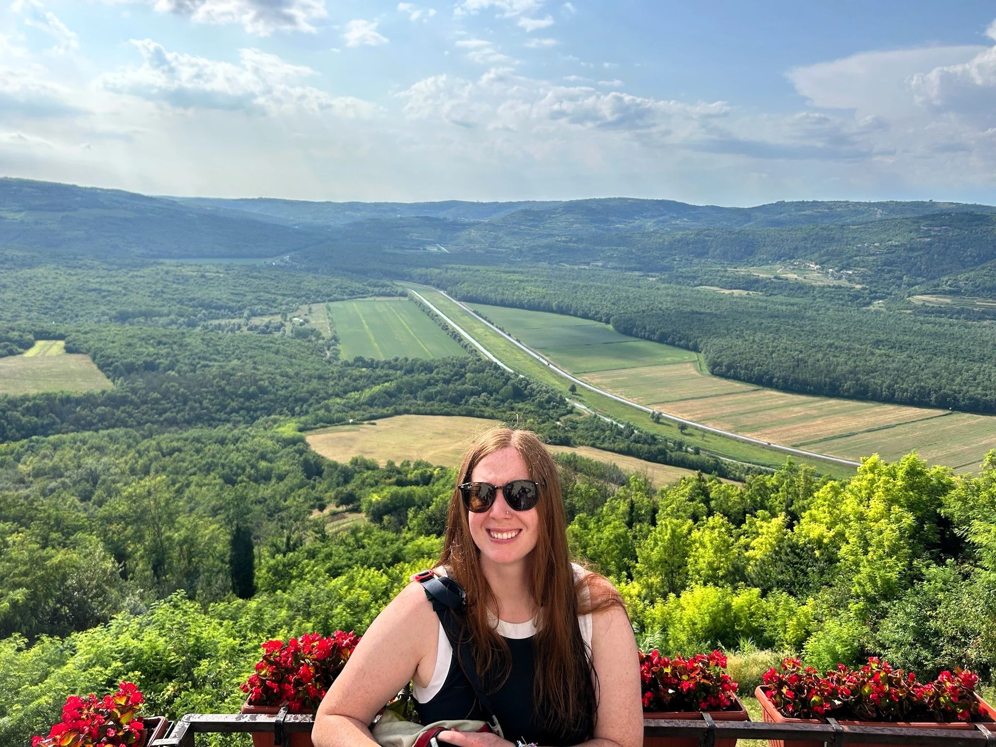
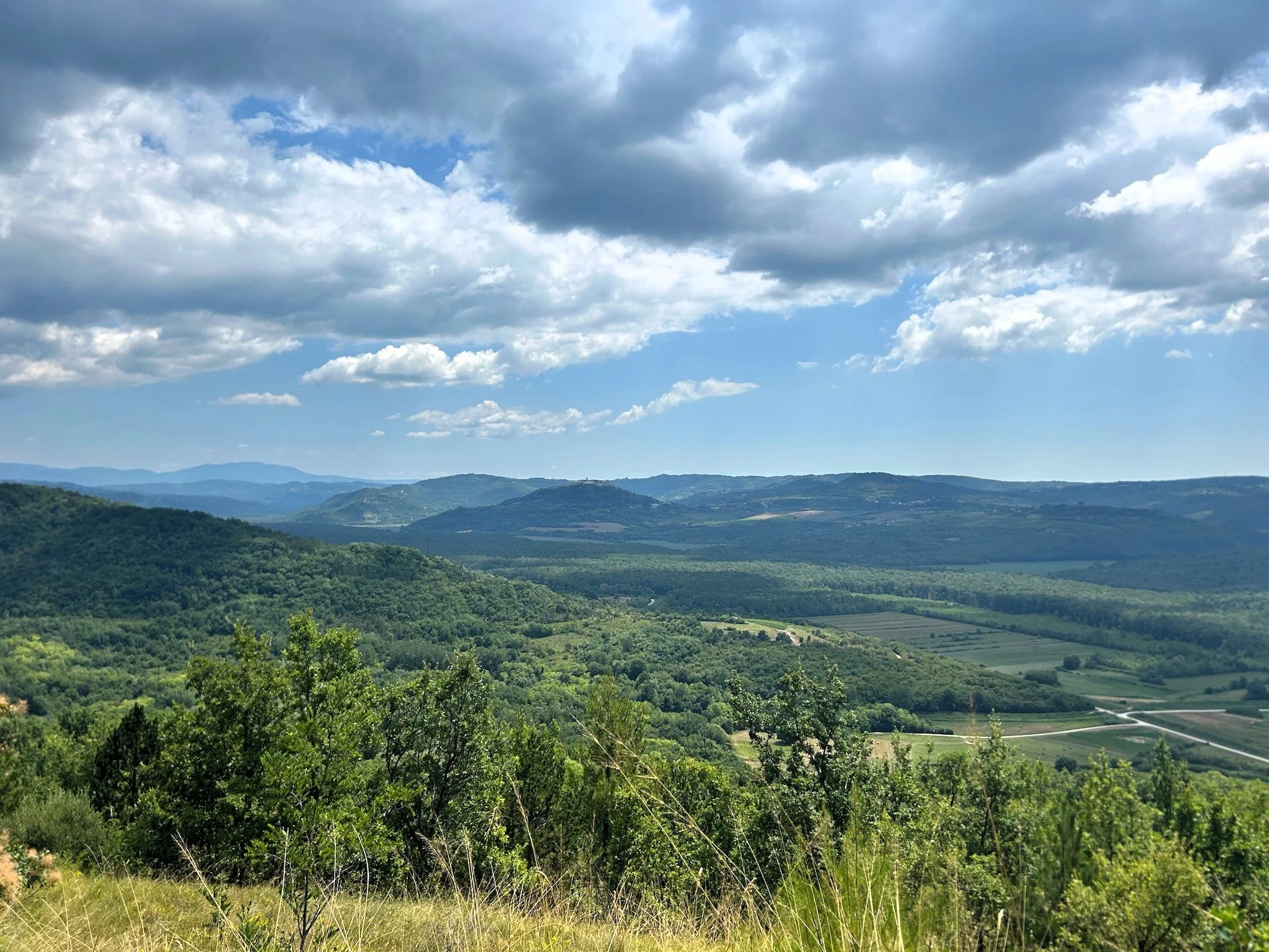
Amanda found this bikepacking trip in the New York times around 2022 and sent it to me. At the time we were living in Essen, DE and trying to get out of there every weekend. We never made it while we lived there - just too many other trips that took precidence, but some surprise tickets to a Taylor Swift European Eras tour came to us by chance via mutual freinds who also share a love for biking and so, in the spring of 2024 I penciled the route out. That summer, after singing our hearts out in Gelsenkirchen, the place we had worked for 2 solid years, we made our way down to the Istrian coast and embarked on one of the greatest bikepacking trips we have ever undertaken. This is the land of great olive oil, crystal blue oceans and Game of Throne-worthy backdrops and it is now the standard up to which i compare all bikepacking trips.
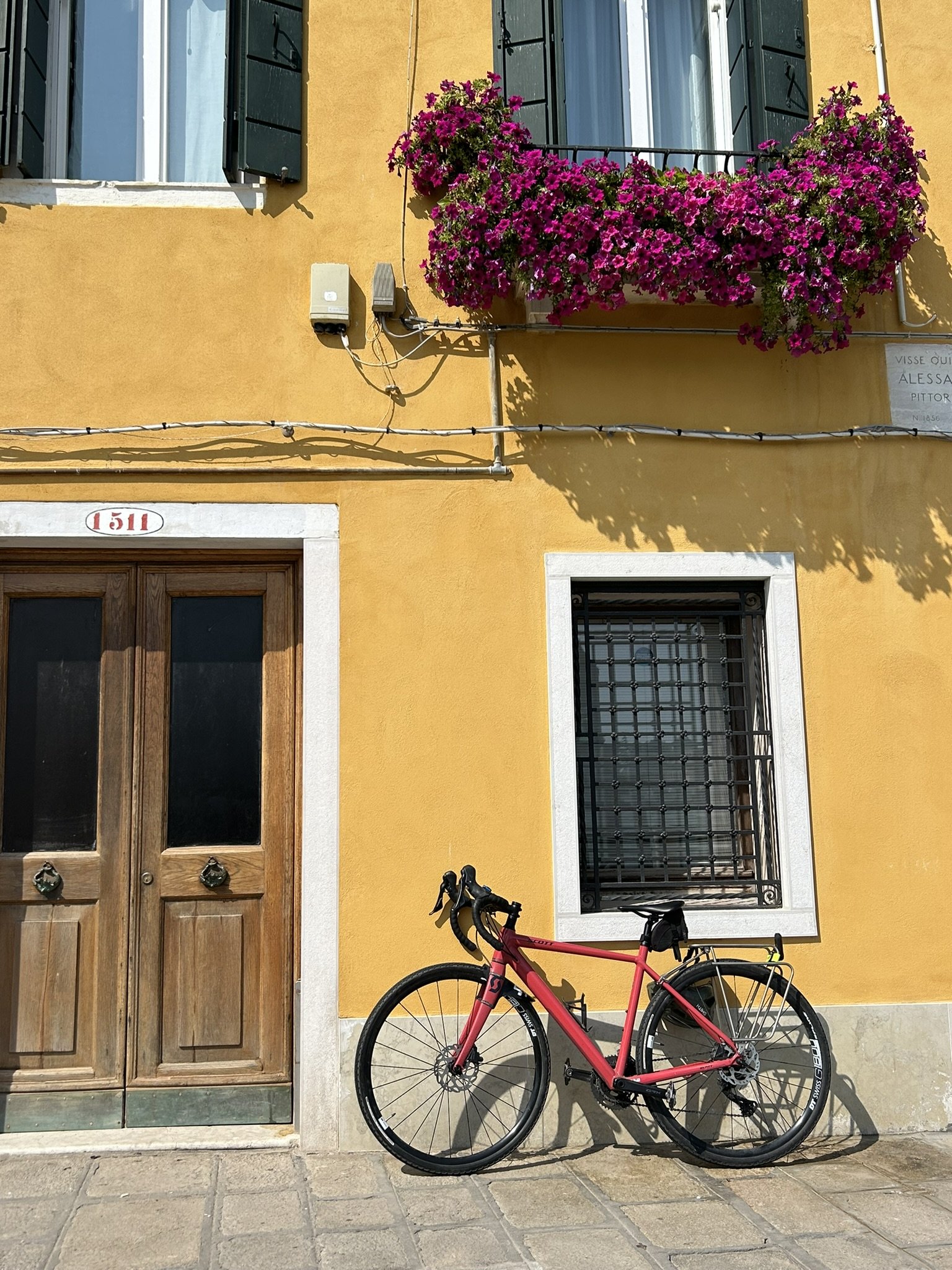
The Juliana getting ready for a ferry that never came in Venice, Italy

Contessa was so photogenic on this trip

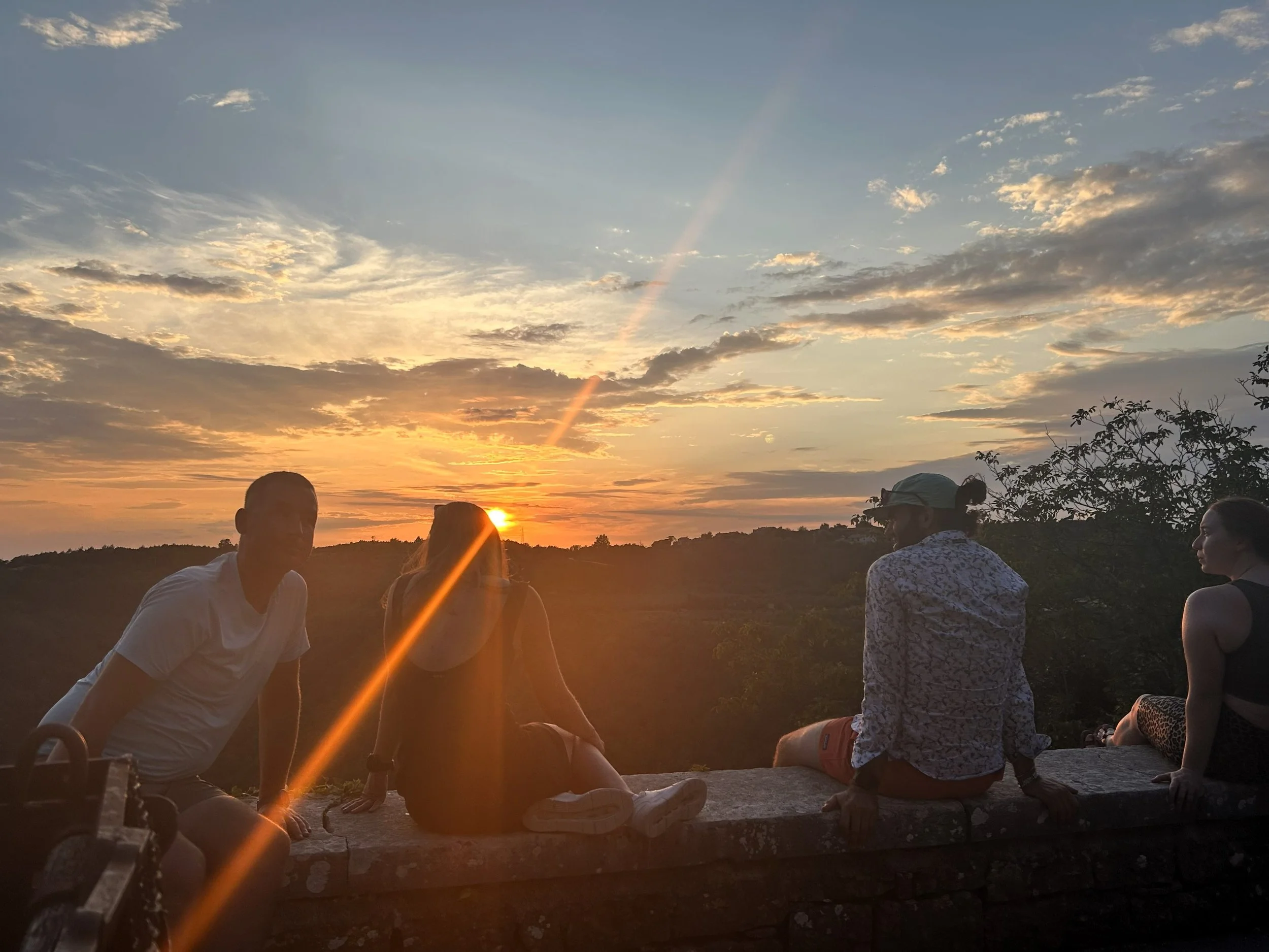
Ready for Day 1

Classic Millenial Peace sign
Day 1: Dante’s Travels
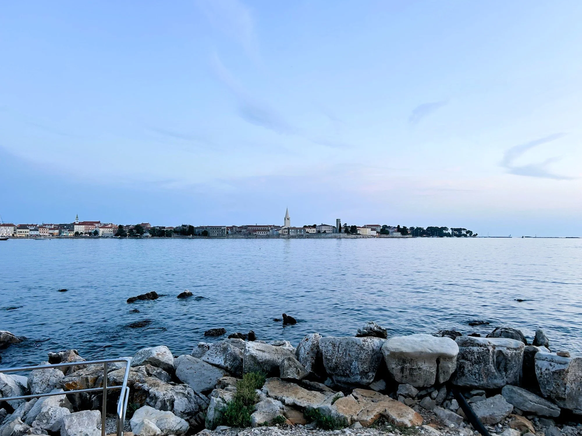
Pula, Hr to Rovinj, Hr
jULY 20, 2024
25.64 Miles
1200’ Ele Gain
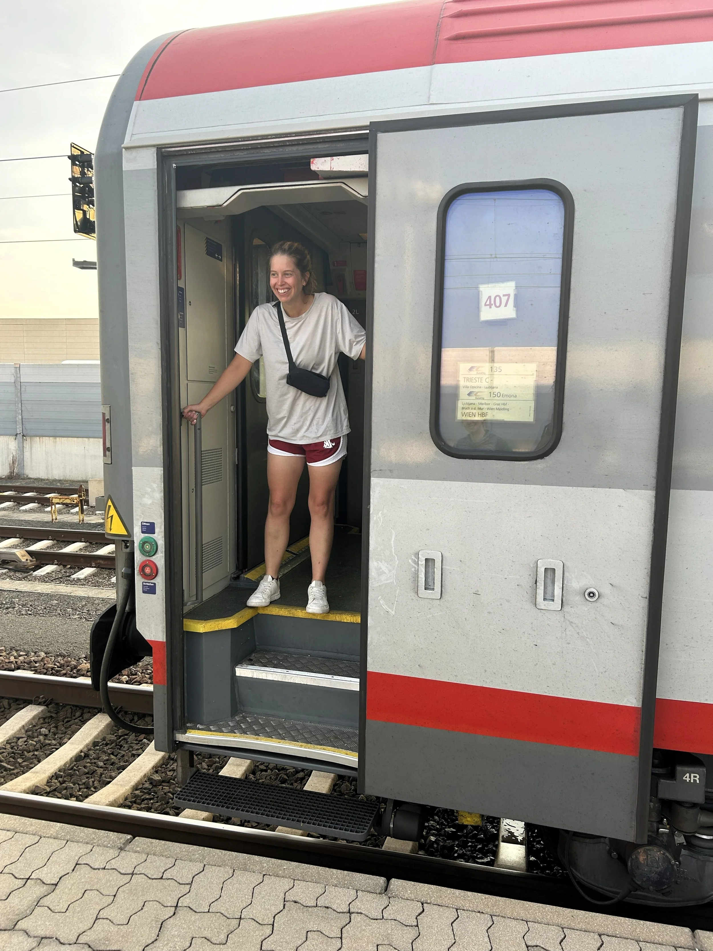
They say you have to go through Hell to get to Heaven and today is proof of that. The last two days have been a train wreck of public transit debacles as we traversed the length of Germany from Dusseldorf to Munich and then Munich to Pula on public transit. We witnessed a mental breakdown and a near death experience when an elderly man fell off a platform into the path of a moving train. We were delayed for over 3 hours in a tiny station north of Koblenz and our wagon was dropped from the Eurocity train set between Innsbruck and Verona. We still got our bikes on the train but had to sit in the aisle, on the floor, for 4 hours while we passed through the alps. We missed the last train out of Innsbruck and stayed in a thin-walled, Munich Red Light district hotel full of guests doing everything but sleeping and got to Venice the next day only to find our ferry was broken down and replaced with a poorly air conditioned bus around the Istrian strait to Pula. In two years living in Germany and riding a lot of public transit - in fact, in my entire life - I have never had a more ridiculous series of unfortunate events.
But…but, today made up for all of that in what was a paradise stage of gravel and road biking through the gorgeous Istrian peninsula. 26 miles along crystalline Mediterranean waters and through ancient olive groves made for what may be the beginning of my favorite, all-time bike packing trip.
The path today starts along the coastline of Pula, Croatia navigating busy streets as it makes its way north. Busy streets give way to car crammed roads and a series of roundabouts which offer a harrowing challenge to the basic biker. The game of frogger only lasts about 2 miles before the path turns off the busy Trscanska ulica and onto quieter, well-kept tarmac before proceeding into the beautiful coastal town of Stinjan. Fazana follows and then Perci, each a beautiful town in its own right, but all connected by a moderately busy road with minimal shoulders. The route continues its march onto Barbariga after a small climb at roughly the half-way point for the day before cutting in-land a bit. At 15.7 miles on there is a chance to stop at a beautiful winery, Menghetti Winery, for an afternoon refreshment and also enjoy the beautiful tarmac that briefly intervenes over the predominant gravel in the area. Shortly after the winery, the route joins the Jadranska cesta before, again, turning onto gravel and heading northwest, creeping ever closer back to the coast. Another 5 miles finally deposits you into the old town of Rovinj with its old style towers and cobbled streets.
We slept in today and we deserved it. I literally died last night - it was the best sleep I have gotten since 20-mile days on the Pacific Crest Trail. I think at some point your body just shuts everything down like a mini-coma and that was what last night was. Evidently, according to Kelly, there was thunder and lightning. Every navy in the world could have spent the night shelling Pula and I probably would have slept through it. In any case, we were up around 9:30 and were out the door around 10:30. We stopped at a small cafe in the Trg Forum square, just a few hundred yards from our place and got breakfast. I’ve already forgotten how subpar breakfast is in Europe. Still fairly confident they all just wake up and chug 3-4 cappuccinos over a pack of cigarettes and then hammer their way to 2 PM before eating a real meal. Kelly is vegan and ended up with a sandwich stuffed with cheese so I traded her for my yogurt and fruit which she strategically ate, giving the yogurt back before we got on the road.
The early parts of today were a little hairy - I won’t deny that. The New York Times article Amanda found a few years ago, which was the genesis story for this trip, actually suggests traversing from north to south on this route. One benefit of this direction is that you end in Pula where there is no small amount of Frogger games through its busy streets. As it was, we began by playing in traffic. We started by passing the gorgeous Pula Amphitheater before navigating some hair-raising traffic circles. Not far after, we got off the busy Trscanska ulica road and onto some quieter streets, which was a great change. Amanda brought up the rear with Kelly and Jesse in the middle and I led. I realized, after a short stop on the quiet road, that when I had reassembled my bike in Amsterdam I had accidently routed the rear derailleur cable inside the frame so that it occasionally rubbed on the cassette - definitely not ideal but was in no mood to stop and fix it. We went through Stinjan, which was a quintessential little coastal village, before making a few wrong turns and getting on a 200 yard stretch of gravel. We cruised on, still playing in traffic. I got cut off a few times but, in general, the Croatians are pretty respectful of bikers.
At Peroj, we pulled over at one of the beaches that I had identified as a good snorkel spot and we locked the bikes to a tree and changed into swimsuits. Croatia outfits all their beaches with easy change stations and they are all gorgeous. We had been looking forward to swimming in the Med since we left Germany and it…was...everything we had been hoping for. Clear, clean, warm water with tons of fun little fish. We swam for about an hour before rinsing off and continuing on. Not far after Peroj, the road turned off onto gravel and, from there to just south of Rovinj, we were on clean and clear gravel roads with negligible car presence.
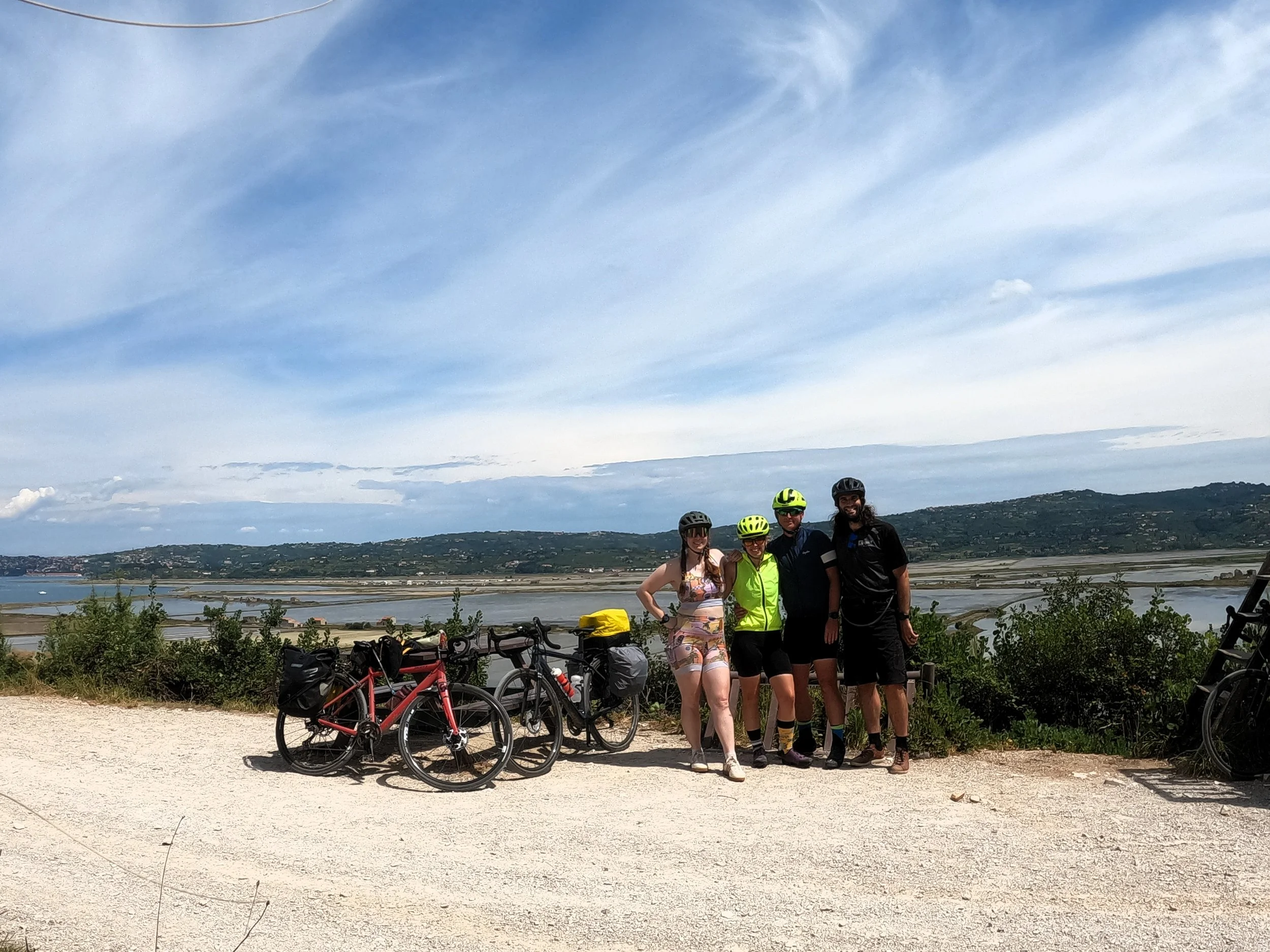
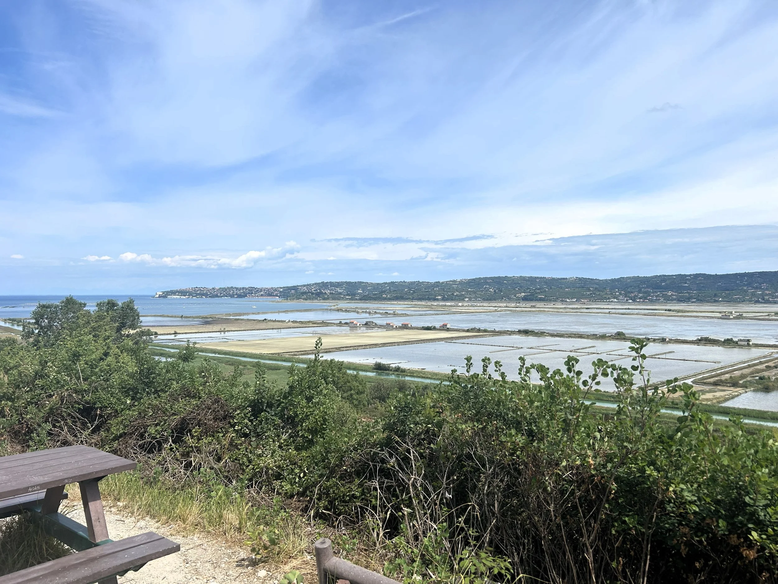
We cruised on for about 5 miles, enjoying the lack of cars, before arriving at one of the first wineries I had found on the route. Menghetti is a modern and very accommodating winery offering some excellent wine and a perfect little bike rack outside. We stopped in and sampled a few options, well - Jesse, Amanda and I did, Kelly just found a red she liked and stuck with it through the whole thing. After Menghetti Winery, we headed on along some more great gravel roads. I gotta say, the appeal of gravel riding is becoming very evident. Jesse’s set up is the best of us three - he ditched the panniers and is riding with a total of ~6 liters of space which is nice, light and well distributed on his frame. I'm a little jealous if I am being honest. We rode on, cruising down awesome gravel roads and were into the outskirts of Rovinj before we knew it. We transitioned back onto the road, this time well separated from traffic by defined bike lanes, and rolled into the gorgeous, old city center of Rovinj sitting along the mediterranean.
Once we were into Rovinj proper, we started to run into crowds and got off to walk our bikes along prestine, waterfront promenades to our AirBnB. Once there, our hostess met us and directed us to a large, street side bike rack. We were a little nervous to park our bikes on the street but decided it would be okay based on the number of other bikes around. We walked up the five flights of stairs to our place and stowed our things before going to find a place for food - which Kelly picked out this time. We had some delicious Italian cuisine and then went for a swim in the twilight before getting some tiramisu and heading to bed.
Bottom line, this stage was amazing. Good quality tarmac and gravel winding through old, Roman cities with views out to the blue waters of the mediterranean. Plenty of opportunities to swim and so much good food. No denying it, I am in love with this area and so excited to see more.
Day 2: Gravel Dreams
Rovinj, HR to Poreč, HR
jULY 21, 2024
27.84 Miles
1714’ Ele Gain
Today was another brilliant day of gravel riding - these stages are living up to, and far exceeding, what I had hoped for. We slept in ‘till about 8:30ish this morning. Contrary to my Suunto’s report that I had managed a 100 sleepscore, I had woken every hour or so to check the location of Amanda’s bike on the FindMy app, reported by the AirTag we have concealed in her stem. No one was excited about leaving the bikes on a public rack in front of the hotel but, as I reconfirmed every hour, the bikes didn’t run off in the night and were waiting for us in the morning.
We ate some sliced-up fruit and vegetables that the girls had purchased the night before and packed our things to get out by 10 am. It was hot when we finally stepped outside, around 80 degrees and warming up. We thought about sticking around in Rovinj and getting some coffee in the little Trattoria at the base of our AirBnB but were all anxious to get moving. I took a chance to reroute the derailleur cable I had accidentally routed inside my frame to the outside while Jesse undid his long cable lock from the other 3 bikes. He’s carrying this 20’ span of stainless steel cable which has been absolutely clutch in keeping our bikes safe. At around 10 am we were off, navigating the already busy old world streets of this amazing Croatian fishing village. We carried on, on increasingly busy streets until we got just out of town where we stopped for a few coffees. Once we were caffeinated we continued, briefly riding on the busy Cesta za Valaltu-Lim road before ducking off onto a gravel road where we started to ascend into the little coastal range of hills that rise off of the Mediterranean.
We wound our way up on incredibly rideable and quiet gravel roads, all remarking on how perfect the route was. As we climbed I noted our road running, at times, parallel to a defined bike path that looked suspiciously like an old railroad grade. We continued, following the route as I had built it, passing several groups of riders also out enjoying the quiet roads. Small, Mediterranean shrubs rose on both sides offering shade as the sun climbed higher into the sky. At five and a half miles in we passed over the defined bike trail and I took a moment to consult my map app. “I think we should jump onto this path,” I put to the group “it looks like an old railroad grade and it will reconnect with our route in about 5 or so miles.” We all agreed, though, the transition point I had chosen was far from optimal and we all nearly took a spill crossing the steep ditch to get over to the path, but it was totally worth it. As nice as the roads we had been riding on were, the old railroad grade which I now know to be called Strika Ferata, was a dream to ride on and we made great time on it all the way into Matohanci, where we turned onto a small road which led down to the D75.
The D75 was a bit harrowing. None of us have a ton of experience sharing the roads with cars. The Croatian drivers are, generally, very respectful and careful but at the D75 we turned down a steep grade and dropped around 500 feet to the base of a long inlet, where the Mediterranean comes inland 10 miles or so. We rode the descent with no bike lane and almost no shoulder and stopped a few times for everyone to catch up. At the bottom, we had to climb back out, about 350 feet, in one shot with a lot of weekend traffic racing around us. It made for a spicy midday stage but Kelly and Jesse loved the climbing so, still a good time was had by all.
At Klostar, we got off the main road and back onto more perfect gravel. I gotta say, if you are a legitimate gravel rider I can't imagine a more idyllic place to kick up some dust - the scenery and extent of the gravel roads here is amazing. From our second highpoint in Klostar we made a long, steady descent into Vrsar. Here, again, I deviated from the route a bit as it attempted to take us down a muddy narrow path and instead paralleled the route on wide gravel roads. I’m all for mountain biking - just more behind it when i actually have my mountain bike.
Just before Vrsar, Kelly popped a flat. We were able to pump it up enough to get us into Vrsar, where we stopped to eat and get some drinks at Konoba Kod Luce. After we got our blood sugar back up we rode up the coast on city streets to just north of Vrsar and got our first swim of the day at Muntraker beach. After a good half hour in the water we dried off and committed to our final 7 miles. We cruised along beachside boardwalks for a couple miles before getting back on a main road, well protected by a defined bike lane, which led us through Funtana where I briefly stopped to admire the DINOSAUR PARK.
From Funtana, the stage got a little contrived. We transitioned through about 6 beachside boardwalks with heavy pedestrian traffic and some stout grades before being deposited out in Porec where we checked into our AirBnB. Porec is another gorgeous seaside Croatian village with a thriving beach and nightlife. Surprisingly, we are running into very few American or Chinese tourists. It seems like this area is a European destination for other Europeans which i definitely appreciate.
After getting our things situated in the BnB we walked a mile up the beach for some dinner and another swim. The restaurant, Trattoria La Pentola, had some excellent vegan options for Kelly and Jesse and we swam in some gorgeous Mediterranean water just next to it right afterwards. Then, we walked back into old town Porec for ice cream and wine before heading back to our place, showering and passing out. All-in-all, another fantastic Croatian day-dream of a day.
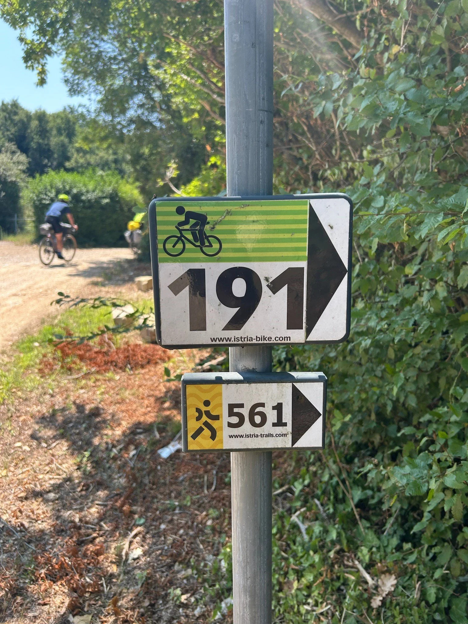
Great marking before the official start of the Parenzana
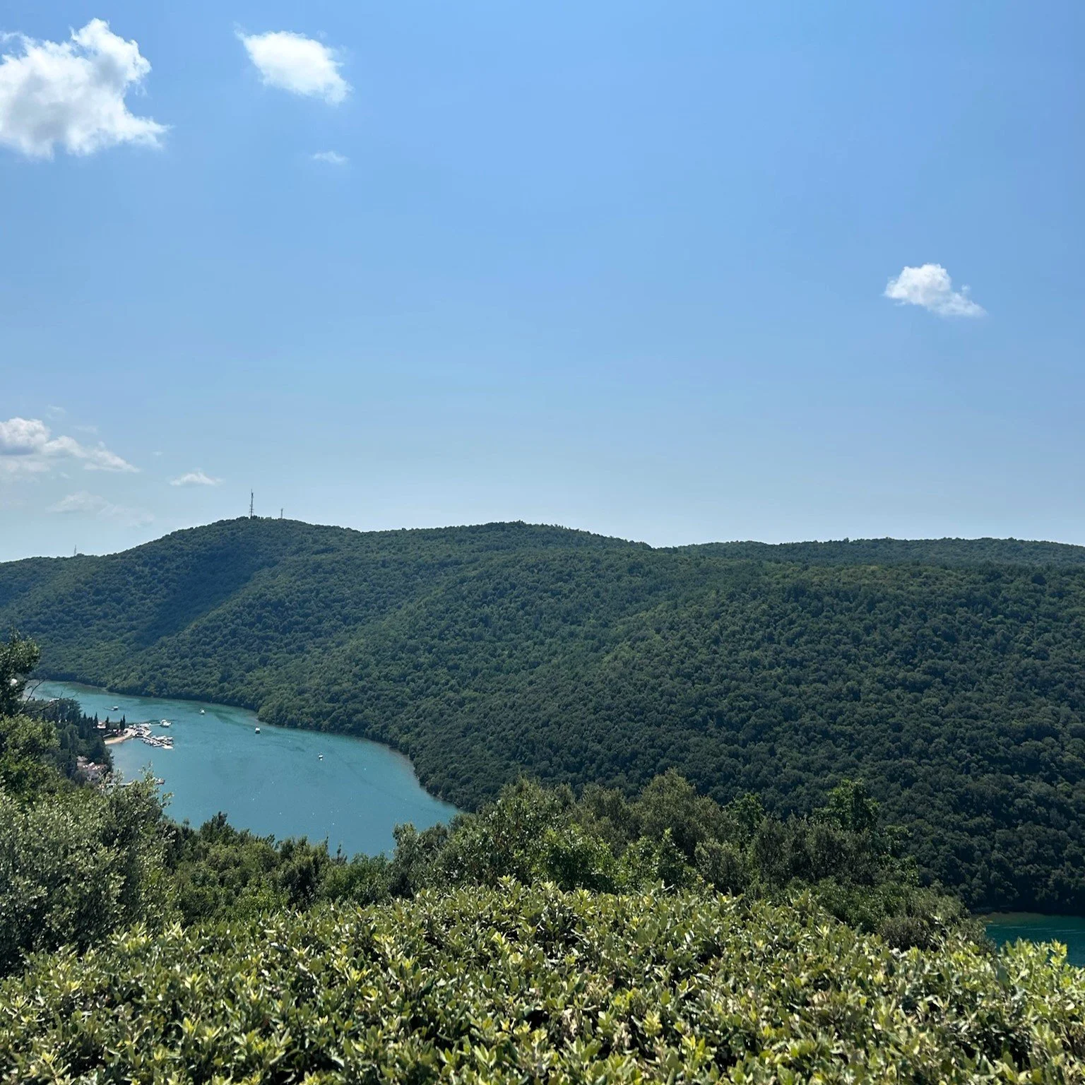
Looking back down on Limski Canal
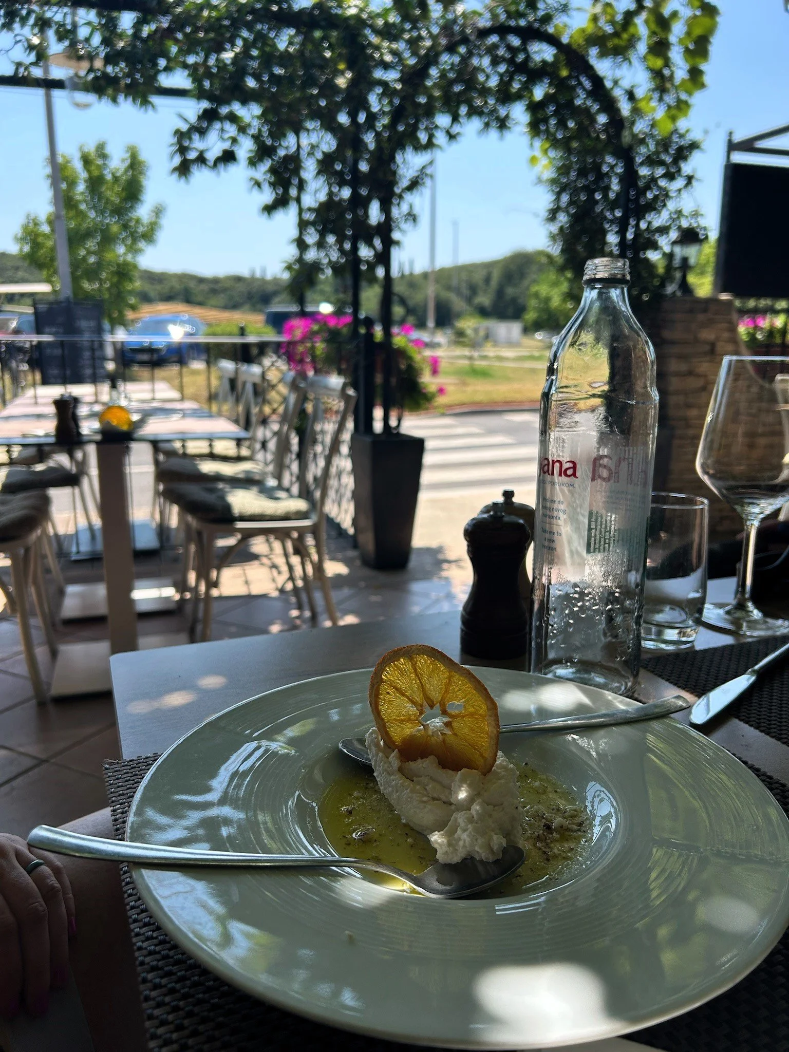
Lunch in Vrsar
City skyline of Porec
The Start of the Official Parenzana
Standing in front of the hill-top town of Motovun
Looking down from Motovun on the Croatian countryside
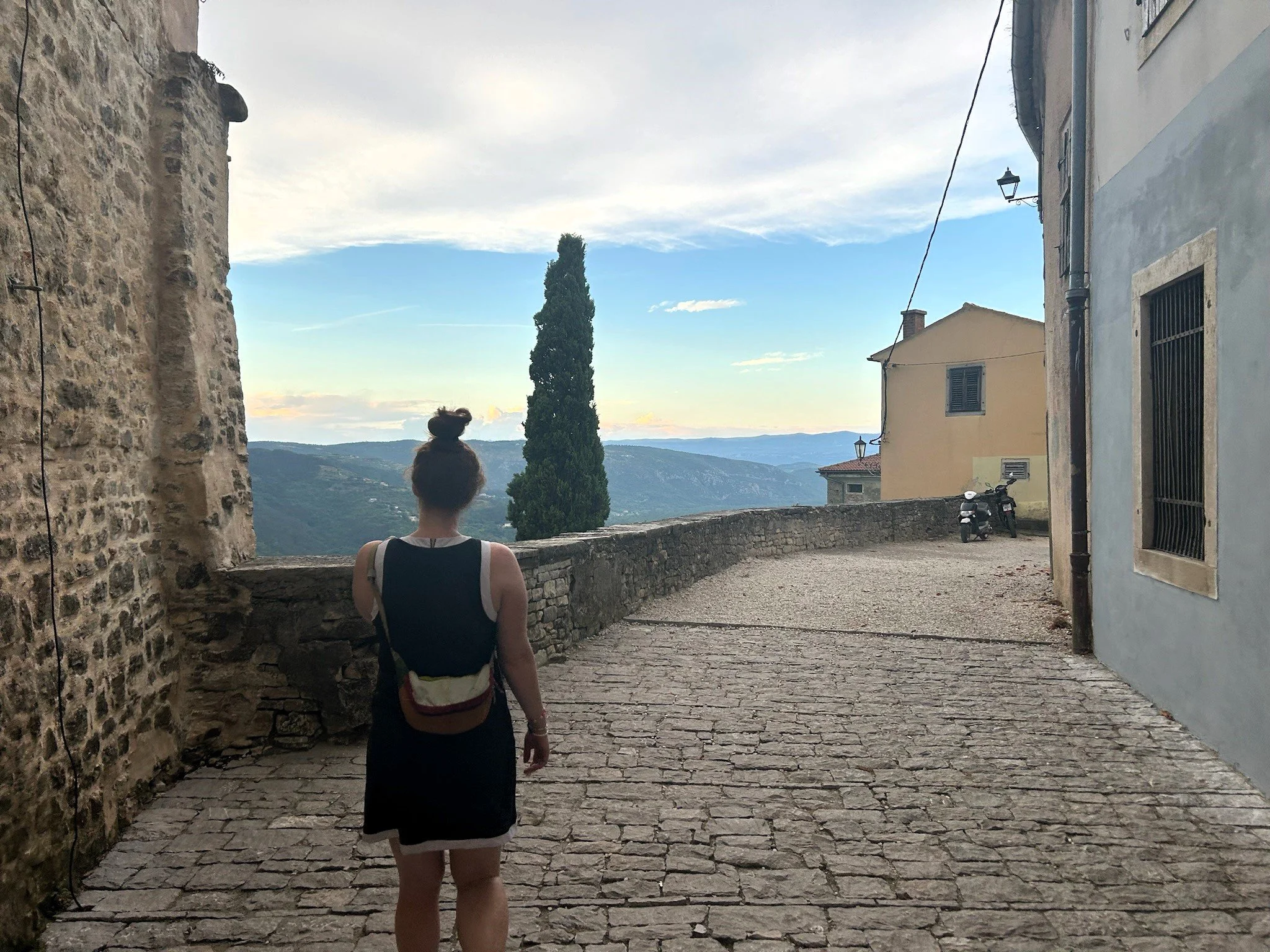
Quiet sidestreat of Motovun
Day 3: The Parenzana
Poreč, HR to Motovun, HR
jULY 22, 2024
22.16 Miles
1427’ Ele Gain
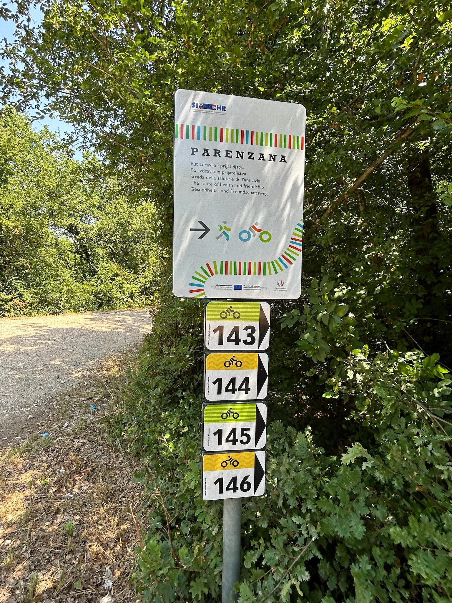
Today, we were on the great Parenzana railroad grade. I am a little ashamed to admit that, despite all the planning I put into this trip, I had no idea this was coming. Evidently, this trail is pretty well known as a fantastic stretch of gravel following an old railroad grade built in 1902. The trains stopped 33 years later but after 2000, the grade was preserved and made into a bike path that runs 123 kilometers from Poreč, Croatia to Trieste, Italy at no more than a 4% grade almost the entire way. Today was our first day on it.
On our way to Poreč the day before, Amanda and I had stopped at the Poreč Dive Center to see if it was possible to get a little diving in. Croatia is the only place we have seen a sea horse so we were hopeful that maybe we could get another chance to see one and had organized a 9 am dive with the shop, so this morning we were up around 7:30, packed an hour later and at the dive shop at 8:40. As is typical with dive shops, no one was there early so we backtracked to the nearest open cafe and got some coffee and light breakfast. It was actually a hotel cafeteria but they were nice enough to let us buy some breakfast. The olive oil here is sooooo good. I forgot about this but when Amanda and I lived in Germany from 2020 - 2022, we noticed there was something differential about the olive oil around the mediterranean and we noticed it once again now that we are back.
We returned to the dive shop at 9 am and suited up. The divemaster had indicated that we could go alone since we were now Rescue Divers and had over a hundred dives each so, after the orientation, we made our way down to the beach and got going. The dive site was the little bay in front of Bellevue Beach and Amanda and I made a slow circuit around its rocky and sandy bottom for about an hour without any seahorse sightings. After we came up, Amanda enthusiastically shared her disdain for how long we had spent in sandier, more boring spots of the bay while skipping over seemingly far more exciting rocky sections. I took this feedback with poise and grace before we met back up with Kelly and Jesse for breakfast at the same place we had gotten dinner the night before, north of Poreč.
After breakfast/lunch, we stopped at what we thought was a bike store to pick up a new tube to replace the one Kelly had popped the day earlier and I purchased 2 CO2 cartridges for quick refill if we needed it. Turns out this wasn’t just a bike shop but a terminus station for the Parenzana trail and they had lots of information for us. They were also strangely enamoured with Kelly’s Checkpoint. Not sure why, but Treks are a bit of a novelty here. After picking up our things and way more information on the trail than I had previously had, we set off again. We played in traffic for about 5 minutes before a final turn took us down a quiet street and we saw the signs for the Parenzana.
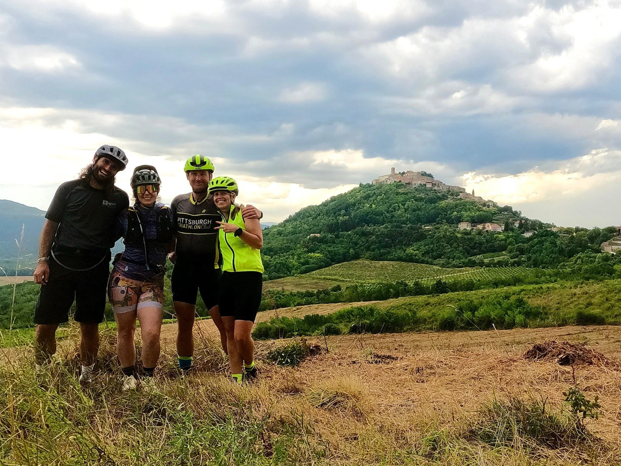
The stage today leaves Poreč heading north, briefly following the coast before cutting northeast into the interior of the Istrian peninsula. It passes through some small outcroppings of Poreč, notably Stancija Vergotin, Gulci and Vranici and crosses over several large roads including the D75 and 5042. Through all of this, the stage makes a slow and steady climb of about 1000 feet to its highpoint at Vrh Lašići where it flattens for 2 miles before committing to 6 miles of glorious descent, which delivers thrilled bikers to the base of Motovun. Motovun itself presents an incredibly stout climb, ~500 feet in 1.3 miles up to the epic city on top of a hill that looks like it should be a backdrop on the Game of Thrones set.
Leaving Stancija Vergotin, Gulci and Vranici behind we headed into the interior of the Istrian peninsula. A short time later we stopped and I let some air out both Amanda and my tires. Running at 70 PSI on this gravel was not going to be fun and we both noticed a difference right away. The road on the ascent was, I'm guessing, a little chunkier than a regular gravel rider would like but really not that bad. We averaged about 7.6 mph going up in the 93 degree heat. The ascent passed by pretty uneventfully. THere were a few major road crossings - not quite highways but still a little hairy. It would be amazing to add some small access tunnels under or bridges over these crossings but that’s just me getting picky. Overall, the Peranzana is superb - the grade never reaches much above 3% and while there are chunkier stretches it is predominantly excellent quality gravel. In the middle third of the day, the path winds through pristine olive groves and vineyards planted in rich, red soil. Overall it is a perfect track for bikepacking.
3 hours of relaxed riding brought us to the top of our day at Vrh Lašići where we were treated to an amazing view of far off Motovun, standing in high relief at the top of a lone hill. We rejoiced in the long downhill that awaited us but also expressed some worry about the very dark rainclouds on the horizon and thunder in the distance. So, after snapping a few pictures with Motovun in the background, we got back in the saddle and commenced our downhill ride of the day.
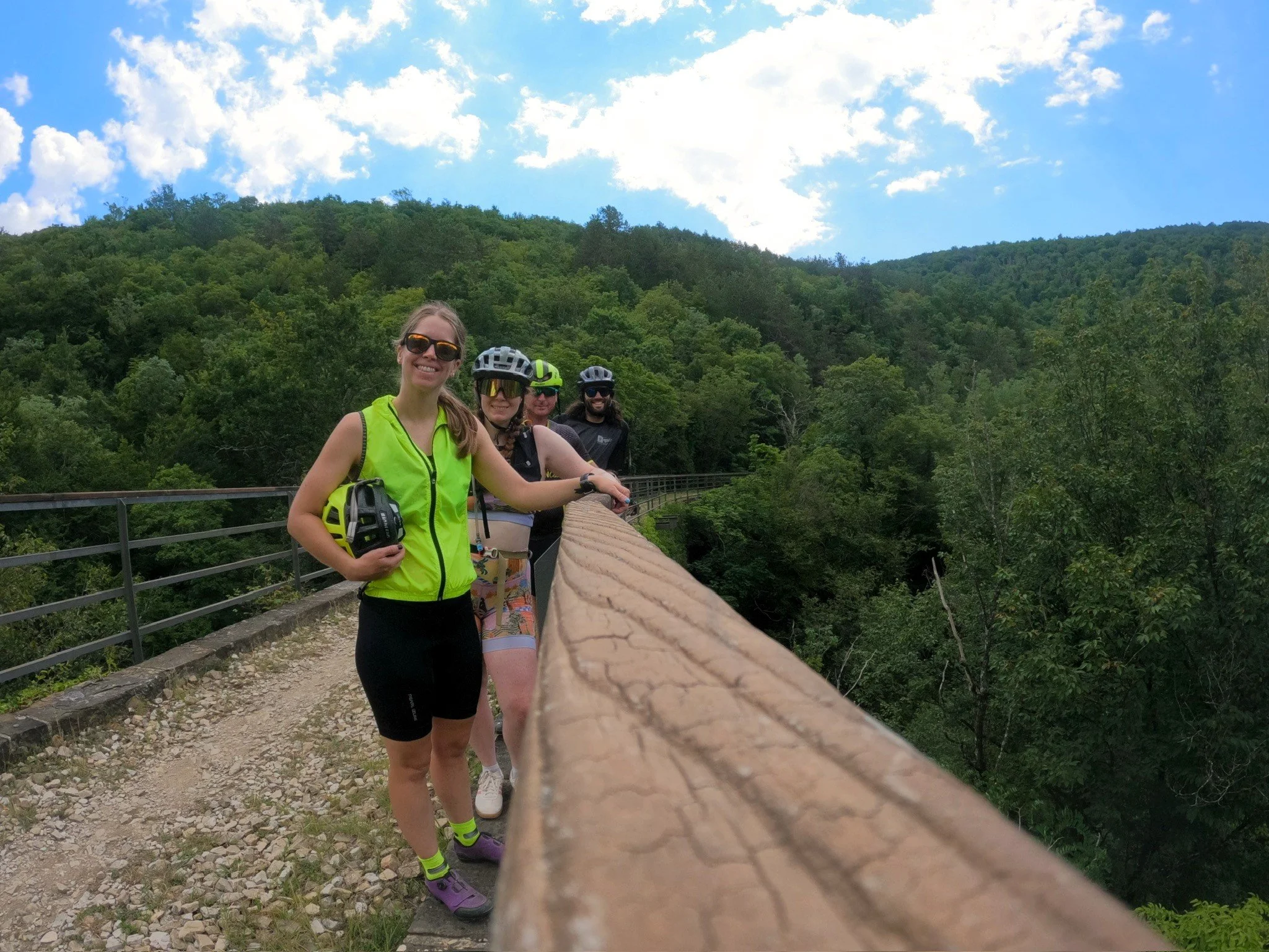
The descent on this stage is, in short, amazing. The quality of gravel is slightly better and the path is nice and wide, allowing a rider to “hammer,” to use one of Kelly’s words, all 6 miles straight down to the bottom of Motovun. Along the way there are two gorgeous bridge crossings. The front coming in also cooled the air a bit as we descended making for an overall, superb ride down. Surprisingly, no one fell and no one got a flat despite some chunkier sections. We stopped at both bridges for some pictures as well as a few vistas looking at Motovune.
We reached the bottom, passing by several wineries, and got another great view of Motovun hill. Then it was time for the hill climb. Jesse and Kelly had been looking forward to what appeared to be, based on the maps, an epic climb up to the town on top. As we started up, I realized that I had accidently routed up the pedestrian trail to the top which, indeed, would have been stout. Instead, the road up offered some nice large switchbacks that stretched the climb out a bit. We raced up to the top, Kelly getting there first and eventually had to transition to walking our bikes on the slick cobblestones. Once on top we congratulated each other for a tough climb that was a perfect end to the day and Jesse went to get a key to stow our bikes.
After getting settled and taking showers, we walked down to the Bistro Bar Montona Gallery for dinner. I discovered my new favorite spritz - Limoncello Spritz - which was incredible and then we had some delicious Istrian food… as well as 2 bottles of wine and 2 shots of limoncello each. Suffice to say, we were pretty tuned up at the end of it all. Afterwards, we got another bottle of wine and headed to the hotel’s pool where we covertly finished it off and cooled down a bit. We popped back up to the hotel restaurant for dessert and then, all feeling a little overindulged, we headed to bed looking forward to another great stage tomorrow.
Day 4: 7 Bridges Road
Motovun, HR to Grožnjan, HR
jULY 23, 2024
22.16 Miles
1427’ Ele Gain
One of my favorite, all-time songs is 7-Bridges Road by the Eagles and, although that song is supposedly about a nondescript road in Alabama, I would like to think it applies here as well because, damn - this is a gorgeous stretch, with plenty of gorgeous bridges.
We overindulged last night - no need to sugar coat it but, given that, everyone was in decently good form this morning. Good enough form to make it out of the hotel by about 10:30, the designated check-out time but it was probably a good thing that this stage was the shortest one because I think we were all just a bit below optimum today.
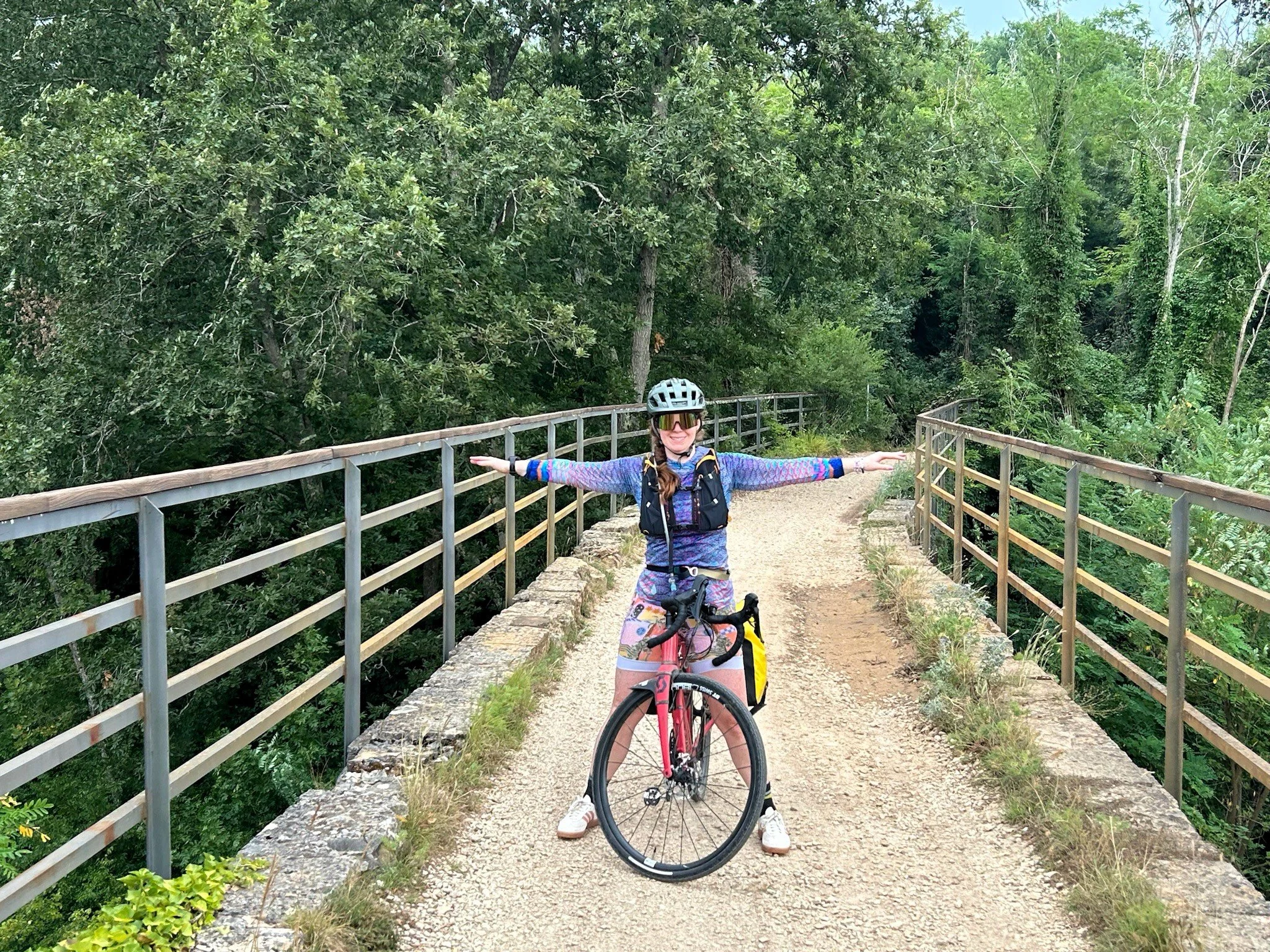
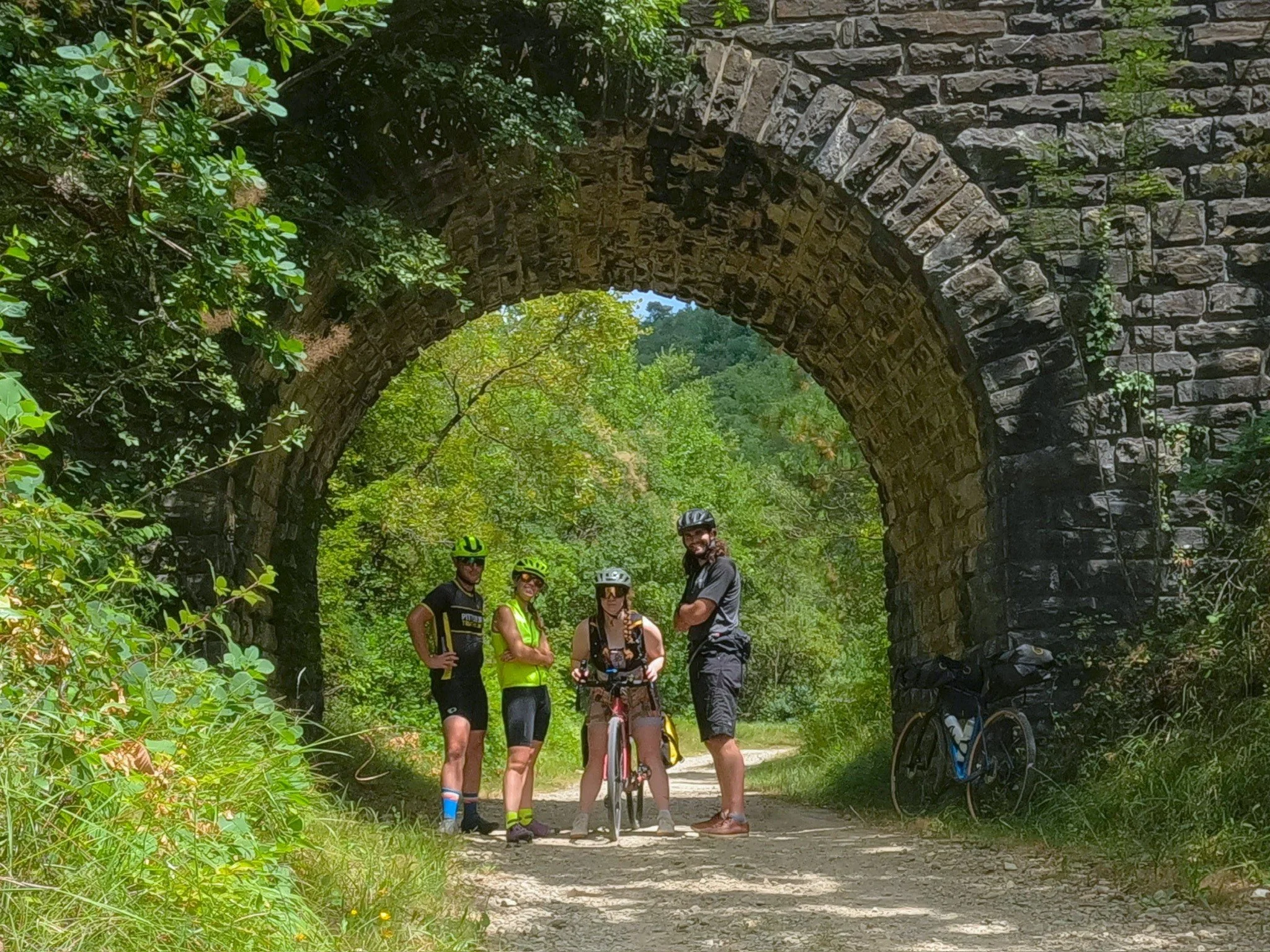
This, the 4th stage of our trek from Pula to Trieste, starts on the high ramparts of Motovun and descends in spectacular fashion 900 feet to the Mirna river where it flattens out and proceeds on to Livade, Croatia on road. In Livade, the path turns back to gravel and begins a climb that sustains through the rest of the day, 900 feet over 12.4 miles at ~1.4% grade, eventually reaching the heights of Groznjan, Croatia in a much more gradual and controlled fashion. Along the way there is a beautiful series of viaduct style bridges, stone arches and old tunnels.
I was up around 7:30, feeling better than I thought I would given everything that went on last night. Amanda was going to sleep another hour so I got up and headed down to the breakfast area hoping to score some early coffee. I was told, as I left, in a brutally honest critique that my breath was terrible so brushed my teeth before heading out. In the breakfast area I updated yesterday’s stage and looked at today. Eventually Kelly and Jesse came down and partook in the decent continental style breakfast followed by Amanda about 15 minutes later. Everyone was doing moderately well but we all agreed we were going to pump the brakes a bit today when we got to Groznjan. At around 9:45 we went back to our rooms to get our things together. By now, I've got a pretty good process going and know where everything needs to be. I can pack up in about 15 minutes - nbd.
At 10:30, we met back in the lobby and checked out. Jesse got the key for the bike storage and we unlocked out 4 trusty rides before getting them loaded up in front of the hotel. Some road racers were already coming up the imposing ascent as we prepped our things. At 10:45, we started our Strava’s and started our drop to the Mirna river. The cobbles were interesting with about 35 extra pounds in the back but I thought I made good time down the grade… until I looked at Strava and saw someone had cut 5 minutes out of my time. Not gunna lie, i can usually reason out how someone was able to take off 5-10 seconds from my descent time mountain biking but i have no idea how someone took 5 minutes off, it must have been suicidal. In any case, we all made our own way and our own times down to the parking lot and regrouped at the car park at the base of Motovun and then dropped further to the tunnel. At the tunnel we, again, went through - some of the light strands illuminating and others staying dark.
After the tunnel we continued to descend to the Mirna river. Just before we crossed I helped an elderly German woman find her way to Karobja. Gotta say, I still got that German in me 😂. We crossed the Mirna and made our way along the road for a bit before turning back to gravel and beginning that good, good ascent. Again, love any trail built off a railroad grade because it never goes much above 4% grade. We climbed out of the Mirna river valley, steadily making progress up and up. The midday passed without much of an event. We went near a few towns and eventually came to a series of beautiful bridges where we stopped to take some pictures. Amanda’s brake levers are too far out and we need to adjust them tomorrow. Her hands are falling asleep as she bikes. Jesse had the perfect descriptions for the road today - “Chunky Peanut Butter.” There were sections that were smooth as glass broken up by very chunky spots that slowed us considerably.
At about 15 miles in we came to a view of Groznjan and stopped for a picture at an elevated platform. The remaining 2 miles were GLORIOUS roads at a fairly even grade which we were able to cruise our way into Groznjan on. We arrived just before 2 pm just as check-in for the hotel Jesse had booked opened. After stowing our bikes we showered and indulged in some great Istrian food before taking a mid-afternoon downtime. I took this time to write down some notes from the day. Later in the afternoon, we wandered the beautiful streets of this hilltop town, took many, many pictures and got dinner at an extremely sub-par italian place with a “Happy, German Bagpipe band” playing in the background - that’s a misnomer if I've ever heard one. We then walked back to the hotel and sat on the high tops of the city walls watching the sun set and taking it in. After all, still trying to recover from our night of rivalry the evening before, we got to sleep pretty early.
Today I packed some excellent gravel riding into a little, 17-mile package. I was confused about the short stage but it’s a nice break in the middle of our 6 day venture to Trieste. Looking forward to tomorrow's bomb back down to the ocean.
Looking out over the Istrian Countryside
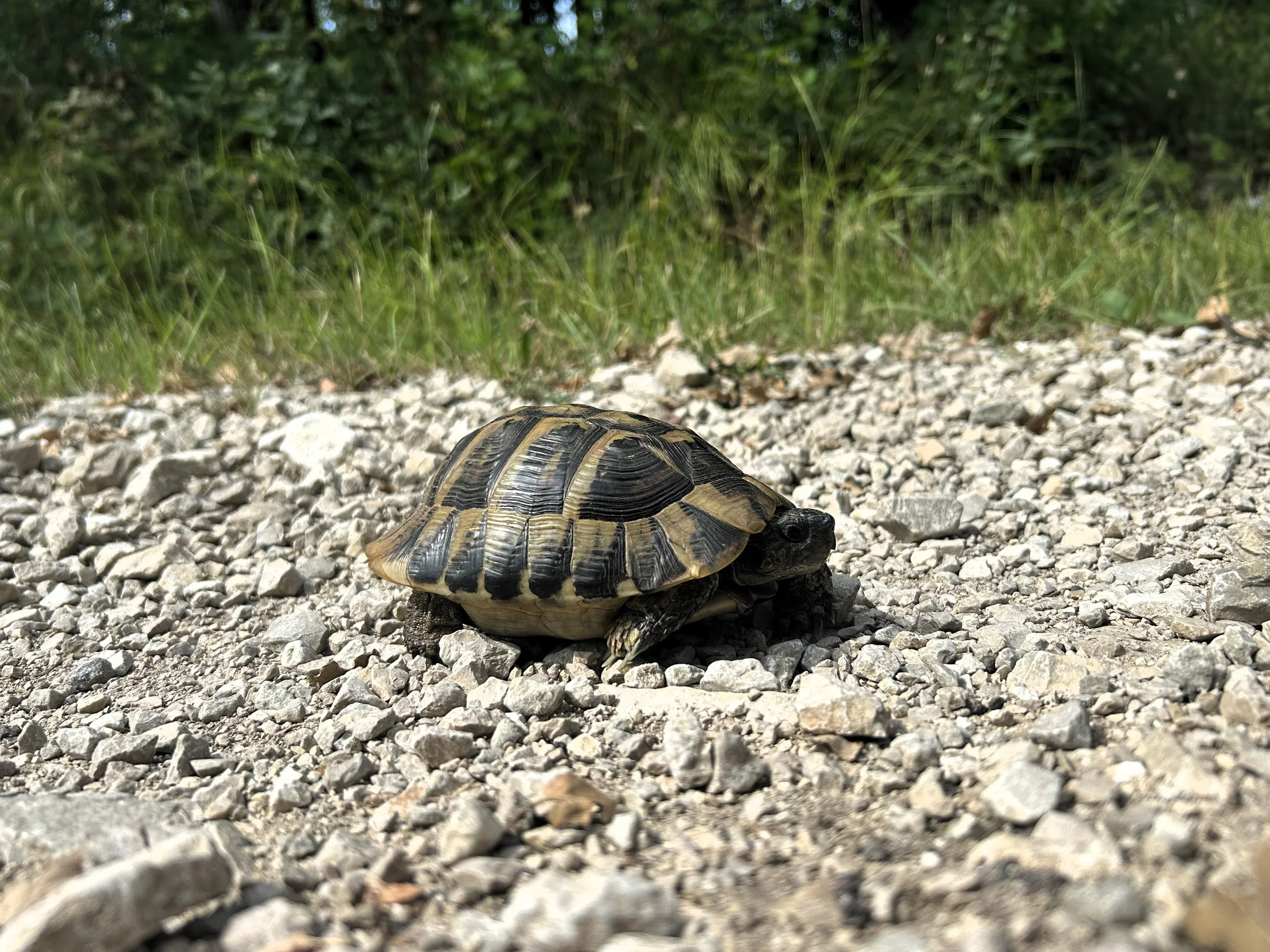
Lil’ Turt to start out the morning
Overlooking Canal Piketo
Overlooking Piran
Day 5: Birthday Coasting
Grožnjan, HR to Piran, SI
jULY 24, 2024
21.87 Miles
1427’ Ele Gain
This morning we were all just a little bit more put together than the previous day - probably due to lots of good sleep and less iundulging the night before. Oh, that and it was AMANDA’s BIRTHDAY! We were up around nine and down for breakfast where we had had lunch the day before. Definitely weren’t going back to the place we had dinner. We ate fruit and eggs while looking out on the beautiful rolling hills of northern Croatia. I’m still struck by how beautiful this area is. It’s not the epic starkness of the Sierra or the dramatic relief of the Dolomites but it has a certain character which i never get tired of looking off into. From Groznjan, you can see off west all the way to the coast which we were descending to today. At some point in the course of breakfast Jesse said something like, “can you imagine looking down from this area a thousand years ago and just seeing an armada of ships out there?” Which was a nice, historically terrifying thought to round out of breakfast.
After we had eaten and paid we made our way back to our rooms, packed and then navigated the winding streets to where our bikes had been stowed. Once we had them, we returned to the lobby and checked out before prepping our things for the day. Amanda’s brakes have been bothering her so i took the opportunity to adjust them backwards so she can reach them easier before we started - pretty easy to do with the GRX groupset, but it only provides about 5 options so i just went with the shortest reach one.
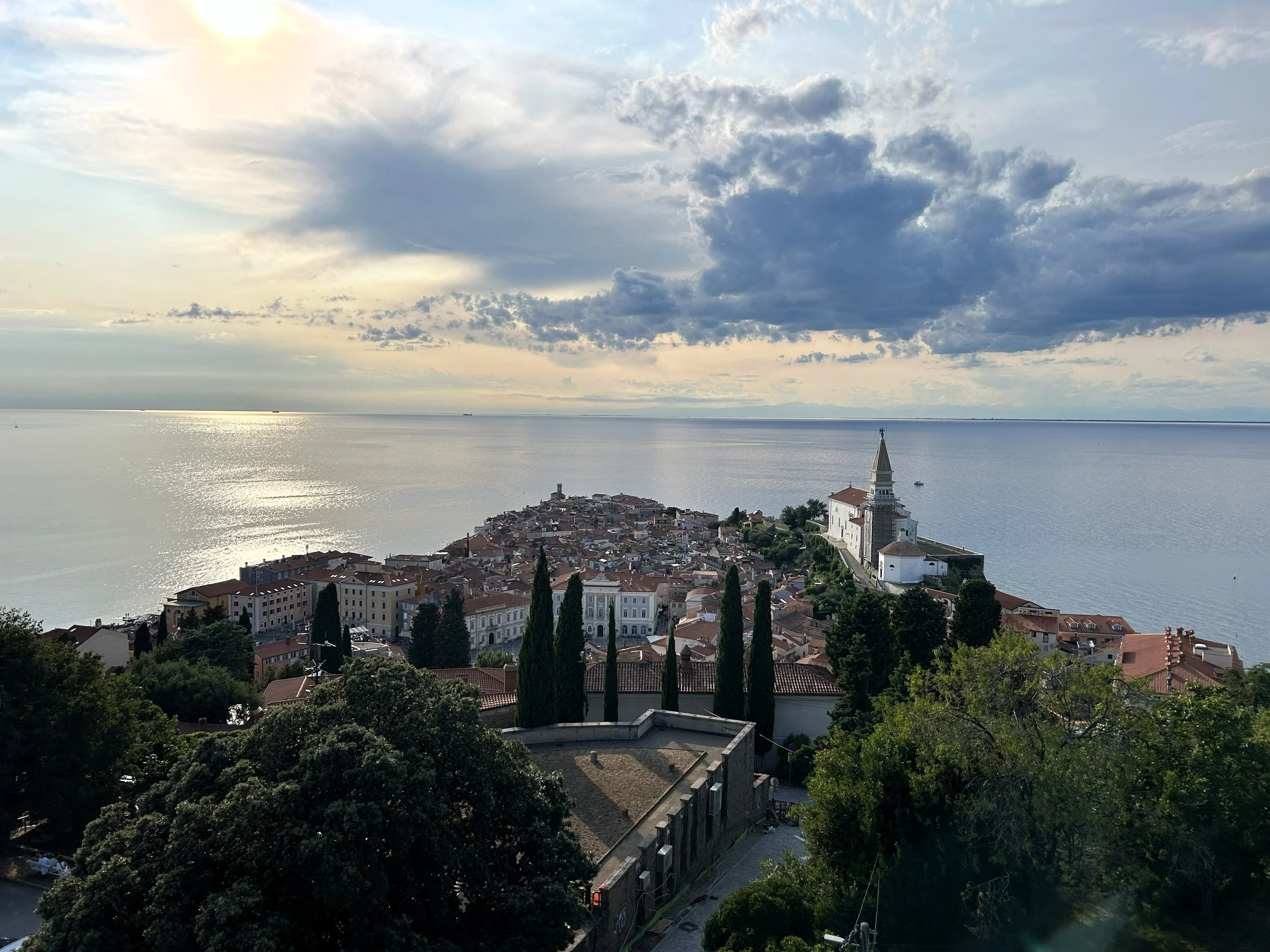
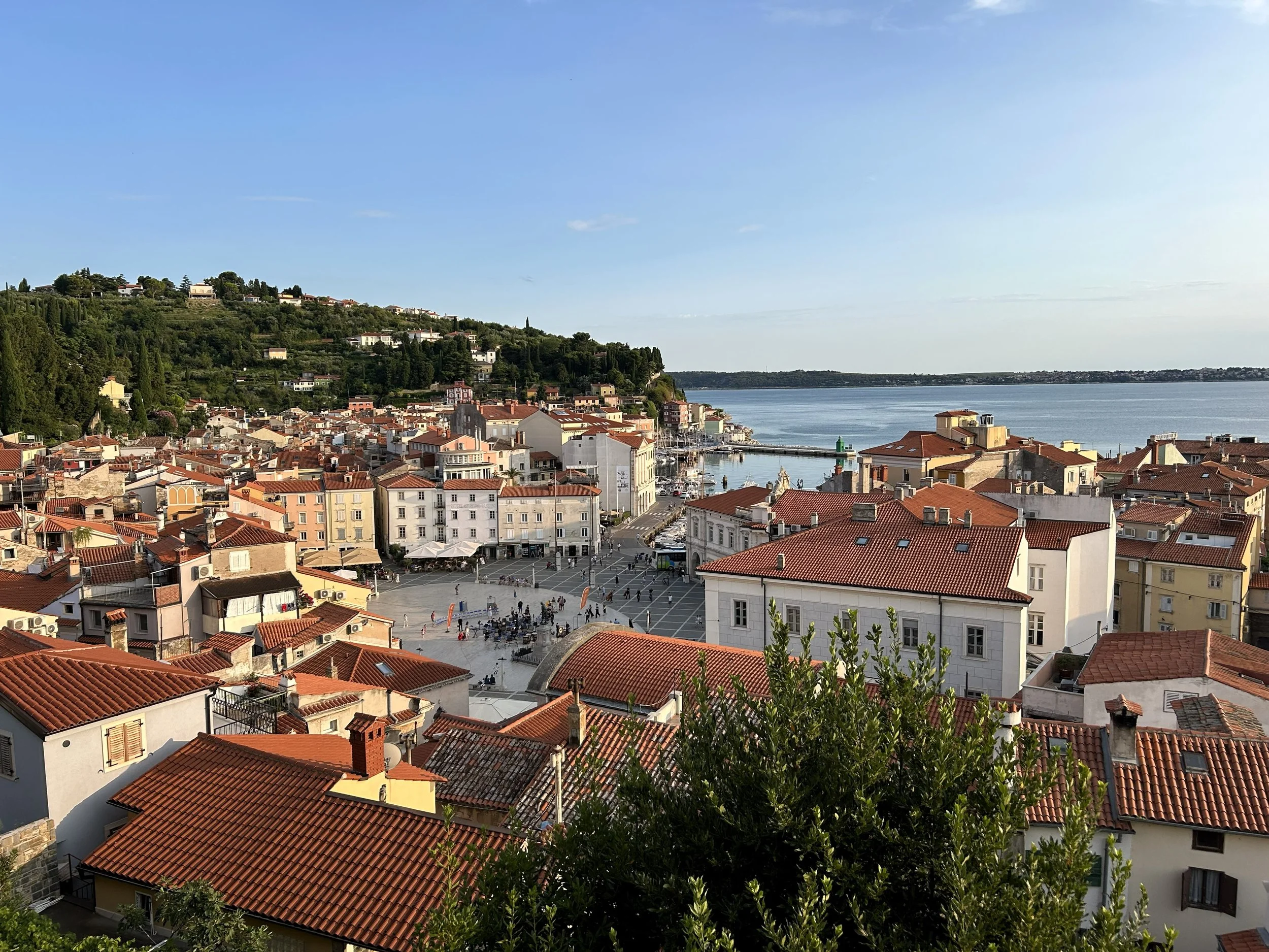
The route today starts at the highpoint of the Parenzana trail at Groznjan and drops all the way back to the Mediterranian. It begins by backtracking to the ridge from which Groznjan sticks out a bit before beginning it’s traverse back north and west along it’s back side. For the first 4 miles the trail descends fairly linearly, which is characteristic of a railroad grade, serpentining around many of the hilltop villages until it reaches Buje, where it enters and quickly exits again. Afte Buje, the trail continues it’s linear descent down and down for another 4 miles, passing through Volpija and Kaldanija before crossing under the E751/A9 highway. After the highway, the Parenzana parallels closely Savudrijska road from east to west down the southern side of the Rujevac ridge which rises steeply from the mediteranean until it turns sharply north and then back east to run down it’s northern side all the way to the Slovenian border. At the border, gravel turns to tarmac and the route follows the coast all the way to the gorgeous seaside town of Piran where it ends for the day.
We were on the road just after 10, making our way quickly downhill towards the coast. Amanda’s brakes seemed to be giving her less trouble which was good news. We turned breifly back towards Groznjan and were treated to an amazing vew of the ridge-top town quickly dissapearing into the distance. About two miles down the road i saw a strange shape making it’s way slowely across the road and stopped to investigate. It was a Herrman’s tortoise that immediatly went into its shell on our arrival. We snapped some pictures, which - fun fact - allows your ios device to identify an animal now and continued on.
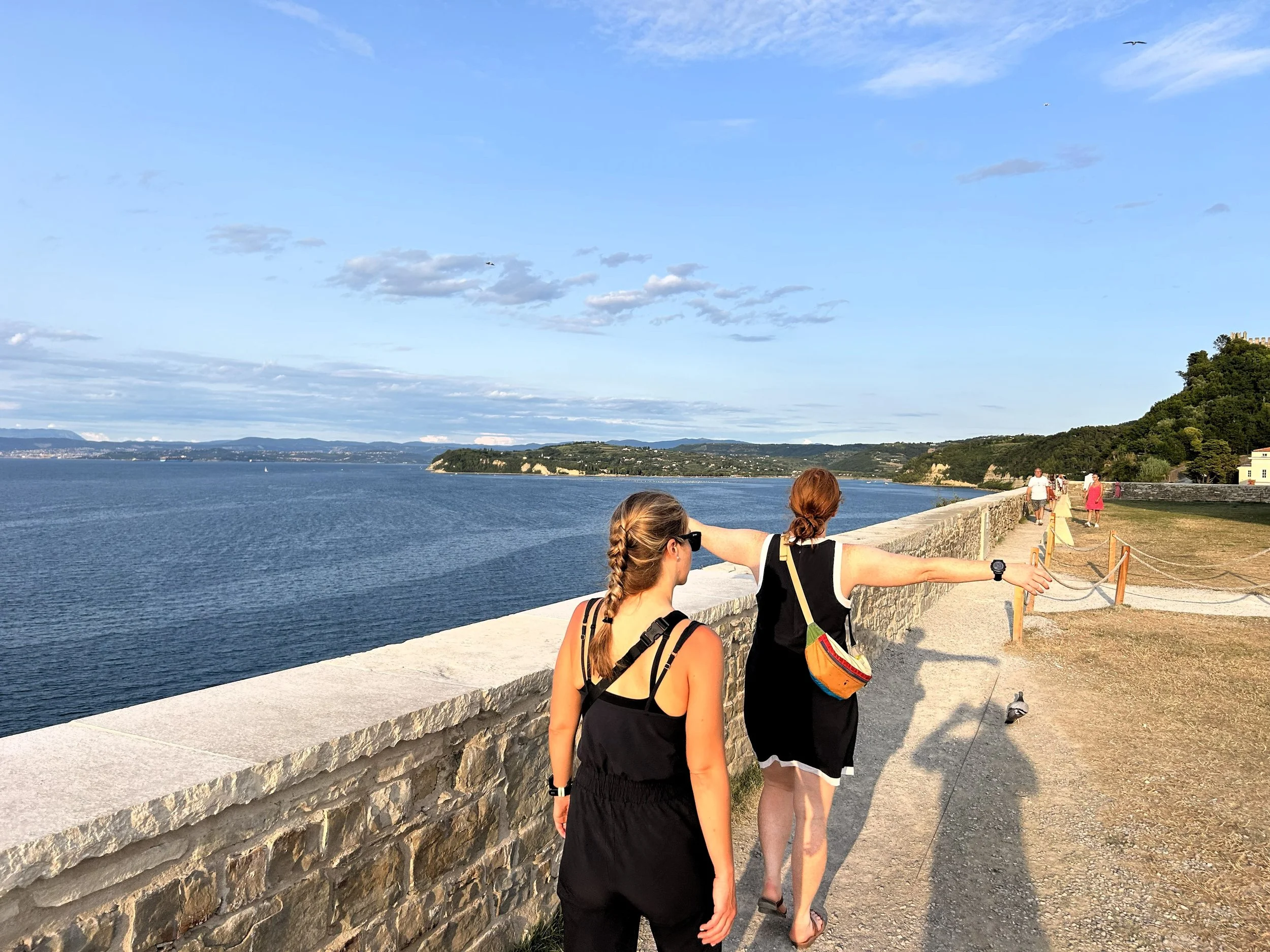
The day was fairly uneventful. The grade was almost entirely downhill and we cruised along at just under 10 mph. More and more the Parenzana drifted through small towns and we found ourselves on semi-busy roads but, just as fast as the road had come, it would dissapear again back onto blissful gravel. At Markovac, we got on a long descent where the Parenzana was built in one incredibly long switchback to gain the hills from the sea at the Slovenian border. The gravel here was perfect and we flew down, avoiding one group of cyclists which had decided to monopolize the entire path to swap out their slicks for gravel tires. Shortly after, we stopped at an overlook while the girls caught up and took some pictures looking out over the perfect blue water of the mediteranian.
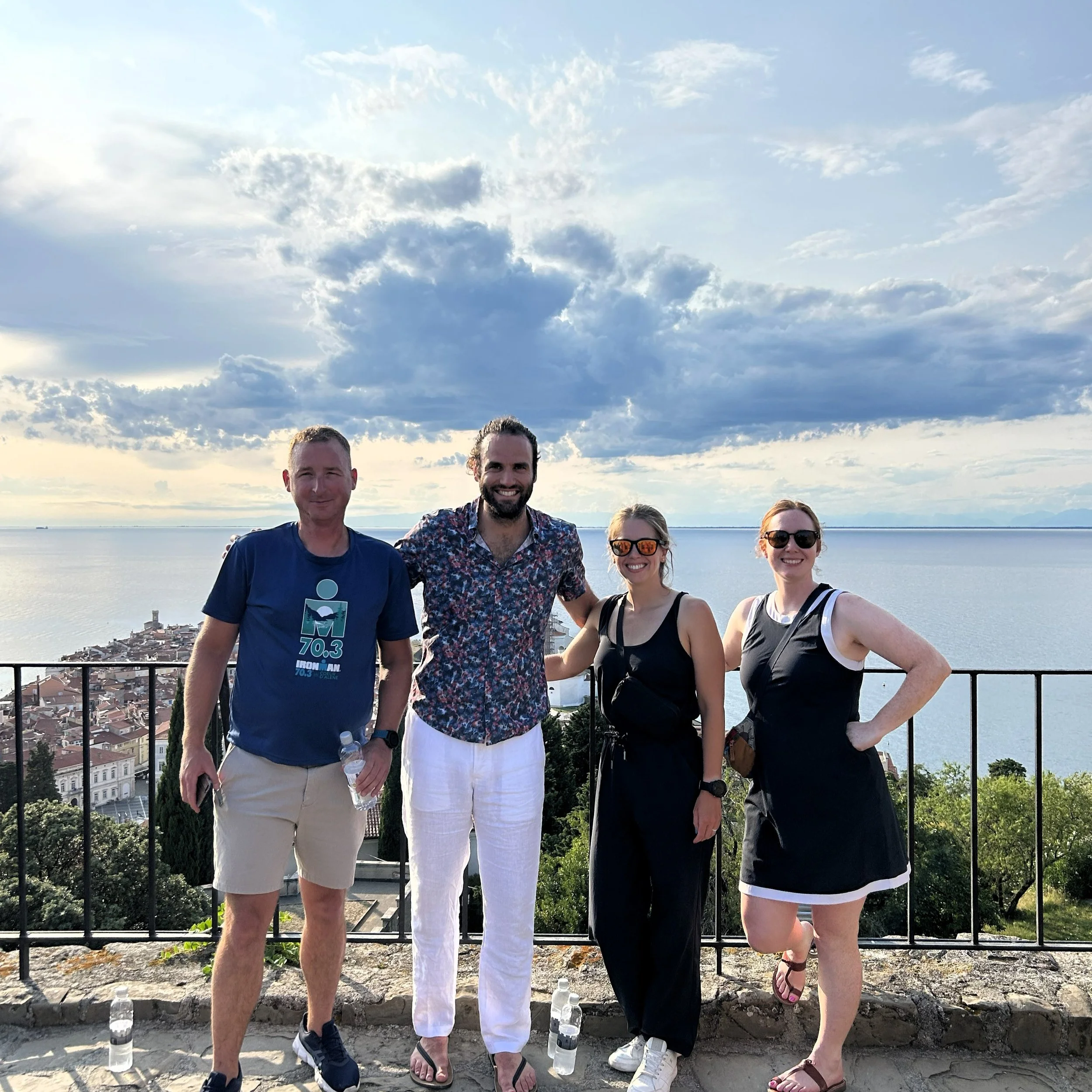
From the lookout it was a short descent to the Slovenian border, where we passed through uneventfully. From here, the path turns almost entirely to tarmac and we proceeded along, hugging the coastline. We passed through the busy coastal towns of Portoroz, Bernardinska reber and Frnaza, eventually rounding the peninsula and traveling north until we reached the gleaming city of Piran. In Piran, i had coordinated an AirBnB with an overly communicative host who asked to meet us in Square 1, on the southern half of the old city. We arrived just before 1 pm and a tall elderly man came out to meet us. He walked us a short distance to the AirBnB, chattering on about the city and the apartment. Inside he gave us some pointers about the place - really way more than we needed, at the end of the day, it’s an apartment they all work more or less the same before finally leaving us alone. He did leave us with one critique before he left - “One day in Piran? Not enough. Whoever plan this trip did bad job,” which had Jesse, Kelly and Amanda rolling as he departed.
After we had settled, we found a vegan restaraunt down the road and stopped in for a post-ride meal. THat was the plan at least… it took 90 minutes to get our food and all the meals came out seperatly so we got to watch everyone eat their own food. We went through all of the phases of grief in that restaraunt - disbelief, anger, rage, mourning and, towards the end, there was nothing left to do but laugh about it. Finally, we were able to extract the bill and were comped free ice cream on the way out. After we extricated ourselves from the situation, we wandered out to the rocky beach and swam in the mediterannian for an hour, cooling off after the day’s hot ride.
We returned from the beach, still laughing about the ridiculous restaraunt experience we had endured that afternon. Back at the apartment we shwoered off and then went back out to see the beautiful walls of Piran which rose high above the old city. From the top ramparts of these beautiful old walls, we got an amazing view out to the sea over Piran, which is just one of the many incredibly picturesque towns visited on the Parenzana.
Later that evening we found a different place to celebrate the birthday girl, which sported some much quicker service and incredible homemade pasta. We ate, drank and talked until the restaraunt closed down and then returned to the apartment where we passed out. The next day we had to catch a train in Trieste, 32 miles awaym, at noon so it was going to require a very early start.
Day 6: Italy Sprint
Piran, SI to Trieste, it
jULY 25, 2024
34.65 Miles
2195’ Ele Gain
Today was an early start. When I had planned this trip, my origional idea was to get to Trieste at a nice, leisurly pace and enjoy the city in the evening but the trains made that a complciated prospect. We had a OEBB Nightjet scheduled for the following day in the evening from Vienna and there was only one train, a Eurocity long route, from Trieste to Vienna that arrived with only about 30 minutes to spare before that Nightjet. Prior to this trip and during the planning phase, i was optimistic about connections, but even then, 30 minutes was risking it on a 9 hour commute. Instead i decided that we would get to Vienna a day ahead, enjoy the city and leave later that evening. In order to catch the Trieste to Vienna connection, we had to be in Trieste by 11 and estimating a conservative 8 mph, we needed about 4 hrs to do that which meant leaving before 7 am.
The final stage starts with a brutal climb out of Piran, well over 10% in some sections but it is only about half a mile climbing x number of feet in y number of miles. At the top, the path drops on switchbacked roads all the way down to the
We rose early and had some breakfast with ingrediants we had purchased the day before. I myself went for some burrata salad. The tomatoes in Europe are incredible, just way more flavorable than what we have in the states and so I eat a whole lotta them while on this side of the Atlantic. After breakfast we unlocked our bikes and got underway. The sun was just getting bright outside and the ride along the Medeteranian was gorgeous as we made our way east and north from Piran. A short distance on we came to our first climb, which was a brutal one. I don’t know how bad but my watch flashed a “Cat. 4 Climb” warning up as we appraoched. If i knew a bit more about cycling that might have meant something to me but, as it was, the climb took me a bit by surprise. I’m guessing there is a better exit to Piran, but the way i routed to us directly over the ridge on the east side of Piran so we had to climb hard for about 15 minutes. It was rough enough that we walked for a short distance before reaching the top. At the top, we took a break for everyone to catch their breath and then enjoyed a joyride of a descent down the Jagodje-Valeta road where we crossed and then cruised through several miles of beautiful vineyards and orchards.
About 4 miles in we bagan a short climb that reached a peak near the city of Jagodje before dropping down to the coast at the town of Izola. In Izola we wound through traffic on well defined bike lanes before we were dumped out on a gorgeous, wide, beachside strip dedicated to walking and biking. We stayed on this for 3 miles, winding around to Koper where we turned back into the city and several outskirt villages.
At around 15 miles in, we began the first of 3 defined climbs in the second half of the stage, each just a little higher than the last and each sporting 5-7% grades which I didn’t think was that bad until I got on it. THis new Suunto just churns out all sorts of fun information. We chugged up the first one without too much incident, pausing regularly to collect our group at key intersections and at the top, before cruising on down. As we descended that first intersection we quietly passed into our 3rd country along the path Italy and stopped to celebrate our first Italian duck siting!
Big thing that i noticed passing into Italy was that we spent a lot more time on roads. Kelly said this was great for the climbing but i wasn’t too big of a fan, honestly. It was loud and the italian drivers were crazy. We began our second climb of the day on a busy street in Stramare with minimal shoulder, which was more than a little sketchy with the big city buses rolling by. Eventually, we turning of the busy Via Flavia di Stramare and onto a much quieter Via di Stramare. I guess if you drop the Flavia part it gets a lot quieter. We continued to climb, at one point Amanda got stuck behind an ambulance executing a 20 point turn but we eventually topped out at ~540 feet surrounded by more olive groves and beautiful rolling hills all the way down to the ocean. I did, almost get run over by an italian grandma here driving like she was in an F1 race but other than that, the second climb was perfect. We cruised down to Bagnoli della Rosandra on quiet roads and began our 3rd climb.
The 3rd climb was a rough one. The biggest of 3 and on very poorly protected roads it did have a touch of Tour de France vibe to it as we chugged up the winding italian road through small, hillside villages. Every time i saw a big truck coming down or going up i worried about Amanda in front of me and Kelly and Jesse ahead of me. We all made it to the top though, despite one cement mixer truck who also thought he was racing in a F1 competition and from the summit near San Giuseppe della Chiusa we jumped off the road and road all the way into Trieste on gorgeous, paved railroad which was the most northern section of the Parenzana railroad. While regularly interrupted by small access roads, this path was beautiful and only moderately busy. At one point, we came upon a few baby goats in the path and stopped to snap a few pictures with them. We cruised downhill for 3.5 blissful miles before coming to the end of the Parenzana, thanking it for miles of great riding and begrudgingly re-entering Italian traffic.
THe last 4 miles we not nearly as fun as the descent. We fought through italian traffic in teh busy port city of Trieste, usually on bike paths but other times bery much in traffic as we navigated our way to the train station. We had hoped to have time to find a beachside shower system to rinse off and get a bite to eat at a sit-down restaurant and none of that happened as our speed tanked in traffic. We did make it to the trainstation area on time but, due to some over-optimisim on my part and our parties general apprehension around trains we were only able to make a quick stop at a grocery store and sit down for a few trainstaion beers at Trieste Centraal.
At 12:20 we lined up at the bike car and loaded our trusty steeds up. By a stroke of pure luck I had re-checked my reservation in Motovun and realized I had not gotten seating reservations on this train and was able to get a 4-pack at a table because, as we were loading about 20 italian boy scouts got on the train to go to Ljubliana and took up every free spot on that thing. As it was we were able to relax in our little 4-pack and play games all the way to Liebnetz and i say Liebnetz instead of Vienna because that is where the train came to a screeching halt before creeping into Liebnetz main station where it stayed, motionless for the next 5 hours. Due to “Emergency Rescue Operations” on the spur north of Liebnetz we did not get into Vienna until 2:30 the following morning. The rash of miserable public transit luck on this trip has been unparalleled by any other experience in my life, including the two years i lived in Germany and used it every day. So, while we did make it to our destination that night, it was very late and we were all more than a little disgruntled when we got there.
THe sixth stage is a beautiful one and anyone who enjoys climbing will likely love this section the most. It is almost entirely tarmac so the ride is smooth and if you are swapping between gravel and slicks, this one culd likely be done on slicks. The views from the top of the 3 climbed in the second half of the stage are staggering and worth getting some pictures of and all of the little hill villages are worth stopping at. It is a dramatic contrast to the middle segments of the Parenzana.

Looking out on the Med on our last day
Leaving Piran
Last train outta Italy
End Word
The Parenzana is a paragon of Adriatic riding, winding its way along pure blue coastline and into the heart of the Istrian peninsula along a 100 year-old railroad grade. The path is well kept and consists around 60% classic gravel, 30% dedicated bike path and 10% bike lanes. Along the way you will experience a diverse mix of italian, slovenian and croatian culture and cuisine and cross a number of iconic viaduct-style bridges. The path is acceptable for all ages and all skill levels and is less an adventure ride and more of a cultural immersion with truly epic views along the way. This one is not to be missed if you are looking for a warm and welcoming coastal ride.
Finally got that sweet sweet ice cream