
Annapurna Circuit, Nepal
Rarely do we lay our eyes upon something the mind cannot comprehend, but in Nepal, the shear geological scale will leave you in disbelief
Trekked September 2016

Looking north from our hostel - Avalon House KTM

ACAP Card Issued at the Tourist Service Center
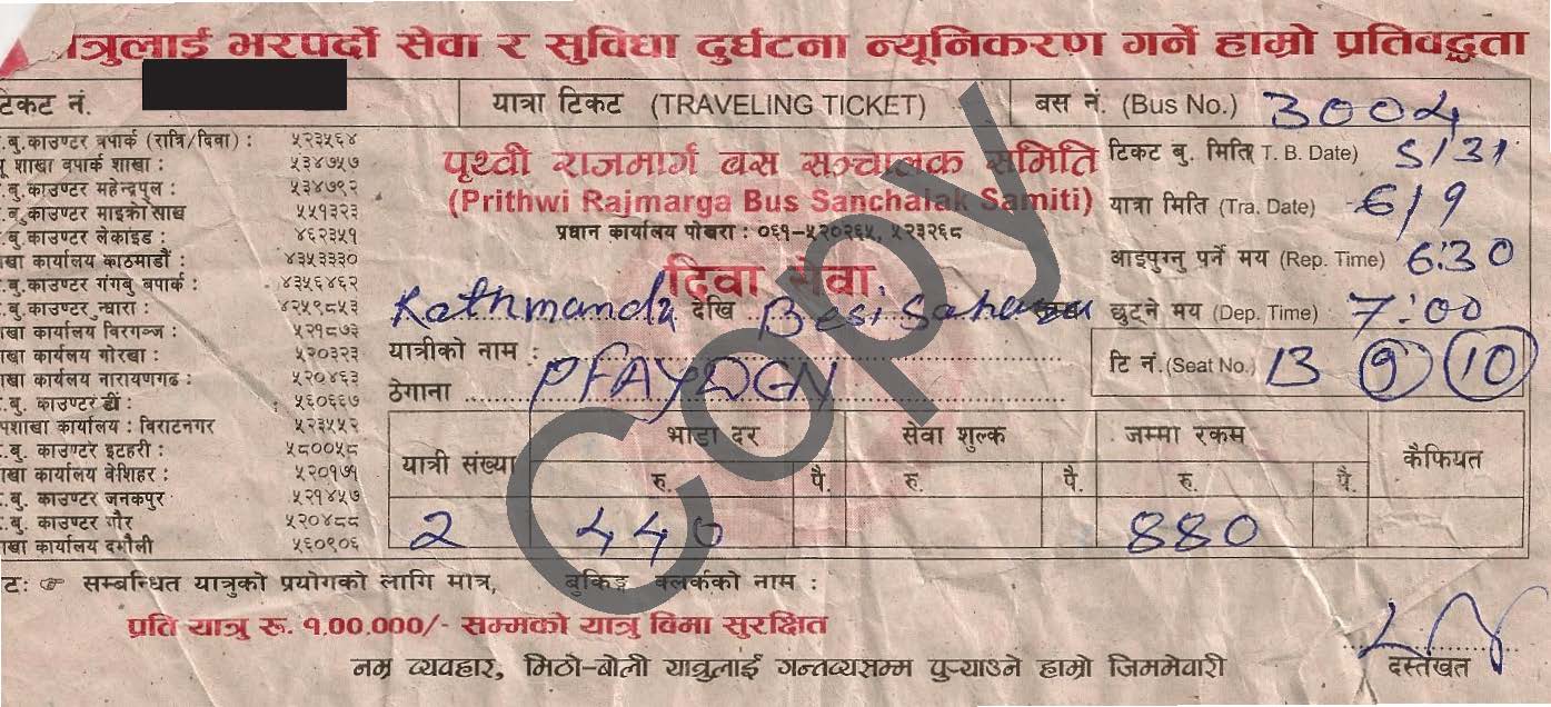
Bus Ticket Purchased at Gongabu Bus Station to Besi Sahar

Amanda in the street in the Thamal district
Day -1: Kathmandu (9/15/2016)
For most trekkers, the Annapurna Circuit will include at least one quality day in Kathmandu. If arriving by plane with prearranged sleeping arrangements, make sure to ask your hostel or hotel for a pick-up at the airport as this will be the most simple and financially savvy option. I would highly recommend not driving yourself - traffic laws are pretty much non-existent in Nepal. Regrettably, Kathmandu is not all it's made out to be by Hollywood. Due to industrial advancement, the city is perpetually blanketed by smog to a point that cloth masks are a ubiquitous sight. Spending more than a couple of days here is almost sure to result in a low grade respiratory infection. Health concerns aside, we found the city to be very safe and felt comfortable walking the city streets. There are several things that should be taken care of in the big city before heading for the trail - permits, cash, and your bus ticket.
A permit, called the ACAP Card, is required for trekking in the Annapurna Sanctuary. While this permit can theoretically be aquired in Besi Sahar, i would recommend picking one up in Kathmandu the day before heading to the trailhead. The headquarters in Kathmandu are much more equipped to issue your permit than at the trailhead where rolling blackouts can take down electronics for weeks at a time. Permits can be purchased at the Tourist Service Center in Bhrikuti Mandap which is in central Kathmandu for around Rs 2000 (~20 USD). If you are trekking without a guide, as we did, you will need to be registered in the Trekkers Information Management System (TIMS) as well. This, again, costs around 20 USD. Our hostel was in the northern Thamel district of the city where most of the popular tourist hostels are. The Tourist Service Center is around a 30 minute walk south and totally worth the walk, get there early to beat the crowds.
You should plan on not having access to reliable ATM's for the duration of your trek. While there are ATM's in Besi Sahar, they are not always open, accessible, or working. Your best bet is to get all the cash you think you will need in Kathmandu. Generally, the cost of accomodation is pretty static along the trail and is between Rs 200-600 (2 - 6 USD) per night. The cost of food, on the other hand, rises with the elevation. At Besi Sahar, the ubiquitous Dahl Baht will cost ~Rs 250 but will rise to ~Rs 1000 at the Thorung La High Camp. A good rule of thumb is that the price of food will increase Rs 1 for every 7 meters you go up. For this reason, Amanda and I took out about RS 32,000 (~300 USD) a piece. This amount will differ depending on where you decide to end your trek
No good trekking route is complete without some awful bus or plane ride to the trailhead and the Annapurna Circuit is no different. The classic trailhead for the Annapurna cicruit is located in Besisahar, Nepal. Whether you intend to start from Besisahar or hire a jeep to take you farther up the road (which is an option), you will need to take a bus to Besisahar from Katchmandu. The night before you intend to travel to Besisahar, visit the Gongabu Bus Station on the north side of Kathmandu just east of the Bishnumati River. Here you can pre-pay your bus-fare for the trip to Besisahar. When you approach the ticket office you will be accosted by 10+ Nepalese men who will ask you for your destination. While this can be a little intimidating we were able to communicate to them that we were on our way to Besisahar and they were very helpful in directing us to the correct ticket office (at the time it was stall 32).
Day 0: Kathmandu to Besi Sahar (9/16/2016)
Amanda and I planned to start the Annapurna Circuit in Besi Sahar, Nepal and hike the circuit counter-clockwise from there. Due to various hydroelectric projects and the increasing popularity of the trail itself, people can start anywhere between Besi Sahar and Manang - a distance of 60 miles, so do not be surprised along the way to encounter people that started ahead of you. According to our ticket the bus was scheduled to leave Kathmandu at 7:00 AM so we arrived 30 minutes early. The act of getting on the bus was an experience in itself. The Gongabu Bus Station is very cramped so your bus will likely be parked half a mile away on a side street, a distance that you will need to walk with your belongings, which shouldn't be an issue given that you will be doing that for over the next 100 miles. Once you are at the bus they will ask to put your backpack in a lower storage compartment. While we've never had issues with stolen amenities on bus rides in Nepal or South America, i would suggest that you watch them put your bags on the bus and that you carry all of your most critical belongings with you on a carry on and that you watch out the window on the many stops the bus will make out of the city. We were lucky enough that there was excess room in the back of the bus so our bags eventually ended up in the back seat where we could keep an eye on them.
According to most guidebooks the bus ride between Kathmandu and Besi Sahar takes ~6 hours and this is probably true once the bus is outside the city proper, but the 10 mile journey from the heart of Kathmandu to the outskirts will include at least 10 stops to pick up the bus driver's friends, aquaintences of people already on the bus, and just about any other person on the street that looks like they might be going "that way." In addition, vehicles and roads being what they are in Nepal there is no guarantee you will not be stopped by some other impedence on the way. All in all, we would recommend allocating 8 hours for the bus ride. Count it all toward the adventure and a chance to get to know those around you. On our trip to Besi Sahar we sat next to a Russian climber looking to summit Kang Guru and another trekker named Peter from the Czeck Republic attempting the circuit.
Assuming the bus leaves around 7 am and the trip takes all 8 hours you will arrive in Besi Sahar at around 3 o'clock in the afternoon. If you are all set to go you can start hiking that same day and potentially reach Bhulbhule or Taranche before the sun goes down. Doing this will make your second day easier. Unfortunatly, for us, we did not take out as much cash as we should have in Kathmandu and the banks in and around Besi Sahar were closed on account of a festival earlier that day. For these reasons we decided to stay in Besi Sahar for the night at the Hotel Mt. Kailash and grab cash in the morning.

Look at the inside of a typical Nepalese mini-bus

Bus stuck on the road out of Besi Sahar


Looking back into Besi Sahar from the start-of-trek arch

Farmer wanted his picture taken so he could see himself on our camera

A brick kani marks the entrance to Kanigaon, a small village 10 minutes prior to Ghermu

The highly recommended Crystal Guest House marks the end your first (or second) day
Day 1: Besi Sahar to Ghermu (9/17/2016)
Start: Besi Sahar
End: Ghermu
Total Time: 9 hrs
Distance: ~25 km
Total Elevation Gain: 753 m
Total Elevation Loss: 411 m
End Elevation: 1208 m
We had elected to stay in Besi Sahar on what should have been our first day of hiking but did not have enough cash to justify leaving the same day as our bus ride. As our plan had origionaly been to arrive in Ghermu on the 2nd day of hiking we decided to hike from Besi Sahar to Ghermu in a single day. As is usually the case, we learned a tremendous amount on the first day.
To start, much of Nepal is not cold, it's really really warm and in the lowlands, usually 100% humidity. Many guidebooks emphasize the Thorung La pass which is, admittadly, the section of trail that requires the most preparation but do not stress the heat at the beginning of the trail. You will want to hike in something that is light and breaths well for at least the first 3-4 days. I wore shorts and a very light technical shirt every day until we arrived in Manang on the 5th day. I would suggest bringing shorts and something light for your torso in the early days of the hike. Amanda did not bring shorts because we did not foresee it being so warm and because we had read that shorts on women were culturally unacceptable. In retrospect, both points are invalid. While exceedingly high track-style shorts aren't suggested, both male and female trekkers should carry one pair of modest hiking shorts for maximum comfort in the early days of the trek. If you feel uncomfortable in shorts visit one of the markets in Kathmandu and purchase a cheep pair of "elephant pants" (very light parachute-like pants) for the trek. Our second great lesson from the first day is, always carry first world medications on third world treks. As stated above, Kathmandu is not a place where your personal health is going to thrive. Both Amanda and I experienced flu-like symptoms 12 hours after reaching Kathmandu and, while Amanda recovered fairly quickly, i did not and hiking for 9 hours did not do me any favors. At the end of the first day I went to bed with a 105 degree fever. Fortunately, we were carrying Ibuprofen and i woke up feeling much better, but this is one of several treks that has been saved by first world medicine. Finally, shoes are important. I know this is probably something you are sick of hearing, it's in every guidebook and hiking manual ever written but on this trip i broke that rule and it was highly unenjoyable. This trek has some really long days and gains massive altitude. 75% of the steps you take are up - not flat and not down and if your shoes are not in good shape your heal won't be either after your first day...and there are at least 10 more to go.
If you choose to set out from Besi Sahar and end in Ghermu on the first day and you feel pretty beat at the finish, don't lose heart. Looking back on it, i think it was one of the more difficult days of the trip on account of the heat, humidity, and rollercoaster elevation profile. We saw some of the most interesting animals on this day, a long brown snake, various lizards, and alarmingly large spiders. On this day you will also walk by some new hydroelectric dams. A Chinese company won the bid to build a few dams on the Marsyangdi River and have a compound on the east side of the tail near Lampata. The most disheartening part of the day is the 350 meter climb up to the town of Bahundanda only to drudge back down into Ghermu. In Bahundanda people will try to convince you to stay as there is a check-point there and you will need to show your ACAP and TIMS certificate. We kept moving because the next day did not look any shorter and it was probably worth it just to save some effort for the impending trek to Tal. An hour or so later we shuffled into Ghermu and sought out the Crystal Guest House which was very nice by lowland standards. The proprietor Suku is incredibly accommodating and fun to talk to. After a cold shower and a delicious Dahl Baht we fell asleep looking forward to another long day.
Day 2: Ghermu to Tal (9/18/17)
Start: Ghermu
End: Tal
Total Time: 7 hrs
Distance: ~21 km
Total Elevation Gain: 876 m
Total Elevation Loss: 346 m
End Elevation: 1746 m
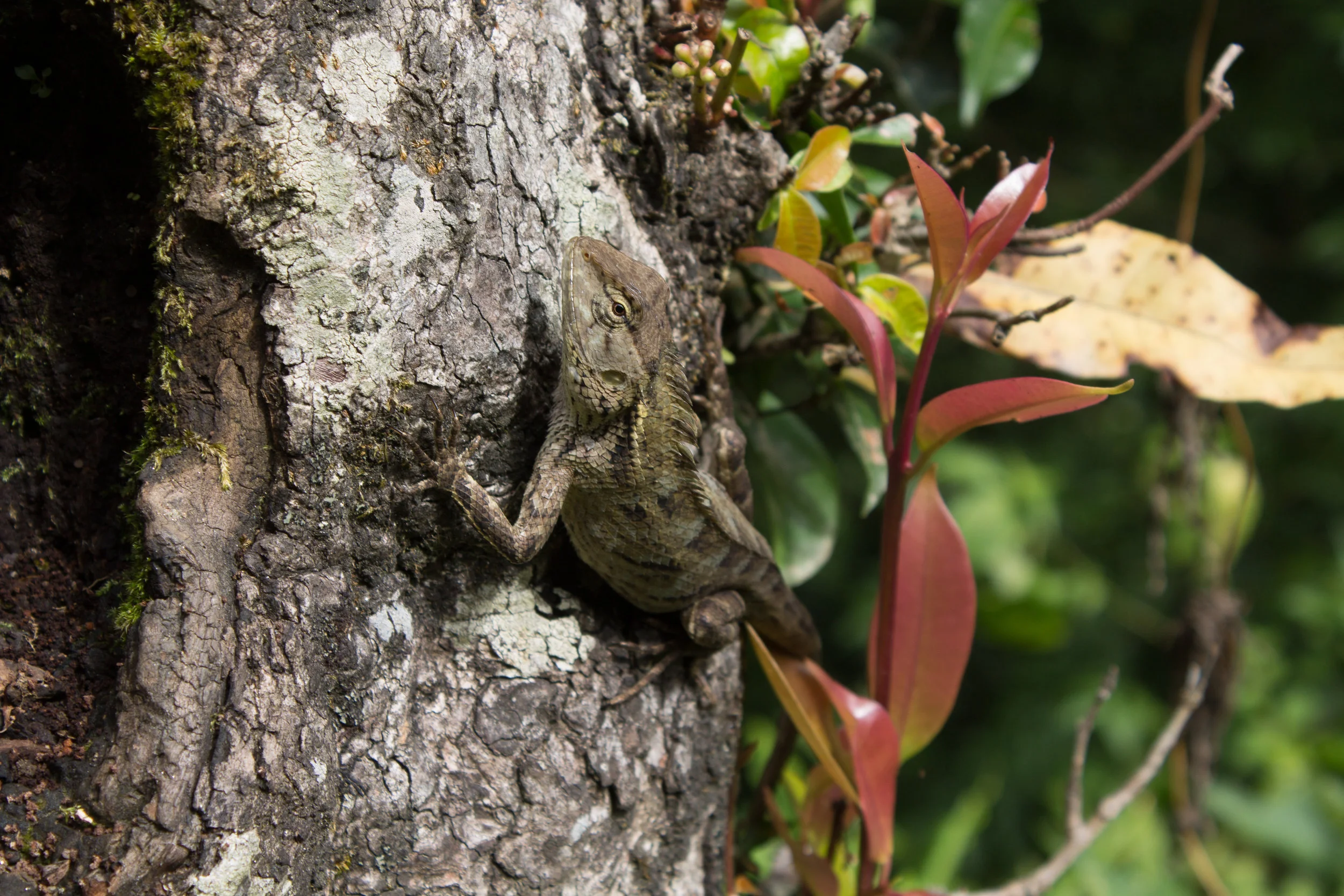
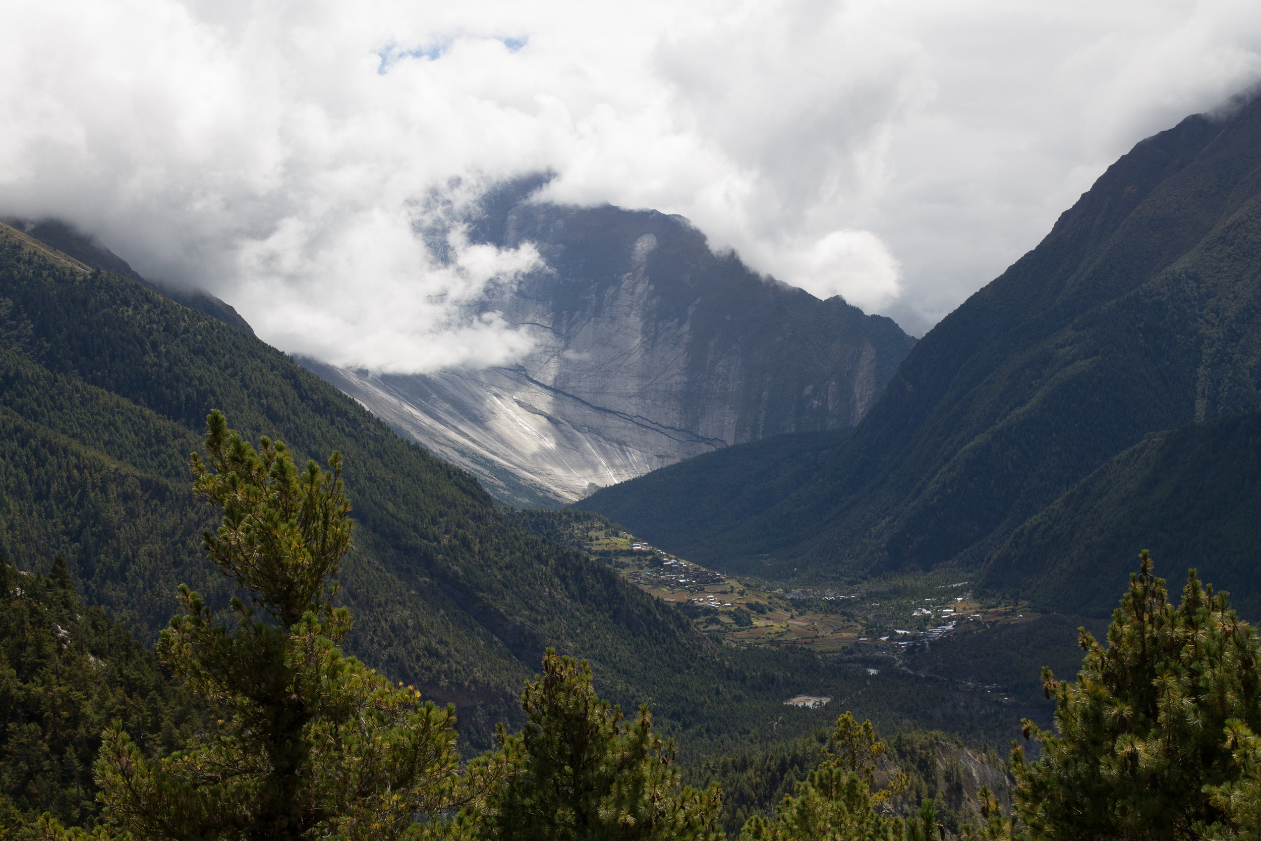
This is another tough day on account of the length, elevation gain, and humidity. Keep in mind that most guide books and trek planners will look to capitalize on the low elevation in the early stages of the trek. This is because, later in the trek, altitude gain per day will need to be minimized to prevent AMS (acute mountain sickness). The flora and fauna on this section of the trail will look very similar to that of day 1. Look for large lizards at the base of trees and on warm rocks as well as monkeys in the tree canopies. You will quickly come to understand a dilemma in the early days of the trek between choosing the easy but monotonous grade of the road versus the difficult but much more interesting path on the trail. We typically chose the trail because of the incessant jeep traffic on the road and slightly better views. The end of the day is marked by a particularily constricted section of the Marsyangdi River cascading down a boulder infested 200 meter drop. Regrettably, the last challenge of the day is a 200 meter climb up that same drop. Half way up the climb into Tal is a shop where you can stop and buy water under a house sized boulder. Continuing up another 45 minutes the trail levels out and the valley opens into a massive, long amphitheater with Tal at it's center. For me, this slight change in scenery was surreal. It marked the first of many altitudinal zones along the trail each one more dramatic than the last. After Tal the trees are no longer as tall and the jungle less oppressive. It's as if you clear the last ridge coming into the village and the world opens up with a massive breath of fresh air.
That night we stayed in Hotel Paradise on the northern side of town. Yes, this means you have to turn down 8 or 9 hostel proprietors who will ask you to stay with them - keep going, the Pumpkin Dahl Baht special at Hotel Paradise is totally worth it. One note to make here regards laundry. If you plan on carrying your own gear and have done the math you will realize that weight restrictions don't allow for a change of clothes every 2-3 days. This means you either wear the same 2 sets of clothing for 12-13 days strait or...you can hand wash your cloths. At almost every Hotel (Tea House), there will be a common wash basin. Sometime between when you arrive and before you go to bed ask your host if you can purchase some laundry detergent (sometimes they will just give you some). When they see that you intend to do laundry they will usually set you up with some sort of large container. Fill the container with water and a little laundry detergent and away you go. Side note here, make sure you rinse your clothes at least twice with plenty of fresh water - the last thing you need is a case of contact dermatitis on a 150 kilometer trek. All tea houses have plenty of space to dry your clothing, though you might have to fight for space when the tea houses start filling up towards late October. Another thing to note in Tal is that it hosts the first of many clean water stations. Through a joint project between the governments of New Zealand and Nepal, many of the villages post Tal provide clean water refills using UV light treatment. The stations are clearly marked, typically open from 6 am to 6 pm and provide water at a cost between 30 and 60 rupees per liter. Through these efforts the ACAP estimates around 1 million fewer plastic bottles are hauled into the conservatory per year.
As we were finishing up dinner a group of ultra trekkers arrived at the hostel. Turns out they were from our part of the world so we chatted with them until bed time. Their group had a bunch of great knowledge, but probably the best advise they gave us was in regards to weather on the Thorung La. Evidently, there is a Norwegian based weather group that is associated with Mt. Everest climbing parties that also distributes a weather report for the pass. A new PDF is generated every day and you should absolutly start taking a look at this in Manang. The URL is shown at the bottom of this day's report, make sure when you open it that it is displaying the correct day. After dinner we headed for bed. As we were turning in it came to Amanda's attention that we were not alone. In the upper corner of the room, above our bed, a massive spider sat pensively staring back at us. For anyone that lives closer to the equator this probably wouldn't have been a huge deal, but for those of us living in the Pacific Northwestern United States, this arachnid was 4 or 5 times larger than anything that makes it into our house on a regular basis...needless to say the night of 9/18 was not a good one for quality sleep.

Amanda at the start on Day 2 of our trek
LIZARD!

Stop for a picture break before the last haul up into Tal
Crossing the Marsyangdi River on one of many suspension bridges along the trail

A concrete kani marks the entrance to Tal and a major shift in the look and feel of the trek

Cloven hill sides near Karte

The kani for Dharpani - eat some food!!

Family of Gray Langur monkeys

New Tibetan Guest House, Chame
Day 3 Tal to chame (9/19/2017)
Start: Tal
End: Chame
Total Time: 10 hrs
Distance: ~25 km
Total Elevation Gain: 1284 m
Total Elevation Loss: 348 m
End Elevation: 2683 m
Today is another haul, and not just distance-wise but also up. Your total elevation gain will almost double what you did getting to Chame. One very important factor will make today's trip much more manageable - a blessed drop in humidity. As stated above, Tal marks the end of the jungle and entrance into a more subalpine zone. For two Pacific Northwest natives, the flora of today's trek started to feel very familiar.
The beginning of day 3 is decieving as altitude gain is minimal for the first 10-12 kilometers so you can make some serious time This is where we made an unfortunate mistake. The town of Danagyu marks the beginning of some serious altitude gain in the latter half of the day. If you have not already done so by the time you reach this town we would suggest that you stop and eat lunch. The second half of the day includes about 800 meters of elevation gain which you will need maximum blood sugar for. By the time Amanda and i got to Timang Besi to eat we were beat and very irritable, even despite seeing Gray Langur monkeys in the outskirts of town! That being said, the roof top view of 7000m Kang Guru was incredibly rewarding and we put down some serious food! After Timang Besi you will check in at the ACAP station in Koto Qupar. This town is a jump off point for many climbing efforts north of the Annapurna Circuit and when you check in you will see many true sherpas preparing for climbs which gives this town a very neat vibe. Pushing on for another hour you will reach Chame which was one of my favorite stops on the entire trek.
That night we staid at the New Tibetan Guest House which was beautiful. Chame marks a shift in village architecture as the village lay-outs and buildings take on a much more stereotypical Tibetan theme. The New Tibetan Guest House lies on the far side of the Chame so you must, again, trudge through a village with many proprietors soliciting you for business - keep going, this place is worth it! Once there, drop your bags in the room and go take a refreshing soak in the hot springs about 200 meters east of the guest house. Evidently the Hot Springs used to be laid out in the boulders immediately adjacent to the roaring waters of the Marsyangdi river which would have been a neat experience but, after the earthquake, these pools were destroyed and the hot springs were replace with a grotto style hot springs which was also a cool setting. On the night we arrived the pools were empty and Amanda and I watched a lightning storm for 30 minutes while soaking our exhausted muscles in the hot water. After a hot meal (dahl baht for me...again) we retired for the night. Having left the jungle we were far less concerned with 8-legged visitors.
DAY 4 Chame TO Ghyaru (9/20/2017)
Start: Chame
End: Ghyaru
Total Time: 8 hrs
Distance: ~23 km
Total Elevation Gain: 1200 m
Total Elevation Loss: 237 m
End Elevation: 3618 m
If i had to choose one day that has it all, this would be the day. Big mountain views, fabled Nepalese apple orchards, and picturesque alpine villages. About 5 clicks out of Chame you will navigate up out of the river valley for about 1 hour. The combination of trail and road can be a little tricky here as there is a bit of a local trail network outside of Chame. Make sure that you are seeing the red and white markers for the Annapurna circuit at regular intervals. At the top of the climb the trail will level out and you will pass among the first of the circuit's apple orchards. It is an odd feeling walking through dense forests for 3 days to suddenly appear in a valley of well groomed apple orchards. The orchards are guarded with high (3-4 meter) fence around the perimeter and a 5000 rupee fine for trespassing. For those from the northwestern United States you will be struck by the resemblance to the eastern Cascade Mountains, complete with apple orchards. A 30 minute walk will put you in the town of Burahdan. This is totally worth a stop to taste some of the apple related treats. Make sure you try the apple brandy, it might be made in old 7-Up bottles but it is TASTY!
A short hike out of Burahdan will lead you under a massive geological feature known as the Paungda Danda wall or Swarga Dwar ("Heaven's Gate"). This incredible slab of granite stands among sights such as El Capitan and the Torres del Paine in grandeur and incomprehensible size. A local legend in surrounding villages is that, when a person passes on, they must climb the wall to reach heaven, hence - Heaven's Gate. Dhukure Pokhari is a great town to stop for lunch. Many of the establishments in this village feature rooftop dining, good food and amazing views. A look back east will give you a great look at Heaven's Gate in it's full grandeur.
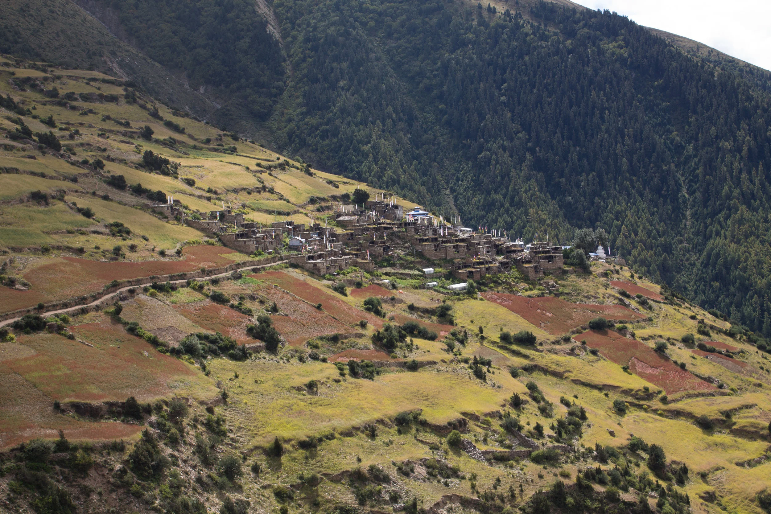
At this point in the trek you must make a choice. You can continue on the main road and stay in Lower Pisang or Norodhara for the evening or you can take the high road to Upper Pisang and then on to sleep in Ghyaru for the evening. We would recommend the latter for a number of reasons. The trip to Ghyaru will add 400 meters to your trip on the 3rd day and probably 2 hours but going this way delivers views of the Annapurnas, specifically Annapurna II and IV, that you cannot get anywhere else on the trail. In fact, by staying on the main road, i can see how people miss a large part of the views that make the trek so awe inspiring. In addition, sleeping at 3700 meters instead of 3300 gives your body an extra day at elevation in preparation for the Thorung La but is not so high as to induce AMS. Shortly after leaving Dhukure Pokhari you will see Upper Pisang perched up in the hills and should see an opportunity to cross the Marsyangdi River on a suspension bridge. Make your way up to Upper Pisang on a network of trails through the red buckwheat. Upper Pisang is one of the first truly authentic feeling villages, made completley out of stacked flat stones. Be careful leaving Upper Pisang as Amanda and I nearly headed off in the wrong direction towards Pisang Peak. Make sure you continue out of Upper Pisang heading Northwest and not due North. A short walk further will bring you to a mani wall - make sure you spin the prayer wheels, you're going to need it.
Looking way up and to the right you will be able to make out Ghyaru 400 meters above you. Cross a final suspension bridge and start trudging. At about the 200 meter mark you will be able to catch incredible views of Annapurna II and IV. Since you are bound to be short of breath take stock in these unbelievable mountains. For me, many of the mountains near my home are ~4000 meters. Standing at an elevation near the summit of many of my favorite climbs in the United States and staring up at incomprehensible heights was truly sobering. Side note here, at several of these stops along this last climb i noted what appeared to be drinking fountains on the side of the trail. I could see how, on a hot day, it would be very tempting to take a long drink before continuing on. Keep in mind that the water at these fountains will have come from above you and will have flowed through animal pastures before reaching you. If you do fill a water bottle up at these stations, take care to sanitize it with either iodine, a pump or a UV light. Amanda and i carried a SteriPen on this trek and it was amazing - low weight and high impact. A short walk on will eventually deliver you in Ghyaru.
On the night of 9/20, Amanda and I staid in the Yar Ru Guest House and we would highly recommend this rustic and authentic establishment for anyone passing through Gyharu. I should mention an important feature of guesthouses along the Annapurna Trek and elsewhere in Nepal. We were told on the trail that some facet of the Nepalese tax system allows guesthouses to avoid certain taxes if they change the name once every several years. This is important if you are using an older guidebook or this beta here in a few years. The names of our favorite places may be completely different when you go through. Amanda and i ordered a small pot of tea and sat on the front porch of Yar Ru to watch the sun's last rays on the Annapurnas and talk with a couple from England and some guys from Chicago (go Bulls). Note that a "small" pot of tea is huge and will provide plenty for two. The night was pretty cold but plenty of blankets made this a non-issue and again...no spiders.

Walking through the first of several beautiful orchards

The little red apples are delicious as is the brandy!
Heaven's Gate from Upper Pisang

Sign signaling the last climb to Gyharu

Annapurna II peaking through the clouds

Our accomodations for the night

The proprietor of Yar Ru with the hotel behind him
Looking back on Gyharu from the trail
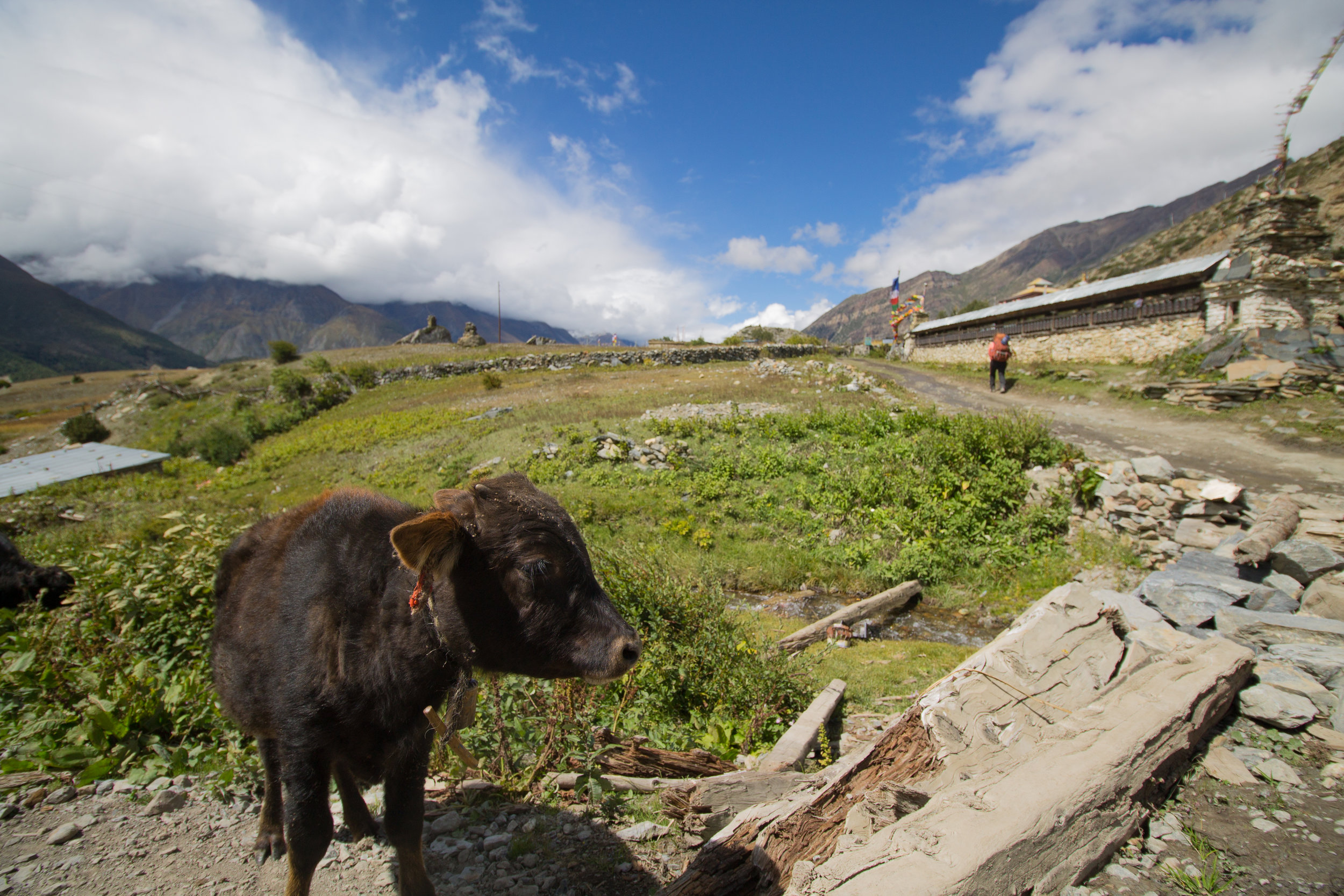
Little cow with a mani wall behind and to the right

Amanda with some Seabuckthorn juice
DAY 5 GHYARU to Manang (9/22/2017)
Start: Ghyaru
End: Manang
Total Time: 6 hrs
Distance: ~15 km
Total Elevation Gain: 374 m
Total Elevation Loss: 497 m
End Elevation: 3479 m
Today is undoubtably your easiest day and comes with blockbuster views of the Annapurnas! Amanda and I settled our bill that morning around 7 and the proprietor of the Yar Ru set us up with some Yak cheese which was really good. The walk out of Ghyaru is mystical especially looking back on the village surrounded by the bright red buckwheat fields. Take in the Annapurna massif on your left as you steadily walk down the elevation to Ngawal. At one point about 2 hours into the hike Amanda and I heard a sound like a large wind sail out in front of us. Before i could get my camera ready a massive bird soared only 3 meters above our head. This was the first of many Himalayan griffons that we saw on the trek.
At Ngawal you have an option to stay high and trek out to Chulu or descent down via Paugla. We elected to begin our descent early and soon dropped down into a drainage like area surrounded by crumbly, sandstone like rock. Just outside of Mungji we stopped to check-in with our ACAP cards. Continuing on into town we passed by one of the many "german" style bakeries on this section of the trail and had to stop for a treat. Amanda and i split a cinnamon role and also had some protein. In this section of the trail, in addition to bakeries, you will also begin to note dishes featuring yak meat and a delicious beverage on the menu known as Seabuckthorn juice. Seabuckthorn juice is made from berries of a hardy bush found throughout the region, the resulting concoction looks like Tang and tastes amazing.
As short walk beyond Mungji leads to the town of Braga and eventually Manang, which signs had been pointing to since Bhulbhule. Those who wish to do the intense day trip to Ice Lake, it is worth considering a stay in Braga for the trip the next day as this will cut out a few kilometers in the morning. We continued on to Manang and elected to stay at Hotel Yeti. At the time of our trip the road officially ends in Manang. Being the terminus of the main road on the Annapurna Trek has made Manang something of a resort town, so to speak. Many of the hotels are "up-scale" as things go in the high country of Nepal and feature warm showers and many ammeneties brought in on the incessant jeep traffic out of Besi Sahar. You can get everything from underwear to snow globes at roughshod convenience stores in the middle of town. That being said, Manang is still a very authentic town featuring traditional Himalayan architecture and a great place to acclimatize for 1-2 days. Many itinieraries for the Annapurna circuit recommend a rest day in Manang as you will have officially reached 3500 meters (12,000 feet). Above this altitude and you increase your odds of experiencing altitude sickness by moving too fast, so take a day and relax, you havae earned it. One note about hotels in this area, and elsewhere on the Annapurna circuit. Room fees will be pretty minimal, usually 300-400 rupees per night, but proprietors like to add a clause whereby if they catch you eating anywhere else but the hotel they will increase your room rate to 2000 rupees for the duration of your stay. Not sure how they would know you were cheating on them, but, in our experience the food was just fun at Hotel Yeti so no reason to search elsewhere.
DAY 6 Manang (9/23/2017)
Start: Manang
End: Manang
Rest Day
Today is a rest day in Manang and there are a couple of options for how to spend it. As mentioned above the most challenging is a day trip up to Ice Lake (Kico Tso). At 4620 meters this side trip offers unparralleled views of the Annapurnas. If you staid the night in Braga then you are well positioned to start out the day here, if not then you will need to backtrack a little.
As it was, Amanda and I opted for a slightly less strenuous option, the day trip to the Praken Gompa at 4000 meters above Manang. This trip is supposedly around 1 hour and 15 minutes one way but the never ending views and many photo opportunities will undoubtably take that time to 2 hours. About halfway up Amanda turned back having issues with her knee. At the top you will encounter a residence chiseled into the base of an open rock face. I was let in by a kindly old monk who blessed our passage over the Thorung La (note that a small donation is requested). After the ritual she was offered me tea and potatoes before my descent back into Manang. It turns out I arrived at this high point at just the right time because the clouds cleared while i was inside and i came back out to a perfect view of the Annapurnas. This prompted me to spend a little more time at the gompa taking some time lapses and pictures. I took a little over two hours heading down enjoying the never ending fields of buckwheat and watching a heard of yaks nearby.
Back in Manang i found Amanda had fallen ill with some sort of food poisining and was in bed reading. Looking back on it, she attributes a rough 24 hours of illnes to some yak cheese potatoes that she had eaten so might be best to avoid excess yak dairy on you rest day in Manang. I took some time to do some laundry and recharge some electronics That night we played some chess before dinner at the Yeti hotel and met back up with our English friends from Ghyaru. After dinner we read and wrote in our journals before falling asleep. Poor Amanda had a very rough night due to the stomach issues.
There was an incident, or a series of incidents, that Amanda and i witnessed in Manang that i would like to draw attention to. There were two girls in a room adjacent to us who had hired a guide/porter to take them on the trek. On several occasions we noticed the guide limping and obviously not 100% healthy. Over our two day hiatus in Manang we witnessed several verbal arguments between the two travelers and their guide. From what we gathered during the confrontations the two women had a timeline that did not allow for a spare day in Manang which, from what we could see, the guide clearly needed. Unfortunatly, talking to other unassisted travelers, this is a fairly common occurance. If you decide to do this trek with porters/guides that is completely fine, you are feeding more revenue into the economy and you will get a more informative trek then doing it unassisted, however, please treat them with the respect they deserve. The nepalese guides and porters are incredible people and can accomplish feats of unbelievable strength and endurance to a point where they are seen by their clients as machines more then men, especially if those clients have never backpacked or trekked unassisted before. Don't do this. Appreciate the fact that their joints and bones are taking a beating that you will not be enduring and approach the contract between them and yourselves with an understanding that you are taking on a responsibility for their health and well-being. This means building in spare days to your trek if necessary and ensuring that they are properly equipped for the trek in it's entirety.

Took a spill on the way up, playing it for all it's worth. Always carry bandaids and Neosporen!

Monk warming up pre-boiled potatoes

Seabuckthorn berries!

Gompa just above Manange on the north side

GoalZero Nomad 7 Solar Panel - bulletproof recharging

Our room in Manang w/ attached bathroom
DAY 7 MANANG (9/24/2017)
Start: Manang
End: Manang
Inadvertent Rest Day
Today Amanda felt better but was too weak for the trek up to Letdar. It is worth noting that, when planning for this trek, you should really build a spare day into the itinerary because you may need it as we did.
I took a walk in the morning. In the morning the clouds had completely dissapated and the mountains were crystal clear. I spent some time at the lower gompa enjoying the views before heading back down to Amanda. We spent the day exploring Manang and uploading tons of digital files when the power allowed. After, we went on a tour of the german style bakeries in town at which point Amanda thought she would be up for some apple pie. The excess sugar proved otherwise and she was back in the room 30 minutes later worshipping the porcelain goddess. I feel like this is a good point in the story to describe some of the bathrooms in Nepal. Most of the time a guesthouse will make 1 toilet available for every 5-10 guest rooms. The toilet is typically not western style as most of Nepal uses squat toilets - Wikipedia has some great discriptions if you would like more info. That being said, the cost of an upgrade to a suite with attached bathroom is generally on the order of ~1 USD/day extra so in some cases we opted for this feature, and, in our stay in Manang it proved very beneficial.
I would also like to put in a plug for a device i used along the trail for the first time ever and found incredibly handy. Shortly before Amanda and i embarked for Nepal i was given a GoalZero Venture 30 Solar Recharging kit for teaching a crevasse rescue class earlier in the year. I was hesitant to carry it on this trip because of the weight but managed to cut a few other items in order to lighten up and take it - bottom line, totally worth it. Power is intermittent throughout the trail and you will need to take a smart phone or simialr device to get weather updates for the Thorung La pass. In addition it is nice to be able to charge Kindles and various other electronics on the way. I found that, in a given day with mediocre light the Venture 30 solar panel was able to recharge the battery to full capactiy which, in turn, was able to charge Amanda and my phone as well as a Kindle. Very nice option to have on, i believe, any 3rd world trekking experience.
After a lazy day, Amanda and I enjoyed dinner and chess before going to bed, excited to move on the next morning.
DAY 8 MANANG to Yak Kharka (9/25/2017)
Start: Manang
End: Yak Kharka
Total Time: 4:47 hrs
Distance: ~10.5 km
Total Elevation Gain: 535 m
Total Elevation Loss: 74 m
End Elevation: 4018 m
We intended to go to Letdar today but Amanda was still not quite 100% so we stopped in Yak Kharka for the night. This is the section of trail where all the long days you did in the beginning start coming to fruition because after Manang, most trek itineraries will try to keep your daily elevation gain under 500 m/day to prevent AMS.
Amanda and I got a late start on the 25th because we drastically underestimated the bill we had wracked up in Manang. The total, we found out, was 16,480 NRs (~150 USD). While this is a pretty great deal for food and accommodation in any major world city, for someone carrying all of their cash on a 12 day trek, it can be catastrophic. The good and bad news from there was that we could pay for the bill on our credit card but there were some bad power outages on the morning of the 25th so we had to wait till almost 11 am to start walking. No amount of chess makes waiting 4 hours for the power to come back on any better. Lesson learned, if there is an opportunity to pay the night before or early the morning of - take it, because you never know when the power is going to disappear.
Amanda and i set out for Yak Kharka at 11 am that day. Heading out from Manang you will walk through beautiful red buckwheat fields and should see large griffons soaring on thermals above. At some point just out of town you will see a second trail heading off to the west as you begin to turn north. This is the trail to Tilicho lake which is becoming a popular alternative to the traditional route over the Thorung La. The route to Tilicho lake adds 3-4 days to your trip and may require camping depending on the season, but all accounts indicate that it is a very worthy alternative. As you pass through the village of Gunsang you will begin to turn north in earnest which may seem counterintuitive as you know in your mind that you will need to pass through a high mountain pass in the next 2 days. Bear in mind that the valley you are in is sandwhiched between the Annapurna massif and the Chulu massif and you are working to attain the pass at the head of the valley, north and west of Manang. Shortly before coming into Gunsang we were rounding a bend in the trail and spooked a heard of ~30 mountain goats. The heard crossed teh road in front of us and passed into the hillside above us. Gunsang is a very typical village and as always, i felt in awe passing through such a primitive inhabitation high in the mountains. A couple kilometers out of Gunsang we stopped for lunch at a sole establishment and were joined by a large group from Israel. It turns out that we were hiking the circuit about 1 week before Rosh Hashanah and had been ahead of a group of about 200 Israelis attempting to finish the trail and be back in Israel before the holiday.
After lunch we continued on and passed over a series of suspension bridges. Along the ay we saw an assortment of livestock including cows, yaks, and horses. The landscape is now devoid of any large trees and consists of smaller, hardy shrubs. We arrived in Yak Kharka around 15:50 hrs and decided not to push on to Letdar. Amanda still had lingering stomach symptoms so we elected to purchase a bedroom with an attached bathroom. That night we had a rowdy dinner with a large group of Israelis after which we played cards and learned just about every Disney song i can think of in Hebrew. That night we went to bed feeling a bit better and excited for the last push before the pass the next morning.
One thing to note, while eating with the group from Israel i found that most of them were carrying some sort of altitude medication and they were very surprised to find that we were not. Dexamethasone seemed to be most popular. At the outset of this trip we had considered taking altitude medication but had opted not to, primarily because we ran out of time and attaining these meds wasn't high on the priority list. In retrospect i can say two things. 1) You don't need medications to do this trek even comfortably if you are willing to take the time to acclimatize properly but 2) doing it without having the medications as an emergency back-up probably wasn't the smartest move either. In a pinch these drugs can save a trip and potetntially your life. My suggestions is that, if you can get ahold of Dex or a similar high altitude drug take it just in case, you don't even need to use it, but having it is a good idea.

Hotel Yeti receipt - wracked up quite a bill
Leaving Manang behind

Mountain goat on our way into Gunsang

Secrets in Nepal

Crossing one of the many suspension bridges on that 7th day

Hotel Gangapurna

Amanda poses as we exit Letdar

Himalayan Blue Sheep (Bharal) Heard outside of Thorung Phedi

Coming to the head of the Jharsang Khola River Valley and entering Thorung Phedi

Amanda and I enjoy the views at the lodge in Thorung Phedi

This is why good shoes are important

Himalayan Pika!

Shot of the Annapurna Massif from the rock outcropping above the Thorung Phedi high camp
DAY 9 Yak Kharka to Thorung Phedi High Camp (9/26/2017)
Start: Yak Kharka
End: Thorung Pedi High Camp
Total Time: 5 hrs
Distance: ~9 km
Total Elevation Gain: 833 m
Total Elevation Loss: 72 m
End Elevation: 4850 m
My GPS ran out of batteries on this day and so my distances going forward are going to be a little shaky. The day started in an odd fashion because we witnessed a fight between the proprietor of the Gangapurna guesthouse and one of the travelers. We didn't really understand all the details but it seems that the operator of the guesthouse was worried about the health of the woman traveling with the other combatant and tried to make them stay another day. The couple felt that they were healthy enough to leave and tried to do so when the proprietor physically stopped them, leading to the fight. You never know what you are going to witness on these treks. In general, the owners of the guesthouses higher on the trail are more worried about your health than they are about what they can make off of you. They have also seen trekkers in just about every condition imaginable and so, if they are concerned about you, heed their warnings because they have very real reason to be so. The couple did make it over the pass, we saw them two days later, but they looked miserable. In addition, the beginning of this day is probably the last chance to check the weather, so do so before heading out!
Today is a good climb, especially depending on where you choose to stop for the night. If you are coming from Yak Kharka, Churi Lattar, or Letdar you have the option of staying the night in Thorung Pedi or continuing up another 1 - 2 kilometers and 400 meters to the Thorung Pedi High Camp. We had heard horror stories about the high camp - the cramped quarters, very cold nights, expensive/bad food, and altitude concerns. I am here to say that almost all of these issues are grossly over exaggerated. We found the high camp to be very accommodating, with good quality food, a room that was no worse than any we had stayed in to date, and plenty of blankets to stay warm. I say almost all the concerns are a non-issue but i will caveat that with two considerations. The first consideration is that the altitude gain on this 9th day is greater than the 500 meters recommended to avoid AMS. During the night, a gentleman staying in the room next to us who was biking the circuit, packed up his belongings and descended to Thorung Pedi in total darkness because of altitude sickness. The second consideration is that available space in Thorung Pedi may get extremely limited in the high season. We were there in September which is the shoulder season so there was plenty of vacancy but we heard that, when things get busy the proprietor of the high camp will start packing people into rooms which means sleeping on the floor and possibly fewer blankets than is necessary for guests. All things considered, the stay was wonderful for us and i would recommend the extra climb on day 9. The real allure of the high camp is that you get an almost 500 meter head start on those staying in Thorung Pedi. This means you can sleep in a little bit longer and get up earlier for the sun-rise which is amazing.
Starting from Yak Kharka you continue on a moderate climb to the very end of the valley at Thorung Pedi. A land slide about 3-4 kilometers after Letdar is relatively new and not reflected on many maps as of yet. The government of Nepal was very fast to add a new suspension bridge over the river though so crossing is easy, but make sure you scout out visually where you want to go as the trails get a little confusing at this point - when in doubt always follow the ever present red and white trail markers. Lots of livestock on this day including heards of yak grazing in the high grasslands. If you are going to the high camp Thorung Pedi is a good place to stop for some food. We started so early that, by the time we got to Thorung Pedi, it was a little early for lunch so we stopped and had some packed snacks to try and lighten our load before the daunting climb ahead of us. While eating we saw a helicopter land up the hill at a rough pad in the side of the hill. A crew got out and carried a tourist onto the helicopter before lifting off again. We learned later that the Chinese trekker had requested an airlift due to advanced AMS symptoms. Keep in mind that if you push too hard and begin succumbing to AMS to a point you require an air lift off the trail, the trip is going to cost you around 4000 USD but may very well save your life. Be smart and don't push on when your body is clearly telling you not to.
After a quick snack we started our 400 meter ascent up to high camp. The trail switchbacks endlessly upwards before cutting through a notch between two rock outcropping to dump you in front of the camp. The high camps is composed of ~4 long blocks of rooms and a very nice central lodge with great views of the Annapurna massif. I had hiked on ahead of Amanda to try and get a room since we did not know how much availability there would be. After securing a room and dropping my pack i descended down to help Amanda with her backpack. She insisted finishing with the pack so i walked the short distance with her until we reached our room and collapsed on the beds. Getting back to the shoe comment i made much earlier i think this would be a good time to revisit it. When i tore my boots off i realized that my heels had bled through the socks into the boot liner despite all the duct tape and moleskin i could apply. The last bit of climb really did my heals in. Sorry for the picture to the left but i want to drive home the notion that shoes are paramount to a good quality trip - if you have any reservations about your foot ware before you leave it is worth the investment to ensure a good trek.
Later that day we walked up another 100 meters to the rock outcropping above the camp for 360 degree views of the mountains including the Annapurna and Chulu massifs. I know you will be exhausted at the end of your climb to the high camp but these views may be the best of the trek and are worth that little bit of extra excersion to witness. For these views i have to put in another plug for a product i purchased for this trip. If you own a GoPro or other action camera then i would suggest the Motorized Panning Head from BlackBolt. It captures some wicked panos in big view areas like the High Camp. That night Amanda and I decided to play it safe and eat the Mountain House backpacking meals we had brought with us. This also meant less weight to carry over the pass the next day. That day we had made friends with a couple groups of people and stayed in the lodge into the evening swapping stories. We also ordered our food for the next morning and settled the bill - the proprietor of the High Camp requests that you do this the night before because of the early departure time the next morning. That night we got everything we could packed up and made all preparations were made for the next morning. We fell asleep excited for the next day and the opportunity to get over the pass and start heading back down.
DAY 10 Thorung Phedi High Camp to Ranipauwa (9/27/2017)
Start: Thorung Phedi High Camp
End: Ranipauwa
Total Time: 8 hrs
Distance: (GPS died)
Total Elevation Gain: 534 m
Total Elevation Loss: 1682 m
End Elevation: 3717 m
Today is the day of days. The moment we had been building toward since the start waaaaaay back in Bhesi Sahar. To begin here is an obligatory cautionary note. The pass is the most dangerous section of the trail you will pass through and this is primarily on account of the weather and the altitude. In October 2014 almost 2 meters of snow fell on the pass in 12 hours during the high season. In that time 500 people were rescued from the pass and 43 trekkers died. Many others have succumbed to the cold, exposure, or altitude on the pass. You should be prepared at the outset of the trek, all the way back in Bhesi Sahar, to turn back below the pass and return the way you came, missing a flight, not completing the trek or coming home a few days after you intended are nothing compared to losing your life on the pass. The worst storms on the pass are generated from cyclone formation in the Indian Ocean that make landfall north of the Bay of Bengal and proceed north dumping precipitation on the Himalayas. In addition to watching the weather via the link up a few days on this page, monitor the Indian ocean for cyclone development while staying in Manang and Ghyaru. Do not think that you can quickly pass through the Thorung La, when you crest the top you are still 5 hours from the nearest lodge thousands of meters below you.
Amanda and i woke at 3:50 on the morning - we did not sleep well on account of the altitude, but this was expected. On treks like this i carry a Spot satellite locator. The battery on it was dead but i was able to power it via the GoalZero auxiliary battery so, before breakfast, i left it outside our room to gather satellite reception. We went to the lodge to get a breakfast of fried eggs and pancakes. It was quick breakfast on account of note wanting to waste the early morning hours. Upon returning to the cabin i found my Spot and auxiliary battery missing. It was dark so i thought that i had potentially misplaced it but a more thorough examination showed it to be missing completely. I checked a few of the adjacent rooms to see if someone had put inside for me but found nothing. My Spot locator and battery had been stolen. This was a pretty shitty realization because, until now, on all the treks we have done domestically and internationally i have never had something stolen from me. What is even more distressing is that i am fairly certain that my items were stolen by a fellow tourist and not one of the local camp staff. Keep in mind that what happened to me is not, in my experience, a common occurrence but it is most likely to be committed by fellow travelers, not locals.
The greatest concern for me, having my Spot stolen, is that someone would press the SOS button which automatically initiates a very expensive rescue effort. Fortunately the proprietor of the high camp lodge had a satellite phone and let me borrow it to call my dad. I was able to communicate to him, for 30 USD a minute, that we were fine, weather looked good, and, as my primary contact for Spot, to cancel any rescue efforts they might make on behalf of a false call. Thanks to that debacle we lost an hour on our start time but managed to leave around 5 am for the pass which was still a good time. The sun had still not peaked from behind the Chulu Massif and we began a slow methodical trudge up to the pass. I led about half a kilometer ahead of Amanda waiting at regular intervals. For the first kilometer i felt pretty decent and was able to make good time. About the time i came up to the first of two huts along the pass, however, the altitude started taking it's toll and i stopped to wait for Amanda about 10 minutes behind me. Keep in mind that, no matter how slow you take it or how fit you are, at above 5000 meters you will feel some effects of high altitude. For me it was an incessant light nausea and not enough oxygen. I mention this because some symptoms are going to be normal at these altitude and are not necessarily cause to immediately turn around. My rule in climbing and high altitude trekking is that, if you are able to stay in control of your primary motor functions and breaks between spurts of exertion return you to normal breathing and state of mind then you should be good to continue. If you find you are not recovering and experiencing and overall drop in physical and mental aptitude then you should seriously consider turning back and waiting an additional day.
The trail winds endlessly up and can be demoralizing at times because of the number of false summits you will go over before actually reaching the top. Take plenty of breaks and drink plenty of water and enjoy where you are. Eventually the trail will level out to reveal the crest of the saddle. The Thorung La actually has a hut at the very top to which supplies are brought up via horse back as well as a bright yellow sign and prayer flags congratulating you for reaching the high point. If you are feeling good take a little time to explore the area. There is a slightly higher viewpoint up the hill south of the trail that offers some great view. You can also get some tea at the hut which is a neat experience. Regrettably, my Canon battery which usually goes weeks without charge drained on me and i was only able to snap a few pictures of Amanda and i in front of the sign. Looking west, to the other side of the pass you will see a very different geography, the dry, aired mountains in the forbidden Mustang region of Nepal.
The general feeling at the top of the pass is one of victory but, regrettably, you aren't even halfway done with the day. From the pass you must descend 1600 meters to the town of Muktinath. In all the backpacking i've done in the past i don't think there has been a descent this brutal. For those with compromised knees this will be, while not the most cardiovascularly difficult part, the most uncomfortable section. Amanda did this entire circuit with a torn ACL and i am missing half of my miniscus in my left knee and we felt it at the end of day ten. Proceed down on scree trails that criss-corss all over each other. This section is pretty easy to follow despite the labrynth of trails because, in general you should always proceed down. After the 2014 incident on the pass the govermnet of Nepal made available a series of emergency shelters for those stuck in bad weather. The second one had some running water available, as before, i would advise treating it in some way. 2-3 hours should see you down to the lodges at the base of the pass in Chabarbu. Stop and take a breather as well as some food.
If you are ambitious you can get to Kagbeni that day. As it was, Amanda and i had a couple days so we decided to stay in Ranipauwa for the evening. Just before Ranipauwa you will pass through Muktinath and it's large walled temple area. This temple is among one of the most important shrines for both Buddhusts and Hindus in Nepal and, down trail from this shrine you will run into many pilgrims from both of these religions using just about any form of transportation you can imagine. Look for the very orthodox ascetic sadhus who will be making the trek in colorful clothing and without shoes. Their trek will, likely, have started thousands of kilometers away in India.
Walk a short distance past the shrine to the main street of Ranipauwa. We had heard good things about the Bob Marley hotel but elected to stay in the equally nice Hotel North Pole. After an awesome lunch, some beer, and some confirmation to our contacts back home that we were alive we took a walk around town. I really needed some chapstick and double A's for the GPS so stopped and got that. Later that night, after dinner, we passed out thankful for an opportunity to put our feet up.

Amanda about half way up to the pass on day 10

Sun rising on Khatung Kang

Amanda and I celebrating at the top of the Thorung La
Looking forward to heading back down the other side

Looking down from just below the west side of the pass

New Holland tractor doing work in Nepal!

Time for dinner at the Hotel Shangrila

Amanda with the forbidden Mustang wilderness behind her
DAY 11 Ranipauwa to Kagbeni (9/28/2017)
Start: Ranipauwa
End: Kagbeni
Total Time: 3 hrs
Distance: 11 km (GPS is back!)
Total Elevation Gain: 100 m
Total Elevation Loss: 845 m
End Elevation: 2941 m
Today is one of the top 3 easiest days as most of it is downhill and the distance is moderately short. Amanda and I slept in knowing that we didn't not have very far to go this day starting at around 11 am. The road down to Kagbeni was pretty simple but maddeningly dusty. This last issue was especially accentuated by the incessent jeep and tractor traffic on the road. Many of the guidebooks warn of fierce winds on the west side of the pass and they are not overexaggerating. At noon, just like clockwork, we ran into a very strong wind coming up the valley from the south, which, again only made the dust worse. I would strongly reccomend sun glasses for this section. At several spots along the trail we ran into pilgrims on their way to Muktinath, being American we got a lot of requests for pictures. Most of the time we obliged though they weren't afraid to ask on some of the most precarious parts of the trail!
In Khingar we ran into some kids and i handed out the last of my dinosaur stickers. Amanda and i had brought along several small toys for kids along the trek including mechanical colored pencils, stickers, and bouncy balls. We found these gifts to be very well recieved at every village we came accross. Just know that, if you start handing trinkets out at the beginning of a village you won't have any left at the end!
Continuing south we eventually made Kagbeni and stayed at the Hotel Shangrila. Note that there are two entrances to the city. The official Annapurna circuit diverges from the road about a kilometer out from the city. We missed this exit and ended up entering the city from the south which was fine, just different scenary. After a dinner and some delicious apple drinks and deserts in the hotel we took a walk through the city and out to the north end where we could look into the forbidden Mustang area. We watched as a shepphard brought a flock of goats down from the hills and into the city and followed to watch the madness as he proceeded to drive them through Kagbeni!
Back in the hotel later that night Amanda and i decided to leave early for Jomsom the next day to try and catch a morning flight to Pokhara. Again, we packed everything up and prepaid our proprietor before passing out.
DAY 12 Kagbeni to JOmsom(9/29/2017)
Start: Kagbeni
End: Jomsom
Total Time: 2 hrs
Distance: 15 km
Total Elevation Gain: 43 m
Total Elevation Loss: 112 m
End Elevation: 2798 m
Amanda and i had agreed to sprint to Jomsom in the morning to get a flight back to Pokhara that day so our alarm went off at 4:30 am and we woke to get everything together and quietly exited the hotel. Out on the trail we enjoyed the quiet - no jeeps, no tractors, and no wind. The road was relatively flat the entire way and we made good time. With no incline or decline my feet go a reprieve from the insistent ware of my dilapidated boots. About an hour in we started seeing the jeep traffic, more and more which made the last hour a little more excited than we wished for.
Jomsom was the largest city we had been to in 13 days and it was a little shocking to suddenly be among so many people. We floundered around until we found the Tara airlines office and were able to buy our ticket. The airlines office was not in the airport and was actually about a kilometer away. We accidentally walked into someone's house next to the ticket office before realizing our mistake! Once we found the Tara airlines office we were able to easily get a seat on a plan leaving around 10:30 am. Regrettably, i did not write down the price of a ticket out of Jomsom but i recall it being around 150 USD. This ate up the rest of the cash we had but was just enough to get us to Pohkara. From the Tara airlines office we walked down to the airport, again, asking for help along the way. Inside there was a very barebones terminal where you could check in. The only airlines that operate the route are Yeti and Tara and both are said to be reputable. About 45 minutes before the flight the on-boarding process starts. You are checked in then required to open your back and unload your belongings so they can be inspected. Then you go through a manual process of being checked for anything on your person. Woman are seperated from men for this section of the check-in process. You are then directed out onto the tarmac where the plane is waiting for you. In a line they walk you to the plan which, in our experience, was a twin otter made by the Canadian aerospace company de Havilland. We did not expect it but the thirty minute plane ride to Pohkara was one of the coolest experiences in our two week adventure in Nepal. The plan flies low and you can see everything on the ground - really a very exciting and authentic experience. Thirty minutes after take-off we were back in the ground in Pohkara, our Annapurna adventure finished. It was an incredible journey start to finish.

Ticket for our flight from Jomsom to Pohkara

Flight check-in station for Tara Air at the Jomsom Airport

On board the twin otter