
Trekked: July 2021
Written: Spring 2023
Intro
It had been a long time since we attempted a multi-day international backpacking trip. The last epic we made happen was the Simien Mountains in Ethiopia during the summer of 2018, then we took a family related trip in 2019 and then everything changed in March of 2020. A global pandemic and a chance to live abroad in Germany changed our lives and it took over a year to get back to some semblance of normal. In the Spring of 2021, we were living in Essen, DE. For anyone who hasn’t been to the industrial heartland of Germany, Essen is about as far from the American Northwest as you can get, but we were close to all things Europe and as the world started to carefully unlock itself from the grips of the pandemic, Amanda and I began to look for ways to make the most of our unique location. A trip that I had wanted to do for a long time was inspired by the pages of a 2013 article in Backpacker Magazine which followed a Colorado based editor through the middle sections of Italy’s Alta Via 2. In February of 2021 I began making plans for us to do the whole Alta Via 2 from Bressanone to Croce d’Aune, Italy over a 15 day period in July as a testament to overcoming months of lock-down, an international move and, of course, Amanda’s birthday. This is our tale of the Alta Via 2.

Amanda on day 8 after a cow encounter

View of the Sella Massif from the Puez Plateau
Day 0: Essen, DE to Innsbruck

Navigating the Streets of Innsbruck
I really wanted to take the train. Early in the year, when Austria’s OBB started running their overnight trains again, it was easy to get a sleeper car reservation. You could make reservations from Hannover to Basel or Dusseldorf to Innsbruck a week before and still find yourself in a mostly empty train car but that changed quickly in the Spring and, as I found out too late, 2 weeks was not enough time to reserve yourself sleeping quarters by the time summer rolled around.
Instead of a train, Amanda and I flew aboard Austrian Air from Dusseldorf to Vienna and from Vienna to Innsbruck. Bright side: You get free chocolate on every leg, and it’s really good chocolate. We landed in Innsbruck at around 11 pm and were about to buy a bus ticket into town when a taxi showed up. About ten minutes later we were at Marmota Hostel in Innsbruck where we shrugged off our packs and passed out – excited to hit the trail the next day.
Day 1: Innsbruck to Bressanone to Plosehutte
Distance: 2.73 Miles
Elevation Gain: 3,767 ft
Moving Time: 1:32 Hrs
Total Time: 4:14 Hrs
Weather: Partly cloudy. 63°F. 3.5 mph winds.
Optional Gondola ride (Plosebahn) and great pizza
In the morning we woke up around 7 to catch our train from Innsbruck across the border into Italy to Bressanone (or Brixen in German). We found out later that, because this area of Northern Italy has been contested regularly throughout the years, many cities bare both their Italian and German names.
Day 1 started from Bressanone at 10:30 in the morning. The “trail” which is a series of sidewalks and bridges in its early stages on this day winds down from the train station and eventually crosses the Eisack – Isarco river before turning south and beginning its slow rise into the mountains. As the path steepens it runs through the grounds of a beautiful old church before the scenery shifts from open farm fields to dense forest. The grade also changes dramatically here as well, from a slow and steady rise to a steep climb. About a mile of steep climbing brings you to one of many small alpine villages on the trek, St. Andrea in Monte. This is a great place to stop and grab a coffee or look over how far you have already come, but if you want some great pizza, go on a little further to the base of the Plosebahn ski lift. The restaurant, called Restaurant Bar Plose – Stodl, is where Amanda and I sat contemplating our next move. The thing to note here, for anyone planning to do any of the Alta Via’s, is that there are a lot of gondolas – they are everywhere and they are tempting. Technically, the biggest elevation day on the Alta Via 2, is day 1. If you go without the gondola, day 1 includes 6000’ of elevation gain which is a rough start to any hike. The gondola cuts your elevation gain in roughly half. So… we took the gondola, which dumps you off at 6800 feet in a small village of restaurants and up-scale outdoor gear shops. Having some pizza already on-board, Amanda and I continued to climb on a small path through open grassy meadows. Now above the tree line and with open sight to the surrounding mountains, every step provided a more spectacular view than the last. As the trail wound around the backside of a small hill, our first hut came into sight. Nestled about 500 feet above us and about a mile away between several small hilltops, Plosehutt was a welcome site for feet that had been out of practice for a long time. Within about an hour we arrived at the doorstep and turned to take a look behind us. As the clouds cleared, we got our first view of the Tullen Massif – a huge wall of white rock rising in the distance though which we would pass on the next day.
Once inside, we were greeted by the first of many wonderful hosts who showed us to our sleeping quarters. We dropped our bags and shed our boots before heading downstairs for beer and a review of an amazing first day.
Further Note: While Plossehutt is technically the first stop on the Alta Via 2, it is also the quietest. Generally, guests are those who take a taxi to the base of the gondola, then take the gondola and hike the last 0.8 mile to the hut before staying the night. If you are looking to shorten your itinerary, this is a good option to do so - combine days 1 and 2 and hike from Brixen to Schlutterhutt. It should be noted here though that, if you combine the first 2 days and do not take the gondola, you are facing 8000 feet of elevation gain in one day and that’s if you choose to skip the optional Sass de Puta climb (see day 2) between Plossehutt and Schlutterhutt.

Amanda with the church behind her
Day 1 Altitude Profile

First of many mountain coooos

Classic Alta Via Sign
Day 2 Elevation Profile

Breaking the tree line on our way to the pass

Amanda with the southern view from Pietlerscharte pass

Amanda on first cable up the Sass de Pütia

Approaching the Schlütterhutt
Day 2: Ploséhutt to Schlütterhutt
Distance: 11.78 Miles
Elevation Gain: 3,575 ft
Moving Time: 5:57 Hrs
Total Time: 9:47 Hrs
Weather: Cloudy. 60°F. 2.1 mph winds.
Note: Optional climb of the Sass de Puta and first taste of Via Ferrata
This is a beautiful stage that takes you across the Tullen Massif with an option to climb the Sass de Puta on the other side. There are great places to eat midway through the day and plenty of highland coo’s to stop and admire.
Amanda and I woke early-ish the next morning. No one else had been scheduled to stay in our room that night and I was getting the impression that COVID might have seriously reduced the number of thru-hikers we were going to meet on this trip (turns out I was super wrong here). We organized our things and headed down to the kitchen for a breakfast that would become increasingly familiar over the next 14 days and included yogurt, bread, butter and your choice of Coffee or Tea.
With breakfast complete, we collected our things and stepped outside for a quick warm-up stretch in full view of the Tullen Massif. We didn’t know it at the time but a theme quickly emerges on the Alta Via 2 which involves spending all day crossing a seemingly impassible ridge of rock and scree only to end your day looking out on another seemingly impassible ridge of rock and scree which you must pass the next day. Once our warmup was complete, we started our Strava’s and began hiking. The route from Ploséhutt to Schlütterhutt takes you down into the Schlartenbach river valley before crossing through the Tullen Massif and winding back to the Schlütterhutt, so the second day starts with a rare descent. As you descend, you cross through green meadows and bare ski slopes. Never far off in the distance is the constant clinking of cow bells. Along the way we ran into a younger group of hikers on vacation and few other smaller groups.
Shortly before lunch we bottomed out in the Schlartenback river valley and began to wind our way along a muddy trail towards the Tullen Massive. As the trail began a slow climb we came out onto the main road through the pass and stopped at a small guest house for coffee and lunch. Speaking in our signature broken German we were able to order some rolls, cheese and caffeine. We sat for the better part of an hour looking back on where we had come from and up at the day’s latter challenge. At around 1 pm, we paid, stretched and began walking along SP29. After a short time, my Garmin identified a trail that ran parallel to the road and we transitioned onto that. 30 minutes of winding through young strands of Norway Spruce and past several gorgeous waterfalls we arrived at the base of what was obviously the committed climb up Pietlerscharte pass. Above us we could see others already on their way up and down a sinuous set of switchbacks. We took a quick break, drank some water and with our heads down began a slow march up.
30 minutes of committed climbing brought us out of the tree line and into the alpine. The wide causeway into Pietlerscharte pass narrowed into a gully of scree and loose rock as we started playing leapfrog with other hikers climbing up and down the narrow stretch. Another hour of steady progress brought us to the saddle and onto Pietlerscharte pass along with about 40 other people. We sat and enjoyed one of the many snacks Amanda had squirreled away in our backpacks and contemplated our next move. From Pietlerscharte pass you have two main options.
Hike on to Schlütterhutt: The refugio is 1.5 miles from Pietlerscharte pass and can, if you are tired or short on time, be made in less than an hour as there is no grade.
Climb up to Sass de Pütia/Kleiner Peitlerkofel: For amazing views and your first crack at a respectable ferrata, climb to Sass de Pütia. Alternatively, if you are not interested in the ferrata, there is a second point, Kleiner Peitlerkofel, which can be reached without any technical challenges.
Elevation: 1400 ft
Time: 1 hour
Distance: 1.7 Miles
As we were interested in getting our toes wet on these Ferratas we had heard so much about we decided to climb to Sass de Pütia. We took a left and began to climb again. After about 10 minutes we found a place to stow our larger bags and donned daypacks with our basic ferrata kit and some other essentials (my drone which, technically, isn’t an essential but I would argue the videos it shoots are). After surveying another endless set of switchbacks that sat before us we again put our heads down and began climbing. 30 minutes of climbing brought us to a fork, the left path leading to the Kleiner Peitlerkofel and the right leading on to our target – Sass de Pütia. After a quick discussion about the concerning sounds of thunder we had started to hear we decided to press on as we were nearing the top.
Note Here: Thunder storms were a near guaranteed phenomena in the afternoon for us. More stories to come but you should expect them on most late afternoons, usually after 4 pm. Read up on what to do if stuck in one and have rain gear ready after lunch.
After another 10 minutes of climbing we reached a flat spot below the ridge running up to Sass de Pütia. At that moment it was completely obscured by mist. After some additional deliberation, Amanda and I donned our ferrata kit and warily approached the ridge.
Note Here: Basic ferrata kit includes standard climbing harness and should include a set of dynamic, extendible clips that can absorb the shock of a fall. These are typically sold as a single piece specialized for ferrata climbing. Within the context of typical lead climbing, these clips are the dynamic piece of your kit that would typically be the rope. This is where Amanda and I messed up because we had, instead of these clips, standard alpine draws made with dynima which is a static attachment, not dynamic, so a fall along the cables of a ferrata could have been dangerous because there would have been no form of shock absorption. My logic going in was that I believed none of the ferratas were truly vertical and the harness was just to prevent total detachment from the ridge and a fatal fall, but if you do this or another ferrata, I would highly recommend the dynamic clips which provide a much greater piece of mind.
At the start of the first steep section, Amanda and I clipped into our first cable and began the climb. The section up to Sass de Pütia is low class 4 but does include some spots where a fall could be fatal so we clipped in whenever one of these areas was traversed. There are no sections up this climb that do not have a cable available. 30 minutes of fun and secure climbing brought us to the top of Sass de Pütia and I fired up my drone to get some orbital shots of our accomplishment. We retreated off the ridge shortly after as the sounds of thunder closed in.
At our bags, we stopped for another quick snack and then dropped down to the pass. From the pass we turned south and headed towards the refugio. For the first half mile we played hopscotch with a group on mountain bikes that had an annoying habit of stopping to snap pictures before asking to pass again…only to stop and take more pictures. The Schlütterhutt stayed out of site for a long time, sitting down in a depression such that I rechecked the GPS several times to make sure we were still on the right path, but eventually it came into view, dramatically overlooking the Sankt Zenon Bach – Rio San Zenon Valley.
The Schlütterhutt was very popular due to the fact that we were there on a weekend and it is also an easy day trip for hikers coming out of the Sankt Zenon Bach – Rio San Zenon Valley. We left our shoes in the entry way to the large hut and were shown up to our rooms on the 3rd level. At the room, we left our things on a set of bunkbeds and made our way back to the dining room for dinner. Due to the high number of people at the Schlütterhutt that evening we were seated in a group with two girls from Austria and a dentist from southern Germany. We sat and talked with them deep into the evening enjoying some Italian brews and a number of local “Grappas” which would become a staple beverage along the way. At one point, when most of the patrons had returned to bed, the hut manager brought out a local grappa made for the hut from, what appeared to be, the root of a daisy-like plant. It was terrible but we grinned and bared it and after a bit more conversation, headed up to sleep.
Day 3: Schlütterhutt to Refugio Puez
Distance: 10.89 Miles
Elevation Gain: 2,669 ft
Moving Time: 5:34 Hrs
Total Time: 8:07 Hrs
Weather: Clear. 52°F. 2.4 mph winds.
Note: Catastrophic boot failure took us on wild gambit off typical route for this day.
I will state up-front that this day did not go as planned due to catastrophic shoe failure, so the route described here is not the typical route taken on the Alta-Via, but if you want a fun story about overcoming incredible adversity, read on!
The morning of the 3rd day started as usual with one of the better breakfasts we would encounter on the trail. After organizing our things, we made our way downstairs early to find a wonderful spread of breads, cheeses, yogurt, honey and excellent coffee. As many of the guests staying in the hut were day hikers and not interested in a terribly early start, we encountered fewer people at breakfast than we had seen at dinner. Our friends from dinner, having indulged in a healthy volume of Grappa, were also nowhere to be seen. As we ate, I went over the details of the day which included two passes and a mandatory ferrata.
After breakfast we packed away our things and made our way out to the front of the refugio which was already fairly crowded with the other thru-hikers looking to begin their hike. We dropped our bags and ran through our daily “industrial athlete” warm-up before re-shouldering our pakcs, starting our Strava’s and stepping off the Schlütterhutt porch.
The third day begins with a light climb (<300 ft) up to the eastern flank of the Sobutsch. If you are interested in better views of the Puez-Odle Massive there is an established trail up to the Sobutsch summit from the eastern flank. On this day the view from the saddle was enough for us so we carried on while other groups diverted off to take on the short climb. From the eastern flank of Sobutsch the trail descends about 500 feet to a saddle, passing a nice café on the way. As we descended, the sole on Amanda’s right Asolo detached from the heel such that half of the sole remained on the boot leaving the other half to flap haphazardly as she descended. Recognizing this as a borderline disastrous situation, we stopped at the above-mentioned café to consider next moves over coffee.
After a quick survey of our fellow patrons at the café as well as the proprietor herself, the best materials we were able to pull together were some small black zip-ties. We considered for a time, “drilling” holes in the sole of the shoe and looping the zip-ties through the holes to keep the sole adhered to the floor of the boot but decided against it, expecting quick failure of the holes. Without a good solution to re-adhere the sole to the boot, going on over the Fortella della Roa pass was not an option. A quick review of a map provided by the café proprietor provided our only solution. From the saddle just below the café the primary trail continued through the Puez-Odle massif, but a second trail diverged from this one and dropped to the Villnößer River valley …2000 feet below us. This is the path that Amanda, now wearing a flimsy set of Keen Sandals, and I would have to follow in order catch a bus at the head of the Villnößer River valley, transfer around the Puez-Odle massif and reach the town of St. Christina in Gröden, where we expected several boot shops could provide replacements for Amanda’s out-of-commission Asolos.
· Note: In retrospect, these Asolo’s were the same ones that took Amanda around the Annapurna massive in Nepal and through the Simien mountains in Ethiopia. They had been through alot and she had considered replacing them before we left but we both thought they might have a bit more life left to get us through - turns out we were wrong. If you are in a similar situation, best to pack some shoe-goo or similar product that can get you through these situations, just long enough to get somewhere convenient to replace a shoe. As stated above, the Alta Via’s all have plenty of gondola access to get you into a town in a pinch, but they are not so prevalent that you will always have them when you need them.
Amanda and I finished up our coffees and, already begrudging a massive drop in altitude, dropped to the saddle, where we turned northwest and dropped off the Furcella de Munt de Furcia ridge. The next hour was spent in no small amount of discomfort. Amanda moved slow on account of a still very full pack and poor shoes underfoot. Possibly more painful than the descent was the constant look of judgment on those hikers ascending the ridge, like “yes – she totally made a conscious decision to hike with a multi-day pack and sandals.” At a point where I thought my feet were going to give out the grade steadily gave away and the setting shifted to a lush, wooded meadow. Another half hour of descent on a gravel access road along the Sankt Zenon river brought us to the visitor center at the head of the Villnößer River valley. Once here, we purchased a ticket on the next bus and munched on some snacks while trying not to look back up on all the elevation we had lost.
After 45 minutes the next bus down to the valley showed up and we were met by its impatient Italian driver. In broken English we attempted to describe where we needed to go only to be met by a blank look and some rapid Italian. Fairly confident that this was the only bus that could get us where we needed to go, we boarded and sat down. After the driver sucked down 2-3 cigarettes he got back on, muttered something in Italian and shoved the bus into gear. For the next hour we followed the Villnößer River as the bus flew down hairpin curves. Through intermittent bouts of cellular service, I was able to stitch together a route to St. Christina in Gröden, so it came as a bit of surprise when the bus driver made a sudden stop behind another bus and began to shout at us while motioning to the other bus. In confusion I mumbled the name of town where I thought our next connection was and that I had expected this bus to take us there which was met with an angry shout and head shake before another violent finger jab at the bus in front of us. Not sure whether he would even allow us to stay on the bus, Amanda and I disembarked and ran to the next bus where a much nicer driver assured us that he was headed towards the main Dolomite bus station in the area and that we would be able to get to St. Christina in Gröden from there. Another hour delivered us to Leitach-Coste, where we transferred onto a Dolomite bus and another hour after that we finally disembarked at St. Christina in Gröden.
St. Christina in Gröden is a wonderful little town on highway SS243, which runs west to east, south of the Parco Naturale Puez Odle. A quick look around confirmed our suspicion that it had plenty of shops to outfit Amanda with another pair of boots so, while Amanda went shopping, I looked for some snacks. Without much luck I waited at an outdoor porch for a while until she came back with a smile and a new pair of Dolomite brand hiking boots. After admiring the new ride for a bit, we decided to get some late lunch/early dinner and plan our next move. We quickly identified a new challenge here. In this region of Italy, as with most of the rest of the country, many shops close in the afternoon for 2-4 hours to prepare for dinner. After a brief search we found a place that still had their pizza oven in operation and sat down on their porch for a margarita pizza and some awful mushroom concoction Amanda wanted. At this point it was around 3 pm and we had a tricky decision to make. The default plan was to just stay in St. Christina in Gröden for the evening and cash in on the rest day I had planned for the day after at Refugio Puez but after looking at a fold out brochure map for a few minutes we discovered a gondola which started out of St. Christina in Gröden and ended very close to the original route between Schlütterhutt and Refugio Puez. There was a mid-way refugio that we also considered but a quick call revealed that they were completely full for the night so we would have to get to Refugio Puez that night or bust. Feeling good with a full pizza in our stomachs we decided to go for it, especially given the long days and fully functional headlamps in our packs. We paid for lunch, shouldered our bags and headed north through St. Christina in Gröden to the Ortisei-Furnes-Seceda gondola.
A short walk and some long escalators brought us to the lower (Ortisei-Furnes) gondola station where we paid an exorbitant price for two, one-way tickets to the top. As we road up, the views stretched out before us, and we shared a mutual appreciation that all the elevation we had lost did not have to be remade on foot. At the top we disembarked, set-up our sticks, started our Strava’s and headed off.
The landscape of the Dolomites is unlike any we had ever encountered and the south-west side of the Val Gardena is especially so. This side of the valley consists of a table-like feature which rises very slowly from south to north, only to plunge precipitously off the northern side, over the top of the Untere und Große Fermeda. The path from the gondola wound us around the highest point of this feature for several miles until it gave way to a beautiful set of yellow-white spires (Kumedel and Sass Rigais). Along the way, the view south provided stunning views of the coming days’ challenge, the Pisciadu Massif, in the distance. I told myself as we passed through various small cafés and establishments, that I had to get back here in the winter for some skiing. After an hour traversing the Puez plateau, the trail began to drop into a small valley cut by the Rio Cisles creek and it’s tributaries. As we came off one of the last rises before the committed descent, we were met with the soft clinking of bells. Looking down into the valley we soon identified the heard of cows and made our way towards them. 30 minutes of much detested descent gave way to the valley floor and the skittish cows avoided us as we weaved our way along the trail.
From here, the trail turned east and up as the route sought to gain the Forcella di Sielles. We took a short break among the cows before committing ourselves to the climb. Shortly after starting I identified the day’s intended route rejoining our own and Amanda and I stopped to share a quick laugh about this before soldering on. 30 minutes later we reached a col which signaled that we were at the ferrata section of the day’s stage. Looking north onto the ridge we soon came to see the cables crisscrossing up the face and decided to don our harnesses. The ferrata on this day is well protected and straight-forward but offers some moderate exposure and a few places where a fall could be fatal. Larger packs make it slightly more challenging. Fifteen minutes of cable games brings you up and over the ridge north of the pass and suddenly you are looking out onto the might Vallunga.
At this point the sun was beginning to sink low but I stopped as Amanda plunged ahead so I could get some areal drone footage on what was now a fiery orange backdrop behind me. The route from here turns northwest and follows a half-mile wide bench feature situated on the southern flanks of the Piz de Puez ridge. This last segment is only 3 miles long but after a day full of unwanted surprises and with darkness quickly enveloping us it seemed to take forever. As we approached Refugio Puez the omniscient sound of bells began to fill our ears again and, in the darkness, we could make out the smaller shapes of sheep moving above us. One final short ridge stood at the end of the table-top feature and on the other side we were met with a most appreciated site of the refugio dimly lit up against the backdrop of bright white “altopiano.”
The hostess met us as we came in the door of Refugio Puez with a smile and lighthearted comment about our late arrival. With a look of regret on her face, she informed us that the kitchen was closed but she could put together a plate of cheese and cured meats which we excitedly accepted along with a cold beer for me. We groaned with mutual appreciation as we freed our feet and plugged in as many of our devices as we could while waiting for the food to arrive. The sights on the alta via are unparalleled, but the two things I came to love almost more were the feeling of feet released from bondage at the end of the day and downing a pint of cold, Italian beer. The food arrived and Amanda and I quickly tucked in. Afterwards we stumbled up to our rooms, located in the attic of the Refugio, and crudely situated our things before passing out for the night.

View of Puez-Odle Massive from W. of Sobutsch

The infamous boot blow-out

Quaint town of St. Christina in Gröden

Back on track at the top of the Ortisei-Furnes-Seceda gondola

View of the Sella Massif - the next stage’s objective

Looking back west across the Val Gardena

Looking up at the formidable Forcella di Sielles

Cresting the Forcella di Sielles - views of the Puez Plateau behind

Looking down on the approach to the Forcella di Sielles

Looking down on the final cable section above Forcella di Sielles
Day 4 Elevation Profile

Refugio Puez
Day 4: “Rest” Day at Refugio Puez
Distance: 2.62 Miles
Elevation Gain: 1,353 ft
Moving Time: 1:44 Hrs
Total Time: 3:41 Hrs
Weather: Clear. 58 °F. 2.2 mph winds.
Note: Technically a rest day, beautiful Piz de Puez behind Refugio Puez.
Fun note on this, our first rest day, on the Alta Via 2. Originally, I forgot to plan rest days. In February of 2020, I started emailing refugios about dates and strung together 14 reservations without a single rest day. In March, I realized that we would probably need some rest and had to reach out to most of the refugios again to re-reserve new dates.
Further note: I planned 3 rest days for this trip and we did appreciate having them. They are good for two reasons.
You are going to be tired and, while some of the rest days you may choose to explore areas around the refugio, others may be good to just get some extra sleep and relax in the amazing area around you.
Rest days act as buffers for unexpected events. Hopefully you won’t have any but if you are waylaid unexpectedly at another hut, your trip will only be affected up until the next planned rest day and not totally derailed.
As day 4 was our first rest day, we woke up a bit later and made our way down for breakfast as most of the groups were finishing eating. Refugio Puez is one of the few refugios along the way that is not serviced by a gondola and everything there has to be provided by helicopter or foot so the breakfast was a little sparse but still very much appreciated. I drank coffee out of a bowl and reviewed the plan for today. On this rest day I had decided that we should climb up to Piz de Puez which was said to offer amazing views back at the route we had followed so far. After breakfast we collected a few things in our daypack and, welcoming the considerably smaller load, set out off the front porch of the 12:30 pm to the twinkle of sheep bells.
The trail up to Piz de Puez climbs up the short ridge crossed on the way into Refugio Puez the night before but instead of crossing it, turns north and climbs up the spine to ~8500 feet and stays there while wrapping west around one of the peaks to the north. From there the climb steepens and sustains for a half mile before gaining the summit of Piz de Puez. The views on top are gorgeous and from there you can look back to Schlütterhutt and we were able to trace the route we were supposed to take. We took 45 minutes on top to take pictures, get a done flight in and eat a snack before heading back down. Total time up was ~40 minutes and an hour down.
We arrived back at Refugio Puez around 2:30 pm just in time to catch the last of lunch – a delicious lasagna concoction made from cheese produced with local sheep milk. To this day, Amanda and I still talk about this meal because it was easily the best we had on the trek and one of the best we had while living in Europe for 2 years. That afternoon, we lounged out in front of the refugio writing down our thoughts and trying to get some time off our feet while the nights’ occupants trickled in. After a simple dinner and some delicious grappa we retired for the night feeling well rested and prepped for the trek to Refugio Pisciadú the next day.
Day 5: Refugio Puez to Refugio Pisciadú
Distance: 7.62 Miles
Elevation Gain: 4,221 ft
Moving Time: 4:27 Hrs
Total Time: 7:53 Hrs
Weather: Clear. 49 °F. 0.9 mph winds.
Note: Optional Via ferrata Brigata Tridentina al Pisciadù section today - arguably most challenging ferrata section on Alta Via 2.
Today follows a roughly reverse “S” shape heading generally south and, topographically, drops into a valley before regaining a perch on the north face of the Sella massif. This becomes a very common theme throughout the trek – first third of the day is a decent, then a relatively flat section along the floor of a valley before spending the afternoon regaining the altitude.
One other note about this section is that it features what is arguably the most famous, though optional, Ferrata section on the trek – the Via ferrata Brigata Tridentina al Pisciadù. I should note up front that Amanda and I hiked around to the base of this ferrata and decided not to attempt it because of our pack weight. It looks amazing and is totally worth planning for but you absolutely need a Ferrata kit (see day 2, above) and your pack should weigh no more than 15 pounds.
We set out from Refugio Puez around 8 am after a filling, if basic, breakfast and more strong Italian coffee. The day starts by skirting along the top of a flat rock shelf loosing and gaining no more than 250 feet in ~2.5 miles but progressing through a few low passes. At mile 2.6 you will reach Passo Crespeina denoted by an artistic crucifix and classic signpost providing distances to a number of POI’s in the area. Stop here for a great picture as you will begin a long descent into the Passo Gardena from here.
At mile point 2.6 begin a 2-mile, 1600 foot decent into Passo Gardena. The trail winds down through red/tan, sandy terrain. Be aware that this is an extremely popular day trip up from the valley floor and you will likely have to fight through busloads of tourists trying to get up to Refugio Puez on what is a narrow and chossy trail. Total descent time for us was about 2 hours.
At the bottom of the descent into Passo Gardena is a small ski town where you can get some great lunch and a beer in preparation for the long climb up to Refugio Pisciadú. Funny story here – Amanda and I stopped at a chalet that offered Buffalo tartar which I took to mean tartar made from Buffalo Mozzerella, which I love. Turns out it was indeed regular tartar with buffalo mozzarella on the side. Devastating as it was, I ignored the raw beef and focused on the mozzarella as the sun hit its pinnacle above and the day moved into the afternoon.
After the classic European dance of flagging down a waiter and procuring our bill we strapped our packs back on and started across the valley. At about the 4.5-mile marker the climb out of the valley begins, the trail heading south-east. At mile 5 the trail begins to climb steeply into a drainage which becomes the primary access climb up to Refugio Puez known as Val Setus. Just as the climb begins in earnest a trail will lead off to the left (due east). If this trail is followed it will bring you along for ~0.7 miles to the base of the Via ferrata Brigata Tridentina al Pisciadù with an excellent view up at the route. As mentioned above, Amanda and I reluctantly decided hauling packs up the near vertical approach was a poor decision and retreated to the conventional approach.
The Val Setus approach is not without its own challenges, most daunting of which is that it climbs 1000 feet in ~0.2 miles. This climb is also popular as a day trip so there will be long lines of day hikers as well as those returning from their day on the Via ferrata Brigata Tridentina al Pisciadù. In addition, this conventional route also includes several ferrata sections – so don’t be worried about missing out if you too decide on the Val Setus approach to Refugio Pisciadú.
Back at the intersection Amanda and I began switching up a loose scree gully on a fairly compacted climbing trail for what seemed like ages. The Val Setus gulley holds on to snow well into the summer so be aware that you will likely need to cross some snow on your way up. As stated above, after about 2-tenths of a mile the gulley will constrict, and the scree will eventually transition to sections of rock. Many of these sections have cables and staples for assisted climbing. Here you can decide to don your ferrata kit for extra security. Be aware that groups will be coming down and you will need to potentially share the cables. We generally gave right away for those travelling down-hill as up-hill travel is more stable but it will depend on positioning. Once on the Val Setus ferrata section there will be a few “false-summits” to give you some footing before topping out on a wide (~half mile wide) rock shelf with the trail meandering east towards Refugio Pisciadú. Another 30 minutes or so should bring you to the lofty Refugio Pisciadú looking over Passo Gardena and back at the Puez-Odle Massif.
Refugio Pisciadú has a beautiful porch where Amanada and I peeled off our backpacks and enjoyed a beer looking back on the long day’s effort. At one point 2 girls who had been looking at the ferrata with us arrived and we talked with them about the climb. As expected, the ferrata was hard but totally worth it with lots of excellent spots to take some pictures and well-marked. After conversing on the porch for a while we went up to make up our sleeping area before returning for dinner and some journaling. That night I headed out after dark to take some pictures and do a night flight with my drone before coming back in for some much-needed sleep.

Setting out from Refugio Puez

Passo Crespeina
Day 5 Elevation Profile

Looking down into Passo Gardena (center-right) as well as across at the lofty perch of Refugio Pisciadú (left)

Amanda on one of several Ferrata sections towards the top of Val Setus

Refugio Pisciadú at the foot of Cima Pisciadú

Amanda on one of the first ferrata sections of the day

Amanda cresting a terrace in the Sella Massif
Day 6 Elevation Profile

Refugio Piz Boe makes for a great mid-morning stop

Downloading into the mist
Day 6: Refugio Pisciadú to Refugio Marmolada
Distance: 8.84 Miles
Elevation Gain: 3,091 ft
Moving Time: 5:09 Hrs
Total Time: 8:41 Hrs
Weather: Thunder Storms. 55 °F. 0.5 mph winds.
Note: Optional climb up to Piz Boe from Refugio Boe. Make sure too look for signs of pre-historic sea life in the rocks.
Day 6 is a long one making a rough “L” shape, initially driving directly south through the Sella Massif before dropping through the lush Viel del Pan and turning east and downwards to the man-made lake of Lago de Fedaia where the inviting Refugio Marmolada awaits.
On day 6 Amanda and I woke for some more delicious refugio breakfast. I will note here that, while there was good variability in the dinners at the refugios, breakfasts were consistent, usually consisting of a bun with butter and maybe some Italian cold-cuts. After breakfast, Amanda and I completed our warm-up exercises, sized our poles and got walking.
The trek from Refugio Pisciadú to Refugio Marmolada starts with some more ferrata action, climbing a narrow gulley from the wide shelf gained the day before. This gulley gains about 1000 feet in a mile before reaching a series of high terraces. The rock composing these terraces is incredible and worth taking a close look at. At one point on the trek, Amanda had read up on this rock and learned that the dolomites were at one time on the ocean floor and are actually composed of prehistoric coral reefs raised to their present heights by epic tectonic activity millions of years ago. If you look closely while meandering through the core of the Sella Massif you will see many examples of the underwater life which once existed here. The rock is also unlike anything you will see in more conventional alpine settings, bone white and molded with an almost plastic consistency.
At the 2-mile marker you will come across the remote Refugio Boe where you can grab yourself some delicious Italian coffee and something to eat if the light breakfast has already let you down. From here you can also do a short climb up to Piz Boe which also has a small café. Amanda and I decided to keep moving. From Refugio Boe, the path winds through the middle of Sella Massif for another 2 miles with negligible elevation change.
After two miles, Amanda and I followed the trail as it turned west at the end of a shallow depression. At 3.5 miles we arrived at Forcella Pordoi and were faced with a difficult decision, whether to put our knees through a 2000-foot descent or ride one of the first easy-out gondolas down to the floor of Passo Pordoi. Gazing down at the seemingly endless series of switchbacks Amanda and I sheepishly decided to download. We climbed up a short section to the gondola station stopping quickly to don some rain gear as fat droplets begin to fall from the sky. At the station we paid about 15 Euro a piece for a ride down and waited 10 minutes for the carriage to make it’s trip up. Thunder sounded in the distance as we loaded on but didn’t seem to bother the operator. When the gate opened we entered the carriage, dislodged out backpacks and looked out. Taking in the steep descent, I could feel our joints silently thanking us for our decision.
At the base we stopped for some classic Italian pasta lunch and watched ominous clouds roll in. From the restaurant we committed to a 500 foot climb out of Passo Pordoi up over a saddle in the Arabba Ski Resort. At this point we faced consistent rain that would stick around through the end of the day. From here a ridge runs west to east and it is possible to take a higher route along the spine before descending to Refugio Marmolada. Due to thunder which was, by now, all around us, Amanda and I decided to take a lower route cutting along the flanks of the ridge which had the added benefit of providing a more modest descent to Refugio Marmolada. Thunder continued to worry us as we traversed east along grassy slopes, stopping in at Refugio Viel del Pan (6.3 Miles Marker) along the way to wait out some of the worst of it.
At 7.5 miles, the descent began to steepen as we dropped off the ridge down towards Lago di Fedaia and Refugio Marmolada. Another hour of descent through forest brought us to the refugio. Refugio Marmolada sits along SS641, so it is one of most well serviced refugios along the Alta Via 2, with an excellent full course dinner, washing machines and boutique rooms all of which we took full advantage of.
At dinner we ran into a trekker doing the Alta Via 2 in reverse (South-to-North) and were able to talk with him about passing over a flank high up on Marmolada peak. This was an alternative route I had been interested in evaluating and potentially trying on our way over and is a popular option with many on the Alta Via 2. Based on beta provided by our fellow trekker we decided that, while it was technically feasible to do, the altitude gain and loss was significant and going to make tomorrow’s day incredibly long. Many who do this route choose to break the segment in two and stay at one of several primitive shelters along the way for a night which I had not budgeted for.
After dinner we returned to bed sleepy and looking forward to a good night’s rest.
Day 7: Refugio Marmolada to San Pellegrino Pass
Distance: 10.76 Miles
Elevation Gain: 4,470 ft
Moving Time: 5:11 Hrs
Total Time: 8:40 Hrs
Weather: Clear. 57 °F. 1.1 mph winds.
Note: Optional “Climbers Route” over a col on the west flank of the Marmolada. Run in with wild horses.
As stated in the post for day 6, the standard progression is to complete the stage from Refugio Marmolada to San Pellegrino Pass in a day and the typical route is to end run Marmolada peak on the east side before wrapping south and then south west towards San Pellegrino Pass on the flanks Passo delle Cirelle, south of Marmolada peak. An alternative, as stated earlier, is to travel directly south over a saddle west of the primary peak of Marmolada. While this route is slightly shorter it adds massive altitude gain to the day and many trekkers who take this route at least leave an option to stop at one of the primitive shelters to cut the day in half. The latter option is a bit more technical and requires some low angle glacier travel but adds some spice to the trek.
As it was, Amanda and I decided on the conventional route around the Marmolada and set off at around 9 am that morning hugging the shoulder of SS641 until we reached a bus stop at ~1.7 miles. From here we decided to take a bus ~2 miles down the road given this distance was going to have to be walked on the shoulder of the road and today was going to be a long one regardless of the decision. After waiting about 20 minutes a bus operated by Dolomite Bus Co. stopped by and we got on. Another 15 minutes brought us to the base of the Malga-Banc gondola where we got out and dropped into a convenience store for some snacks. Quick note here, this is the last convenient place to purchase supplies until the end of the Alta Via 2.
From the base of the Malga-Banc gondola the trek proceeds southwest on a logging road for a short distance before climbing 3300 feet in 3.4 miles on good quality trail. The grinding climb sticks to the trees and groups of day-hikers until about halfway when it breaks back into alpine meadows eventually topping out at 8000 feet. At the top Amanda and I took a break to eat and take in the lush views. From here the path becomes a confusing series of cow trails cut into the extensive meadow. The route continues southwest and keeps the high ridge of white peaks on your right including the impressive Passo delle Cirelle and Monte La Banca.
It was about an hour into picking out way through cow trails that Amanda and I came upon a herd of “wild” horses which were very curious about our presence in their high-altitude paradise. At one point a few of the herd’s braver members decided to come check us out and I had to raise my poles to dissuade them from whatever further plans they had. At about 8 miles in (not including the bus ride) the trail passed by the refugio I had originally wanted to stay at – Refugio Fuchiada - which looked like a fantastic place to stay. To add insult to injury the trail turned back uphill, our feet already dead from what was turning into one of the longest days.
A mile and 1000 feet of climbing brought us to the upper reaches of the Alpe Lusia San Pellegrino ski resort mostly on what would be cat tracks in the winter. From here we started downhill on one of the more painful descents of the trip. About halfway down I observed a larger snake making its way off the gravel road. Looking it up later I identified it as a common European adder. At the bottom we walked along the road to Hotel Castabella who provided a room for us that night. Getting to our room we rejoiced in removing our boots and slipping on some sandals before heading back out to find some food and beer.
Looking north from Forca Rosa Pass
Day 7 Elevation Profile
Approaching Forca Rosa Pass from South

Horses pose an ever-present threat on this section of the trail

Refugio Fuchiade - sad we couldn’t stay here that night

Birthday girl at the top of Col Margherita

Starting up from Passo Valles

Encounters of the cow kind

Amanda starts in on one of the smaller cable sections

Overcoming some solid rock benches below Sasso Arduini
Approach to Refugio Mulaz
Day 8: San Pellegrino Pass to Refugio Mulaz
Distance: 8.22 Miles
Elevation Gain: 3,640 ft
Moving Time: 4:26 Hrs
Total Time: 6:41 Hrs
Note: Optional gondala ride removes first 2000 ft of elevation gain. Funny run in with cows today.
The path from San Pellegrino to Refugio Mulaz is a frustrating one. The day starts with a 2000-foot climb to the southern peak of the San Pellegrino Ski Area only to descend immediately down 1500 feet to Passo Valles. From Passo Valles the trail ascends again to the lofty reaches of the Pale di San Martino range. Some of this altitude can be negated by riding gondolas in the San Pellegrino Ski Area, if so desired. Today also features some minor ferrata action which is always refreshing.
Amanda and I woke on Amanda’s birthday, July 24th, ready for a long day of ups and downs, happy to feel our feet recovered from yesterday’s trauma. Around 8 am we made our way down to the hotel’s restaurant for a filling, if overly formal, breakfast. At 9 am we did our pre-walk stretches, strapped on our backpacks and grabbed our poles before heading off.
Given it was someone’s birthday we opted to forgo the initial 2000-foot climb for a much gentler gondola ride on the Col Margherita gondola so, to begin, we walked along the south side of Strada Statale 346 del Passo di S. Pelegrino for just under a mile before arriving at the valley station for the gondola. Here, we purchased a 15 Euro/person ticket and relaxed for 15 minutes before boarding the carriage. From the valley floor the gondola spirited us up 2000 feet into the cloudy upper reaches of the San Pellegrino Ski Area. On top Amanda and I collected our things and exited the carriage onto a grassy plateau which sloped south in the direction we were headed.
From the top of the ski resort the trail winds south-southeast down black diamond ski slopes which, I couldn’t stop thinking, would have gone much quicker 6 months earlier with some sticks under foot. As it was, the descent from the top of the San Pellegrino Ski Area took 90 minutes as it dropped ~1500 feet in 3 and a half miles. At the bottom we were turned out into another small ski village on the Strada Provinciale 81 where we briefly stopped at the Rifugio Capanna Passo Valles for some lunch and coffee eyeing our first real climb of the day – sans gondola - up into the reaches of the Pale di San Martino.
After lunch we pulled our packs back on and crossed the road stepping onto the dirt path at the other side. After a short flat section, the trail stepped up steeply passing a small chapel and we weaved through small groups of day hikers. The trail wound north around a small hill before switching up to the north facing flank of a west-east running ridge. At about three-quarters of a mile out of the pass the trail runs alongside a small pond. Here Amanda and I were treated to a hilarious scene. As we had come across many times, a small heard of cows had dispersed themselves around the pond. The pond also appeared to have been a romantic destination for a young Italian couple who had set up a picnic on its north shore. The cows, who we had found to be exceedingly curious throughout the trek, appeared to have taken a special interest in this picnic and attempted to join the couple. Based on the increasingly exasperated tone of the young man’s shouts, this had been going on for some time to no avail. Amanda and I took in the scene for some time before heading on up the trail. Not long after Amanda had her own encounter with a cow as it tried to wrap its long tongue around one of her trekking poles.
The trail continues along the ridge, hopping from one side of it to the other as it turns south. The last mile of the trail climbs 1000 feet. Small, exposed sections are protected with cables and an occasional rung – not true ferrata’s but enough to prevent a dangerous fall. At around 7500 feet the trail winds through a scree filled gulley. As the trail tops out of this gulley, it proceeds through a series of solid rock benches before ultimately reaching a plateau at 8500 feet and turning southwest where the airy Rifugio Mulaz sits a stones throw from the border between the Trentino-South Tyrol and Veneto Cantons.
Rifugio Mulaz was set up as a dormitory with several large rooms outfitted with 20-30 bunkbeds. Amanda and I took one of the remaining beds near the door and headed downstairs for dinner. Rifugio Mulaz, like some refugios located near mountain passes, makes for a desirable overnight destination for would-be day hikers which decide to stay overnight. At dinner, Amanda and I were seated with a group of young Italian guys from a small village near Trento. Through very broken English and some German we discerned that this group was a high school reunion celebrating ten years since graduation. They had decided on this rifugio as their destination last minute and, as such, were going to sleep on the floor of the dining hall once the evening festivities were wrapped up. At some point they discovered that it was Amanda’s birthday and ordered a slew of grappas to celebrate – some great and some just terrible. Two hours later Amanda had gone off to bed and I was giddily laughing along with some Italian story that I could only barely understand when she came back down to inform the hostess that a younger patron in the bunk above her had imbibed too much and thrown up down the side of the bed. At this she gave me a look that said I had probably also had too much and it was bedtime. I followed her up to the bunk room where we shifted her things to a fresh bunk and I climbed into mine slightly worried about how the nights festivities were going to leave me the next day.
Day 9: Refugio Mulaz Rest Day
Distance: 0 Miles
Elevation Gain: 0 ft
Moving Time: 0 Hrs
Total Time: 0 Hrs
Note: Take some time to rest up!!
Day 9 was the second of two rest days I planned during our time in the dolomites. On this day Amanda and I (mostly me) recovered from the earlier night’s raft of grappas. I flew my drone along the north-south ridge that propagated south from Refugio Mulaz which generated some amazing footage. That night Amanda and I mused about our path the next day, read our respective books and looked at some awesome climbs just off the front steps of the refugio.
That night we enjoyed a much more low-key dinner with a couple from Austria who had started the trek about a day behind us and had caught up with us due to the rest day.
Note about Refugio Fee’s: Generally, I found that the refugio’s cost was around 25 Euro/Person/Night. This generally included dinner though some refugios’s allowed separate purchases. Lunch was generally not included but could be purchased to carry with you the next day for an added fee (5-10 Euro/person). It should also be noted that many refugios accepted cards, though there were exceptions to this – Refugio Puez for example due to signal deficiencies. If you are reserving ahead see if you can pay for your stay with iban if your account lets you (sorry Americans), otherwise, ensure you carry 1-200 Euros to pay for stays and other necessities along the way.

Descent to Baita Segantini

Bypassing the Pale di San Martino

Switching her way up to Rosetta

Last stretch before topping out at the end of the day

Refugio Rosetta enshrouded in the clouds
Day 10: Refugio Mulaz to Refugio Rosetta
Distance: 10.27 Miles
Elevation Gain: 3,657 ft
Moving Time: 5:18 Hrs
Total Time: 7:17 Hrs
Note: Took the low route today and still managed to get caught in a lightning storm!
As you get farther south on the Alta Via 2, stages get more technical and increasingly more options are available to bypass these sections, typically skirting valley floors nearby to do so. The section between refugio Mulaz and Rosetta is composed of many long and exposed ferrata sections which Amanda and I had been looking forward to completing however weather projections, which Amanda and I had been watching over the last 48 hours, suggested a massive thunderstorm was poised to crash onto the Pale di San Martino at the same time we were going to cross over it.
In the morning Amanda and I deliberated whether or not to cross through the storm but ultimately decided to take the low road through the ski town of Baita Segantini. We set off after another simple mountain breakfast and strong coffee around 9 am, the trail leading off to the southwest under the refugio’s service gondola. After a very short climb the trail splits, one path leading up into the heart of the Pale di San Martino while the other descends to the valley floor 2000 feet below. Amanda and I glanced at each other before begrudgingly turning right and downward.
90 minutes of descent brought us down into a small north-south running valley where the trail turned back up a series of lazy switchbacks climbing ~800 feet to a small pond, Laghetto Baita Segantini, overlooked by an even small shelter. Here, Amanda and I stopped for a small snack and to take in the views down to the ski town of Baita Segantini. From the pond, the trail marches on due west through the meadowed mountainside for another mile to the ski town. Once at Baita Segantini this stage transitions onto one of our least favorite surfaces – roadway. From here, trekkers are forced to hike along the Strada Statale 50 for 0.8 miles before the trail turns back off the road at a non-descript, muddy cow shelter.
As we turned off the road, we looked back up at the Pale di San Martino massif where the predicted thunderstorm was nearing full development and were encouraged that maybe our decision had been a good one. The turn-off marked the low point of the day at 6400 feet and 2000 feet of elevation gain lay before us as the trail turned south-east gradually climbing the southern flanks of the Pale di San Martino massif.
At mile 7, the trail grade increases sharply, gaining 500 feet in two-thirds of a mile. We strained upwards and the day turned dark, large storm clouds moving out of the massif to our left. The interval between thunder became worryingly short. As we topped out of the short climb, we found ourselves on an exposed ridge with the electrical storm almost directly above us. As the first few chips of ice began to fall from the ski and lighting struck a hillside several hundred yards away, Amanda and I scurried into a hollow under a truck sized boulder and a massive barrage of hail began to fall. We shut off all electronics and moved them into an adjacent hollow trying desperately to remember all the do’s and dont’s we were taught as children if caught in a storm – funny how that stuff never comes back clearly in your moment of need. We remained huddled in our hollow for about 30 minutes as the sky opened above us, dumping its contents all around. Lightning stuck very close many times but, eventually, moved off south and we felt grateful to have somewhere to hunker down, which was sure to be in very short supply on the high route. As we gathered our things, I looked up higher on the slope to find another heard of wild horses who seemed unbothered by the massive storm that had just moved over us.
Note: Do’s and don’ts of Thunderstorms since we are talking about them here.
Familiarize yourself with the weather forecast. Do not attempt high, exposed routes if there is a chance you will be there during the storm.
If caught in a storm while outside act quickly to find shelter. Crouching down can reduce your chances of being struck by lightning. Do not lie flat – this will increase your contact with the ground. Crouch down in a ball-like position with your head tucked and hands over your ears.
Never shelter under an isolated tree. If you are in a forest, shelter under smaller, lower lying trees.
Never take shelter under a cliff or rocky overhang (which is exactly what Amanda and I did).
Immediately get away from small or large bodies of water.
Stay away from high profile objects which can conduct electricity (i.e. Windmills, barbed wire, fences, etc.)
Separate from others (Amanda and I did not do this either)
At mile 8 on the low route, the trail makes a turn from east to due south as it descends slightly on a shelf for about a mile. At around 9 miles the final climb up to Refugio Rosetta begins. Note that this climb can be bypassed by taking a short descent down to the lower Funivia-Rosetta gondola station between mile 8 and 9 and riding the gondola up to the top. If this path is taken, about a thousand feed and 1.5 miles at the end of the day can be avoided. Amanda and I decided to make the climb and began up the switchbacks.
The final climb of the day is ~1.5 miles and includes ~1200 feet of elevation gain. It also features a number of small, protected sections. Amanda and I crawled up the final 100 feet, the trail turning from scree to solid rock, jealously looking up as the gondola carriages full of gawking day trippers zipped up and down above us. 30 minutes of climbing brought us to the top of the climb and the well-stocked Refugio Rosetta. Once there, we were led to some very comfortable rooms where we stripped off our well-worn socks and dropped our packs before returning to the dining room. That evening we spent time reading and writing as well as meandering around the bright white rock shelf upon which Refugio Rosetta sat. The storm over the Pale di San Martino massif was losing steam and had left the refugio shrouded in a sheet of thick fog. Eventually we returned to the refugio for another delicious dinner, a few pints of beer and some down time before bed.
Day 11: Refugio Rosetta to Refugio Treviso
Distance: 5.37 Miles
Elevation Gain: 1,969 ft
Moving Time: 3:57 Hrs
Total Time: 7:32 Hrs
Note: Cool, optional ferrata section. Crazy cool looking rocks. Brutal descent.
So, quick forward on this day’s route taken from my Strave notes.
“The👏most👏brutal👏descent👏we👏have👏ever👏done👏off👏anything”
In all the hikes Amanda and I have done in our life there are 3 descents that stand out, 2 are in the Himalayas descending off 6000-meter passes and the third is this one – it is brutal. The first half of the trail from Refugio Rosetta to Treviso is relatively flat, skirting across a broad basin in the heart of the Pale di San Martino massif. This section also features an optional Via Ferrata as well as several alternative routes. The second half is defined by a brutal, steep descent down natural rock terraces into the Torrente Canali River Valley.
Amanda and I woke, had breakfast and were outside ready to start at 8:30 am. We headed off due east through the ghostly white rock basin weaving around high points and spotting ancient signs of sea life entombed in the walls rising from the trail. At 1.5 miles of cairn-to-cairn hiking we dropped ~500 feet down the flanks of the Col delle Fede and, eventually, into the heart of a small drainage. As the drainage began to open and I began to worry we had missed the Ferrata, we spotted it winding up the east side of the drainage. A few more minutes of rock hopping brought us to the base of the Ferrata which featured an imposing sign describing the dangers of what we were about to embark on in both English and Italian.
At the base, Amanda and I slipped into our harnesses, clipped into the first cable and began up. 20 minutes of true ferrata work brought us out of a series of steep shelves to a flat rock platform. From here, some route finding, and slightly exposed climbing navigates through more shelves with epic views south-west off the flanks of the Pale di San Martino massif, down into the alpine towns of Tonadico and Transacqua, Italy.
Note: If you want to avoid the brutal descent into Val Canali you can continue down the drainage out of which the ferrata ascends to the top station of the Pedemonte-Pradidali gondola. This gondola will take you down to near the valley floor. From here it is possible to skirt south around a finger of the Pale di San Martino massif and come up the valley to Refugio Treviso.
The trail tops out of the ferrata section at 8750’ and a touch over 2.5 miles. Here the path reconnects with the route which bypasses the ferrata section and begins to traverse southwest – the descent from hell. The descent starts in a large, 2 mile wide, southeast facing amphitheater and follows through some nasty scree slopes. At ~8400 feet, the trail transitions back to solid rock which should have been a blessing but generally translated to large steep sections which required butt sliding or downright downclimbing to descend. It is here the trail passes by a WW1 Memorial with an ancient machine gun and nearby emergency shelter. Signs of life around the shelter suggested someone had been staying there recently but a quick peak inside turned no one up.
Amanda and I stayed at the shelter for a quick snack of nuts and fruit leather, looking down in trepidation at the long descent before us. Begrudgingly, we decide to get a move on. The trail starts off due east before turning south and tracing contour lines as it winds endlessly into the depths of the Torrente Canali River Valley. At 6500 feet the trail turns back east and transitions from exposed rock terraces and into the shade of trees returning to dirt. As the trail descends further and further it is impossible to not look at the rocks without acknowledging them as the foundation that supports the airy heights above – a literal descent into the roots of the mountain. In this sense, today is a full tour of the Pale di San Martino massif’s anatomy which is painfully fulfilling.
The trail eventually dumps out onto the Torrente Canali River valley from which is switchbacks back up 250 feet to the Refugio Treviso. This is one of the lower refugios at 5200 feet which sits in the trees and is a nice change of scenery with a great porch looking out on the Torrente Canali River. Amanda and I spent the afternoon on the porch listening to the river gurgle down below and writing down our thoughts while looking back up at the brutal descent. That night we had another delicious dinner and retired to bed.

Embarking on day 11 with Refugio Rosetta behind
Day 11 Ele Profile

Ladder Time
Descent from hell

Pre-game Chapstick on Refugio Treviso’s porch

Climb up to Cima d’Oltro ridge
Spire Fly-by
Sittin’ on a spire

Day 12: Refugio Treviso to Refugio Cerrada
Distance: 4.33 Miles
Elevation Gain: 2,147 ft
Moving Time: 2:40 Hrs
Total Time: 6:17 Hrs
Note: Light day starting in the woods. Amazing rock formations about 2/3rds of the way through are worth taking some time to look at.
Today’s hike clears the eastern most edge of the Pale di San Martino massif and features a long climb up to and along the Cima d’Oltro ridge before descending through some very alien looking spires and into the town of Passo Cereda. While a short day in terms of distance, there is appreciable elevation difference and it is here that one gets a distinct feeling that the topography and feel of the region is changing.
Amanda and I woke in the morning in a distinctly different setting than we had experience over the last 2 weeks. Unlike most previous refugios, which perch high on a mountainside or near some daunting precipice, Refugio Treviso sits in a broad swath of Norway Spruce within ear shot of the Torrente Canali River. We came out front to the dining room and sat with the couple from Austria we had met in refugio Mulaz to enjoy some more simple Italian breakfast and strong coffee. After, we headed out to the front of Treviso to stretch and start our day.
The trail leads from Treviso for about a mile through strands of beech and pine trees before the climb up to Forcella d’Oltro begins. At the 1-mile marker and about 5500 feet, the trail connects with another coming east out of the Torrente Canali River valley before starting a very steep climb to the top of the ridge. Shortly after, we came across a waterfall coming down from the ridge and stopped to enjoy the sites and sounds.
The trail switchbacks its way out of the forest, gaining sub-alpine brush at about 5700’. Here you can look across the valley at the devastating descent overcome the previous day. Amanda and I stopped here and traced our fingers in the air over the previous day’s route, already fondly remembering the points where we would stop to take a break and revel at the elevation we still had to lose. Turning our back on our past tribulations we continued up, the drainage constricting in front of us. The path continued upwards, and 45 minutes of climbing delivered us to the pass – Forcella d’Oltro. Here we stopped to take in epic views of the Cimonega Massif in the distance and snack on some tuna.
From Forcella d’Oltro, the trail turns southeast and skirts the lower flanks of Cima d’Oltro, Le Rocchette and Monte Feltraio, respectively. While not truly exposed, one gets the sense of walking along the edge of an appreciable precipice as the trail meanders through thick grass with giant rocks ever present on the right. The trail climbs towards an eventual peak of ~7000 feet where it connects with another trail coming east down from another pass. Here we encountered the first of many strange rock spire formations. The closest analogous formations Amanda and I could think of to what lay before us where the castle like pinnacles we had observed in Bryce Canyon and other areas of the American Southwest. Instead of red rock sandstone however, these were composed of bright granite. Here, again, we took a break, and I did a few flights with my drone to capture the strange looking spires.
After a 30-minute break it was time to descend into the Passo Cereda – a total descent of ~2500’ weaving through the spires and back into shrubby pine trees and eventually pastures. Amanda and I welcomed the tree line when it was finally reached as the sun was beginning to cook us. At about 5000 feet the trail became overgrown and confusing and we stopped a moment to get our bearings. It was decided that, because we knew a defined road ran Northeast to Southwest below is we could bushwack downhill until it was located. 5-10 minutes of this descent brought us to a fenced cow pasture which we broke into and crossed, trying not to alarm the cows, and eventually reached the road on the far side. We said goodbye to the cows and merged onto the road heading southwest.
Another 20 minutes of walking brought us to Refugio Passo Cerada with much welcomed cold beer and snacks. We chatted with the Austrian couple for the afternoon and wrote down our thoughts on the day before enjoying a delicious dinner and heading to bed – knowing full well that we were closing in on the final days of our Dolomite journey.
Day 13: Refugio Cerrada to Refugio Bruno Boz
Distance: 8.12 Miles
Elevation Gain: 5,031 ft
Moving Time: 4:37 Hrs
Total Time: 9:29 Hrs
Note: A day that just never seems to quit. Some moderate ferrata action and some unprotected exposure.
Today is a long one. Every time you think you are close to finishing, there is one more valley to cross or small saddle to clamor over. Today’s stage also features some surprising, unprotected exposure along the pearly white rock of the Cimonega Massif. Be wary of starting this section late, as crossing the Forcella Comedon pass in bad weather would be difficult.
Amanda and I woke on another beautiful summer day in the Italian Dolomites and completed our now familiar and practiced routine of getting ready for the trek. After breakfast we did our small set of stretches, tightened our boots, and set off from Refugio Cerrada, the Cimonega Massif rising imposingly in the background.
At 4500 feet, we knew there was a lot of climbing ahead. The trail starts across the road from Refugio Cerrada and meanders through farms and pasture eventually diving into the trees off of a forest service road. We both gave thanks for the shade as the day warmed up around us. At a mile and a half into the stage, the road turns southeast and tilts downward losing elevation. Another mile on the trail breaks out of the trees and back into the sunlight passing the small hamlet of Mattiuz. From here trail No. 801 turns South off the road and steepens as it immediately devolves to switchbacks. At around 3 miles the small scrubby trees and grass fall away as the trail gains the upper flanks of the Cimonega Massif. At 5200 feet the path shifts inward to hug steep dolostone cliffs on hiker’s right side and the trail transitions to loose stone. As we continued to climb, protected sections began to appear at ever more frequent intervals, and we stopped to put on our climbing harnesses.
Be wary in some sections of the trail here where it hugs close to the sheer cliff faces. These sections are nominally north facing aspects and snow will endure long into the season. Without pickets you may find yourself traversing steep snow fields unprotected and a slip could lead to a dangerous fall. At one point, Amanda and I chose to hike between a receding snowfield where it had retreated from the wall and the wall itself which created a convenient shallow gulley. While slower, this allowed us to progress without being exposed to the steep slopes on our left side.
A half mile before the pass, the trail breaks away from the shear walls off to the right and steepens. The path is frustrating here as it picks its way through very steep scree fields. 2 steps forward, 1 step back. When we hiked this section, we were the only people present on the trail but you should take caution if you happen to attempt this on a busier day as rocks kicked from above can be very dangerous. As we strained through this final ascent to the Forcella Comedon pass there were patches of timber boardwalks which appeared to have been placed by some trail association to help with the steepness of the climb. Where still intact, these boardwalks and ladders were very helpful but, due to the constantly shifting landscape in this section, many of these built-out spots were in disrepair.
At the 4-mile marker we reached the Forcella Comedon pass at just under 7000 feet. We took a big break here enjoying the sandwiches packed for us at the Refugio Cerrada and gazed south and east to take in the pearl blue Lago della Stua in Valle Canzoi and snap a picture with the “Passo del Comedon” sign. From here the trail turns south then due west under the watchful eye of Sasso delle Undici. As you turn the corner a large drainage basin, approximately 3-4 miles wide opens before you and the red Bivacco Feltre-Bodo can be seen down below. This comes with a small twinge of regret when you realize that the basin must be descended into in order to walk by the bivouac.
At around 4.3 miles, the trail gets confusing and one must descend on very unstable scree slopes into the basin. This is a descent I remember clearly because, while short, it is brutal. After another 0.5 miles more stable and gradual ground was reached and we began to trace contour lines west and then southwest around the basin – eventually passing the Bivacco Feltre-Bodo. Here we stopped to take pictures, refill water and talk with some hikers traveling the opposite direction. I also took a moment here to fly my drone through a gorgeous dolostone canyon.
The trail bottoms out in the basin around mile 6 at 6000 feet before embarking back up 500 feet and exiting the basin by end running the southeast ridge of Sass de Mura. Once around the end of the ridge, the trail turns due west again and meanders around another, more grassy basin dropping another 500 feet in this traverse. On the north side of the basin you can look across and over the final pass of the day - Passo de Mura - to see Refugio Bruno Boz, now only a mile more to get to. Stop here to enjoy warm grassy slopes and look for small marmots catching some rays.
At mile 7 the trail crosses above some high cliffs (~300 feet tall). A wall on your right as you cross over these cliffs is unprotected and you must walk about 200 feet exposed to this fall. It was surprising to me that this was left unprotected given other, less exposed sections earlier in the trek were outfitted with cables. The trail is 3-4 foot wide in this section leaving some space but go slow here as a fall could easily be fatal.
It should be noted that the last 2-3 stages of the Alta Via 2 (or first 2 stages if walking South to North) see significantly less traffic than the northern stages. In my mind this has translated to overall less infrastructure on these stages. This is awesome because if provokes a more solitary and pristine feeling but it is also a bit more dangerous and unsupported.
At the 7-mile marker, Amanda and I where slowed by some trail degradation which made for a very exposed downclimb without any protection. Bear in mind that the Alta Via is always changing, and trail crews cannot immediately address these changes so, at some points, you may have to overcome some steep and unprotected sections.
Continue around the basin steadily regaining the elevation lost to enter it. At the 7.5 miles mark watch on your right for a WW1 storage tunnel dug into the side of the basin ~15 feet tall and wide. Just after this tunnel you will gain the Passo de Mura pass and descend through more meadows and some wooded areas eventually reaching the front door of Refugio Bruno Boz and their delightful staff.
That night we enjoyed some delicious dinner accommodated by a wide selection of grappas. We swapped stories with a few hikers just starting their south-to-north journey on the Alta Via 2 and sadly reflected on the fact that tomorrow would be the last full day before our exit out to Croce d’Aune. That night we spent a good hour outside staring at the seemingly limitless night sky looking for shooting stars before eventually retiring to bed and some much-needed sleep.

Looking out on the Cima d’Oltro ridge from yesterday

Little mid morning ferrata in route to Forcella Comedon

Quick photo op at Forcella Comedon pass
Descent to Feltre-Bodo
Dolostone Canyon

Amanda near Sass de Mura
Turning the corner under Sass de Mura

So begins the exposure
Day 14 Ele Profile
Devils garden near Piazza del Diabolo

Refugio Dal Piaz in the clouds
Day 14: Refugio Bruno Boz to Refugio Dal Piaz
Distance: 7.88 Miles
Elevation Gain: 4,012 ft
Moving Time: 4:36 Hrs
Total Time: 6:58 Hrs
Note: Last full day on the Alta Via skirts some epic ridges and old routes
Today is the final, full stage of the North-to-South route of the Alta Via 2 and traverses the Feltrine Massif. It is a quiet and airy section that features one of the most wicked rock gardens I have ever seen in my life as well as some more unprotected exposure. This is another day which should not be started too late as thunderstorms in the middle could prove very dangerous.
Amanda and I woke and were on the trail around 8 am, wanting to avoid any chances of hitting weather high on the ridge. The trail loses some elevation initially as it traverses the northeast side of a small river valley on muddy stock trails.
At about 0.75 miles in the path begins to steepen as you make your way up the northeastern flanks of the Feltrine Massif. The north facing aspects stay mostly grassy in this section of the Alta Via. At about 1.5 miles we came upon the low pass of Passo de Finestra. Here, a reassuring hand cable protects the approach to a small, knife edge neck of rock exposed on both sides to another potentially fatal fall. Go carefully here and try to enjoy the exhilarating passage as much as possible.
From Passo de Finestra the trail drops 200 feet onto the south facing aspects of the Feltrine Massif and then begins to ascend again. At 5900 feet a short bench is reached and continues for 0.25 miles as the trail progresses along contour lines before turning south and ascending sharply again. At 2.5 miles on another exposed neck of rock is traversed without protection. On the other side the trail descends around the southeast shoulder of Sasso di Scarnia. Steel yourself in this section as many parts feature appreciable exposure with little to no protection but also make sure to stop and look up every once in a while for epic views south.
At 3.25 miles the trail bottoms out again before steeply climbing towards the third pass of the day near Piazza del Diavolo. Exposure is better here, the most dramatic parts behind. As you climb you are treated to views of an amazing rock garden. Massive, pearlescent boulders lay strewn across a green meadow. Amanda and I stopped here so I could make some drone flights of this epic chaos of rock. Just a few minutes beyond is the 3rd high point - Piazza del Diavolo which, unbelievably, only marks the halfway point of the day.
After Piazza del Diavolo we entered what appeared to be a large, high plateau with a spine running north to south halfway through it. Passo Peitena, which sits atop this spine, marked our final high point for the day and we headed towards it. 40 minutes of light climbing brought us to the top of the spine and gorgeous views of the western half of the basin below us to the south.
From Passo Peitena, the path drops consistently for a mile into the basin on switchbacks eventually coming alongside a small lake formed by snowmelt in the middle. From here it is one mile of gradual climbing to the front door of Refugio Dal Piaz.
As Amanda and I mounted the steps to the refugio, deep thunder boomed in the distance. We took a seat at one of the tables and each ordered a flat bread while I took out my GPS to look at our location. While it had been our original intent to stay the night at Refugio Dal Piaz we considered continuing on to get an extra day in Venice from which we were going to fly back to Dusseldorf. As we ate our flatbread the storm got worse, throwing torrents of rain against the windows. We deliberating a while and hearing additional thunder we decided to stay the night and leave extra early the next day.
We spent a bittersweet evening at Refugio Dal Piaz, knowing it would be our last in Dolomites, reflecting on all we had seen and experienced. Later that evening after dinner we listened to the continued rain and thunder in the distance before drifting off to sleep.
Day 15: Refugio Dal Piaz to Venice, Italy
Distance: 4.64 Miles
Elevation Gain: 33 ft
Moving Time: 2:10 Hrs
Total Time: 2:16 Hrs
Note: Time to drop on out of the Dolomites and head to one of Italy’s most famous cities.
The final stage of the Alta Via 2 is mercifully short – only about 4.7 miles through high cow pastures and thick forest. Traditionally, the trail ends in the city of Croce d’Aune where a DolomiteBus can be caught into the larger town of Feltre 2-3 times a day in the summer.
Amanda and I awoke around 4 am in order to leave the refugio by 5. As stated above, the bus only departs Croce d’Aune a few times per day and we wanted to make sure we caught the early bus to maximize our time in one of our favorite European cities – Venice. The hosts graciously set out some food for us the night before, yogurt and berries, and after eating we set off in a hurry.
The trail starts off in muddy cow pastures and crosses over the much longer, if less steep, access road for the refugio. After 2 miles the sun was starting to light the horizon just as we descended into a thick forest. From here we continued to descend on a rocky path into Croce d’Aune. 2 hours descent brought us into the quaint streets of Croce d’Aune and to a stop just as our bus – a short Mercedes van outfitted with ~15 seats – pulled up. We paid the driver our fare and then sat, with our packs in the seats adjacent to us, in the near empty bus.
From Croce d’Aune the bus continued to drop into the large valley below eventually dropping us off in Feltre. From Feltre we purchased an Autobus ticket to Belluno which gave us an hour to get some coffee and snacks and for Amanda to purchase a large picture book of the Dolomites. We flipped through it at a nearby coffee stand reveling in all we had accomplished and how many other amazing hikes meander through these incredible mountains. At 9:21 we boarded our bus and rode 30 minutes to Belluno where we rushed to catch our connecting train to Venice. 2 hours on the Regionale 16232 brought us into Venezia S. Lucia and the beautiful city of Venice. Here we spent another day visiting some of our favorite spots and eating some of the best food in Europe all while remembering fondly the trials and tribulations of a most epic adventure.

Classic snack right there

Make sure to stop in Burano if you get a chance!
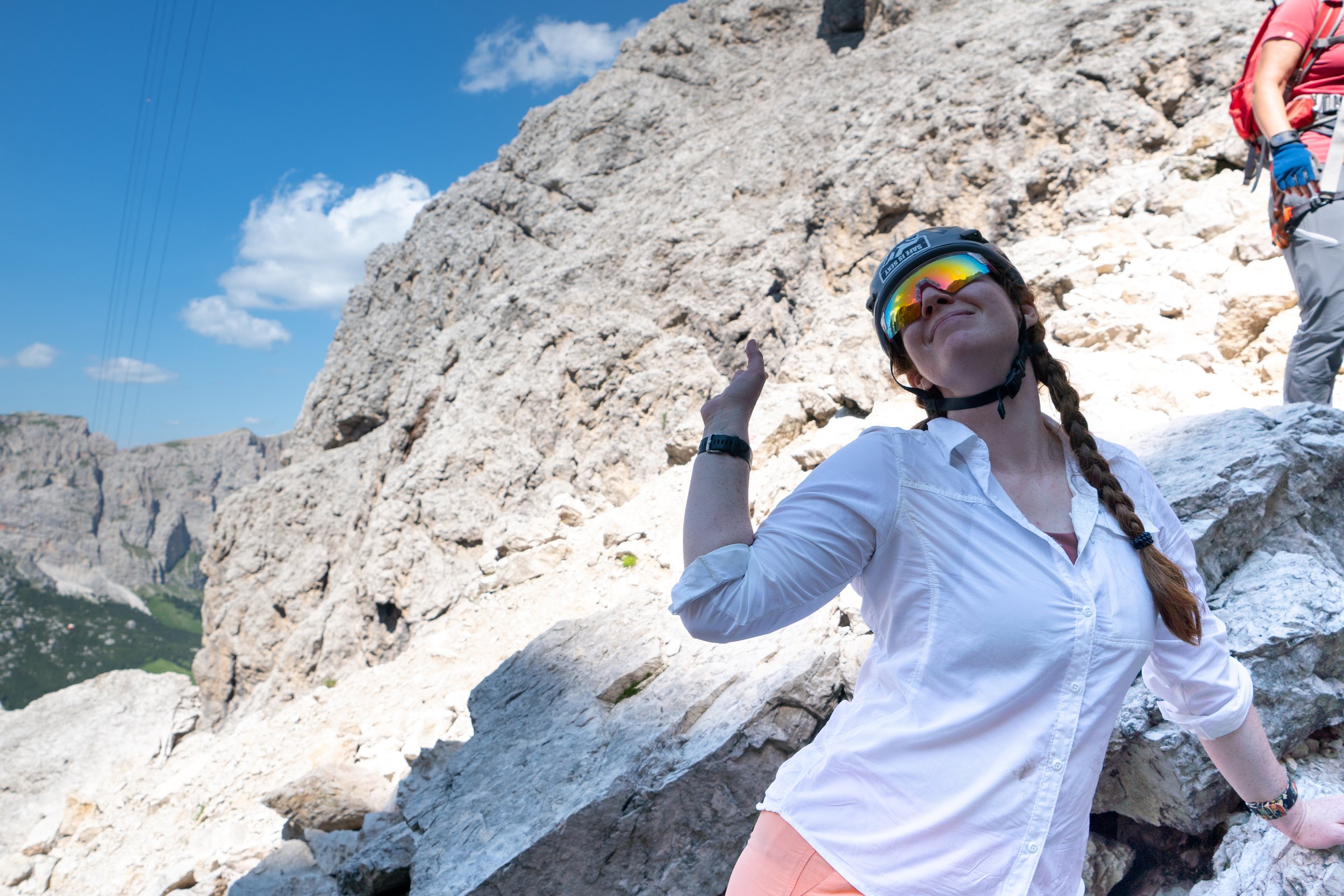
Crctd Dist. (Mile +Ele/1000) per Day

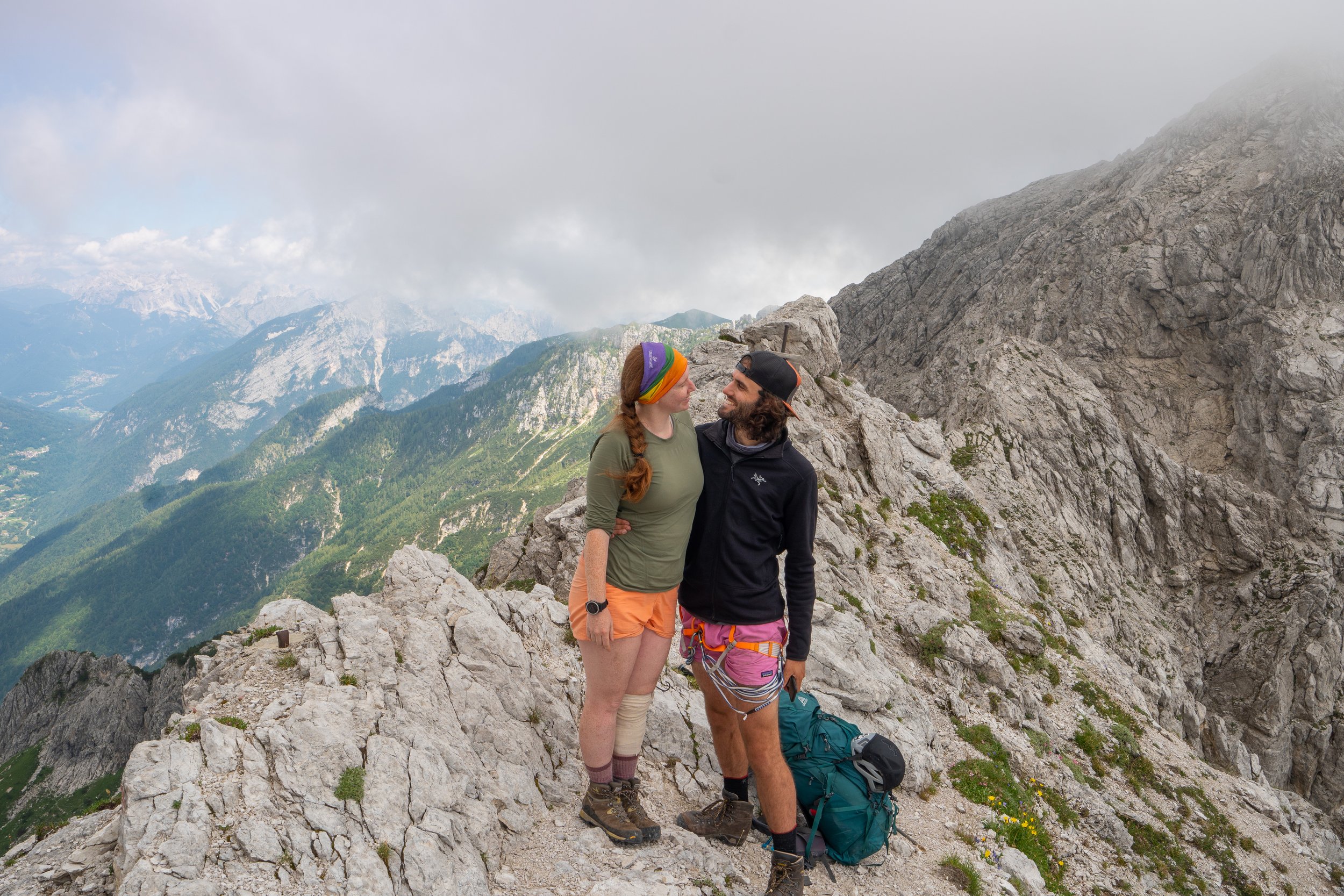
End Notes
The Alta Via 2 is truly a European classic. All told we hiked 104 miles and gained over 43 thousand feet of elevation. Having been to many other parts of the alps as well as other ranges within mainland Europe, the Dolomites are easily the jewel of that continent. The white rock and stunning spires persist in my mind as one of the most beautiful ranges, not just in Europe, but in the world.
As stated in several places throughout this trip report we found the first 2/3rds of the trek (Plossehut to Rosetta) to be the busiest and most popular. These stages contain the most iconic peaks, ferrates and refugios but also host the largest crowds. Once on the southern 3rd of the trek (Rosetta to Croce d’Aune) the trail becomes more rugged and solitary. This has its own upside in that you get time and space to reflect on the incredible journey that is coming to a close.
The ferratas along the route add spice to an already epic adventure. If you are interested but on the fence about attempting them than I readily encourage you do so. This is a chance to scale epic precipices in relative safety and, for the most part, advanced knowledge of rock climbing is not necessary to utilize these “Iron Ways.” The one exception is the Brigata Tridentina al Pisciadù which ends at Refugio Pisciadù. This is an advanced ferrata and it is advisable to have some knowledge of rock climbing before attempting it. Alternatively, outfitters in Passa Gardena could be contracted to guide you on the ferrata to ensure a safe journey. If you are planning on completing many of the ferrata along the way it is advisable your bag weight be limited to 20 pounds, as extra weight can make the climb dangerous. Finally, see note in the Ploséhutt to Schlütterhutt stage regarding ferrata kits.
The Alta Via 2 significantly shaped our view of the Alps and of access to mountains in general. In all our time spent in high places throughout the world - from the North Cascades in America to the Simien Mountains in Ethiopa - it has been universally understood that mountains are places of solitude and independence. This notion did not escape the Dolomites unscathed. Off all the alpine regions in the world, the Alps are by far the most accessible. This can be frustrating for many that retreat to areas like this for quiet and isolation but the flip side of that coin is that all can come and share in the magnificence of these mountains. Infrastructure throughout the alps has allowed everyone, from a kid on a school trip to a 90 year old Oma enjoying retirement, the chance to get out and get up into the pristine heights of the mountains. This is one of the true miracles of the Dolomites.
Note here about the refugios. As stated earlier, I reserved many of the them early on in the year, around March. For some of these alpine alms this was necessary, especially
Schlütterhutt
Pisciadù
Mulaz
Fuchiada (Lost my spot here rescheduling 15 days after original reservation)
For most others, however, there were either other options or they just were not very full. It should be noted that we talked with several, mostly younger, trekkers who made no reservations whatsoever and had not encountered many difficulties finding shelter each night. Whatever you decide to do, make sure you have a plan and do not expect there to always be an open bed, especially in the high season. Some hut highlights follow below.
Favorite Hut: My favorite hut was Puez for the amazing scenery, isolated feel, funny sheep and absolute best meal on the trek.
Least Favorite Refugio: My least favorite refugio was not really a refugio but a hotel - Hotel Castabella. I think it was just a sudden change to go from the homy hut life to a hotel – didn’t compute. This is why Refugio Fuchiada is worth trying to snag a spot in. We were really devastated when we had to walk through it and down to San Pelegrino.
Ritzy-est Hut: This would be Refugio Marmolada. Really nice but not quite a hotel, a great mood booster before what is one of the longest days.
Note about tent camping. I had read that it was possible to tent camp on the Alta Via 2 but got the sense going into it that this was “frowned upon.” The entire trip, we did not see a single tent so I think it’s safe to say it’s, at the very least, not popular. Some of this is just the alps – they have always had a large network of high alms, but I would also consider this to be part of the experience there. Staying in huts may not have the same nitty gritty feel as trekking in other parts of the world but it does offer a distinct experience. I guarantee you that, when you are sitting outside on a porch, perched high on the mountain side, watching the sun set over Pisciadu Massif with a cold beer in your hands – you won’t be missing your tent.
In close, the Alta Via 2 is a visually and culturally unique experience unlike anything else in the world. While it lacks some of the rawness of other treks around the world it offers some amazing comforts and brings a very different feel to trekking. Give it a try and I guarantee you will love it.